|
An important USWRP priority is to improve the forecasts of storm intensity and structure change in landfalling hurricanes in order to mitigate problems associated with these storms. A major source of difficulty in the past has been the inability to measure intensity directly, particularly surface winds, and our inability to predict how it changes in response to external and internal fo rcing. Several dramatic cases occurred in recent years suggesting a strong role of air-sea interaction processes on hurricane intensity change. Many of these cases occurred wit hin 24 h of landfall where intensity change forecasts are especially critical. In 1992 Hurricane Andrew gained strength as it passed over the Gulf Stream just before landfall in South Florida. While in 1995 Hurricane Opal intensified rapidly as it moved over a warm eddy in the Gulf of Mexico, then rapidly weakened as it moved over colder shelf water. Over half of the storms that occurred between 1995-2000 had intensified when crossing sea surface temper ature (SST) boundaries, either preexisting or created by previous storms. HL2002 will focus on the relationship between hurricane intensity change and changes in the internal storm structure, environmental interactions, and underlying SST caused by the storm winds. Direct linkages between hurricane intensity change and observed air-sea changes have been difficult to make since many storms are influenced by atmospheric circulations. In addition, detailed oceanographic and atmospheric observations are generally lackin g. Thus, the primary goal of this study is to capture two complete snapshots of a hurricane, mapping storm structure out to 1000 km from the storm center, from the top of the troposphere to 200 m below the ocean surface for use in studies and modeling of processes related to storm intensification. We hope to establish the link between changes in air-sea interaction processes brought about by changes in oceanic features and changes in the storm structure. To overcome these past difficulties, a mobile obser ving strategy comprised of air-deployed GPS dropsondes, subsurface ocean probes, and airborne remote sensors directly measur ing the atmospheric winds, particularly at the surface. For information about USWRP gall@ncar.ucar.edu, or elsberry@nps.navy.mil
The Coupled Boundary Layers/ Air-Sea Transfer (CBLAST)
experiments are a multi-agency project under the Office of Naval
Research's Defense Research Initiative.
The Hurricane Component of the CBLAST aims to measure, analyze, understand and parameterize air-sea fluxes in the hurricane environment. Unlike mid-latitude cyclones where baroclinic processes are important, hurricanes, or tropical cyclones, draw their energy supply from the ocean. The significant air-sea flux exchanges greatly modify the near-surface ocean temperature and currents. However, the air-sea interfacial boundary under hurricane winds is not well defined, and physical processes are not properly quantified. Observation, understanding, and, eventually, modeling of the structure and physical processes in the hurricane-ocean coupled boundary layer are the main objectives of the CBLAST Hurricane Component. The airborne measurements will be conducted with the NOAA WP-3D, equipped with radome and nose-boom mounted turbulence packages for direct measurement of momentum, heat and moisture fluxes. Other onboard measurements include the UMass scatterometers (SCSCAT/KSCAT) with improved horizontal resolution at 15 m and coherency to obtain the ABL wind profiles. A Particle Measurement System (PMS) will be used to measure spray droplet size distribution down to an altitude of 60 m in rain-free, high-wind ABL. The surface-wind measurements will be supplemented with Quikscat and TRMM images. GPS dropsondes and AXBTs will be expended to obtain vertical sounding of atmospheric and oceanic structure below flight level. TOPEX/POSEIDON satellite altimetry will be utilized to analyze ocean heat content during hurricane passage. The NASA airborne Scanning Radar Altimeter (SRA) will provide measurements of wave topography in all quadrants of hurricanes over open water. Directional wave and swell spectra will be deduced in real-time during the field experiment from SRA wave topography. Modified SOLO/ARGO floats will be also deployed by USAR WC-130, carrying additional sensors to measure surface wave heights, breaking, voids, heat fluxes, rainfall, wind speed, and the thermal-salinity structure of the upper ocean. Detailed logistics planning and coordination of aircraft operations in order for the multi-sensor, simultaneous, hurricane-ocean measurements to be successful will be conducted at HRD/AOML. The CBLAST Hurricane field experiment will be coordinated with the USWRP Hurricane Landfall Experiment. At present the CBLAST effort already maintains a close relationship with an NSF-funded airborne hurricane-ocean field study relating ocean heat content changes in the Gulf of Mexico Loop Current and associated warm eddies to changes in hurricane intensity. 
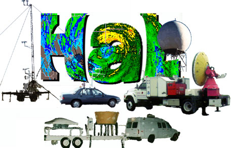
Also supported by NASA, NSF, and other agencies are a number of portable groundbased instruments. These instruments will be positioned at the closest point of hurricane landfall. The observations wi ll be focused on the surface wind and rain structure as the storm makes landfall and moves inland. NASA is supporting:
The two SMART radars are run by a consortium including Texas A&M University, Texas Tech University, and the NOAA National Severe Storms Laboratory (NSSL). The X-band radar is operated by t he University of Connecticut and the MIPS by the University of Alabama, Huntsville. The Institute for Building and Home Safety is also supporting six mobile 10-m towers to measure surface winds during hurricane landfall:
Texas Tech University and NSSL also may provide two or three portable mesonets mounted on renta l cars to make surface wind (3-m) measurements as the storm moves inland. |
Links of Interest
AOML Tools & Resources
Employee Tools
|
