
Photo Gallery Story
Originally published on the GOSHIP I07 Blog. Author: Victoria Coles
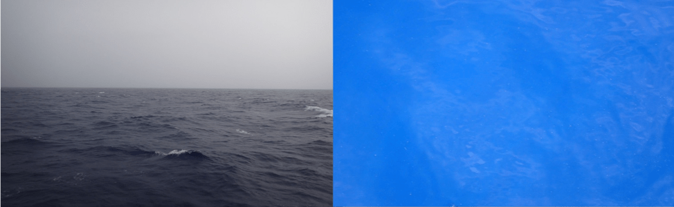
Inhaling and exhaling, the ocean trades gases with the atmosphere; carbon dioxide, oxygen, chlorofluorocarbons and more. Different scientists on IO7 measure each of them. But what happens to the gases away from the sea surface? In the sunlit ocean, phytoplankton busily use energy from the sun to create more oxygen gas, and to convert carbon dioxide gas to plant mass. Equally active are the bacteria and animals who devour the plants as well as each other, respiring, or turning carbon biomass back to carbon dioxide while using up oxygen. The water here all looks blue to us.
From one day to the next there might be more or fewer whitecaps or torrential rain or fierce sun, but the water looks the same. Below the surface however, there is a hidden world with huge variability in plants and animals. Recently, we have begun to learn that the specific types of plant and animal food webs affect how gasses are processed in the ocean. So, we expect changes in the ecology to influence how much carbon or oxygen the ocean stores, and how much it passes back to the atmosphere.
And this brings us back to how we measure the plant and animal world at and beneath the ocean’s surface. In the Bio Lab on the ship, Hannah Morrissette (MS student at University of Maryland Center for Environmental Science) and I are working with collaborators (Greg Silsbe, Raleigh Hood, and Joaquim Goes) using funding from NASA to understand the plant and animal communities that lie at the surface where satellites can see them, as well as below where they cannot. This is Hannah’s first time at sea, and I am continually reminded of how lucky we are to be here by experiencing this adventure through her eyes. For NASA, the satellites are our eyes; they measure the wavelength of the light reflected from the sea surface, then convert this to measures of chlorophyll content that can tell us both how many plants are present and how fast they are growing. These are key measures of the health and state of the ocean, used for managing fisheries (like the tuna industry here in the Indian Ocean), as well as for understanding changes in the ocean’s exhalation of oxygen and carbon dioxide.
But the satellite measurements of plankton growth must be confirmed and improved using direct measurements from a ship because the equations that convert the satellite reflectance to plankton biomass and growth depend on atmospheric conditions that are changing as well as the specific makeup of the plants that live in a region which is also changing. Here, on the Ronald H. Brown, we filter a lot of water (more than 2600 gallons so far; fig 3) to detect different pigments that each have a unique signature in the wavelengths the satellites measure. From this, we’ll improve the satellite maps to learn how the base of the food web responds to changing climate. We also continuously photograph the plankton community using a FlowCam, and measure the size and shape of the cells as well as how they photosynthesize in response to light (using a FIRe instrument. Each morning, we also sample the water column to learn how fast the plants and animals are growing by looking at changes in oxygen over time in sealed bottles. This will help us to develop estimates of how much plant based carbon sinks into the deep ocean – affecting the carbon and oxygen breath of the water when it ultimately returns to the surface.
We also tow nets in the upper ocean to learn more about the small animal or zooplankton communities that likely create the fastest source of sinking carbon to the deeper ocean. The water all looks blue, but the plants and animals have been changing radically over the different areas of the Indian Ocean; from the deserts of the subtropics, to the fertile tropical upwelling areas. These zooplankton samples get photographed and stored at sea for later analysis. Some animals will be examined to learn whether their shells are dissolving in waters with acidic pH. Other samples will be counted (old school) to learn who is there. Some samples will get analyzed with new genetic barcoding techniques (high tech) to find out which DNA occurs in each region. Using old and new school measurements allows us to compare this section with the last one 20 years ago while still staying up to date with modern technologies. As we steam through these hidden plant and animal habitats we are continually reminded of how little we know about the diverse organisms below the surface that alternately fuel and steal the ocean’s breath.
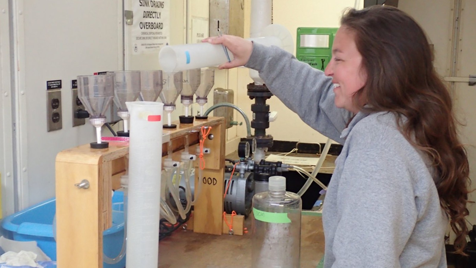
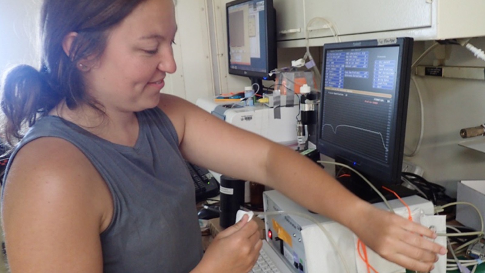
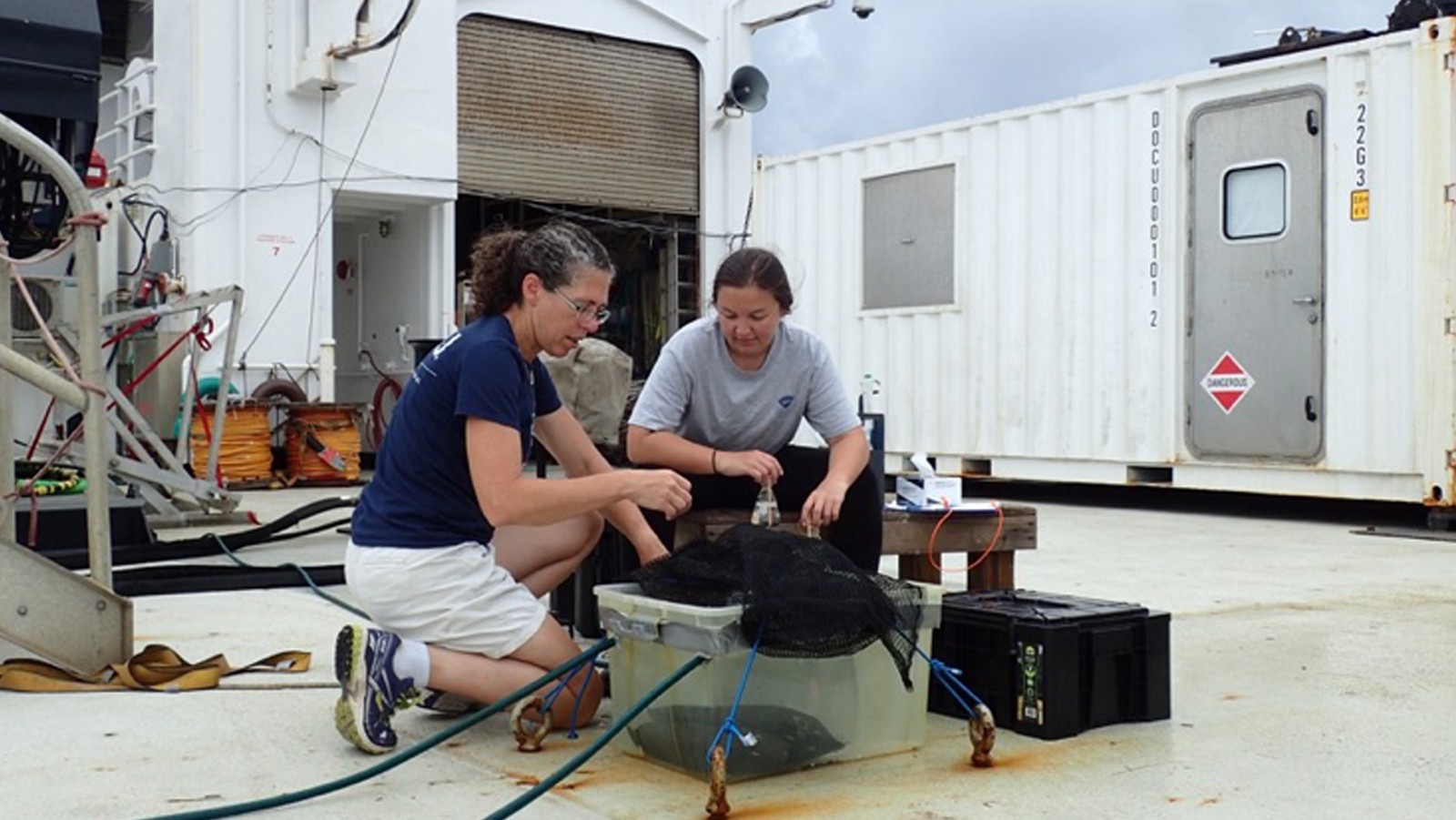
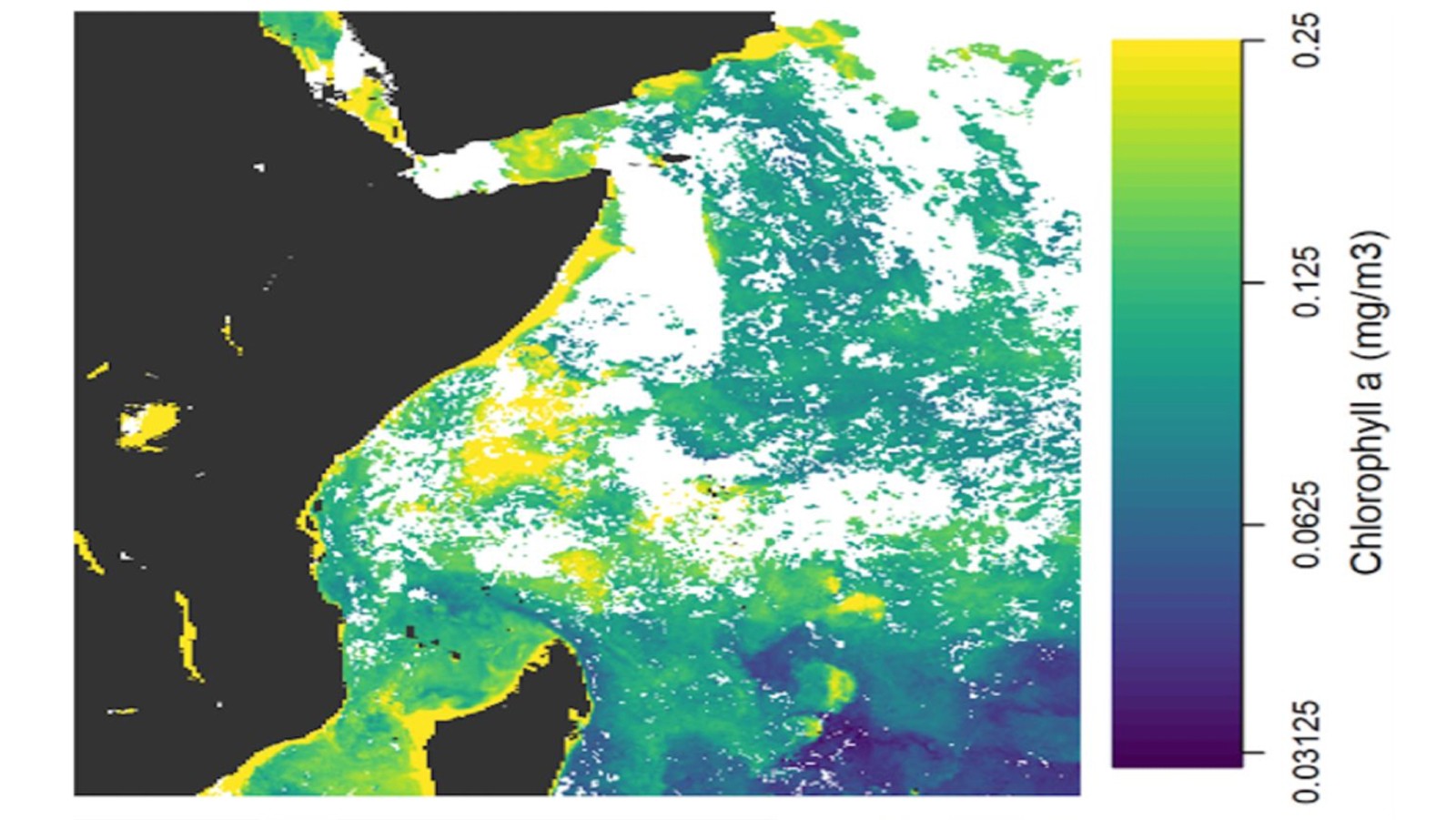
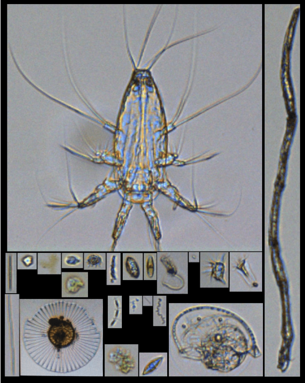
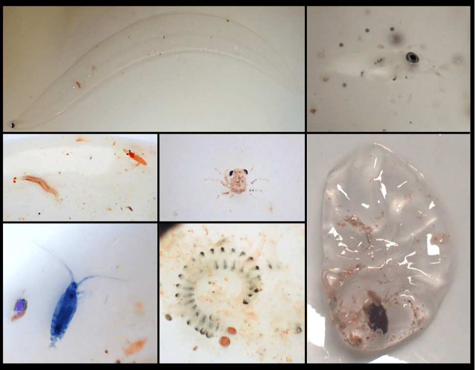
Image Captions
From Left:
- Hannah filtering water from different depths. Photo Credit: NOAA.
- Hannah measuring variable fluorescence in the FIRe instrument. Photo Credit: NOAA.
- Setting up oxygen change experiments in a mini “ocean” on deck. Photo Credit: NOAA.
- Ocean chlorophyll-a composite map using NOAA VIRS and NASA MODIS satellites. (Credit: Dr. Greg Silsbe)
- Plankton from the FlowCam images. Photo Credit: NOAA.
- Some of the animals collected across our net tows. Photo Credit: NOAA.
- Different shades of blue ocean on IO7. Photo Credit: NOAA.