|
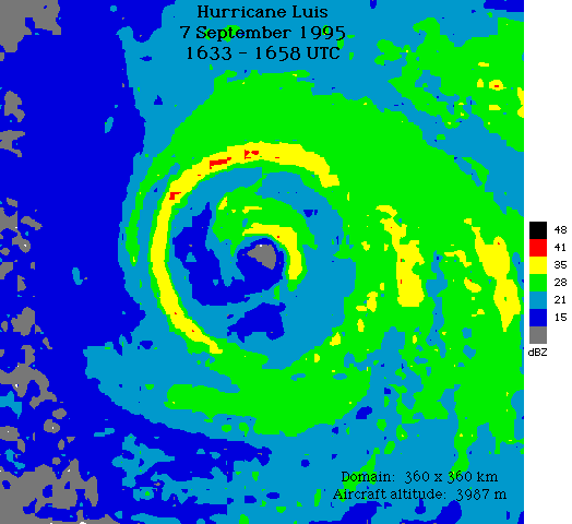
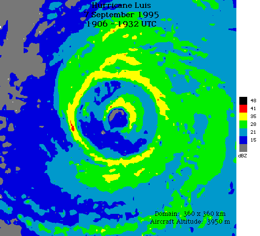
On 07SEP95, Hurricane Luis intensified from
about 100 kt winds and 940 mb minimum sea-level pressure (MSLP)
to 120 kt and 935 mb MSLP as it moved northwestward away from
the Lesser Antilles. During the course of the day (UT) an outer
concentric eyewall formed surrounding the original eyewall at 50
nmi radius. Early on 08SEP95, the new eyewall became the
dominant feature and the maximum winds decreased to about 100 kt
again. Natural eyewall cycles such as Luis' are virtually identical
to the expected result of the STORMFURY modification
experiments carried out in the 1960s. Two radar composites
transmitted in real time from a NOAA research aircraft to
forecasters at the OAR show Luis' well
defined outer eyewall surrounding the dissipating partial inner
eyewall:
More profound weakening through a similar eyewall replacement was the most important factor in avoiding a major disaster when Hurricane Opal approached the Gulf Coast after attaining a MSLP of 916 hPa overnight 03-04OCT95. |
Links of Interest
AOML Tools & Resources
Employee Tools
Stay Connected
|

| ||