Southwest Atlantic Meridional Overturning Circulation (SAM)
The backbone of the South Atlantic MOC Basin-Wide Array along 34.5°S
SALTAR A LOS DATOS O DESPLÁCESE PARA SABER MÁS
Quiénes somos
Lo que hacemos
The South Atlantic Meridional Overturning Circulation (SAM) project, which began in 2009, involves an array of four pressure-equipped inverted echo sounders (PIES) along 34.5°S near the Atlantic western boundary. SAM measures key ocean transports near the western boundary which are part of the meridional overturning circulation (MOC). SAM seeks to capture the daily variability of key components of the MOC in a relatively under-sampled region – the South Atlantic Ocean.
Numerical climate models indicate that important water mass transformations are undergone by the MOC flows in the South Atlantic, and that these variations likely control the stability of the MOC flow itself, however little data has previously been available for the study of these flows in this region.
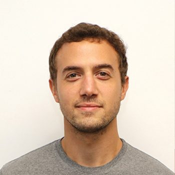
| Shenfu Dong, Ph.D
Co-investigador principal
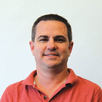
| Christian Saiz
Engineering & Field Work
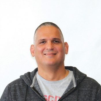
| Rigoberto Garcia
Data management
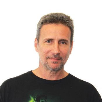
| Ryan Smith
Data Analysis
Emeritus Members: Silvia Garzoli, Chris Meinen, Molly Baringer, Gustavo Goni
Leer más noticias
Impactos de la investigación
SAM Array
The SAM array seeks to capture the daily variability of key components of the MOC in the subtropical South Atlantic Ocean. The array consists of a zonal line of four pressure-equipped inverted echo sounders (PIES) deployed near the western boundary at 34.5°S. Data from these instruments are used to monitor the Brazil Current and the Deep Western Boundary Current as they carry components of the MOC along the western boundary of the basin, and most recently have been used to detect deep and abyssal water mass changes. Coupled with annual or semiannual hydrographic observations collected on Argentine or Brazilian research vessels, these data are providing better understanding of the processes involved in MOC, boundary currents, and water mass variability in the South Atlantic. The SAM array is funded by the NOAA Global Ocean Monitoring and Observing (GOMO) and the NOAA Atlantic Oceanographic and Meteorological Laboratory (AOML). It is maintained through a collaboration between AOML and scientists in Argentina and Brazil.


Additional collaborations with Argentine, Brazilian, French, German, South African, and Spanish programs has led to a line of moorings across the entire basin called the South Atlantic MOC Basin-wide Array (SAMBA). SAMBA observations are used to produce continuous time series of the trans-basin MOC flows at this latitude. SAMBA is part of an international effort, the South Atlantic Meridional Overturning Circulation (SAMOC) initiative, to observe the dynamics and variability of the overturning circulation system at multiple latitudes in the South Atlantic.
Antecedentes
Recognizing the Need for Observations in the South Atlantic
Variations in the Meridional Overturning Circulation (MOC) have been linked to changes in critical climate variables such as precipitation, surface air temperature, sea level and extreme weather (e.g. drought, heat waves, hurricane intensification) across the globe. Models indicate that important water mass transformations are undergone by the MOC flows in the South Atlantic Ocean, and that these variations likely control the stability of the MOC flow itself, however little data has previously been available for the study of these flows in this region. SAM began in 2009 and seeks to capture the daily variability of key components of the MOC in the subtropical South Atlantic Ocean. The initial array deployed as part of the SAM project involved a zonal line of three pressure-equipped inverted echo sounders (PIES) and one current-and-pressure-equipped inverted echo sounder (CPIES) deployed near the western boundary at 34.5°S. In 2011 the CPIES was replaced with a PIES. The array has been sustained in this format to the present, with augmentations to the array from international partners.
Cruceros
Our Argentinian and Brazilian partners regularly conduct hydrographic cruises. SAM joins these cruises for the PIES mooring deployments and recoveries, and telemeter PIES data. Please use the drop down below to view the details of previous cruises.
Upcoming Cruise: Fiscal Year 2025

March 2009
- Vessel: Cruzerio do Sul (Brazil), SAM 01
- Work area: Western end of “SAMBA” line on 34.5S
- Ports: Rio Grande City, Brazil to Rio Grande City, Brazil
Activities: Deploy 3 NOAA PIES & 1 CPIES moorings, CTDs/XBTs - Chief Scientist: Christopher Meinen (US)
- AOML/CIMAS participants: Christopher Meinen (Chief Scientist, AOML), Ulises Rivero (AOML)
August 2009
- Vessel: Puerto Deseado (Argentina), SAM 02
- Work area: Western end of “SAMBA” line on 34.5S
- Ports: Mar del Plata, Argentina to Mar del Plata, Argentina
- Activities: Telemeter NOAA PIES & CPIES, CTD, water samples for nutrients, O2, chlorophyll-a.
- Chief Scientist: Alberto Piola (Argentina)
- AOML/CIMAS participants: Pedro Pena (AOML)
Julio de 2010
- Vessel: Puerto Deseado (Argentina), SAM 03
- Work area: Western end of “SAMBA” line on 34.5S
- Ports: Mar del Plata, Argentina to Mar del Plata, Argentina
- Activities: Telemeter NOAA PIES & CPIES, CTD, water samples for nutrients, O2, chlorophyll-a.
- Chief Scientist: Alberto Piola (Argentina)
- AOML/CIMAS participants: Ulises Rivero (AOML)
December 2010
- Vessel: Puerto Deseado (Argentina), SAM 04
- Work area: Western end of “SAMBA” line on 34.5S
- Ports: Mar del Plata, Argentina to Mar del Plata, Argentina
- Activities: Telemeter NOAA PIES & CPIES, CTD water samples for nutrients, O2, chlorophyll-a
Chief Scientist: Alberto Piola (Argentina) - AOML/CIMAS participants: Rigoberto Garcia (CIMAS)
July 2011
- Vessel: Puerto Deseado (Argentina), SAM 05
- Work area: Western end of “SAMBA” line on 34.5S
- Ports: Mar del Plata, Argentina to Mar del Plata, Argentina
- Activities: Recover 1 NOAA CPIES, deploy 1 new NOAA PIES. Telemeter 3 NOAA PIES, CTDs
- Chief Scientist: Alberto Piola (Argentina)
- AOML/CIMAS participants: Pedro Pena (AOML)
February 2012
- Vessel: Ice Lady Patagonia II (Argentina), SAM 06
- Work area: Western end of “SAMBA” line on 34.5S
Activities: Telemeter 2 NOAA PIES, XBTs - Chief Scientist: Alberto Piola (Argentina)
- AOML/CIMAS participants: None
Julio de 2012
- Vessel: Puerto Deseado (Argentina), SAM 07
- Work area: Western end of “SAMBA” line on 34.5S
- Ports: Mar del Plata, Argentina to Mar del Plata, Argentina
- Activities: Telemeter 4 NOAA PIES, CTDs, water samples+LADCP
- Chief Scientist: Alberto Piola (Argentina)
- AOML/CIMAS participants: Rigoberto Garcia (CIMAS)
December 2012
- Vessel: Alpha-Crucis, SAM 08, SAMOC Br 01
- Work area: Western end of “SAMBA” line on 34.5S
- Ports: Santos, Brazil to Santos, Brazil
- Activities: Recover 3 NOAA PIES, deploy 3 new NOAA PIES; Telemeter 1 NOAA PIES, CTD, deploy 3 new Brazil CPIES, water samples for nutrients, O2, chlorophyll-a
- Chief Scientist: Edmo Campos (Brazil)
- AOML/CIMAS participants: Silvia Garzoli (AOML), Chris Meinen (AOML), Ulises Rivero (AOML)
October 2013
- Vessel: Puerto Deseado (Argentina) Subtropical Shelf Front
- Work area: Western end of “SAMBA” line on 34.5S
- Activities: CTD+water samples+LADCP inshore of PIES A
- Chief Scientist: Alberto Piola
- AOML/CIMAS participants: None
December 2013
- Vessel: Alpha-Delphini (Brazil). SAM 09, SAMOC Br 02
- Work area: Western end of “SAMBA” line on 34.5S
- Ports: Santos, Brazil to Santos, Brazil
- Activities: Deploy 1 Brazil ADCP and 1 Brazil pressure gauge
- Chief Scientist: Francisco Vicentini Neto
- AOML/CIMAS participants: None
October 2014
- Vessel: Puerto Deseado (Argentina), SAM 10
- Work area: Western end of “SAMBA” line on 34.5S
- Ports: Mar del Plata, Argentina to Mar del Plata, Argentina
- Activities: Telemeter 4 NOAA PIES & 3 Brazil CPIES, CTDs, water samples+LADCP
- Chief Scientist: Alberto Piola
- AOML/CIMAS participants: Rigoberto Garcia (CIMAS)
November 2015
- Vessel: RV Alpha Delphini (Brazil), SAM 12
- Work area: Western end of “SAMBA” line on 34.5S
- Activities: PIES turnaround, ADCP recovery, Brazil pressure gauge recovery
- Chief Scientist: Edmo Campos
- AOML/CIMAS participants: Chris Meinen (AOML), Ulises Rivero (AOML)
October 2016
- Vessel: ARA Austral (Argentina), SAM 13
- Work area: Western end of “SAMBA” line on 34.5S
- Ports: Mar del Plata, Argentina to Mar del Plata, Argentina
- Activities: Recover and redeploy 3 NOAA PIES and 2 Brazilian CPIES, Telemeter 1 NOAA PIES; CTD profiles
- Chief Scientist: Alberto Piola
- AOML/CIMAS participants: Pedro Pena (AOML)
September-October 2017
- Vessel: ARA Puerto Deseado (Argentina), SAM14
- Work area: Western end of “SAMBA” line on 34.5S
- Ports: Mar del Plata, Argentina to Mar del Plata, Argentina
- Activities: Telemeter 4 NOAA PIES and 2 Brazil CPIES; approximately 15-20 CTD profile
- Chief Scientist: Alberto Piola (Argentina)
- AOML/CIMAS participants: Rigoberto Garcia (CIMAS)
April-May 2018
- Vessel: N. Oc. Alpha-Crucis (Brazil), SAM 15, SAMBAR A1
- Work area: Western end of “SAMBA” line on 34.5S
- Ports: Santos, Brazil to Santos, Brazil
- Activities: Recover and redeploy 2 NOAA PIES and 2 Brazilian CPIES, Telemeter 2 NOAA PIES; CTD profiles
- Chief Scientist: Edmo Campos (Brazil)
- AOML/CIMAS participants: Rigoberto Garcia (CIMAS), Pedro Pena (AOML)
October 2018
- Vessel: ARA Puerto Deseado (Argentina), SAM 16
- Work area: Western end of “SAMBA” line on 34.5S
- Ports: Mar del Plata, Argentina to Mar del Plata, Argentina
- Activities: Telemeter 4 NOAA PIES and 2 Brazilian CPIES, CTD profiles, recover and redeploy 2 NOAA PIES
- Chief Scientist: Marcela Charo (Argentina)
- AOML/CIMAS participants: Chris Meinen (AOML)
January-February, 2019
- Vessel: N. Oc. Antares (Brazil), SAM 17, SAMBAR B1
- Work area: Central and western end of “SAMBA” line on 34.5S
- Ports: Rio de Janeiro, Brazil to Itajai, Brazil
- Activities: Deployed sites E and F with Popeyes Data Shuttle, and Vema Channel moorings
- Chief Scientists: Mathias C. van Caspel, Edmo Campos(Brazil)
- AOML/CIMAS participants: None
June 2019
- Vessel: N. Oc. Alpha-Crucis (Brazil), SAM 18, SAMBAR A2
- Work area: Western end of “SAMBA” line on 34.5S
- Ports: Mar del Plata, Argentina to Mar del Plata, Argentina
- Activities: Telemeter 4 NOAA PIES and 2 Brazilian CPIES, CTD profiles, Deployed 2 NOAA PIES and 4 Brazil CPIES
- Contacts: Chief Scientist – Elisabete Braga, Olga Sato (Brazil)
- AOML/CIMAS participants: Diego Ugaz (CIMAS)
December 2022
- Vessel: ARA Puerto Deseado (Argentina), SAM 20
- Work area: Western end of “SAMBA” line on 34.5S
- Ports: Mar del Plata, Argentina to Mar del Plata, Argentina
- Activities: Redeploy 3 NOAA PIES and 2 Brazilian CPIES, recover 1 Brazilian CPIES, CTD profiles
- Chief Scientist: Alberto Piola (Argentina)
- AOML/CIMAS participants: Pedro Pena (AOML)
July-August 2022
- Vessel: N. Oc. Alpha-Crucis (Brazil), SAM 19, SAMBAR A3
- Work area: Western end of “SAMBA” line on 34.5S
- Ports: Santos, Brazil to Santos, Brazil
- Activities: Recover and redeploy 2 NOAA PIES and 1 Brazilian CPIES, CTD profiles
- Chief Scientist: Olga Sato (Brazil)
- AOML/CIMAS participants: Diego Ugaz (CIMAS), Christian Saiz (CIMAS)
January-February 2023
- Vessel: N. Oc. Antares (Brazil)
- Work area: Interior and western end of “SAMBA” line on 34.5S
- Ports: Niteroi, Brazil to Itajai, Brazil
- Activities: Recovered sites E and F with Popeyes Data Shuttle, and redeploy Vema Channel moorings
- Chief Scientists: Dr. Luiz V. Nonnato and Engr. Francisco L. Vicentini Neto (Brazil)
- AOML/CIMAS participants: None
August 2024
- Vessel: N. Oc. Antares (Brazil)
- Work area: Vema Channel
- Ports: Niteroi, Brazil to Santos, Brazil
- Activities: Recover Vema Channel moorings
- Chief Scientist: Engr. Francisco L. Vicentini Neto (Brazil)
- AOML/CIMAS participants: None
Looking Forward
SAM is leveraging BIL/IIJA funding to build and deploy two data pod shuttle systems at the two inshore SAM sites. These systems are the newest iteration of the Adaptable Bottom Instrument Information Shuttle System (ABIISS) developed by NOAA/AOML in collaboration with the University of Miami’s CIMAS. They consist of a prototype submerged system that releases a data pod at predetermined intervals as specified by the user (i.e., every 6-24 months). Upon release the data pods float to the surface and transmit their recorded data via satellite. If proven robust and successful, these systems will help retrieve data from the subsurface moorings alleviating some of the pressure on crewed research vessels for data recovery. These systems are experimental, and we will deploy them at two SAM mooring locations where we already have moorings deployed. These side-by-side mooring deployments mean that this important step towards developing autonomous data recovery capabilities will not interrupt the continuity of SAM mooring data. Deployments are planned for FY2026.
Additionally, SAM is collaborating with French scientists to deploy a microcat at its furthest offshore site to measure temperature and salinity changes of Antarctic Bottom Water (AABW) near the seafloor. Deployment is planned for FY2025.
The Southwest Atlantic MOC project serves data products produced from AOML Pressure-equipped Inverted Echo Sounder (PIES) moorings.
How to Acknowledge/ Cite SAM Project Data:
Data from the Southwest Atlantic MOC project are made freely available to the public. Project scientists would appreciate it if you added the following acknowledgment to any publications that use these data:
“Data from the Southwest Atlantic MOC project (SAM) are funded by NOAA’s Global Ocean Monitoring and Observing Program and the Atlantic Oceanographic and Meteorological Laboratory. These data are freely available via the SAM web page.”

Temporal variability of the volume transports from the SAMOC basin-wide array of moorings within the upper cell (B – red) and the abyssal cell (C – blue). Image from Kersale et al. 2020.
SAM Bibliography
Publicación destacada
Since the inception of the international South Atlantic Meridional Overturning Circulation (SAMOC) initiative in 2007, substantial advances have been made in observing and understanding the South Atlantic component of the Atlantic Meridional Overturning Circulation.
Renellys Perez, Shenfu Dong, and Claudia Schmid, scientists at NOAA’s AOML, contributed to an important recent international review article in Communications Earth and Environment led by Maria Paz Chidichimo (Argentine Scientific Research Council-CONICET and Hydrographic Service, Buenos Aires, Argentina). The NOAA team worked with co-authors from six countries (Argentina, Brazil, France, Germany, South Africa, and the United States) to synthesize insights gained into overturning flows, interocean exchanges, and water mass distributions and pathways in the South Atlantic from 15 years of SAMOC observations.
The following is a list of scientific publications that reference South Atlantic MOC (SAM) data.
Póngase en contacto con los autores de las publicaciones para obtener una versión electrónica o impresa de los artículos. También puede realizar una búsqueda en Google del título de la publicación, que puede dirigirle a una versión electrónica del artículo.
SAM Publications
- Baker, J. A., R. Renshaw, L. C. Jackson, C. Dubois, D. Iovino, H. Zuo, R. C. Perez, S. Dong, M. Kersalé, M. Mayer, J. Mayer, S. Speich, and T. Lamont, South Atlantic overturning and heat transport variations in ocean reanalyses and observation-based estimates, in: 7th edition of the Copernicus Ocean State Report (OSR7), edited by: von Schuckmann, K., Moreira, L., Le Traon, P.-Y., Grégoire, M., Marcos, M., Staneva, J., Brasseur, P., Garric, G., Lionello, P., Karstensen, J., and Neukermans, G., Copernicus Publications, State Planet, 1-osr7, 4, https://doi.org/10.5194/sp-1-osr7-4-2023.
- Chidichimo, M. P., R. C. Perez, S. Speich, M. Kersalé, J. Sprintall, S. Dong, T. Lamont, O. T. Sato, T. K. Chereskin, R. Hummels, and C. Schmid, Energetic overturning flows, dynamic interocean exchanges, and ocean warming observed in the South Atlantic. Commun. Earth Environ., 4, 10, doi: 10.1038/s43247-022-00644-x, 2023.
- Biastoch, A. et al., Regional imprints of changes in the Atlantic Meridional Overturning Circulation in the eddy-rich ocean model VIKING20X. Ocean Sci., 17, 1177–1211, doi: 10.5194/os-17-1177-2021, 2021.
- Chidichimo, M. P., A. R. Piola, C. S. Meinen, R. C. Perez, E. J. D. Campos, S. Dong, R. Lumpkin, and S. L. Garzoli, Brazil Current volume transport variability during 2009-2015 from a long-term moored array at 34.5S. Journal of Geophysical Research Oceans, doi: 10.1029/2020JC017146, 2021.
- Kersalé, M., C. S. Meinen, R. C. Perez, A. R. Pola, S. Speich, E. J. D. Campos, S. L. Garzoli, I. Ansorge, D. L. Volkov, M. Le Henaff, S. Dong, T. Lamont, O. T. Sato, and M. van den Berg, Multi-year estimates of Daily Heat Transport by the Atlantic Meridional Overturning Circulation at 34.5S, Journal of Geophysical Research Oceans, doi: 10.1029/2020JC016947, 2021.
- Meinen, C. S., R. C. Perez, S. Dong, A. R. Piola, and E. Campos, Observed ocean bottom temperature variability at four sites in the Argentine Basin: Evidence of decadal deep/abyssal warming amidst hourly to interannual variability during 2009-2019, Geophys. Res. Lett., 47, doi: 10.1029/2020GL089093, 2020.
- Kersalé, M., C. S. Meinen, R. C. Perez, M. Le Hénaff, D. Valla, T. Lamont, O. T. Sato, S. Dong, T. Terre, M. van Caspel, M. P. Chidichimo, M. van den Berg, S. Speich, A. R. Piola, E. J. D. Campos, I. Ansorge, D. L. Volkov, R. Lumpkin, and S. Garzoli, Highly Variable Upper and Abyssal Overturning Cells in the South Atlantic, Science Advances, 6, eaba7573, doi: 10.1126/sciadv.aba7573, 2020.
- Volkov, D.L., C.S. Meinen, C. Schmid, B. Moat, M. Lankhorst, S. Dong, F. Li, W. Johns, S. Lozier, R. Perez, G. Goni, M. Kersale, E. Frajka-Williams, M. Baringer, D. Smeed, D. Rayner, A. Sanchez-Franks, and U. Send, Atlantic meridional overturning circulation and associated heat transport [in “State of the Climate in 2019″]. Bull. Amer. Meteor. Soc., 101 (8), S163-S169, doi:10.1175/BAMS-D-20-0105.1, 2020.
- Weijer, W., W. Cheng, O. A. Garuba, A. Hu, and B. T. Nadiga, CMIP6 models predict significant 21st century decline of the Atlantic Meridional Overturning Circulation, Geophysical Research Letters, 47, e2019GL086075, doi: 10.1029/2019GL086075, 2020.
- Frajka-Williams, E., I. J. Ansorge, J. Baehr, H. L. Bryden, M. P. Chidichimo, S. A. Cunningham, G. Danabasoglu, S. Dong, K. A. Donohue, S. Elipot, P. Heimbach, N. P. Holliday, R. Hummels, L. C. Jackson, J. Karstensen, M. Lankhorst, I. A. Le Bras, M. S. Lozier, E. L. McDonagh, C. S. Meinen, H. Mercier, B. I. Moat, R. C. Perez, C. G. Piecuch, M. Rhein, M. A. Srokosz, K. E. Trenberth, S. Bacon, G. Forget, G. Goni, D. Kieke, J. Koelling, T. Lamont, G. D. McCarthy, C. Mertens, U. Send, D. A. Smeed, S. Speich, M. van den Berg, D. Volkov, and C. Wilson, Atlantic Meridional Overturning Circulation: Observed transport and variability, Frontiers in Marine Science, 6:260, doi: 10.3389/fmars.2019.00260, 2019.
- Kersalé, M., Perez, R. C., Speich, S., Meinen, C. S., Lamont, T., Le Hénaff, M., van den Berg, M., Majumder, S., Ansorge, I. J., Dong, S., Schmid, C., Terre, T., Garzoli, S. L. Shallow and Deep Eastern Boundary Currents in the South Atlantic at 34.5°S: Estructura media y variabilidad. J. Geophys. Res. doi: 10.1029/2018JC014554, 2019.
- Valla, D., A. R. Piola, C. S. Meinen, and E. Campos, Abyssal transport variations in the Southwest South Atlantic: first insights from a long-term observation array at 34.5S, Geophysical Research Letters, 46 (12), 6699-6705, doi: 10.1029/2019GL082740, 2019.
- Meinen, C.S., S. Speich, A.R. Piola, I. Ansorge, E. Campos. M. Kersale, T. Terre, M.-P. Chidichimo, T. Lamont, O.T. Sato, R.C. Perez, D. Valla, M. Van den Berg, M. Le Henaff, S. Dong, and S.L. Garzoli. Meridional Overturning Circulation transport variability at 34.5°S during 2009-2017: Baroclinic and barotropic flows and the dueling influence of the boundaries. Geophysical Research Letters, 45(9):4810-4188, doi:10.1029/2018GL077408, 2018.
- Valla, D., A.R. Piola, C.S. Meinen, and E. Campos. Strong mixing and recirculation in the northwestern Argentine Basin. Journal of Geophysical Research-Oceans, 123(7):4624-4648, doi:10.1029/2018JC013907, 2018.
- Meinen, C.S., S.L. Garzoli, R.C. Perez, E. Campos, A.R. Piola, M.P. Chidichimo, S. Dong, and O.T. Sato, Characteristics and causes of Deep Western Boundary Current transport variability at 34.5°S during 2009-2014. Ocean Science, 13(1):175-194, doi:10.5194/os-13-175-2017, 2017.
- Garzoli, S.L., S. Dong, R. Fine, C. Meinen, R.C. Perez, C. Schmid, E. van Sebille, and Q. Yao, The fate of the Deep Western Boundary Current in the South Atlantic, Deep-Sea Res. I, doi:10.1016/j.dsr.2015.05.008, 2015.
- Perez, R. C., M. O. Baringer, S. Dong, S. L. Garzoli, M. Goes, G. J. Goni, R. Lumpkin, C. S. Meinen, R. Msadek, and U. Rivero, Measuring the Atlantic meridional overturning circulation, Mar. Tech. Soc. J., 49(2):167-177, doi:10.4031/MTSJ.49.2.14, 2015.
- Dong, S., G. Goni, and F. Bringas, Temporal variability of the South Atlantic meridional overturning circulation between 20S and 35S, Geophys. Res. Lett., doi:10.1002/2015GL065603, 2015.
- Meinen, C. S., S. Speich, R. C. Perez, S. Dong, A. R. Piola, S. L. Garzoli, M. O. Baringer, S. Gladyshev, and E. J. D. Campos, Temporal variability of the meridional overturning circulation at 34.5S: Results from two pilot boundary arrays in the South Atlantic, J. Geophys. Res. Oceans, 118, 6461-6478, doi:10.1002/2013JC009228, 2013.
- Meinen, C. S., A. R. Piola, R. C. Perez, and S. L. Garzoli, Deep Western Boundary Current transport variability in the South Atlantic: Preliminary results from a pilot array at 34.5S, Ocean Sci., 8, 1041-1054, doi:10.5194/os-8-1041-2012, 2012.
- Perez, R. C., S. L. Garzoli, C. S. Meinen, and R. P. Matano, Observing Methods for the Meridional Overturning Circulation and Meridional Heat Transport in the South Atlantic, J. Atmos. Ocean. Tech., 28, 1504-1521, doi:10.1175/JTECH-D-11-00058.1, 2011.

Socios
International Partners for Field Work
- Edmo Campos: Oceanographic Institute, University of São Paulo, São Paulo, Brazil
- Maria Paz Chidichimo: Consejo Nacional de Investigaciones Científicas y Técnicas (CONICET), Argentina, Escuela de Hábitat y Sostenibilidad, Universidad Nacional de San Martín , Buenos Aires, Argentina
- Alberto R. Piola: Universidad de Buenos Aires, Buenos Aires, Argentina
- Marcela Charo: Servicio de Hidrografia Naval, Argentina
- Olga T. Sato: Oceanographic Institute, University of São Paulo, São Paulo, Brazil
- Cesar Rocha: Oceanographic Institute, University of São Paulo, São Paulo, Brazil
Full list of SAM related partners: Here

Logros clave
Twenty cruises have been completed by Argentine and Brazilian partners, from which SAM moorings operations were conducted.
SAMBA-West hydrographic data have been used to study the pathways of water masses within the Argentine Basin (Valla et al., 2018).
SAMBA-West data have been used to study Brazil Current (Chidichimo et al., 2021), Deep Western Boundary Current (Meinen et al., 2012, 2017), abyssal flows (Valla et al., 2019), and deep/abyssal temperature variations (Meinen et al., 2020; Campos et al. 2021). DWBC and temperature records have been updated through 2022 and are being validated.
SAMBA data were used to characterize the daily upper and abyssal MOC variations and the contributions of each of those cells to meridional heat transport along 34.5°S from 2013-2017 (Kersalé et al. 2020; Kersalé et al. 2021).
SAM mooring data were used to characterize daily MOC temporal variations from 2009-2010 and 2013-2017, along with measurements from other elements of the South Atlantic MOC Basin-wide Array (SAMBA, Meinen et al. 2013, 2018, Kersalé et al. 2020, 2021). The updated MOC record extends through December 2022 and is being validated.

