|
Subject: A17) What is the Saharan Air Layer (SAL) ? How does it affect tropical cyclones ?
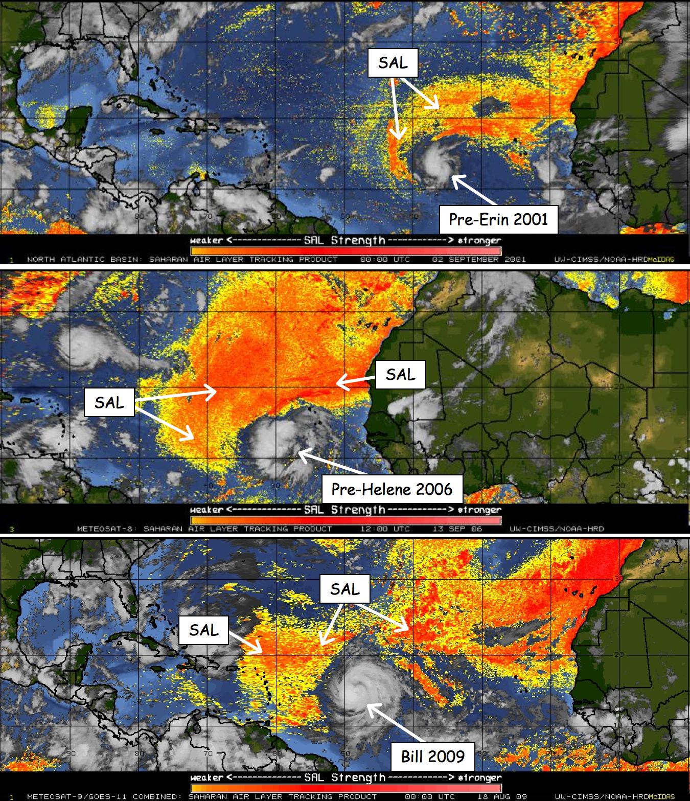 The SAL and (top) 2001 Erin (middle) Helene 2006, and (bottom) Bill 2009 Contributed by Jason Dunion (HRD) The Saharan Air Layer (SAL) is a mass of very dry, dusty air which forms over the Sahara Desert during the late spring, summer, and early fall and usually moves out over the tropical North Atlantic Ocean every 3-5 days. The SAL extends between ~5,000-20,000 ft (~1500-6000 m) in the atmosphere and is associated with large amounts of mineral dust, dry air (~50% less moisture than a typical moist tropical sounding), and strong winds (~25-55 mph or ~10-25 m/s). These strong winds, or jets, are usually found between 6,500-14,500 ft (2000-4500 m) above the surface in the central and western North Atlantic and have a depth of ~1-2 miles (~1.6-3.2 km). The SAL can have a significant negative impact on tropical cyclone intensity and formation. Its dry air can act to weaken a tropical cyclone by promoting downdrafts around the storm, while its strong winds can substantially increase the vertical wind shear in and around the storm environment. It is not yet clear what effect the SAL's dust has on tropical cyclone intensity, though some recent studies have suggested that it can actually impact the formation of clouds. The SAL can cover an area the size of the continental U.S. and has been tracked as far west as the Caribbean Sea, Central America, and the Gulf of Mexico. Real-time satellite imagery for tracking the SAL can be found here. References:
Last updated March 17, 2010
|
TC FAQ
Links of Interest
AOML Tools & Resources
Employee Tools
Stay Connected
|

| ||