FAQs
|
Contact Us
HRD Home
About HRD
Overview
Milestones
Awards
History
NOAA Aircraft
Publications
Affiliates
Research Themes
Observing Techniques
Modeling and Prediction
Data Assimilation
Dynamics and Physics
Impacts
Data
Field Program Data
Numerical Models
Radar Data
Re-Analysis Project
Surface Wind Analyses
Data Formats
Personnel
Printer Friendly Version
Gustav 2008 radar data
Airborne radar data
Doppler wind analyses
CAUTION : CLICK LINK BELOW
Important information on Doppler radar data
N42RF by flight leg
tar'd JPEG plots of Doppler winds from all levels
tar'd JPEG plots of vertical profiles of radar data
tar'd ASCII 3D Doppler analyses
zip'd Doppler radials TEXT files
N43RF by flight leg
tar'd JPEG plots of Doppler winds from all levels
tar'd JPEG plots of vertical profiles of radar data
tar'd ASCII 3D Doppler analyses
zip'd Doppler radials TEXT files
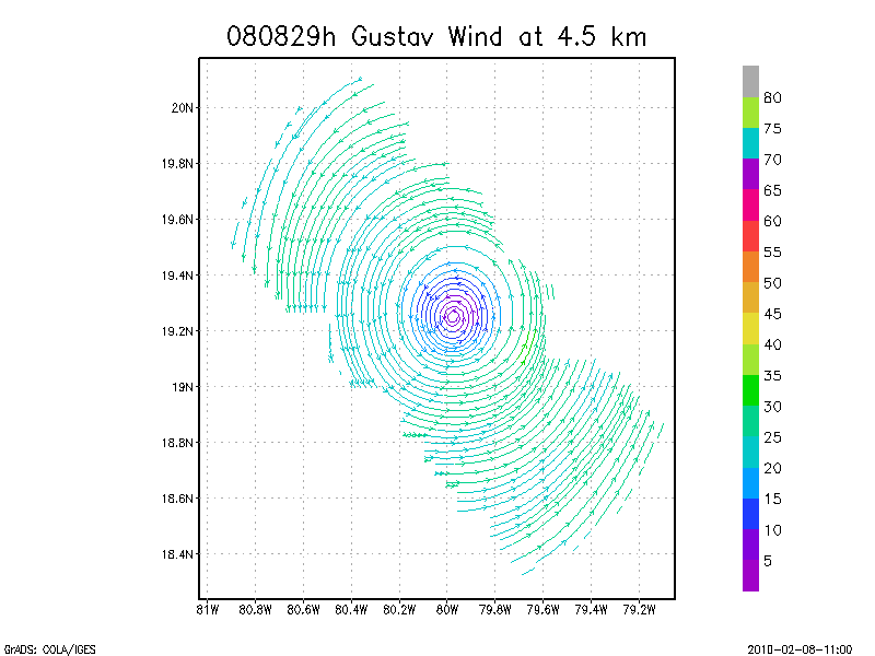
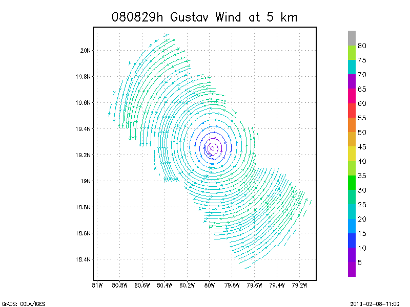
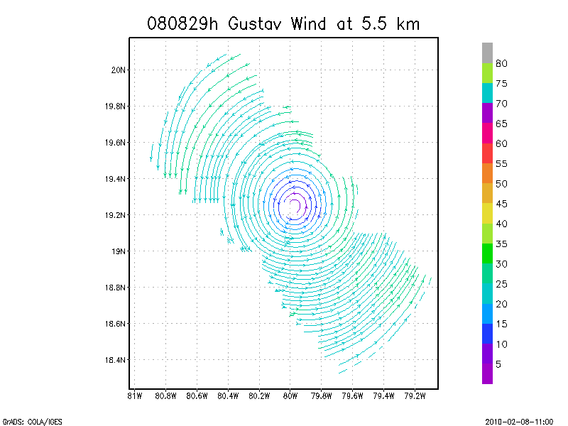
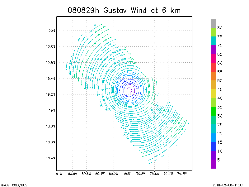
August 29, 2008
N42RF
Composite of all legs and dropsondes
Gridded radar data
GrADS control file radar data
Gridded dropsonde data
GrADS control file dropsonde data
GrADS map of dropsonde data
Winds at :
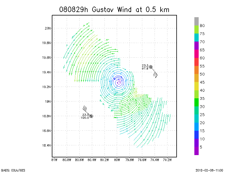
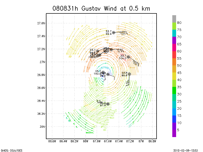
.5 km
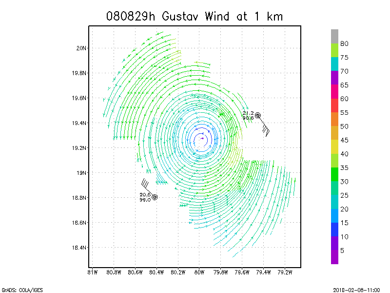
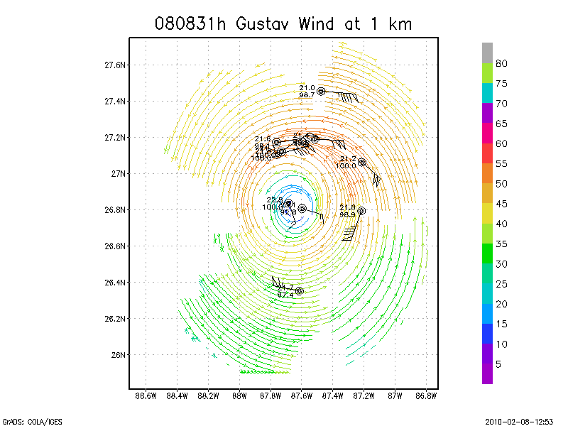
1.0 km
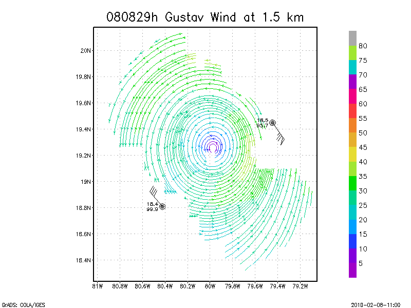
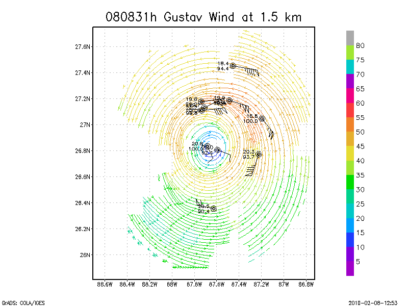
1.5 km
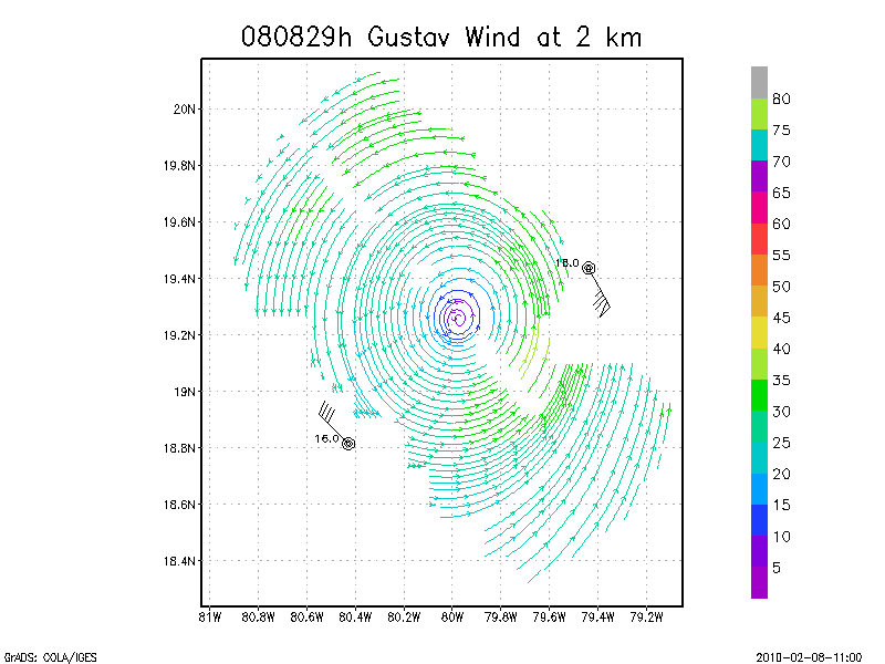
2.0 km
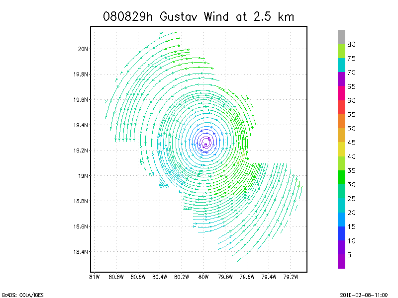
2.5 km
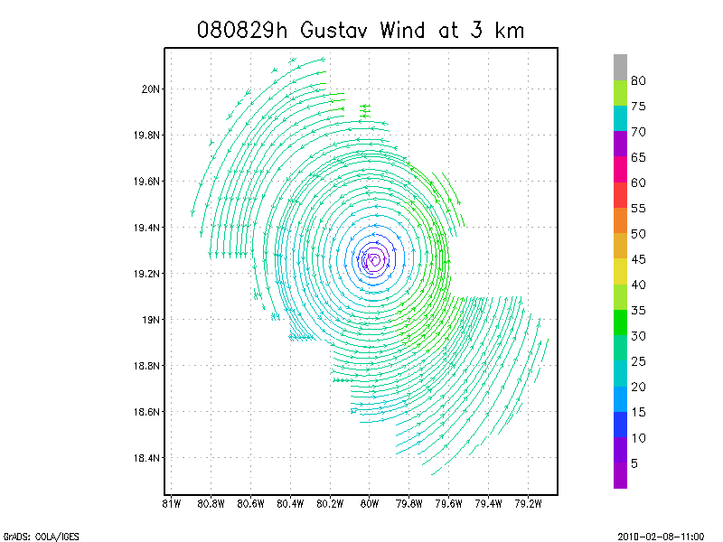
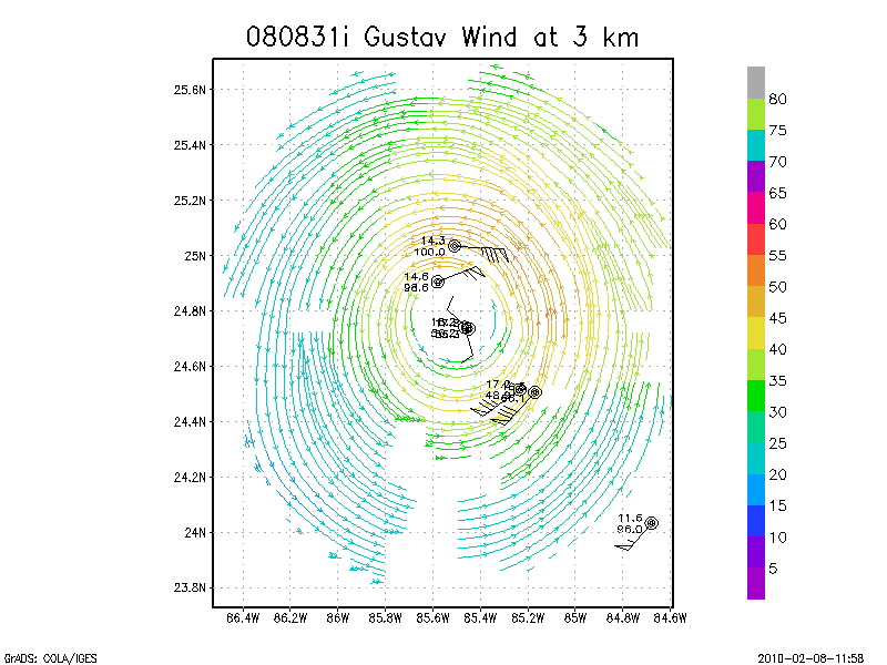
3.0 km
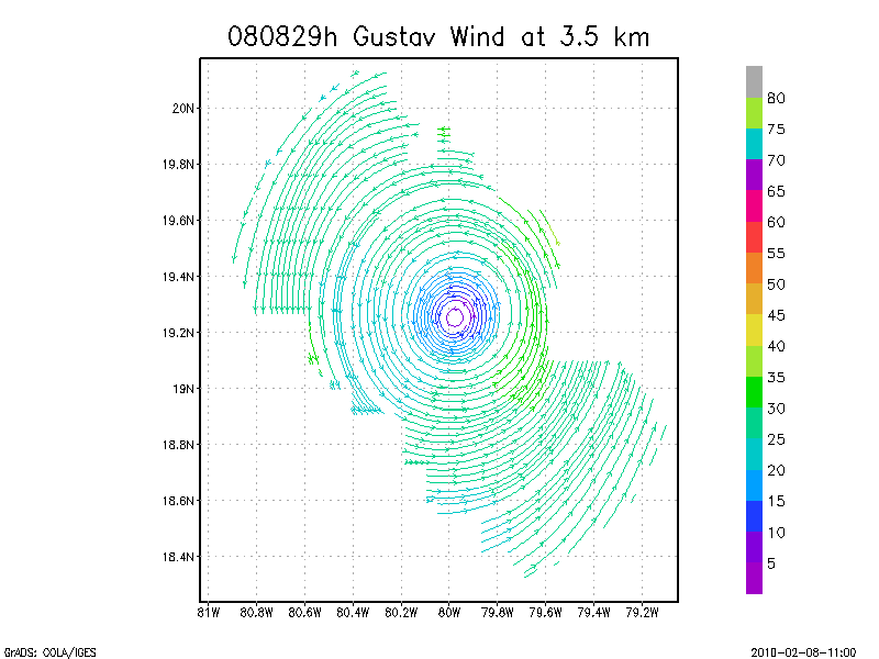
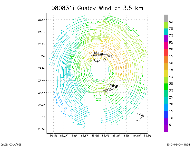
3.5 km
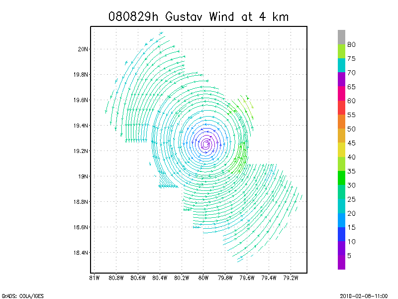
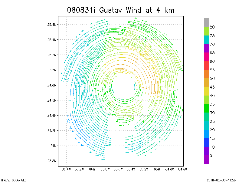
4.0 km
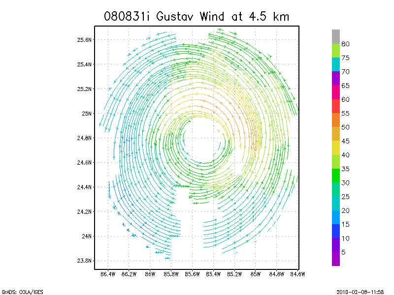
4.5 km
Winds at :
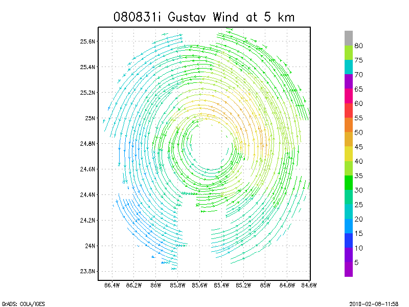
5.0 km
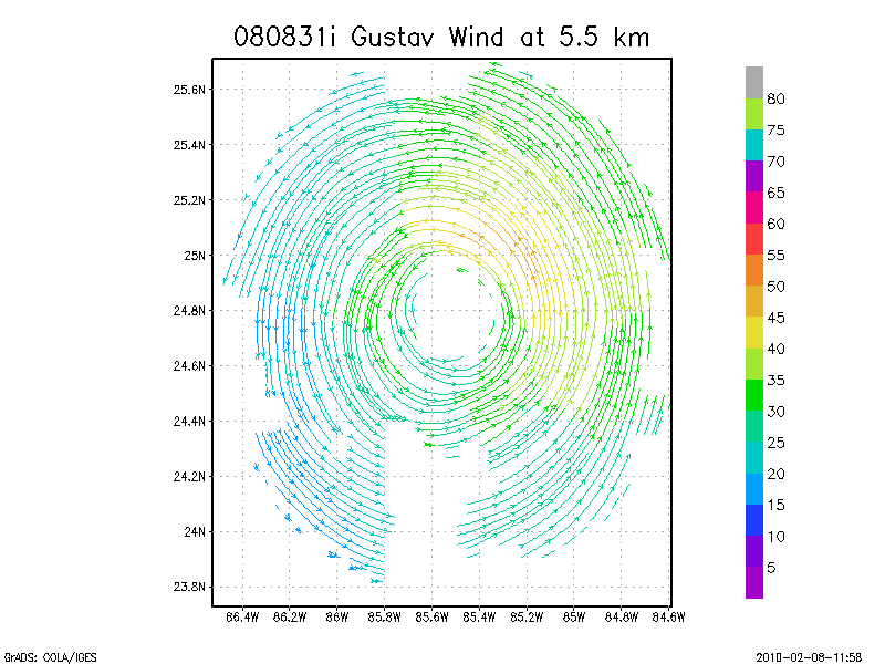
5.5 km
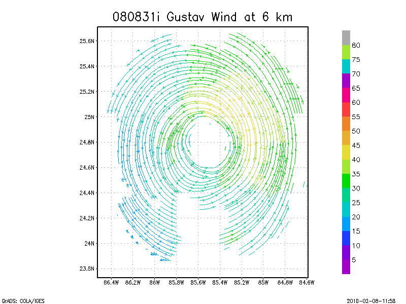
6.0 km
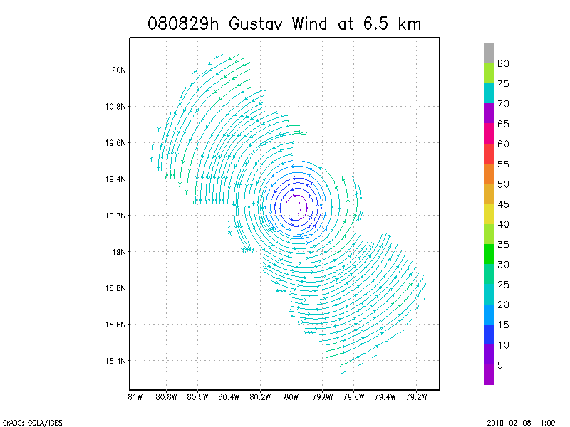
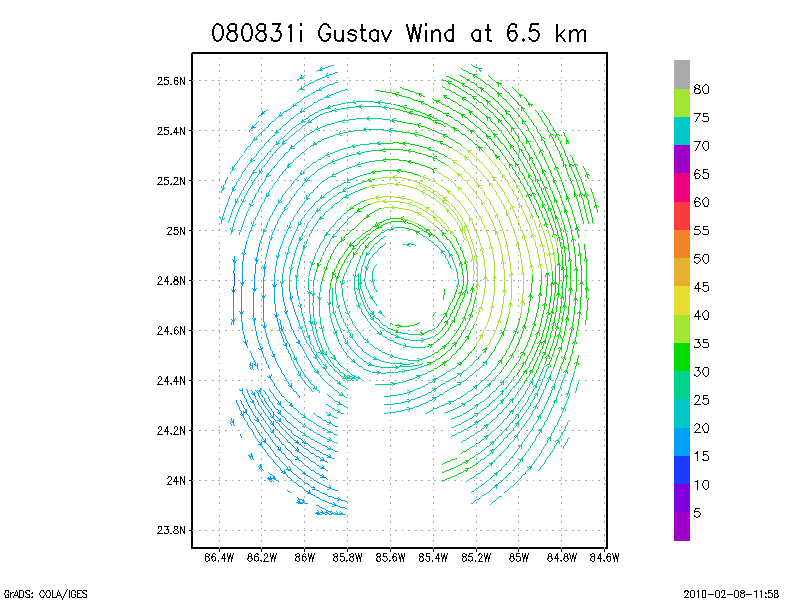
6.5 km
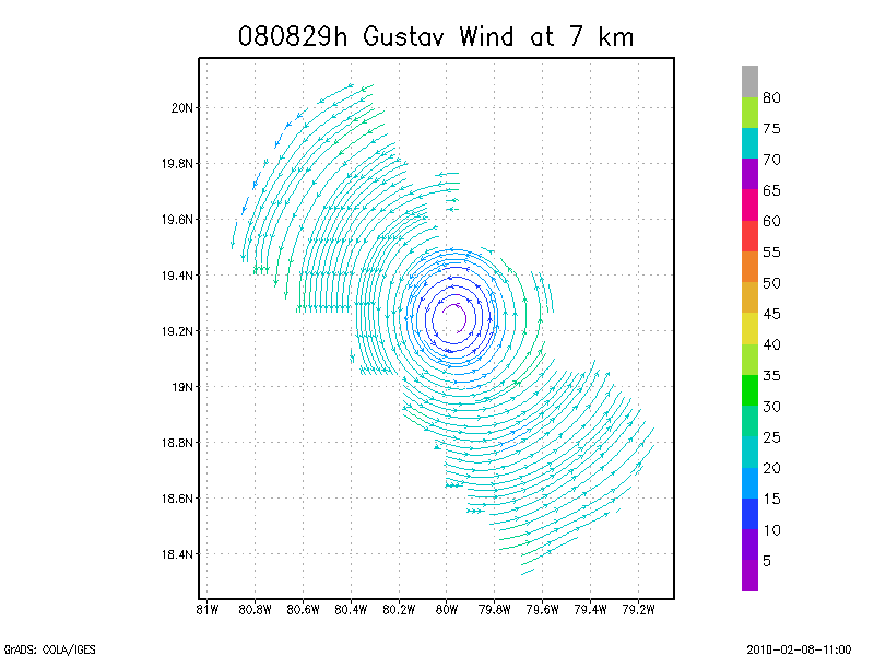
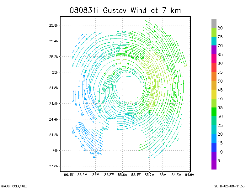
7.0 km
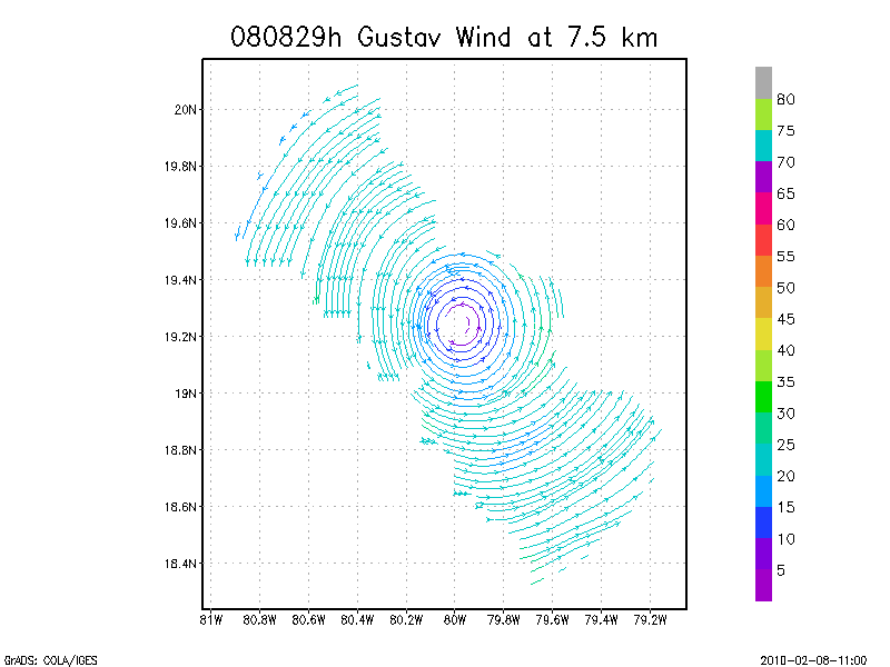
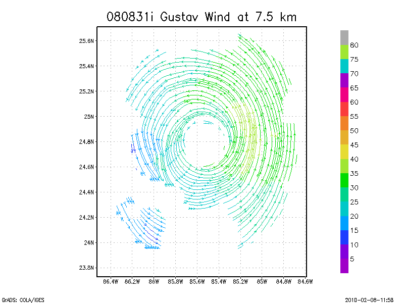
7.5 km
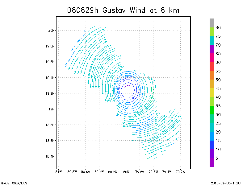
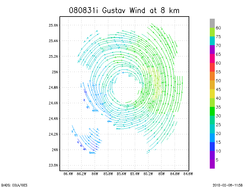
8.0 km
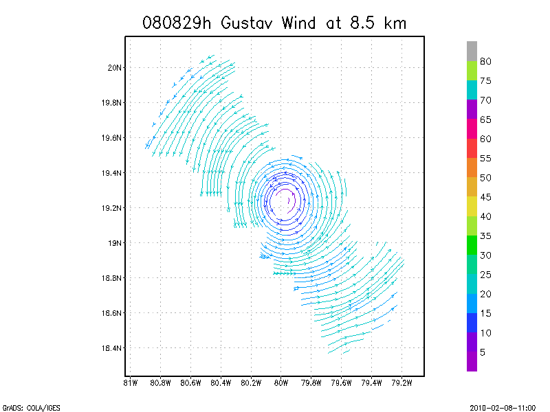
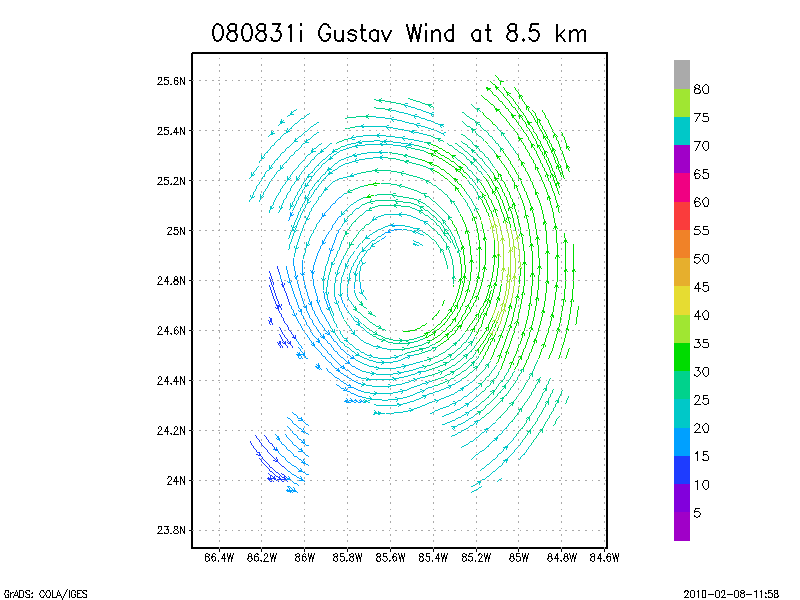
8.5 km
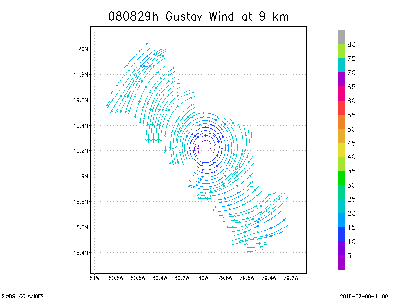
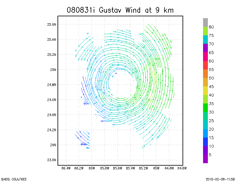
9.0 km
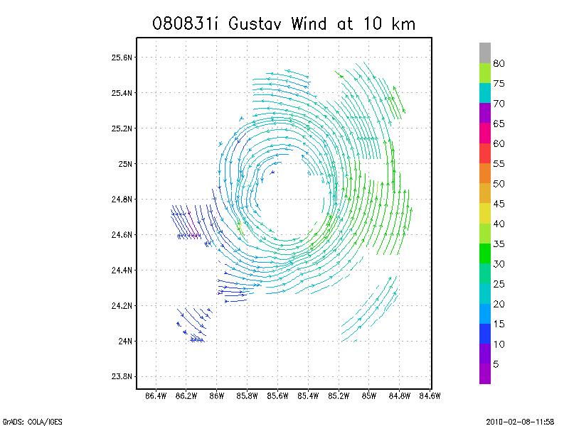
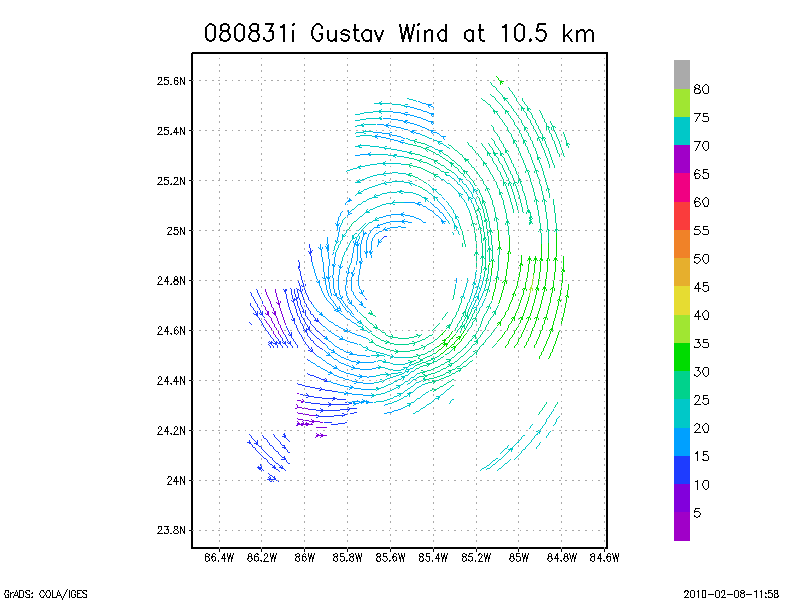
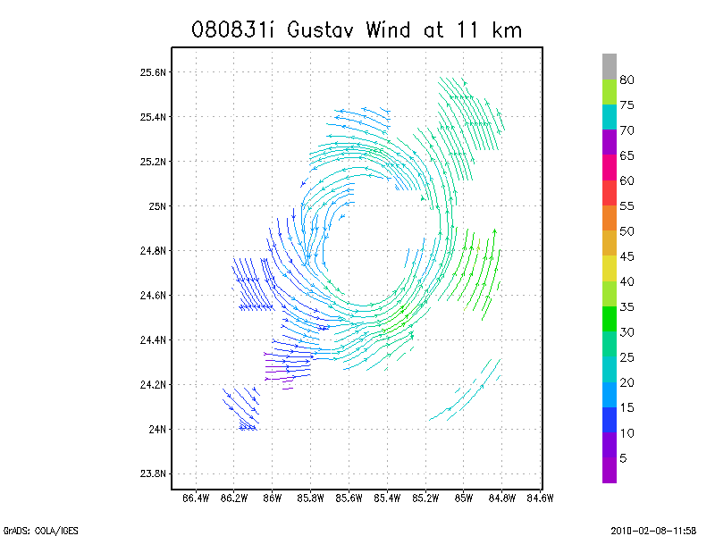
Winds at :
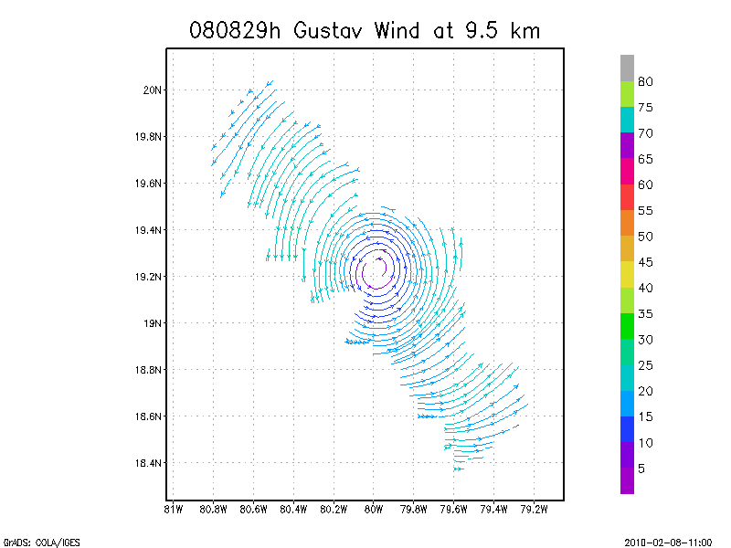
9.5 km
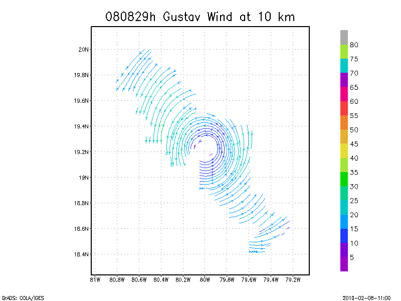
10.0 km
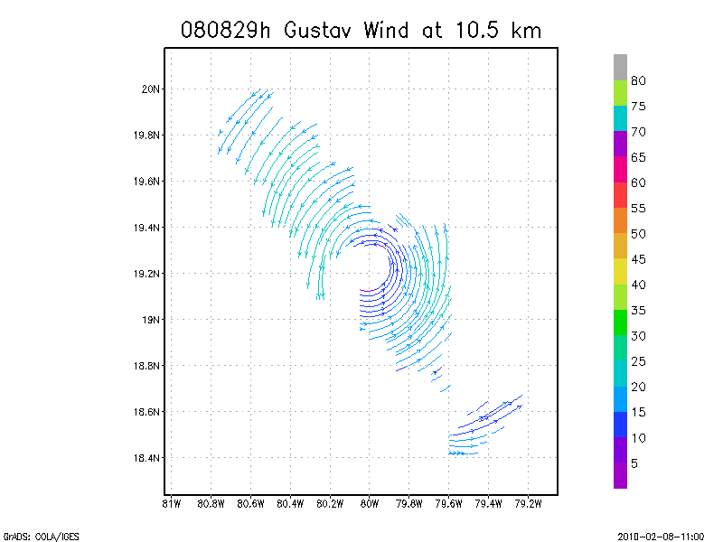
10.5 km
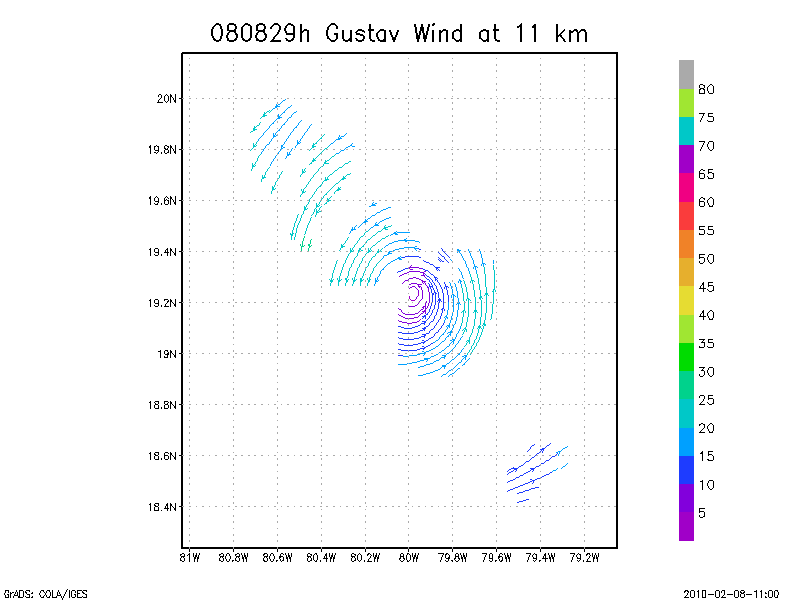
11.0 km
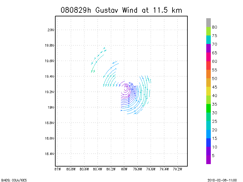
11.5 km
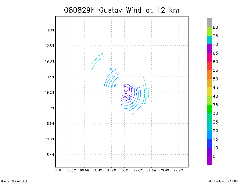
12.0 km
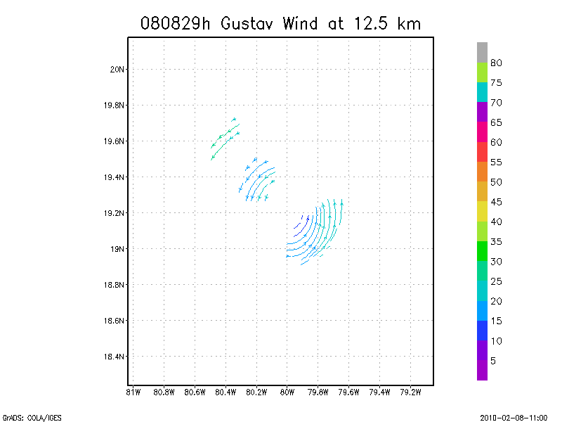
12.5 km
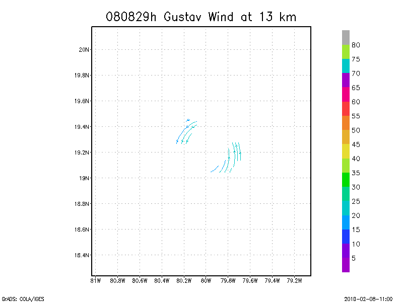
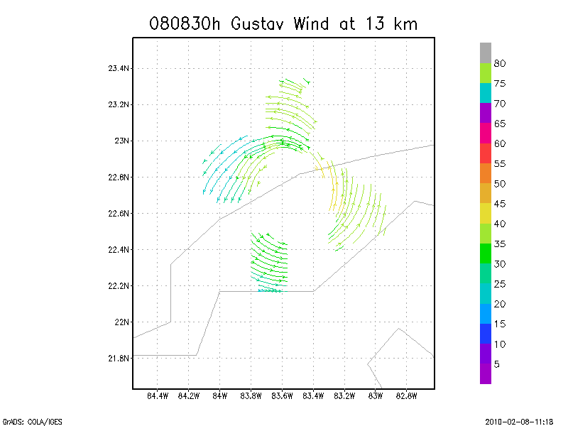
13.0 km
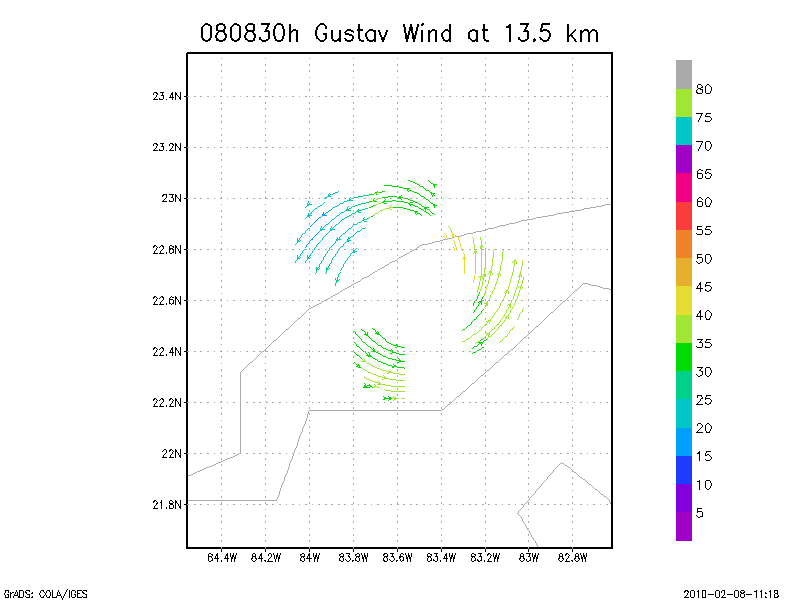
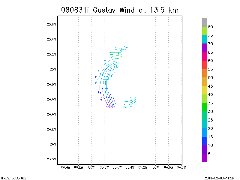
13.5 km
Winds at :
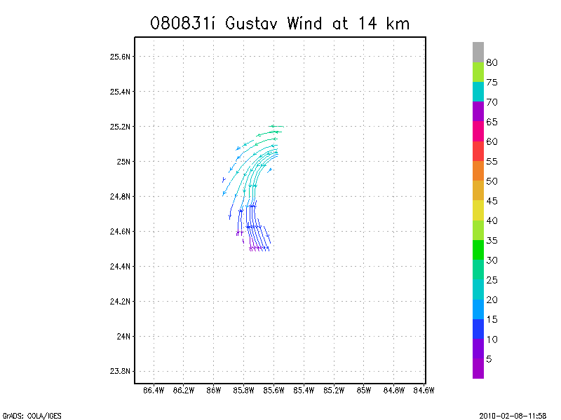
14.0 km
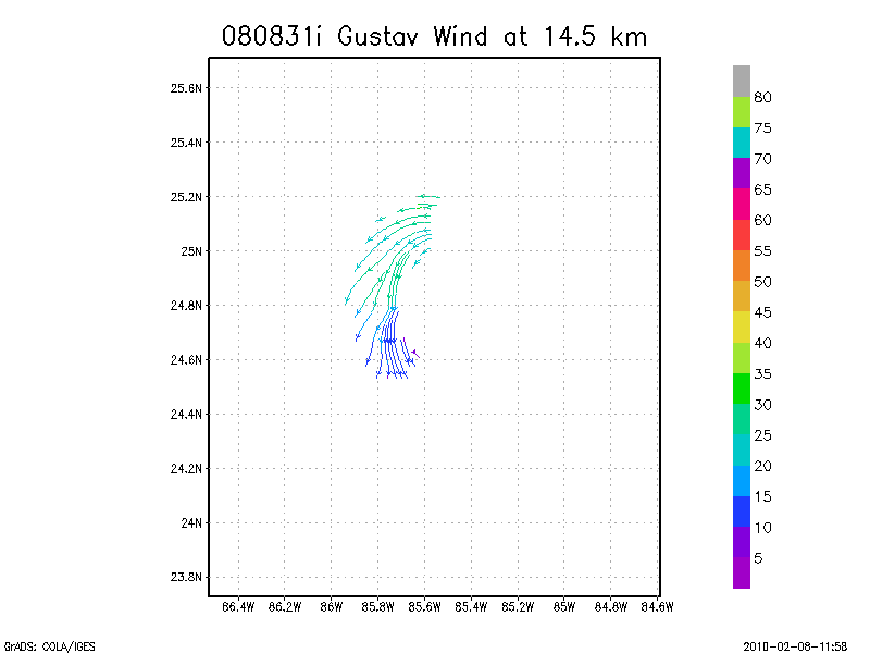
14.5 km
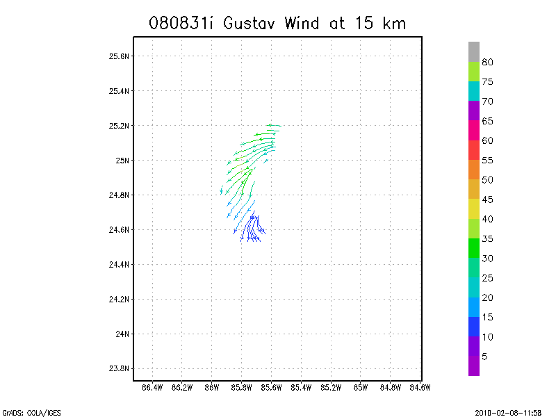
15.0 km
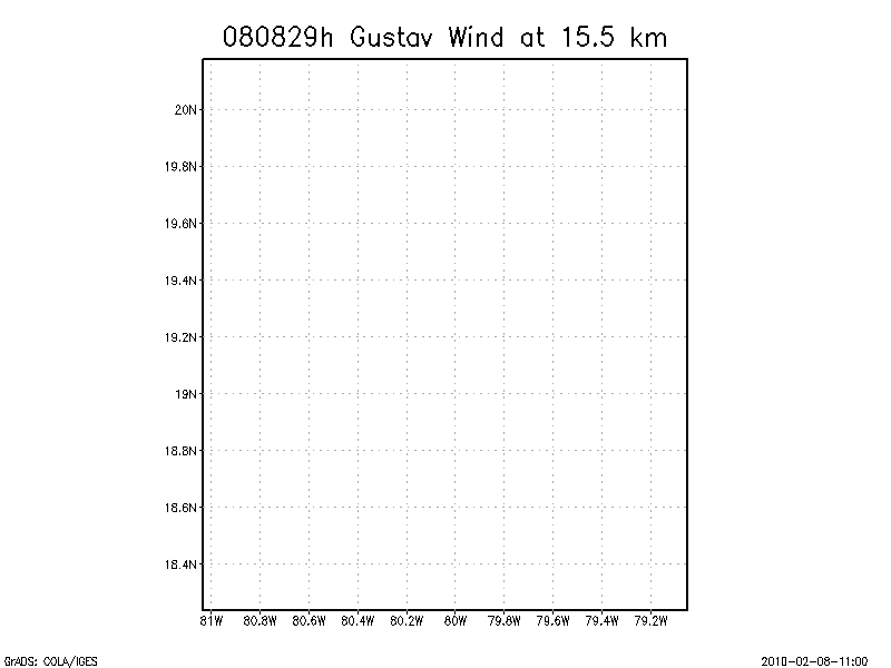
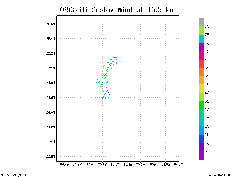
15.5 km
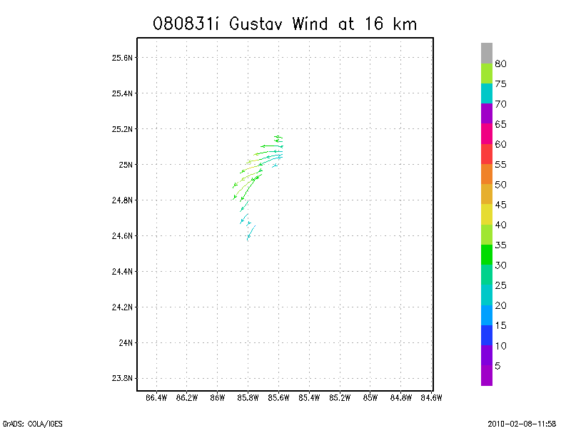
16.0 km
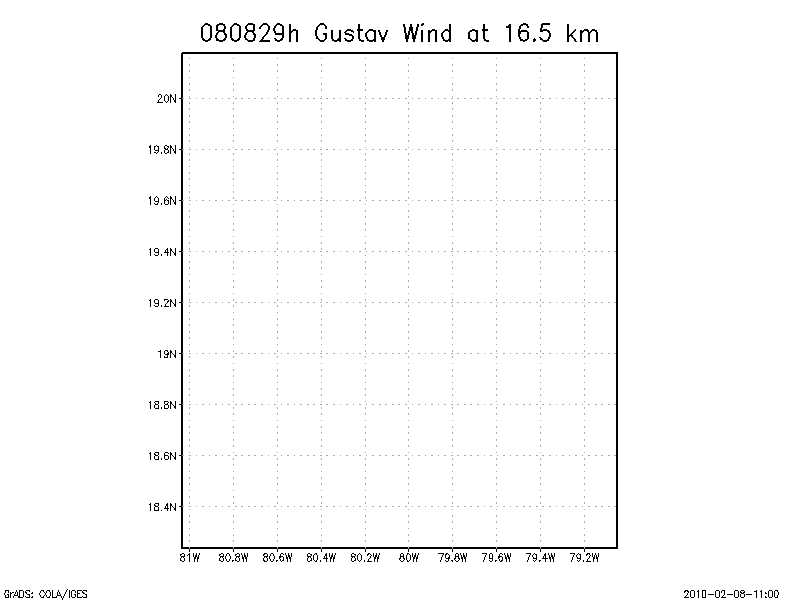
16.5 km
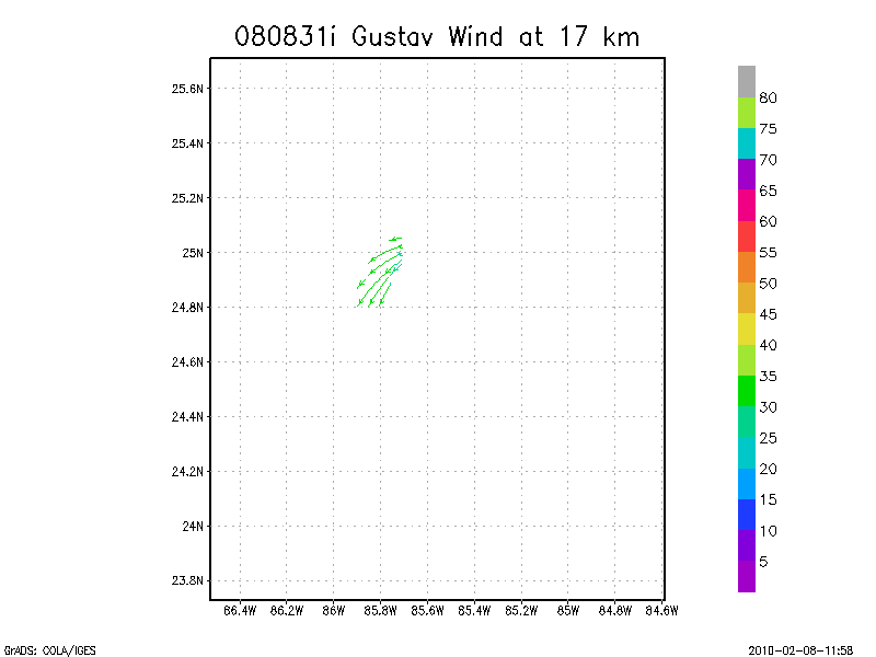
17.0 km
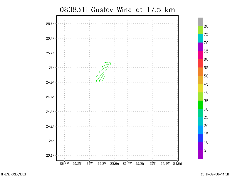
17.5 km
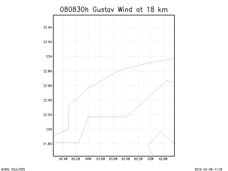
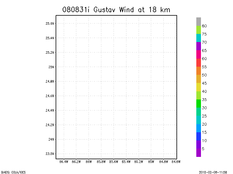
18.0 km
Individual sweeps
(aircraft relative)
Note : Radar in sector mode
Animated radar
tar'd and gzipped single frame GIFs
tar'd and gzipped sweep data
Individual sweeps
(storm relative)
Note : Radar in sector mode
Animated radar
tar'd and gzipped single frame GIFs
tar'd and gzipped sweep data
Individual sweeps
(storm relative)
660 x 660 km
Note : Radar in sector mode
Animated radar
tar'd and gzipped single frame GIFs
tar'd and gzipped sweep data
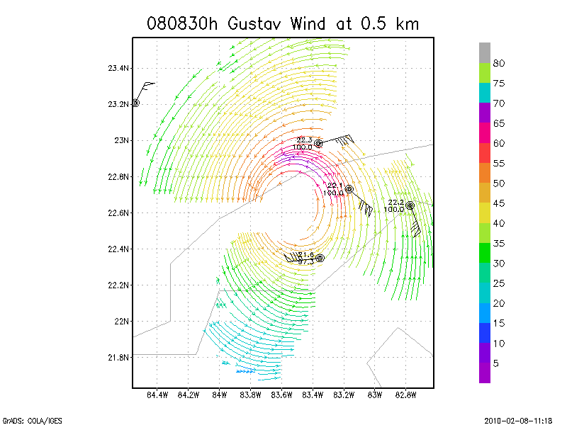
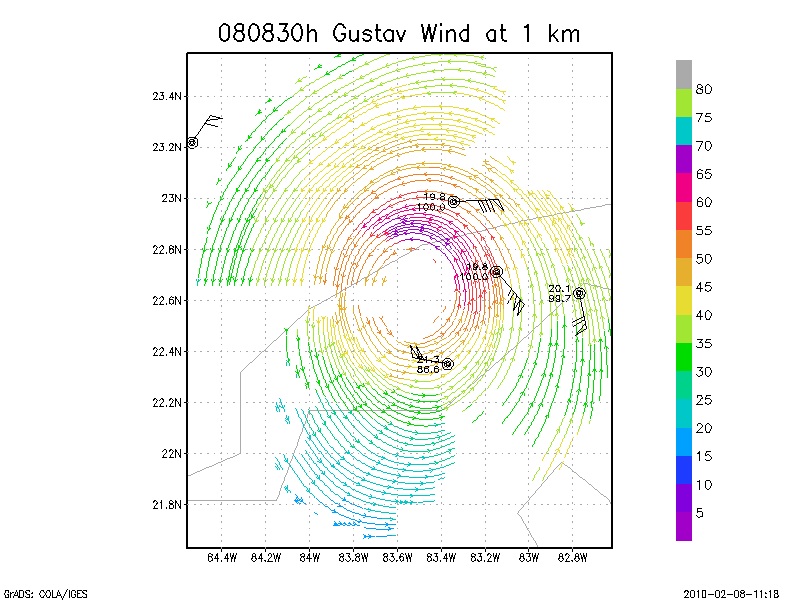
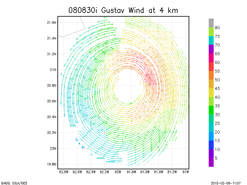
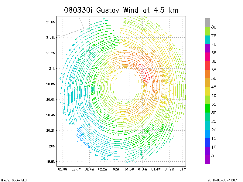
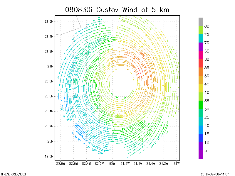
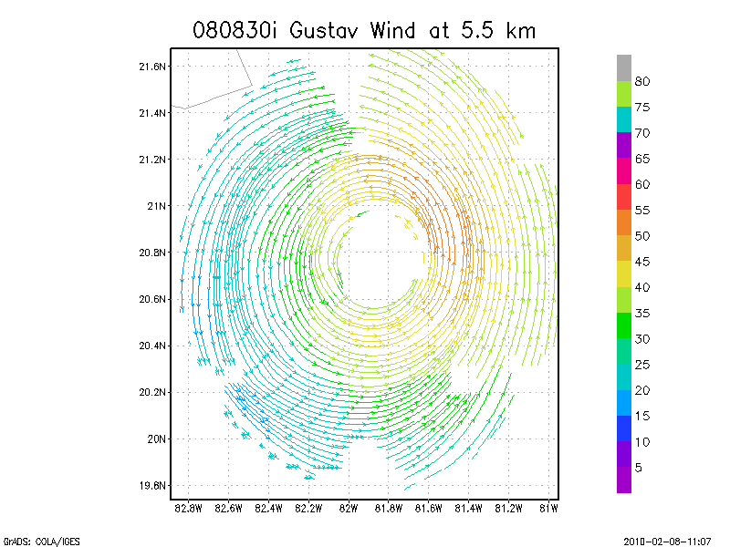
August 30, 2008
N42RF
Composite of all legs and dropsondes
Gridded radar data
GrADS control file radar data
Gridded dropsonde data
GrADS control file dropsonde data
GrADS map of dropsonde data
Winds at :
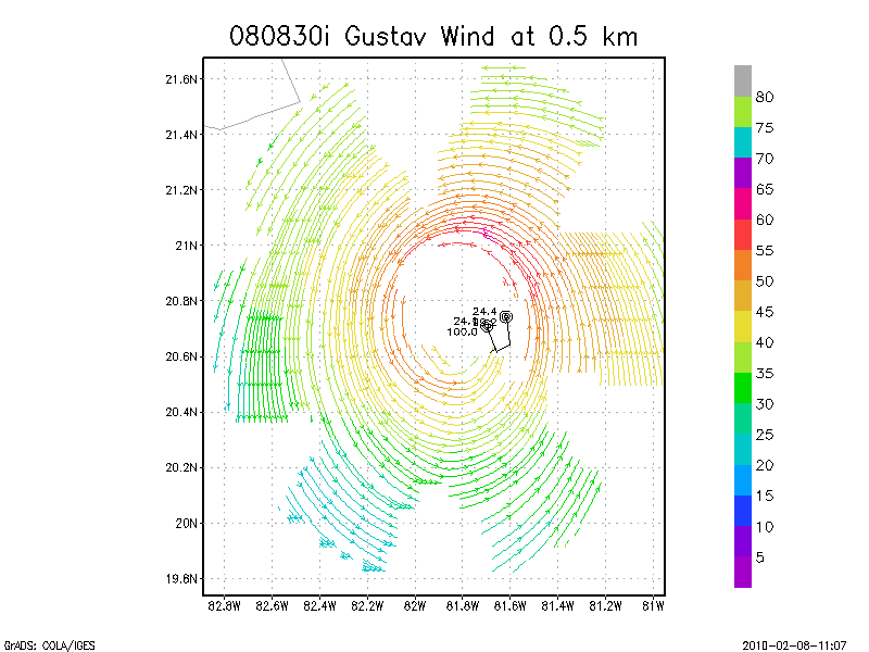
.5 km
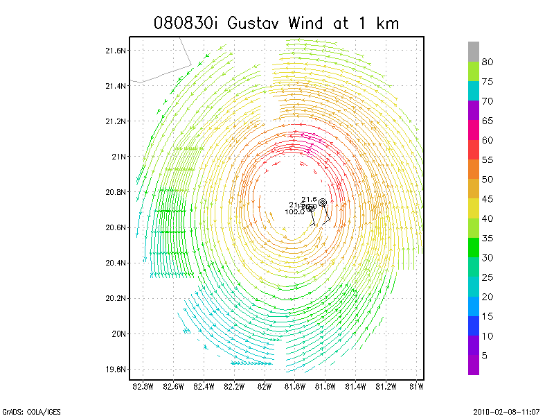
1.0 km
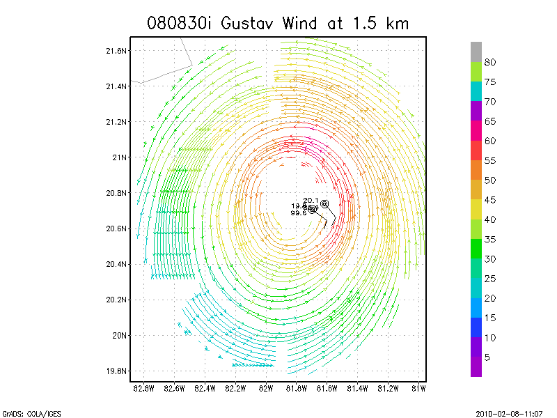
1.5 km
2.0 km
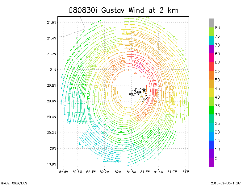
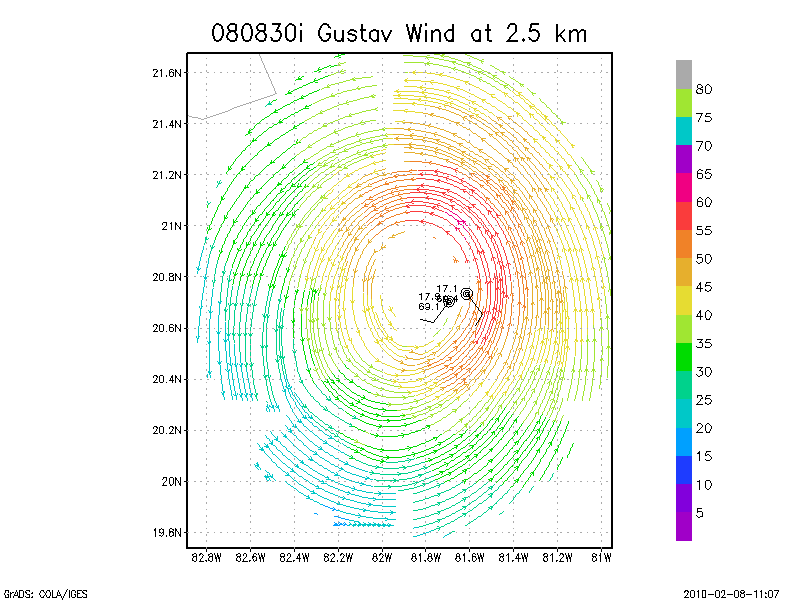
2.5 km
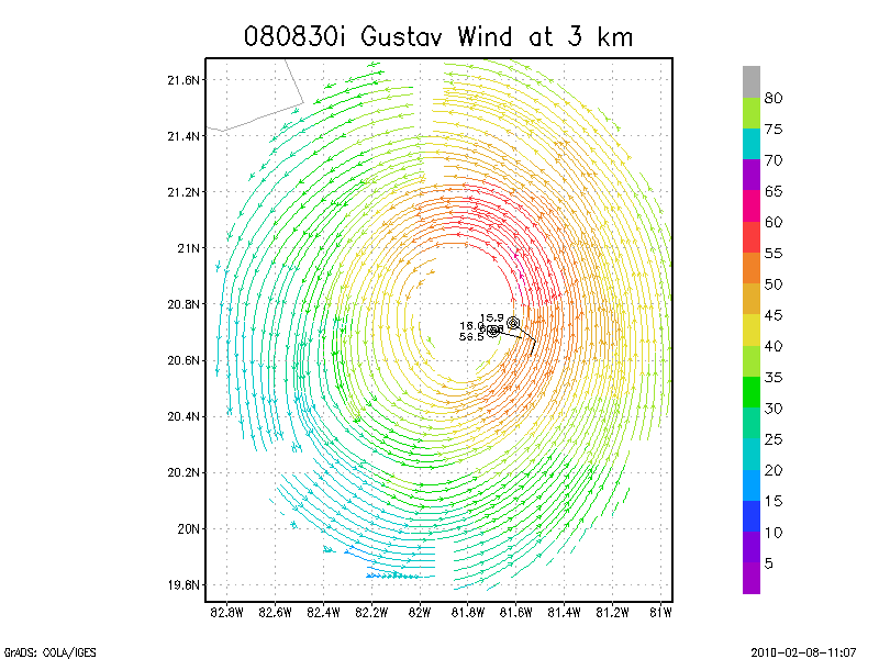
3.0 km
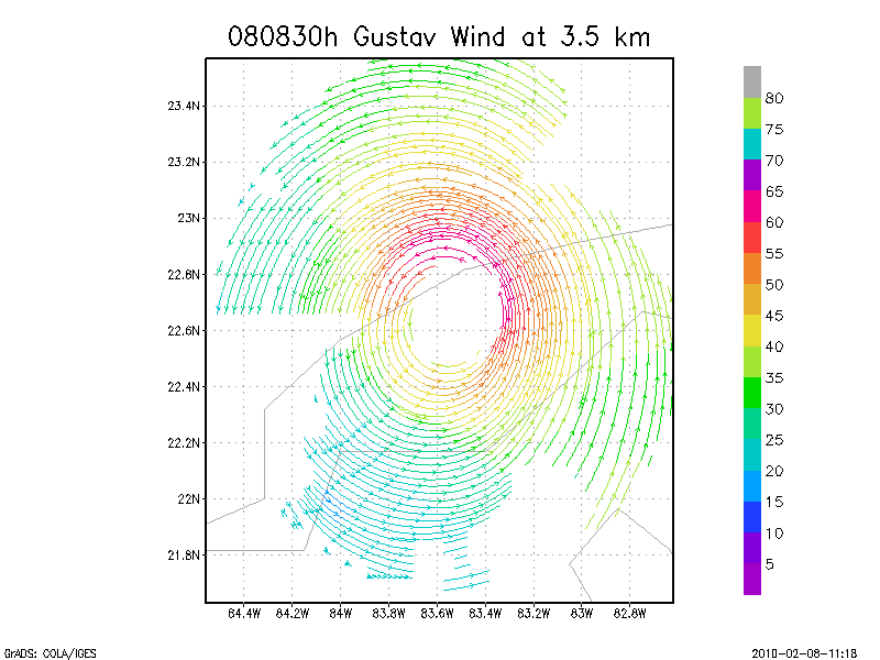
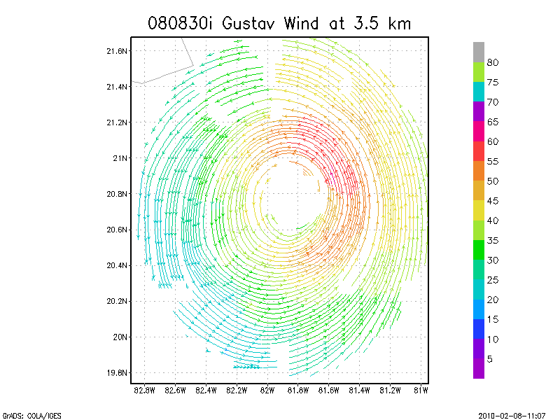
3.5 km
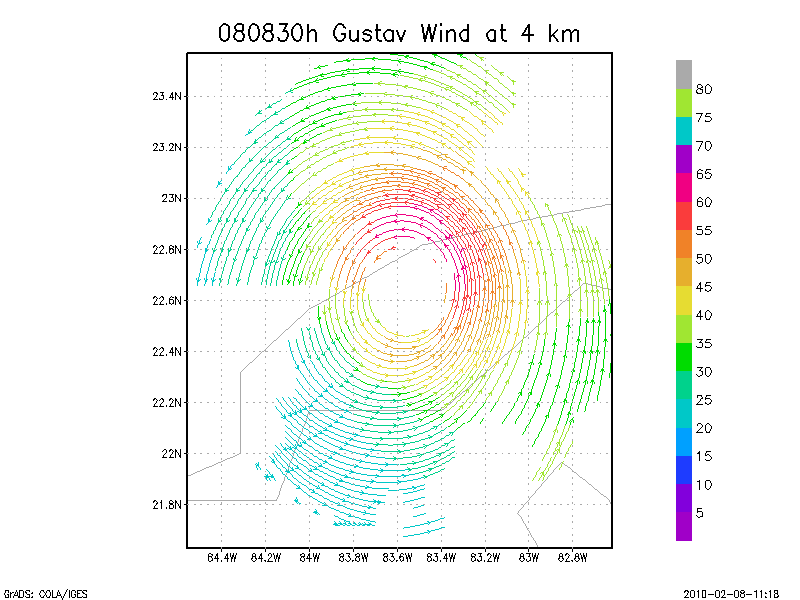
4.0 km
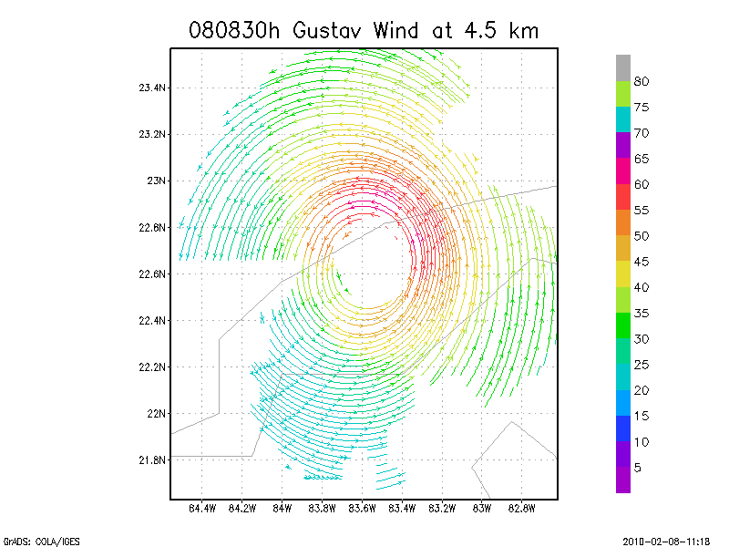
4.5 km
Winds at :
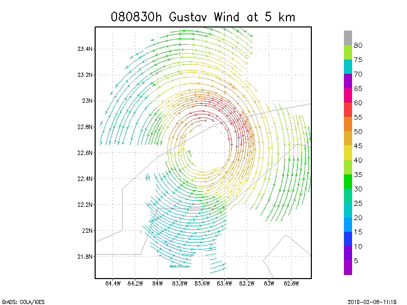
5.0 km
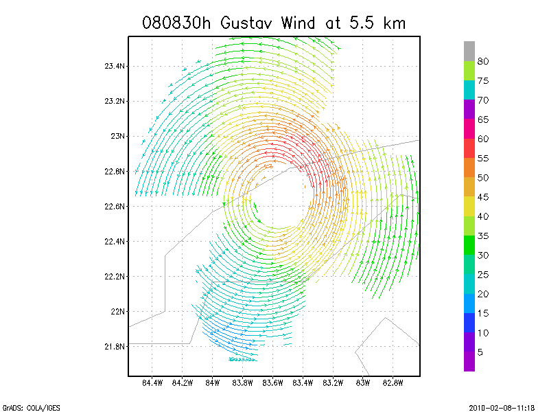
5.5 km
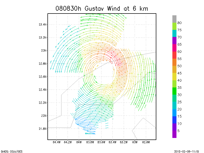
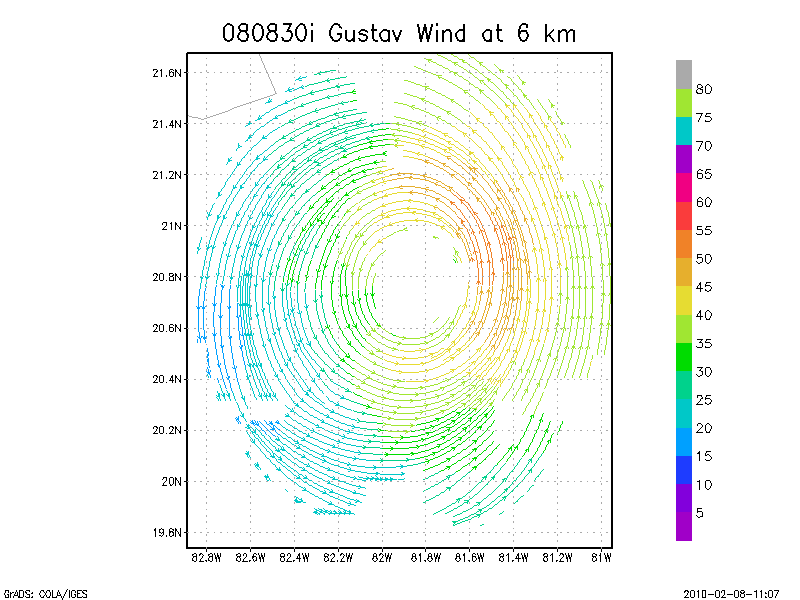
6.0 km
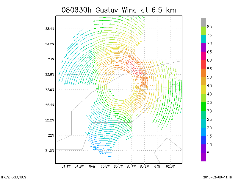
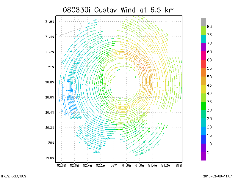
6.5 km
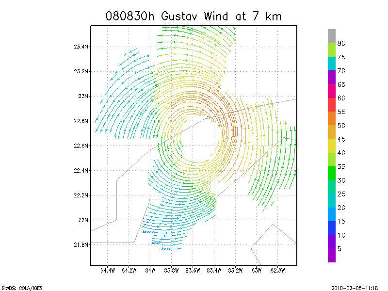
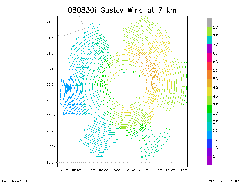
7.0 km
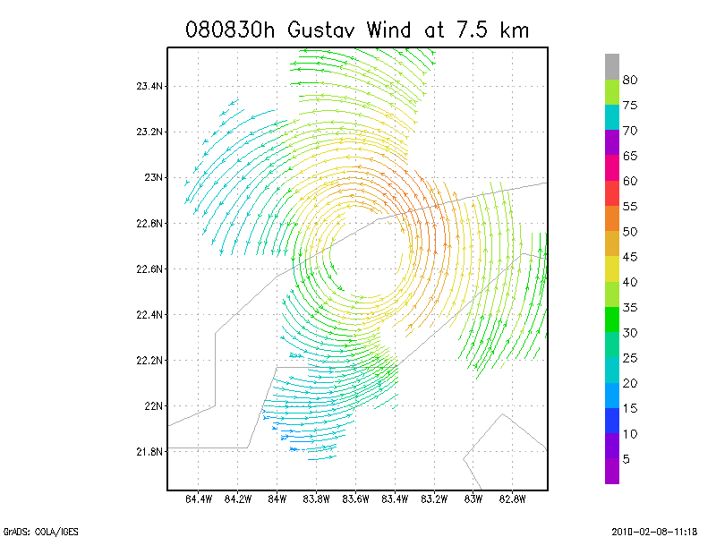
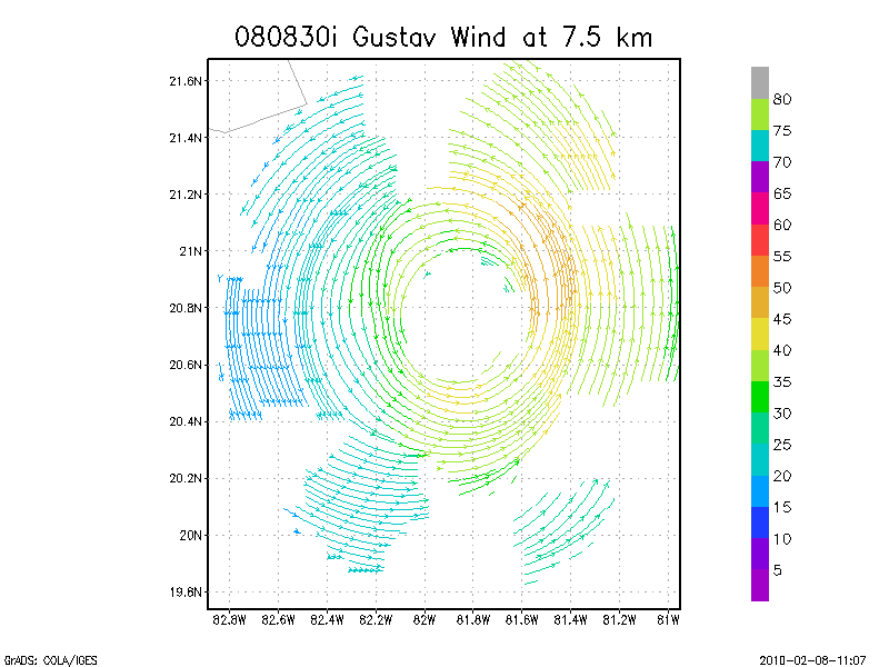
7.5 km
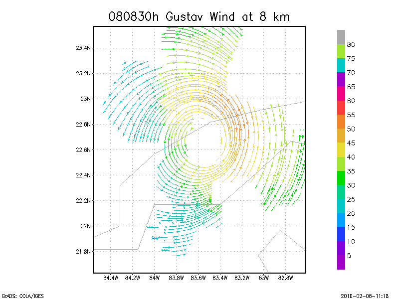
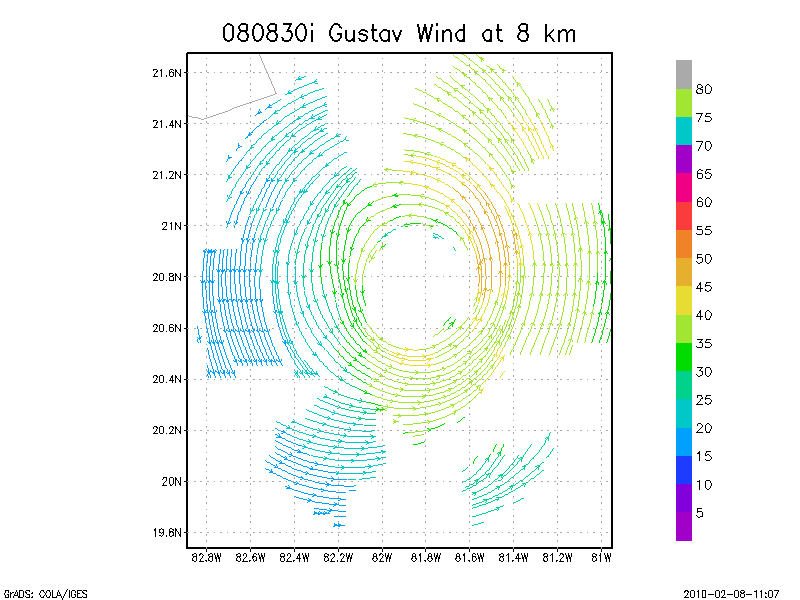
8.0 km
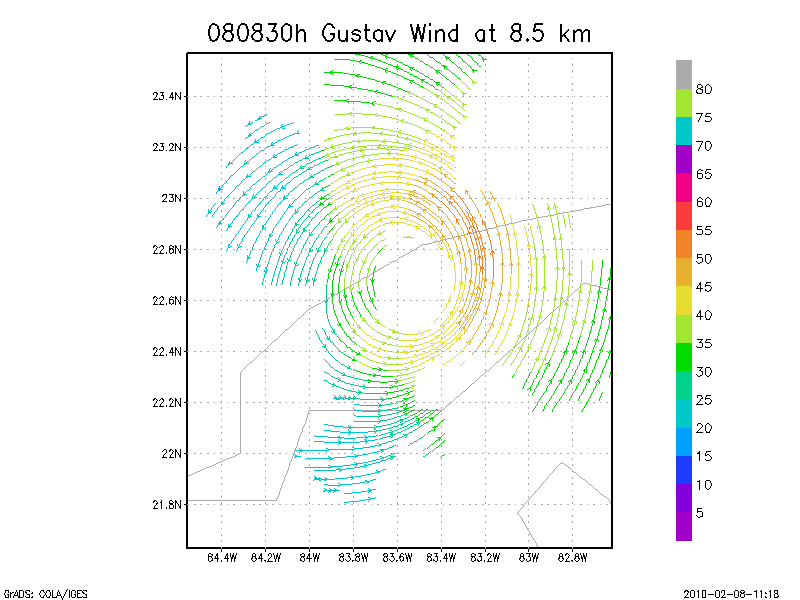
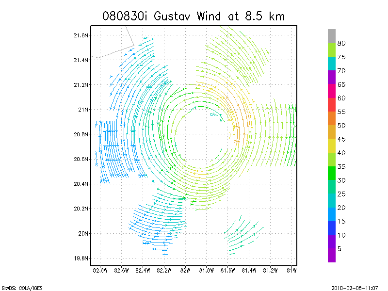
8.5 km
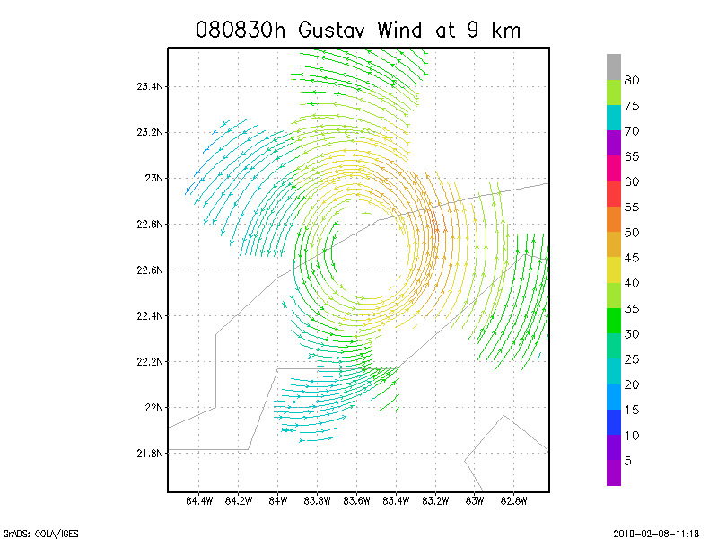
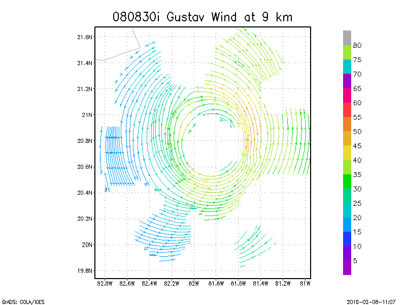
9.0 km
Winds at :
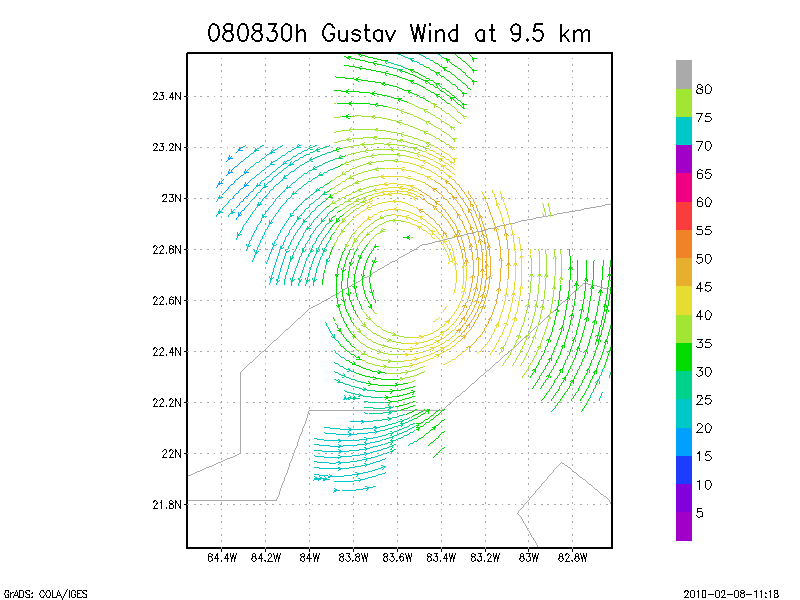
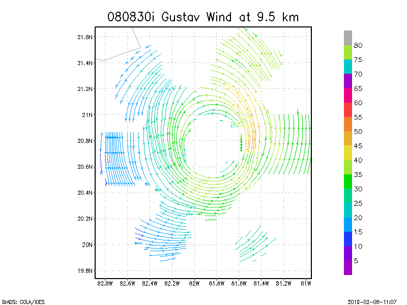
9.5 km
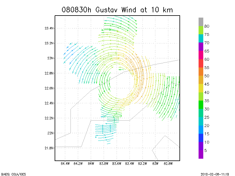
10.0 km
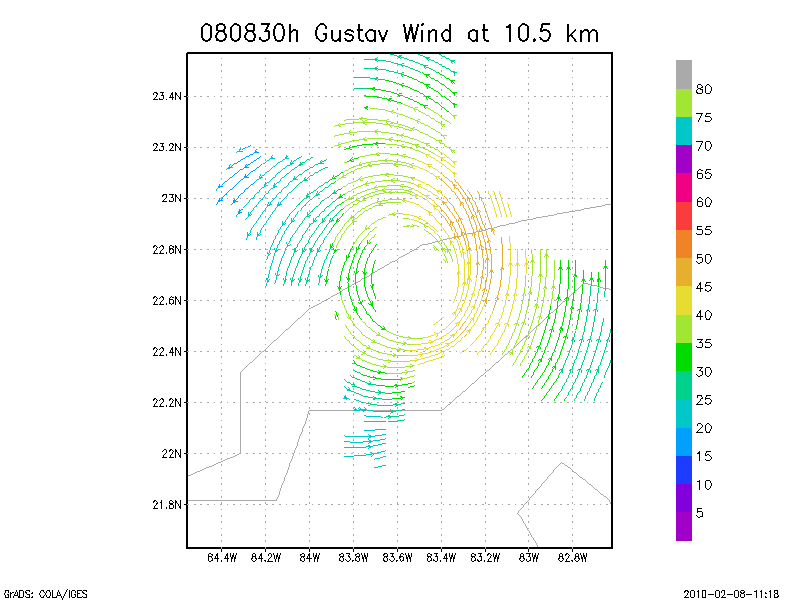
10.5 km
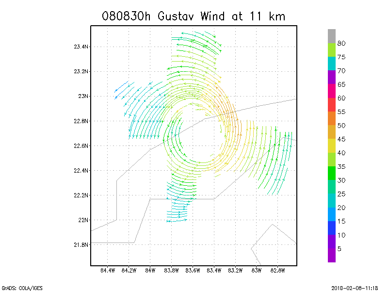
11.0 km
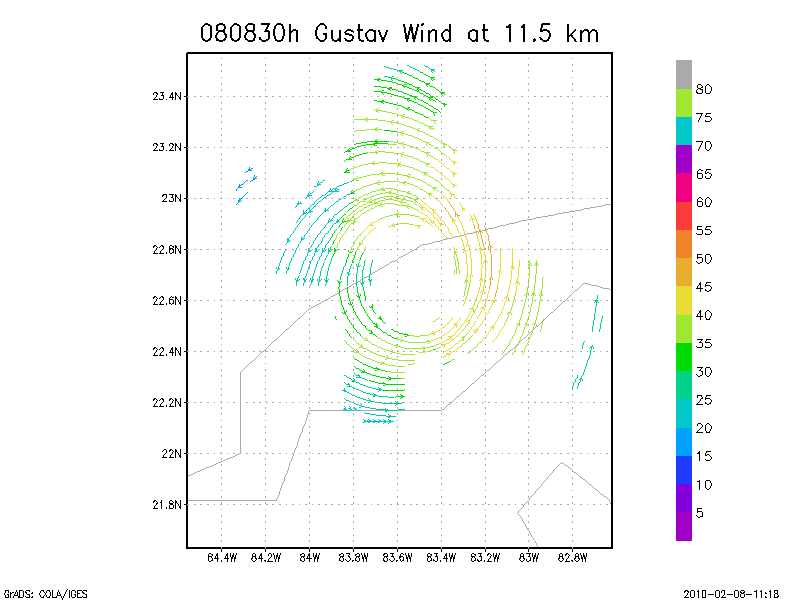
11.5 km
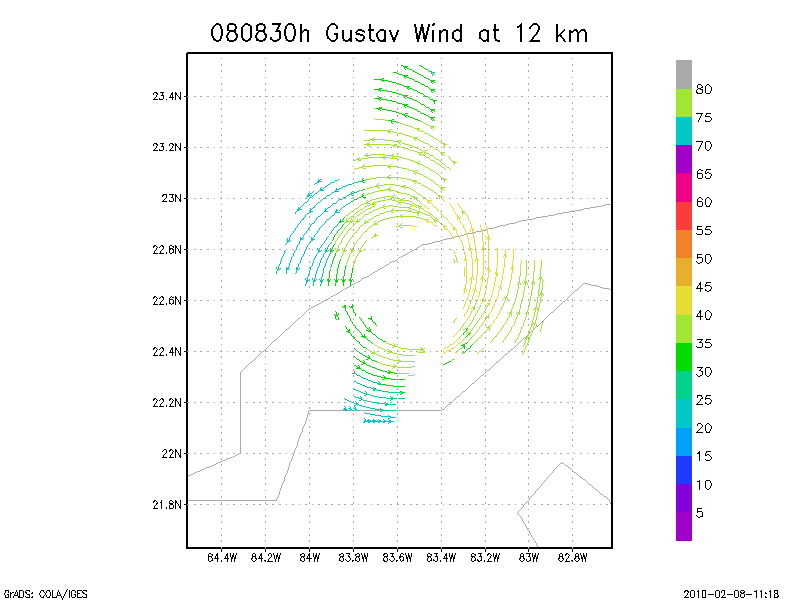
12.0 km
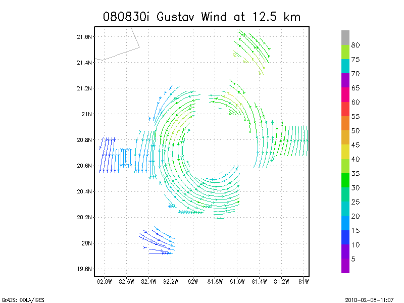
12.5 km
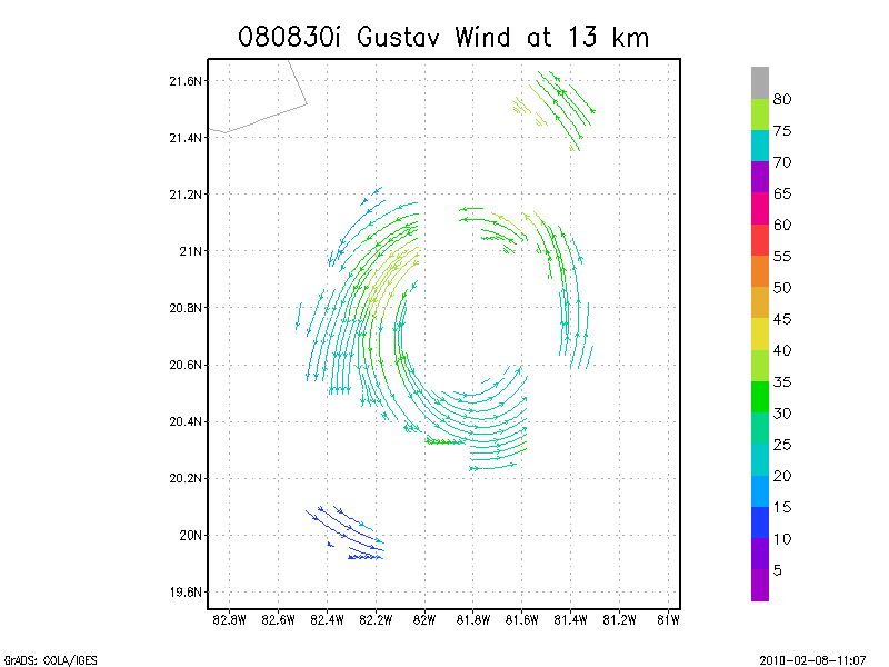
13.0 km
13.5 km
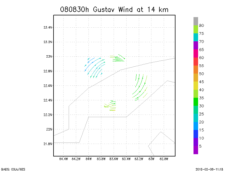
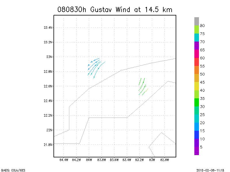
Winds at :
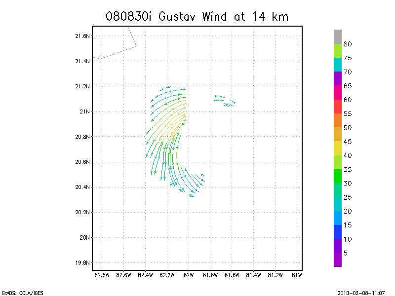
14.0 km
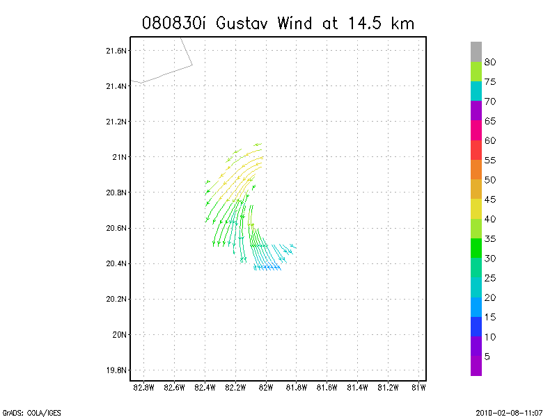
14.5 km
15.0 km
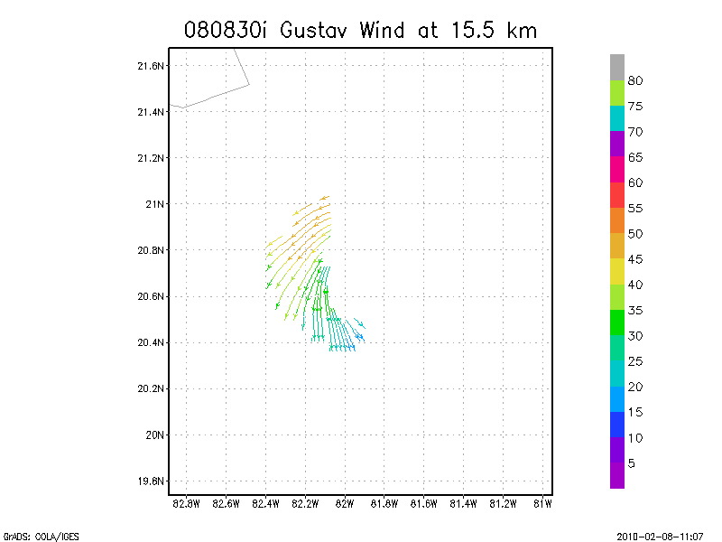
15.5 km
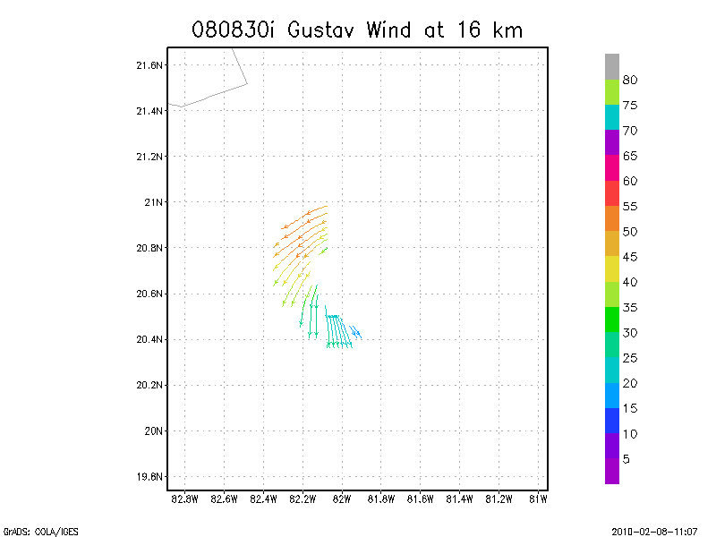
16.0 km
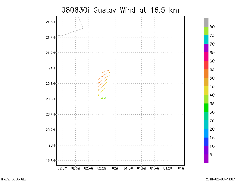
16.5 km
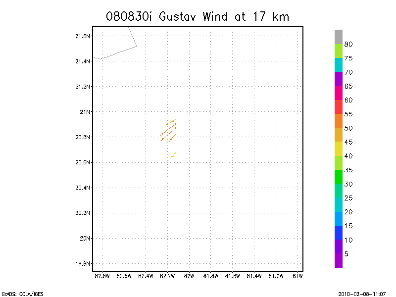
17.0 km
17.5 km
18.0 km
Individual sweeps
(aircraft relative)
Note : Radar in sector mode
Animated radar
tar'd and gzipped single frame GIFs
tar'd and gzipped sweep data
Individual sweeps
(storm relative)
660 x 660 km
Note : Radar in sector mode
Animated radar
tar'd and gzipped single frame GIFs
tar'd and gzipped sweep data
Individual sweeps
(storm relative)
Note : Radar in sector mode
Animated radar
tar'd and gzipped single frame GIFs
tar'd and gzipped sweep data
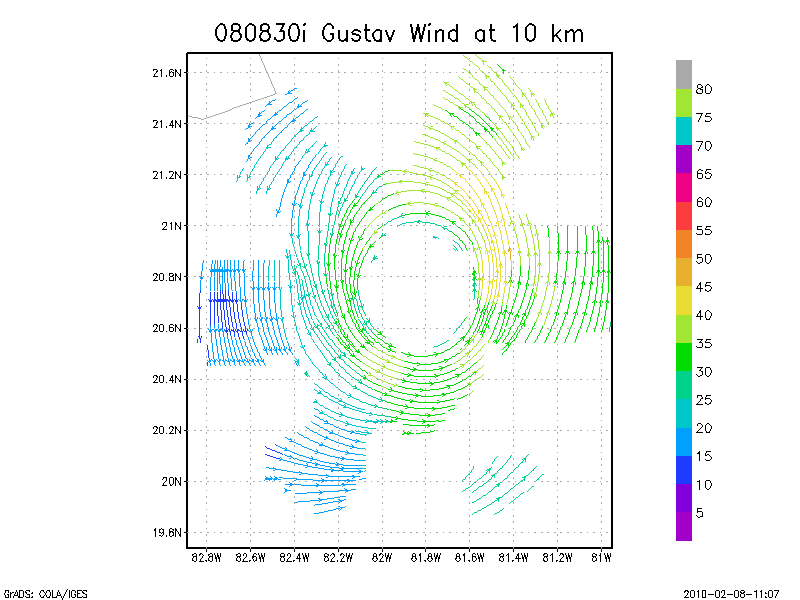
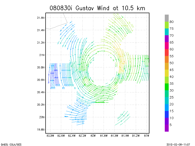
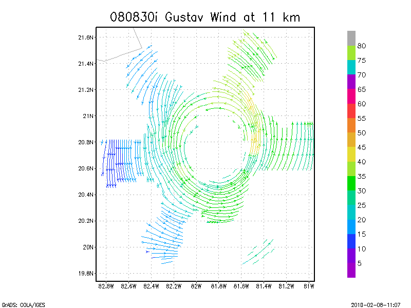
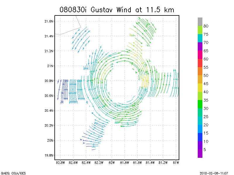
August 30, 2008
N43RF
Composite of all legs and dropsondes
Gridded radar data
GrADS control file radar data
Gridded dropsonde data
GrADS control file dropsonde data
GrADS map of dropsonde data
Winds at :
.5 km
1.0 km
1.5 km
2.0 km
2.5 km
3.0 km
3.5 km
4.0 km
4.5 km
Winds at :
5.0 km
5.5 km
6.0 km
6.5 km
7.0 km
7.5 km
8.0 km
8.5 km
9.0 km
Winds at :
9.5 km
10.0 km
10.5 km
11.0 km
11.5 km
12.0 km
12.5 km
13.0 km
13.5 km
Winds at :
14.0 km
14.5 km
15.0 km
15.5 km
16.0 km
16.5 km
17.0 km
17.5 km
18.0 km
Individual sweeps
(aircraft relative)
Animated radar
tar'd and gzipped single frame GIFs
tar'd and gzipped sweep data
Individual sweeps
(storm relative)
660 x 660 km
Animated radar
tar'd and gzipped single frame GIFs
tar'd and gzipped sweep data
Individual sweeps
(storm relative)
Animated radar
tar'd and gzipped single frame GIFs
tar'd and gzipped sweep data
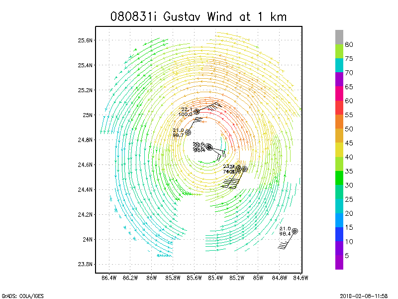
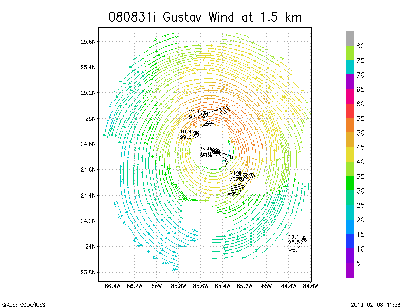
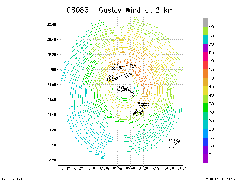
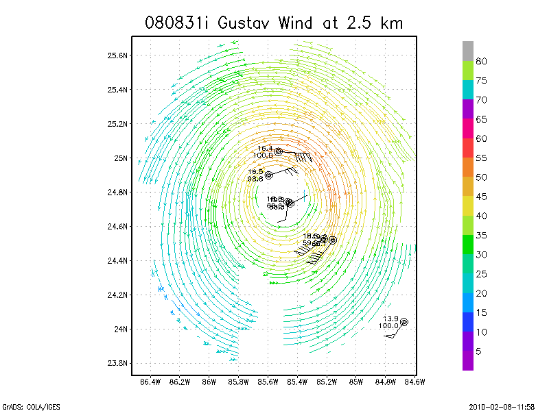
August 31, 2008
N42RF
Composite of all legs and dropsondes
Gridded radar data
GrADS control file radar data
Gridded dropsonde data
GrADS control file dropsonde data
GrADS map of dropsonde data
Winds at :
.5 km
1.0 km
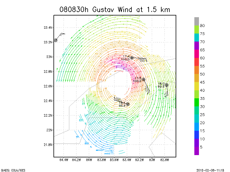
1.5 km
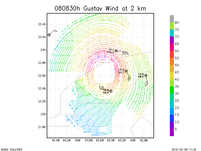
2.0 km
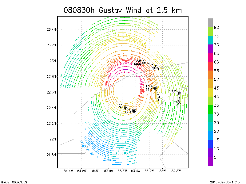
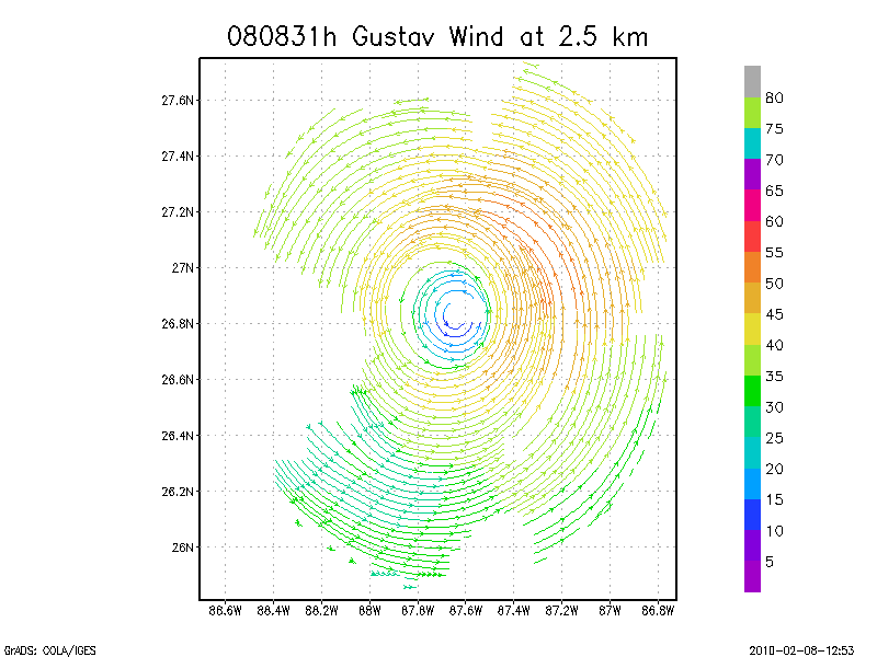
2.5 km
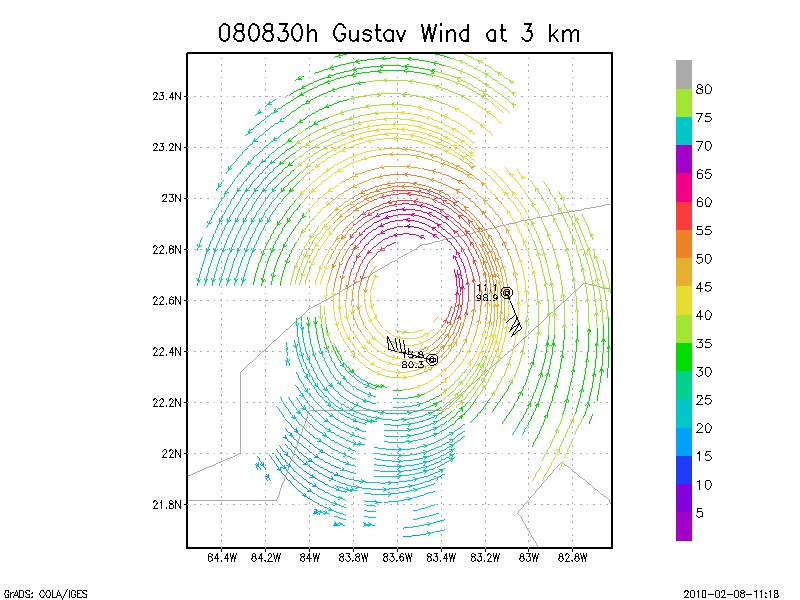
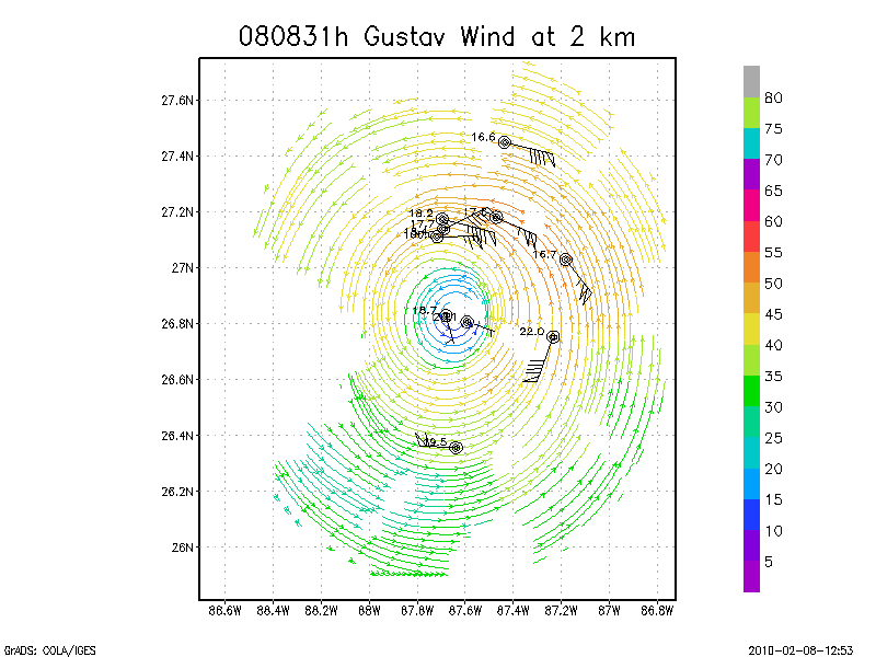
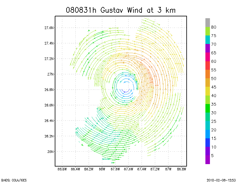
3.0 km
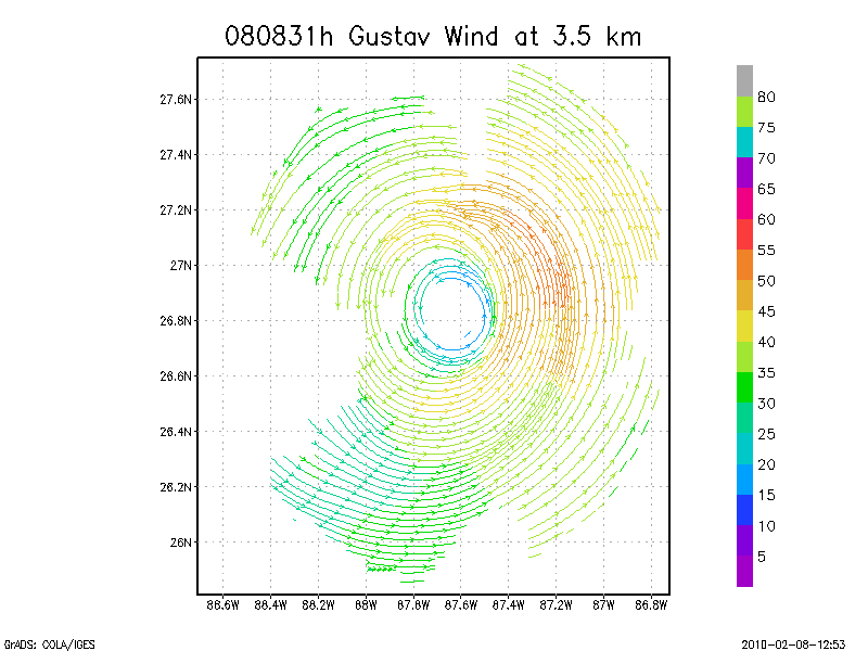
3.5 km
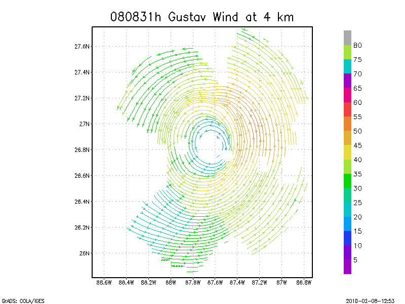
4.0 km
4.5 km
Winds at :
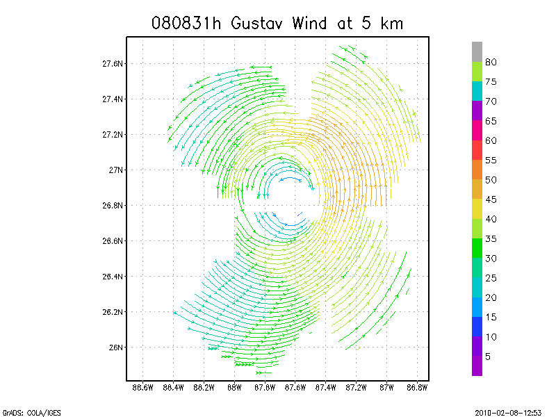
5.0 km
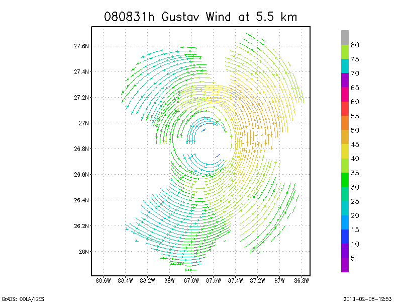
5.5 km
6.0 km
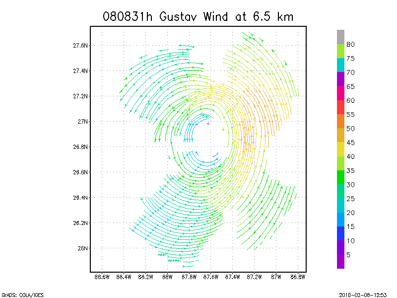
6.5 km
7.0 km
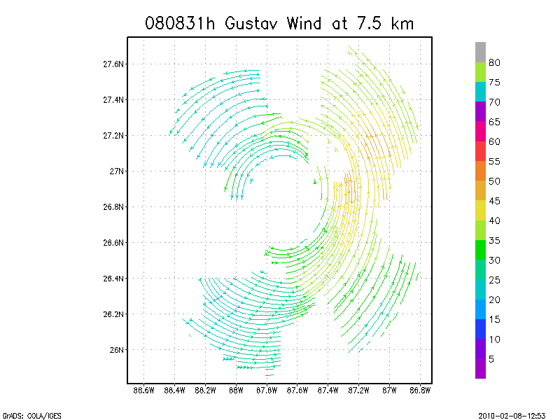
7.5 km
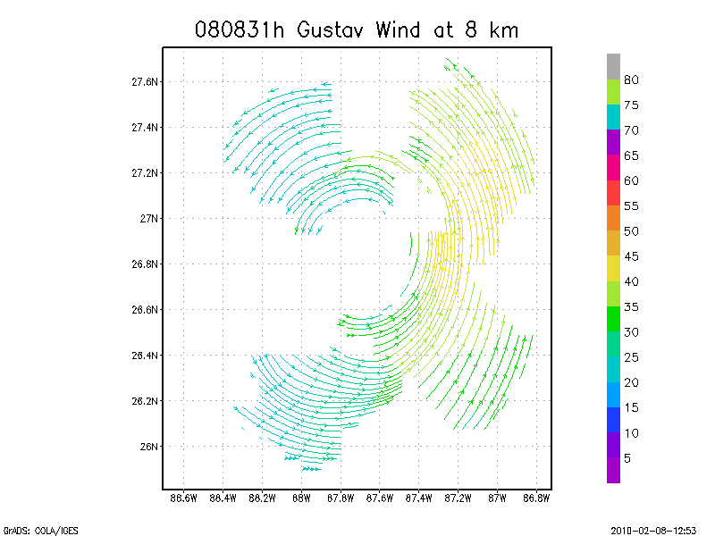
8.0 km
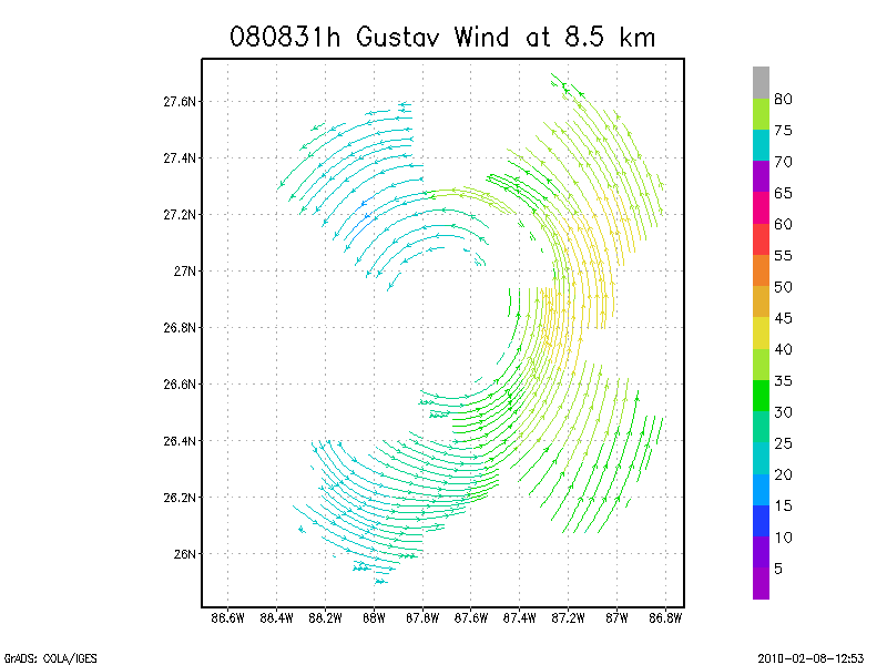
8.5 km
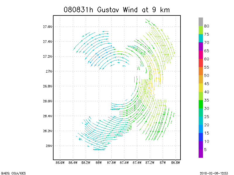
9.0 km
Winds at :
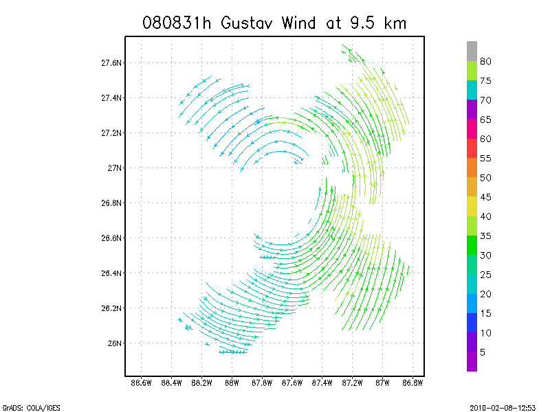
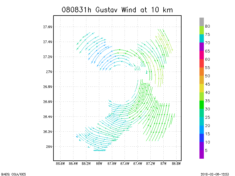
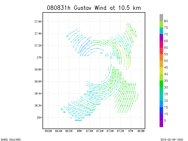
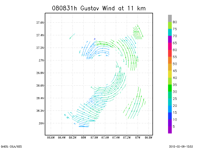
9.5 km
10.0 km
10.5 km
11.0 km
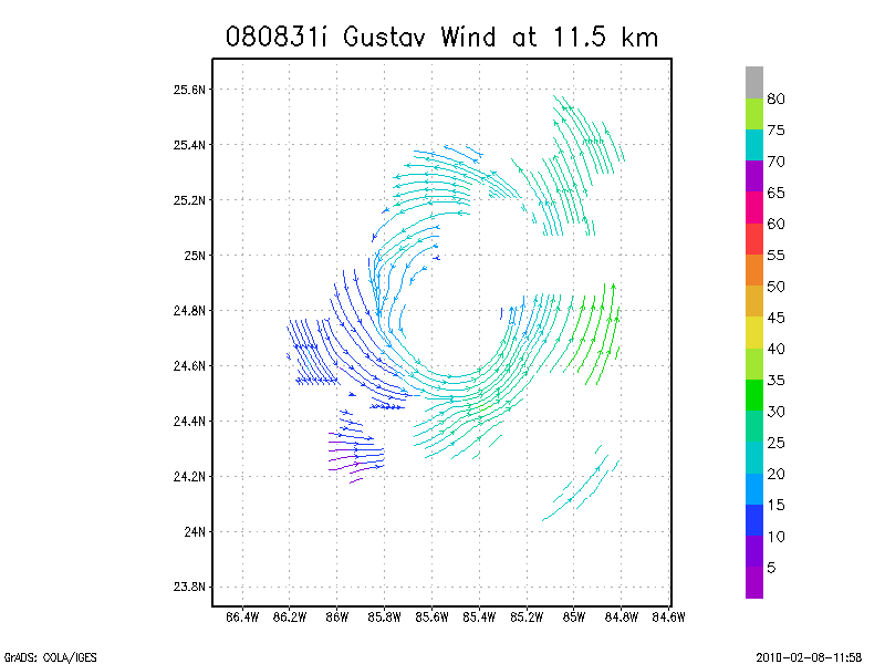
11.5 km
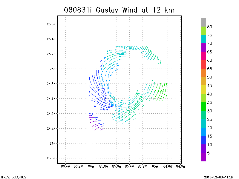
12.0 km
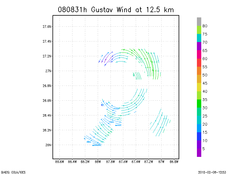
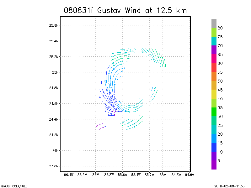
12.5 km
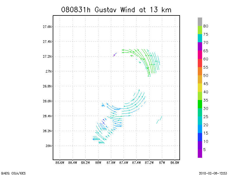
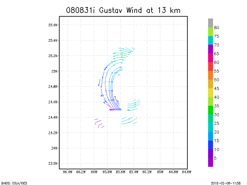
13.0 km
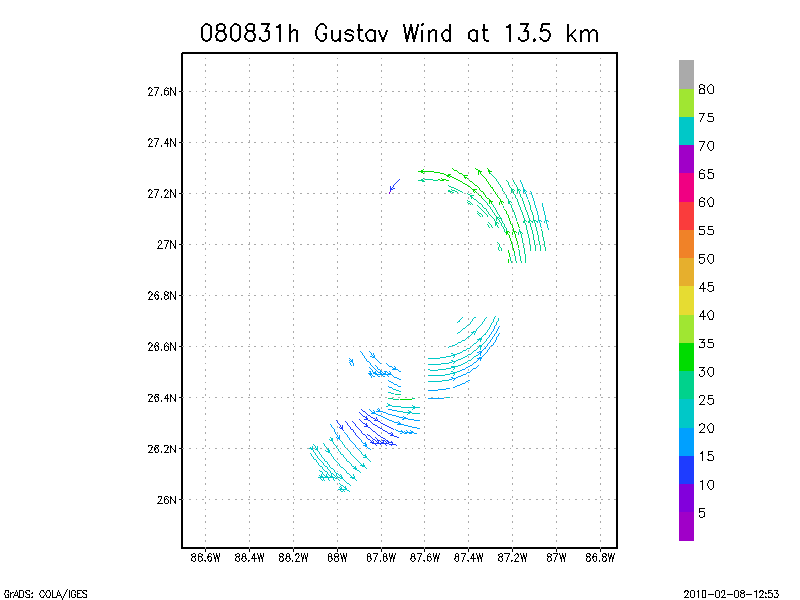
13.5 km
Winds at :
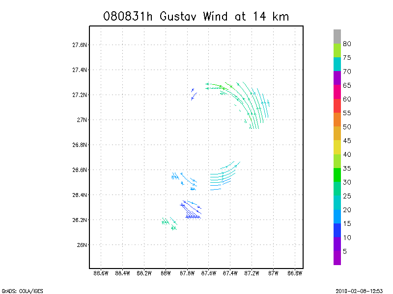
14.0 km
14.5 km
15.0 km
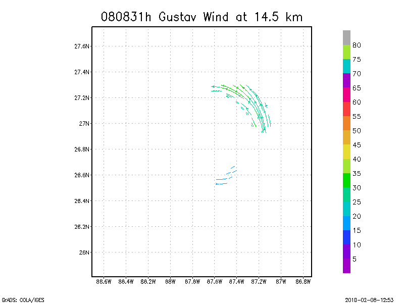
15.5 km
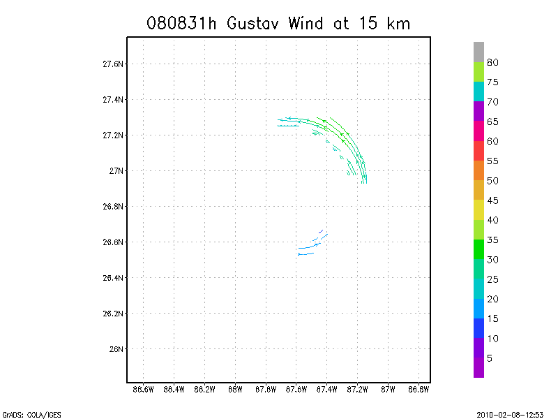
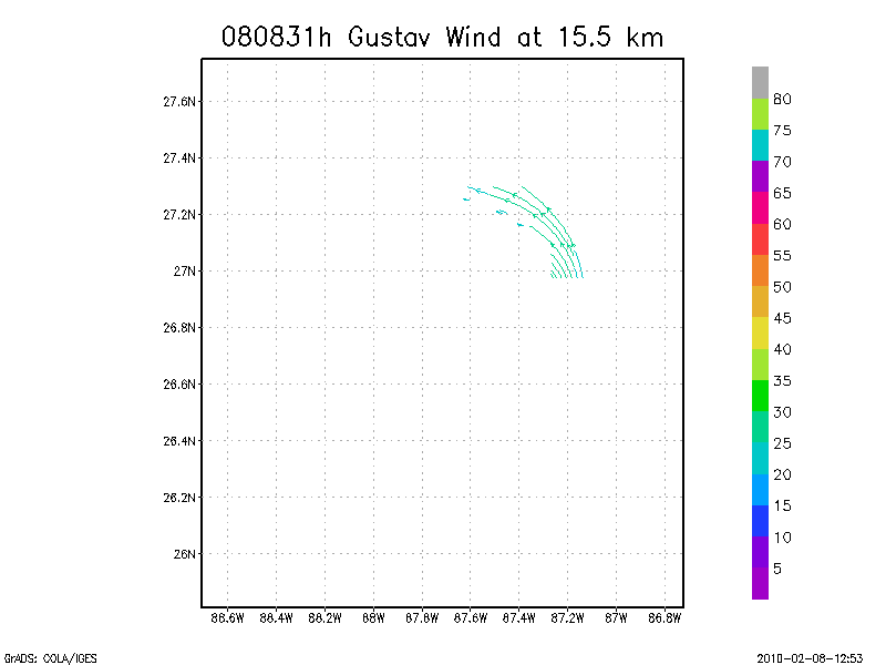
16.0 km
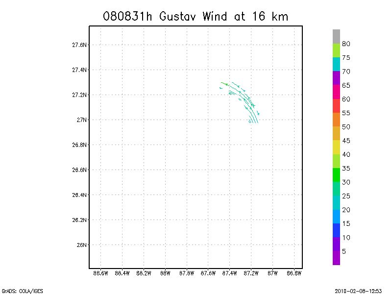
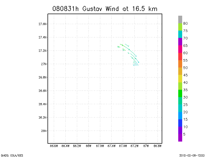
16.5 km
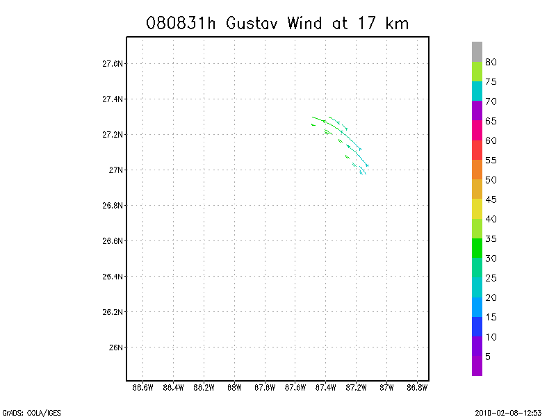
17.0 km
17.5 km
18.0 km
Individual sweeps
(aircraft relative)
Note : Radar in sector mode
Animated radar
tar'd and gzipped single frame GIFs
tar'd and gzipped sweep data
Individual sweeps
(storm relative)
660 x 660 km
Note : Radar in sector mode
Animated radar
tar'd and gzipped single frame GIFs
tar'd and gzipped sweep data
Individual sweeps
(storm relative)
Note : Radar in sector mode
Animated radar
tar'd and gzipped single frame GIFs
tar'd and gzipped sweep data
August 31, 2008
N43RF
Composite of all legs and dropsondes
Gridded radar data
GrADS control file radar data
Gridded dropsonde data
GrADS control file dropsonde data
GrADS map of dropsonde data
Winds at :
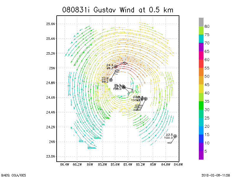
.5 km
1.0 km
1.5 km
2.0 km
2.5 km
3.0 km
3.5 km
4.0 km
4.5 km
Winds at :
5.0 km
5.5 km
6.0 km
6.5 km
7.0 km
7.5 km
8.0 km
8.5 km
9.0 km
Winds at :
9.5 km
10.0 km
10.5 km
11.0 km
11.5 km
12.0 km
12.5 km
13.0 km
13.5 km
Winds at :
14.0 km
14.5 km
15.0 km
15.5 km
16.0 km
16.5 km
17.0 km
17.5 km
18.0 km
Individual sweeps
(aircraft relative)
Animated radar
tar'd and gzipped single frame GIFs
tar'd and gzipped sweep data
Individual sweeps
(storm relative)
660 x 660 km
Animated radar
tar'd and gzipped single frame GIFs
tar'd and gzipped sweep data
Individual sweeps
(storm relative)
Animated radar
tar'd and gzipped single frame GIFs
tar'd and gzipped sweep data
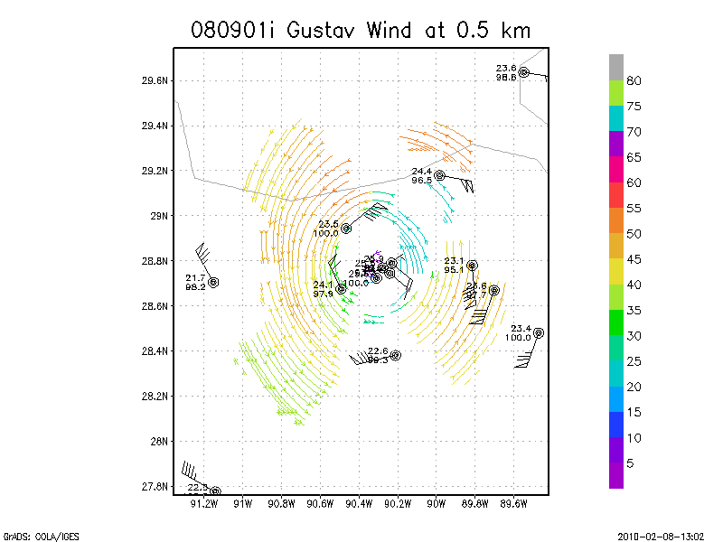
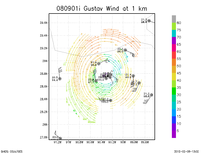
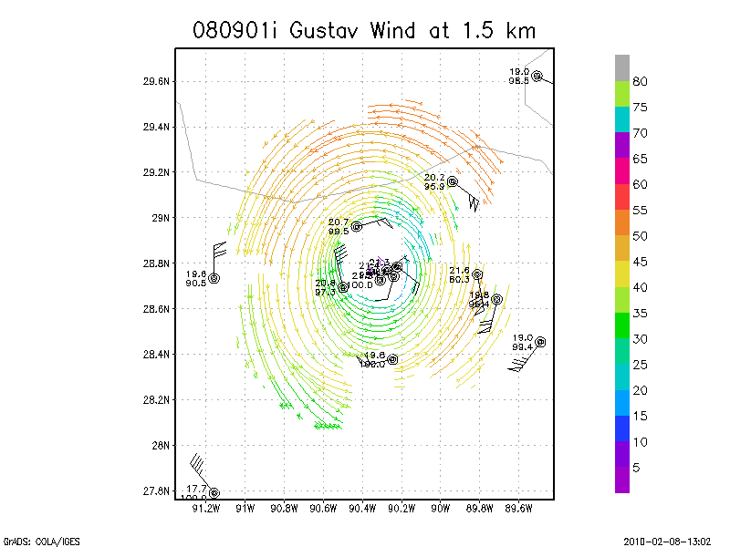
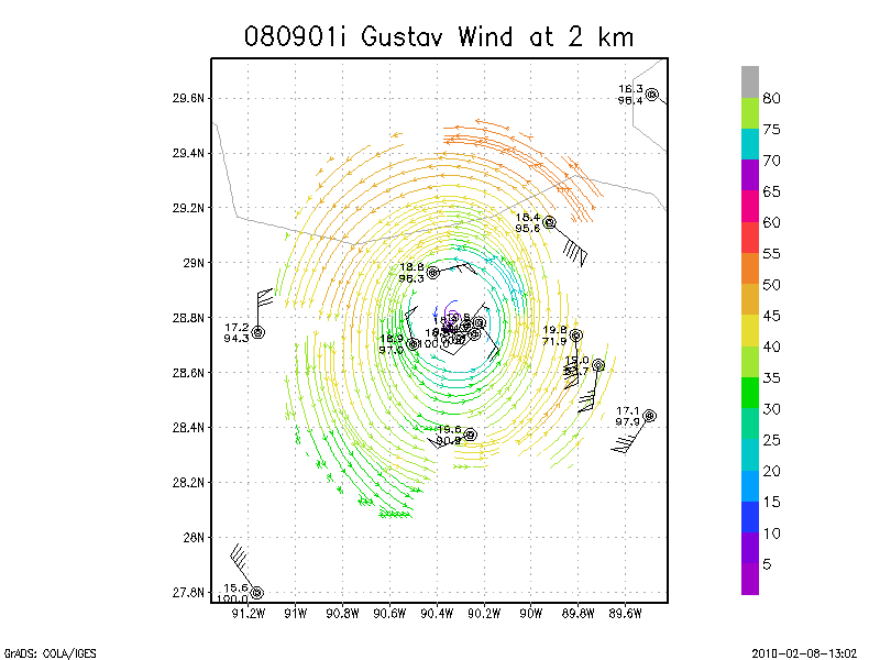
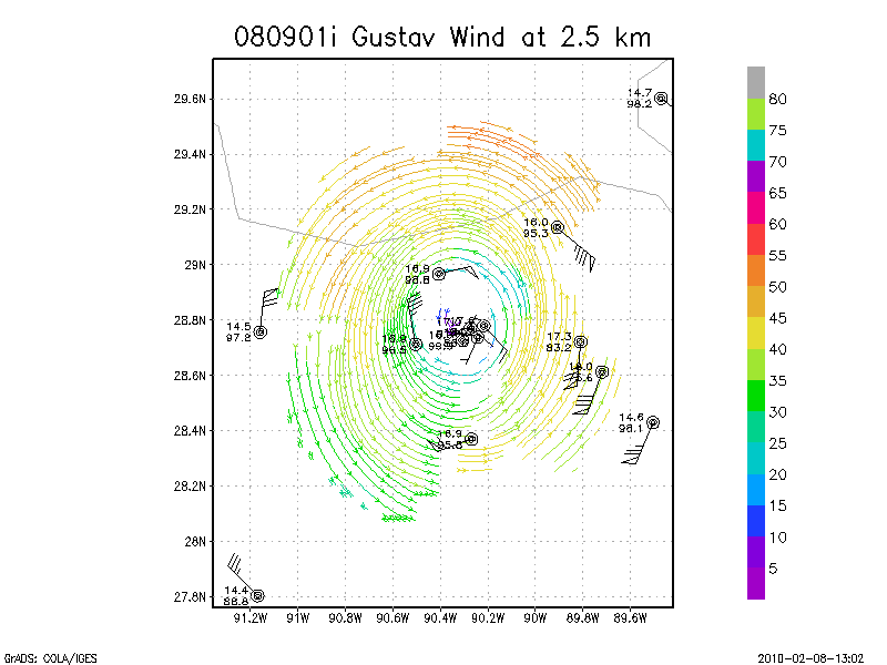
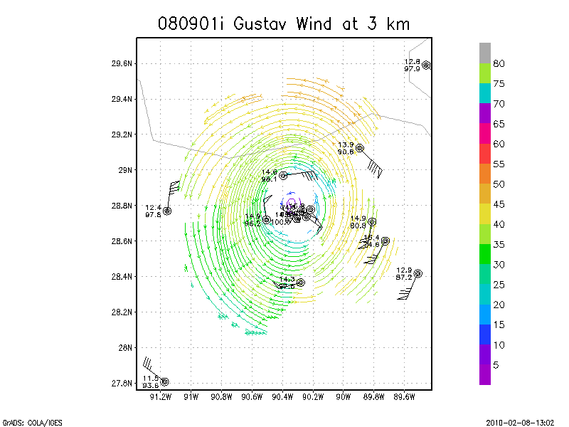
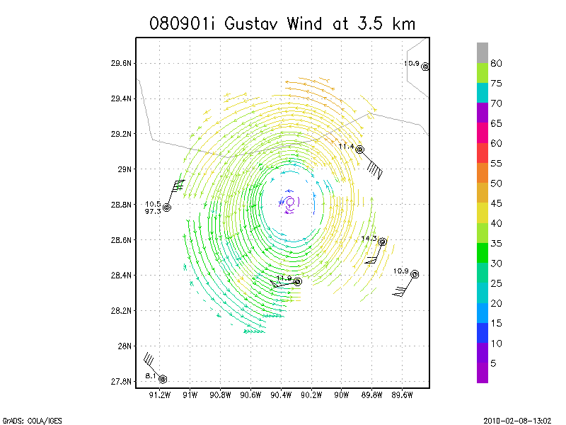
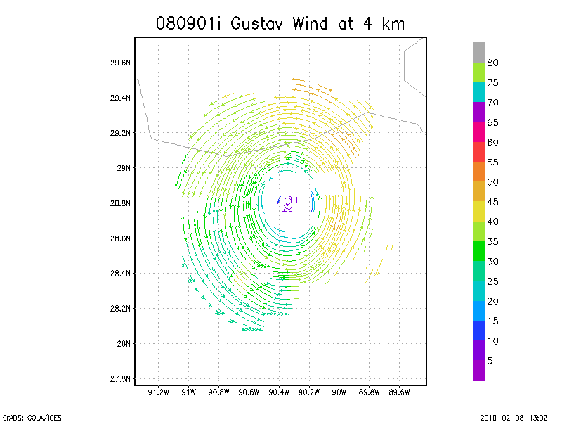
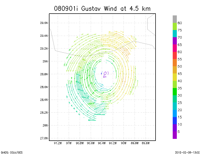
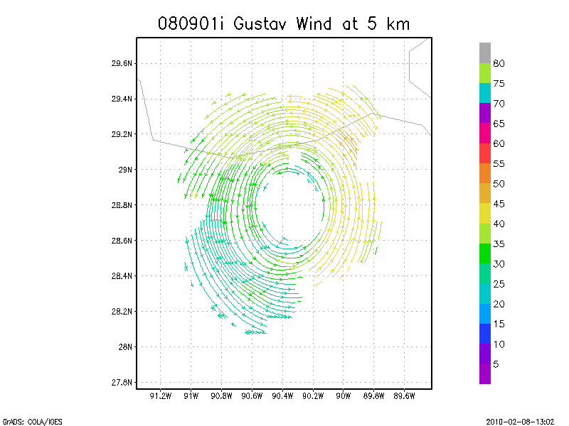
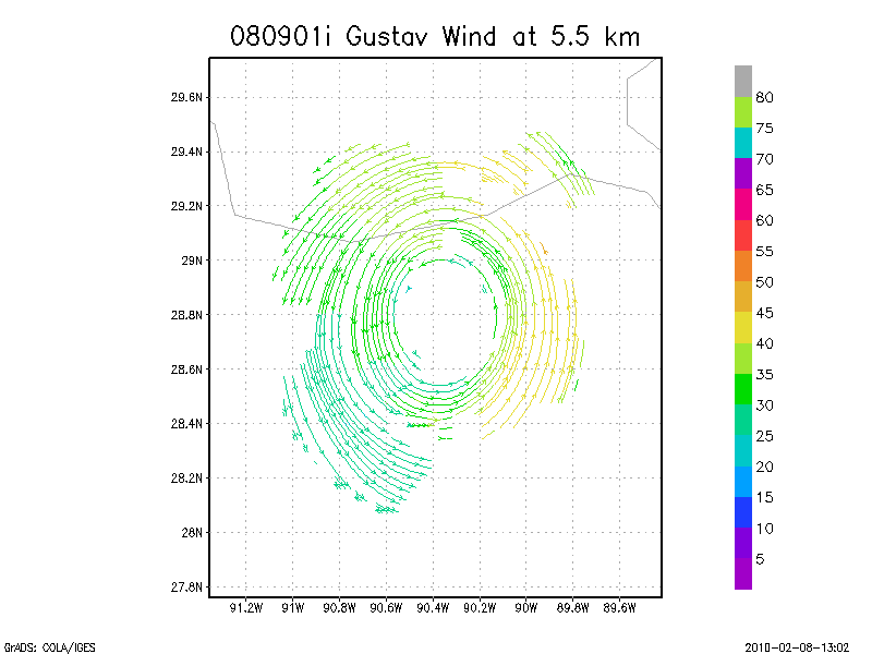
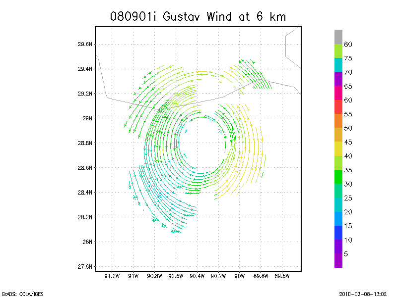
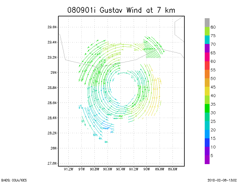
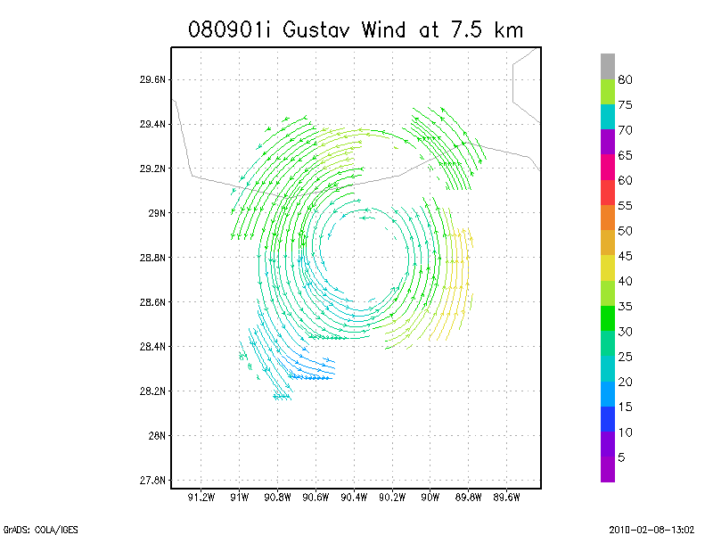
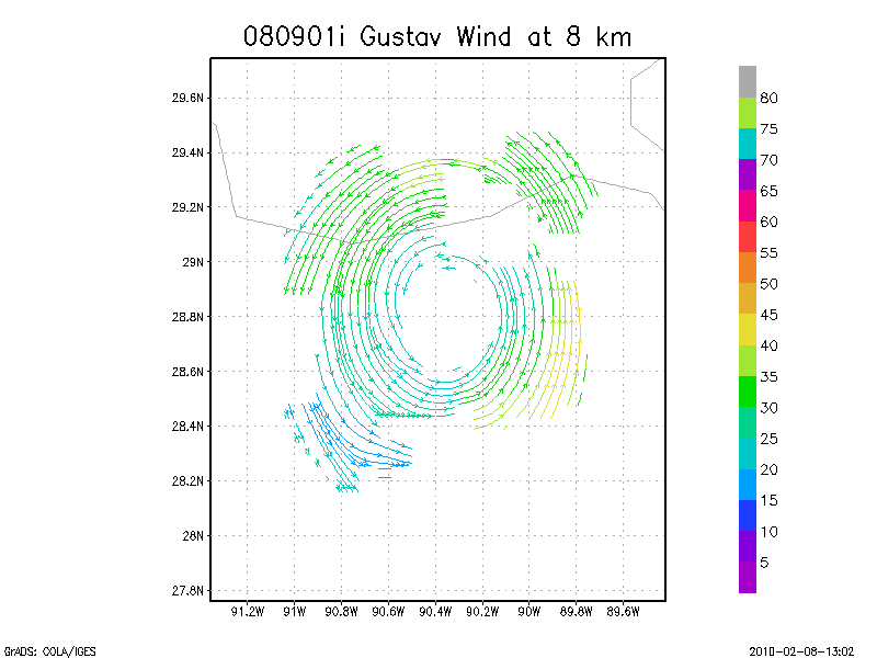
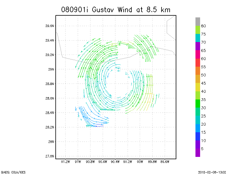
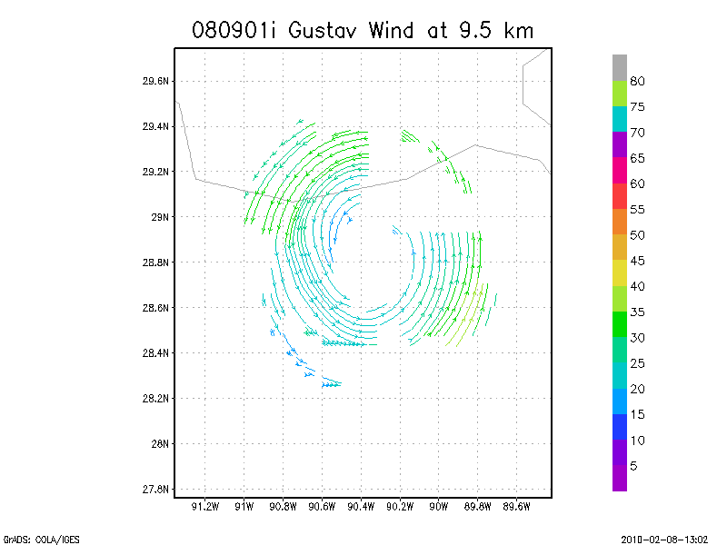
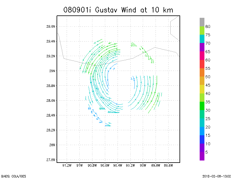
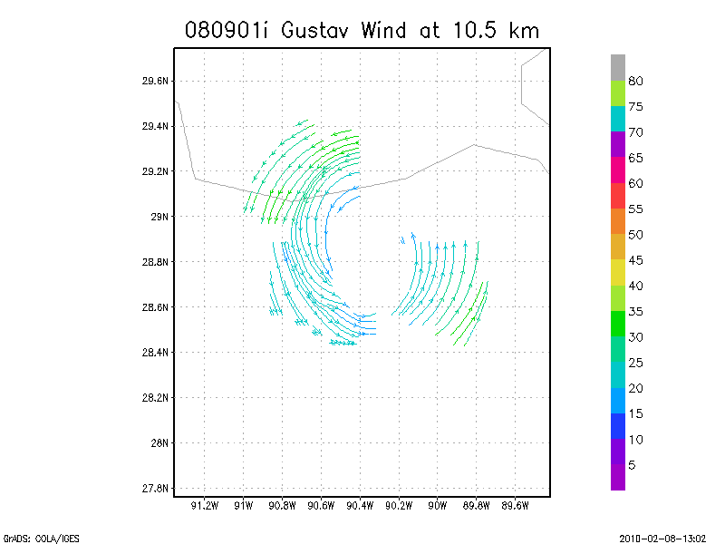
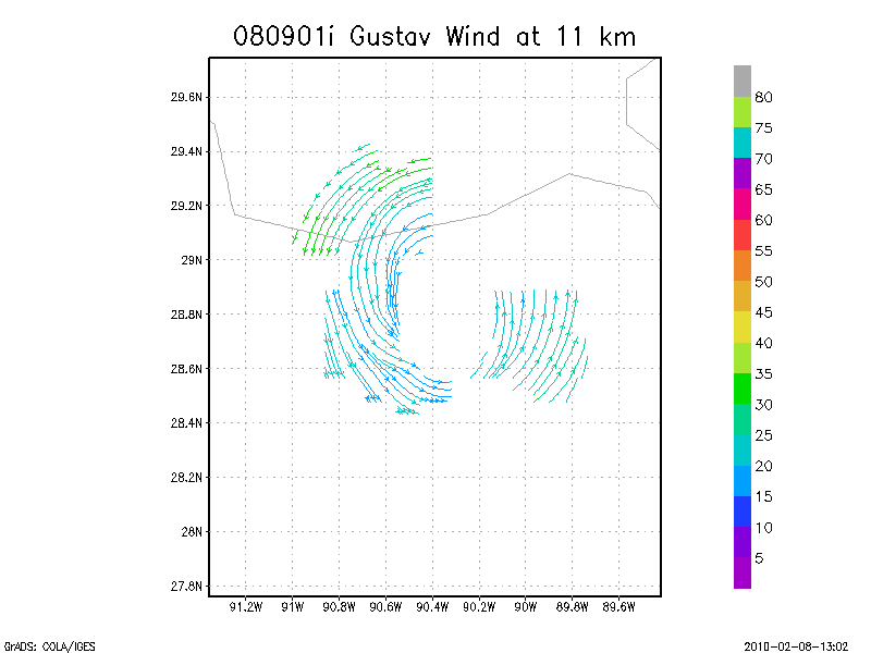
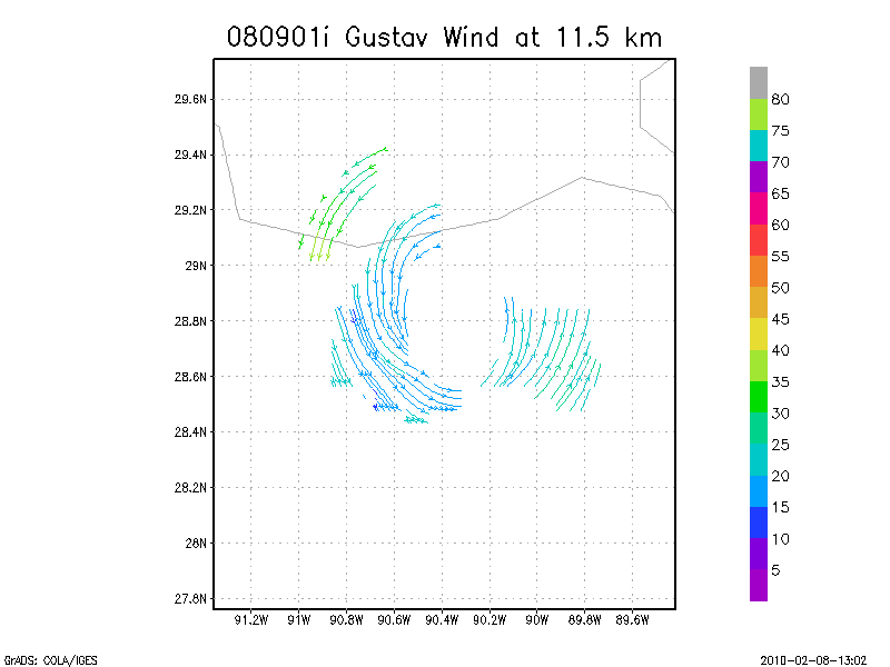
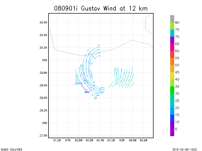
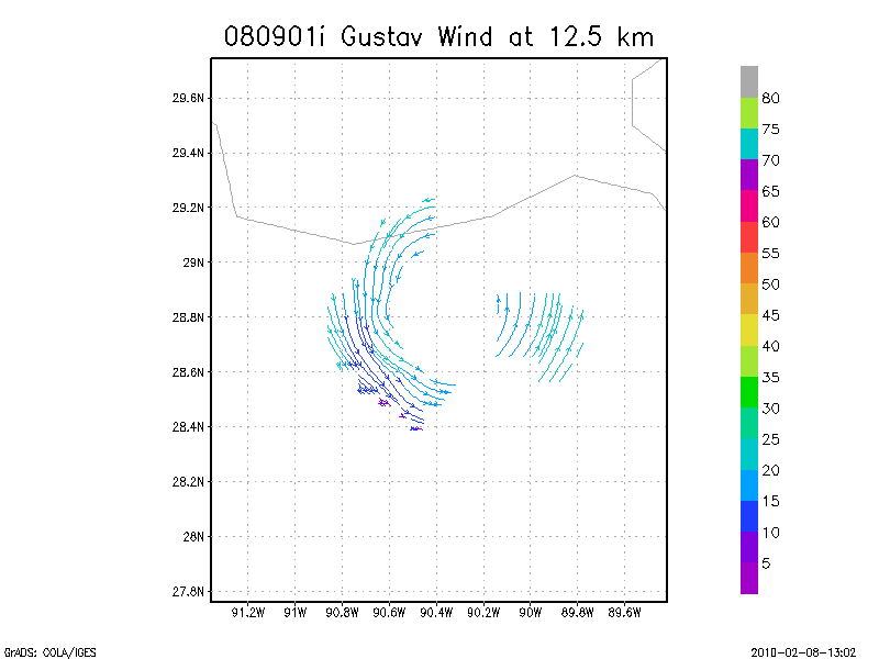
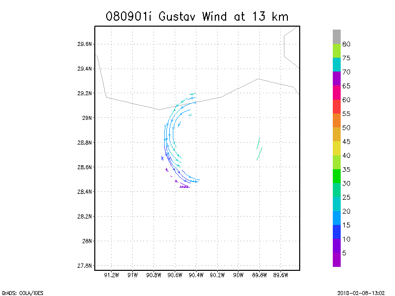
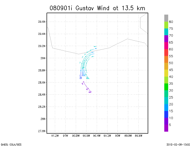
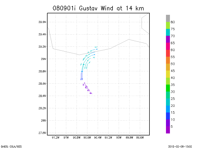
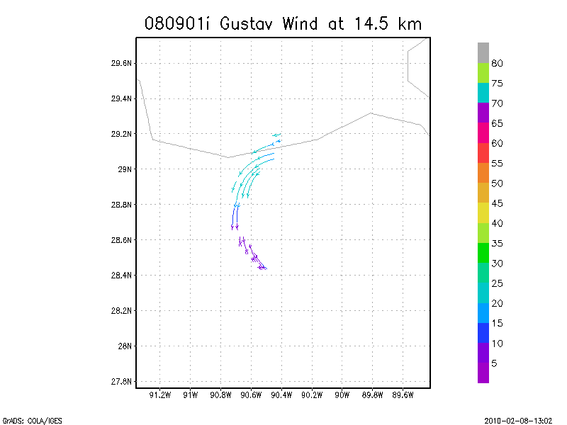
September 01, 2008
N43RF
Composite of all legs and dropsondes
Gridded radar data
GrADS control file radar data
Gridded dropsonde data
GrADS control file dropsonde data
GrADS map of dropsonde data
Winds at :
.5 km
1.0 km
1.5 km
2.0 km
2.5 km
3.0 km
3.5 km
4.0 km
4.5 km
Winds at :
5.0 km
5.5 km
6.0 km
6.5 km
7.0 km
7.5 km
8.0 km
8.5 km
9.0 km
Winds at :
9.5 km
10.0 km
10.5 km
11.0 km
11.5 km
12.0 km
12.5 km
13.0 km
13.5 km
Winds at :
14.0 km
14.5 km
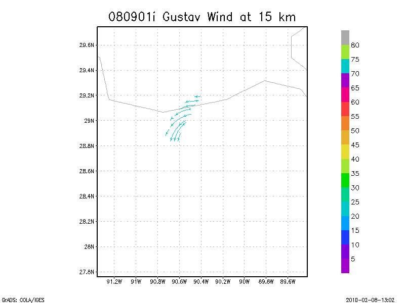
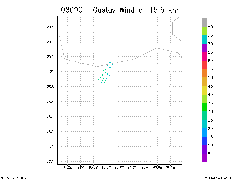
15.0 km
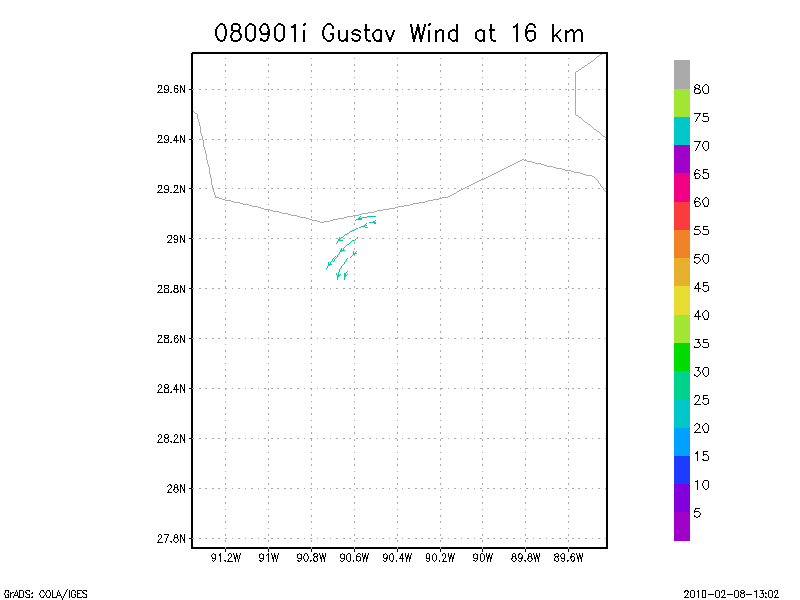
15.5 km
16.0 km
16.5 km
17.0 km
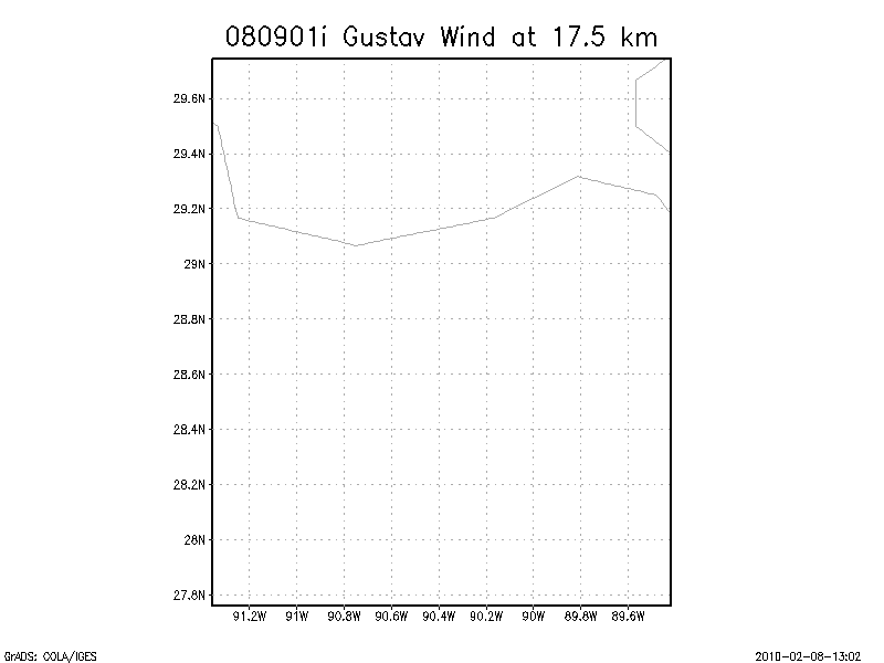
17.5 km
18.0 km
Individual sweeps
(aircraft relative)
Animated radar
tar'd and gzipped single frame GIFs
tar'd and gzipped sweep data
Individual sweeps
(storm relative)
660 x 660 km
Animated radar
tar'd and gzipped single frame GIFs
tar'd and gzipped sweep data
Individual sweeps
(storm relative)
Animated radar
tar'd and gzipped single frame GIFs
tar'd and gzipped sweep data
Return to Gustav Page.
Data Sets
Mission Catalog
Surface Wind Analysis
Radar Data
Synoptic Surveillance
Re-Analysis Project
Data Formats
Links of Interest
Hurricane Field Program
Current Hurricane Data
Hurricane FAQ
HRD Projects
HRD Calendar
Basin-Scale HWRF Model
HRD Blog
Flyers
AOML Tools & Resources
AOML Home
Contact Information
Search for Staff
Search Publications
AOML Newsletter
AOML Weather
Employee Tools
Check Email
AOML Intranet
HRD Intranet
Edit Bio Page
Edit Project Page
Stay Connected


