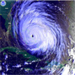
Hurricane Earl 2010
 Satellite Pictures of Hurricane Earl from various sources
 Photos taken during NOAA flights and operations
 Radar Composites from NOAA flights both operational and
post-processed
 Dropsonde data and synoptic plots from Earl
Last updated: February 16, 2011
|
|