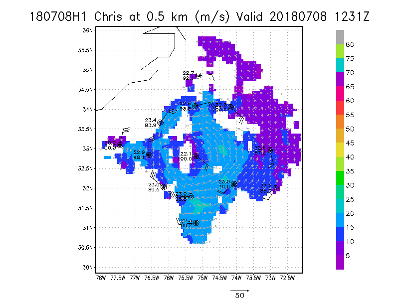
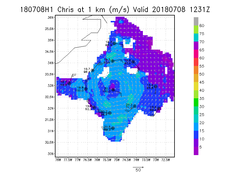
July 08, 2018
N42RF #2
|
|
Individual legs
|
Leg #1
25:31Z
|
20180708H2 2531Z dbz profile
|
20180708H2 2531Z vt BL profile
|
20180708H2 2531Z ws profile
|
|
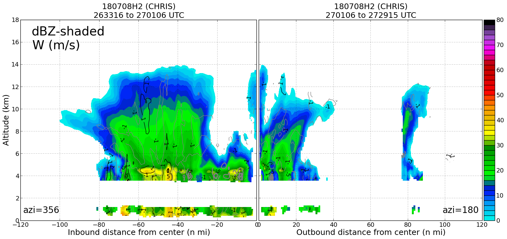
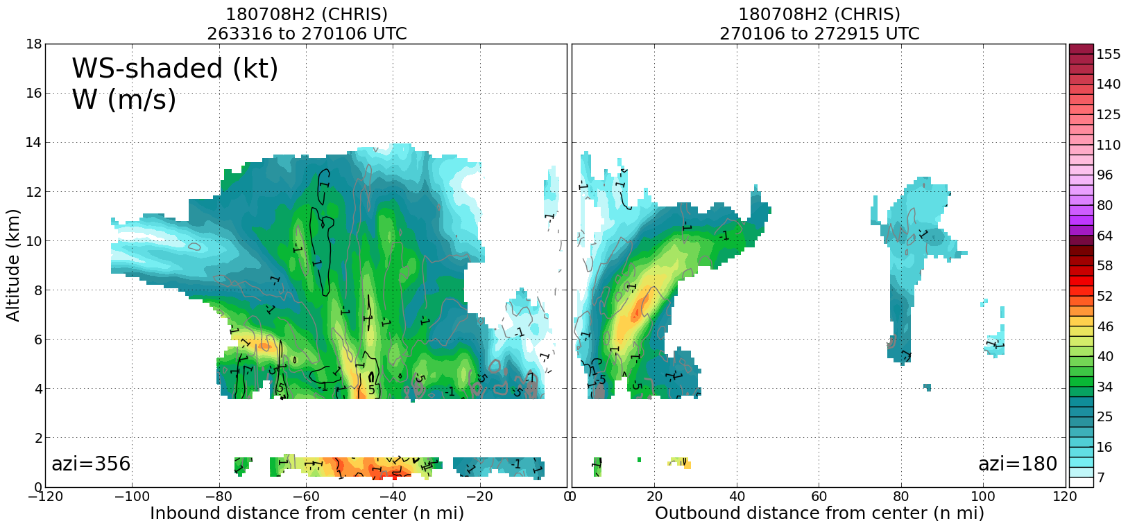
Leg #2
27:01Z
|
20180708H2 2701Z dbz profile

|
20180708H2 2701Z vt BL profile
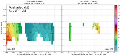
|
20180708H2 2701Z ws profile
|
|
|
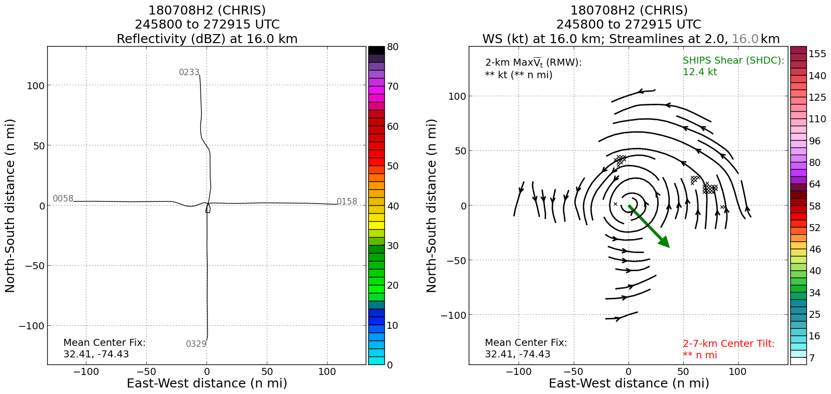
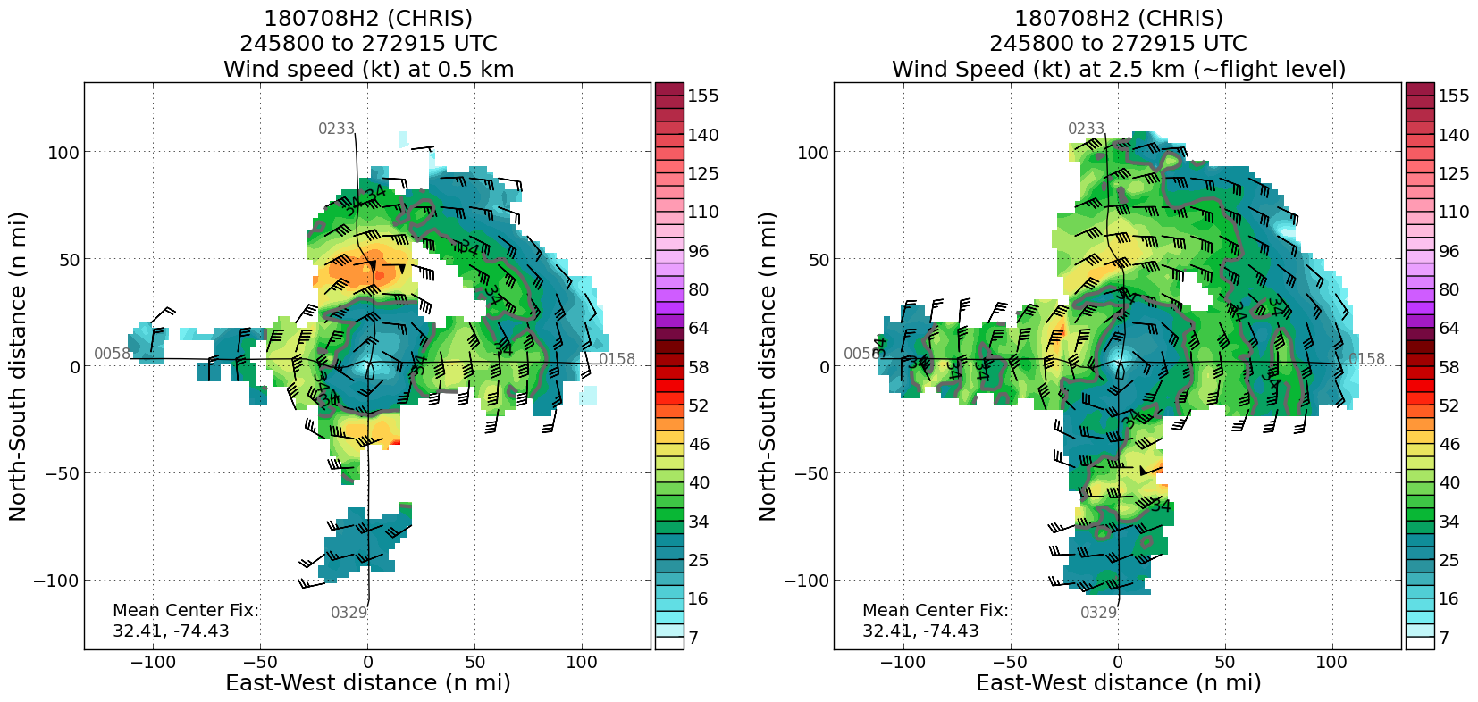
Plan views
|
20180708H2 ws dbz planview
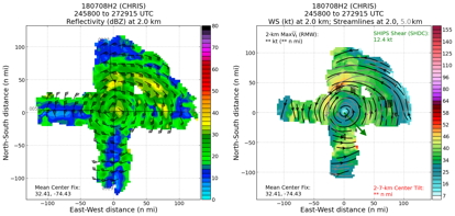
|
20180708H2 ws dbz upper planview
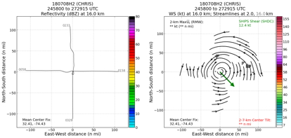
|
20180708H2 ws nhc planview

|
|
Gridded radar data
GrADS control file radar data
|
Winds at :
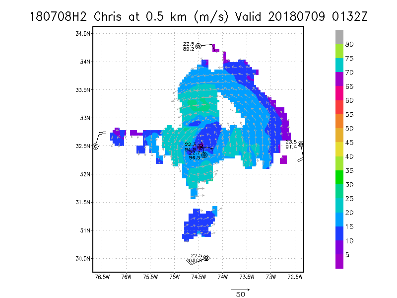
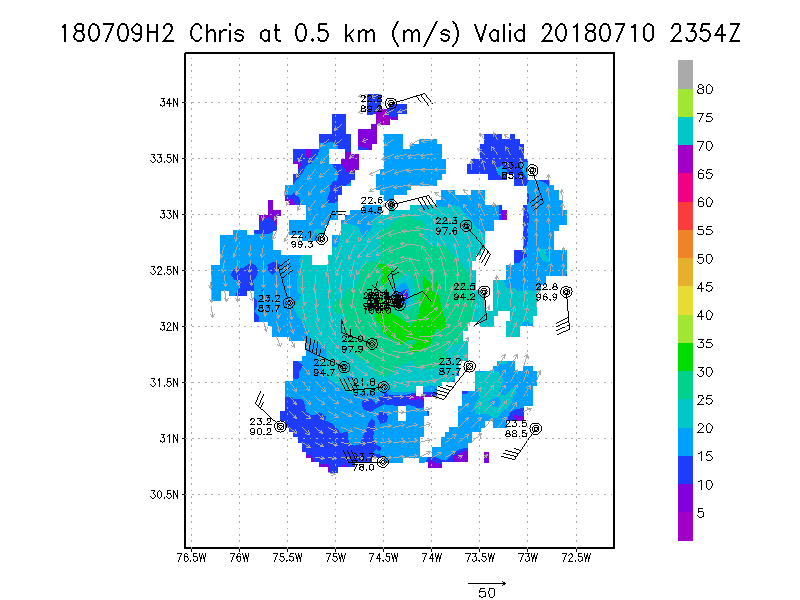
.5 km
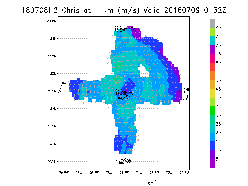
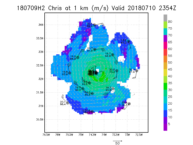
1.0 km
1.5 km
2.0 km
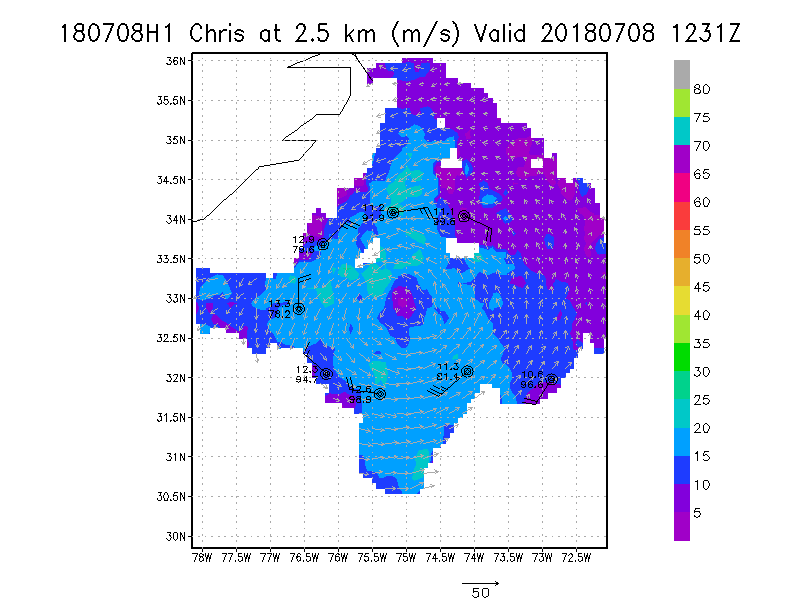
2.5 km
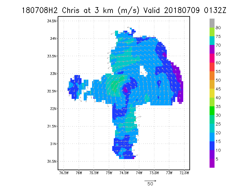
3.0 km
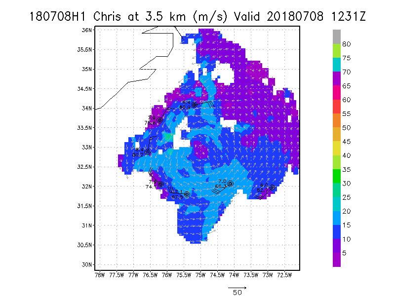
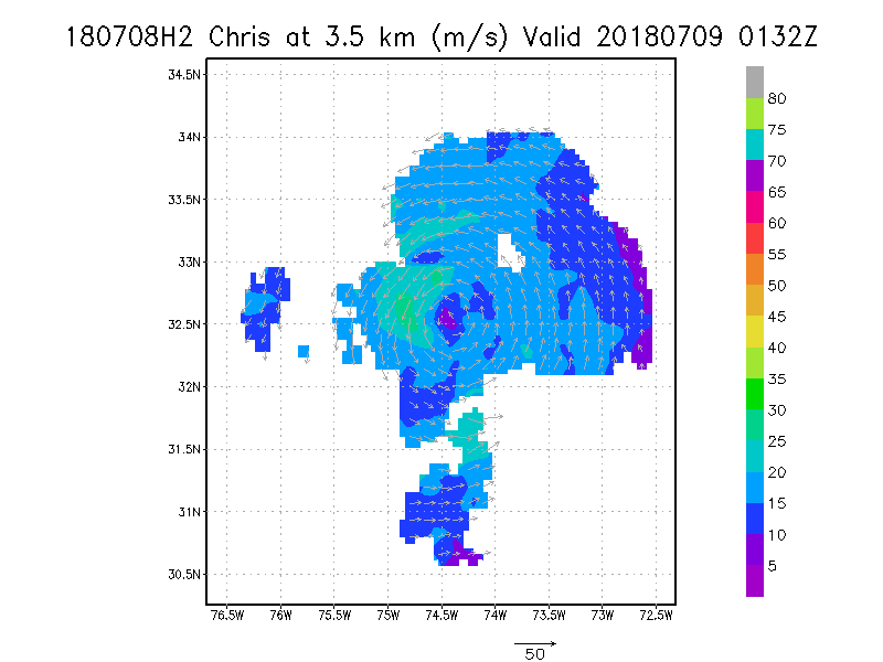
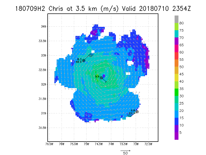
3.5 km
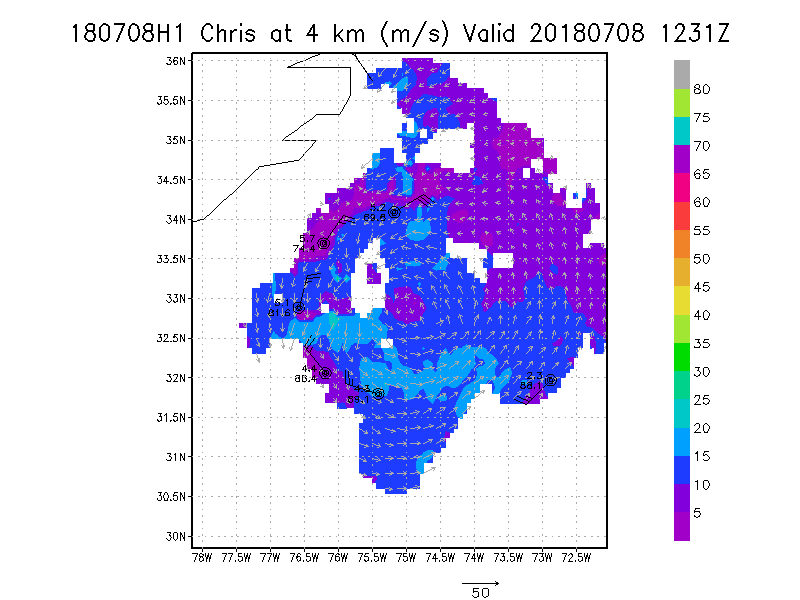
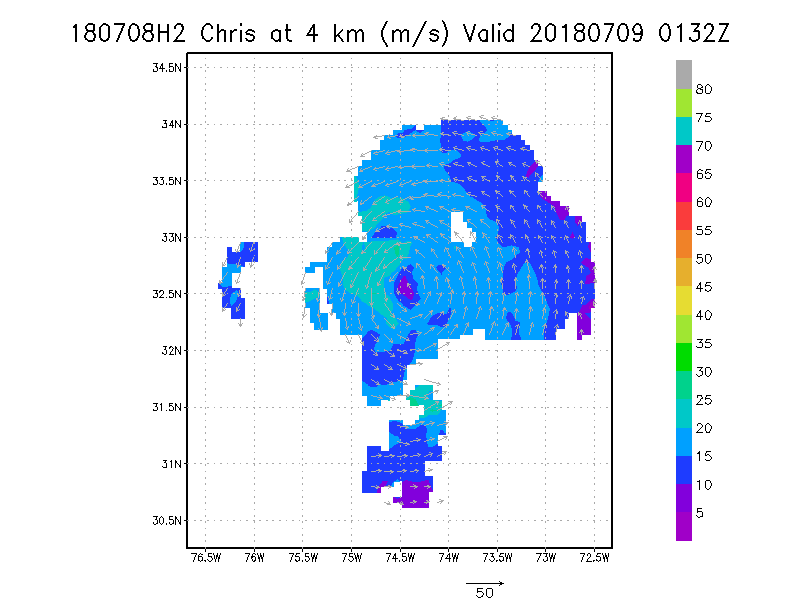
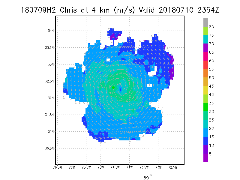
4.0 km
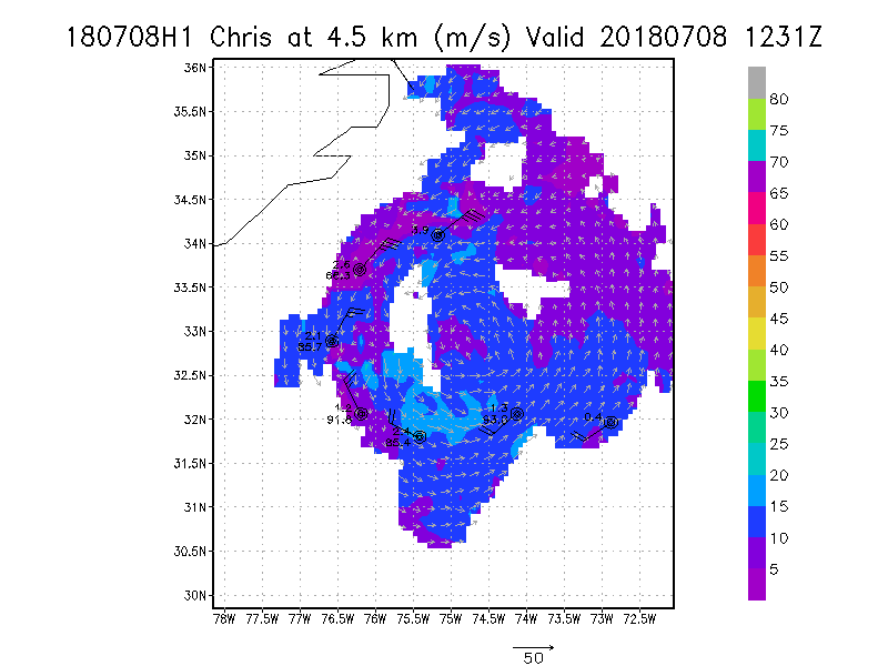
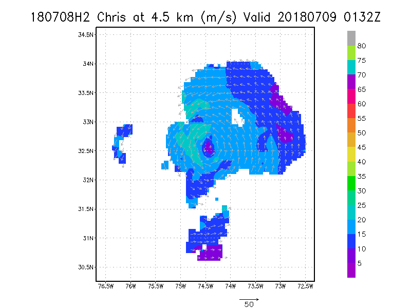
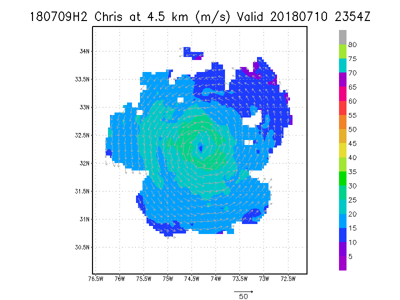
4.5 km
|
Winds at :
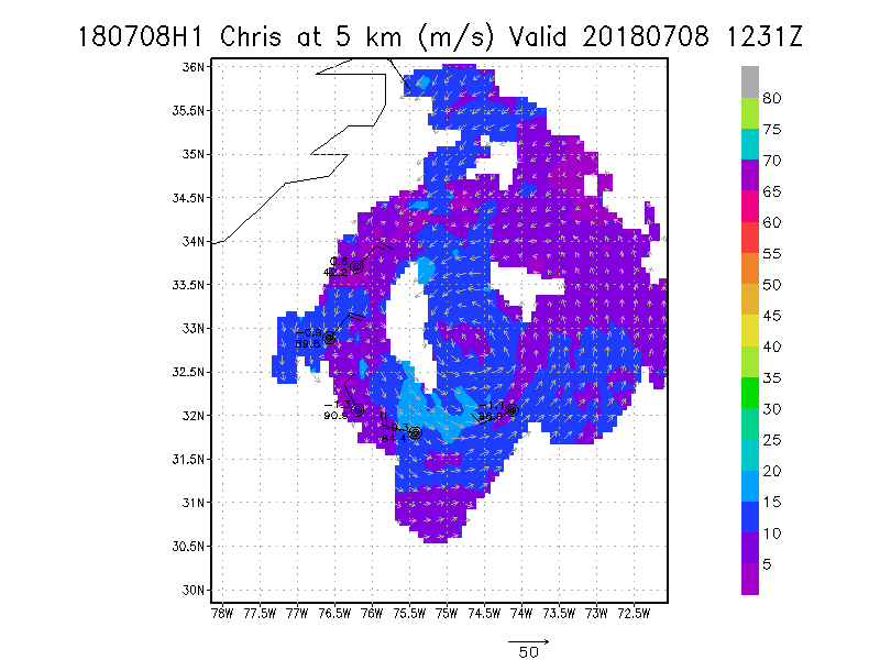
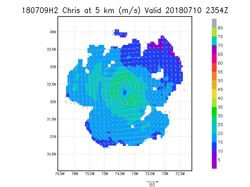
5.0 km
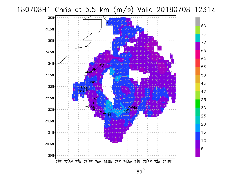
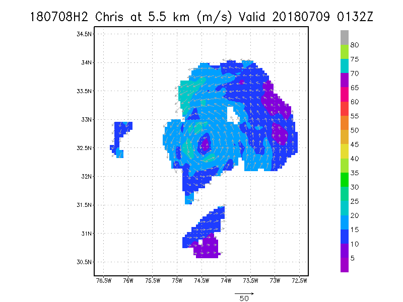
5.5 km
6.0 km
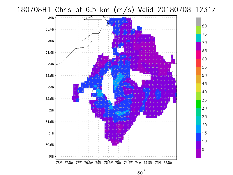
6.5 km
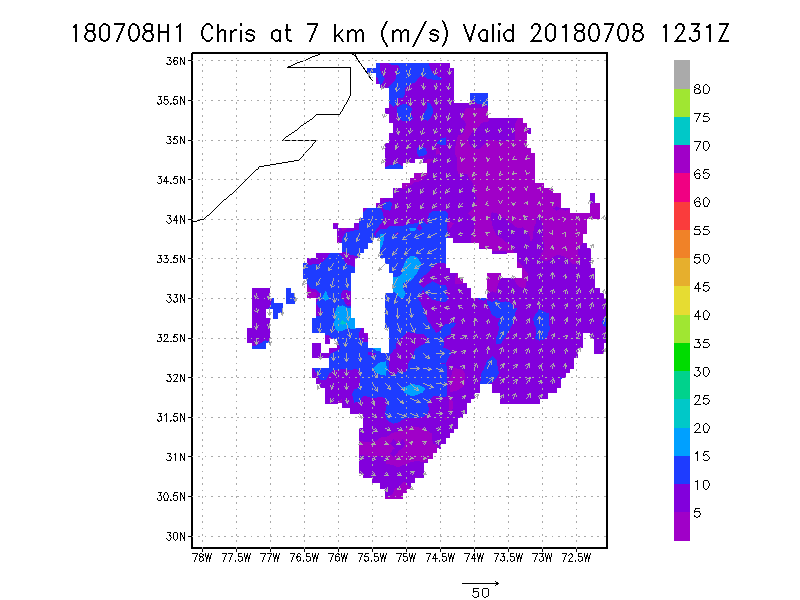
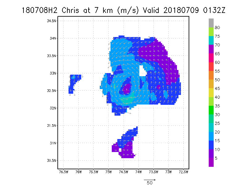
7.0 km
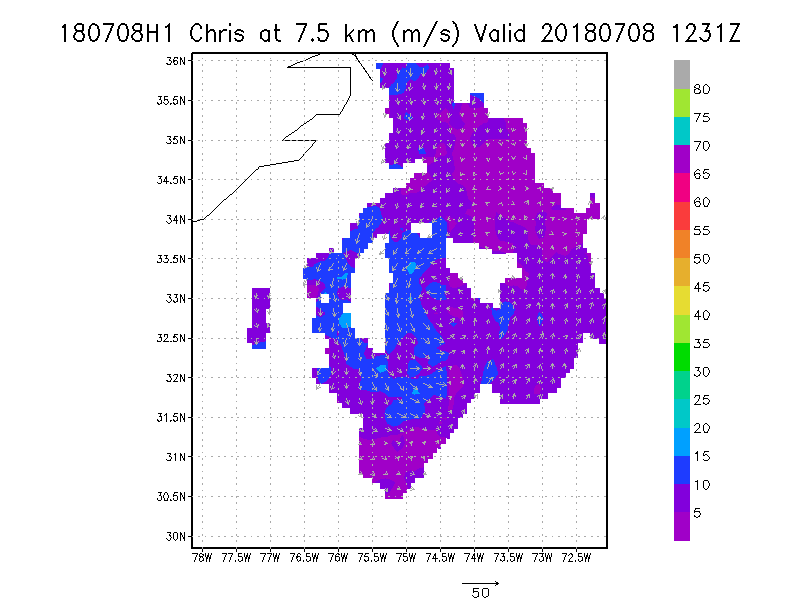
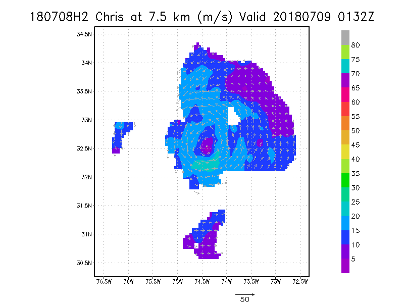
7.5 km
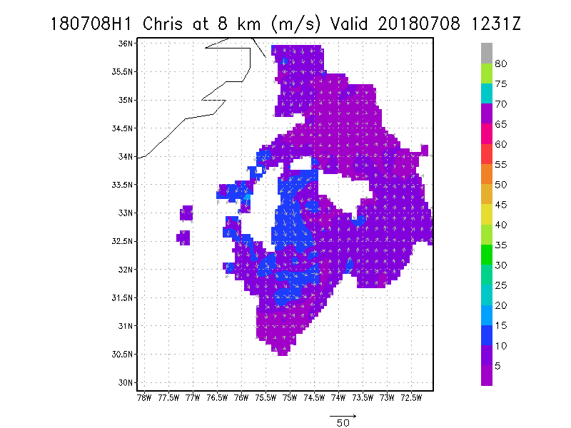
8.0 km
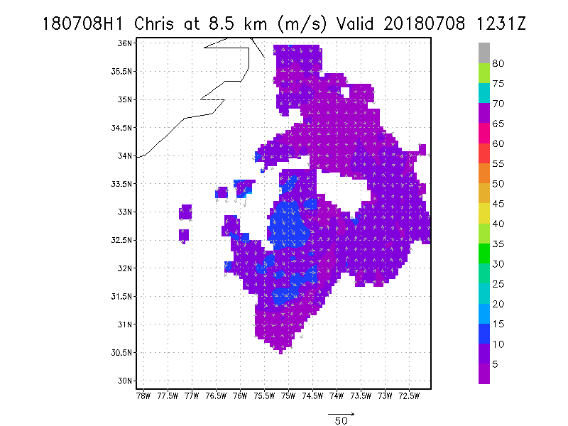
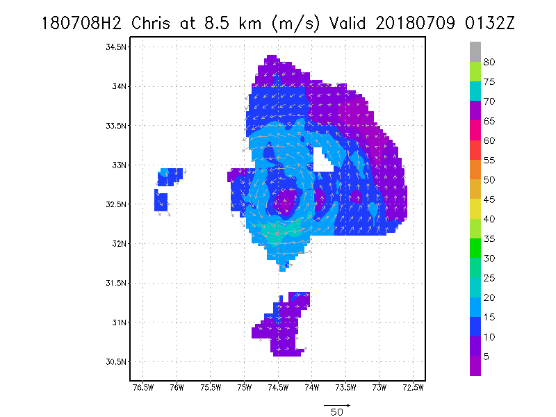
8.5 km
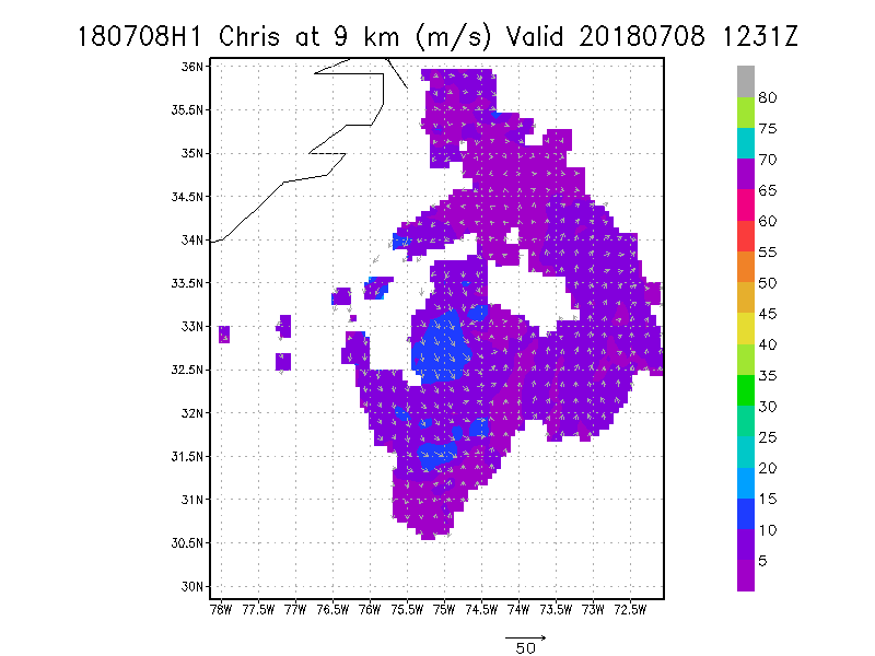
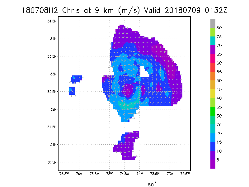
9.0 km
|
Winds at :
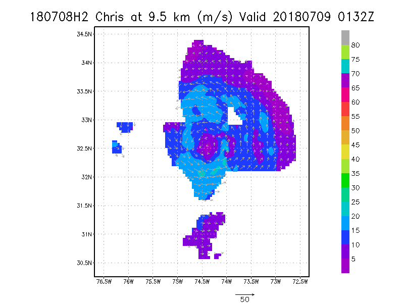
9.5 km
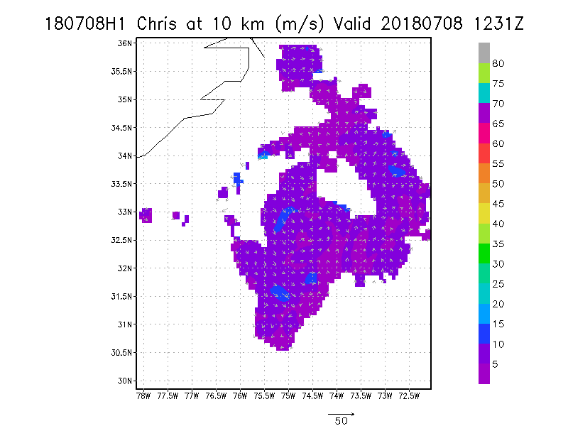
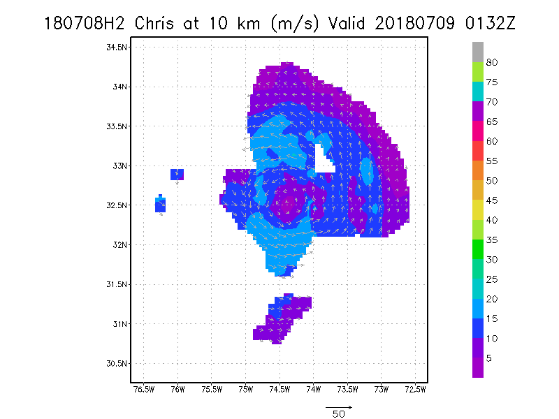
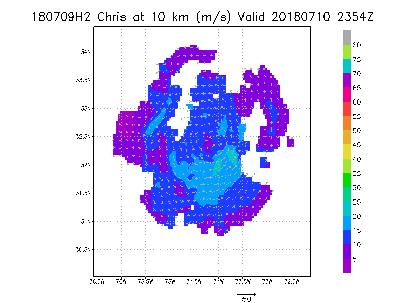
10.0 km
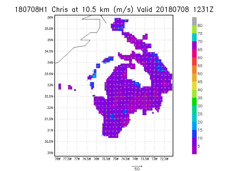
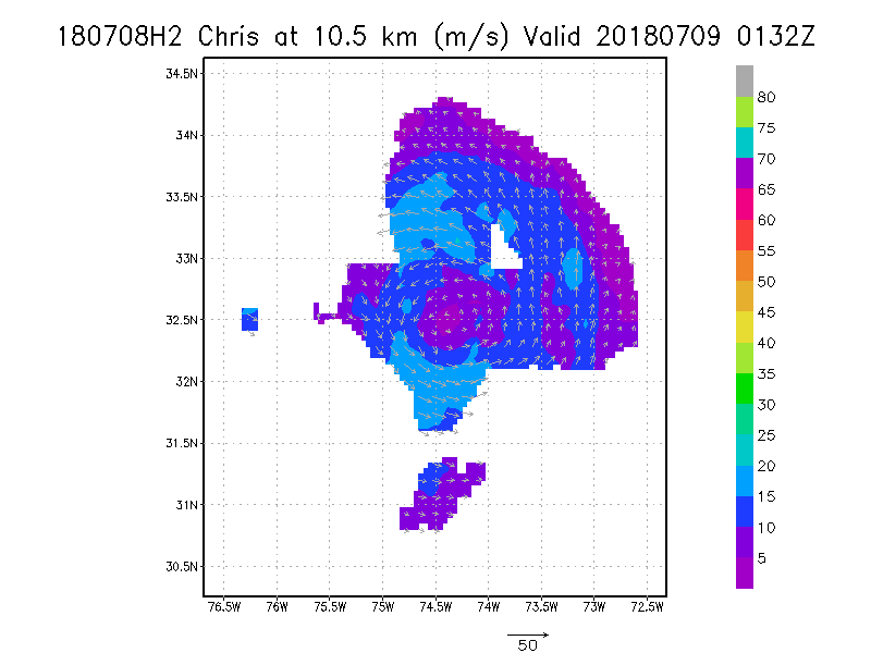
10.5 km
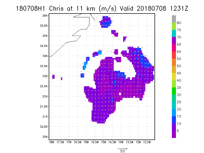
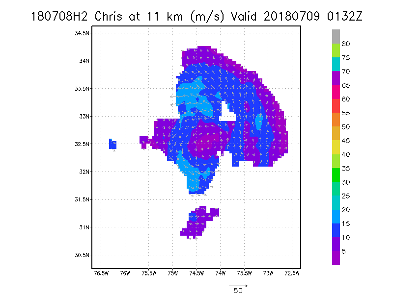
11.0 km
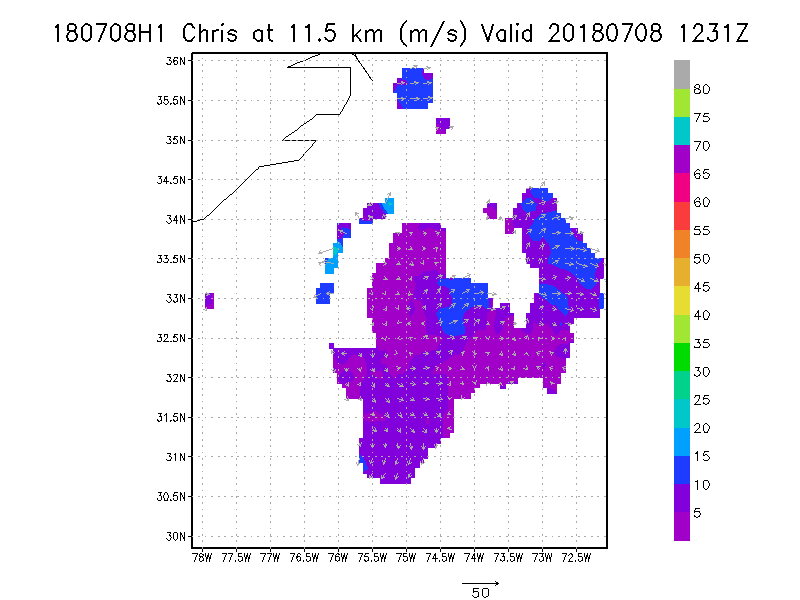
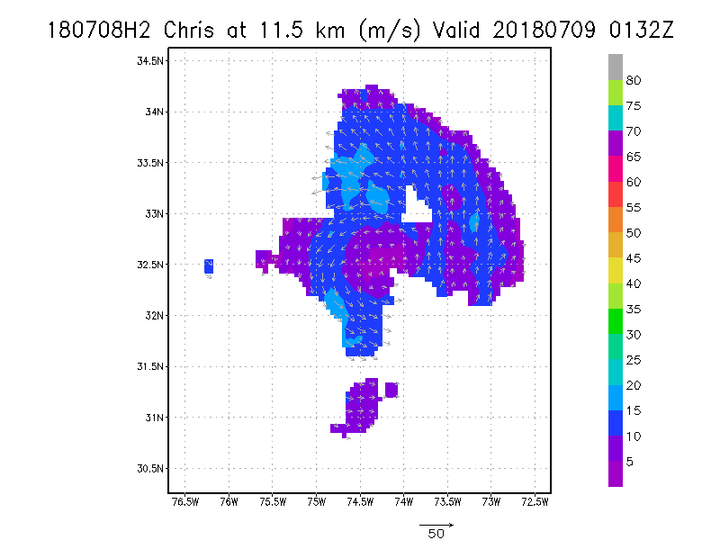
11.5 km
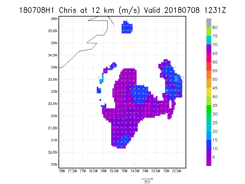
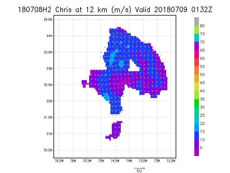
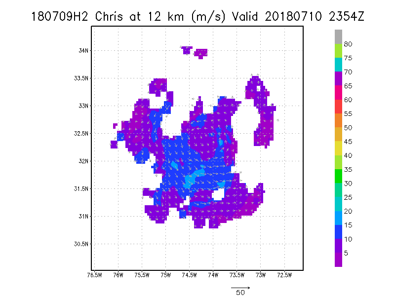
12.0 km
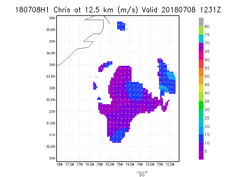
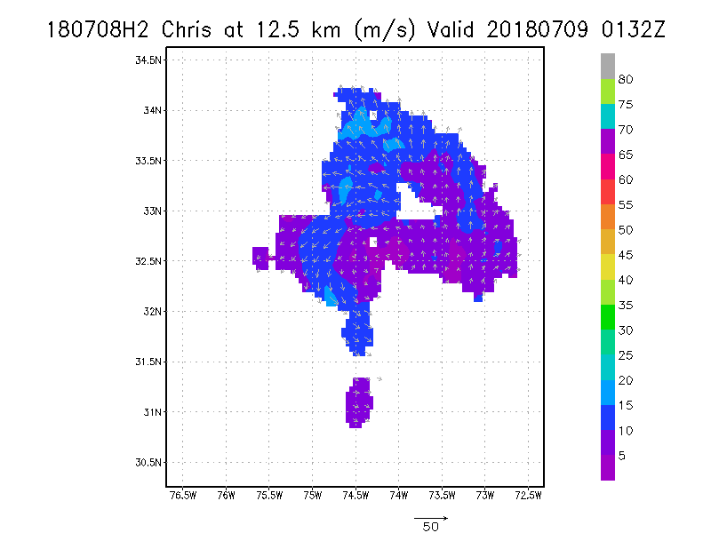
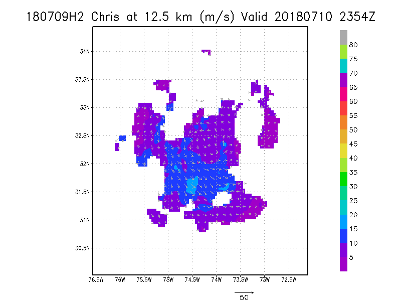
12.5 km
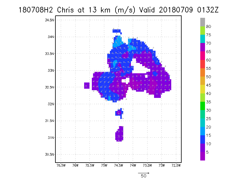
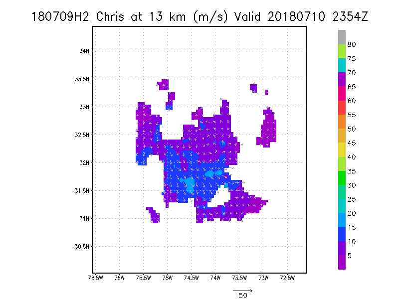
13.0 km
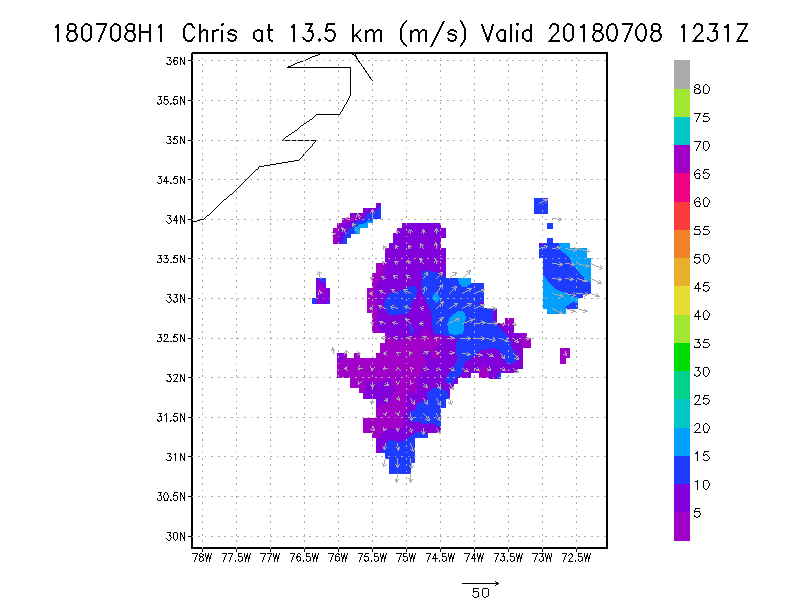
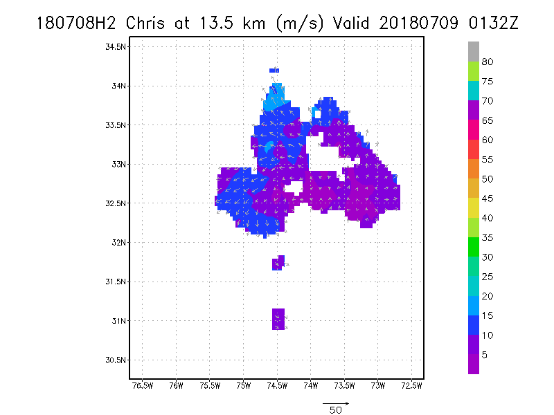
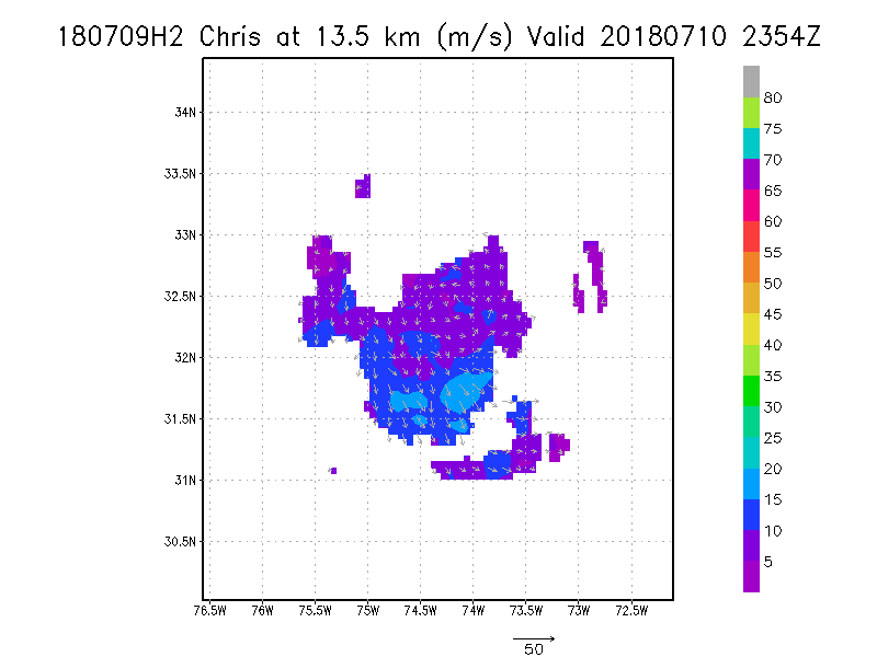
13.5 km
|
Winds at :
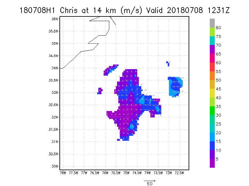
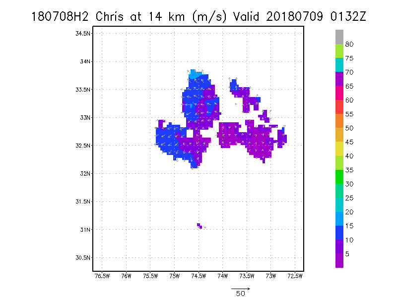
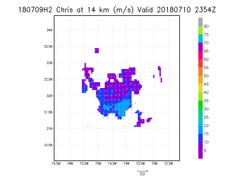
14.0 km
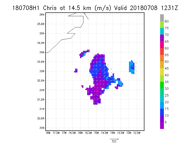
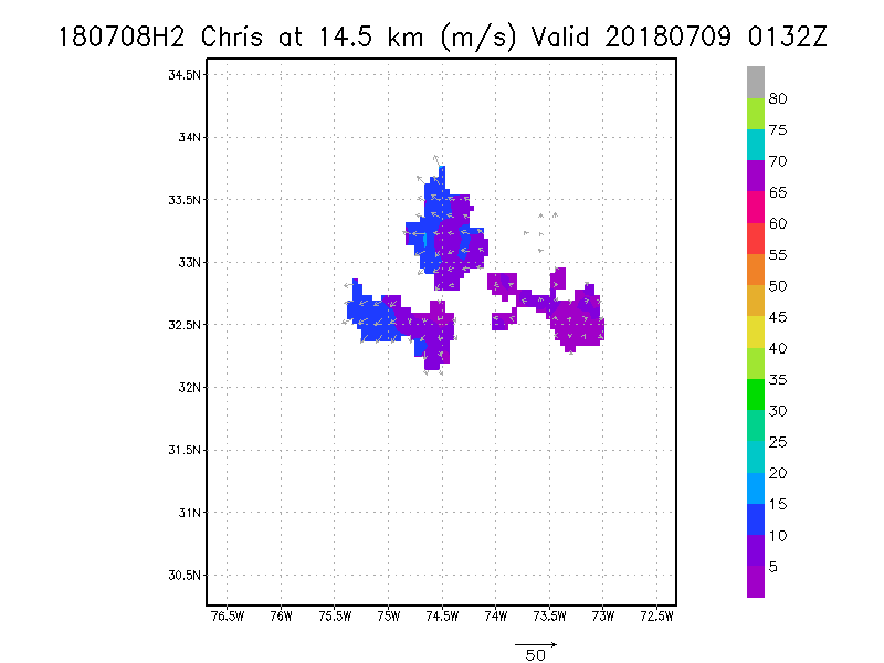
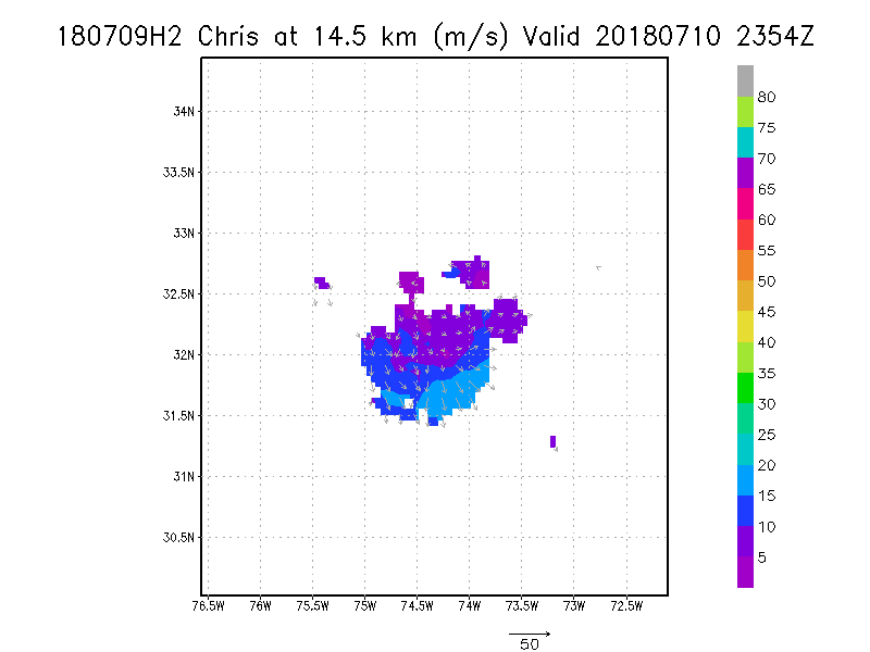
14.5 km
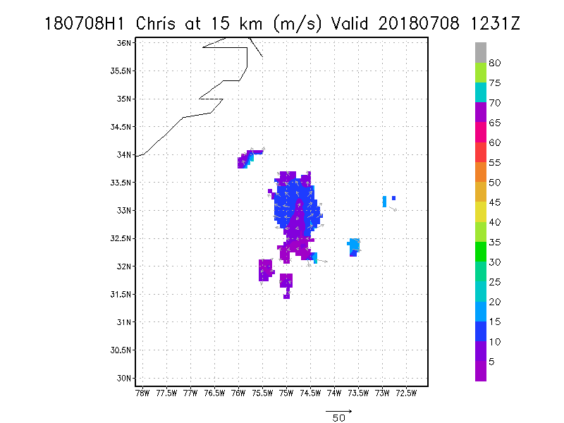
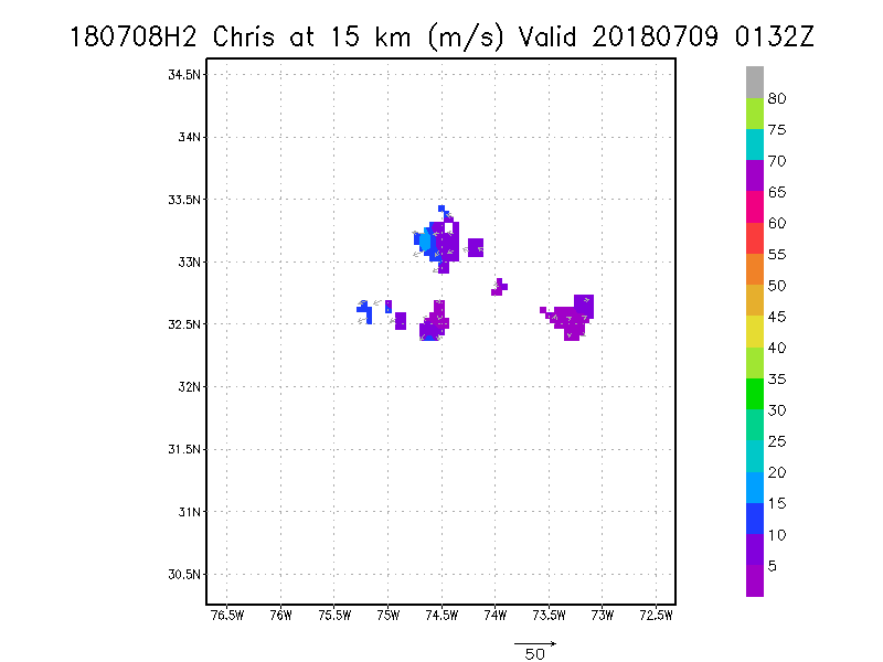
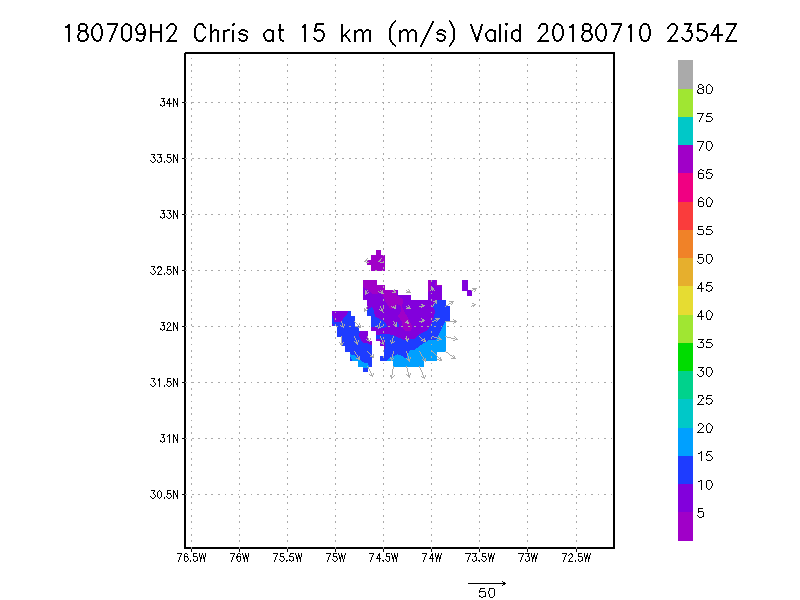
15.0 km
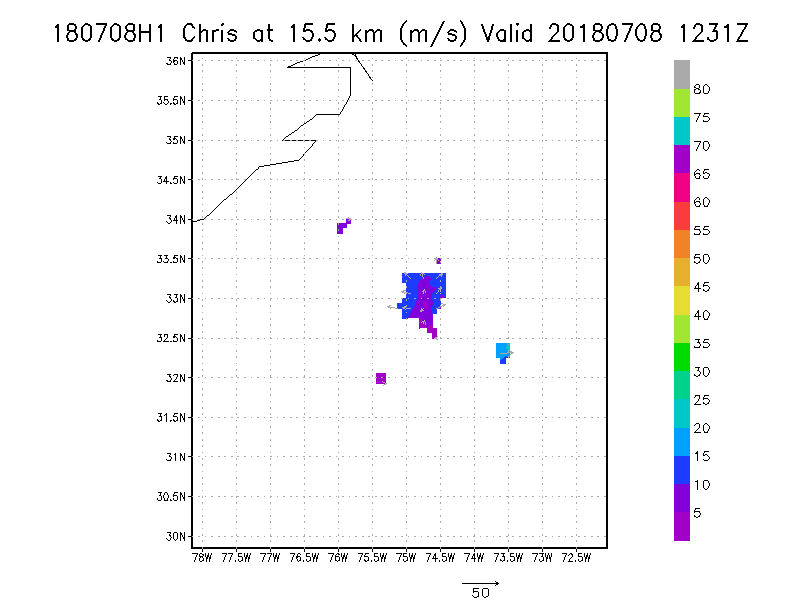
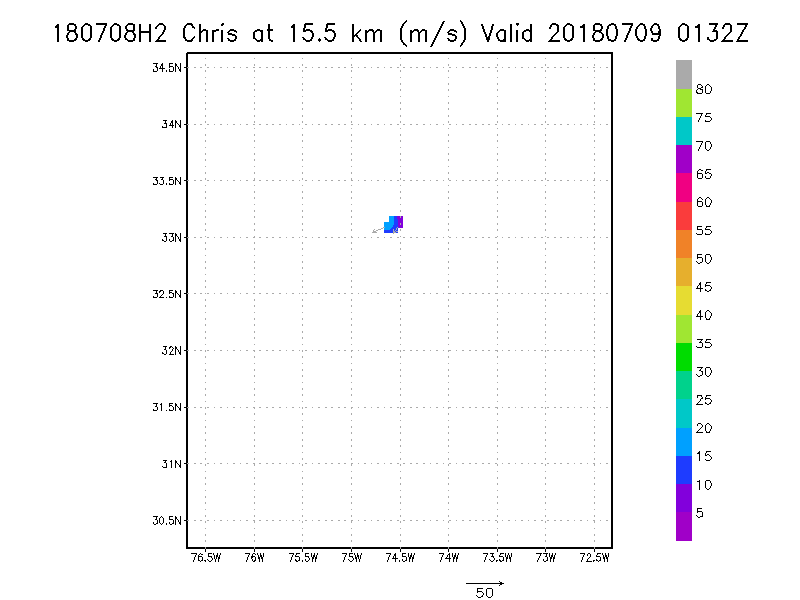
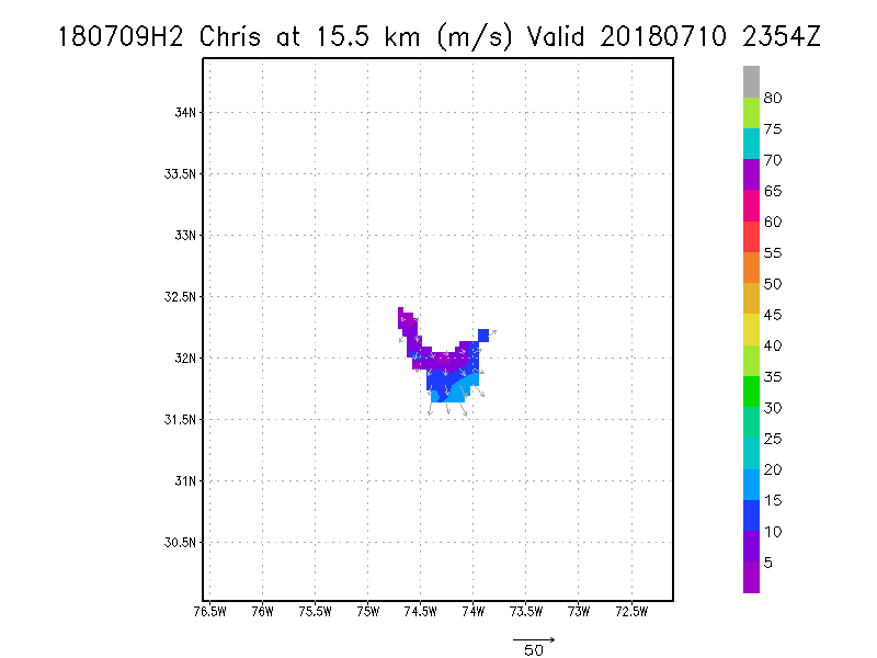
15.5 km
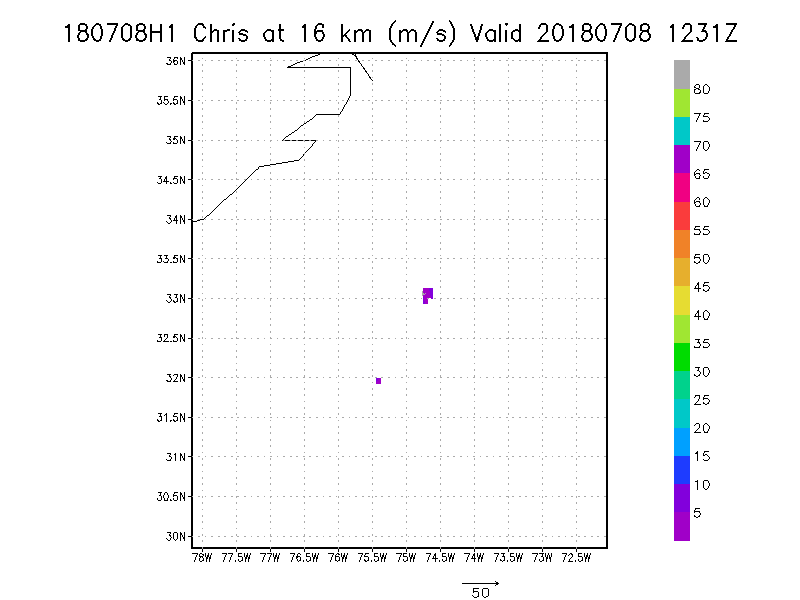
16.0 km
16.5 km
17.0 km
17.5 km
18.0 km
|
July 09, 2018
N42RF #1
|
|
Individual legs
|
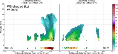
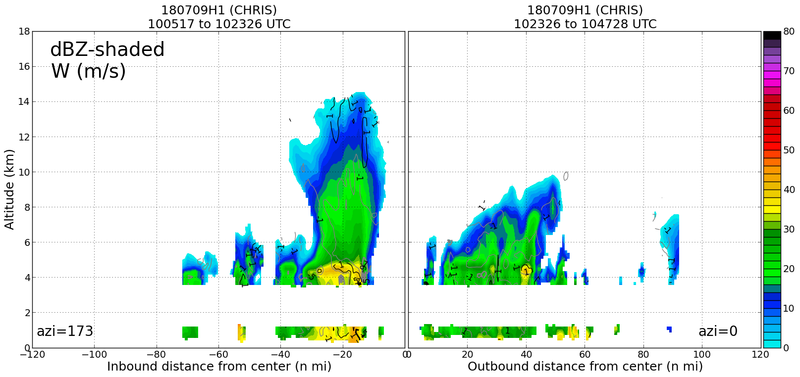
Leg #1
10:23Z
|
20180709H1 1023Z dbz profile

|
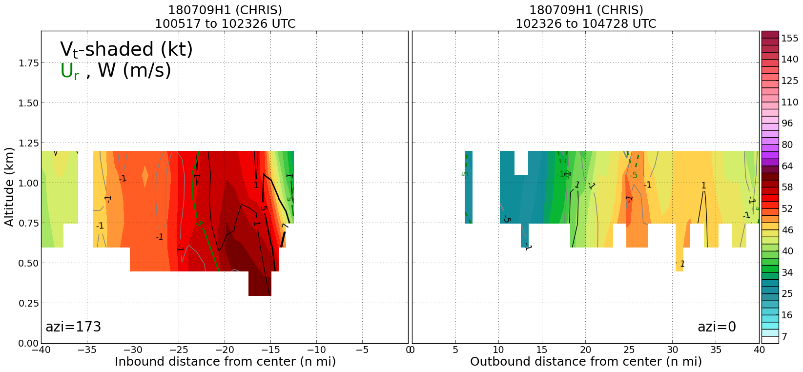
20180709H1 1023Z vt BL profile

|
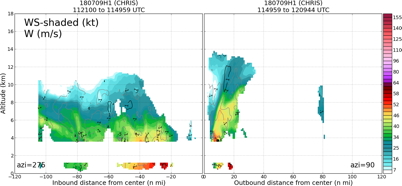
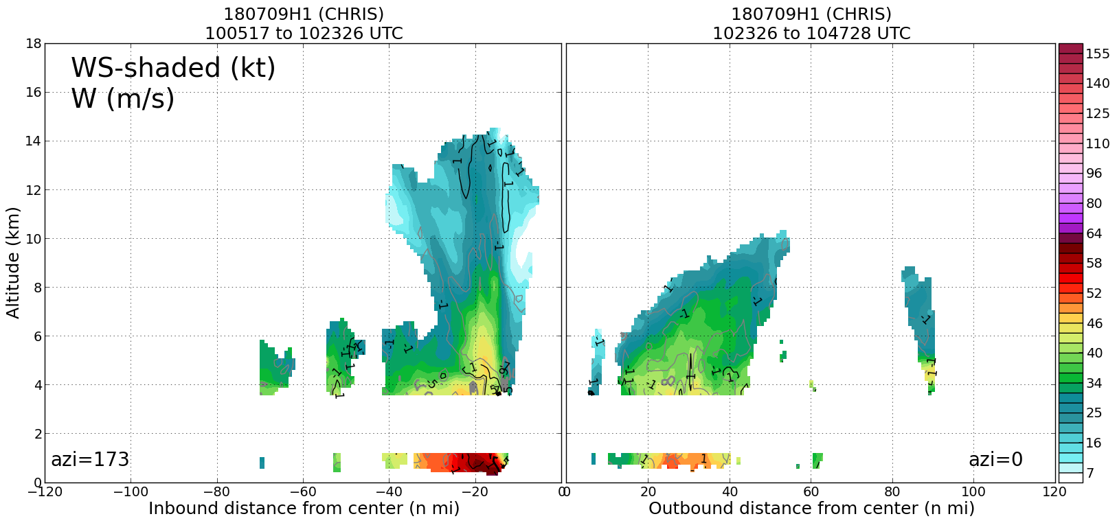
20180709H1 1023Z ws profile
|
|
Leg #2
11:49Z
|
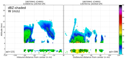
20180709H1 1149Z dbz profile

|
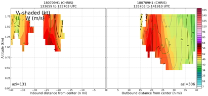
20180709H1 1149Z vt BL profile

|
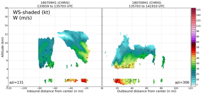
20180709H1 1149Z ws profile
|
|
Leg #3
12:47Z
|
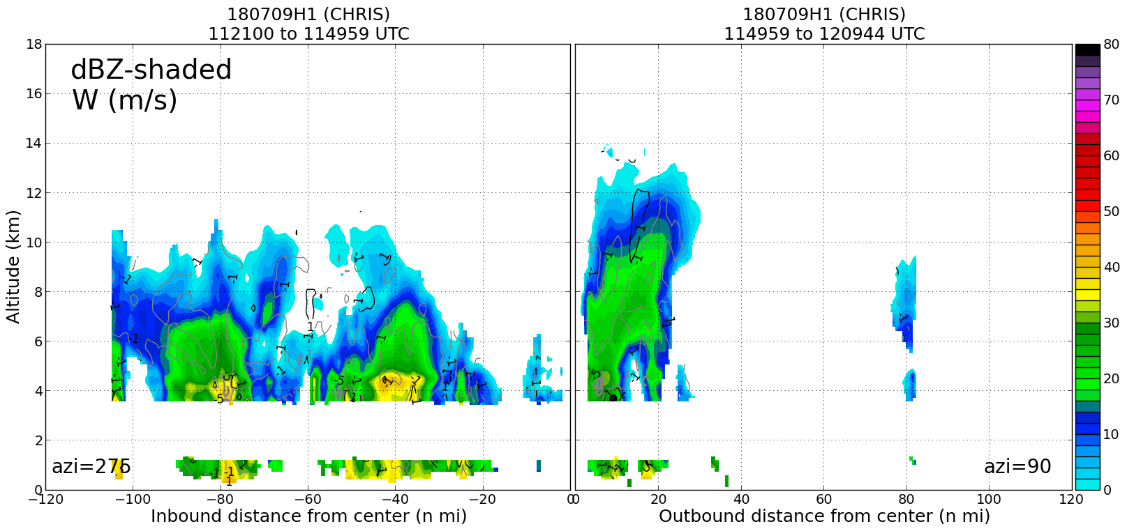
20180709H1 1247Z dbz profile

|
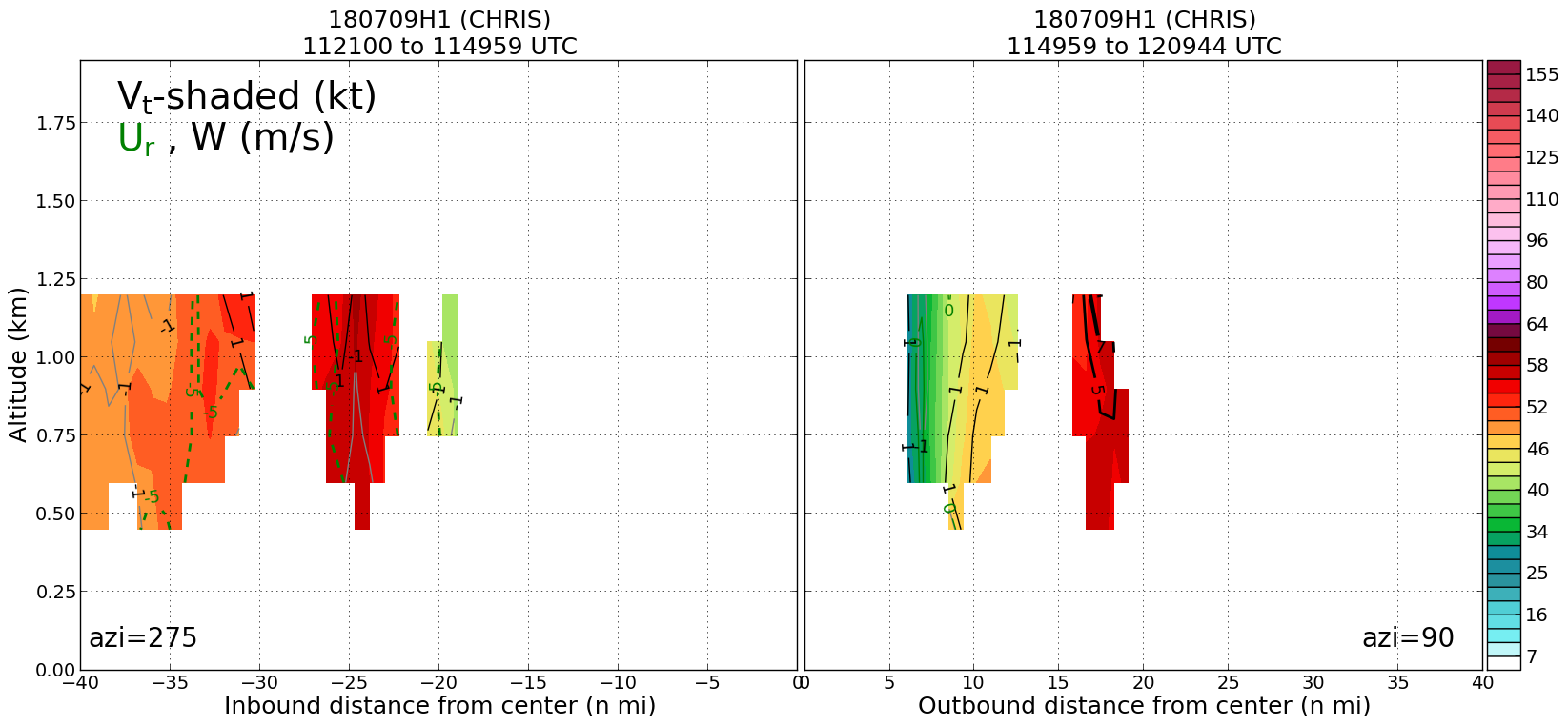
20180709H1 1247Z vt BL profile

|
20180709H1 1247Z ws profile

|
|
Leg #4
13:57Z
|
20180709H1 1357Z dbz profile
|
20180709H1 1357Z vt BL profile
|
20180709H1 1357Z ws profile
|
|
|
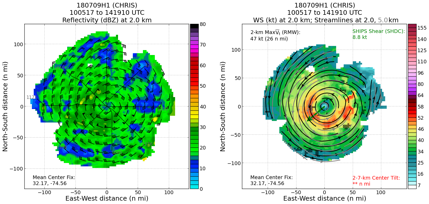
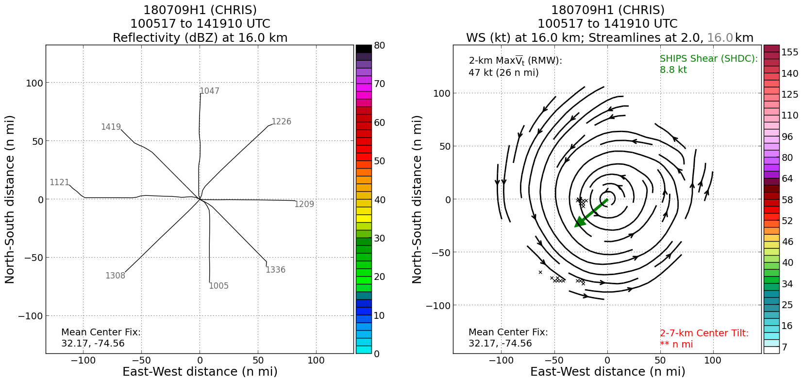
Plan views
|
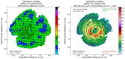
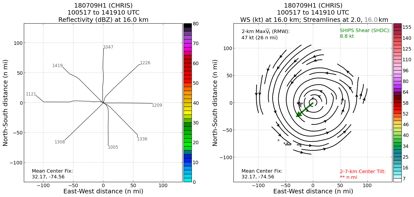
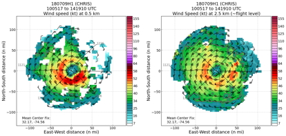
20180709H1 ws dbz planview
|
20180709H1 ws dbz upper planview
|
20180709H1 ws_nhc_planview
|
|
Gridded radar data
GrADS control file radar data
|
|
Winds at :
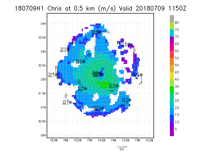
.5 km
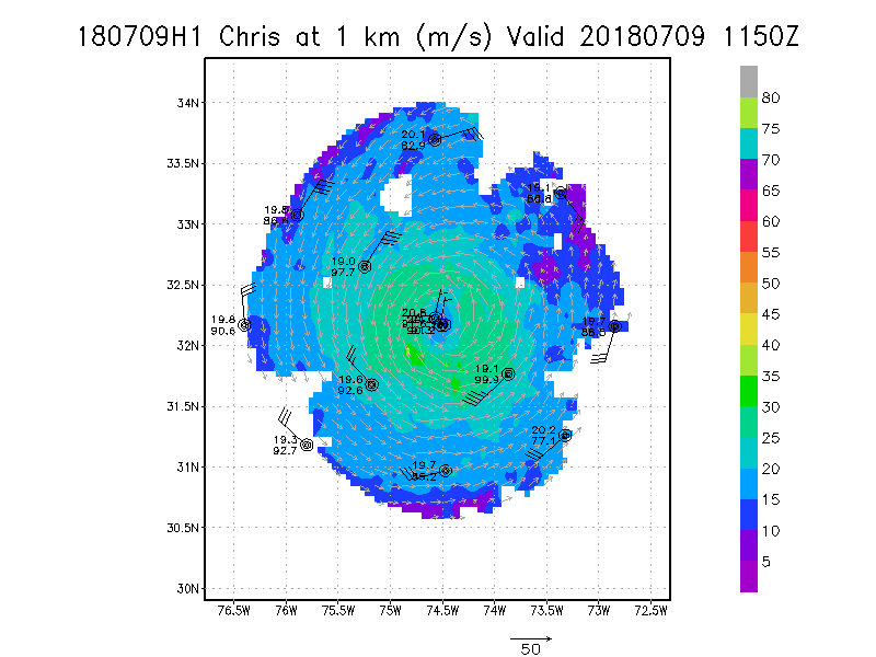
1.0 km
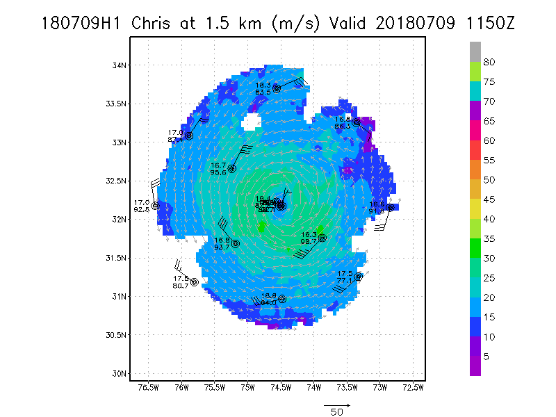
1.5 km
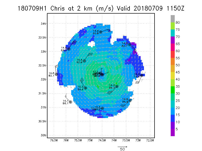
2.0 km
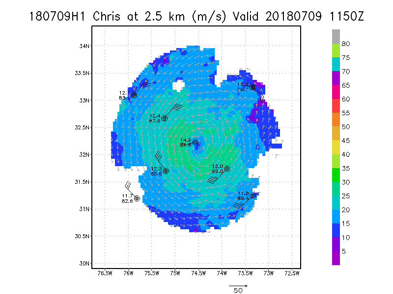
2.5 km
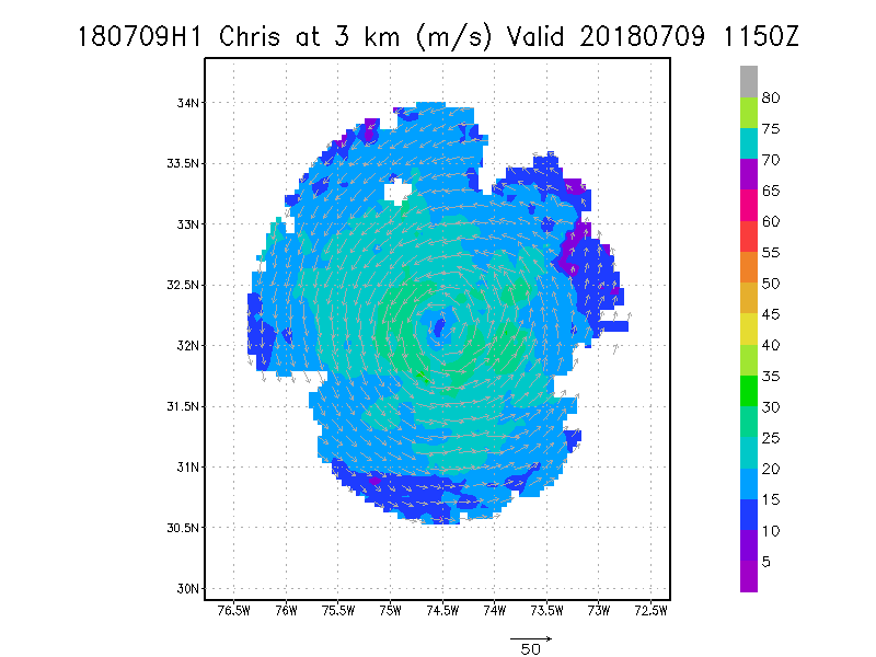
3.0 km
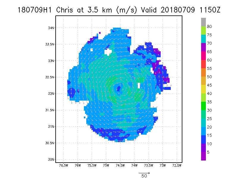
3.5 km
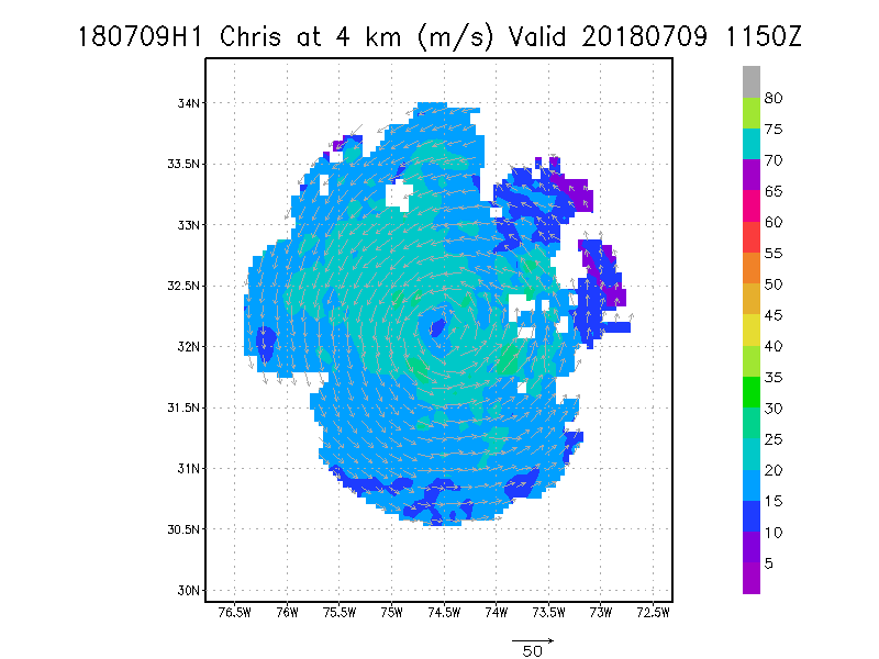
4.0 km
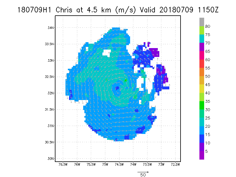
4.5 km
|
Winds at :
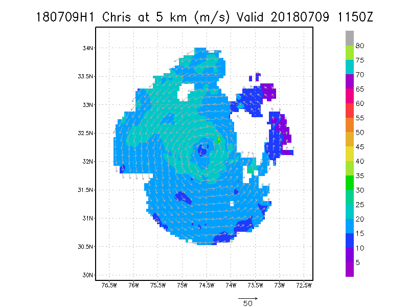
5.0 km
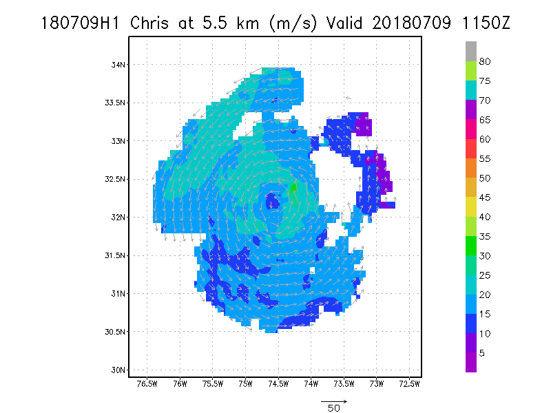
5.5 km
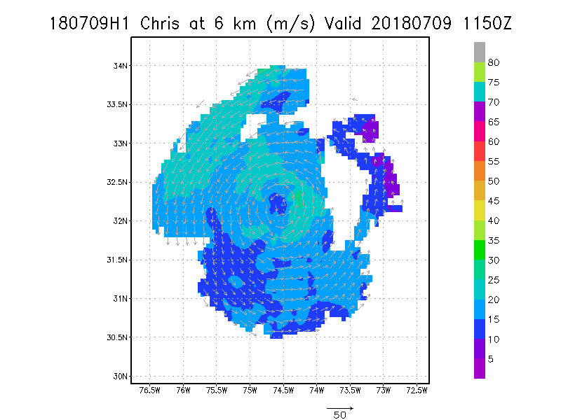
6.0 km
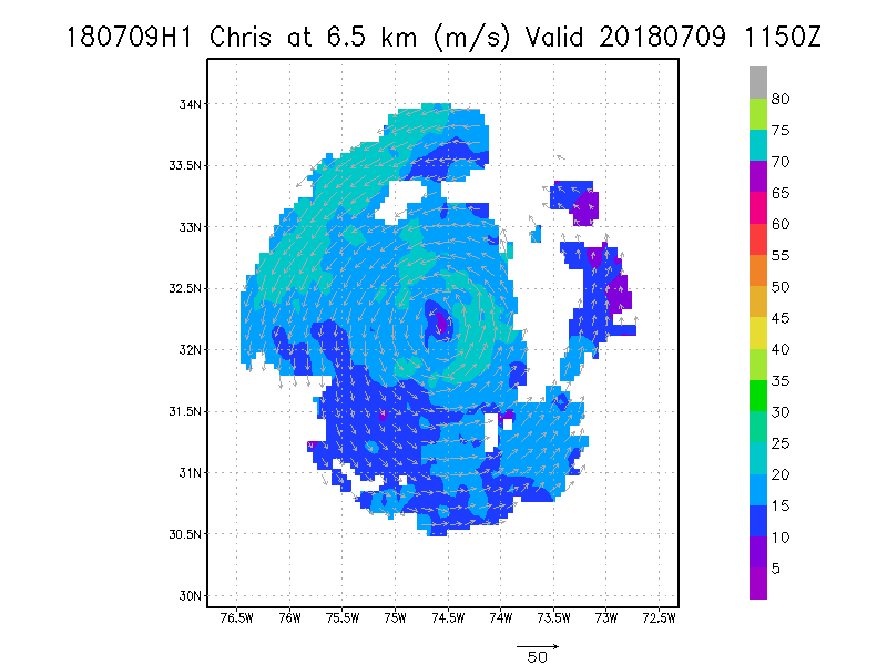
6.5 km
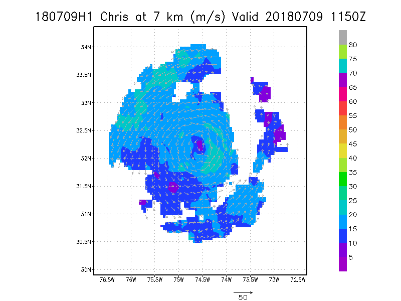
7.0 km
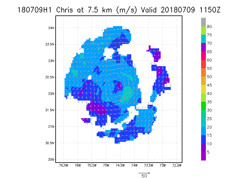
7.5 km
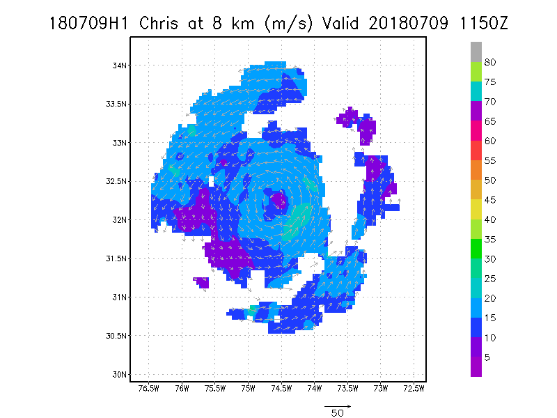
8.0 km
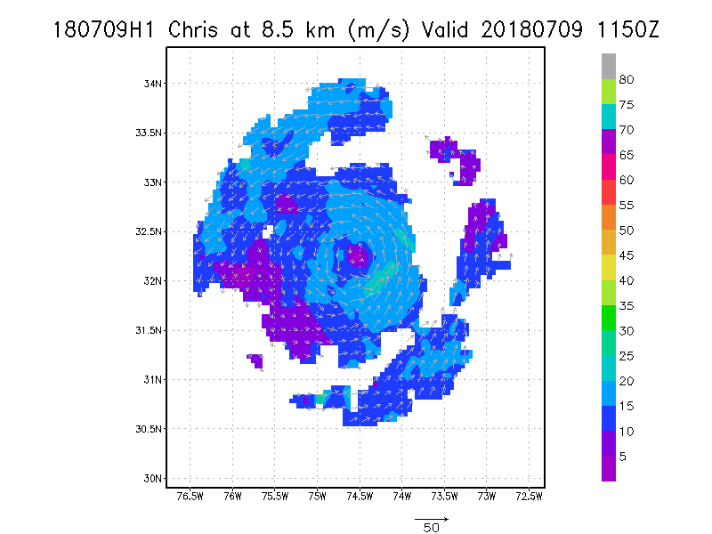
8.5 km
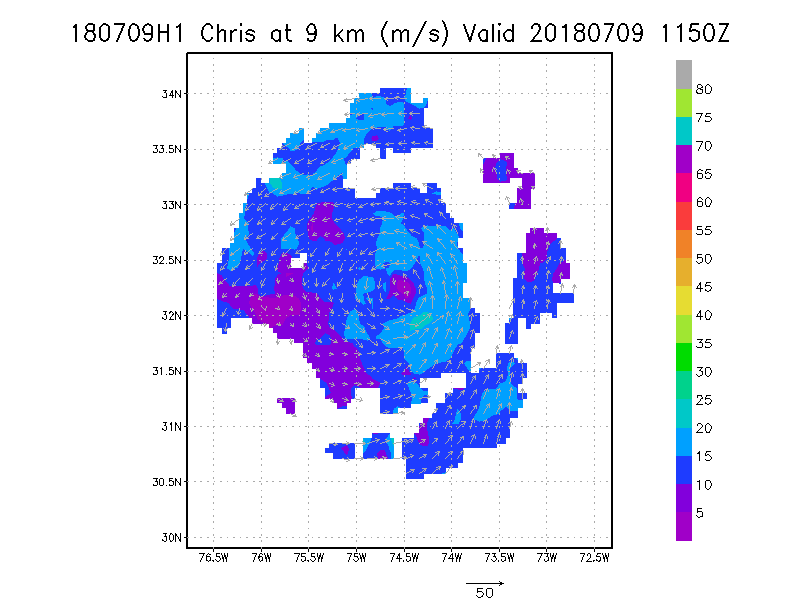
9.0 km
|
Winds at :
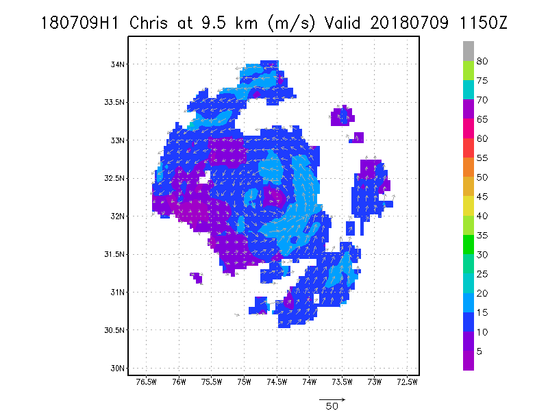
9.5 km
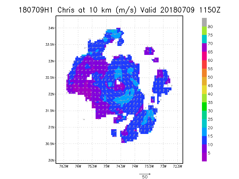
10.0 km
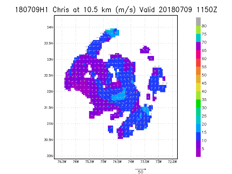
10.5 km
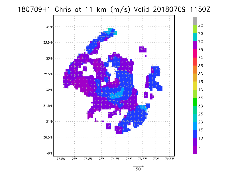
11.0 km
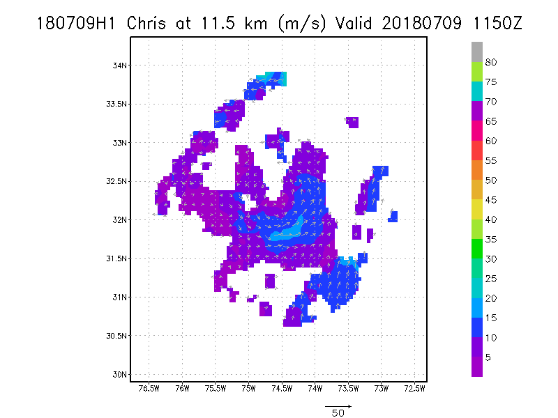
11.5 km
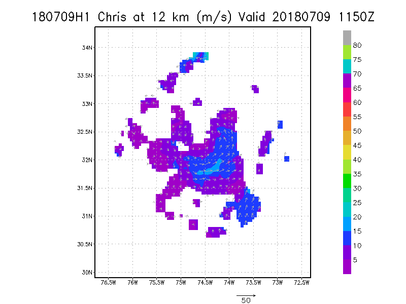
12.0 km
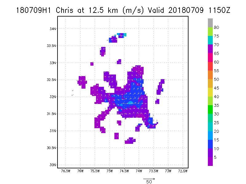
12.5 km
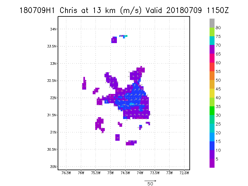
13.0 km
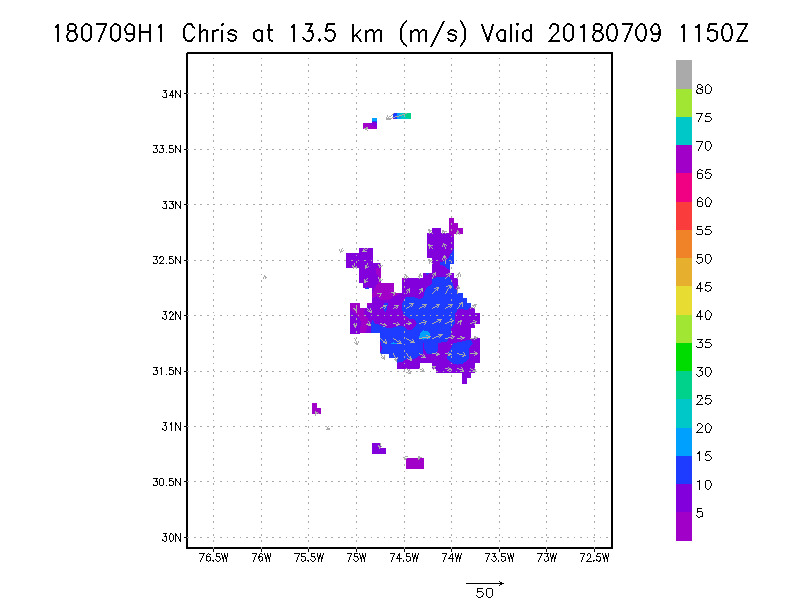
13.5 km
|
Winds at :
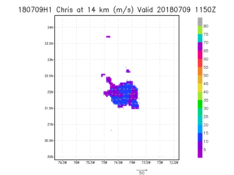
14.0 km
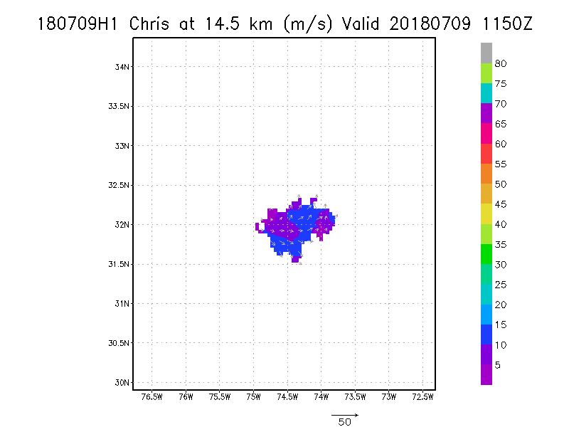
14.5 km
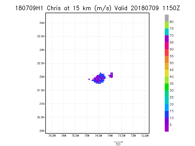
15.0 km
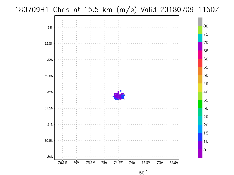
15.5 km
16.0 km
16.5 km
17.0 km
17.5 km
18.0 km
|
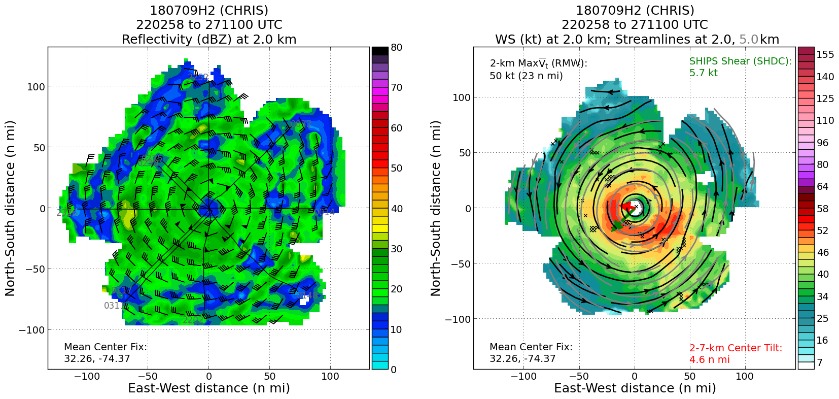
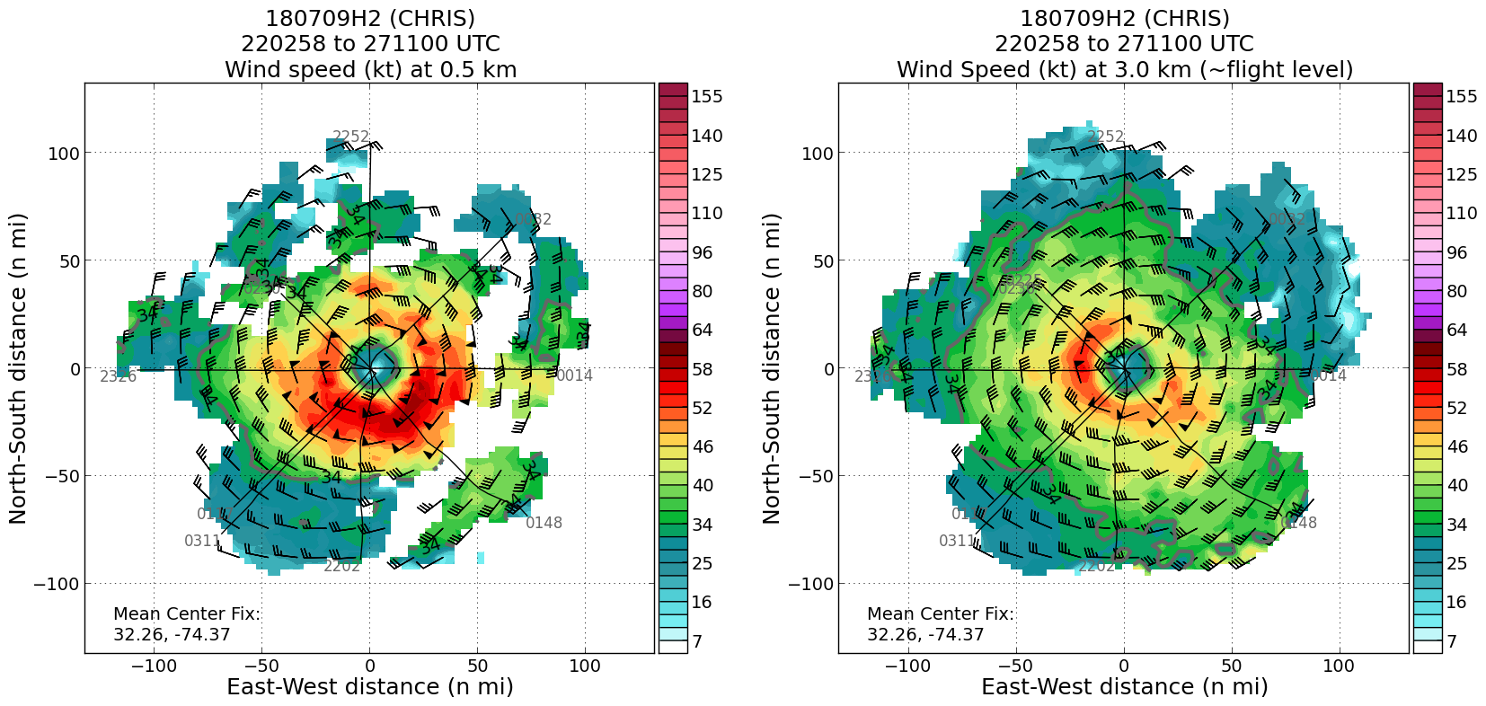
July 09, 2018
N42RF #2
|
|
Individual legs
|
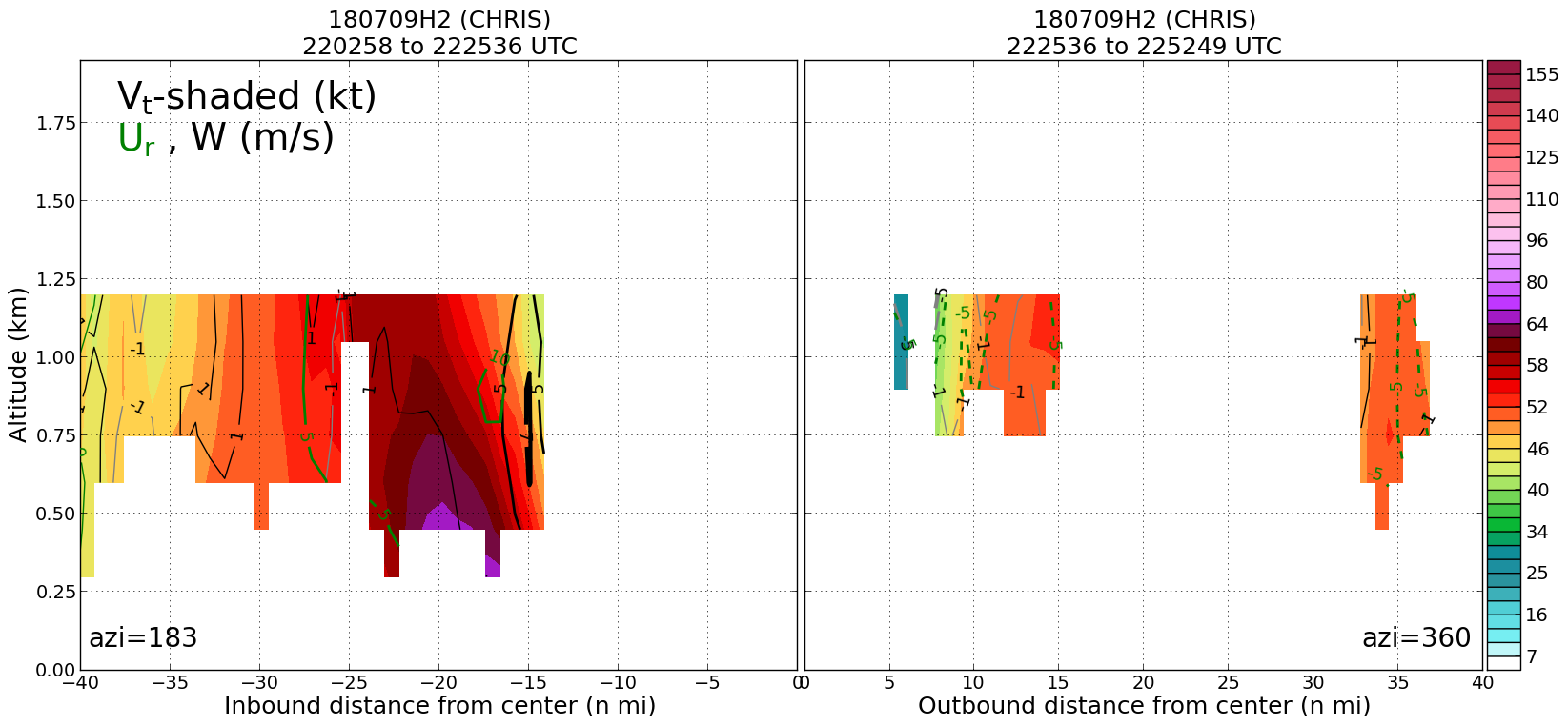
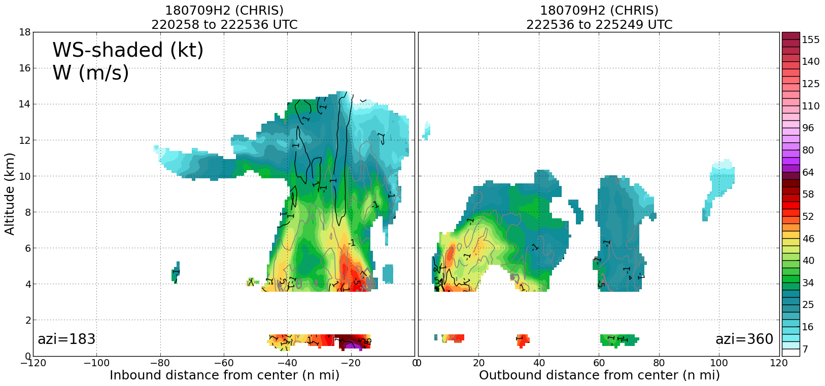
Leg #1
22:25Z
|
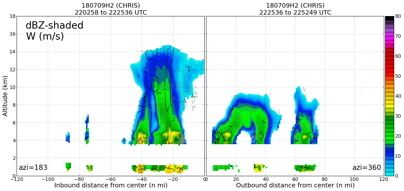
20180709H2 2225Z dbz profile
|
20180709H2 2225Z vt BL profile
|
20180709H2 2225Z ws profile

|
|
Leg #2
23:53Z
|
20180709H2 2353Z dbz profile

|
20180709H2 2353Z vt BL profile
|
20180709H2 2353Z ws profile
|
|
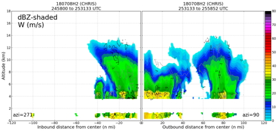
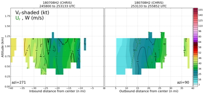
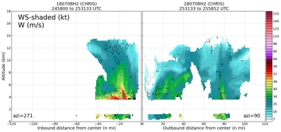
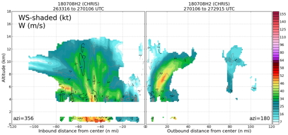
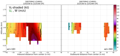
Leg #3
24:55Z
|
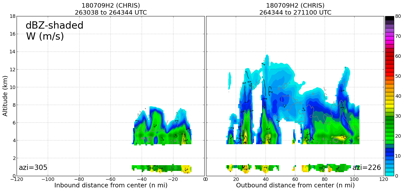
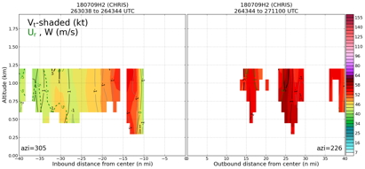
20180709H2 2455Z dbz profile
|
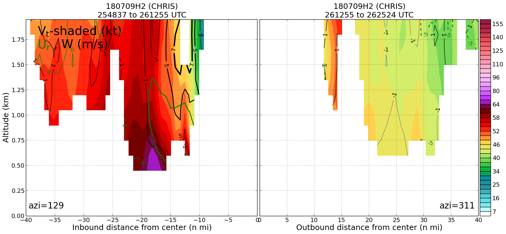
20180709H2 2455Z vt BL profile
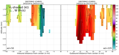
|
20180709H2 2455Z ws profile
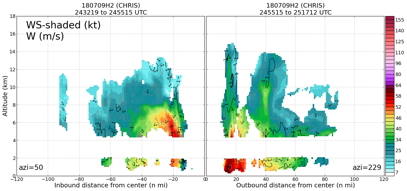
|
|
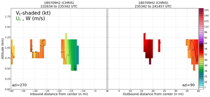
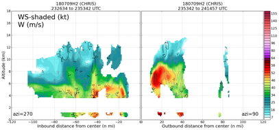
Leg #4
26:12Z
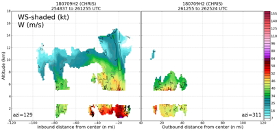
|
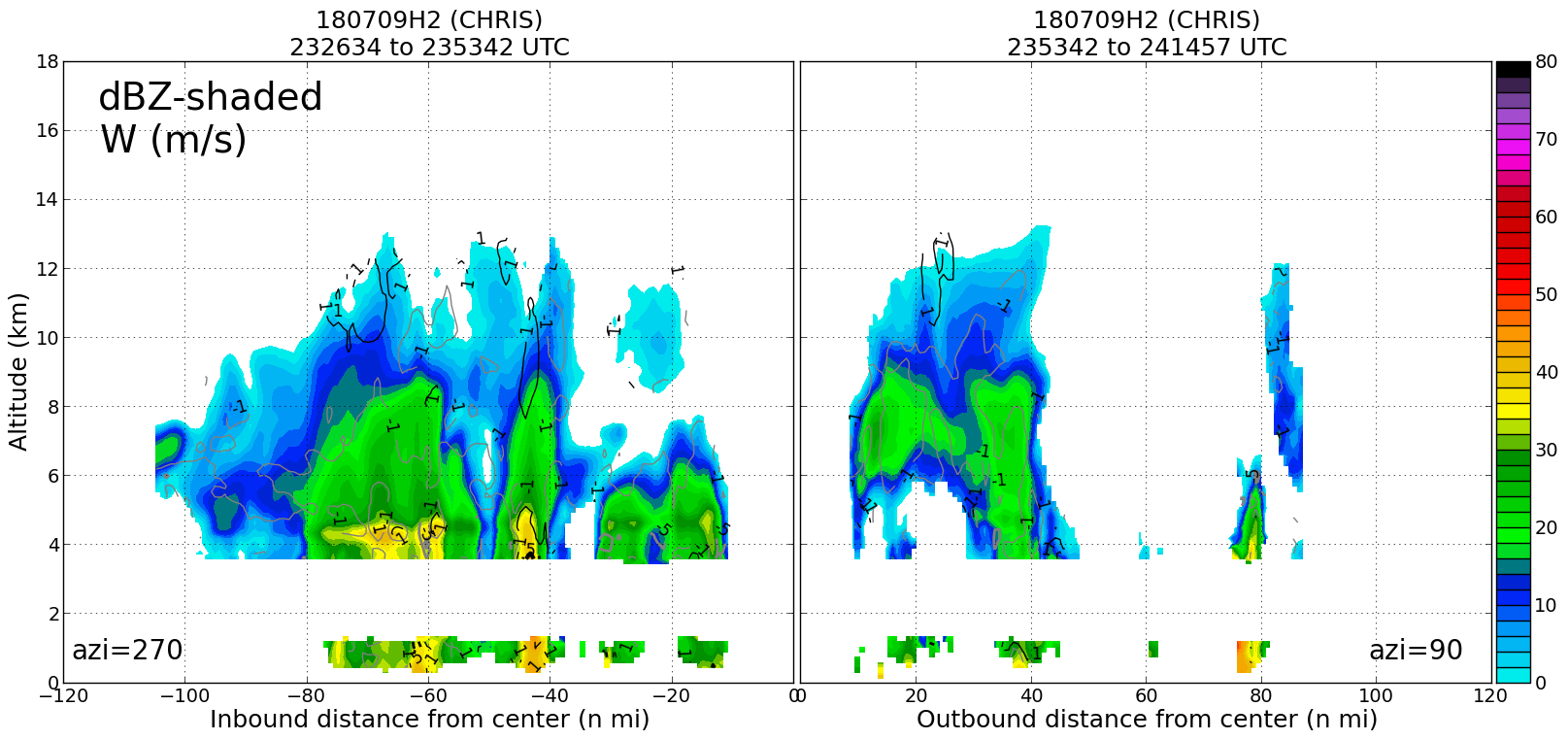
20180709H2 2612Z dbz profile
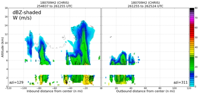
|
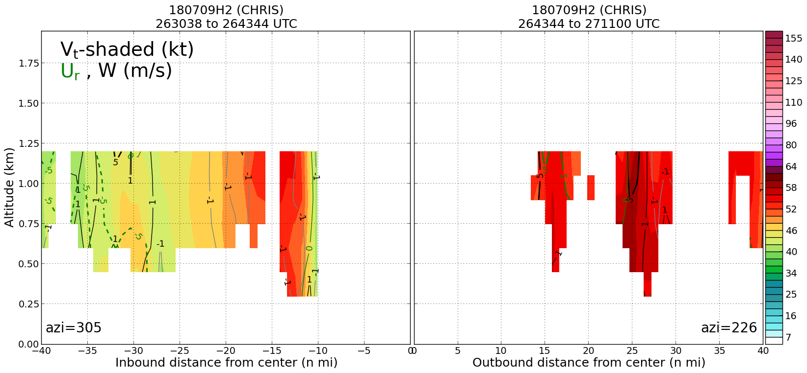
20180709H2 2612Z vt BL profile
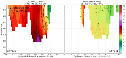
|
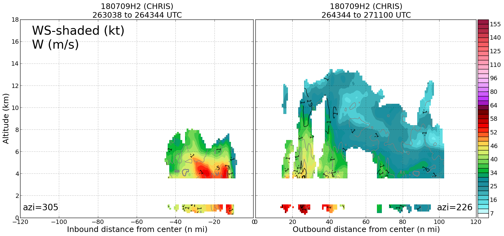
20180709H2 2612Z ws profile
|
|
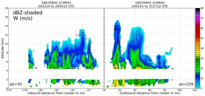
Leg #5
26:43Z
|
20180709H2 2643Z dbz profile
|
20180709H2 2643Z vt BL profile
|
20180709H2 2643Z ws profile

|
|
|
Plan views
|
20180709H2 ws dbz planview

|
20180709H2 ws dbz upper planview
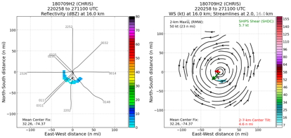
|
20180709H2_ws_nhc_planview

|
|
Gridded radar data
GrADS control file radar data
|
|
Winds at :
.5 km
1.0 km
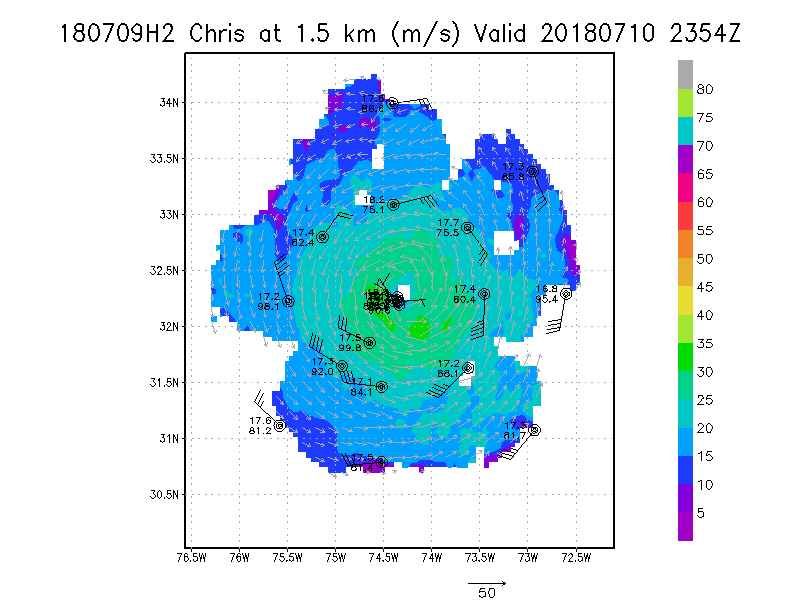
1.5 km
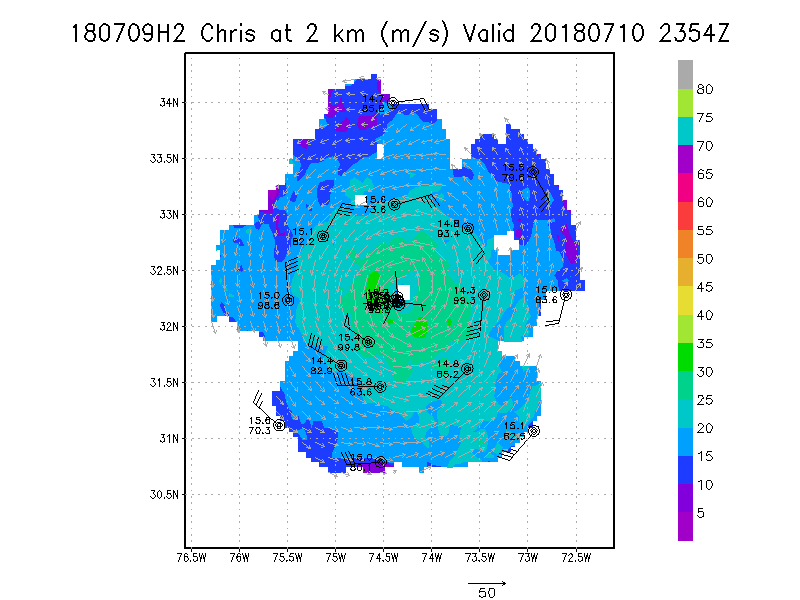
2.0 km
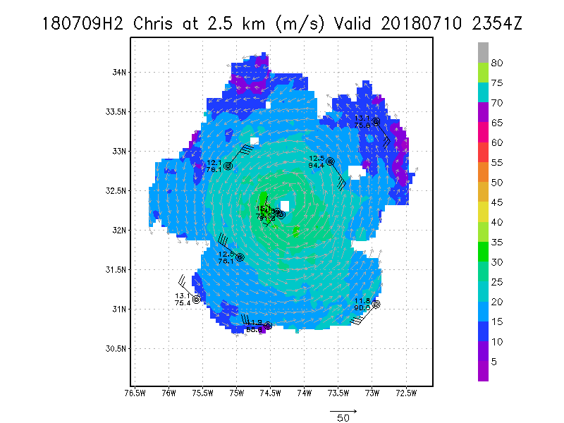
2.5 km
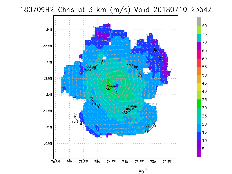
3.0 km
3.5 km
4.0 km
4.5 km
|
Winds at :
5.0 km
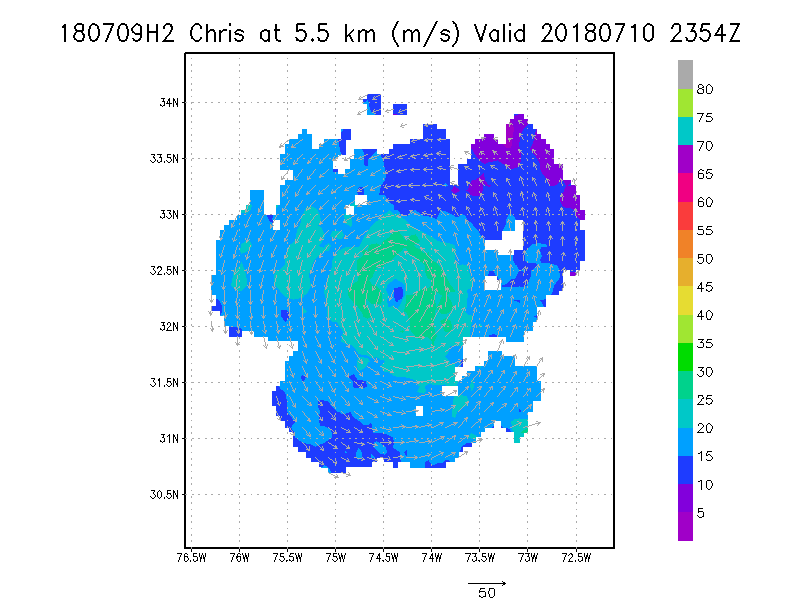
5.5 km
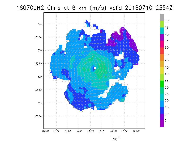
6.0 km
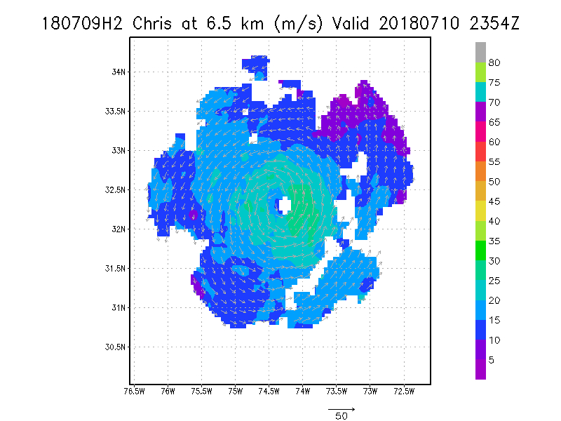
6.5 km
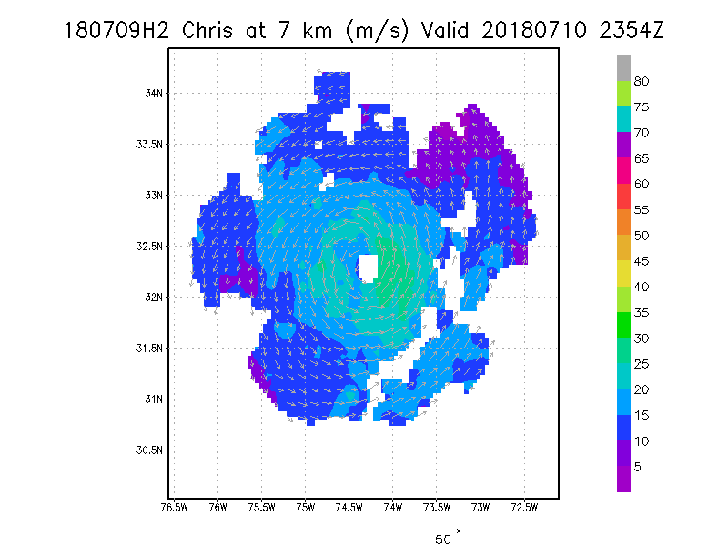
7.0 km
7.5 km
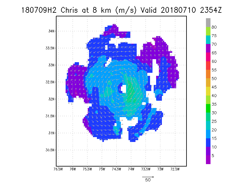
8.0 km
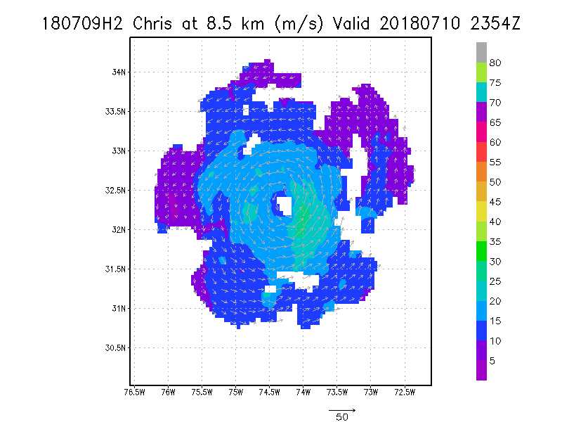
8.5 km
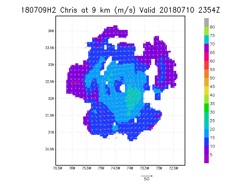
9.0 km
|
Winds at :
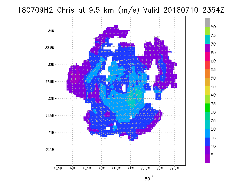
9.5 km
10.0 km
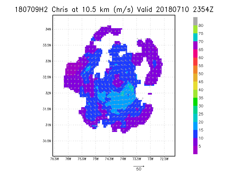
10.5 km
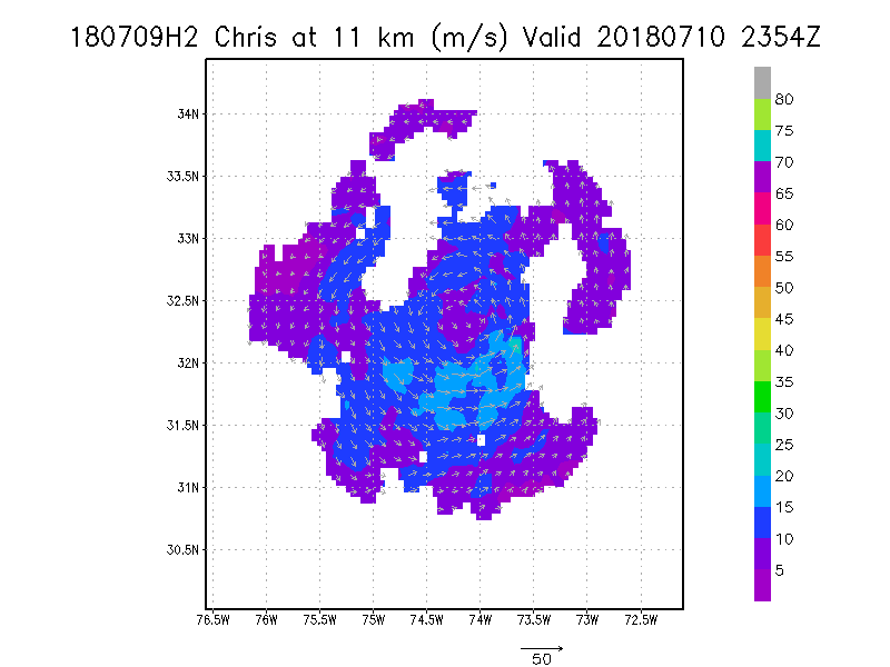
11.0 km
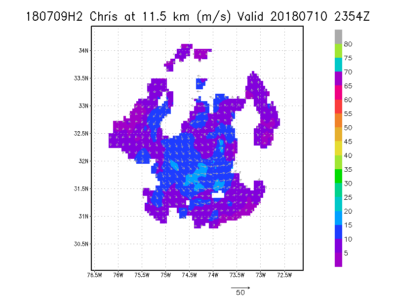
11.5 km
12.0 km
12.5 km
13.0 km
13.5 km
|
Winds at :
14.0 km
14.5 km
15.0 km
15.5 km
16.0 km
16.5 km
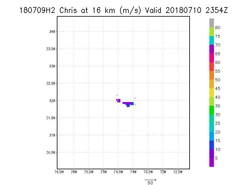
17.0 km
17.5 km
18.0 km
|


