
This paper is an overview of what we currently know about processes important in tropical cyclone intensity change and the research that has been done during the past 15 years using aircraft data. The paper describes the eye and eyewall and how they change in time, the region close to the ocean surface where the energy that fuels the system is transferred to the atmosphere, and the region at the top where air flows away from the system. It also discusses how the tropical cyclone behaves in different environments, like warm versus cold water, when it is surrounded by moist or dry air, or when the wind at the top of the tropical cyclone is very different from or similar to that at the bottom (wind shear). The formation and organization of weak tropical cyclones that may or may not develop into strong hurricanes is also highlighted. Things that we currently do not understand are also highlighted, and future plans for research with airborne data moving forward are discussed. The paper also has an extensive list of references where readers can get details on any of the information presented.

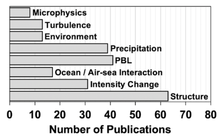
Microphysics refers to how individual water or ice particles in clouds behave and how that changes intensity .
Turbulence is a set of unpredictable small features that can mix different fluids; in tropical cyclones, it helps transfer energy between the atmosphere and warm ocean below it, so is important to understand for intensity changes.
The environment is the region outside the tropical cyclone, such as the ocean below and the air above and all around it, that can impact the tropical cyclone and affect its intensity.
The PBL (Planetary Boundary Layer) is the part of the atmosphere closest to the ocean surface where heat gets transferred from the ocean to the atmosphere and motion goes the other way in the process known as Air-Sea Interaction.
Structure refers to how the different parts of the tropical cyclone (clouds, rainbands, eyewall and eye) come together to impact intensity changes.
For more information, contact aoml.communications@noaa.gov. The full paper can be found at https://www.mdpi.com/2073-4433/12/5/650.