
The Hurricane Weather Research and Forecasting Model (HWRF) has become an important tool for both hurricane forecasters and researchers. The current HWRF has three domains around only one tropical cyclone. Its inner domain makes forecasts on a grid with points 2 km apart and follows the tropical cyclone during the forecast. During hurricane season in the North Atlantic and Northeast Pacific Oceans, more than one tropical cyclone was present 81% of the time during 2011-2014 hurricane seasons. These tropical cyclones can affect each other, but the HWRF may not be able to forecast these effects. A new Basin-Scale HWRF (HWRF-B) allows for forecasts of more than one tropical cyclone at the same time, so these effects can be captured. This study compares forecasts of where the tropical cyclone will go, known as track forecasts, from the two models. HWRF-B made better forecasts than HWRF when more than one tropical cyclone was present and proved the concept of concurrent tropical cyclone forecasts in a regional model.
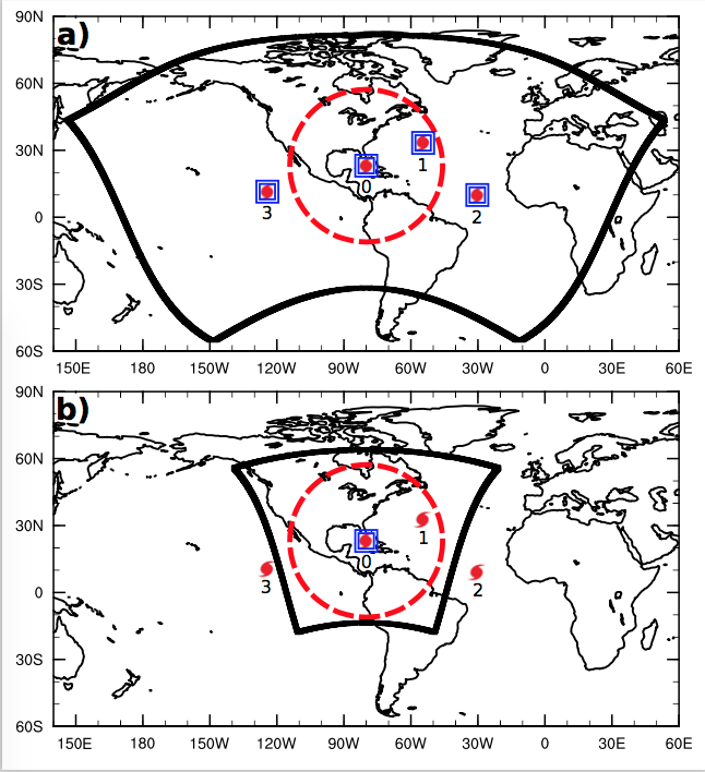
Black lines show the edges of the outer domain of (a) HWRF-B and (b) HWRF. HWRF-B has a much larger outer domain so that all tropical cyclones in the North Atlantic and Northeast Pacific Oceans can be forecast at the same time. Blue boxes are inner domains that follow each tropical cyclone. The new HWRF-B has these domains around all four tropical cyclones, but HWRF can have this for only one at a time. The red circle marks 3500 km from the one of the tropical cyclones.
Important Conclusions:
- HWRF-B track forecasts are as good as those from HWRF for all 1000 cases from 2011-2014.
- HWRF-B track forecasts are better than those from HWRF when more than one tropical cyclone is present, even when they were greater than 3500 km apart.
- HWRF-B track forecasts are better than those from HWRF when a tropical cyclone was north of 25°N or west of 60°W.

You can read the paper online at http://journals.ametsoc.org/doi/abs/10.1175/WAF-D-16-0150.1
