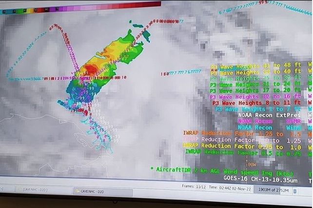


During recently flights into Hurricane Lisa, researchers from NOAA’s Atlantic Oceanographic & Meteorological Laboratory (AOML), National Hurricane Center (NHC), Global Systems Laboratory (GSL), National Environmental Satellite, Data, and Information Service (NESDIS) participated in a technical workshop, or “hack-a-thon,” in the new Hurricane and Ocean Testbed.

The goal of the exercise was to accelerate the integration of aircraft & in-situ observations into the National Weather Service’s data repository, called AWIPS (Advanced Weather Interactive Processing System). AWIPS is a processing, display, and telecommunications system that lies at the foundation of their operations and relies on observational data collected by scientists and Hurricane Hunter aircraft.

The exercise, held at the National Hurricane Center in Miami, Florida, was a huge success, resulting in a series of enhancements to products that display these observations in AWIPS.

Para más información, póngase en contacto con aoml.communications@noaa.gov.