
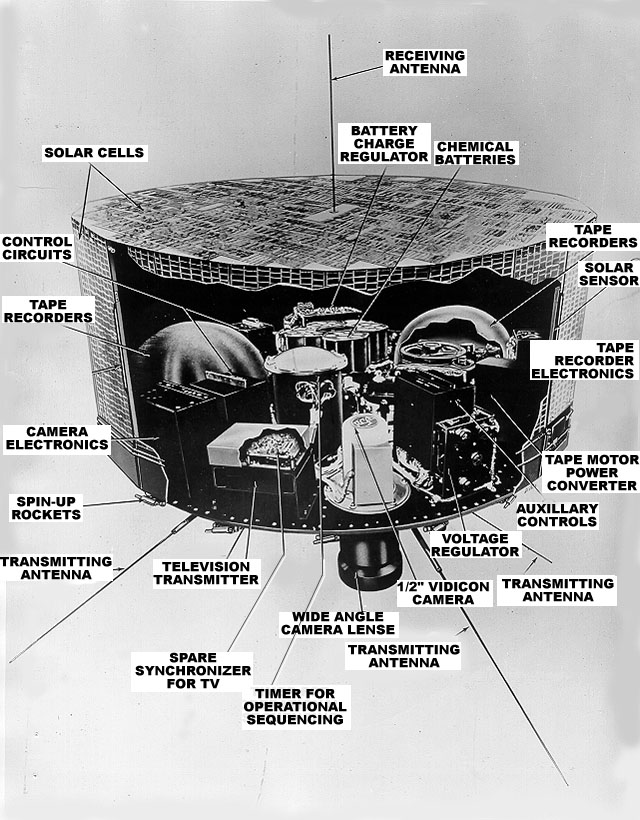
On April 1, 1960, NASA launched its first experimental Television Infrared Observation Satellite (TIROS I). The instrument broadcast television pictures of the Earth back to stations below, offering a continuous view of the cloud cover. TIROS orbited some 400 miles (650 km) above the planet and operated until June of 1960. Since the next TIROS wasn’t launched until November, the 1960 Atlantic hurricane season was the last one for which no satellite observations were made.

The impact that satellites have had on meteorology and hurricane science have been profound, and the quality of the data has improved over the last half century from the fuzzy TV images sent by TIROS I. But even this first early step had an impact as a tropical cyclone near New Zealand that had gone undetected was discovered just days after the first weather satellite’s launch.