October 06, 2017
N42RF #2
|
Individual sweeps
(aircraft relative)
|

Animated radar
|

tar'd and gzipped single frame GIFs
|

tar'd and gzipped sweep data
|
Individual sweeps
(storm relative)
660 x 660 km
|
Animated radar
|
tar'd and gzipped single frame GIFs
|
tar'd and gzipped sweep data
|
Individual legs
|
Leg #1
21:42Z
|
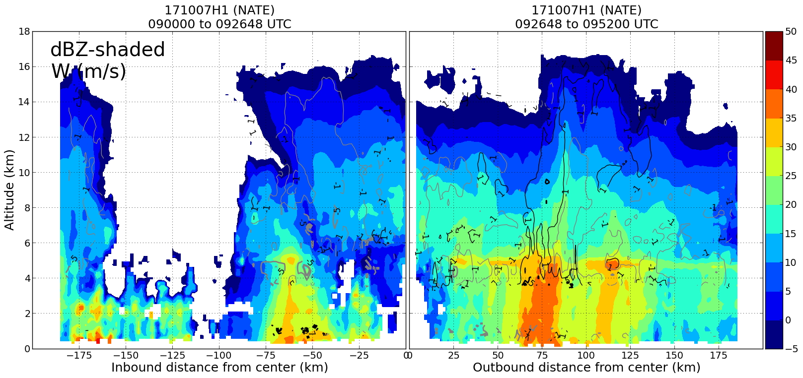
dBz profile
|
ws profile
|
|
|
ws profile
|
|
Leg #2
22:55Z
|
dBz profile
|
ws profile
|
|
|
ws profile
|
|
Leg #3
23:527Z
|
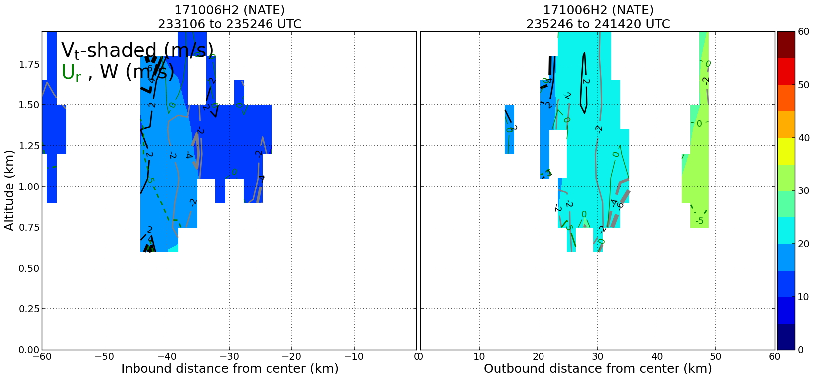
dBz profile
|
ws profile
|
|
|
ws profile
|
|
Leg #4
25:12Z
|
dBz profile
|
ws profile
|
|
|
ws profile
|
|
Plan views
|
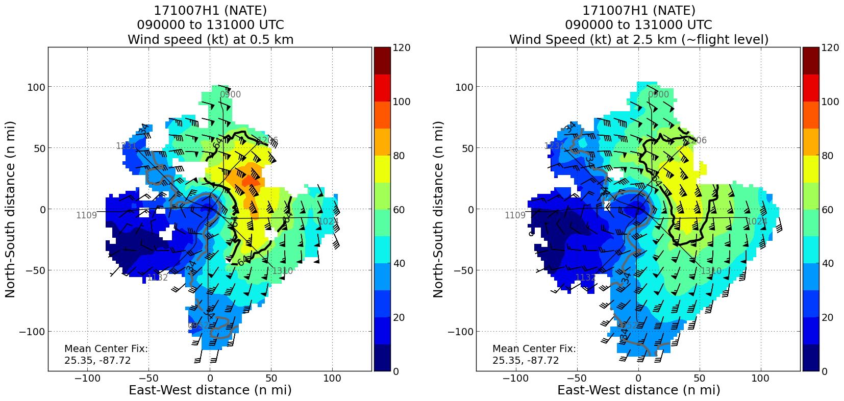
Ws dBz planview
|
Ws NHC planview
|
Gridded radar data
GrADS control file radar data
|
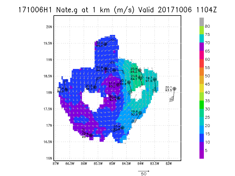
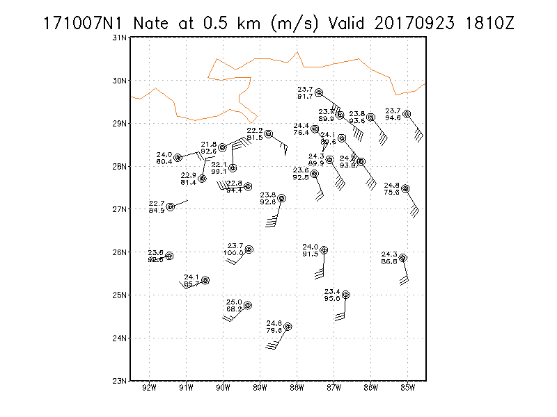
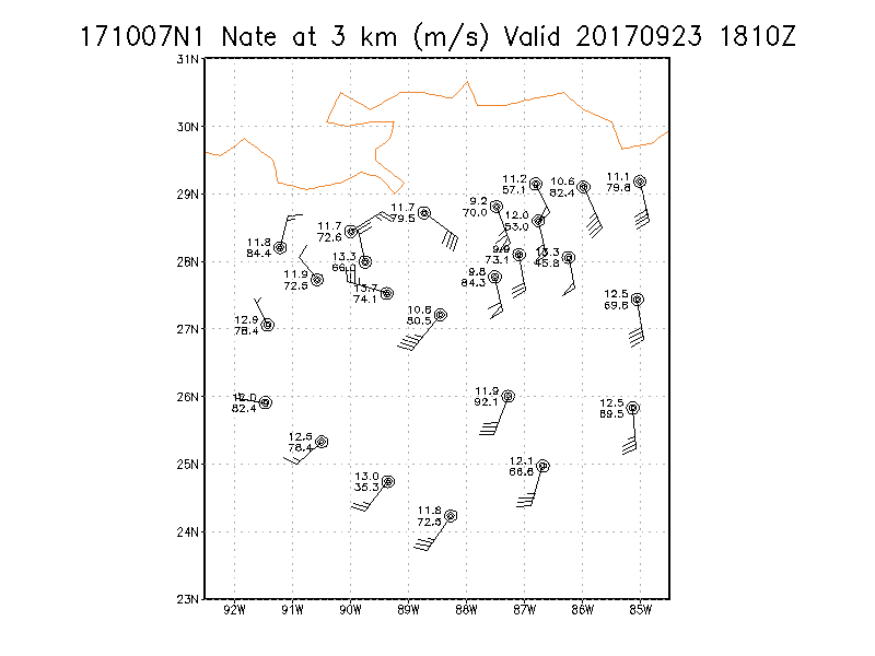
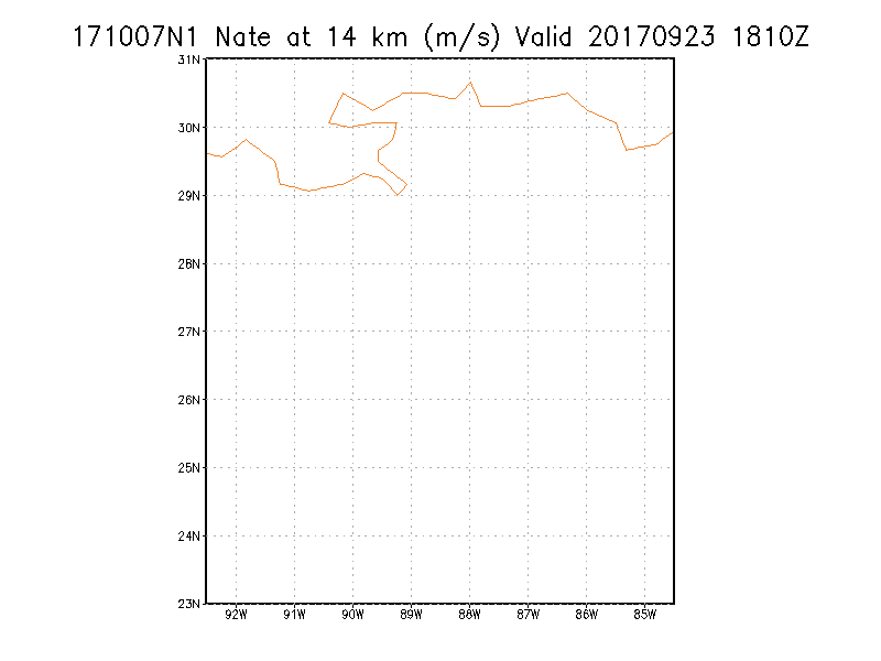
Winds at :
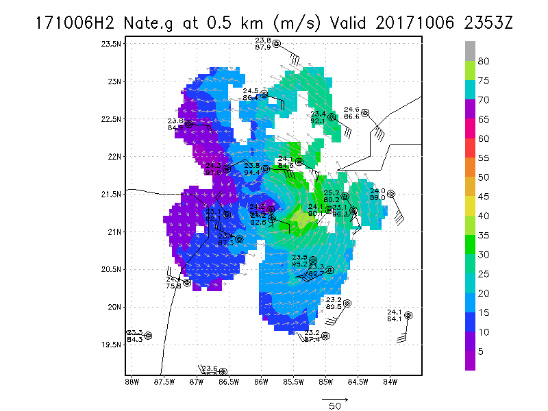
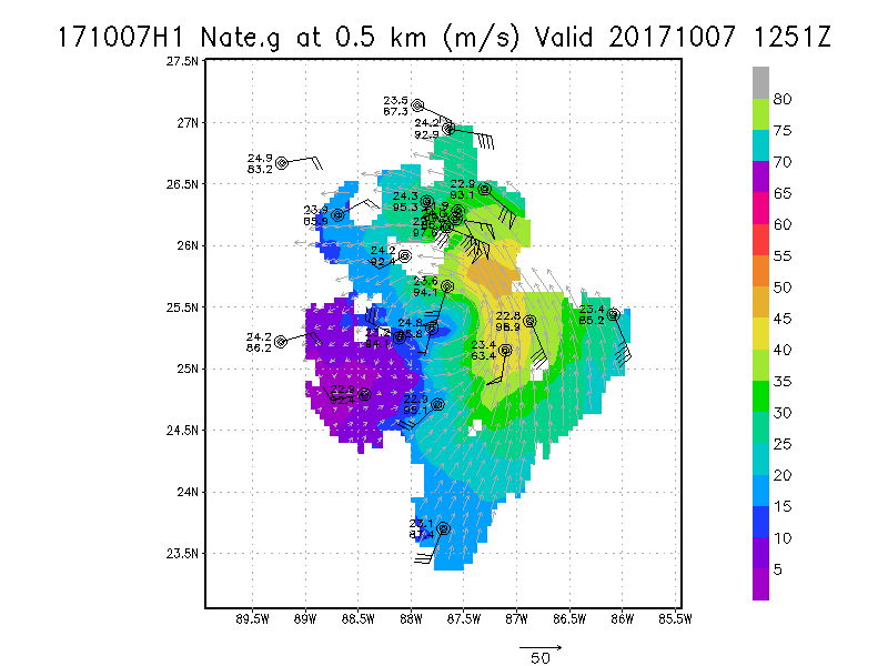
.5 km
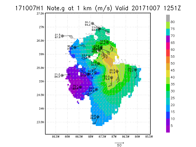
1.0 km
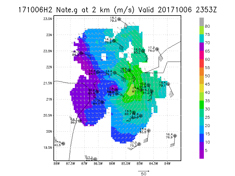
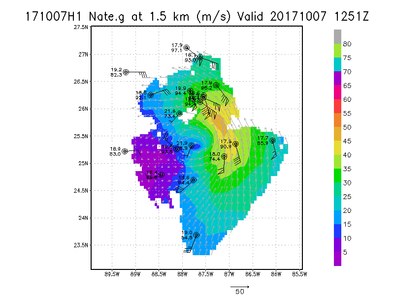
1.5 km
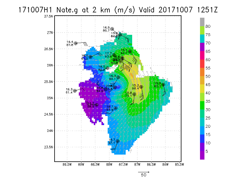
2.0 km
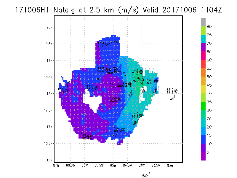
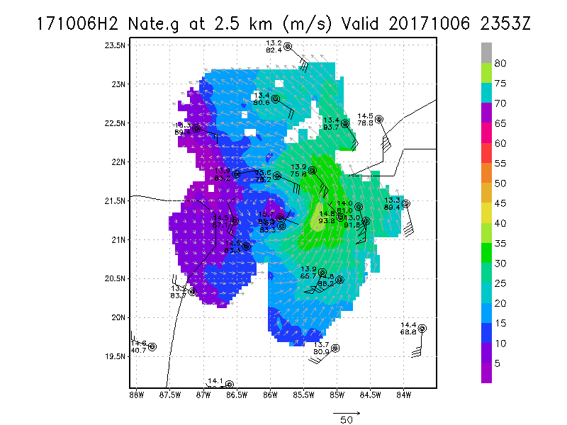
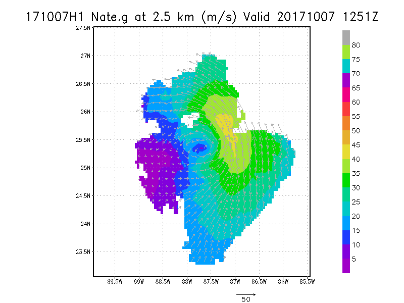
2.5 km
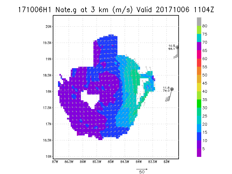
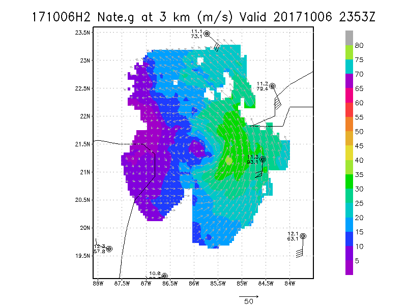
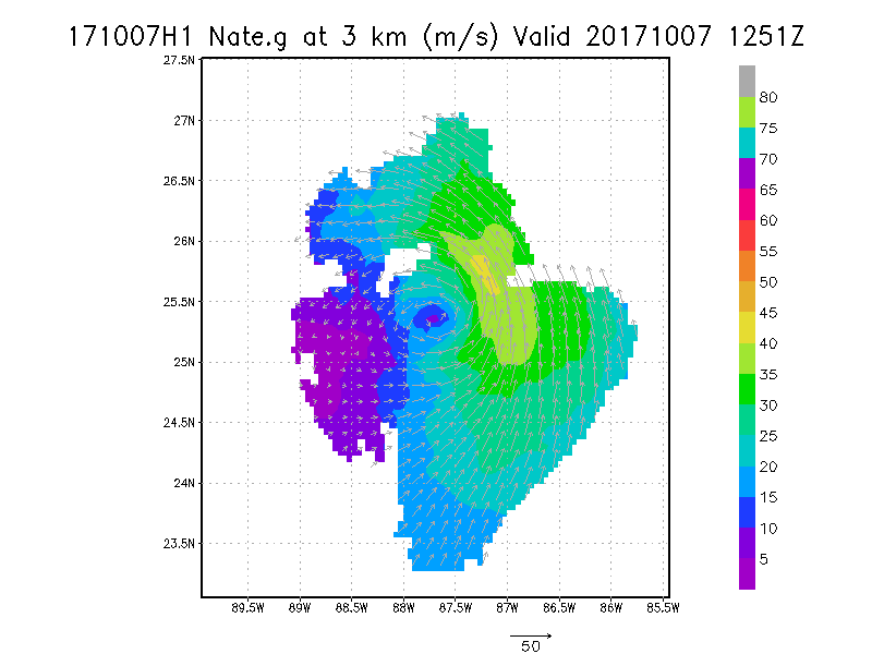
3.0 km
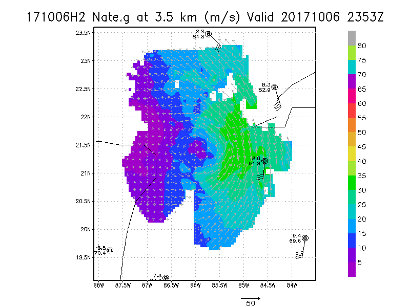
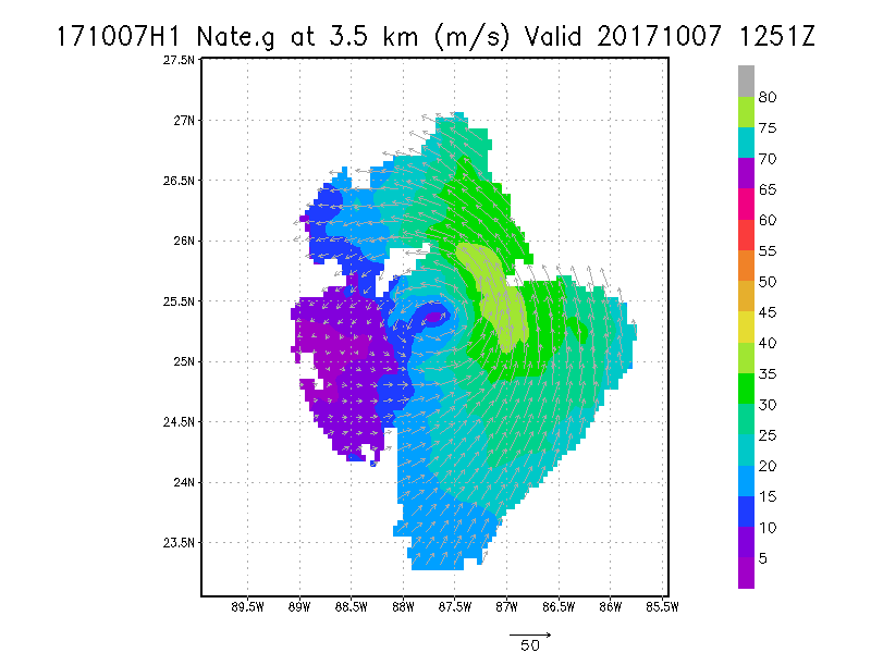
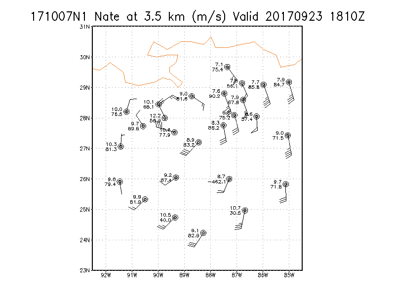
3.5 km
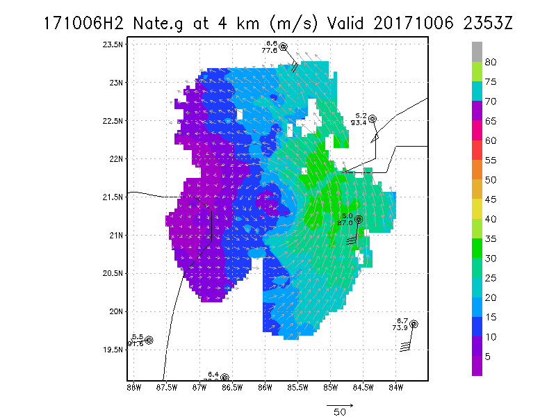
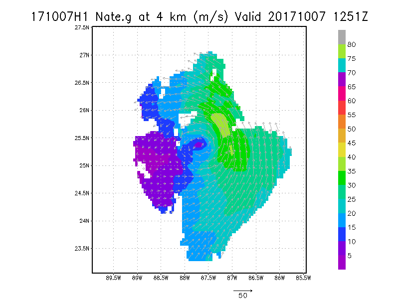
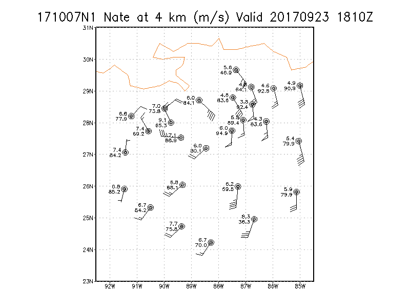
4.0 km
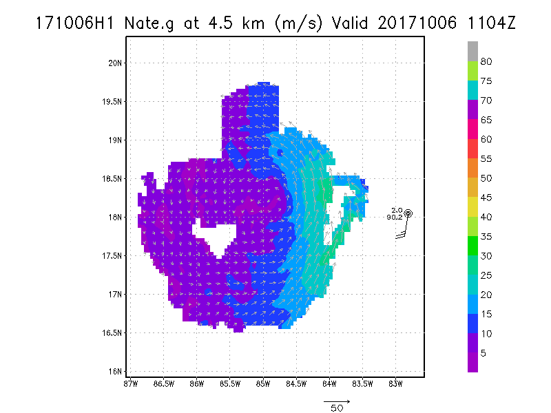
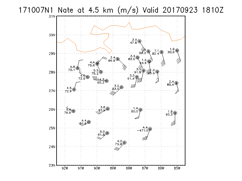
4.5 km
|
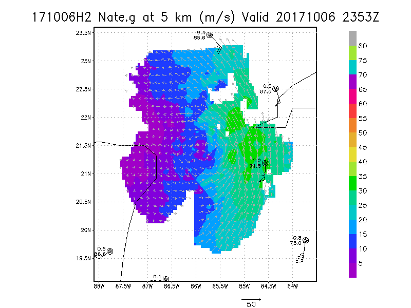
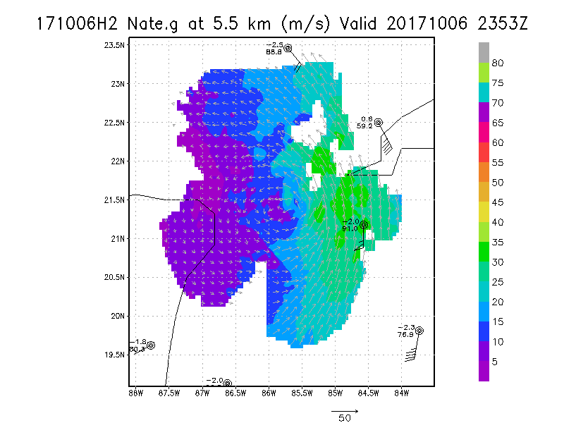
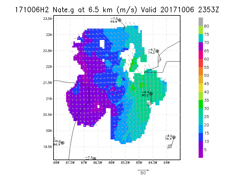
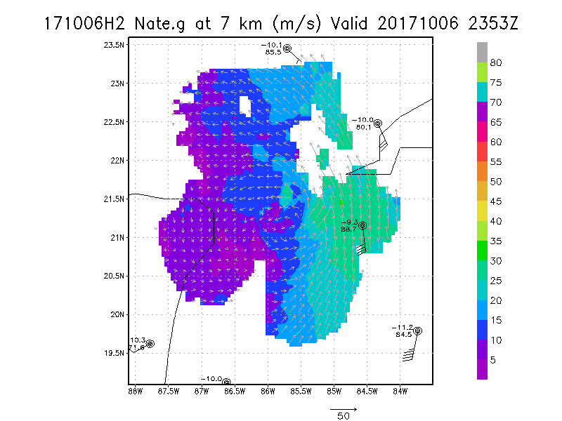
Winds at :
5.0 km
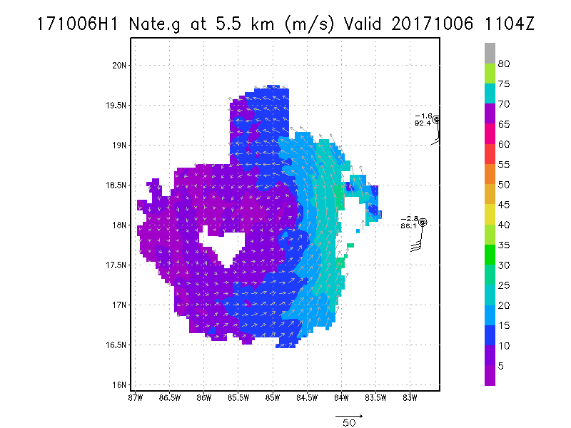
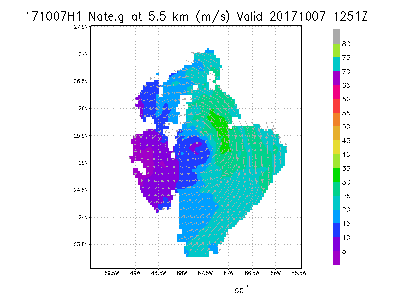
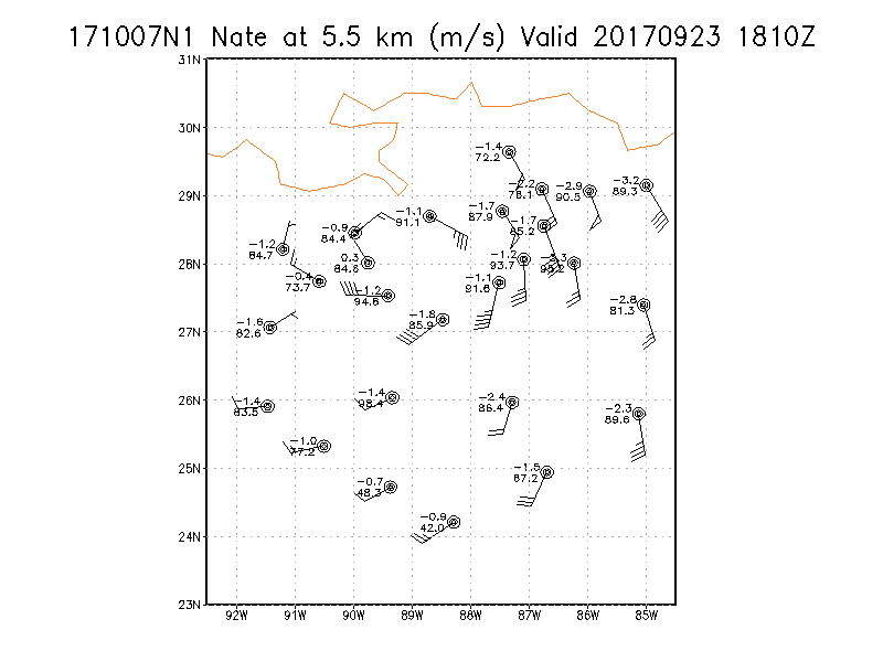
5.5 km
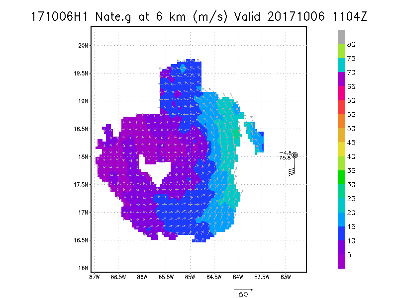
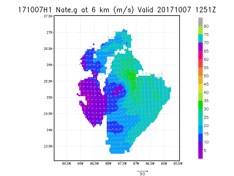
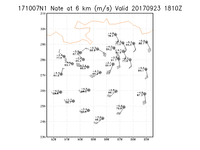
6.0 km
6.5 km
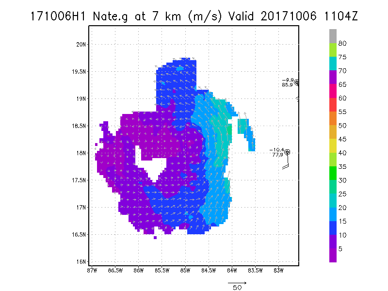
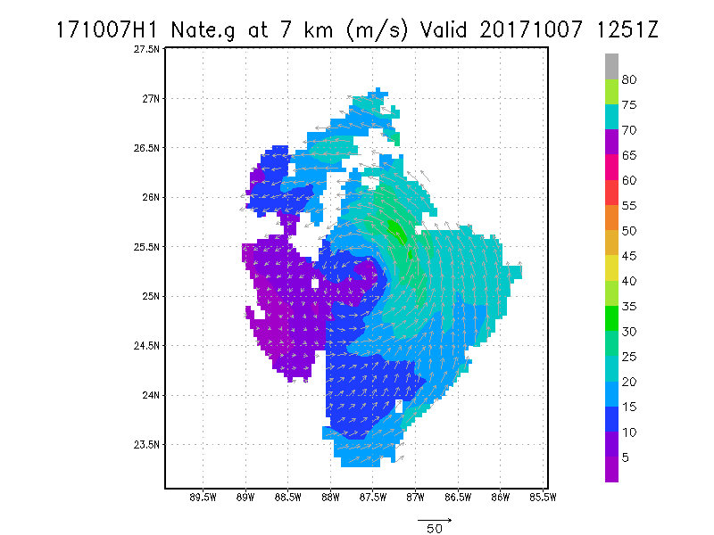
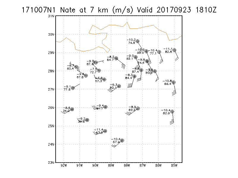
7.0 km
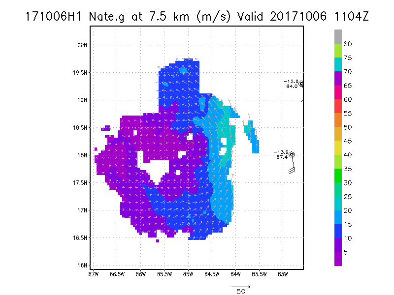
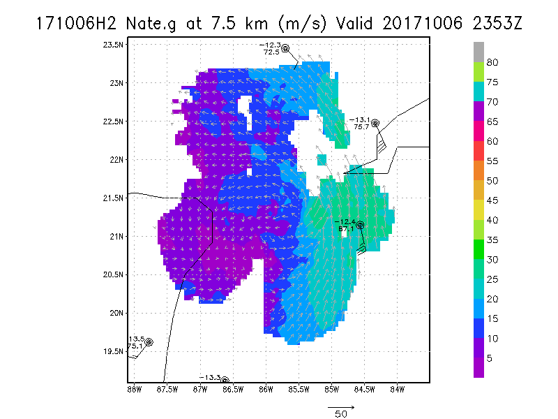
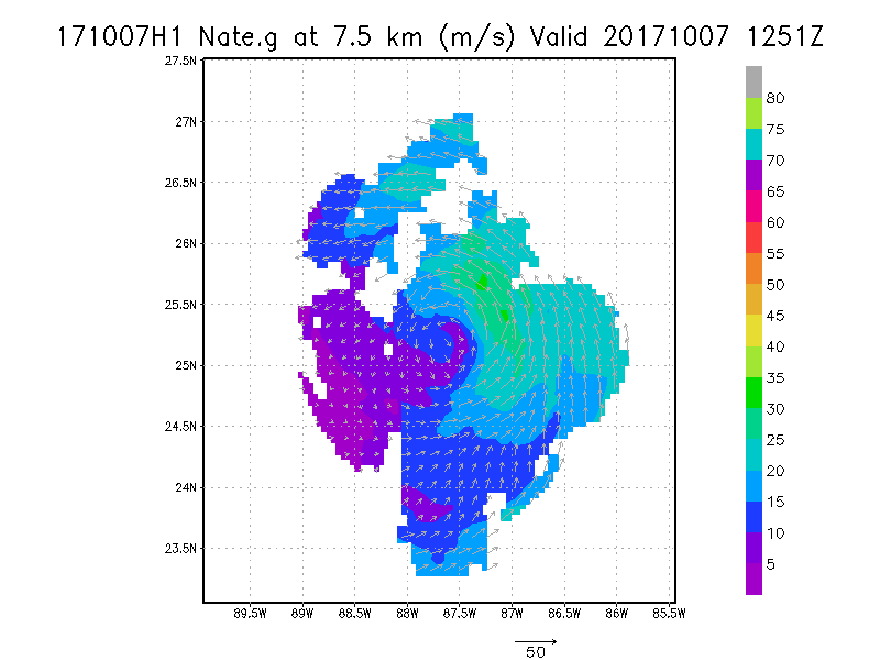
7.5 km
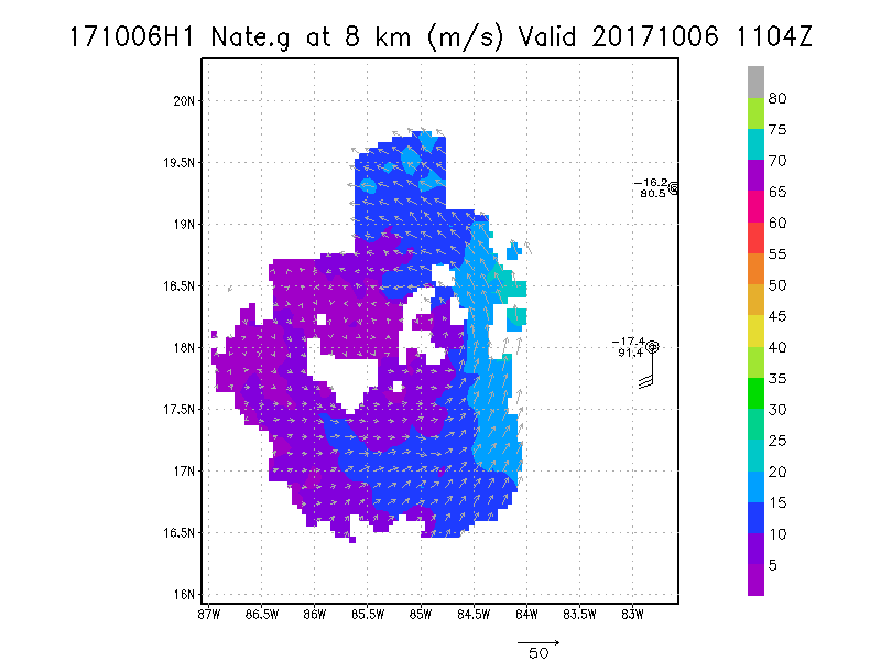
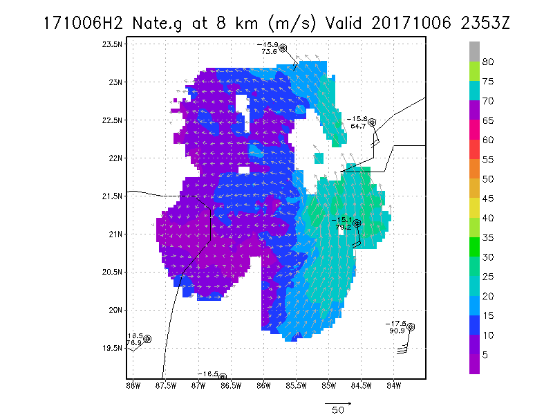
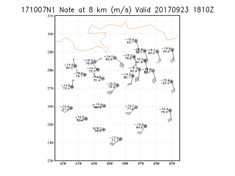
8.0 km
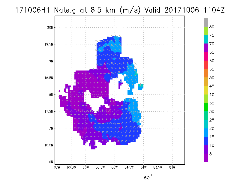
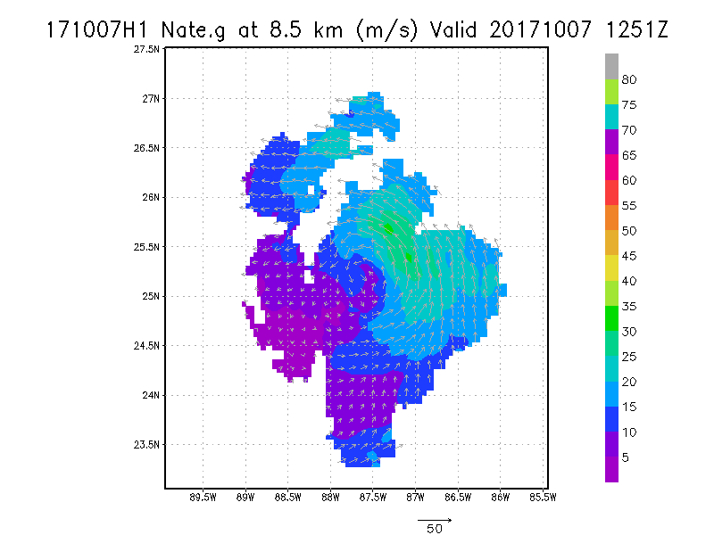
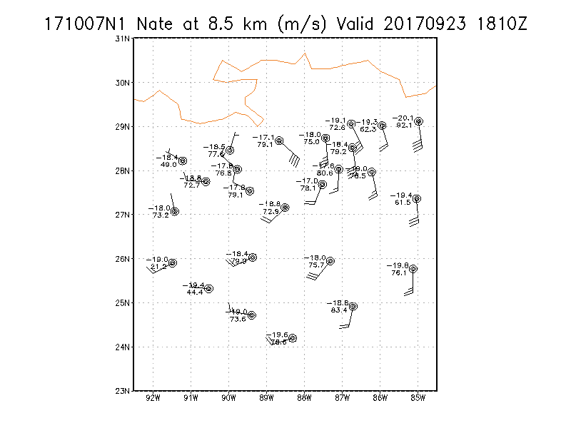
8.5 km
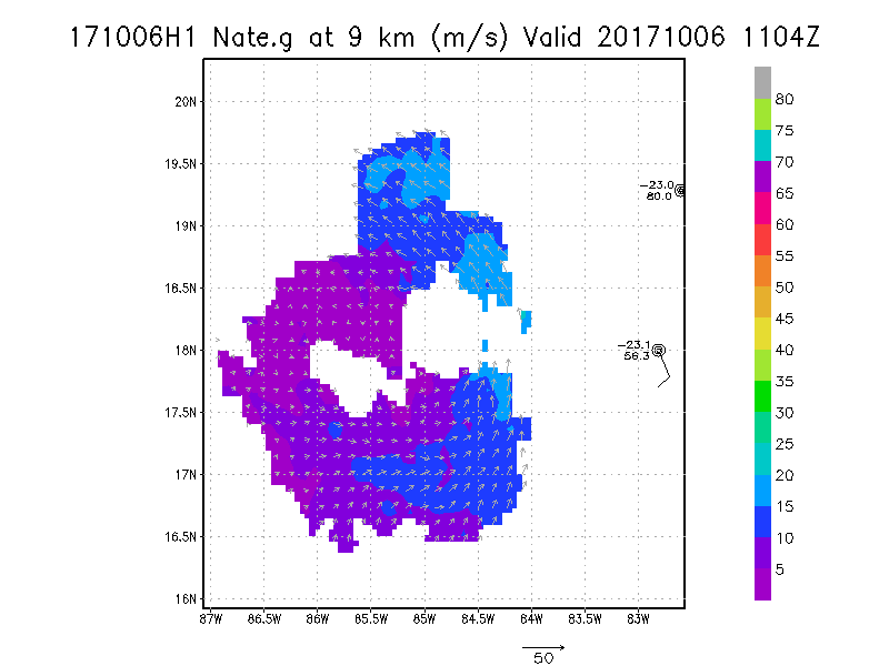
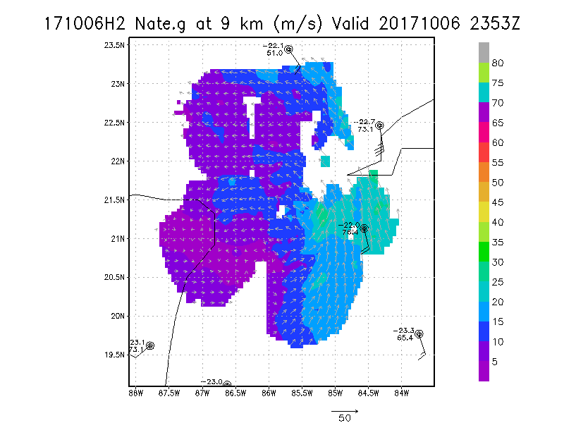
9.0 km
|
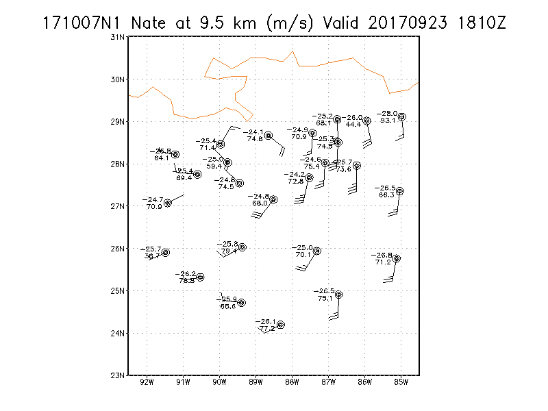
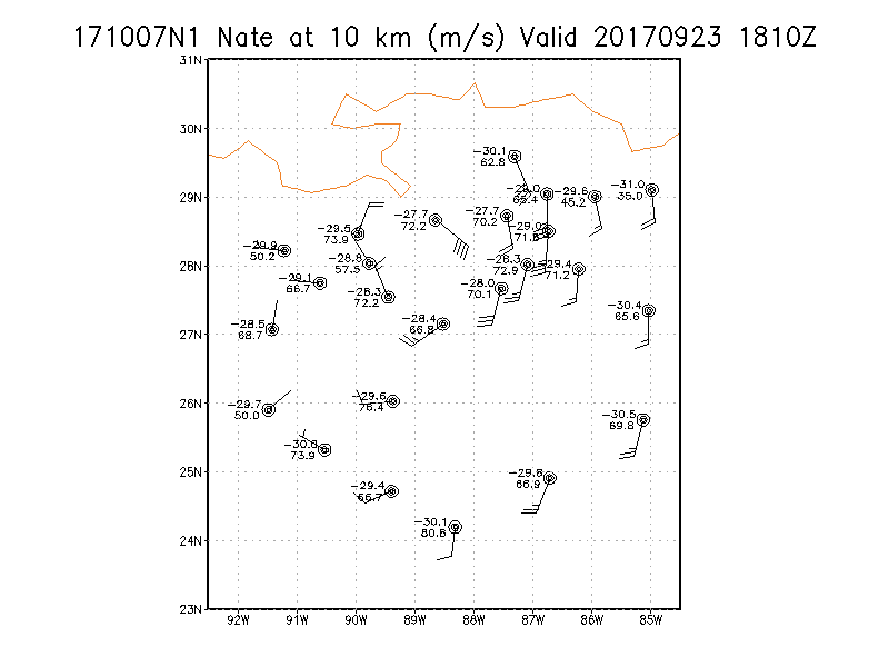
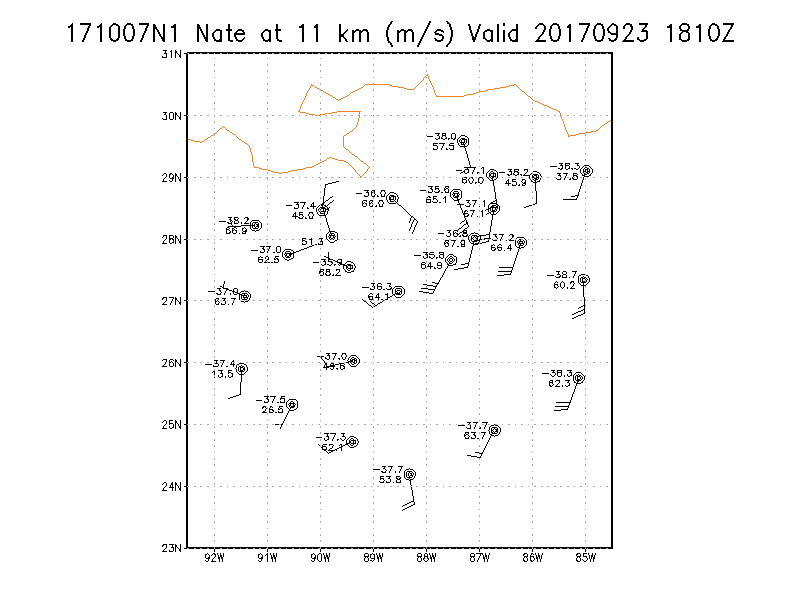
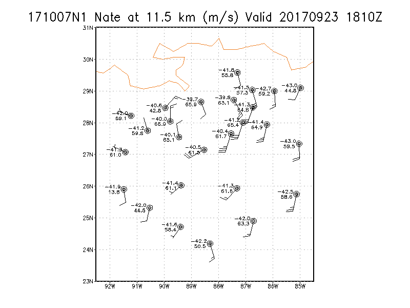
Winds at :
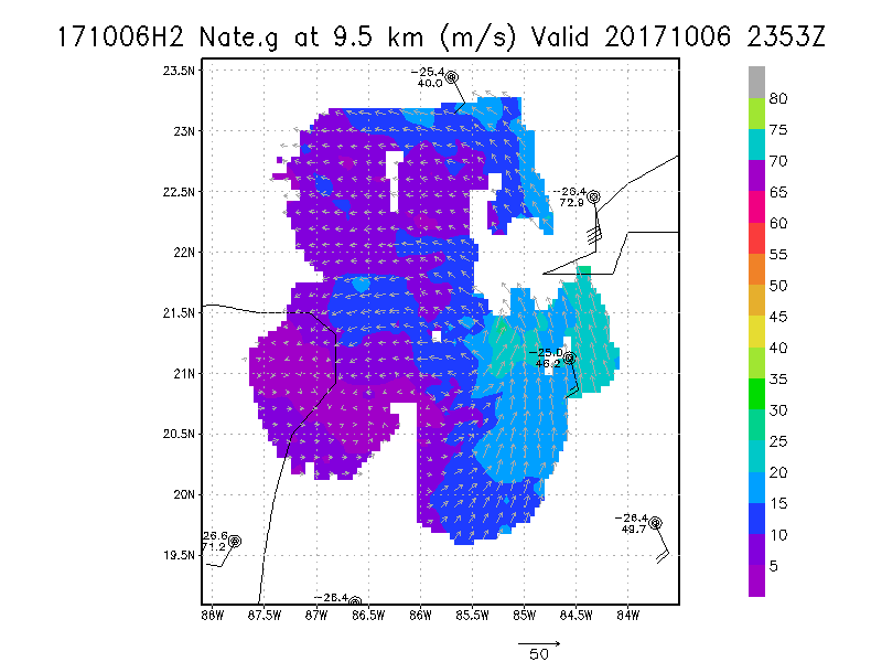
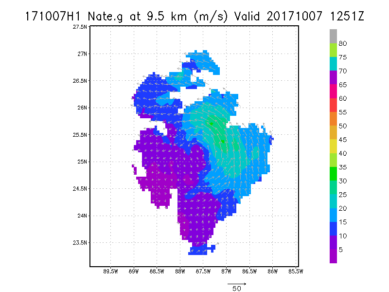
9.5 km
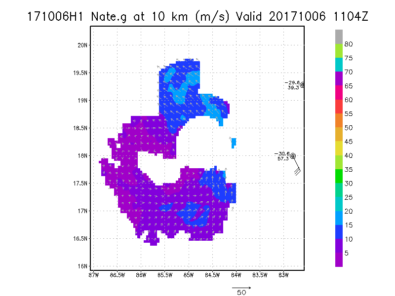
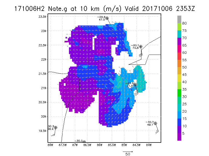
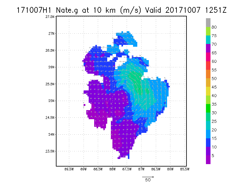
10.0 km
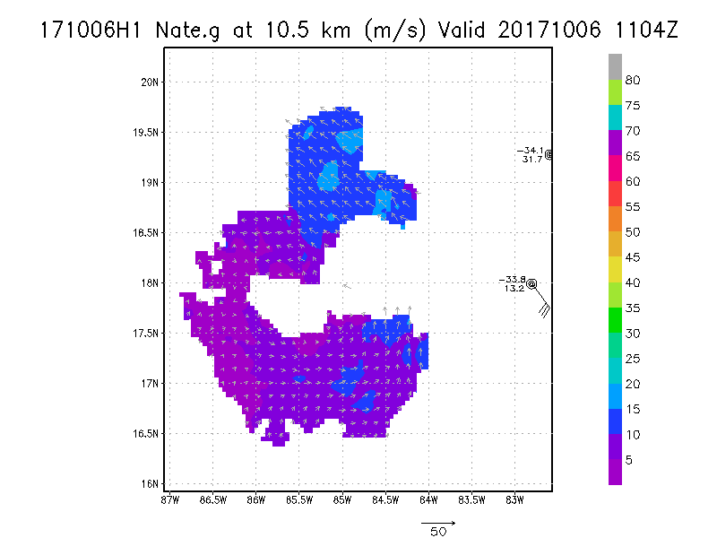
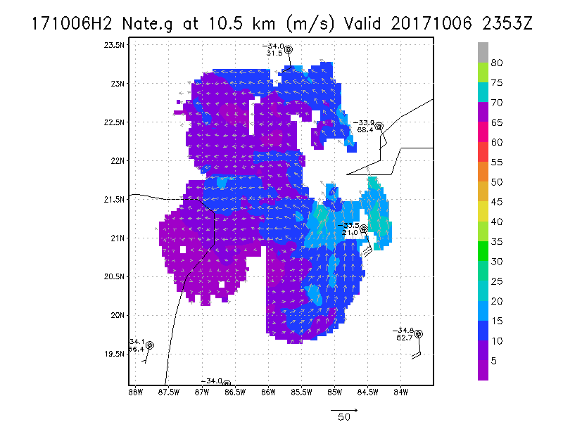
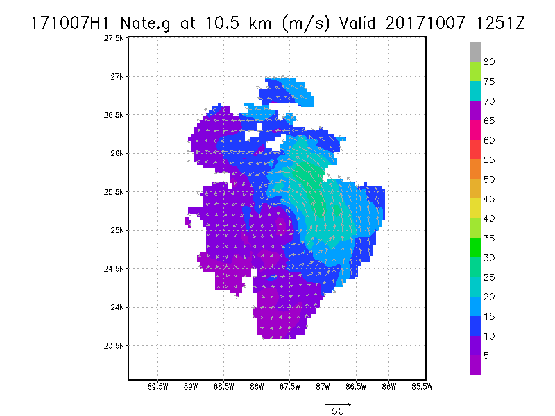
10.5 km
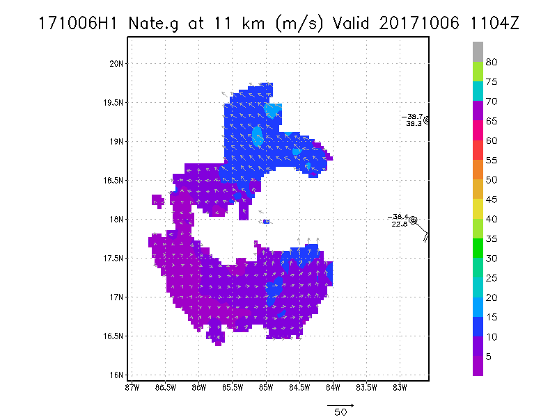
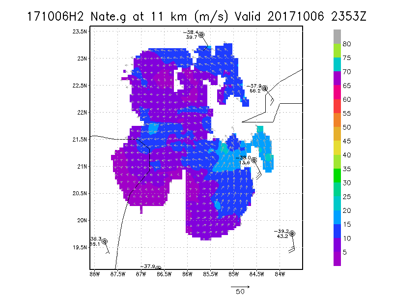
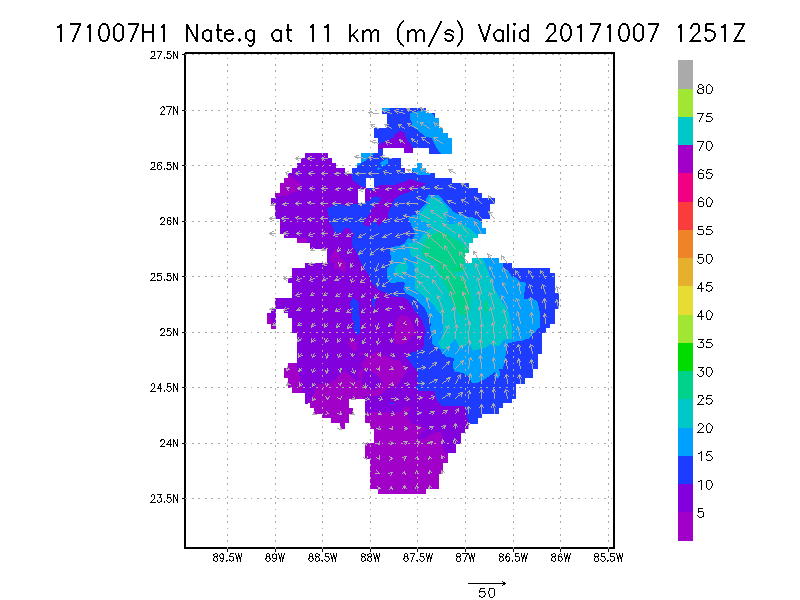
11.0 km
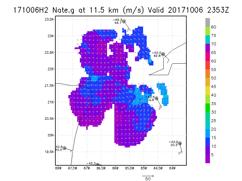
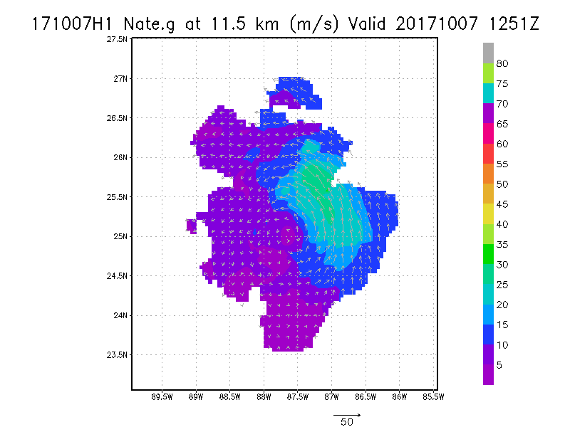
11.5 km
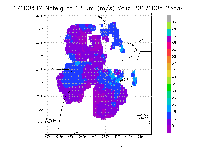
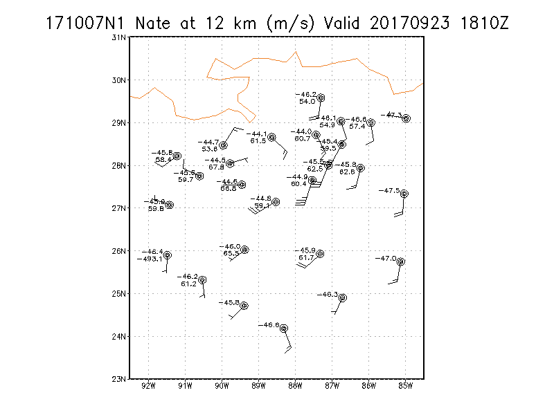
12.0 km
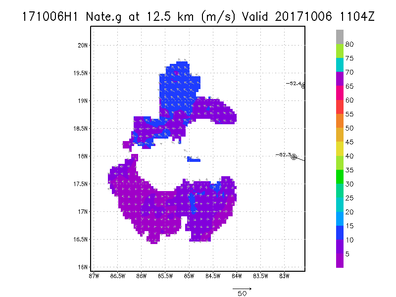
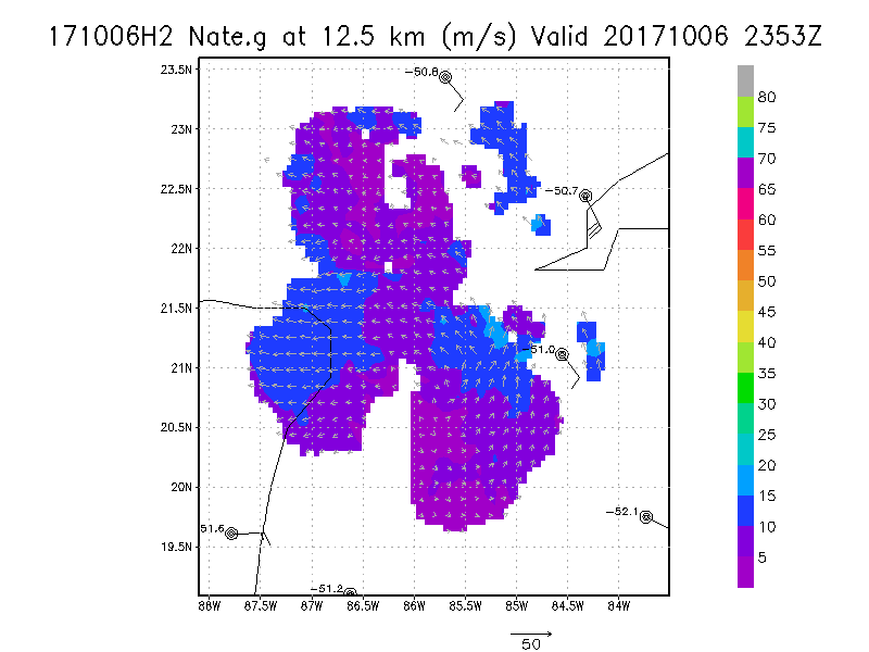
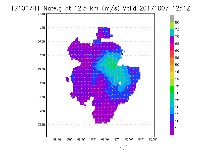
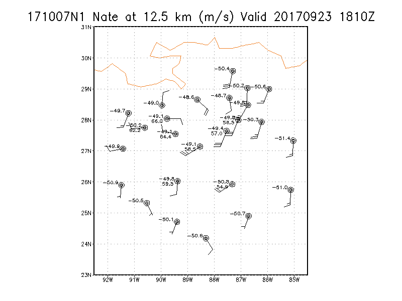
12.5 km
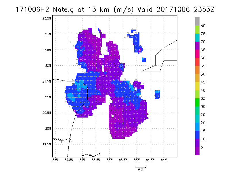
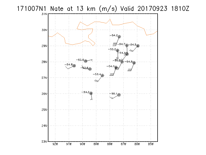
13.0 km
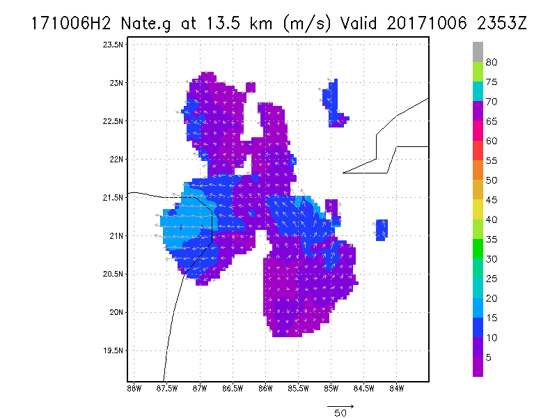
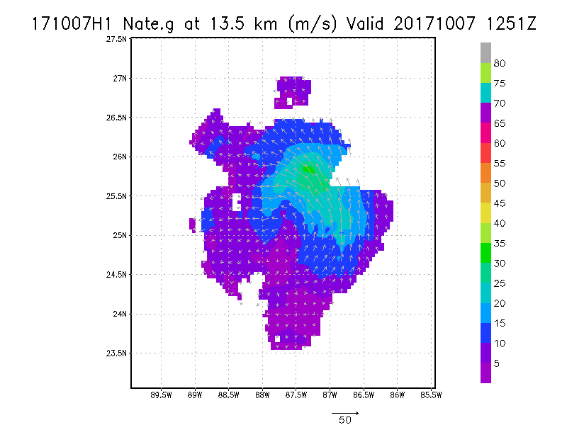
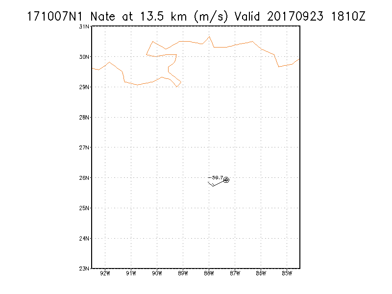
13.5 km
|
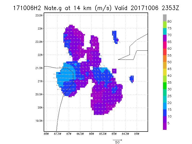
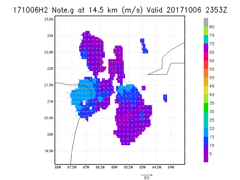
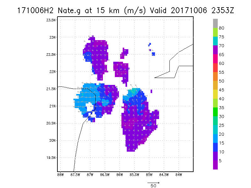
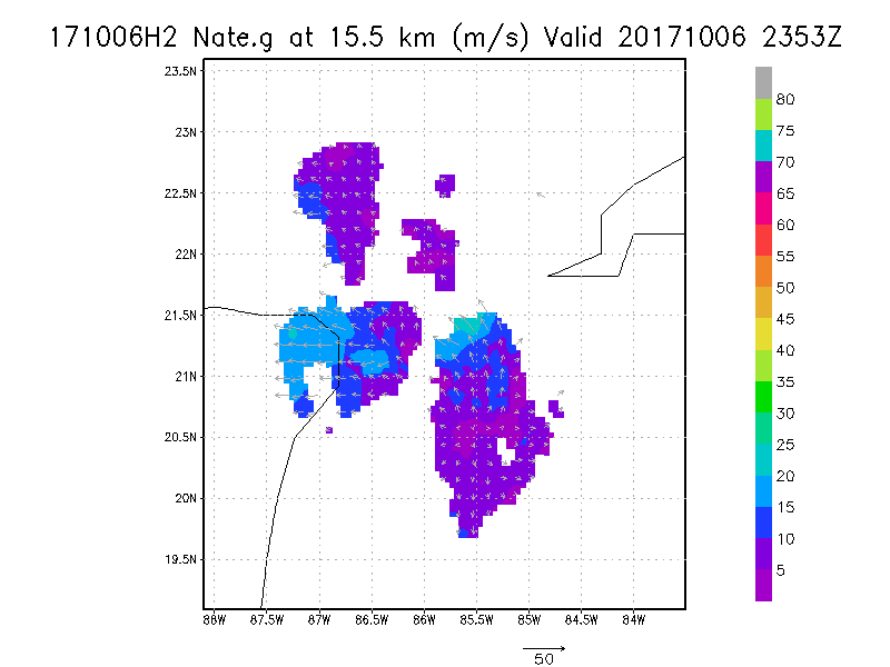
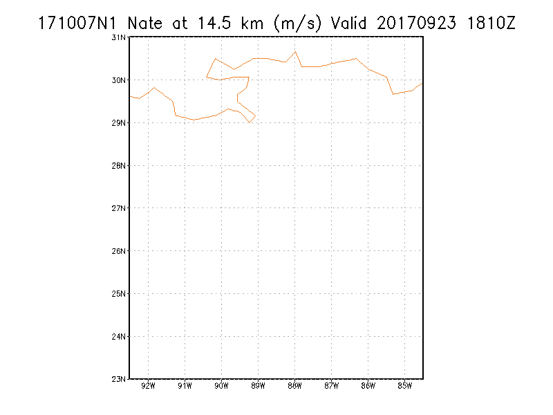
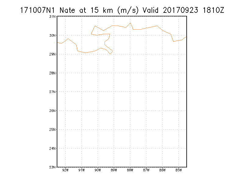
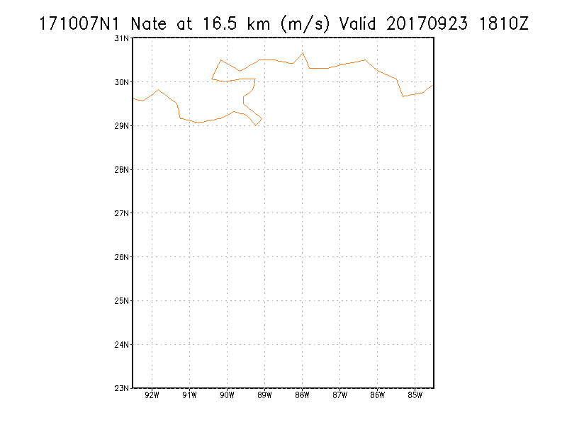
Winds at :
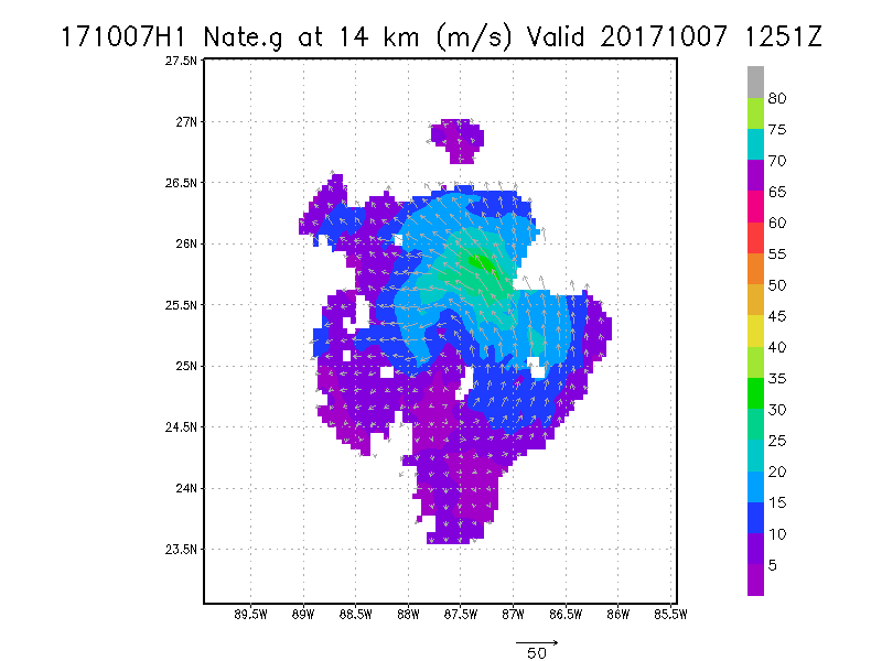
14.0 km
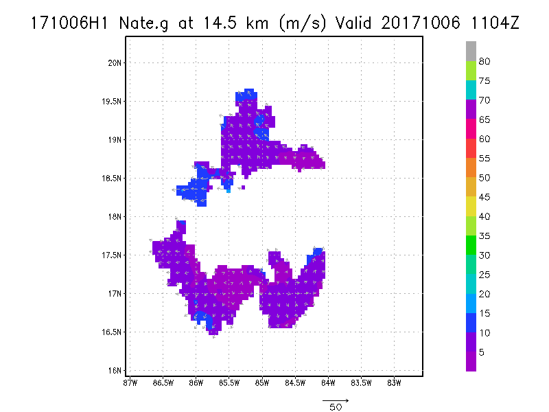
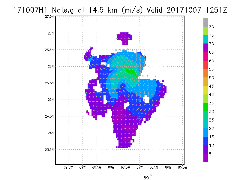
14.5 km
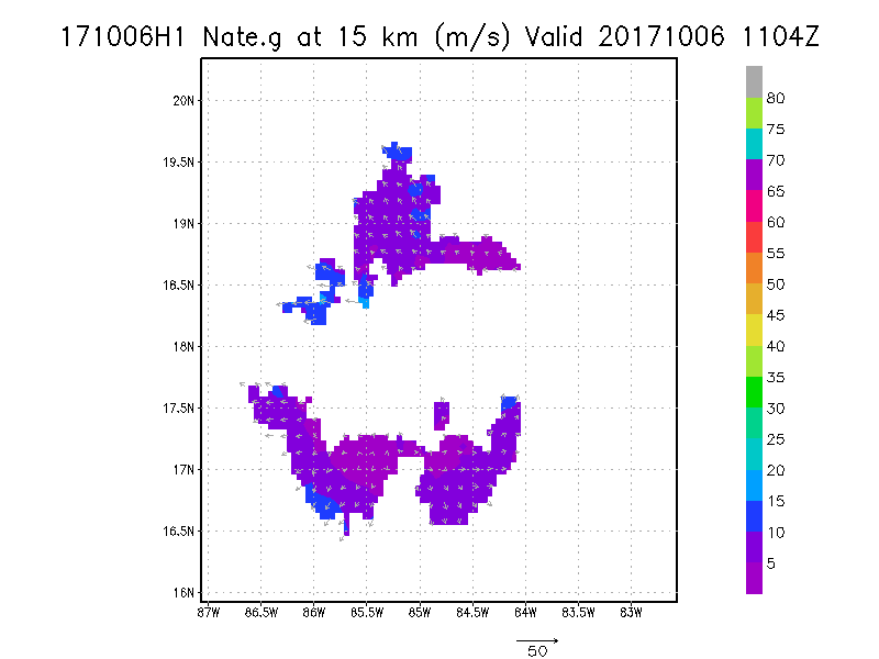
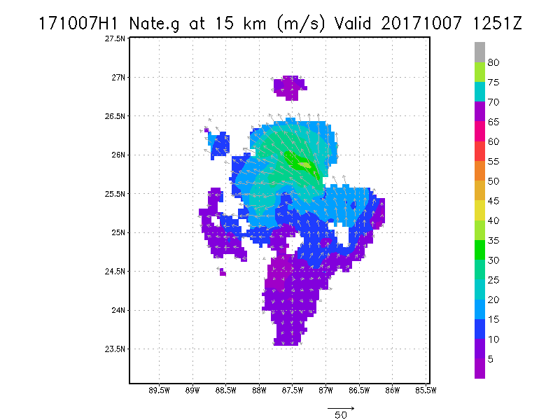
15.0 km
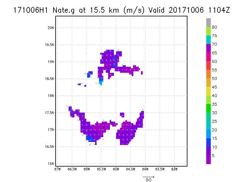
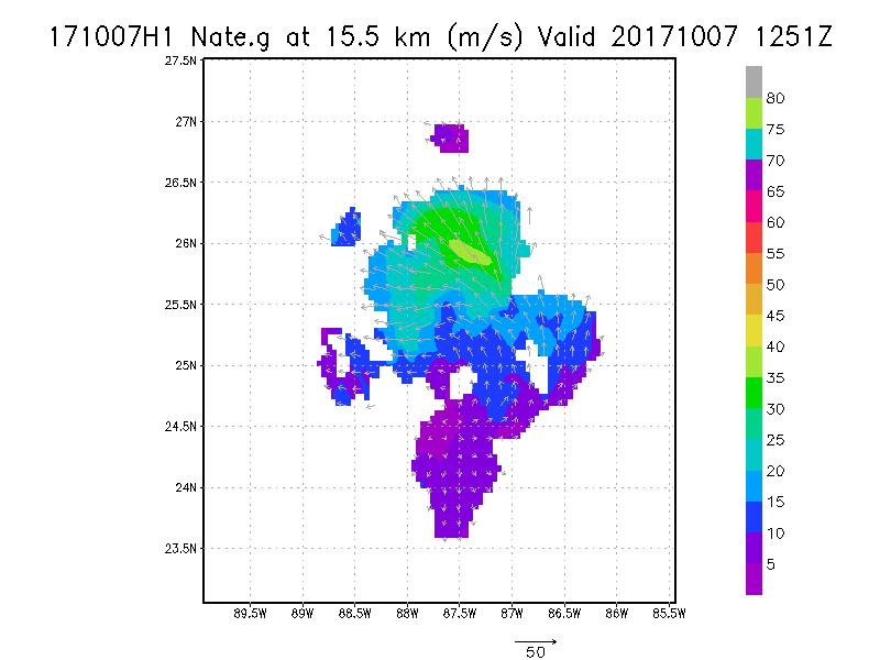
15.5 km
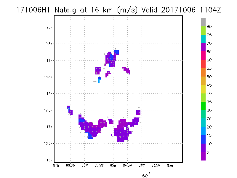
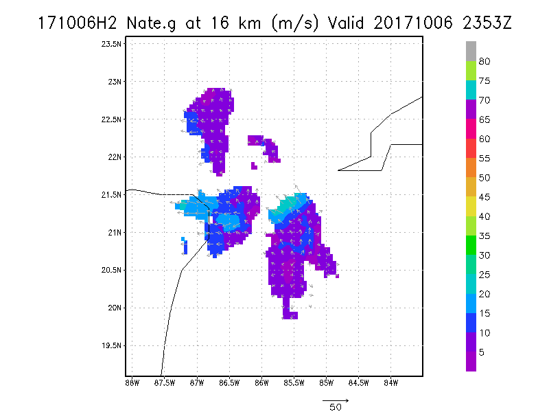
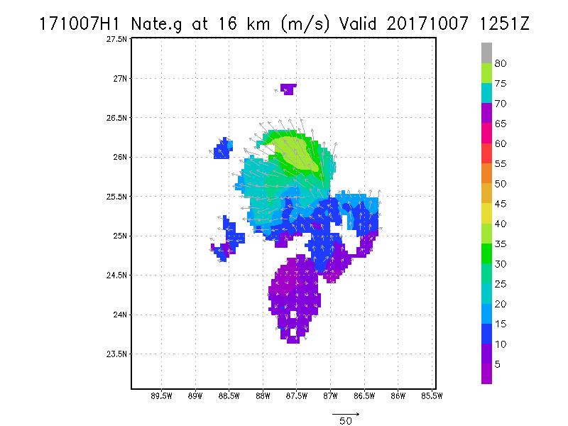
16.0 km
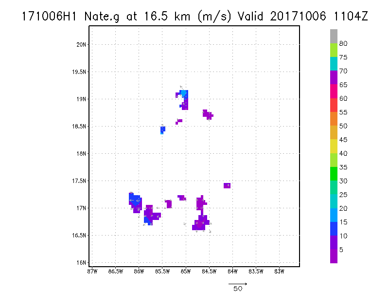
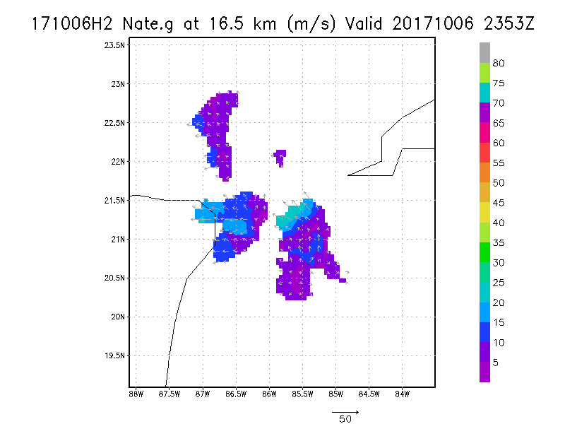
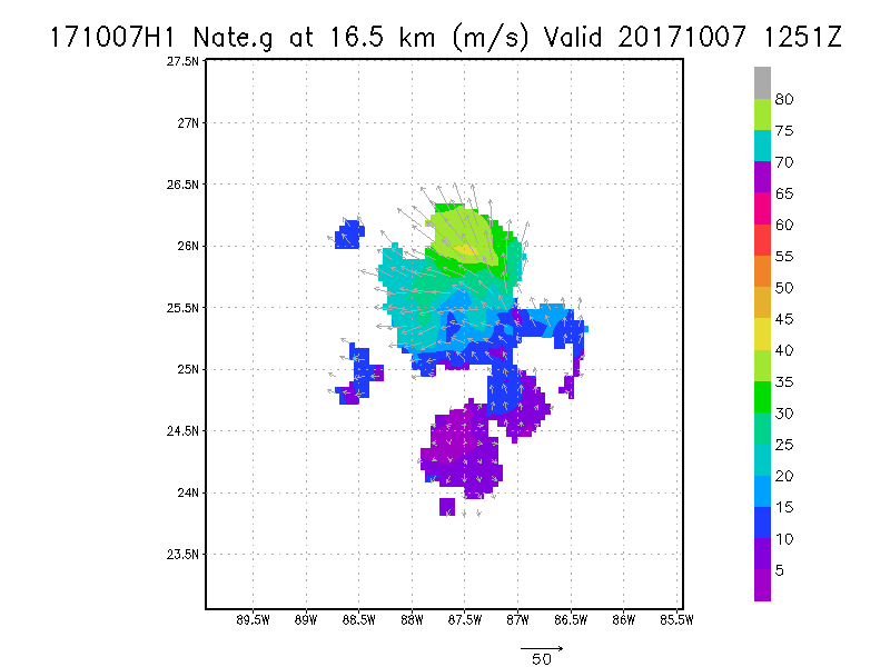
16.5 km
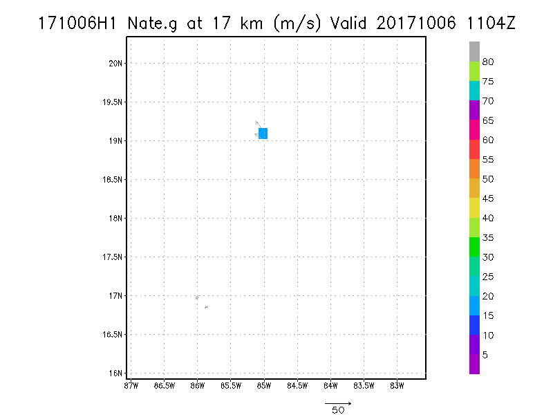
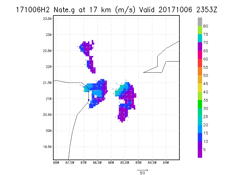
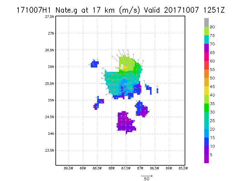
17.0 km
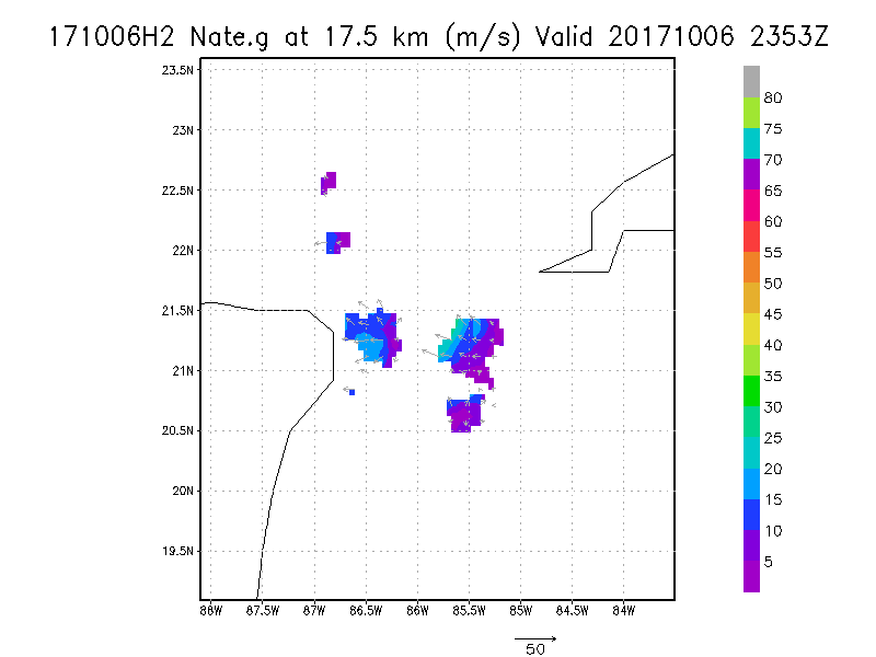
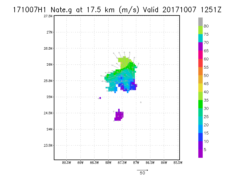
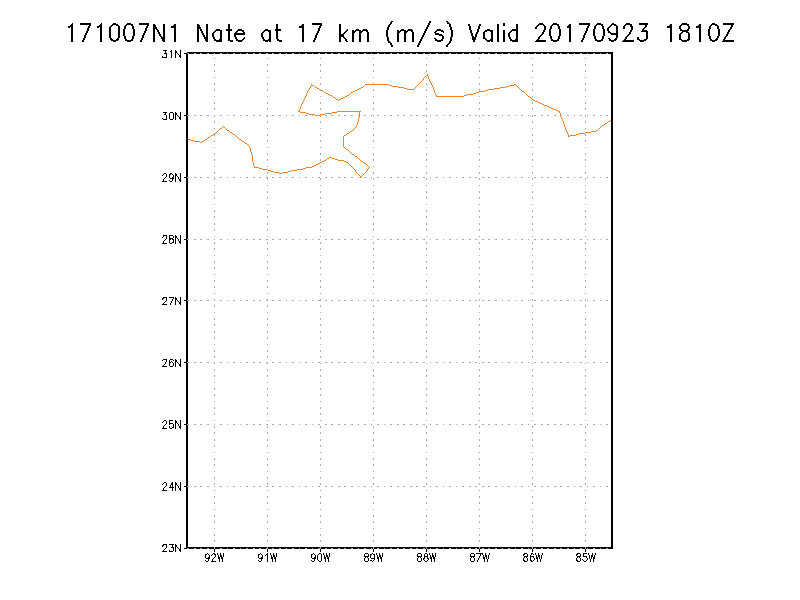
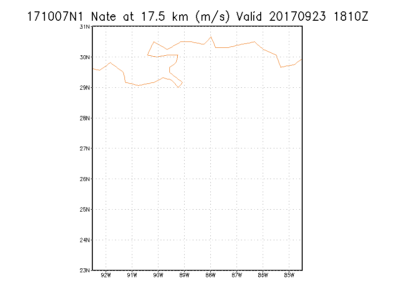
17.5 km
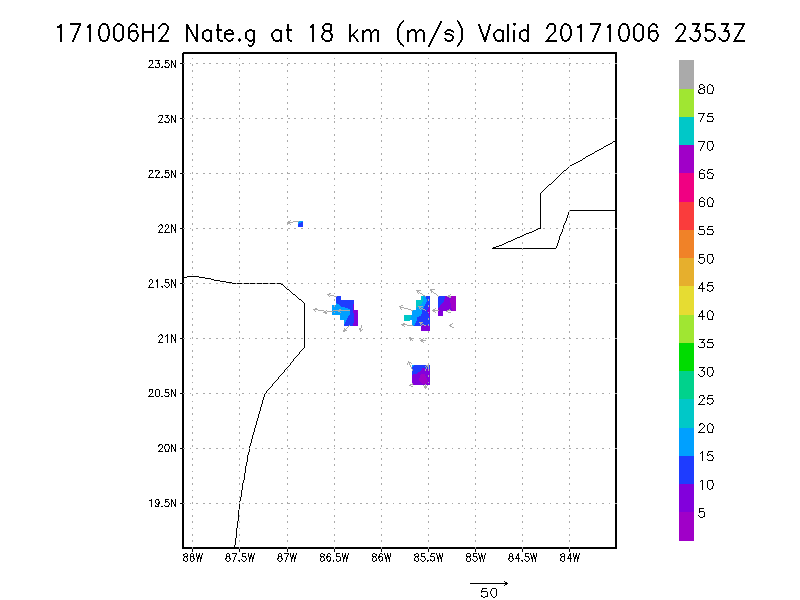
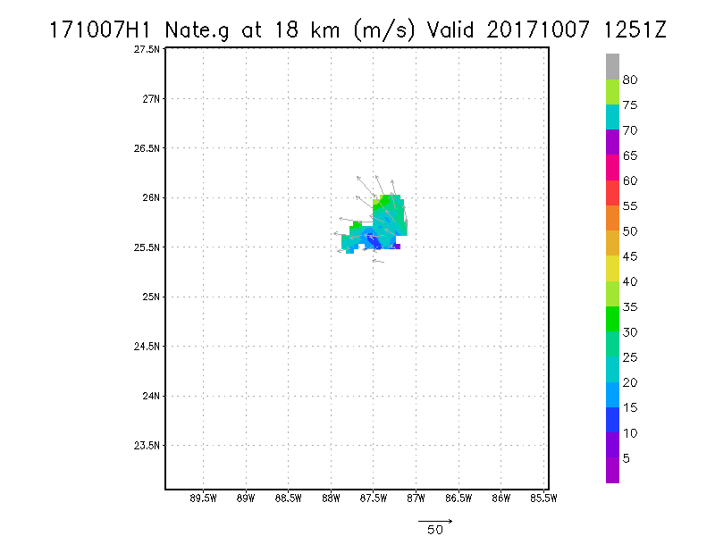
18.0 km
|


