October 09, 2018
N42RF #2
|
|
Individual legs
|
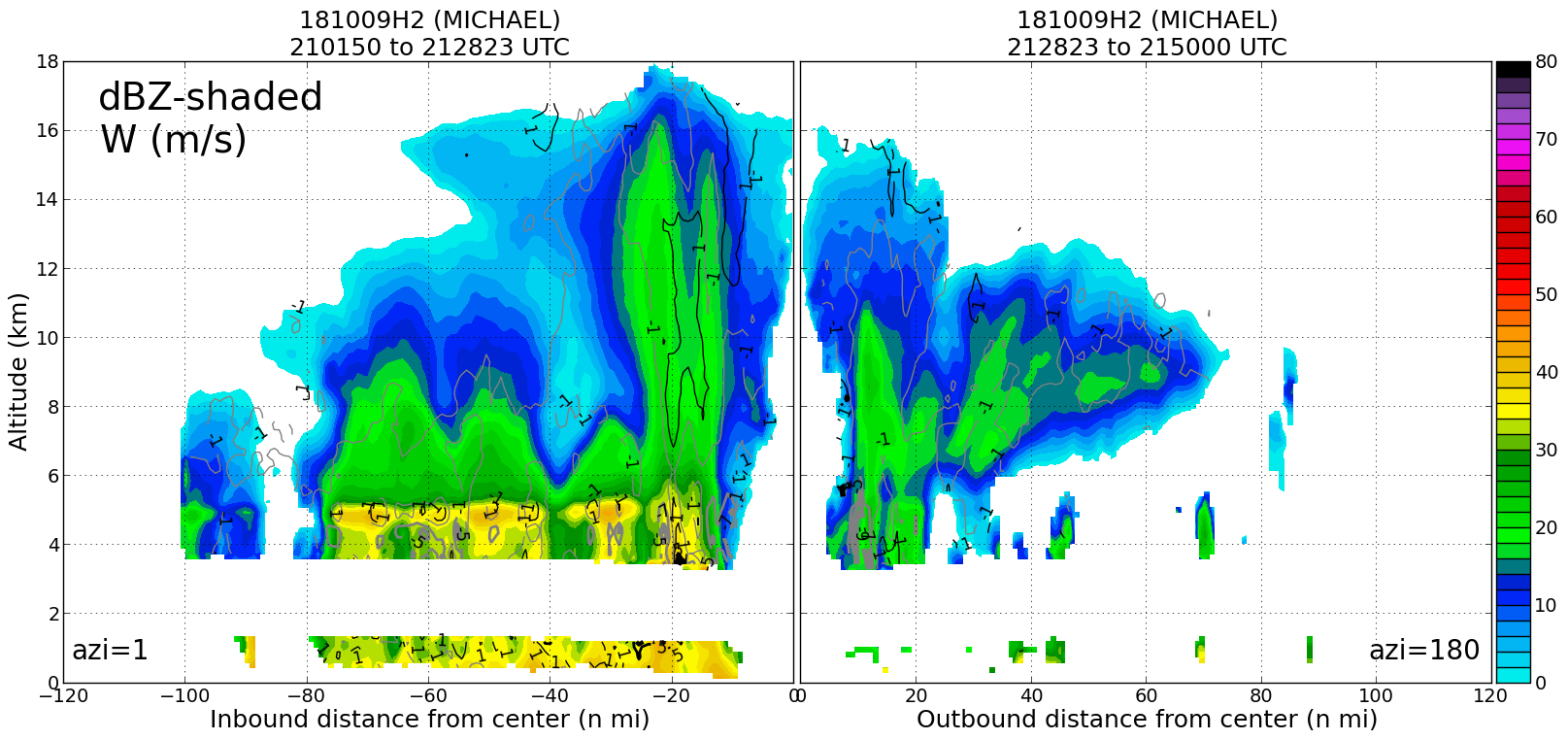
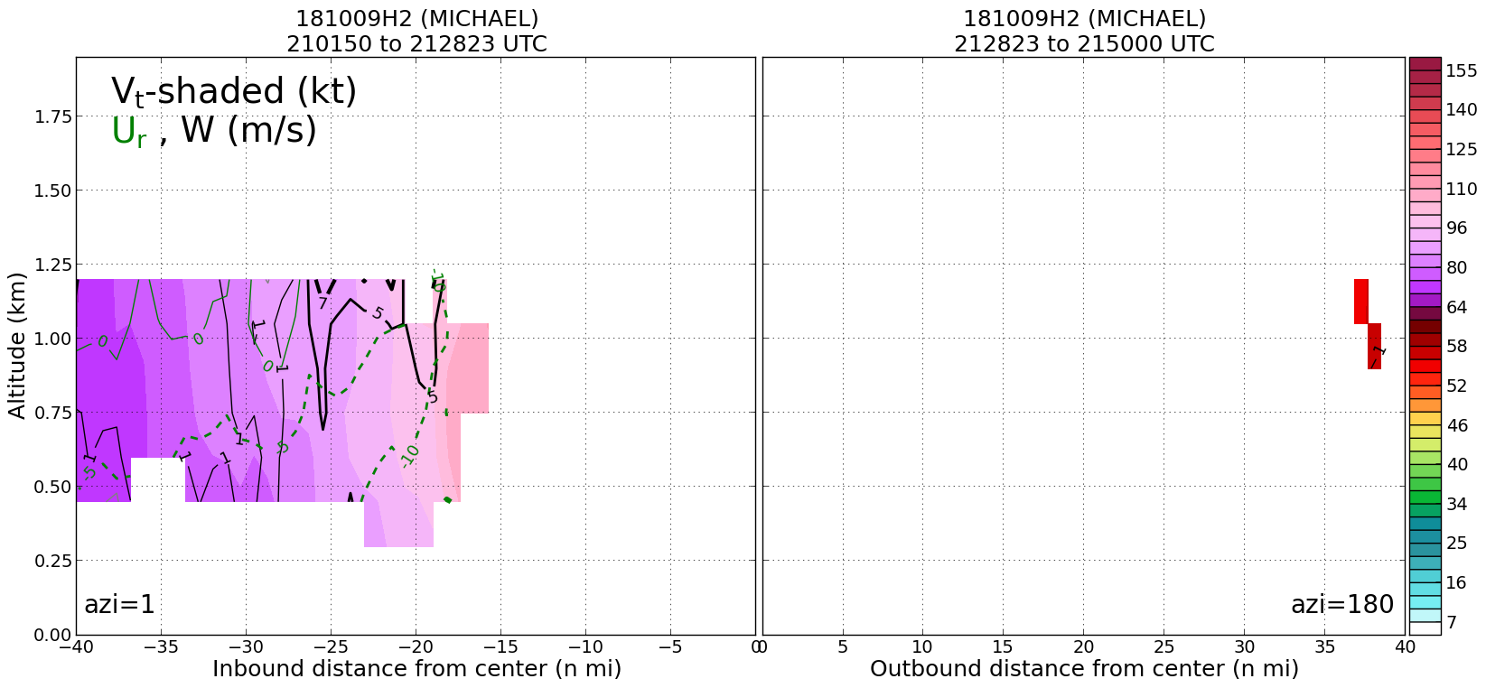
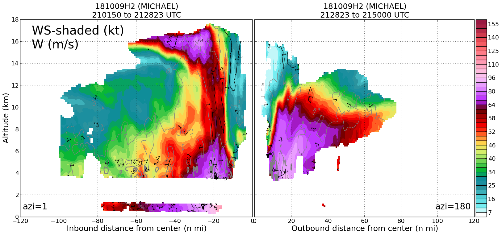
Leg #1
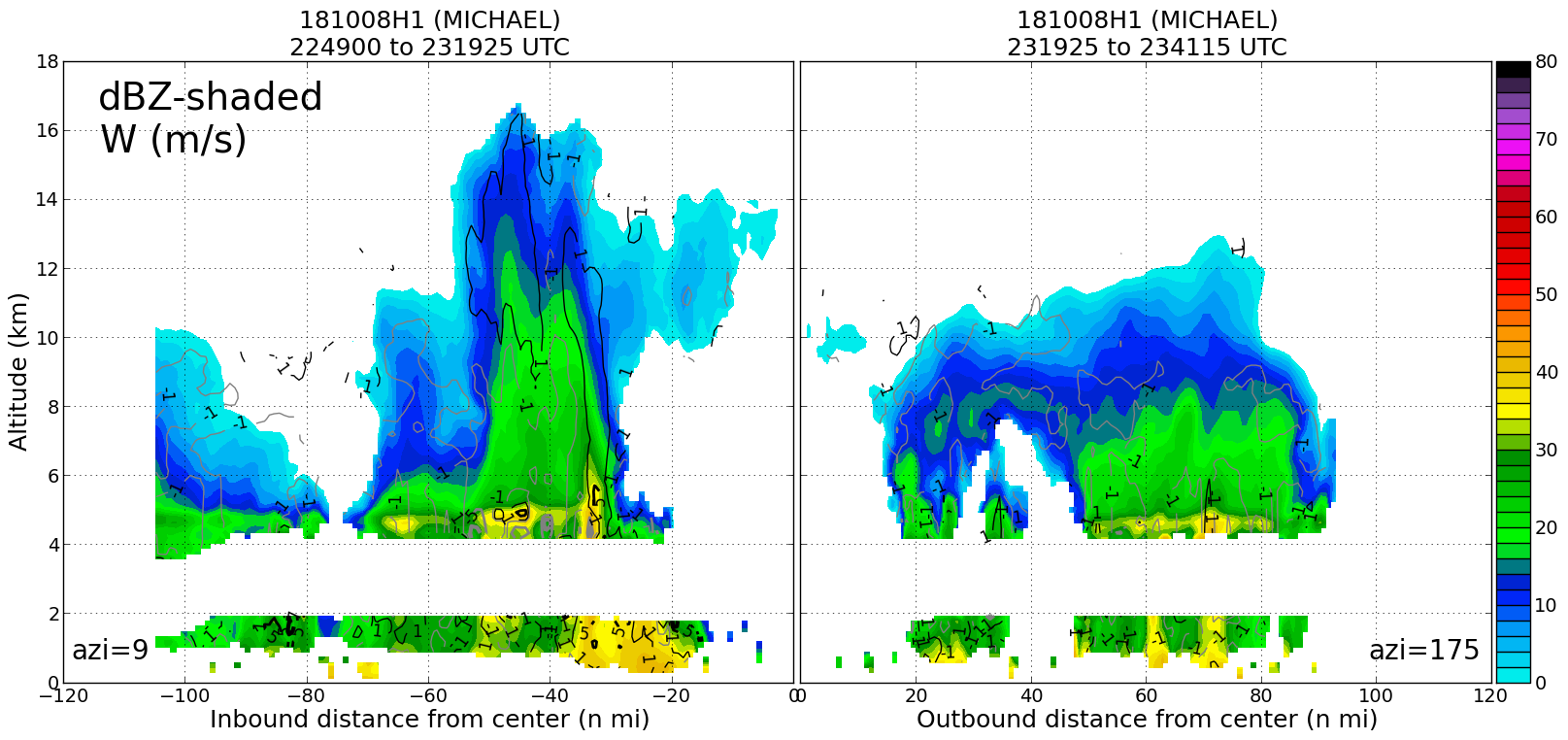
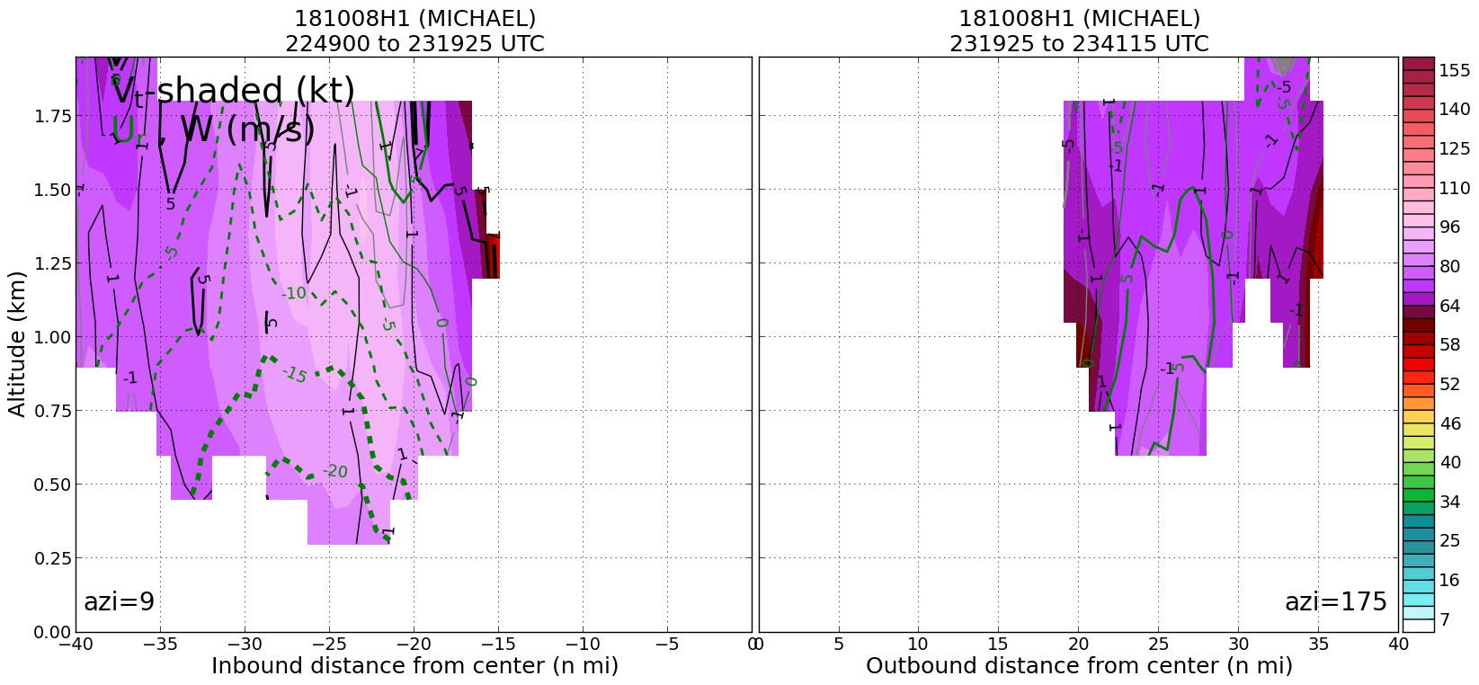
21:28Z
|
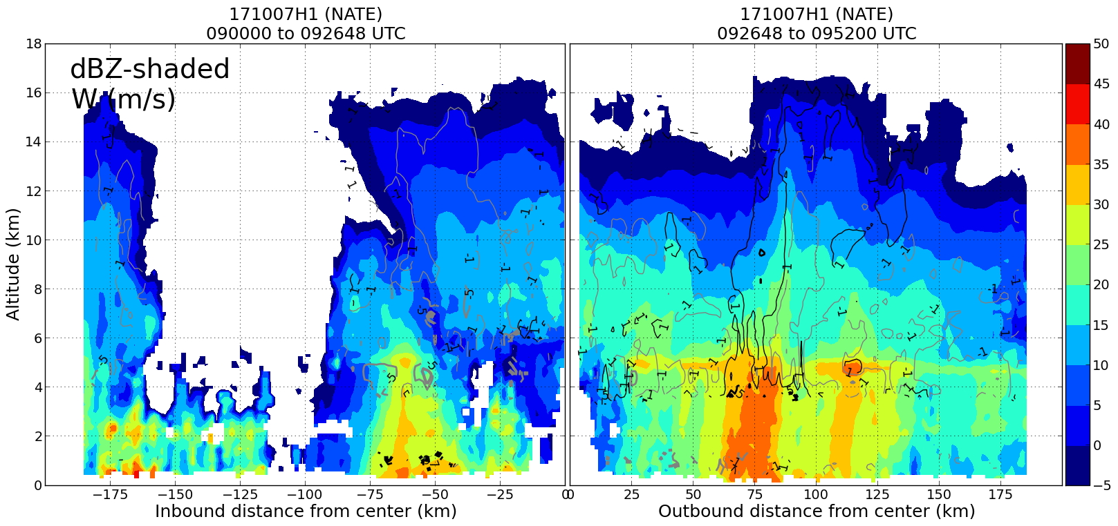
20181009H2 2128Z dbz profile
|
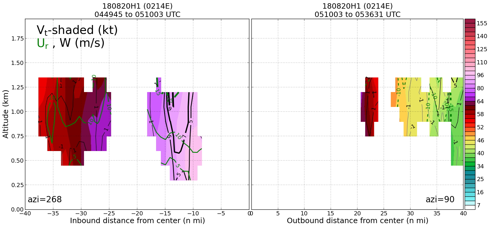
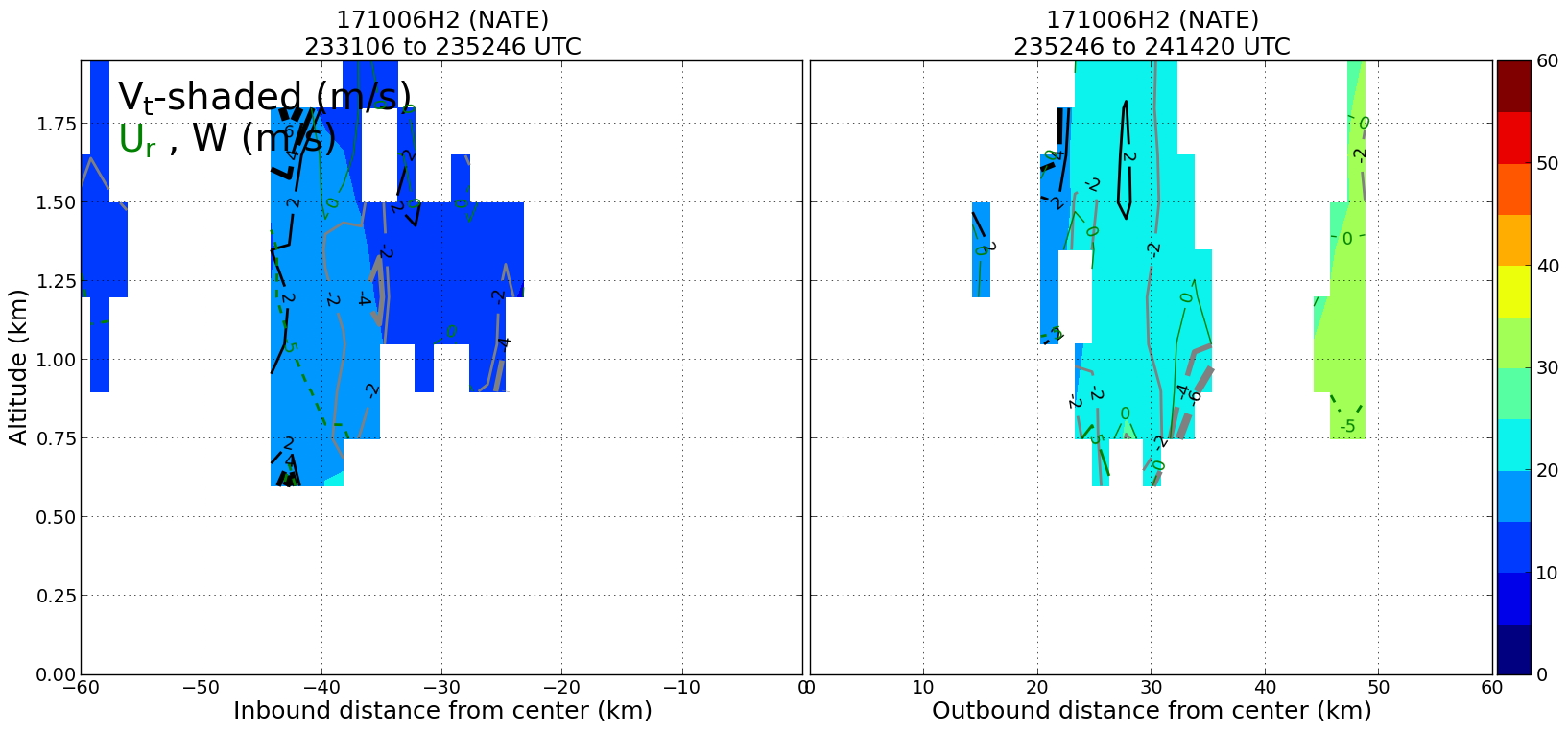
20181009H2 2128Z vt BL profile
|
20181009H2 2128Z ws profile
|
|
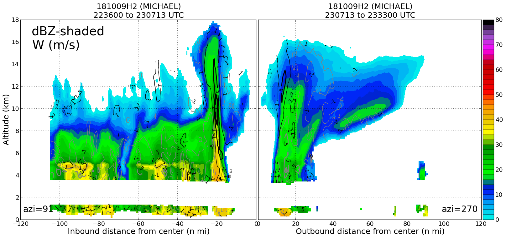
Leg #2
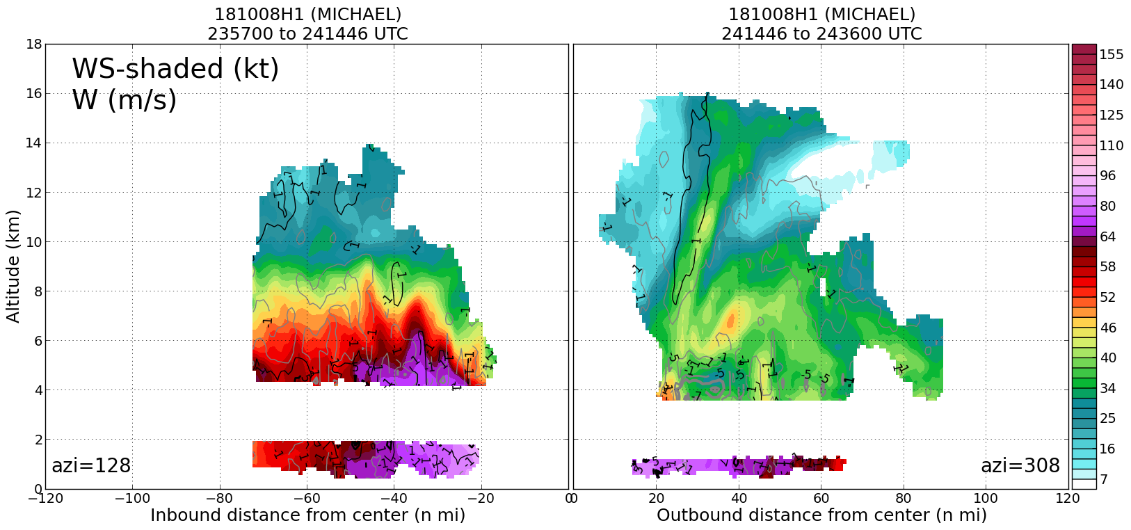
23:07Z
|
20181009H2 2307Z dbz profile
|
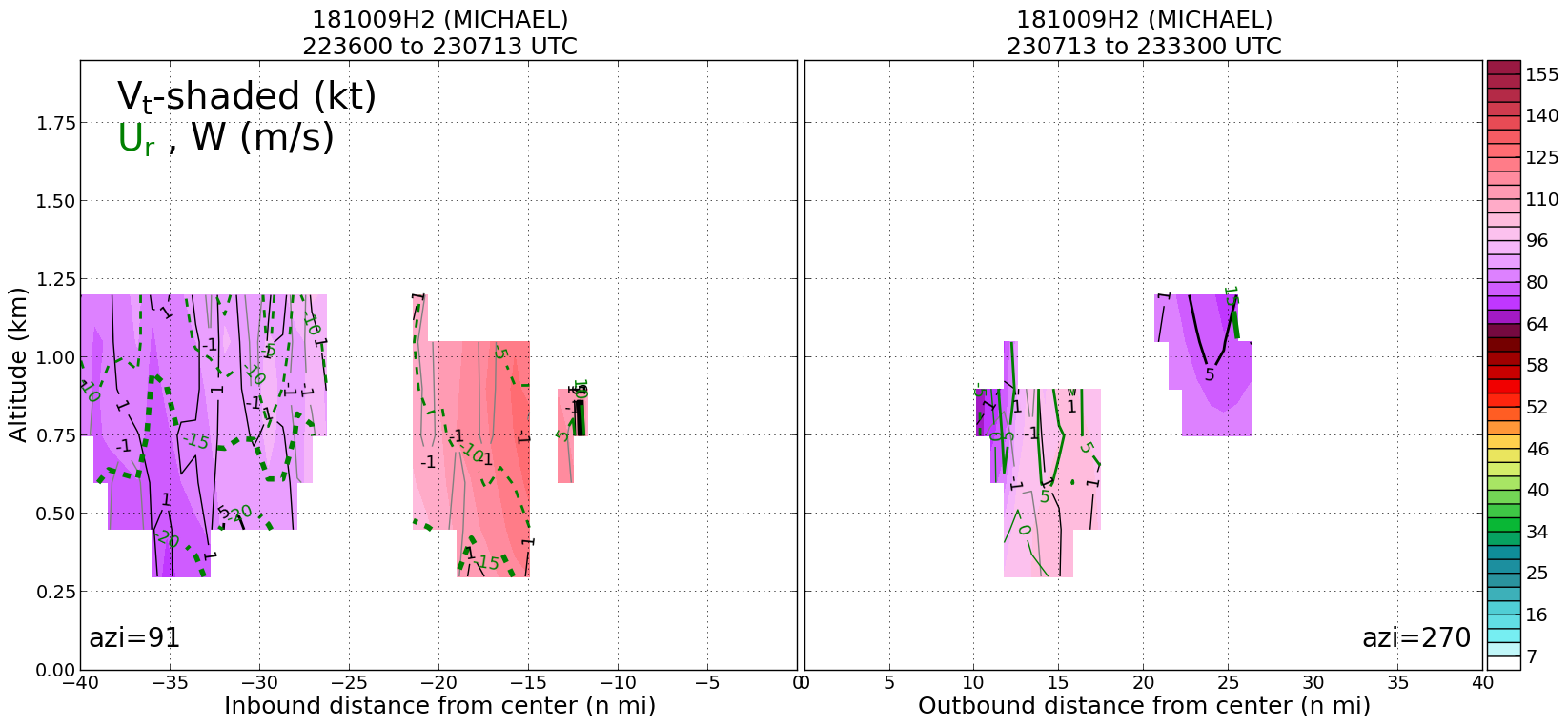
20181009H2 2307Z vt BL profile
|
20181009H2 2307Z ws profile
|
|
Leg #3
24:15Z
|
20181009H2 2415Z dbz profile
|
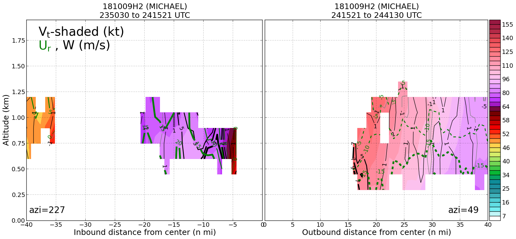
20181009H2 2415Z vt BL profile
|
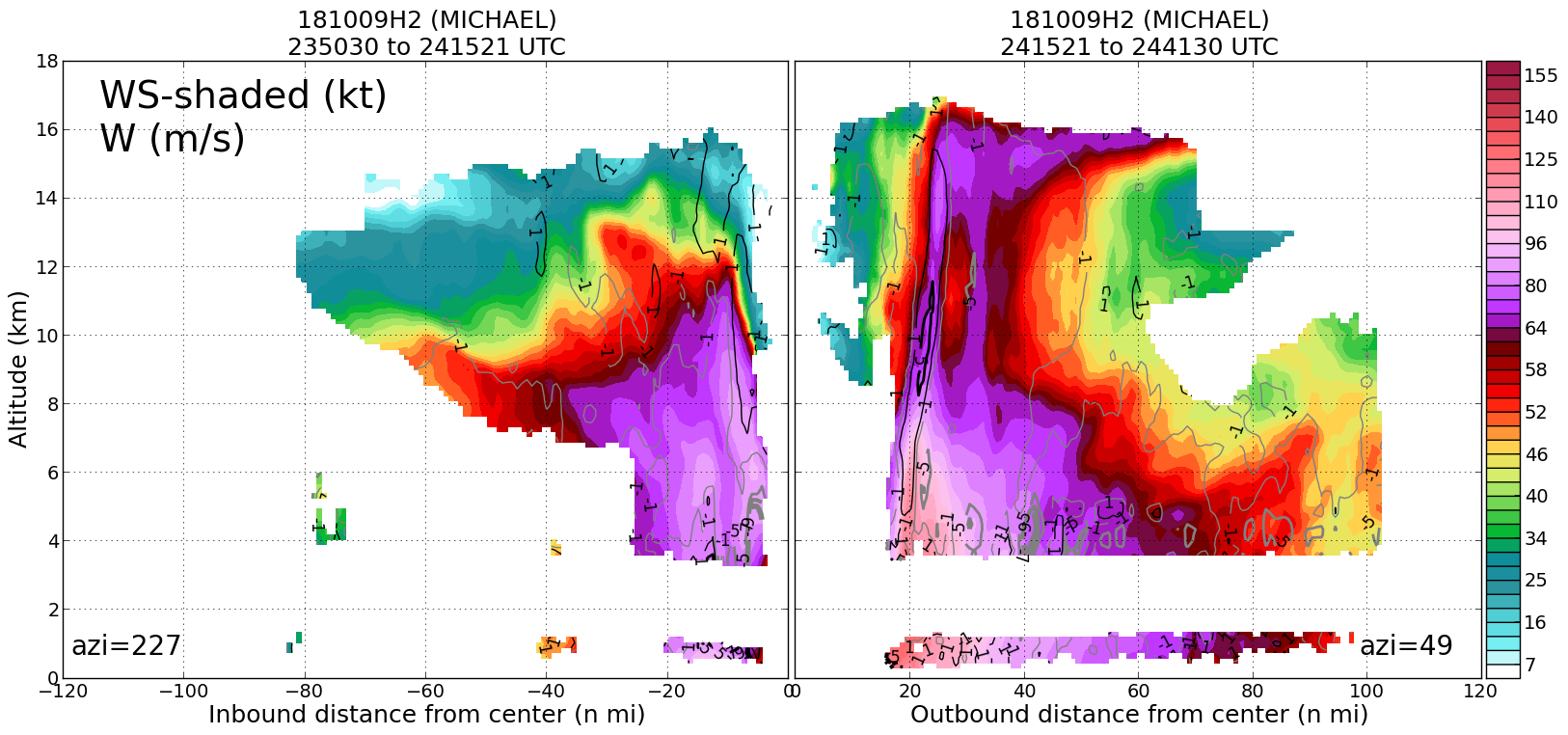
20181009H2 2415Z ws profile
|
|
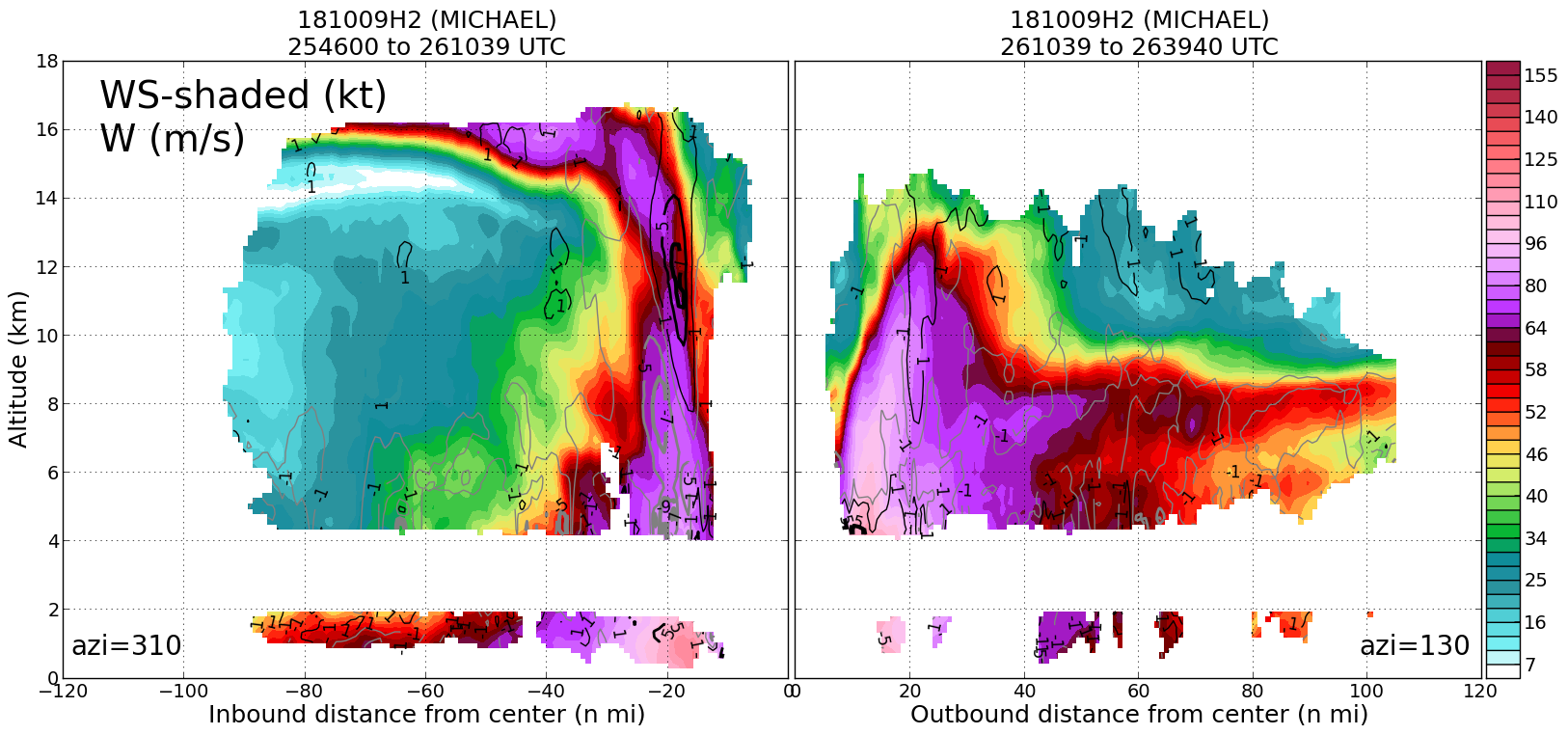
Leg #4
26:10Z
|
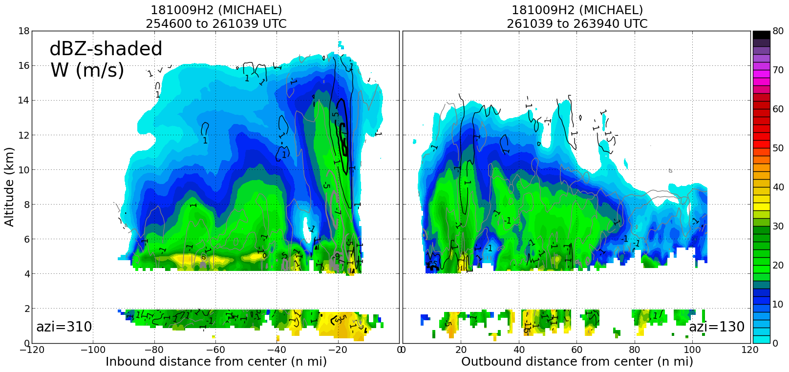
20181009H2 2610Z dbz profile
|
20181009H2 2610Z vt BL profile
|
20181009H2 2610Z ws profile
|
|
|
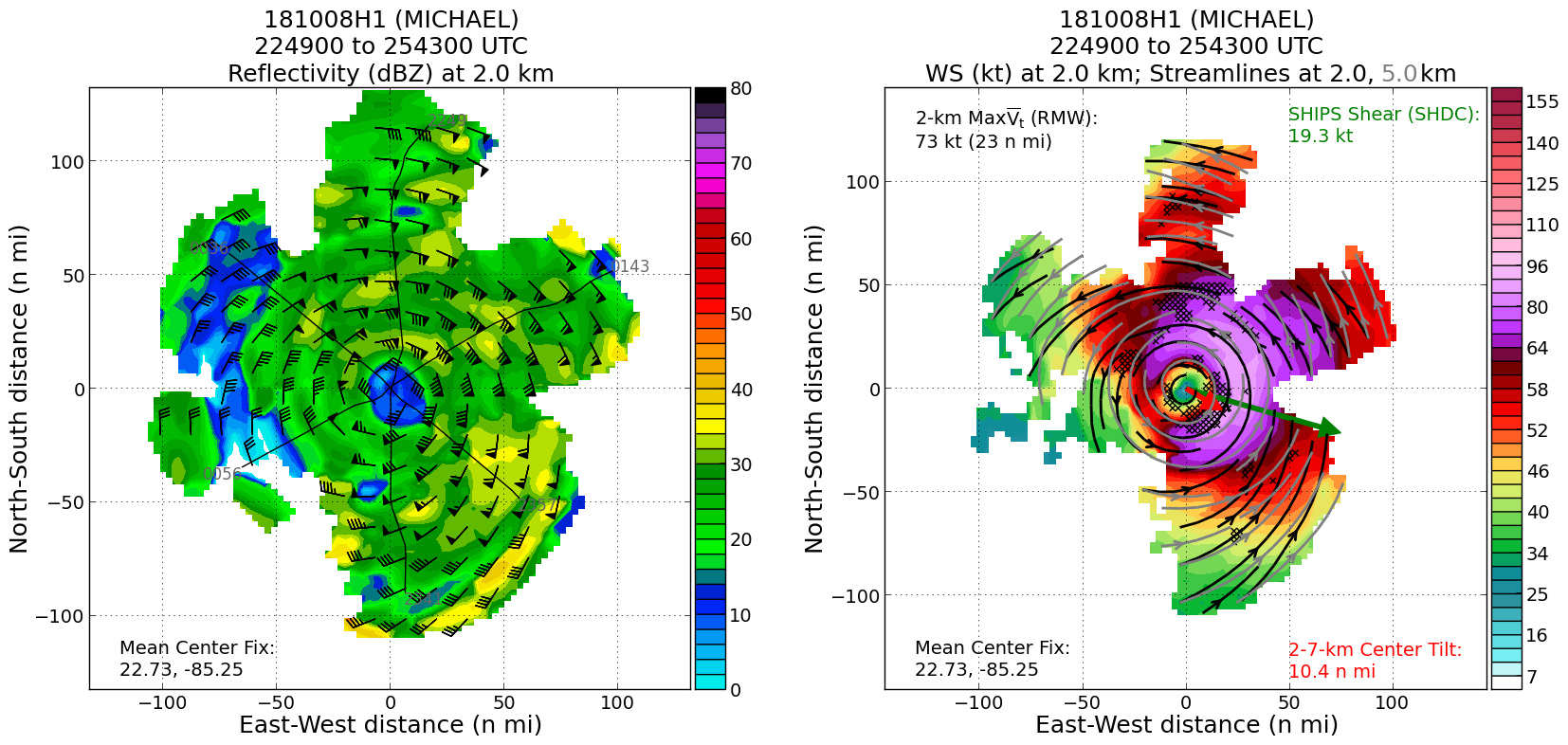
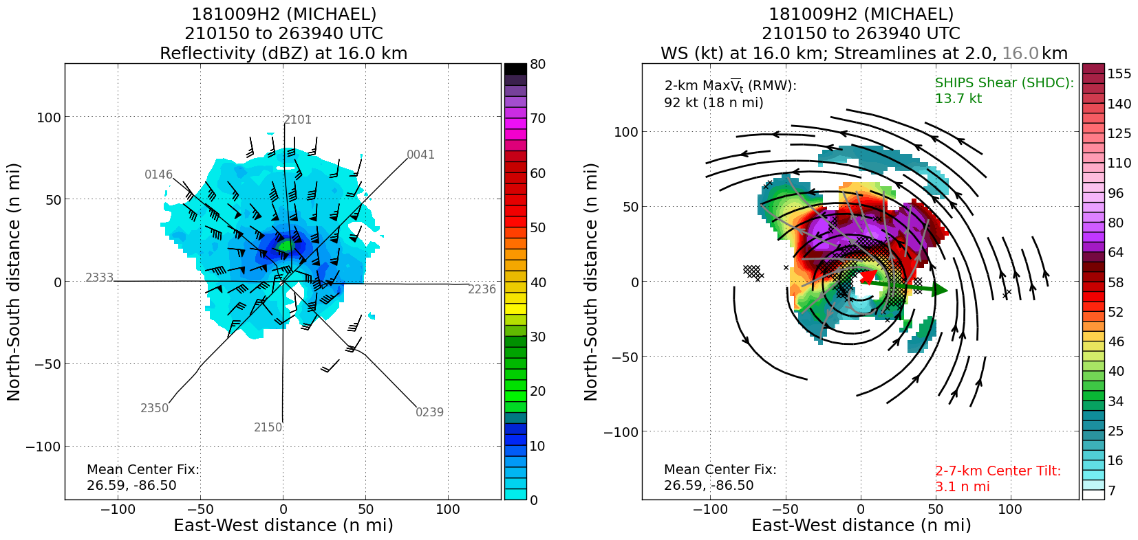
Plan views
|
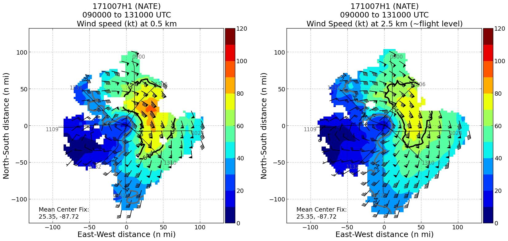
20181009H2 ws dbz planview
|
20181009H2 ws dbz upper planview
|
20181009H2 ws nhc planview
|
|
Gridded radar data
GrADS control file radar data
|
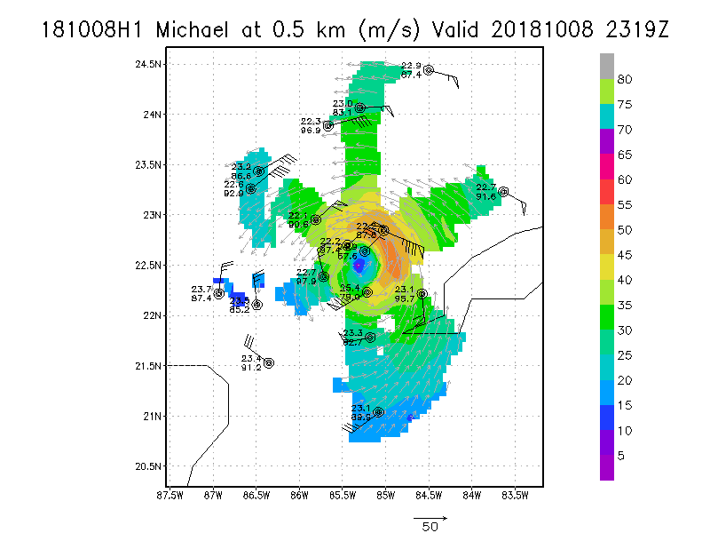
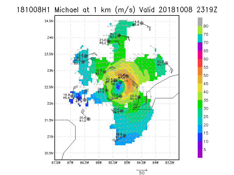
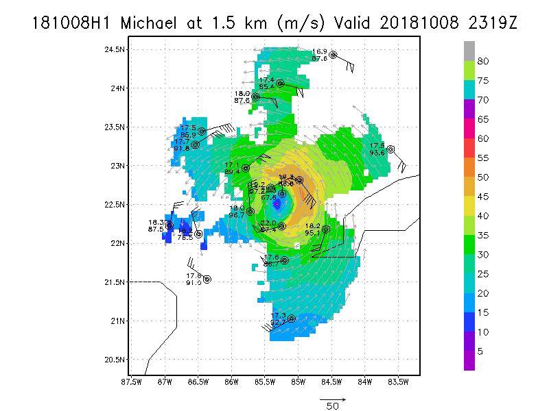
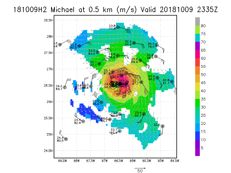
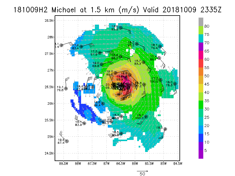
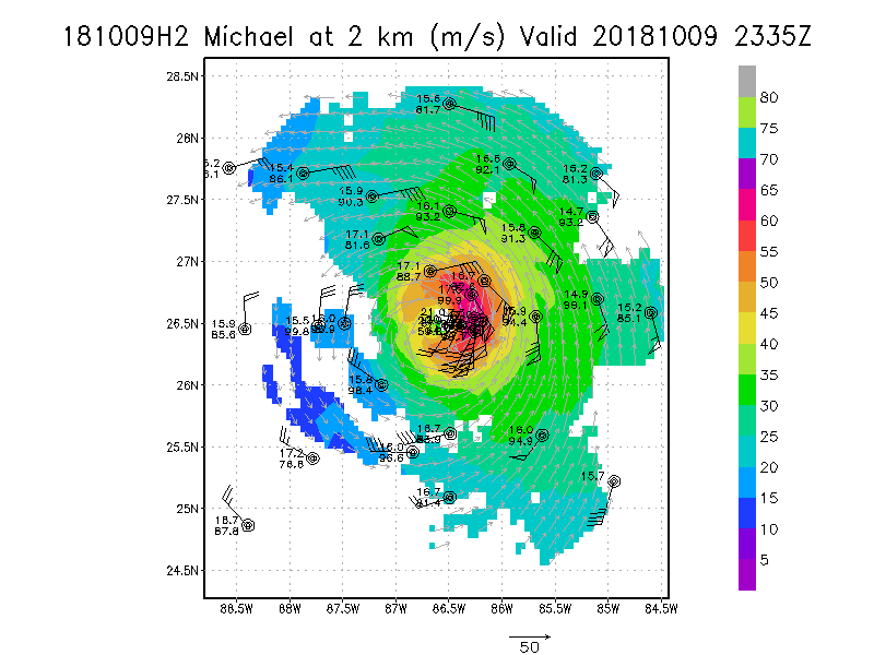
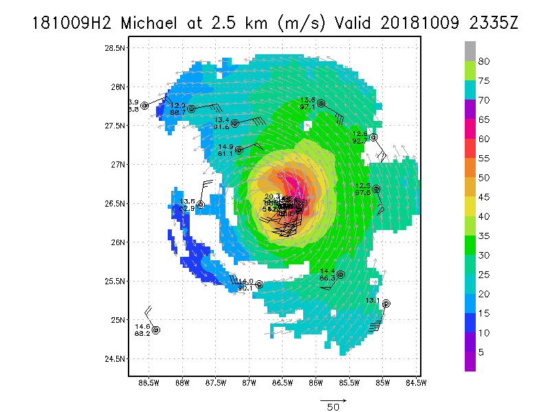
Winds at :
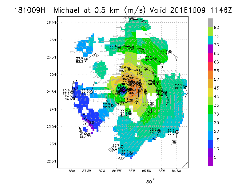
.5 km
1.0 km
1.5 km
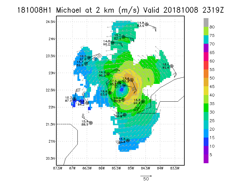
2.0 km
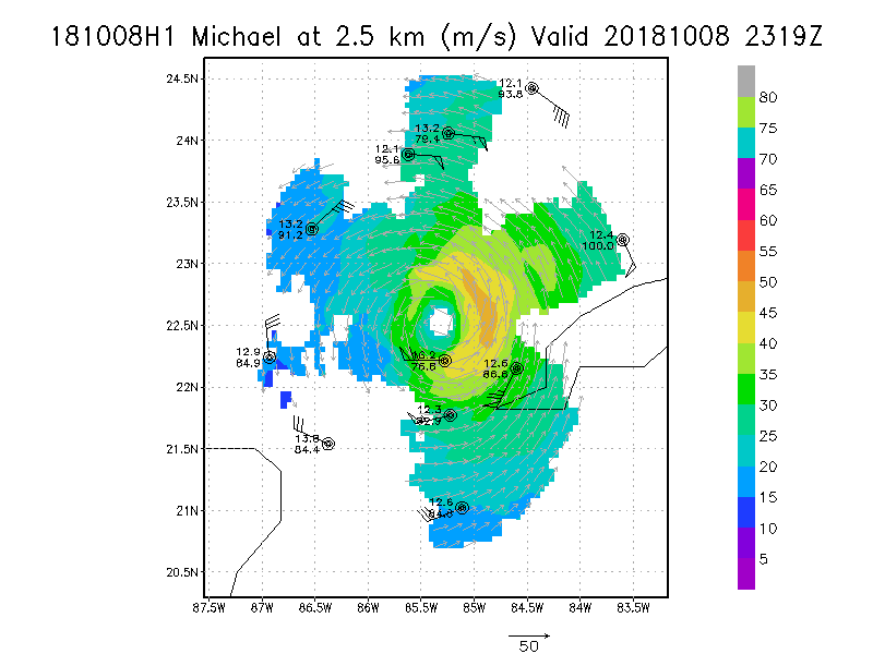
2.5 km
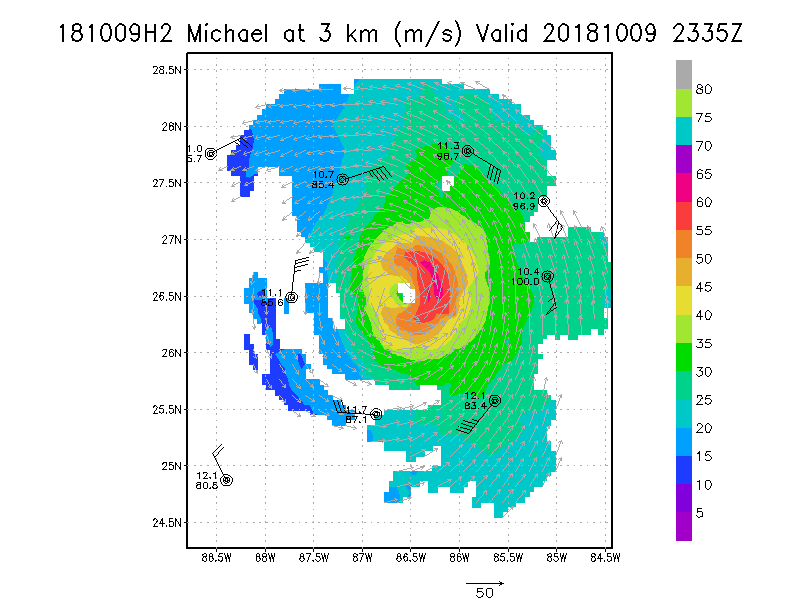
3.0 km
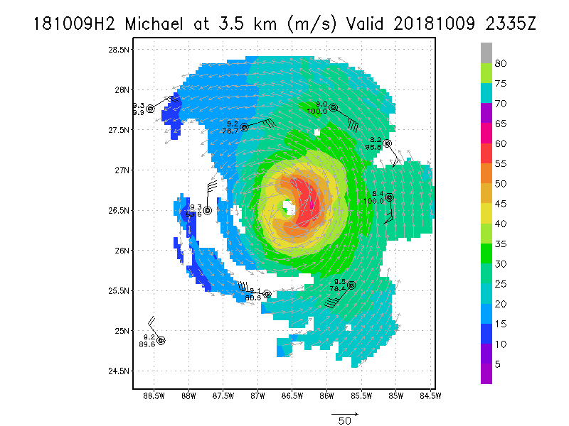
3.5 km
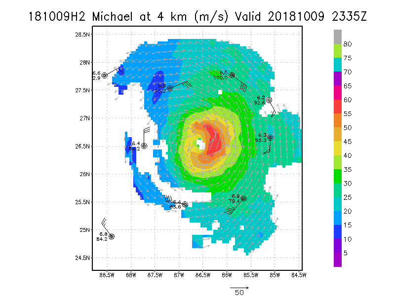
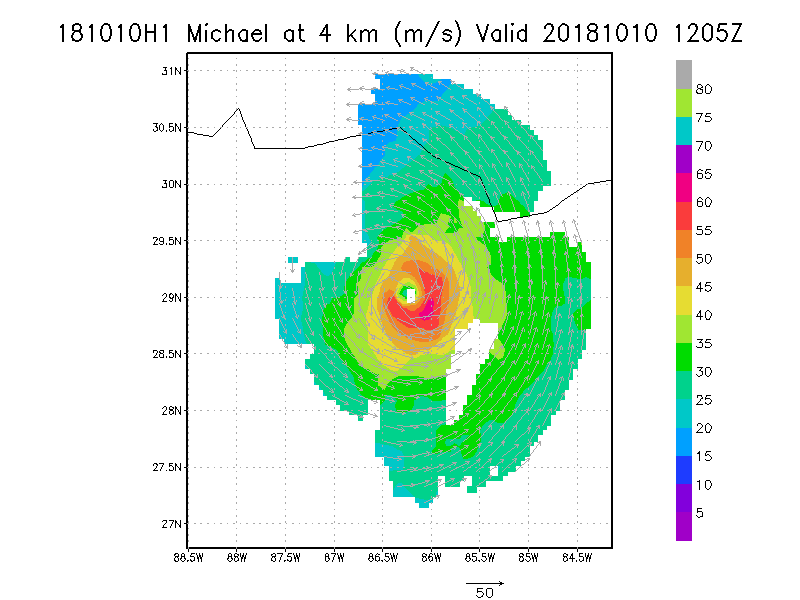
4.0 km
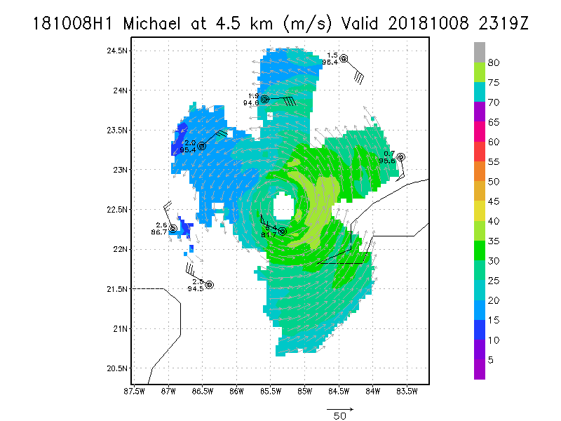
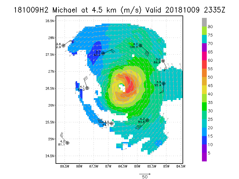
4.5 km
|
Winds at :
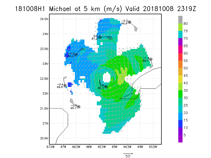
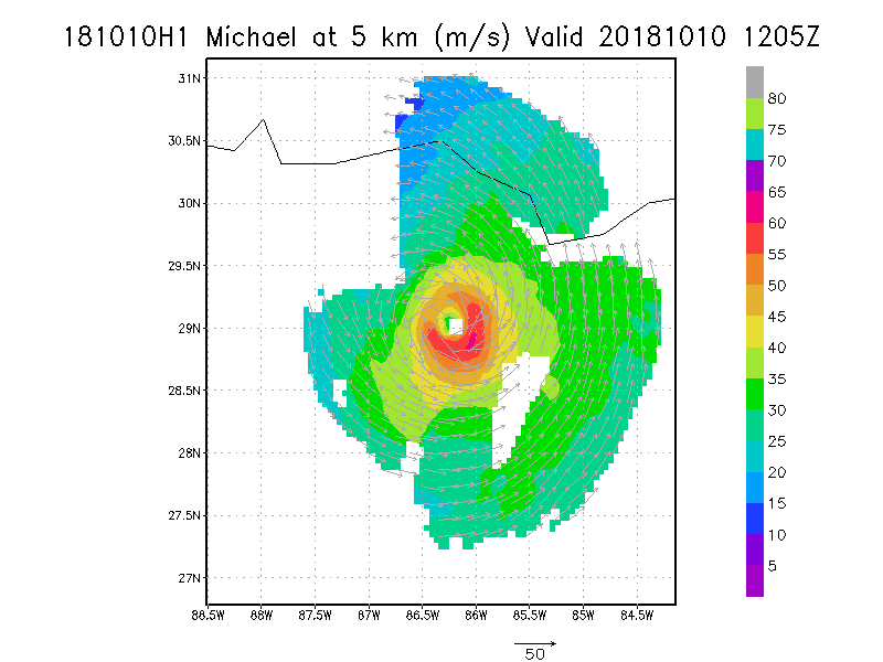
5.0 km
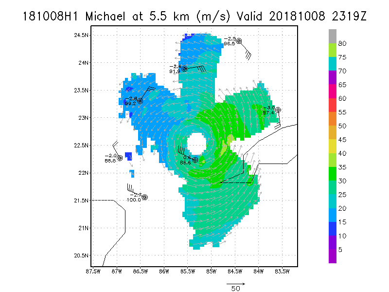
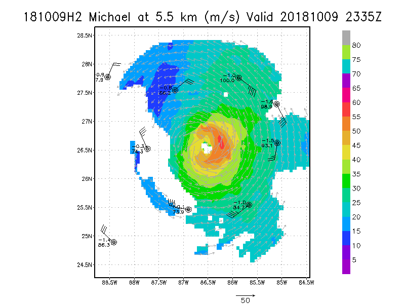
5.5 km
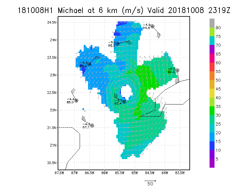
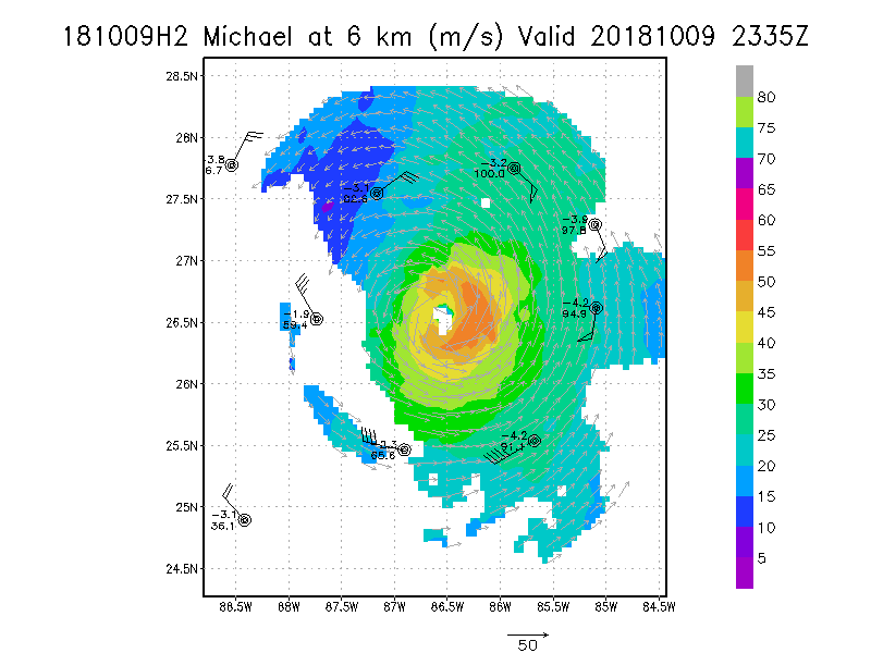
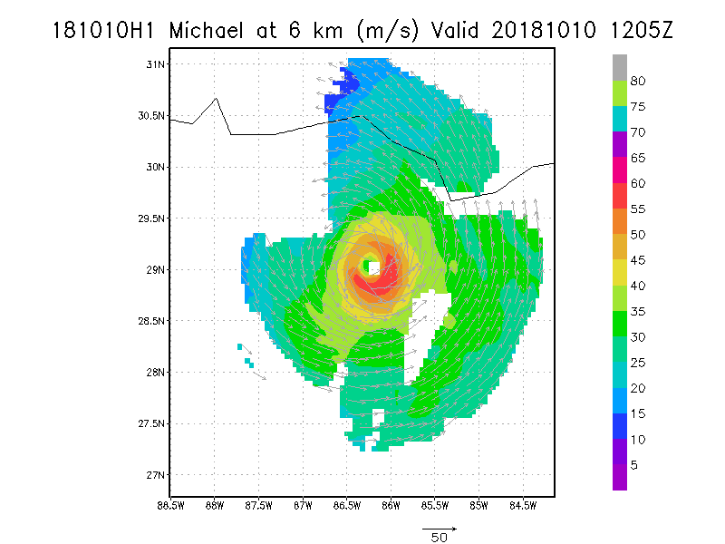
6.0 km
6.5 km
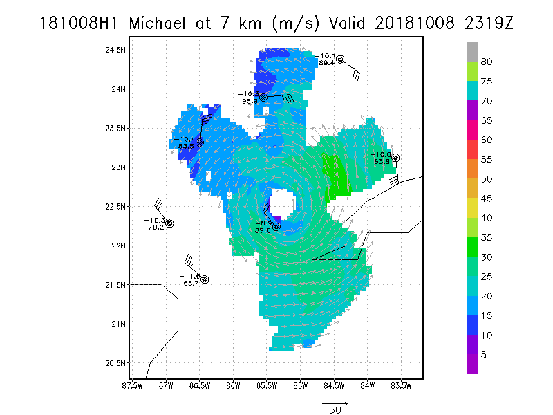
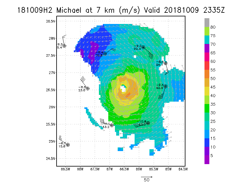
7.0 km
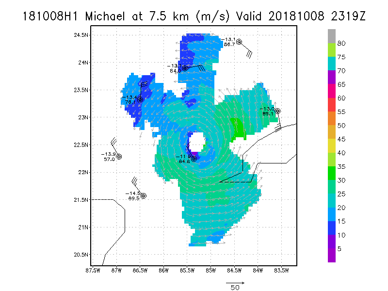
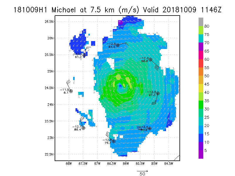
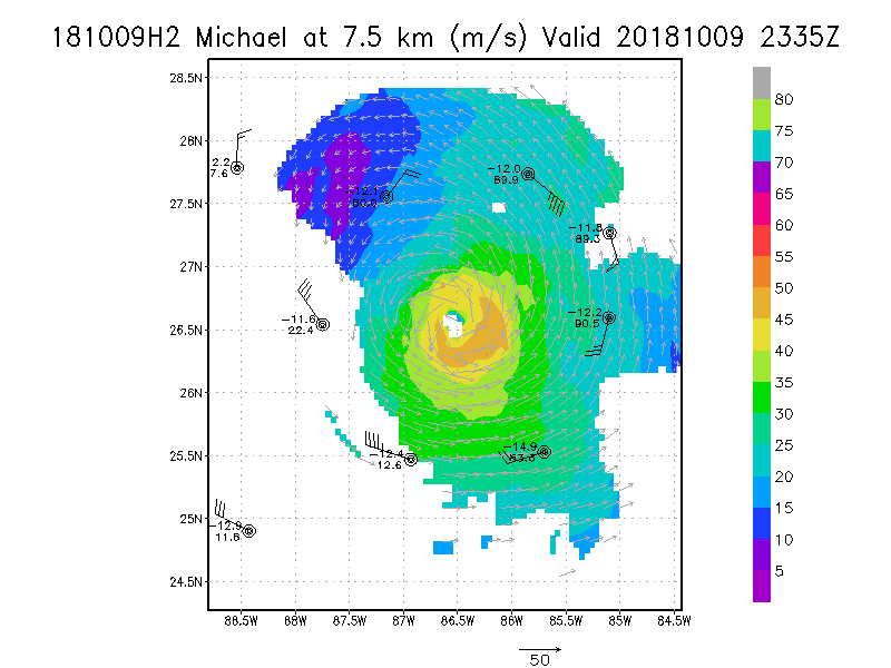
7.5 km
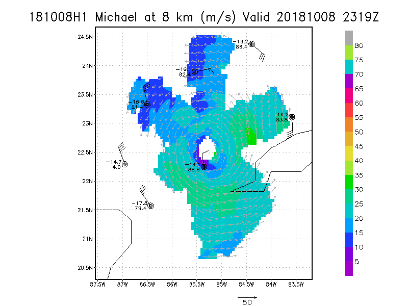
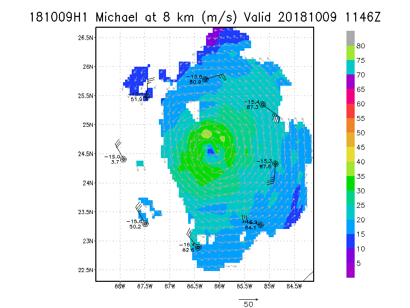
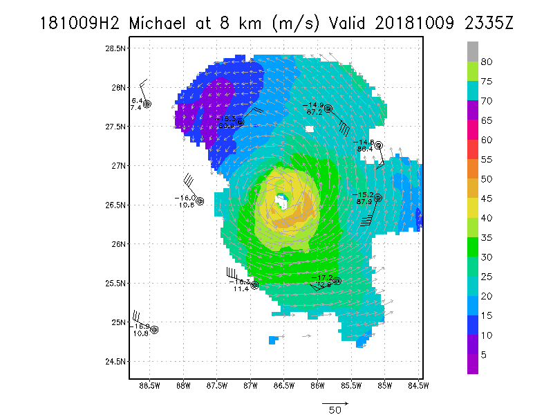
8.0 km
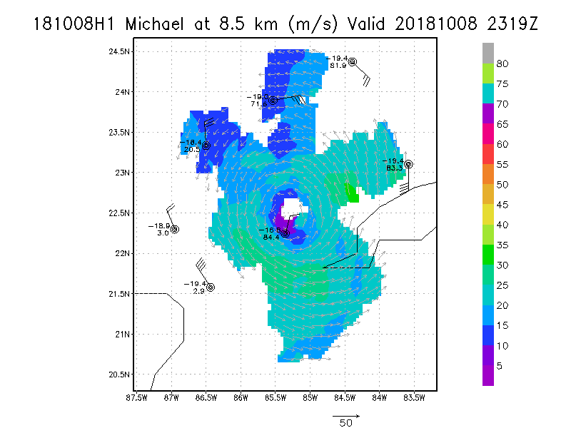
8.5 km
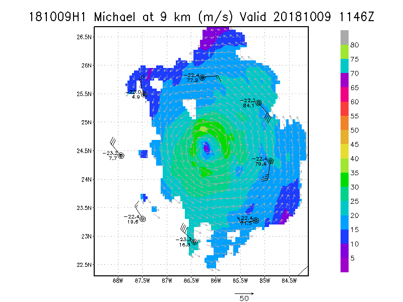
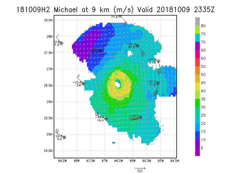
9.0 km
|
Winds at :
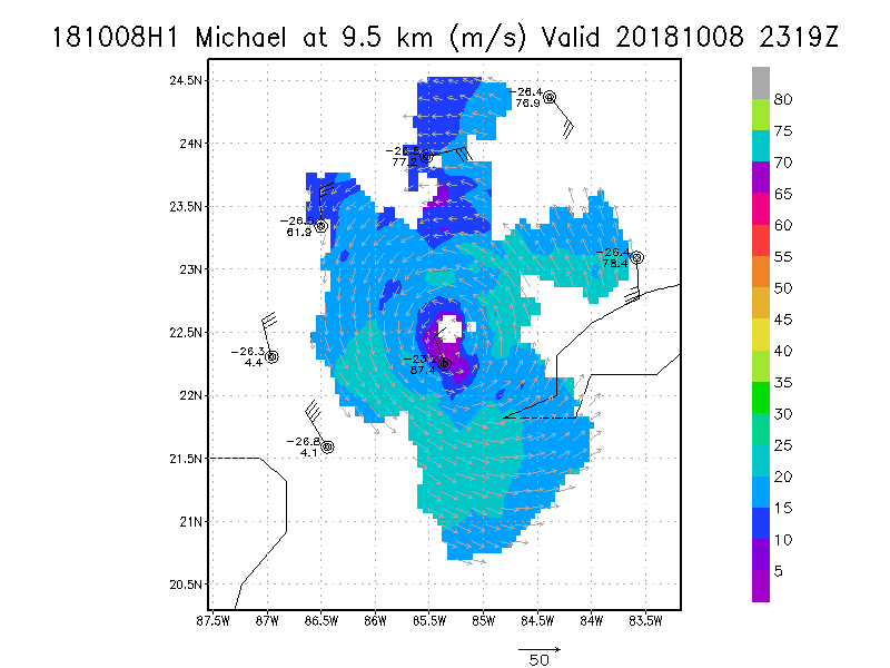
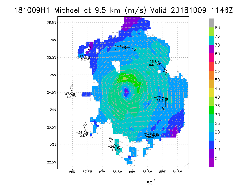
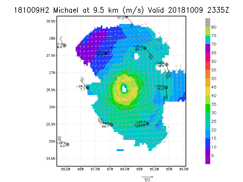
9.5 km
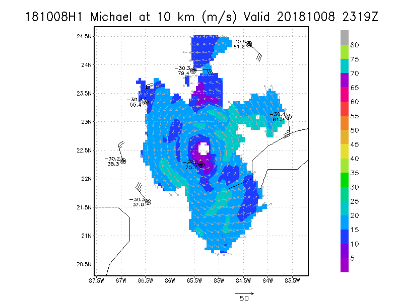
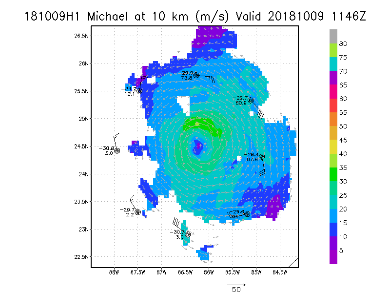
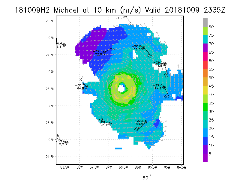
10.0 km
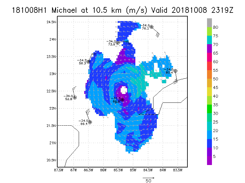
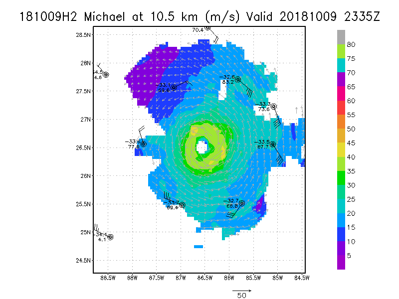
10.5 km
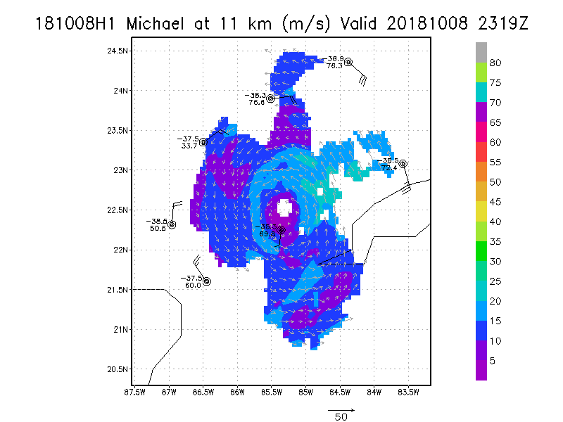
11.0 km
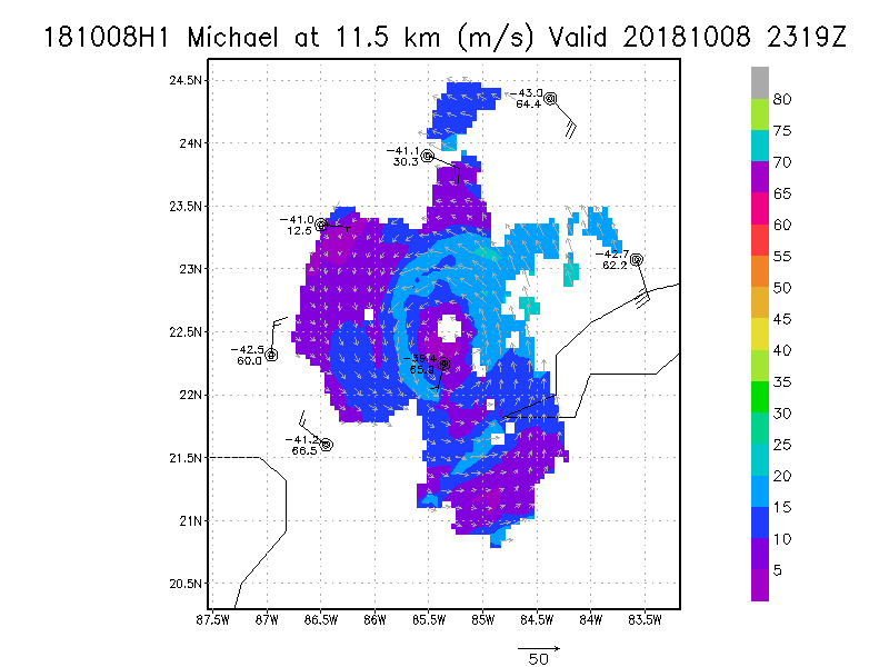
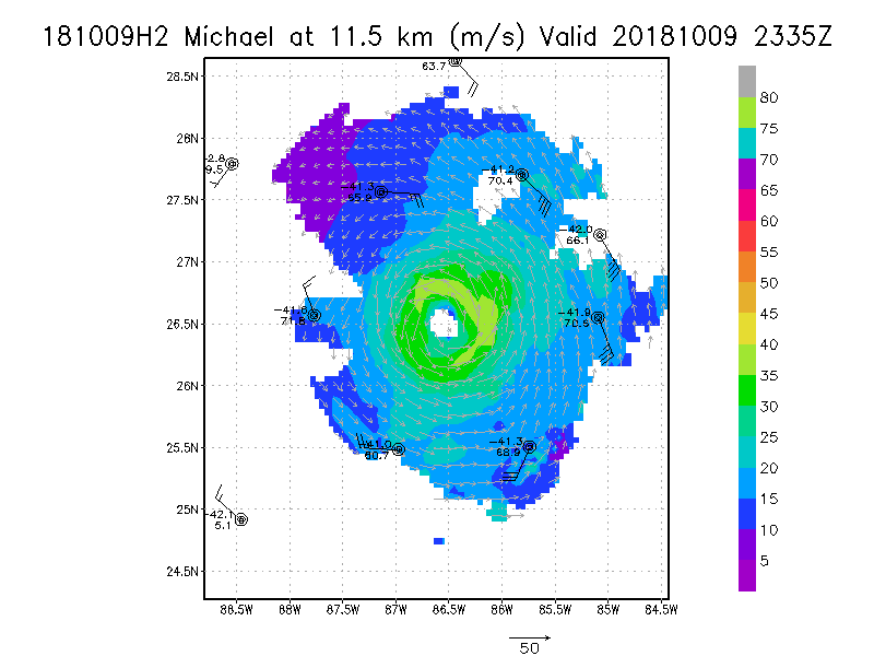
11.5 km
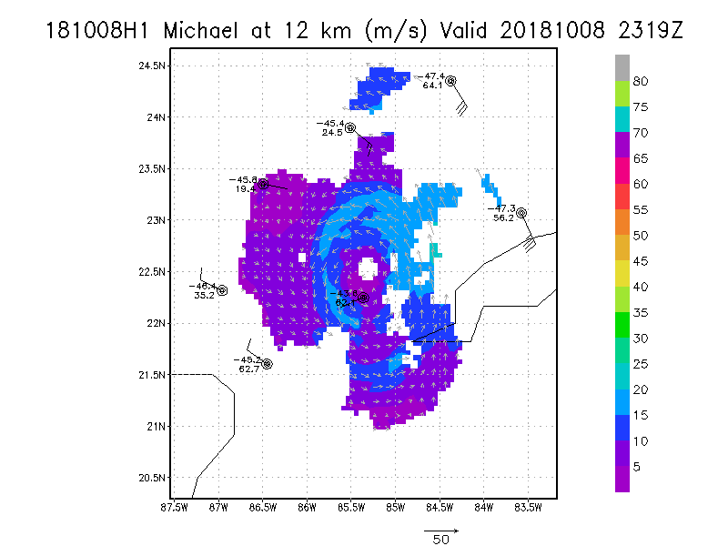
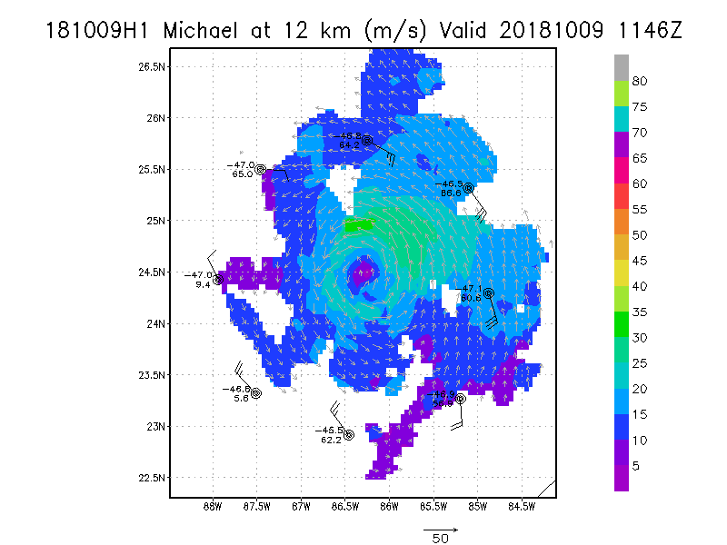
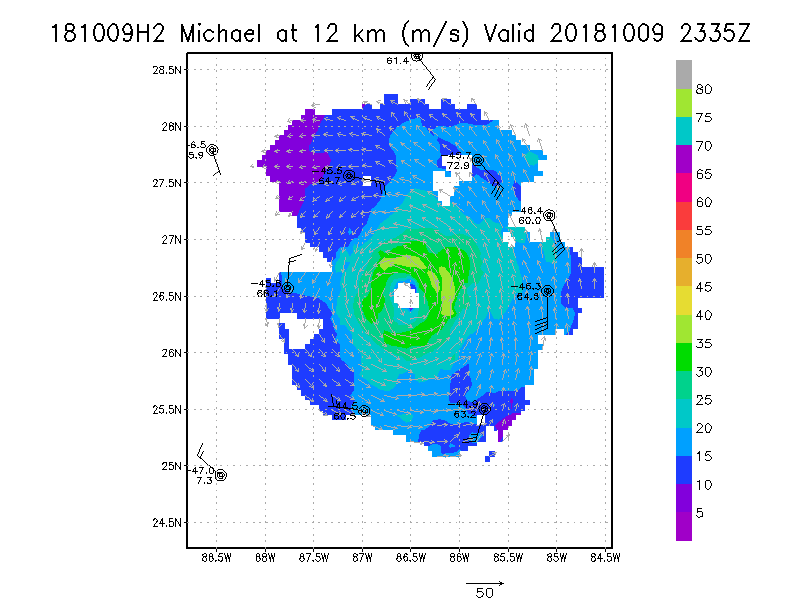
12.0 km
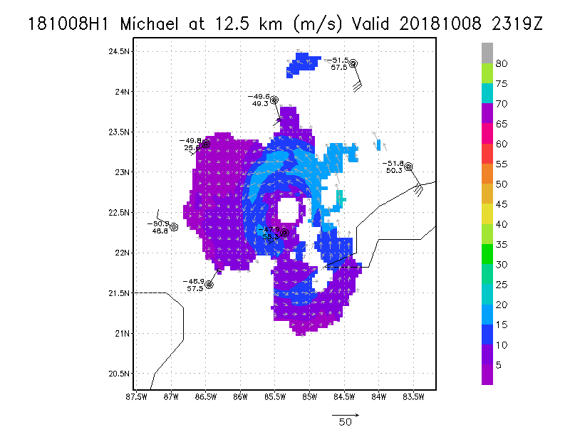
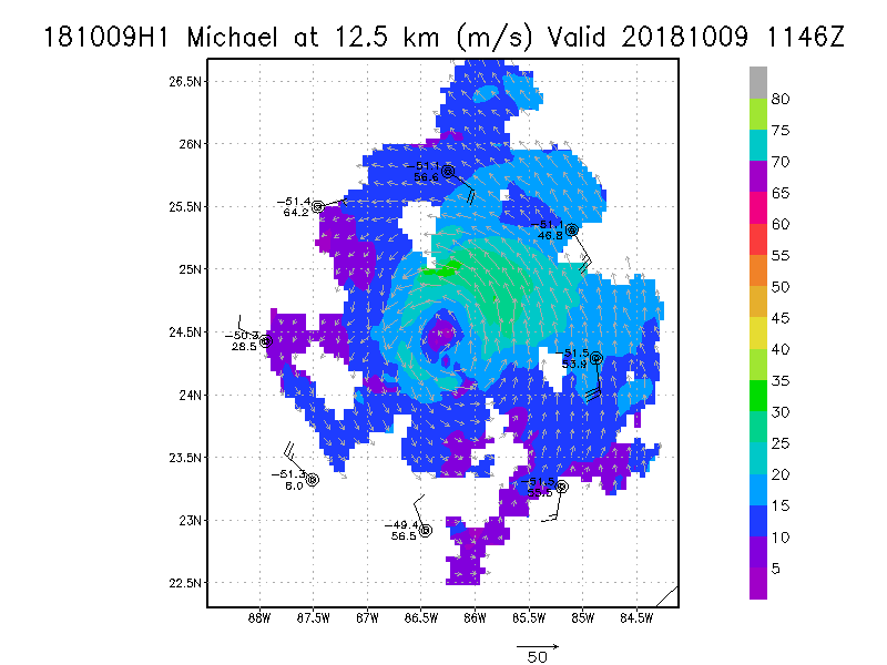
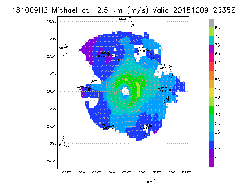
12.5 km
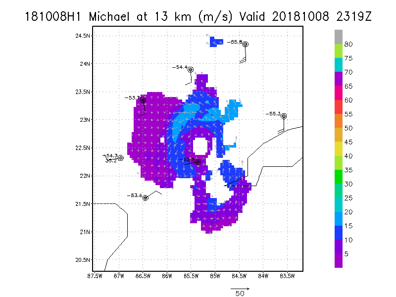
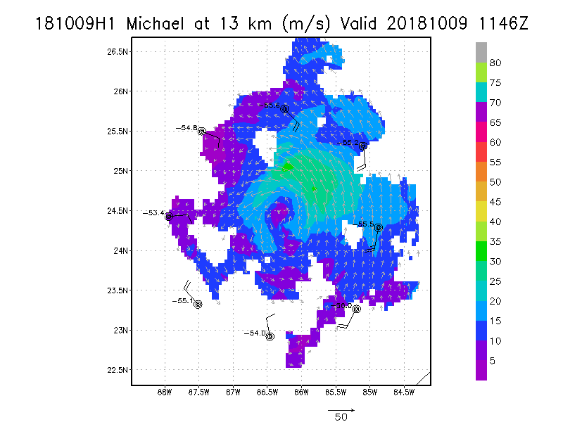
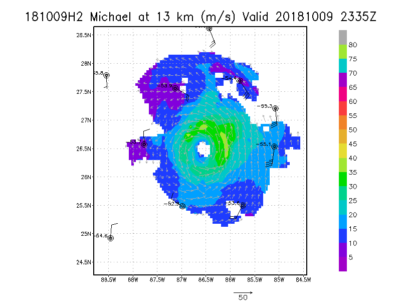
13.0 km
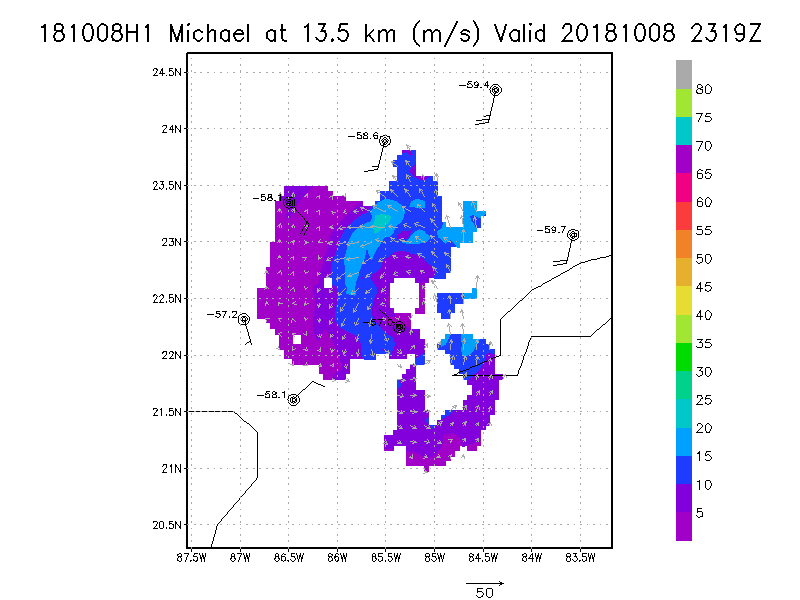
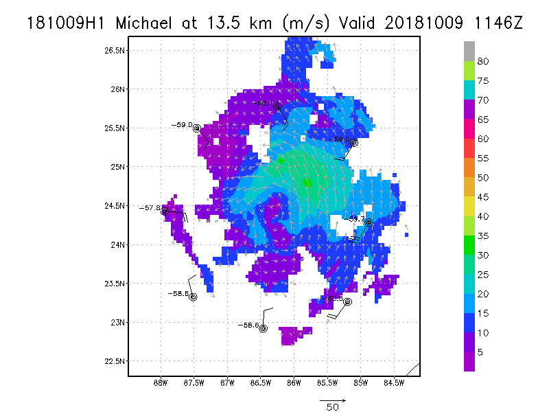
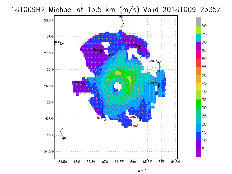
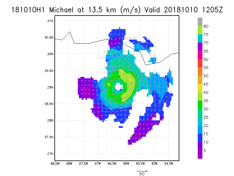
13.5 km
|
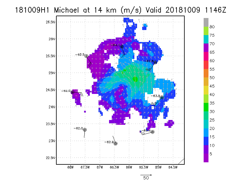
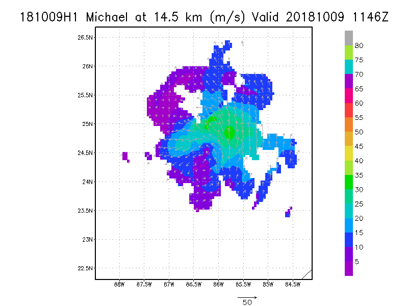
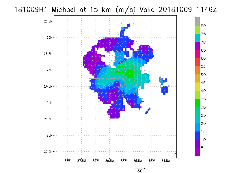
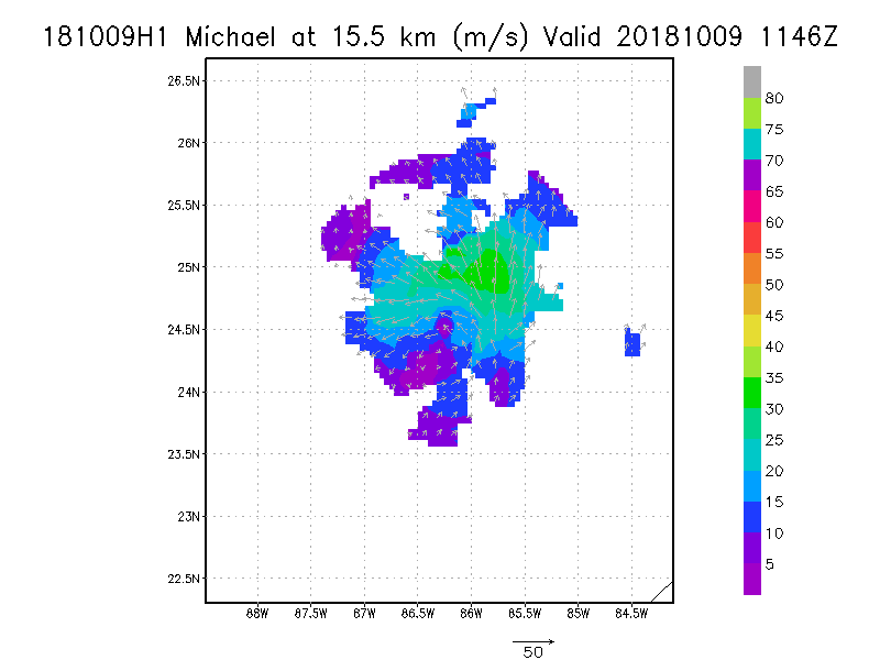
Winds at :
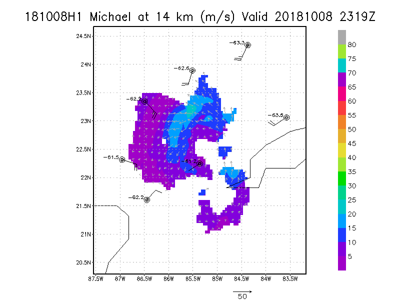
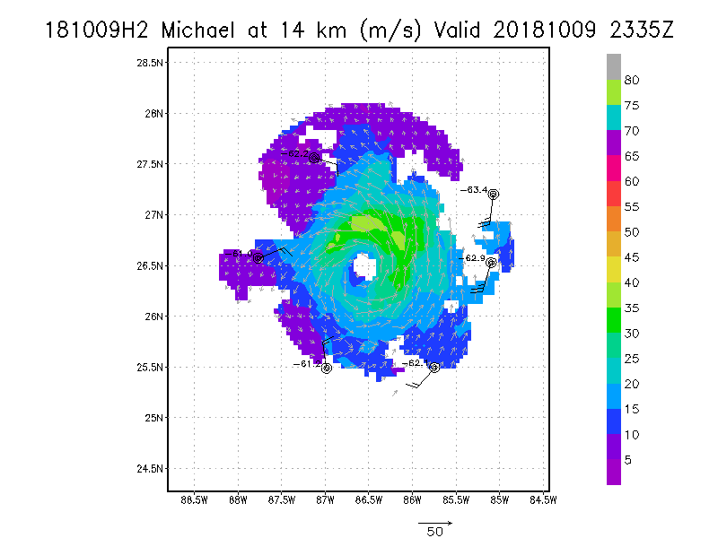
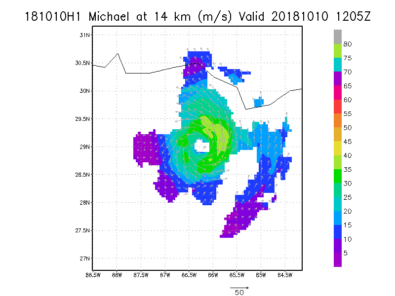
14.0 km
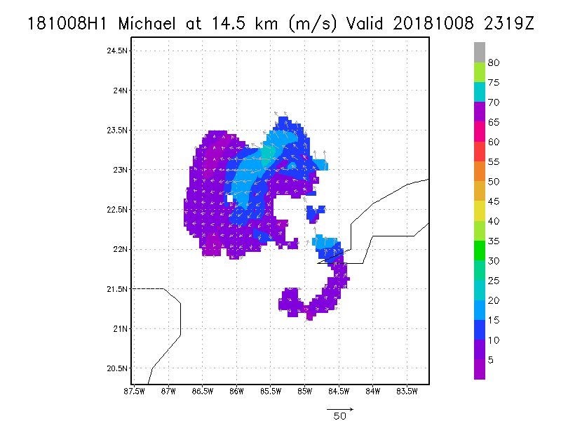
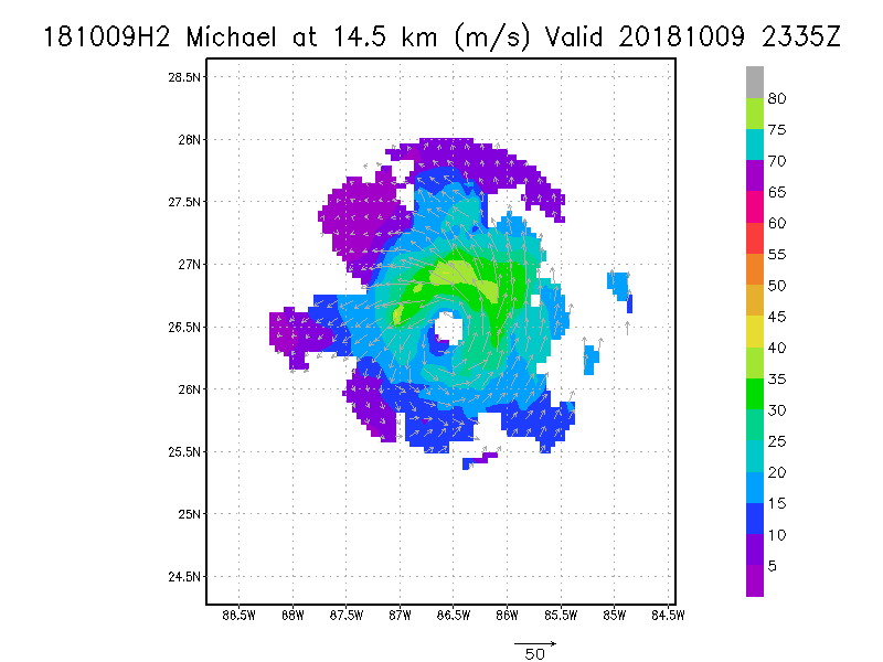
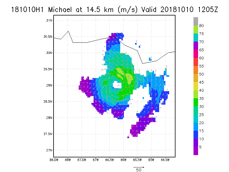
14.5 km
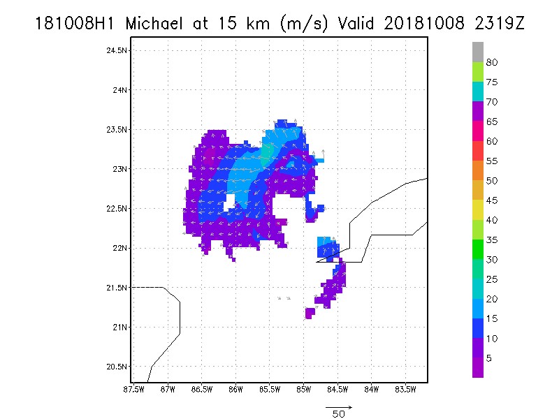
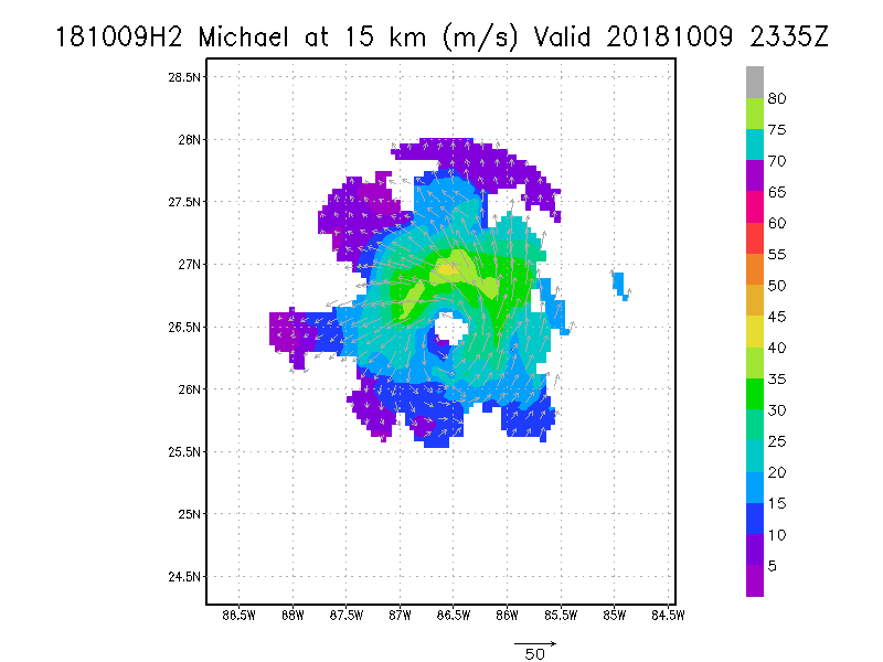
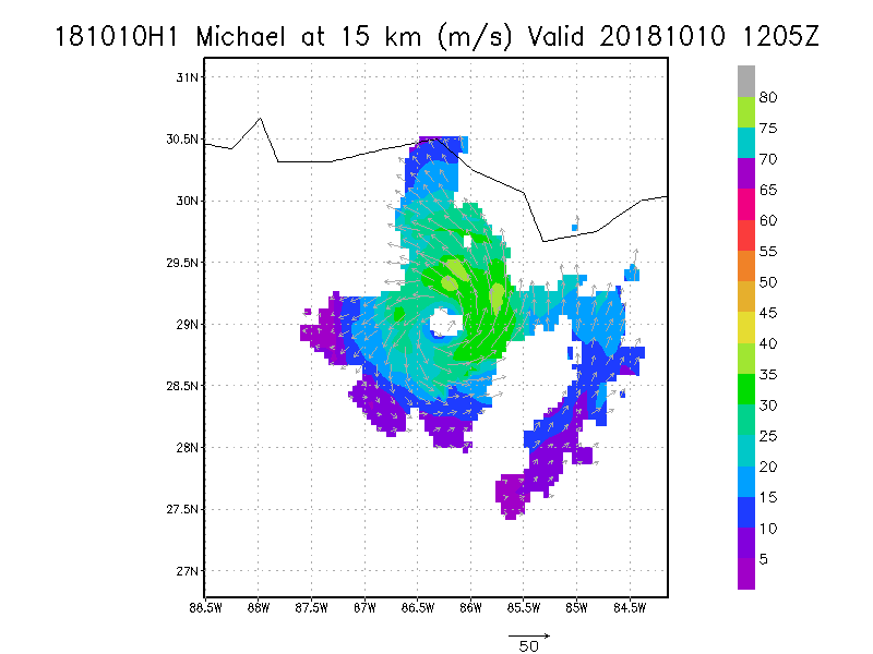
15.0 km
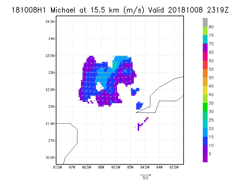
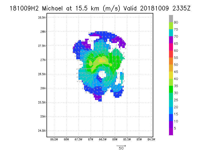
15.5 km
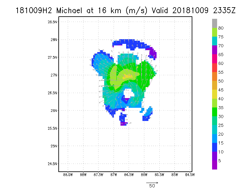
16.0 km
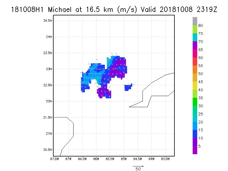
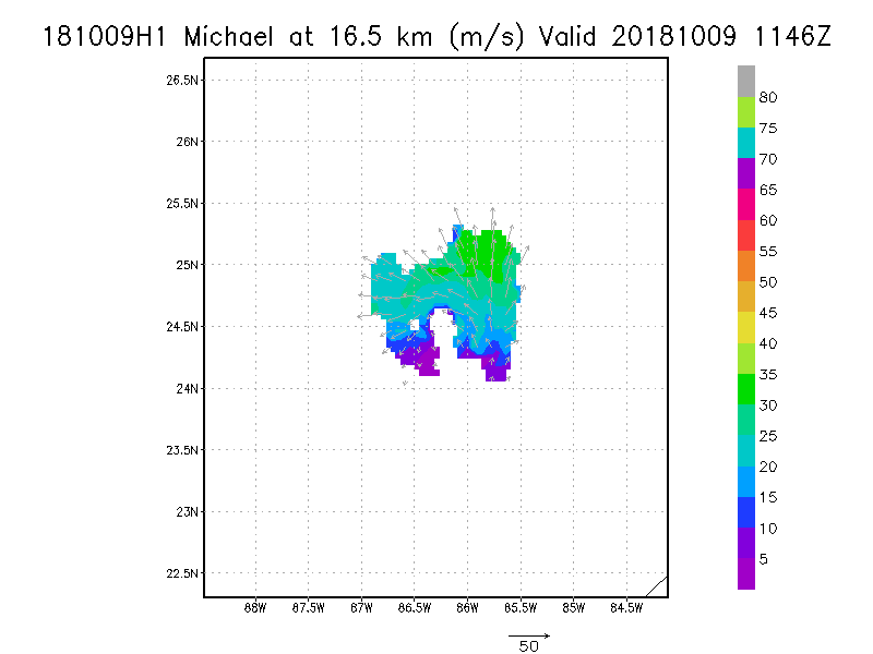
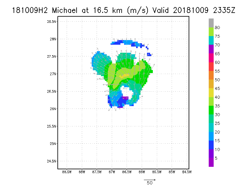
16.5 km
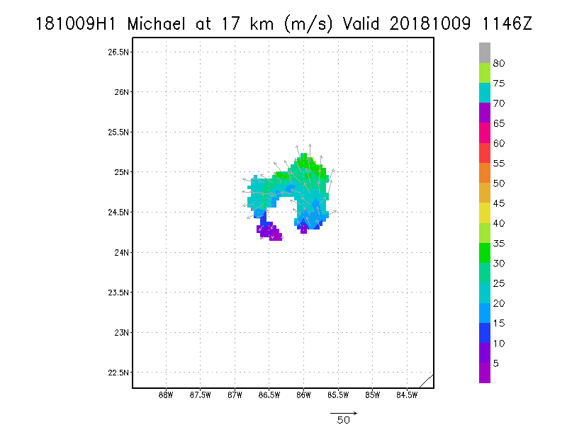
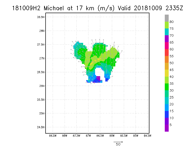
17.0 km
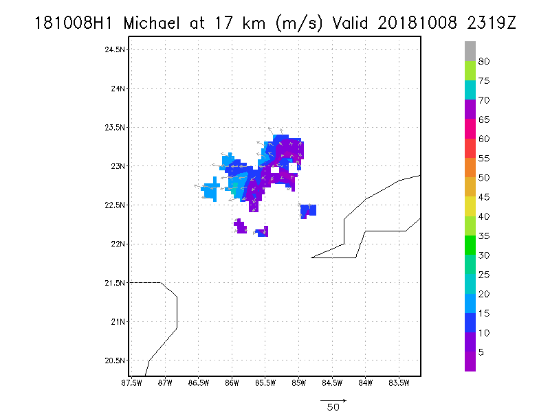
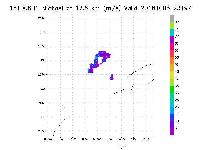
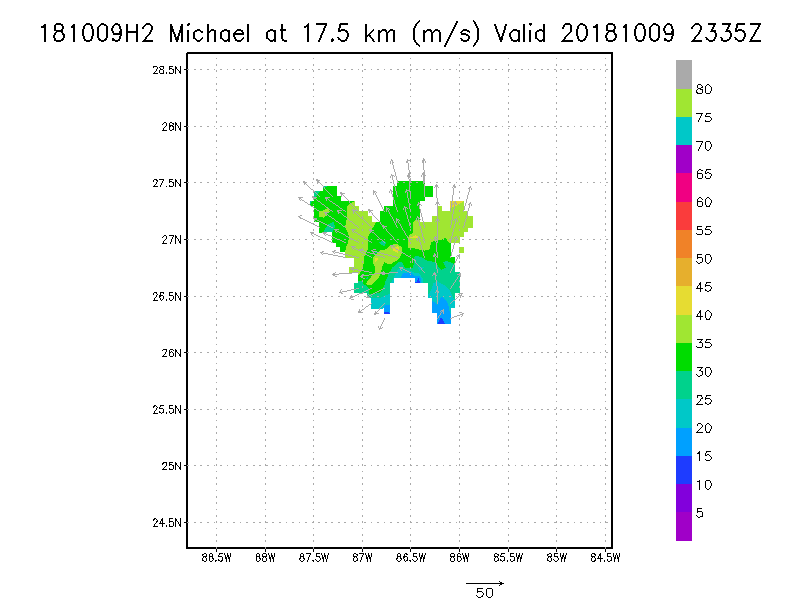
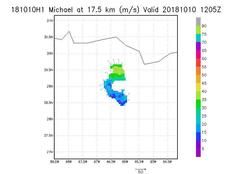
17.5 km
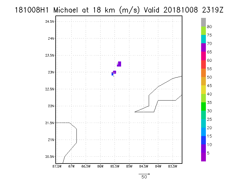
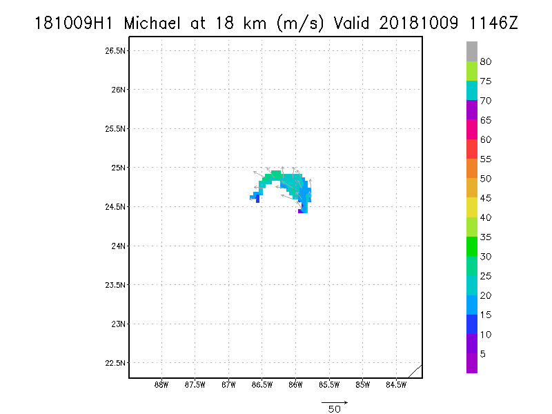
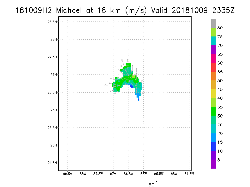
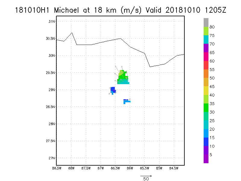
18.0 km
|
October 10, 2018
N42RF #1
|
|
Individual legs
|
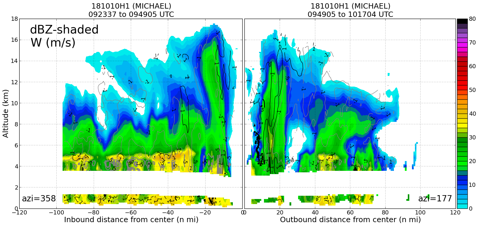
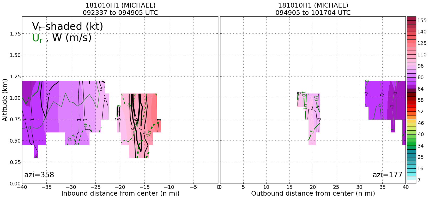
Leg #1
09:49Z
|
20181010H1 0949Z dbz profile
|
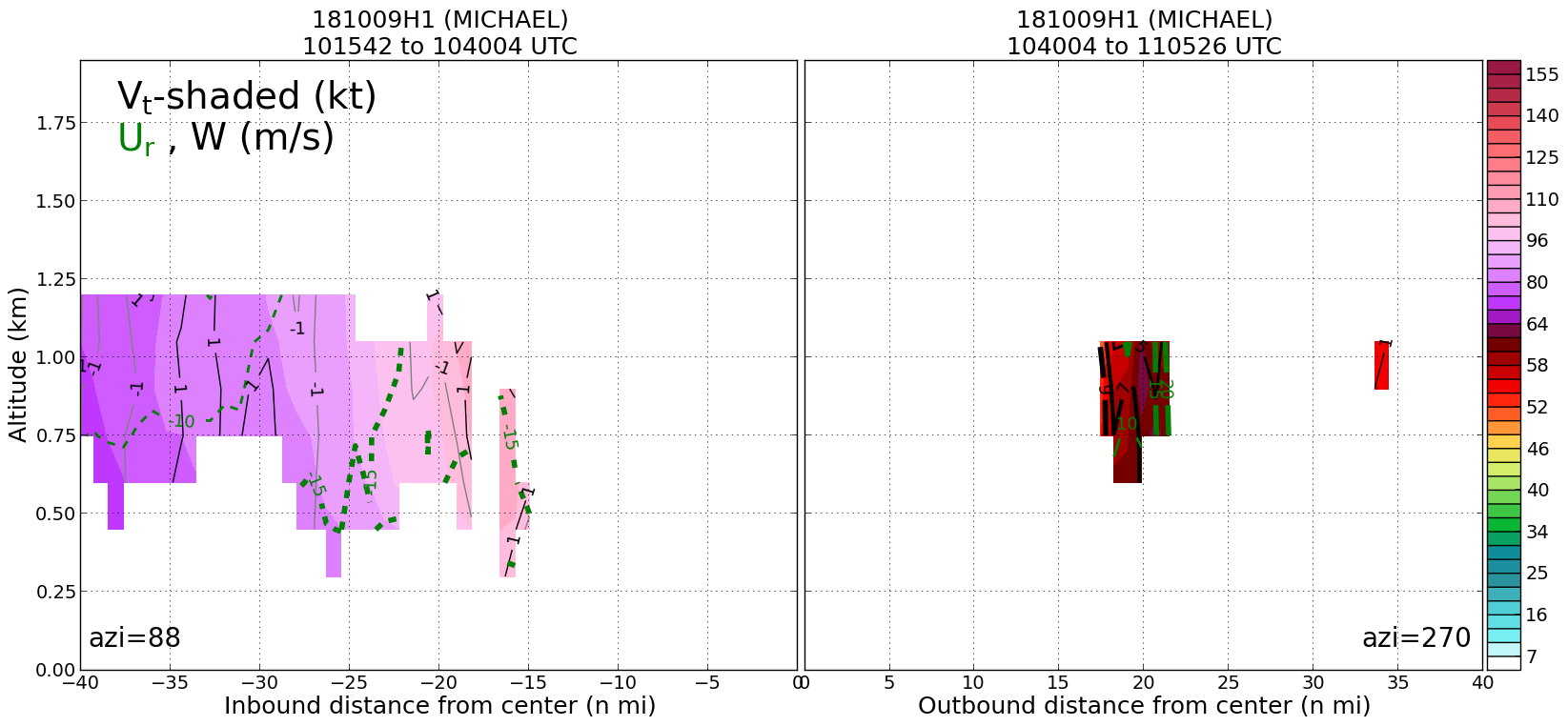
20181010H1 0949Z vt BL profile
|
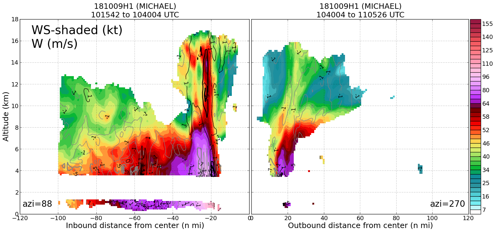
20181010H1 0949Z ws profile
|
|
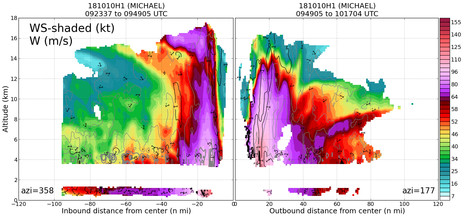
Leg #2
11:16Z
|
20181010H1 1116Z dbz profile
|
20181010H1 1116Z vt BL profile
|
20181010H1 1116Z ws profile
|
|
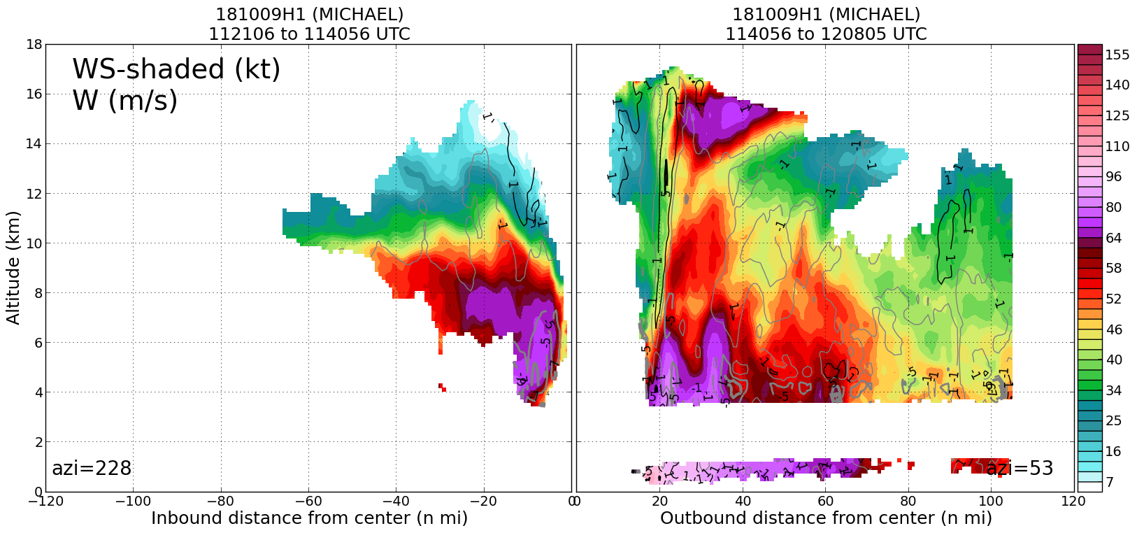
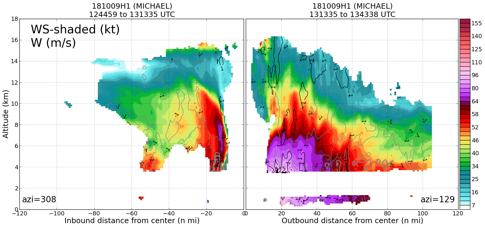
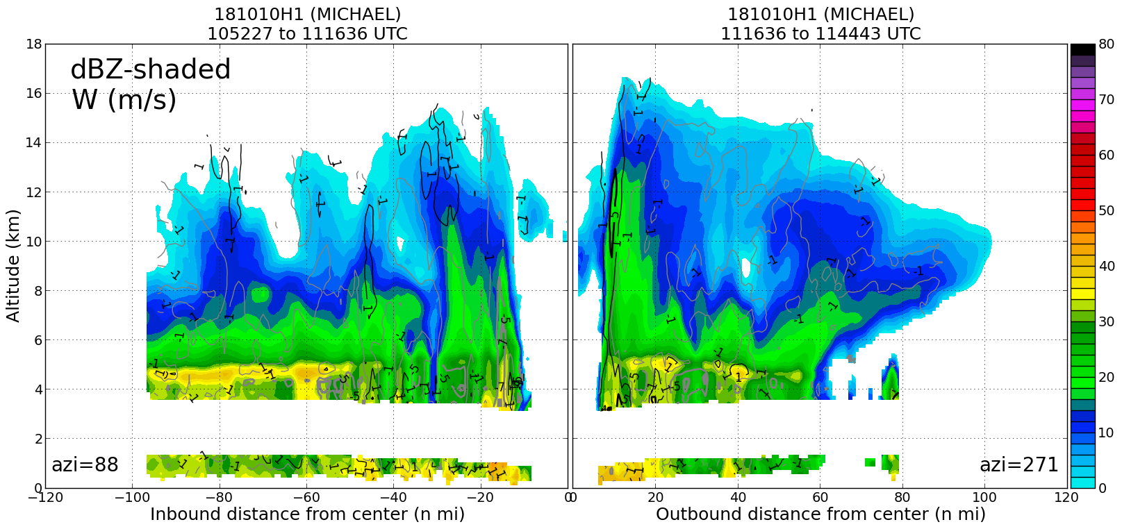
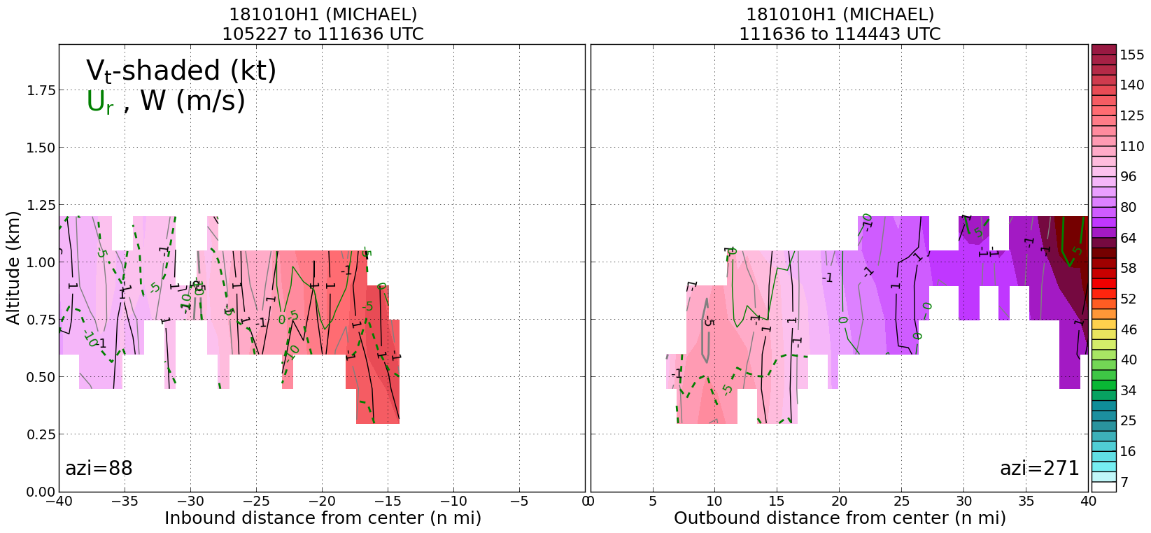
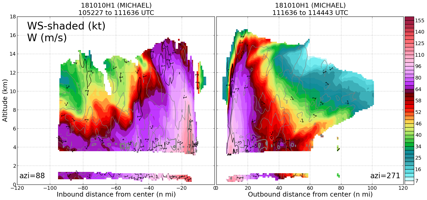
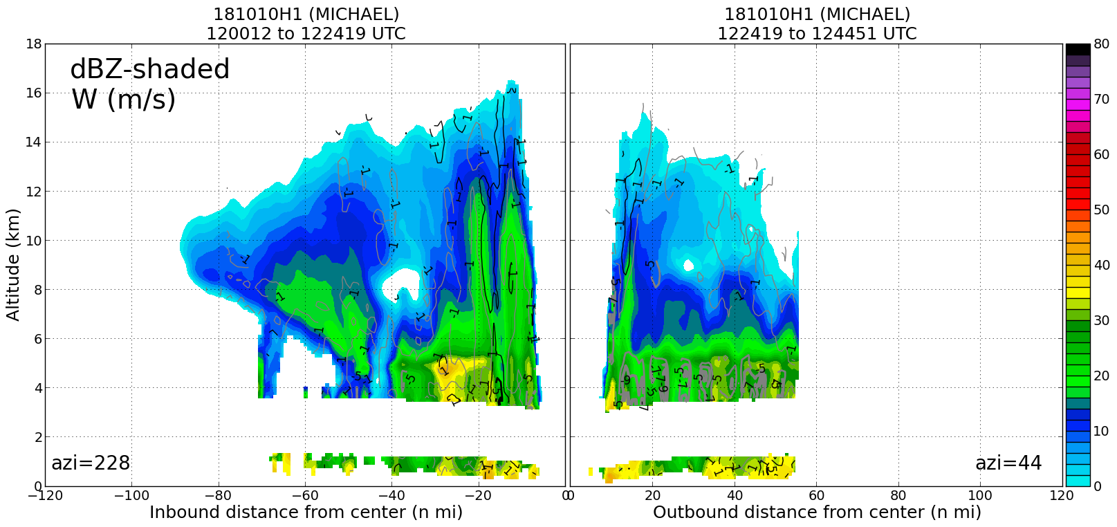
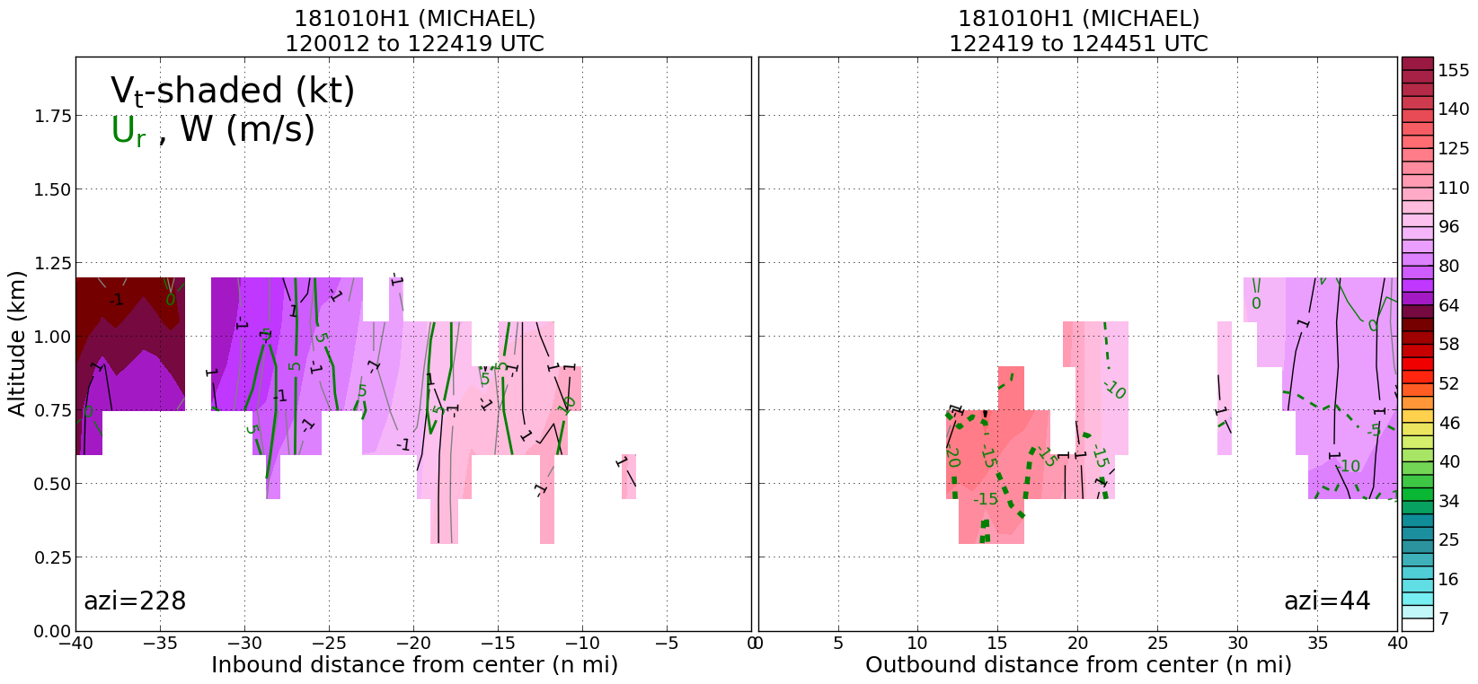
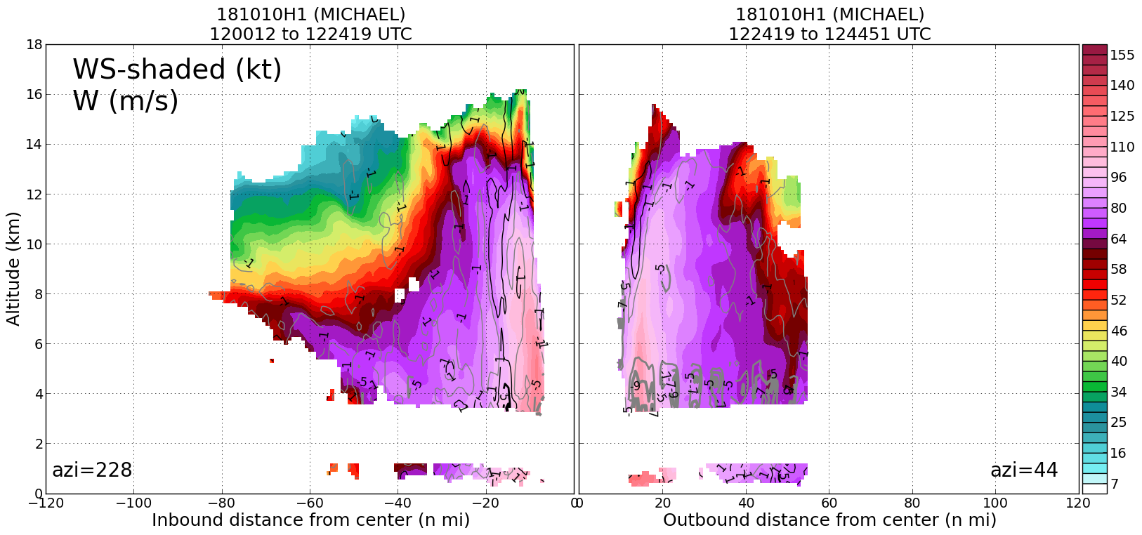
Leg #3
12:24Z
|
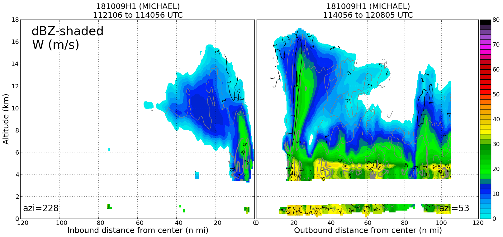
20181010H1 1224Z dbz profile
|
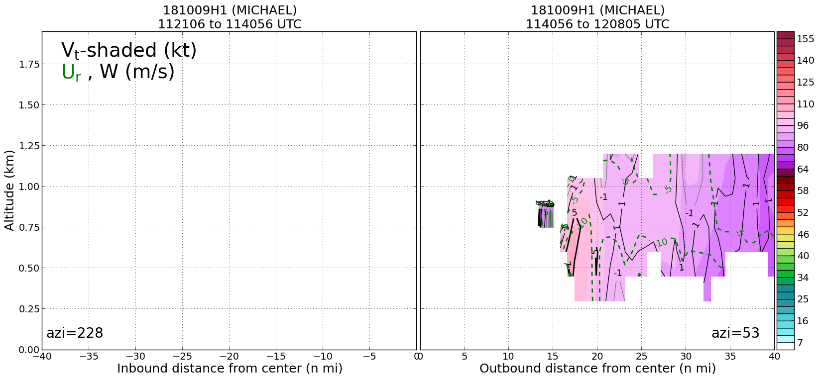
20181010H1 1224Z vt BL profile
|
20181010H1 1224Z ws profile
|
|
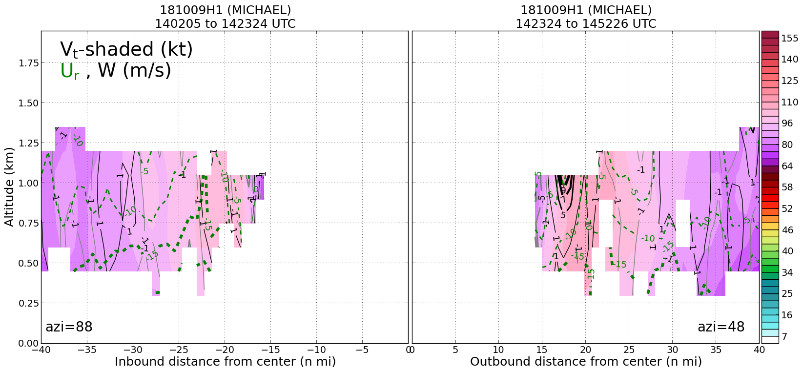
Leg #4
13:42Z
|
20181010H1 1342Z dbz profile
|
20181010H1 1342Z vt BL profile
|
20181010H1 1342Z ws profile
|
|
|
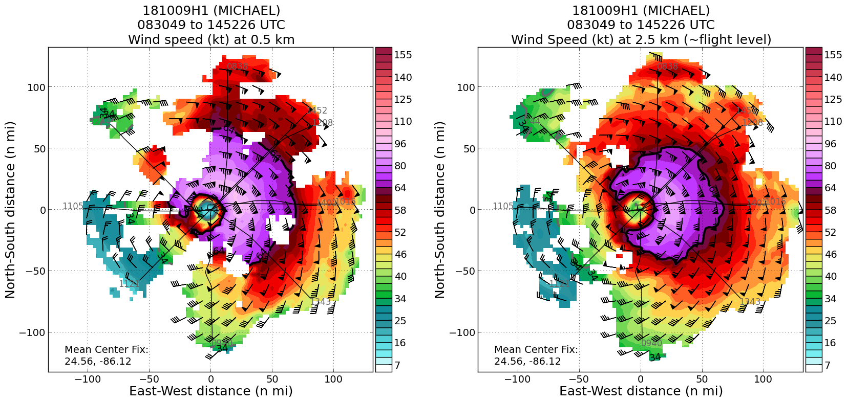
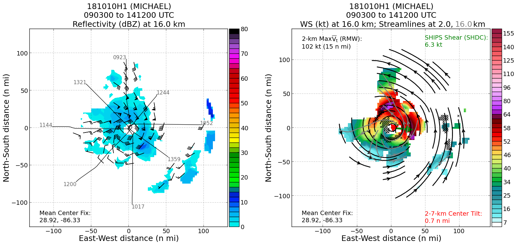
Plan views
|
20181010H1 ws dbz planview
|
20181010H1 ws dbz upper planview
|
20181010H1 ws nhc planview
|
|
Gridded radar data
GrADS control file radar data
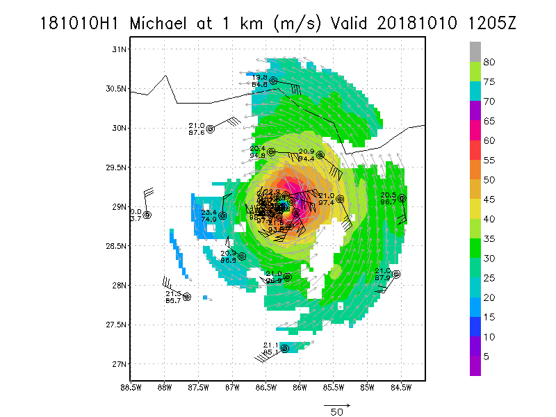
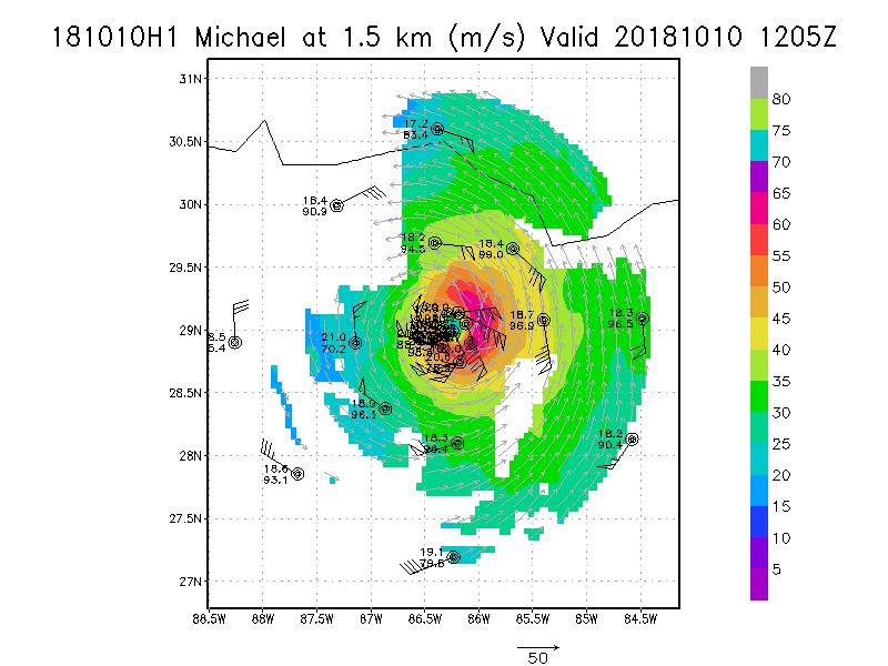
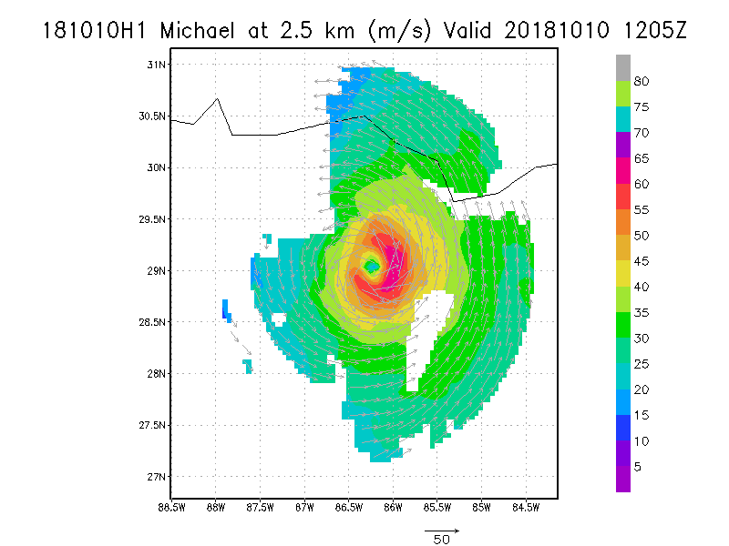
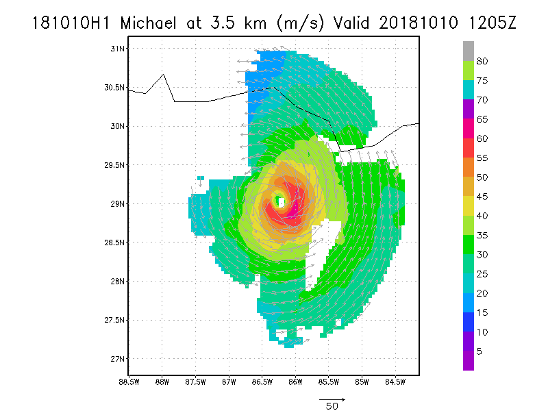
|
Winds at :
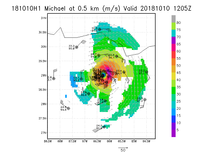
.5 km
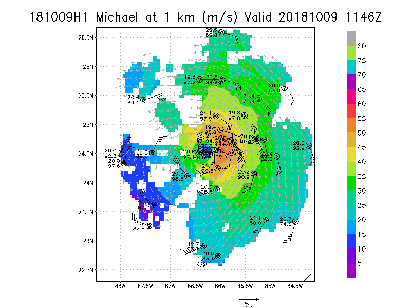
1.0 km
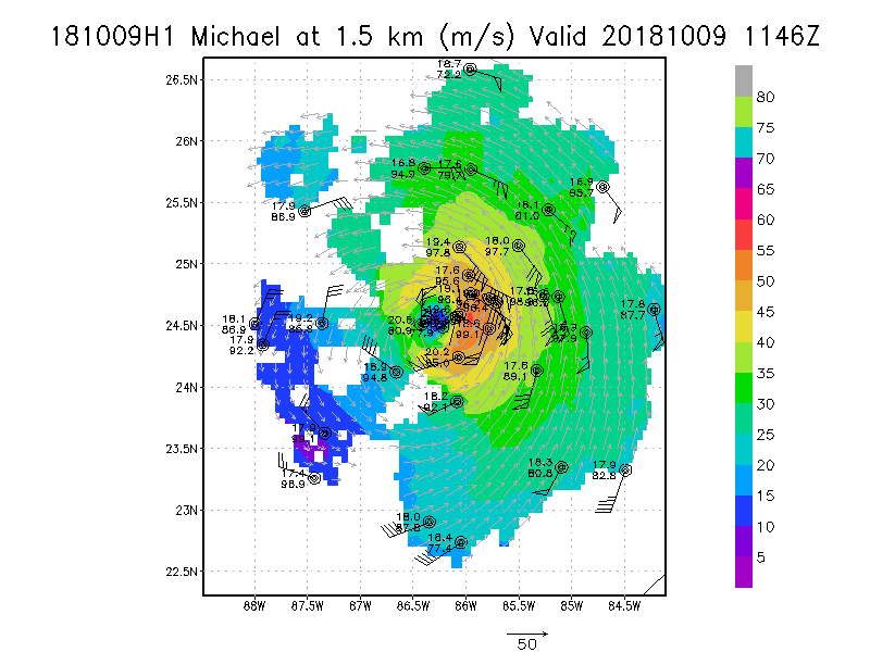
1.5 km
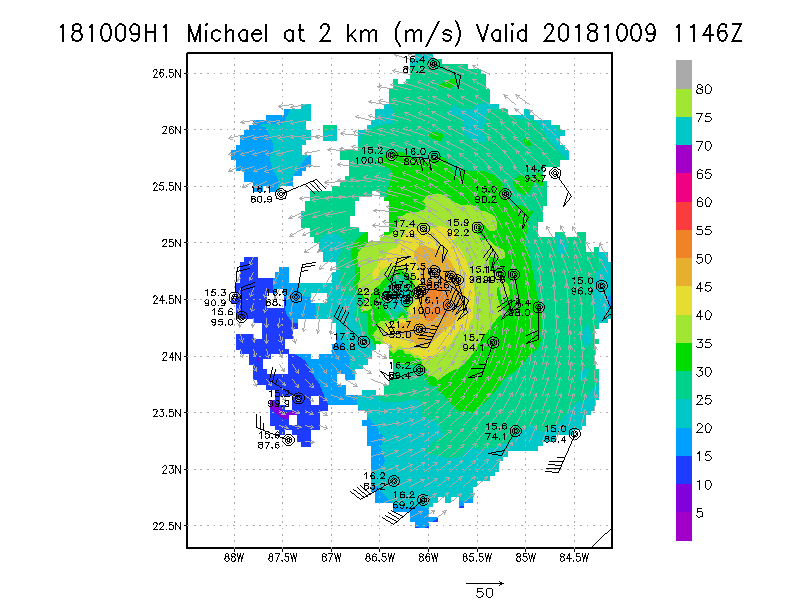
2.0 km
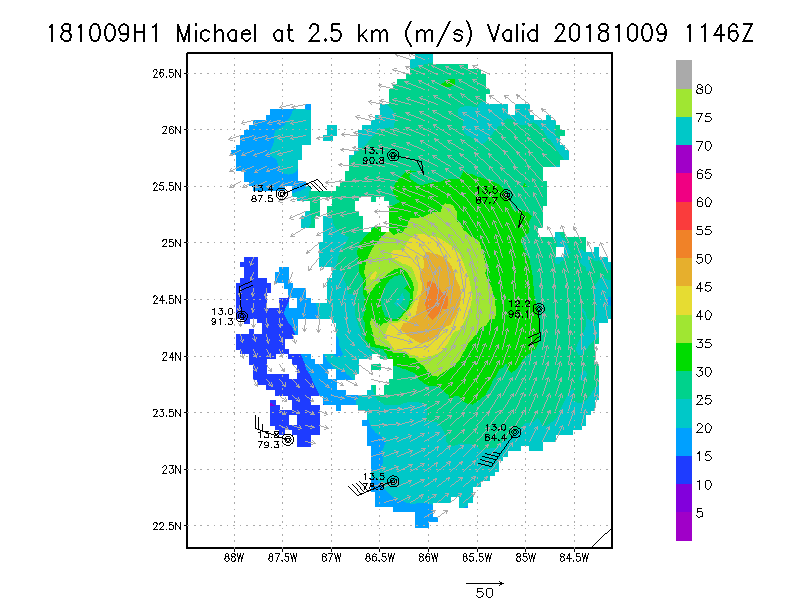
2.5 km
3.0 km
3.5 km
4.0 km
4.5 km
|
Winds at :
5.0 km
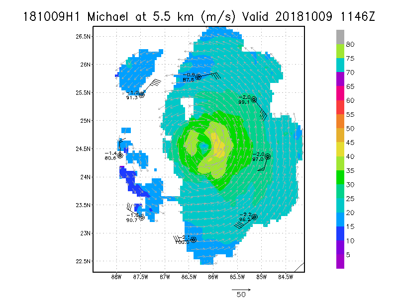
5.5 km
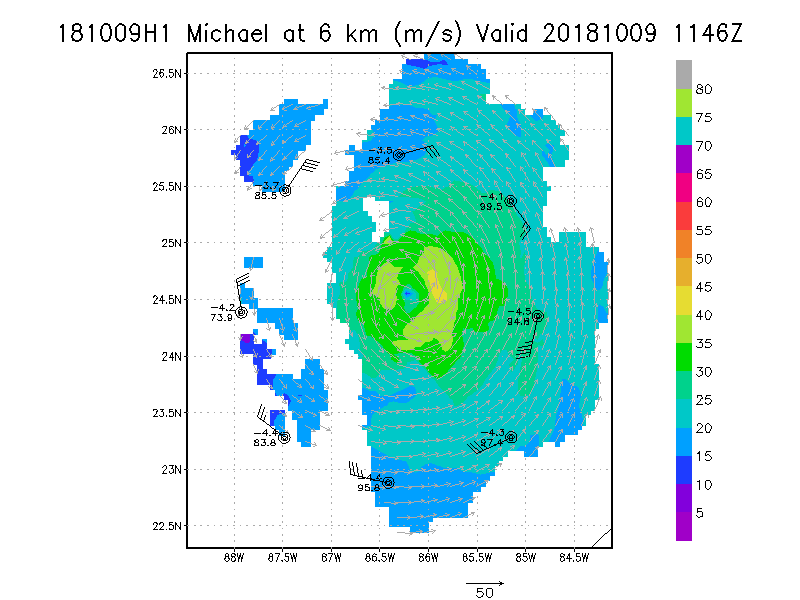
6.0 km
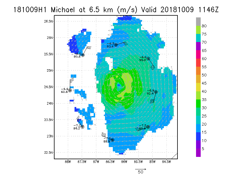
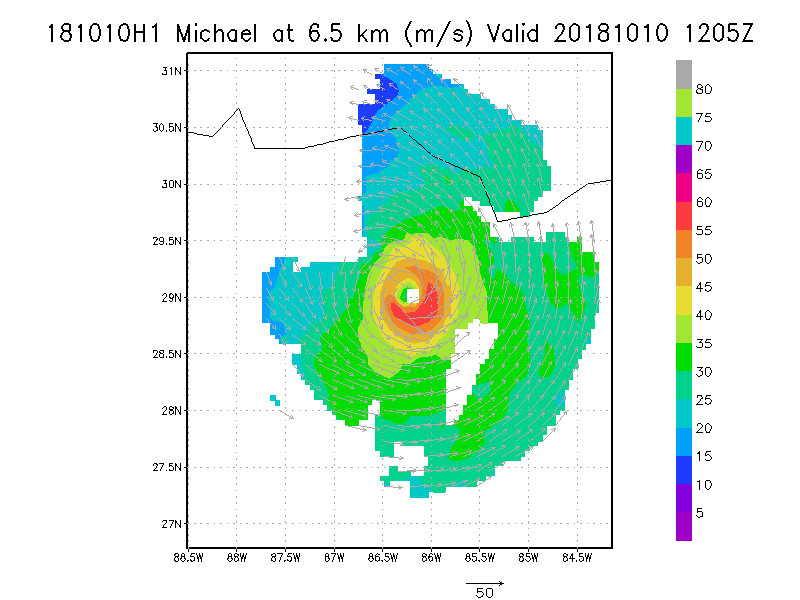
6.5 km
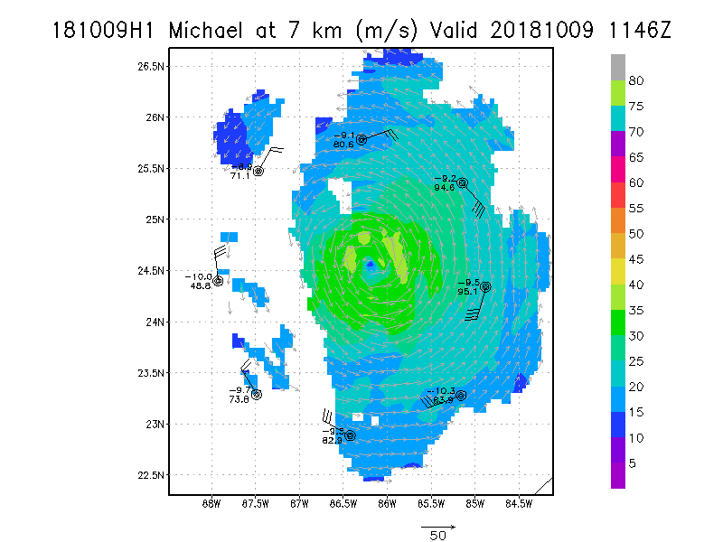
7.0 km
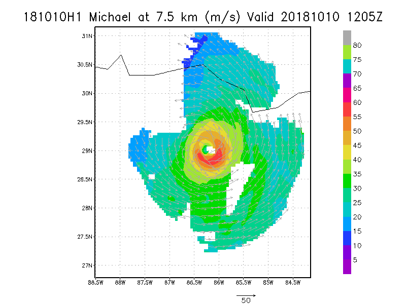
7.5 km
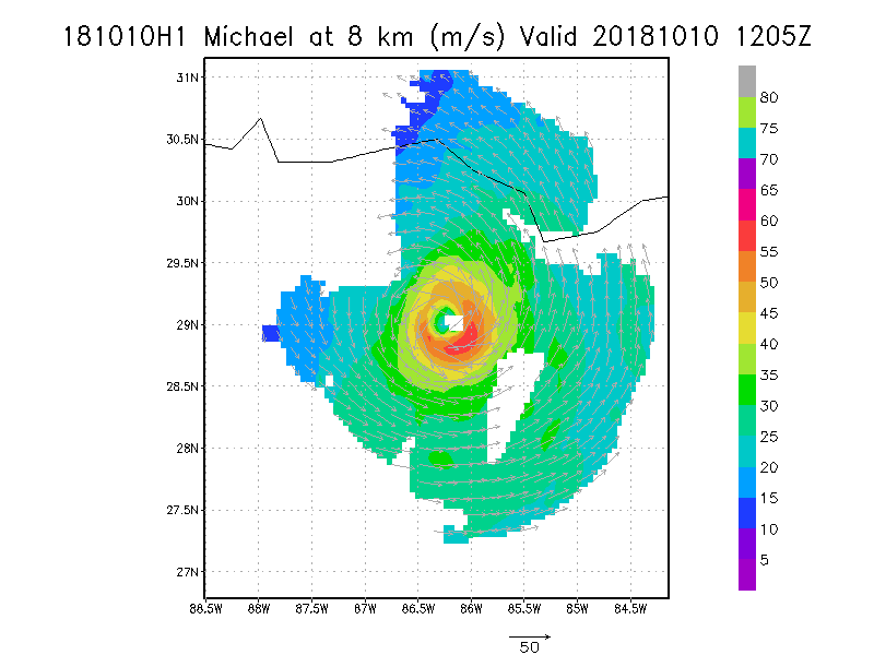
8.0 km
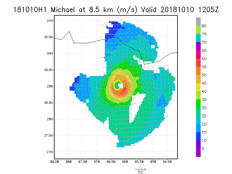
8.5 km
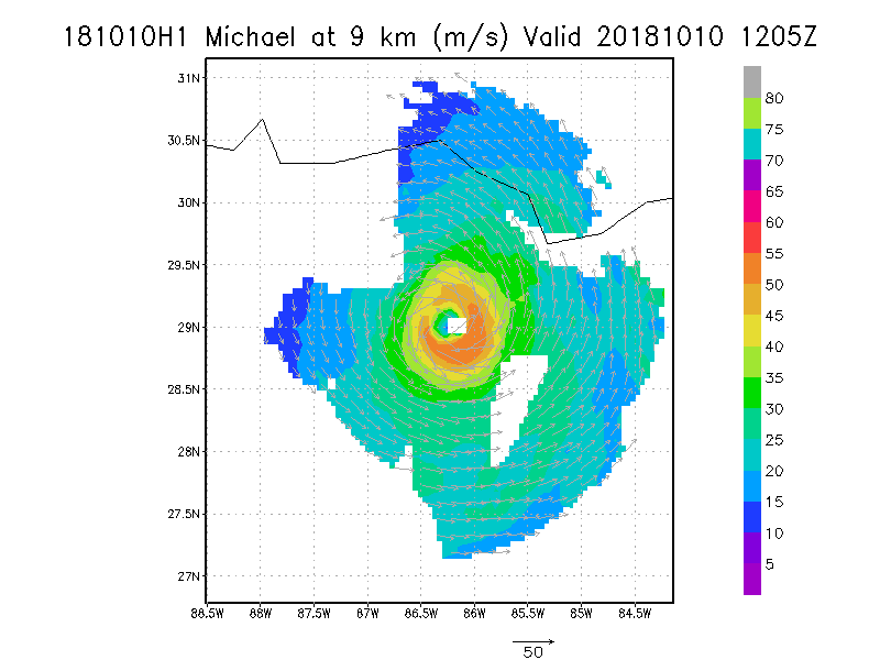
9.0 km
|
Winds at :
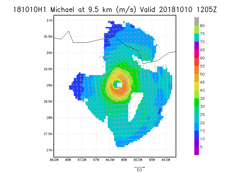
9.5 km
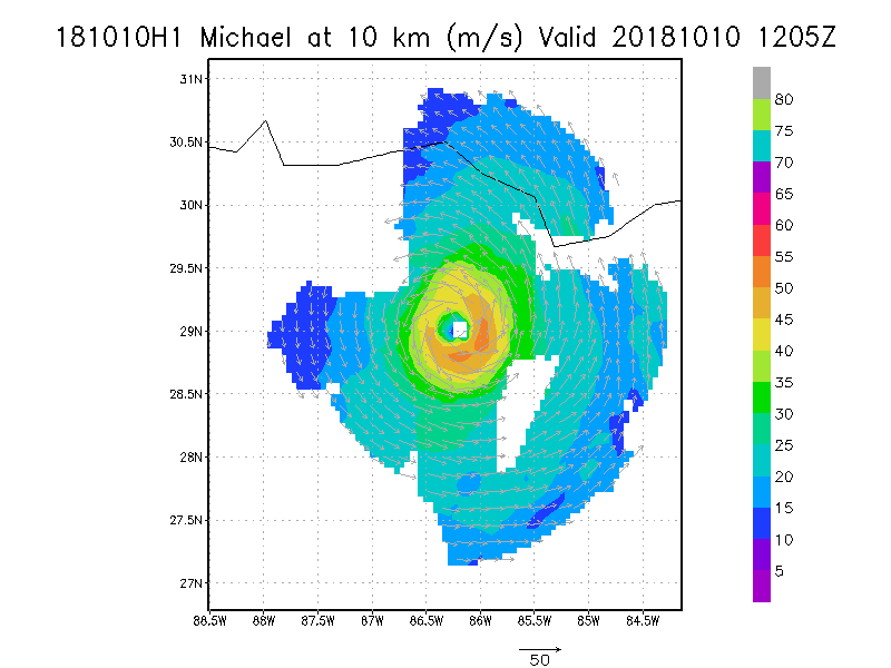
10.0 km
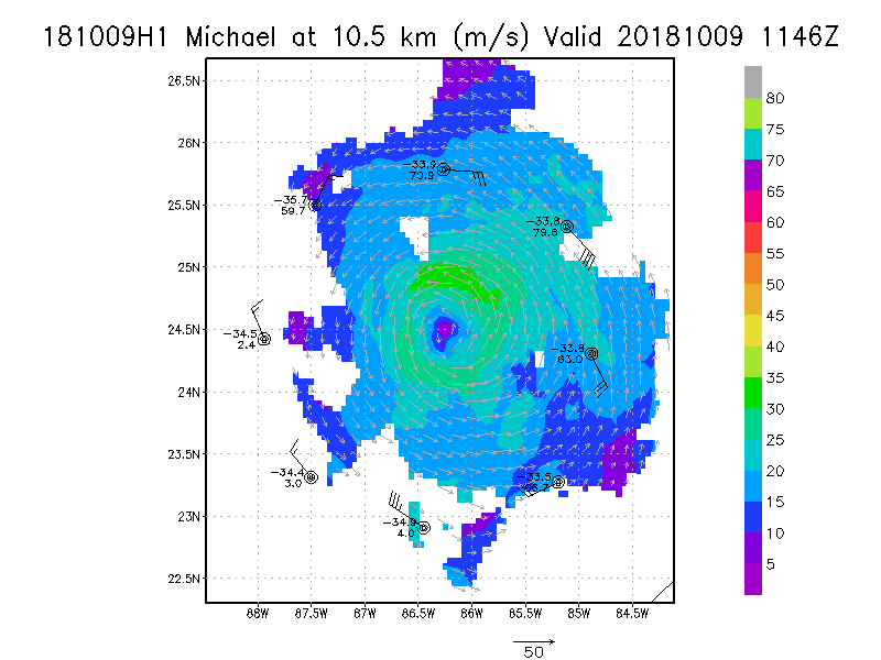
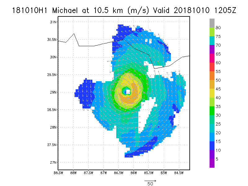
10.5 km
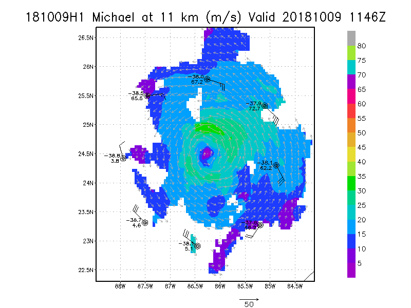
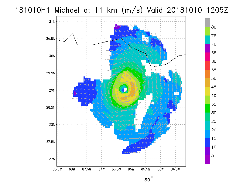
11.0 km
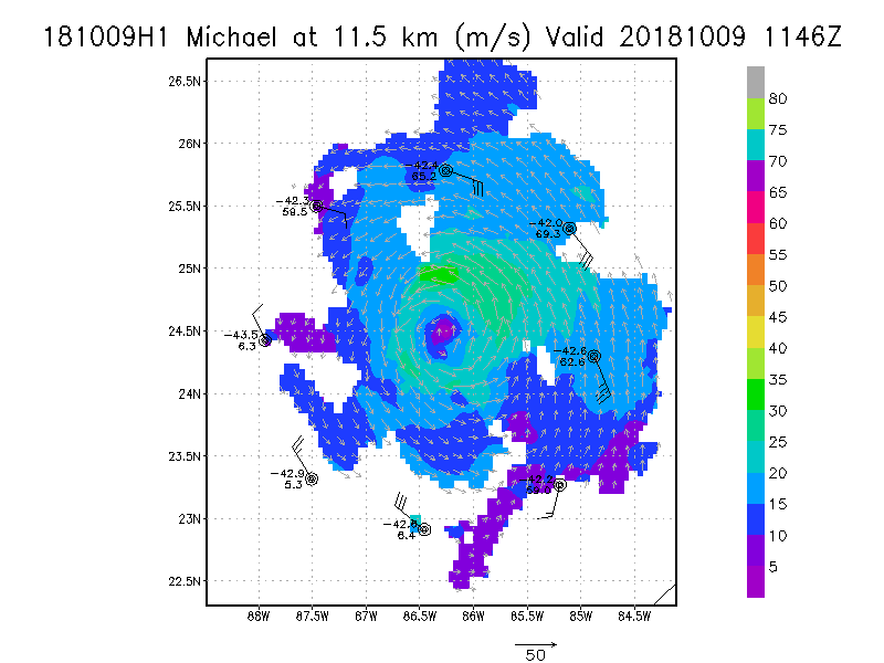
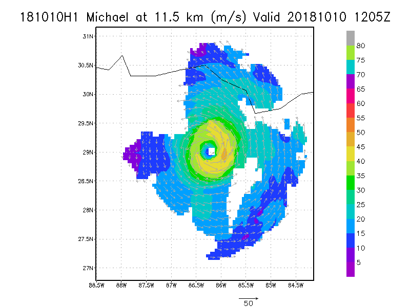
11.5 km
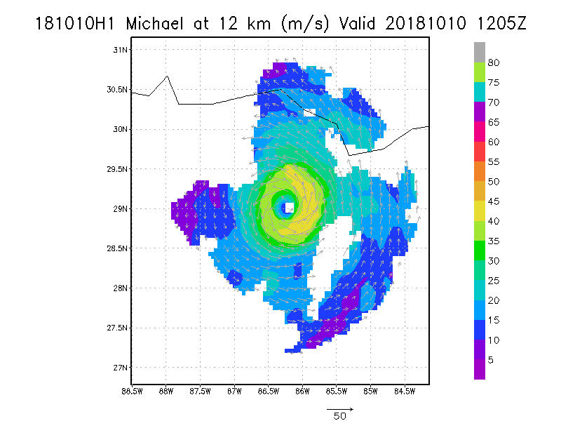
12.0 km
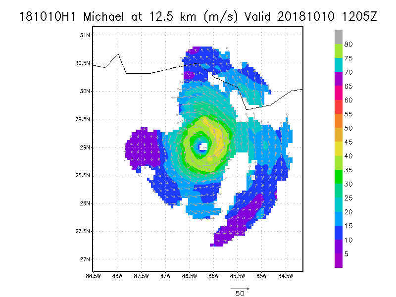
12.5 km
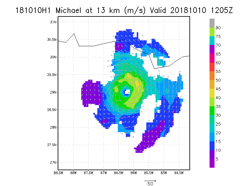
13.0 km
13.5 km
|
Winds at :
14.0 km
14.5 km
15.0 km
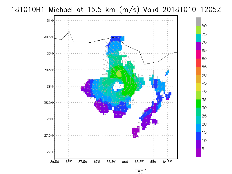
15.5 km
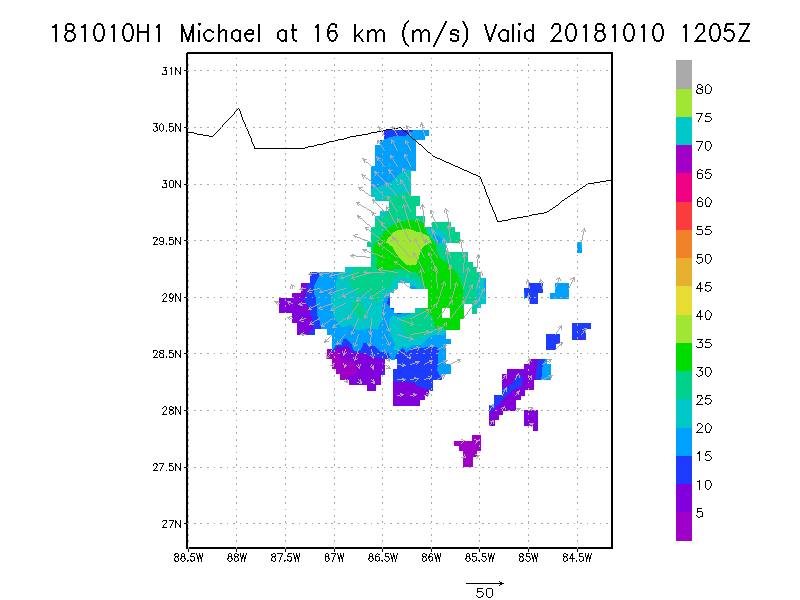
16.0 km
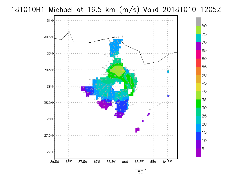
16.5 km
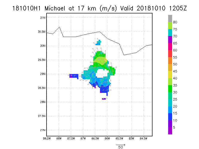
17.0 km
17.5 km
18.0 km
|


