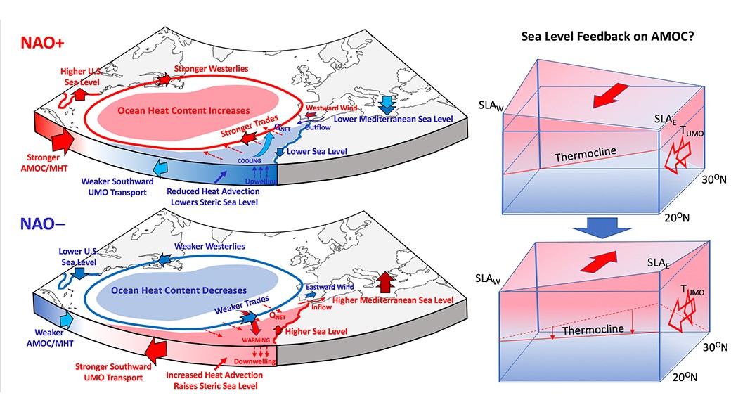
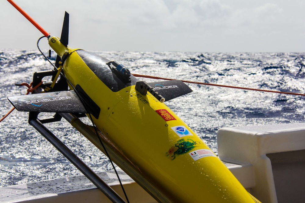
The global mean sea level rise caused by ocean warming and glacier melting over landforms such as Greenland is one of the most alarming aspects of a shifting global climate. However, the dynamics of the ocean and atmosphere further influence sea level changes region by region and over time. For example, along the U.S. East Coast, a pronounced acceleration of sea level rise in 2010-2015 was observed south of Cape Hatteras, while a deceleration occurred up North. These patterns provide background conditions, on top of which shorter-period (and often stronger) weather-driven sea level fluctuations compound what coastal communities directly experience day by day. Therefore, to develop or improve regional sea level predictions, it’s important to identify these patterns and explore how they change over time.
Unmanned Ocean Gliders Help Improve Hurricane Forecasts
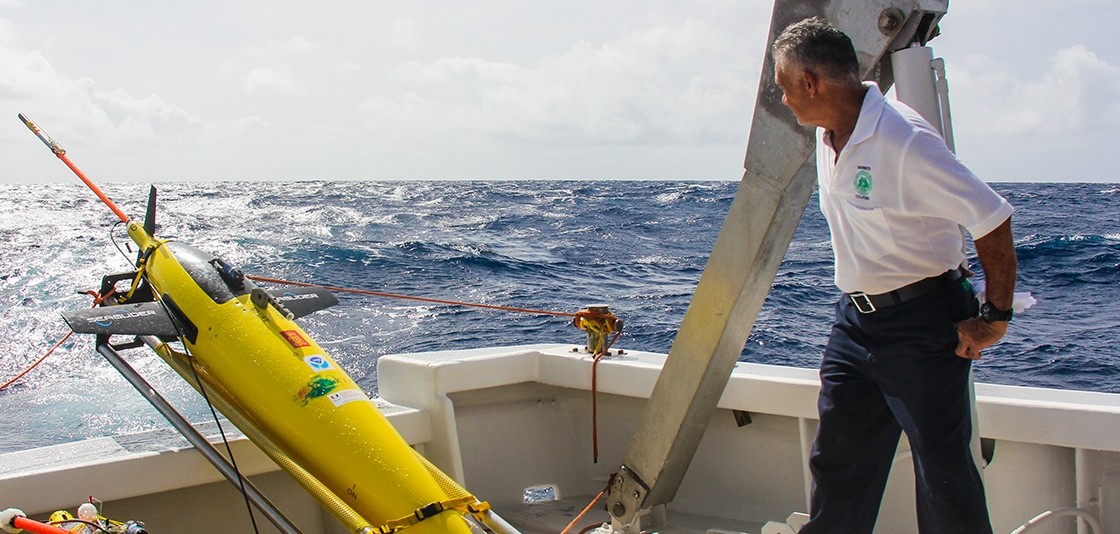
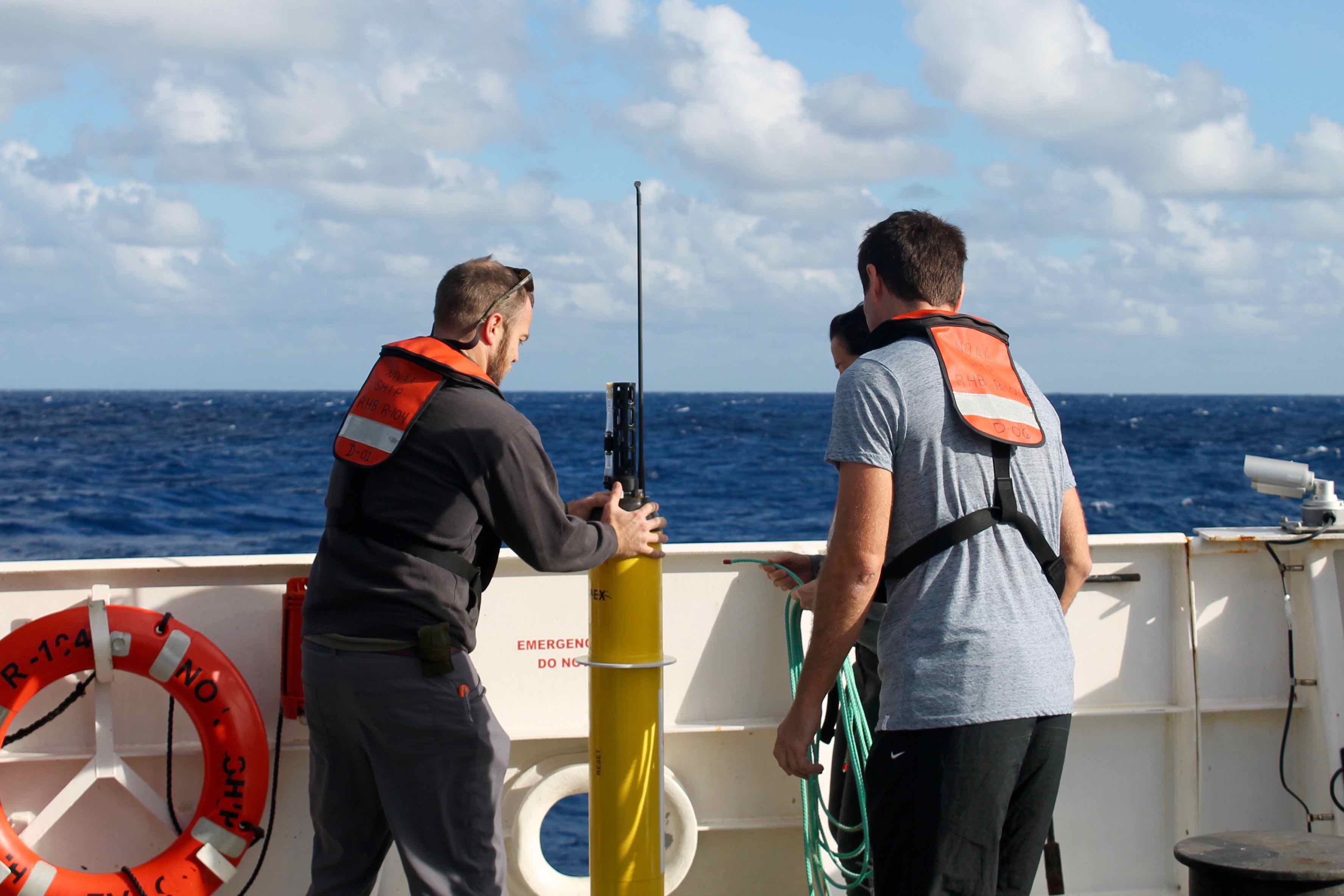
NOAA will soon launch a fleet of 15 unmanned gliders in the Caribbean Sea and tropical Atlantic Ocean this hurricane season to collect important oceanic data that could prove useful to forecasters. “If you want to improve prediction of how hurricanes gain strength or weaken as they travel over the ocean, it’s critical to take the ocean’s temperature and measure how salty it is,” said Gustavo Goni, an oceanographer at NOAA’s Atlantic Oceanographic and Meteorological Laboratory who is helping lead the glider research. “Not just at the surface, which we measure with satellites, but down into deeper layers of ocean waters.”
NOAA’s Global Drifter Program: Ocean Dynamics Data Improves Forecasting and Coastal Safety
NOAA’s Global Drifter Program is a globally collaborative research project that provides near real-time marine data for the world. It allows us to record data for weather forecasts, track decadal patterns, and pinpoint inter-annual climate variations like El Nino Southern Oscillation. Global drifters provide observational verification for weather models, calibrate satellite observations, and collect and transfer new data about the ocean temperature, currents and barometric pressure.

Argo Data Acquisition Center at AOML Surpasses One Million Profile Benchmark
Staff with the US Argo Data Acquisition Center (DAC) at AOML marked an important milestone this past February by processing the one millionth profile from Argo floats. The DAC team has been processing and quality controlling all of the raw data obtained from US-deployed Argo floats since 2001, with about 90,000 temperature-salinity profiles processed annually since 2007. These profiles have provided the global scientific community with an unprecedented record of the evolving state of the upper ocean, advancing understanding of the ocean’s role in world climate.
Indian Ocean Hydrographic Cruise Allows Scientists to Sample for the First Time Since 1995
Existing observations show that Indian Ocean surface water temperatures have been increasing since the 1970’s. But has the deep ocean warmed? Have the regional concentrations of dissolved oxygen, carbon dioxide, or nutrients changed? Has the western Indian Ocean become more acidic? These and more questions will be addressed by scientists after the completion of this cruise.
Underwater Gliders Contribute to Atlantic Hurricane Season Operational Forecasts
Scientists strategically deployed the gliders during the peak of hurricane season, from July through November 2017, collecting data in regions where hurricanes commonly travel and intensify. The gliders continually gathered temperature and salinity profile data, generating more than 4,000 profiles to enhance scientific understanding of the air-sea interaction processes that drive hurricane intensification.
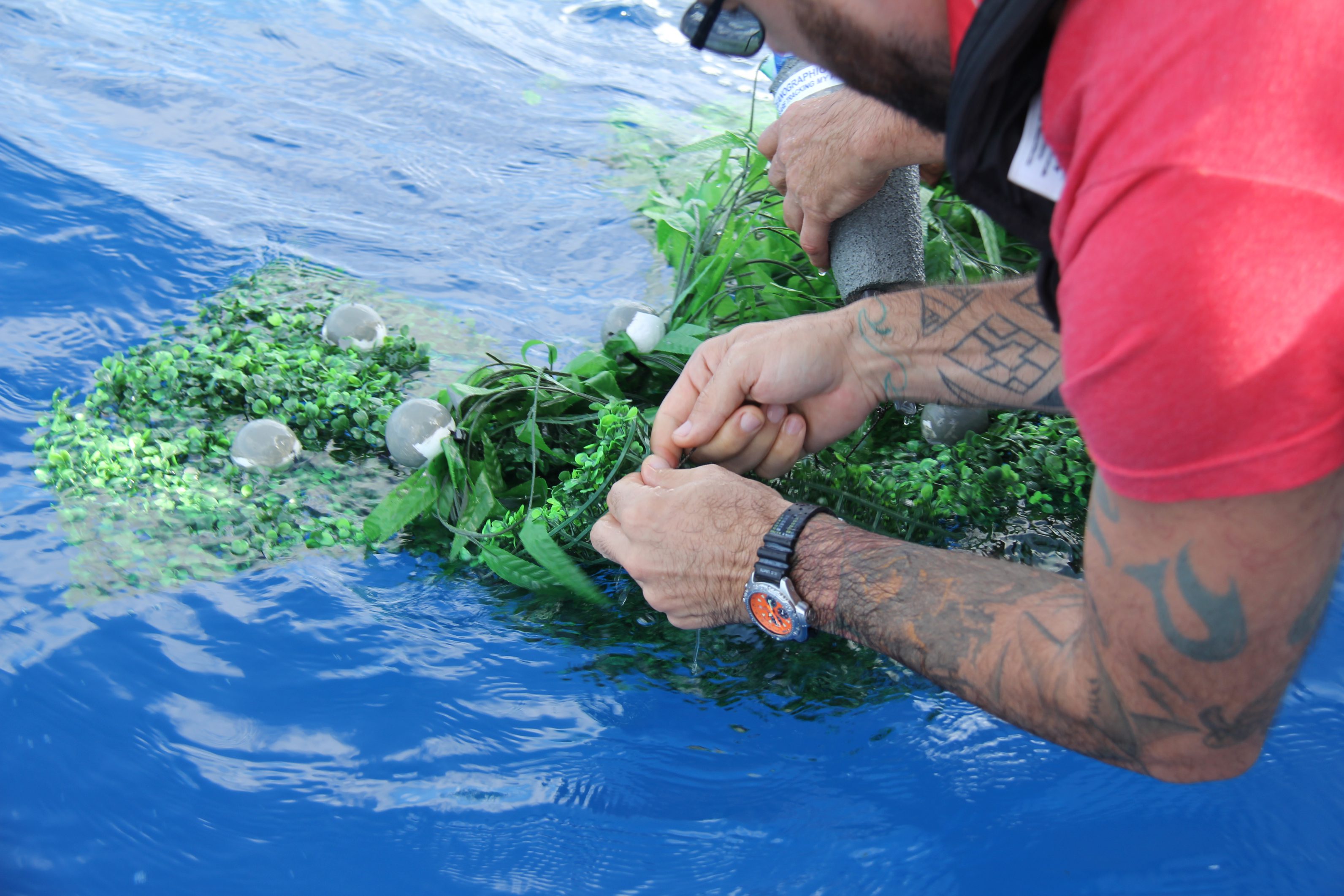
Tracking Marine Debris
Researchers at AOML, NESDIS CoastWatch, and the University of Miami are currently exploring how the distribution of marine debris is affected by both ocean currents and wind. During a recent experiment, scientists deployed several prototype drifters in the Florida Current off the coast of Miami to simulate commonly found debris of varying weights and shapes. These drifters carry GPS transmitters that provide their location four times per day.
New Data Set to Improve Tropical Atlantic Ocean and Atmospheric Research
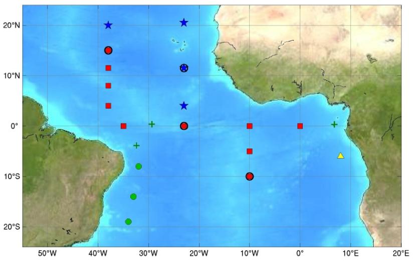
Researchers at NOAA AOML have released a new tropical Atlantic data set that includes several enhancements to improve data accuracy and data collection in the tropical Atlantic. The new data set is called enhanced PIRATA, or ePIRATA, and provides continuous records of upper-ocean temperature, salinity, and currents, together with meteorological data such as winds, humidity, and solar radiation. ePIRATA should prove valuable in better analyzing ocean and atmospheric processes in the tropical Atlantic.
PIRATA, the Prediction and Research Moored Array in the Tropical Atlantic, is a multinational observation network, established to improve knowledge and understanding of ocean-atmosphere variability in the tropical Atlantic. It is a joint project of Brazil, France and the United States of America, motivated by fundamental scientific issues and by societal needs for improved prediction of climate variability and its impact on the countries surrounding the tropical Atlantic basin. PIRATA provides measurements at 18 locations throughout the tropical Atlantic
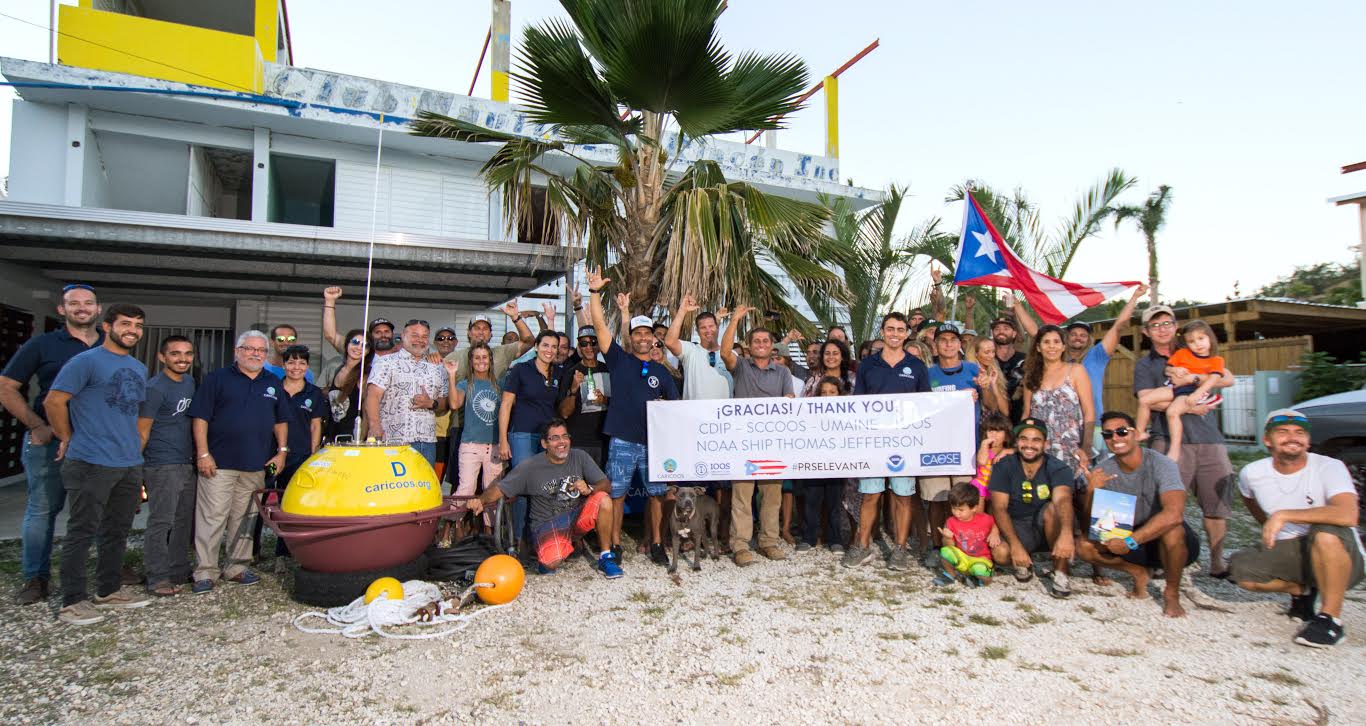
Gliding Through the Blue Frontier
Glider SG609 is one of four gliders that are part of the Hurricane Field Program at NOAA’s Atlantic Oceanographic and Meteorological Laboratory. AOML launched its glider project in 2014 with the goal of enhancing the understanding of air-sea interaction processes during tropical cyclones. Scientists and technicians from AOML and the University of Puerto Rico at Mayagues run the deployments and recoveries out of Isla Magueyes Marine Laboratories in Puerto Rico, which neighbors the colorful coastal island community of La Paguera.
Crash Site of Malaysian Airlines Flight MH370 Likely Falls Within Official Search Area
In a paper published in the Journal of Operational Oceanography, a team of scientists with the Physical Oceanography Division at AOML, the University of Santiago de Compostela in Spain, the University of Miami, the University of Hawaii, and the Commonwealth Scientific and Industrial Research Organisation (CSIRO) of Australia analyzed possible pathways to link the location of the found debris in the southwestern Indian Ocean with potential crash sites, probably in the eastern Indian Ocean.