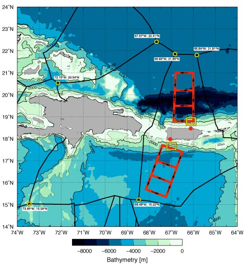
How do hurricanes form, survive, and intensify? Hurricane scientists have long believed upper ocean temperatures are the key factor. AOML’s Dr. Joe Cione reveals a new theory, after observing 62 Atlantic hurricanes of a span of 32 years, suggesting this common theory may not be all that accurate. If his theory holds, it could have the potential to significantly improve hurricane intensity forecasts for the nation.
Dr. Cione found that in addition to ocean temperature, the near-surface air temperature and moisture around the hurricane are also essential energy requirements for sustaining a hurricane. These two variables often play an even more important role than ocean temperature.
This study assessed sea surface conditions in tropical systems, by monitoring the difference between dewpoint temperature and the sea surface temperature within the hurricane environment. When the dewpoint temperature was higher than the hurricane’s inner core’s sea surface temperature, the storms internal energy would decrease and weaken the hurricane.
Contrary to long held assumptions, results from this study show hurricanes can, and occasionally do, maintain intensity even when sea surface temperatures are at or below a threshold of 26°C. In six percent of the cases Dr. Cione studied, ocean surface temperatures of 26°C or higher were not required for a hurricane to survive.
For hurricanes south of 29°N, near-surface atmospheric moisture was found to be the most important factor in maintaining a hurricane. In deep tropic storms between 10°N – 20°N, atmospheric environment in and around a storm was found to be the primary factor responsible for determining how much surface energy was drawn up out of the ocean and into the hurricane environment.
Dr. Cione’s research has potential to greatly impact intensity hurricane forecast models, which traditionally focus on ocean surface temperature. With this study showing the importance of moisture and atmospheric temperature for hurricane growth, scientists can now investigate how these factors impact hurricane intensity prediction.
Originally Published in February 2015 by Shannon Jones
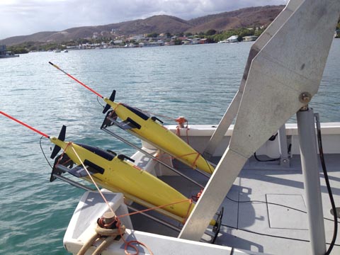 Two gliders ready for deployment from the R/V Sultana,