Coyote UAS: A new tool to help us better
|
|
Flight Patterns 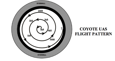   |
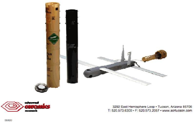
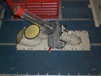
In this illustration, Raytheon's Coyote UAS is depicted. As noted in this graphic, the Coyote is deployed using NOAA's P-3 aircraft and its associated Sonobuoy (AXBT) lauch chute.
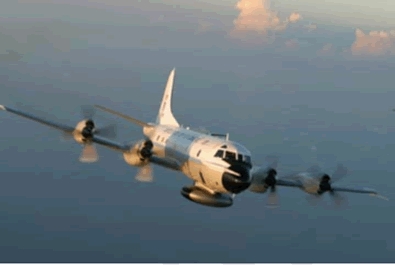
In 2015, a NOAA team led by Dr. Cione plans to deploy several new Coyote UAS during HRD's annual field program. Building on momentum from 2014's ground-breaking P-3/Coyote UAS missions into Hurricane Edouard, HRD will be deploying upgraded-for-2015 Coyotes that boast improved range and incorporate new and improved atmospheric pressure, temperature, and moisture sensors. In addition to these improvements, a new ifrared sensor capable of capturing sea surface temperatures will also be employed. As in 2014, the Coyote UAS will use on-board GPS technology to measure and report wind speed and direction. It should also be noted that during the 2015 campaign, Coyote UAS data will, for the first time, be reported to NOAA's National Hurricane Center in near real-time.
Small Unmanned Aircraft Vehicle Experiment
(SUAVE)
Part of IFEX Goal 2: Develop new measurement technologies
SUAVE objectives:
- Provide support fo NOAA Operational Centers (NHC/EMC)
- Provide near real-time TC boundary layer wind observations (NHC)
- Significantly enhance wind and thermodynamic coverate
(especially atmospheric moisture) within the TC boundary layer (EMC)
- Improve understanding
- Investigate TC Ocean/ATm T/q/M exchanges
- Investigate eye/eyewall T/q/M exchanges
- Post-storm operational coupled model evaluation (atm and SST)

