Skip to Content

Blog Archives

NOAA’s Global Drifter Program: Ocean Dynamics Data Improves Forecasting and Coastal Safety

NOAA’s Global Drifter Program is a globally collaborative research project that provides near real-time marine data for the world. It allows us to record data for weather forecasts, track decadal patterns, and pinpoint inter-annual climate variations like El Nino Southern Oscillation. Global drifters provide observational verification for weather models, calibrate satellite observations, and collect and transfer new data about the ocean temperature, currents and barometric pressure.

0 Continue Reading →

Crash Site of Malaysian Airlines Flight MH370 Likely Falls Within Official Search Area

In a paper published in the Journal of Operational Oceanography, a team of scientists with the Physical Oceanography Division at AOML, the University of Santiago de Compostela in Spain, the University of Miami, the University of Hawaii, and the Commonwealth Scientific and Industrial Research Organisation (CSIRO) of Australia analyzed possible pathways to link the location of the found debris in the southwestern Indian Ocean with potential crash sites, probably in the eastern Indian Ocean.

0 Continue Reading →

Drifter Program Catches a Lift to the Southern Ocean with the Volvo Ocean Race

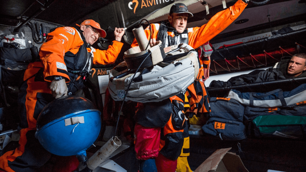
If you’ve ever sailed aboard a ship in the coastal ocean, or checked a weather report before going to the beach, then you are one of many millions of people who benefit from ocean observations. NOAA collects ocean observations and weather data to provide mariners with accurate forecasts of seas, as well as coastal forecasts and even regional climate predictions. It takes a lot of effort to maintain observations in all of the ocean basins to support these forecasts, and NOAA certainly can’t do it alone. Partnerships are essential to maintaining a network of free-floating buoys, known as drifters, and NOAA’s latest partner is not your typical research or ocean transportation vessel: the six sailboats and crew currently racing around the world in the Volvo Ocean Race.

As one of the world’s major global sailing races, the Volvo Ocean Race greatly depends on accurate predictions of ocean currents and marine weather. All six of the Volvo Ocean Race teams will each deploy a drifter, a free-floating sensor that measures surface pressure and ocean currents and transmits the information by satellite to NOAA, during the fifth leg of the race, in the Southern Ocean – a region oceanographers don’t get to visit regularly, but one that is important to observe.

  • Sailors from Team Alvimedica deploy a drifter in the Southern Ocean.

    Image credit: Amory Ross/Volvo Ocean Race

  • Deployment site for drifters on Volvo Ocean Race 2014-2015 Route Map. Image Credit: Volvo Ocean Race and NOAA/AOML

Update from the Southern Ocean:

On March 20th, despite less than ideal conditions, sailors aboard the six sailing vessels successfully deployed drifters at target locations in the Southern Ocean.

Will Oxley, Team Alvimedica’s navigator, was excited to participate in the drifter deployment. Aside from being a top offshore sailor, Oxley is a marine biologist who recognizes the importance of data collection in the Southern Ocean.

“It’s believed the Southern Ocean absorbs up to about 60 percent of the heat and carbon dioxide produced by humans,” he explains. “So the Southern Ocean is a very important ‘sink’ that is absorbing carbon dioxide and slowing the pace of global warming.”

NOAA scientists will soon be receiving critical real-time data from some of the most remote waters on the planet. Access the drifter data online by clicking on the thumbnail.

Originally Published March 2015 by Shannon Jones

0 Continue Reading →

NOAA’s Array of Drifting Ocean Buoys

Global Drifter Program

Drifting buoys are a primary tool used by the oceanographic community to measure ocean surface circulation at unprecedented resolution. A drifter is composed of a surface float, which includes a transmitter to relay data via satellite, and a thermometer that reads temperature a few centimeters below the air-sea interface. The surface float is tethered to a holey sock drogue (a.k.a. “sea anchor”), centered at 15 m depth. The drifter follows the ocean surface current flow integrated over the drogue depth.


A drifting buoy being deployed from the Bark Europa off South Africa (credit: NOAA/AOML)

A drifting buoy being deployed from the Bark Europa off South Africa (credit: NOAA/AOML).


/pix/Keynotes/drifter_group.jpg
Schematic of a drifting buoy.(credit: NOAA/AOML)


There are currently over a thousand drifters circulating in the world ocean measuring sea surface temperature and other data as ocean currents carry them along. These currents carry heat from place to place around the ocean basins, which affects regional climates. Drifter velocities are derived from finite differences of their position fixes. These velocities and their concurrent sea surface temperature measurements are archived at AOML’s Drifting Buoy Data Assembly Center where the data are quality controlled and interpolated to quarter-day intervals. While satellite technology makes it possible to obtain sea surface temperature measurements from space, drifters are needed to ensure the measurements are accurate. Without drifter observations to correct satellite measurements, dust and other aerosols in the atmosphere can cause errors.


Approximately half of the drifters also measure air pressure, and send the data to weather centers for improved marine forecasts.  A smaller number of drifters have been deployed to measure other properties such as surface salinity and heat content in the upper 150m of the ocean.  Drifters have been air deployed in the paths of hurricanes and typhoons to measure how the ocean and atmosphere interact during storm passage and to improve intensity forecasting.


Although NOAA’s Global Drifter Program deploys, monitors, and collects data from drifting buoys globally, the program is managed by researchers at AOML and the Scripps Institution of Oceanography. “The goal of NOAA’s Global Drifter Program is to maintain a global array of satellite-tracked drifters and to provide valuable climate and weather data to the forecasting and research community,” said Dr. Rick Lumpkin, Global Drifter Program Principal Investigator at AOML. “These drifters also provide an excellent oppor­tunity for children to learn more about the ocean as they track currents and eddies.”

Students deploy an adopted drifter for Earth Day 2013
Students deploy an adopted drifter for Earth Day 2013. (credit: NOAA/AOML) 


Each drifter is part of a global ocean array that can be followed online. AOML’s component of the Global Drifter Program consists of the Drifter Operations Center (DOC) and the Drifter Data Assembly Center (DAC). The DOC manages global drifter deployments, using volunteer ships of the Ship Of Opportunity Program, research ships and aircraft. The DAC verifies that the drifters are operational, distributes the data to meteorological services, assembles, quality controls and makes the data available on the web, and offers drifter-derived products.

 Map of drifter trajectories in the North AtlanticMap of drifter trajectories in the North Atlantic. (credit: NOAA/AOML)


Using more than 30 years of observations obtained from satellite-tracked surface drifting buoys, NOAA scientists derived a global climatology of seasonally varying ocean surface currents at one-half degree resolution. This data set can be used to better understand how the ocean transports properties such as heat, salt, and passive tracers, and as a reference for studying changes in ocean currents over time.

Congratulations to Rick Lumpkin & Mayra Pazos, awarded as OAR Employees of the Year!

Rick Lumpkin and Mayra Pazos of PhOD won the 2013 OAR Employee of the Year Award.  The award was given to recognize the Global Drifter Program’s federal employees, Rick Lumpkin and Mayra Pazos, for their efforts to improve the quality of the drifter data by developing a new methodology to evaluate when drifters have lost their drogues.  This reevaluation required manual examination of time series from over 14,000 drifters, to determine cases in which the drogue lost time was misdiagnosed, and to reassess those times.  The reevaluation was initiated in April 2012 and concluded in April 2013, and publicly-available metadata files containing drogue off dates were revised 16 times during that period to distribute the most recent results. Published results by Lumpkin et al. (2013) indicate that the revised data set is significantly improved, with spurious low-frequency current variations in places like the Southern Ocean now no longer present.  Research papers published by Rick Lumpkin while addressing the problem have been cited in more than 28 peer-reviewed publications so far.


The Drifter team at AOML

The drifter team at AOML (credit: NOAA/AOML) 
 

2014 Hurricane Season Global Drifter Updates

Hurricane Ana approaches Hawaii'i and crosses over NOAA's array of drifting Ocean Buoys

Hurricane Ana approaches Hawai’i while passing over NOAA’s array of Ocean Buoys. (credit: NOAA/AOML)


On Friday, October 17, as Tropical Storm Ana strengthened and moved towards the Hawaiian Islands, Air Force Hurricane Hunters deployed 10 drifting buoys in her path. Ana was forecasted to become a hurricane as it passed over the drifter array on her way to the main Hawaiian Islands.


Data from 9 of the drifters was successfully retrieved, providing wind speed and direction, barometric pressure, ocean temperatures to 150m depth, and ocean currents in the mixed layer.  The data from these drifters will reveal the strength of the storm, the structure of its oceanic wake, and will help improve hurricane intensity forecasting models with an active ocean component. NOAA’s Global Drifter Program coordinated these deployments.

Originally Published August 2014 by Shannon Jones

0 Continue Reading →