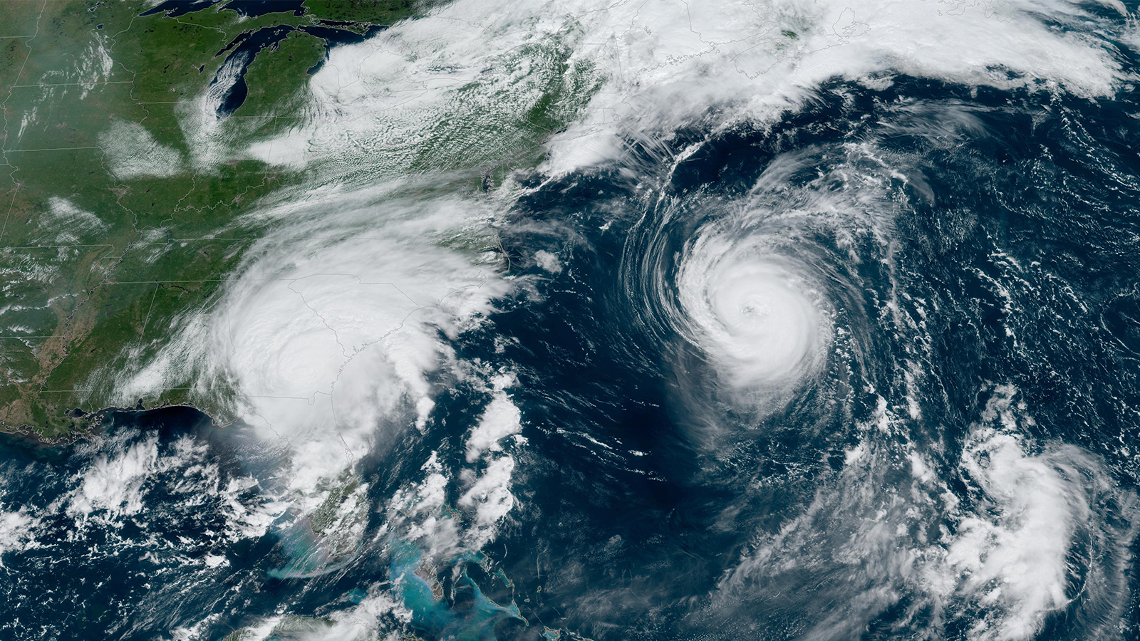

As Hurricanes Franklin and Idalia strengthened in late August, NOAA scientists collected critical data from the air, sea surface, and underwater to enhance forecasts and increase scientific knowledge.
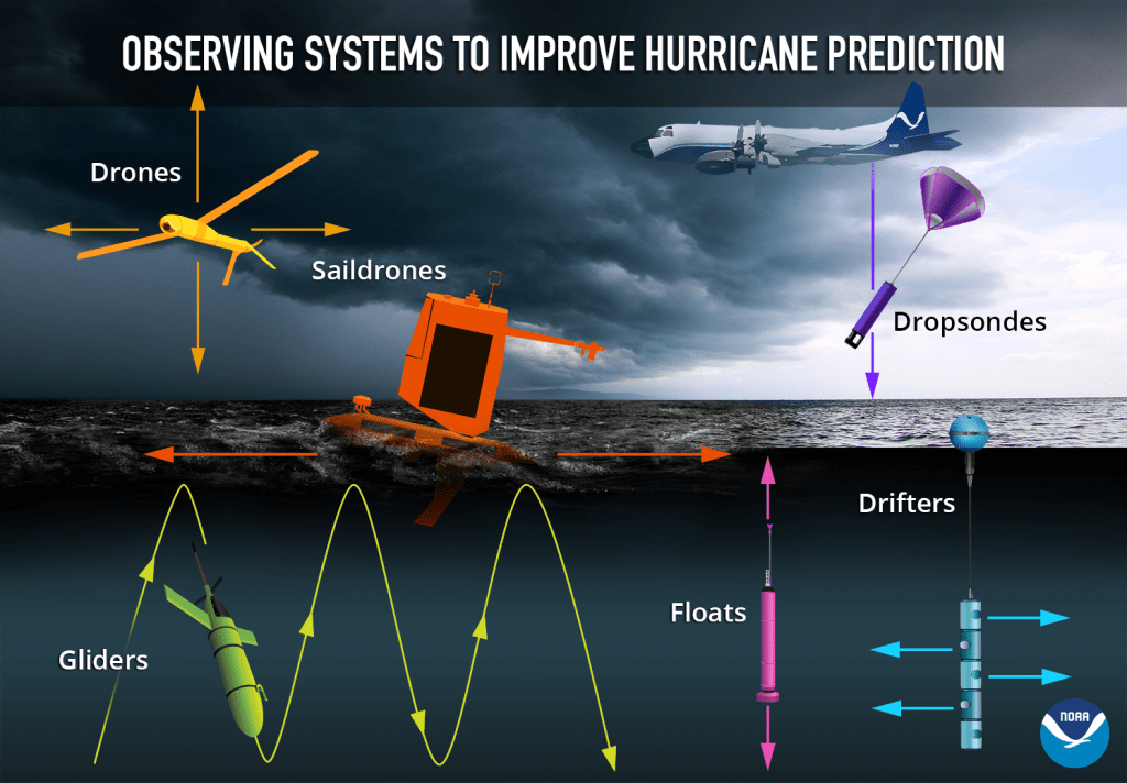
In less than two weeks, a fleet of strategically placed oceanographic instruments gathered temperature, salinity, and surface wind speed data, while NOAA’s Hurricane Hunter aircraft repeatedly flew into the storms to collect atmospheric data. Each element of this coordinated effort is an integral piece of the atmospheric puzzle that helps NOAA National Weather Service forecasters issue vital warnings and NOAA researchers better understand the storms, all with the goal of protecting lives and property.
Air
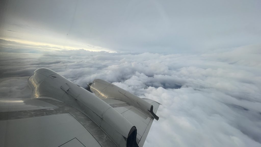
NOAA conducted 17 operational and research missions into Hurricanes Franklin and Idalia from August 21 to August 31, 2023. The NOAA P-3 conducted operational missions to observe the location and intensity of both systems, and Tail Doppler Radar missions to gather data to improve hurricane model initial conditions and forecasts. The NOAA G-IV conducted one Tail Doppler Radar mission and numerous Synoptic Surveillance missions with the goal of improving forecasts. The aircraft captured the organization and development of both storms before and during the periods they underwent rapid intensification (when hurricane winds strengthen by 35 mph or more in 24 hours or less).
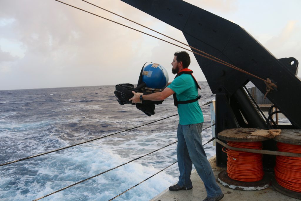
The crew aboard the P-3 aircraft deployed dropwindsondes that measure air pressure, temperature, humidity, and wind, as well as Airborne Expendable BathyThermographs (AXBTs), that measure ocean surface and subsurface temperature near the hurricanes. Through careful coordination, these instruments landed very close to a saildrone, an uncrewed surface vehicle.
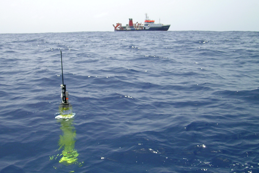
Sea Surface
For the third year, NOAA and Saildrone, Inc. deployed saildrones, uncrewed surface ocean observation platforms powered by solar, wind, and wave energy, to track Atlantic hurricanes. These robots provide key information about the ocean and atmosphere, including sea surface temperature, salinity, surface air temperature, humidity, pressure, wind direction and speed, and wave height. Saildrones are deployed in the beginning of hurricane season in areas where tropical cyclones usually travel with the goal of collecting observations as a storm passes by.
Three saildrones were impacted by Franklin, including one that spent 12 hours and 40 minutes within tropical storm conditions. It measured a maximum sustained wind speed of 54.31 knots, confirming the NOAA National Hurricane Center’s maximum intensity at that time. A NOAA P-3 aircraft was in coordination with the saildrones and deployed dropsondes nearby.
Four saildrones gathered data before, during, and after Idalia in both the Gulf of Mexico and the Atlantic. On August 29, Saildrone 1083 passed right through the north side of the eye wall, into the eye of Idalia, then through the southern eye wall, all while multiple dropsondes were deployed over the saildrone from the P-3 aircraft. This particular uncrewed surface vehicle withstood sustained tropical storm force winds for more than nine hours and experienced 9.6 meter (31 feet) high waves.
Underwater
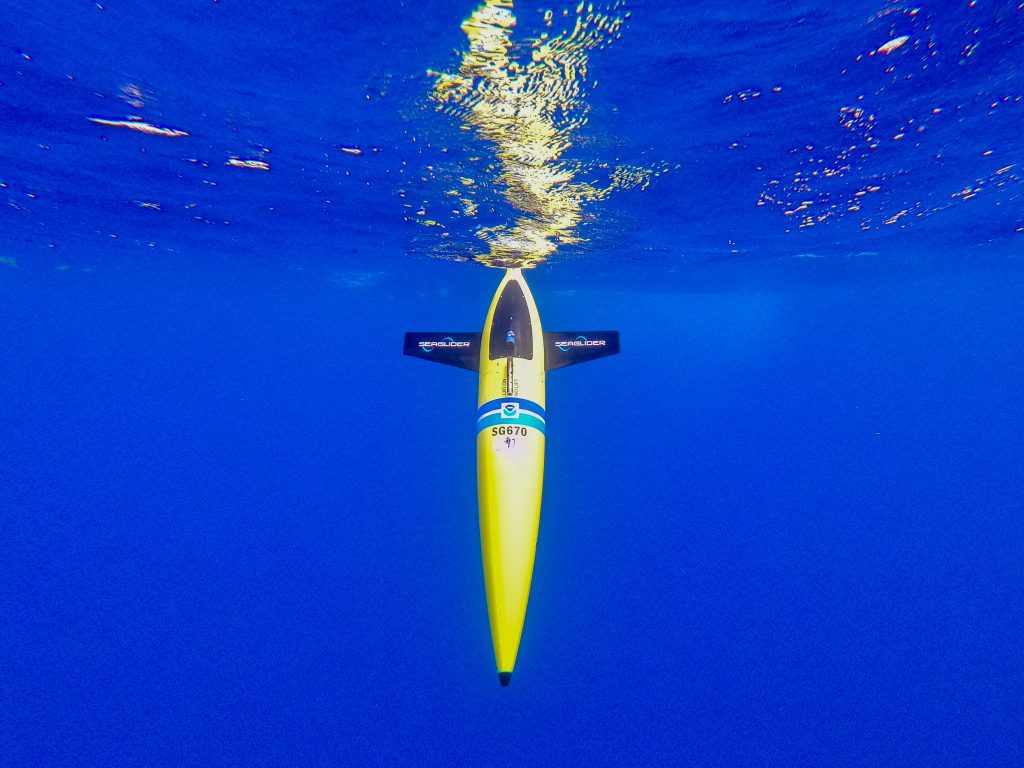
While the planes, dropsondes, radars, and drones were measuring the air and sea surface, gliders, floats, and drifters were monitoring the ocean, which plays a major role in hurricane intensity. NOAA’s new Extreme Events Program is coordinating research using a variety of ocean observing technologies with the goal of investigating how hurricanes respond to changes in ocean conditions and how ocean observations can improve hurricane forecast models.
For the tenth consecutive year, underwater hurricane gliders are conducting observations in the tropical Atlantic basin during hurricane season, operated by IOOS Regional Associations, US Navy, NOAA’s Atlantic Oceanographic and Meteorological Laboratory, academic institutions, and other partners. Underwater gliders are autonomous platforms that profile water properties in nearshore and open ocean environments, providing temperature and salinity observations to depths of 1000 meters, slightly more than a half mile, in areas where hurricanes are known to either intensify or weaken. One of these gliders, operated by IOOS and the University of South Florida, passed under the track of Hurricane Idalia and conducted collocated and simultaneous observations with one saildrone.
Data was also collected by Argo floats and drifters, two ocean observing instruments NOAA has used year-round for decades. Argo floats are autonomous profiling instruments deployed across the global ocean. In the Atlantic Ocean basin they provide temperature, salinity, and pressure profiles as they drift with the currents and move vertically through the water column. Several floats were in the area as Franklin and Idalia passed by, including one biogeochemical Argo float that collected a profile in the path of Idalia on August 29 in the Gulf of Mexico. In addition to collecting temperature and salinity data, these specialized floats also collect oxygen, nitrate, pH, chlorophyll-a, irradiance, and particles, unlocking new information on natural, biogeochemical processes in the wake of a major storm.
Drifters are satellite-tracked surface drifting buoys that provide in-situ observations of mixed layer currents, temperature, atmospheric pressure, winds, waves, and salinity. An array of drifters is distributed across the Atlantic basin, and several were impacted by Franklin and Idalia. One Scripps wave drifter (part of the Global Drifter Program) was overrun by Category 1 Idalia on the morning of August 29 as the storm moved north past Cuba, towards Florida. It measured barometric pressure dropping to a low of 986.3 hPa, and significant wave heights peaking at 7.36m (25 feet).
The research performed by NOAA scientists and partners during missions into Hurricanes Franklin and Idalia exemplifies the commitment of our scientists to advance our knowledge of tropical cyclone development, enhance forecasting, and gain greater insight into the environmental conditions at play from the atmosphere to the deep ocean.
NOAA scientists continue with their pursuit of multi-faceted research into tropical cyclone development and forecasting. Analysis of data collected during Hurricanes Idalia and Franklin are ongoing. Saildrones and gliders are being repositioned and hurricane researchers are boarding aircraft to investigate Hurricane Lee as it develops into a major hurricane.
Related resources:
NOAA Research Improves Hurricane Forecasts
NOAA’s Saildrone Observations of Atlantic Hurricanes for Improved Intensity Forecasts – 2023 Mission
NOAA NESDIS CoastWatch-AOML/ PhOD Ocean Observations Viewer (near-real time location of ocean observations and satellite products)
Media contact: Laura.Chaibongsai@noaa.gov