The Oleander Project

Statistics of XBT deployments and data submitted to the Global Telecommunication System (GTS)


XBT probes are launched from the MV Oleander and data are logged to a computer where they are processed and formatted for transmission in real-time or near real-time to NOAA/AOML. The data then undergo automatic and visual quality control (QC) procedures. Data that pass QC are transmitted to the GTS and are then used by national and international organizations, universities and government laboratories for weather and climate forecasting and for climate research.

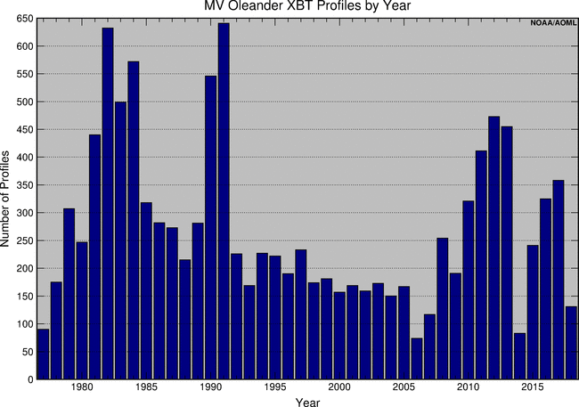
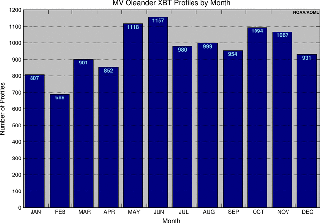
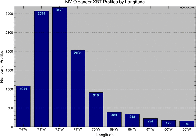
The bar graphs below show the number of XBT observations collected from MV Oleander since 1977, most of which has been distributed through the GTS. They are grouped by year, month and longitude.

Number of XBT profiles collected from MV Oleander, grouped by Year

Annual

Total number of XBT profiles collected from MV Oleander since 1977 between New Jersey and Bermuda. At different periods of time, XBTs, XBT equipment, computers and transmission on board the MV Oleander have been provided by NOAA/AOML.

Number of XBT profiles collected from MV Oleander, grouped by Month

Monthly

Total number of XBT profiles collected from MV Oleander since 1977 between New Jersey and Bermuda. At different periods of time, XBTs, XBT equipment, computers and transmission on board the MV Oleander have been provided by NOAA/AOML.

Number of XBT profiles collected from MV Oleander, grouped by Longitude intervals

Zonal

Total number of XBT collected from MV Oleander since 1977 between New Jersey and Bermuda at longitude intervals of ±0.5°W of the indicated Latitude values. Note the high-density mode between 70°W and 74°W, a region of high scientific interest. At different periods of time, XBTs, XBT equipment, computers and transmission on board the MV Oleander have been provided by NOAA/AOML.