Missions 18, 19, 20, and 21: Successfully Completed
| Glider ID | Status | Region | Deployment | # of profiles | Last Comm. (UTC) |
|---|---|---|---|---|---|
| SG630 | Recovered | Caribbean Sea | 07/16/2018 |  |  |
| SG635 | Recovered | Caribbean Sea | 07/16/2018 |  |  |
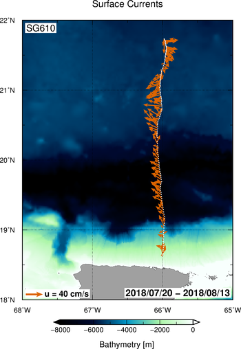
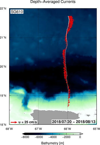
| SG610 | Recovered | North Atlantic | 07/19/2018 |  |  |
| SG649 | Recovered | North Atlantic | 07/31/2018 |  |  |
|
|
AOML also operates four additional gliders in partnership with the US Navy. Data from these gliders can be found in the IOOS website |