Florida Current volume transport from satellite altimetry
Daily monitoring of the Florida Current volume transport with a submarine cable has been maintained nearly continuously since 1982. Because of the extremely high value of these measurements for Earth system studies, efforts are underway to find a suitable backup observing system for the inevitable future when the cable fails. Due to the Earth’s rotation, the direction of major oceanic currents is parallel to the lines of constant sea level, which for the Florida Current translates into sea level near the Bahamas being about 1-meter higher than sea level along Florida east coast. Variations in the Florida Current volume transport are, therefore, linked to changes in the sea surface tilt across the Straits of Florida. Satellite altimetry is a component of the Global Ocean Observing System that has provided periodic sea level measurements across the Straits of Florida along predetermined ground tracks for nearly three decades. Accounting for the platform-specific limitations, satellite altimetry can serve as a limited but useful alternative to cable measurements, with the advantage of not being prone to damage from severe weather, which can often endanger the existing cable-based system. The altimetry-based estimates of the Florida Current volume transport are obtained from the linear regression of the cable transport estimates on the crossflow sea level differences along the descending track 178 of Topex/Poseidon and Jason series satellites. The accuracy of the altimetry-based transport estimates is 2.1 Sv, which is based on the comparisons with the cable as well as with dropsonde and LADCP section-based estimates (for details see Volkov et al., 2020).
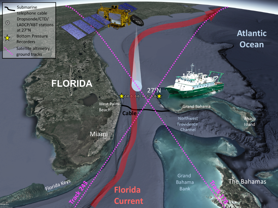
Components of the Florida Current observing system. The daily Florida Current volume transport has been measured with a submarine telephone cable between Florida and Grand Bahama Island since 1982. These measurements are calibrated/validated with regular direct dropsonde and LADCP measurements at 9 stations along the 27N transect during calibration/validation cruises. The full-depth temperature and salinity profiles are also obtained with CTD and XBT casts. Altimetry satellites, from Topex/Poseidon to Jason series, have measured sea surface height along the descending track 178 and the ascending track 243 across the Florida Current since the end of 1992.
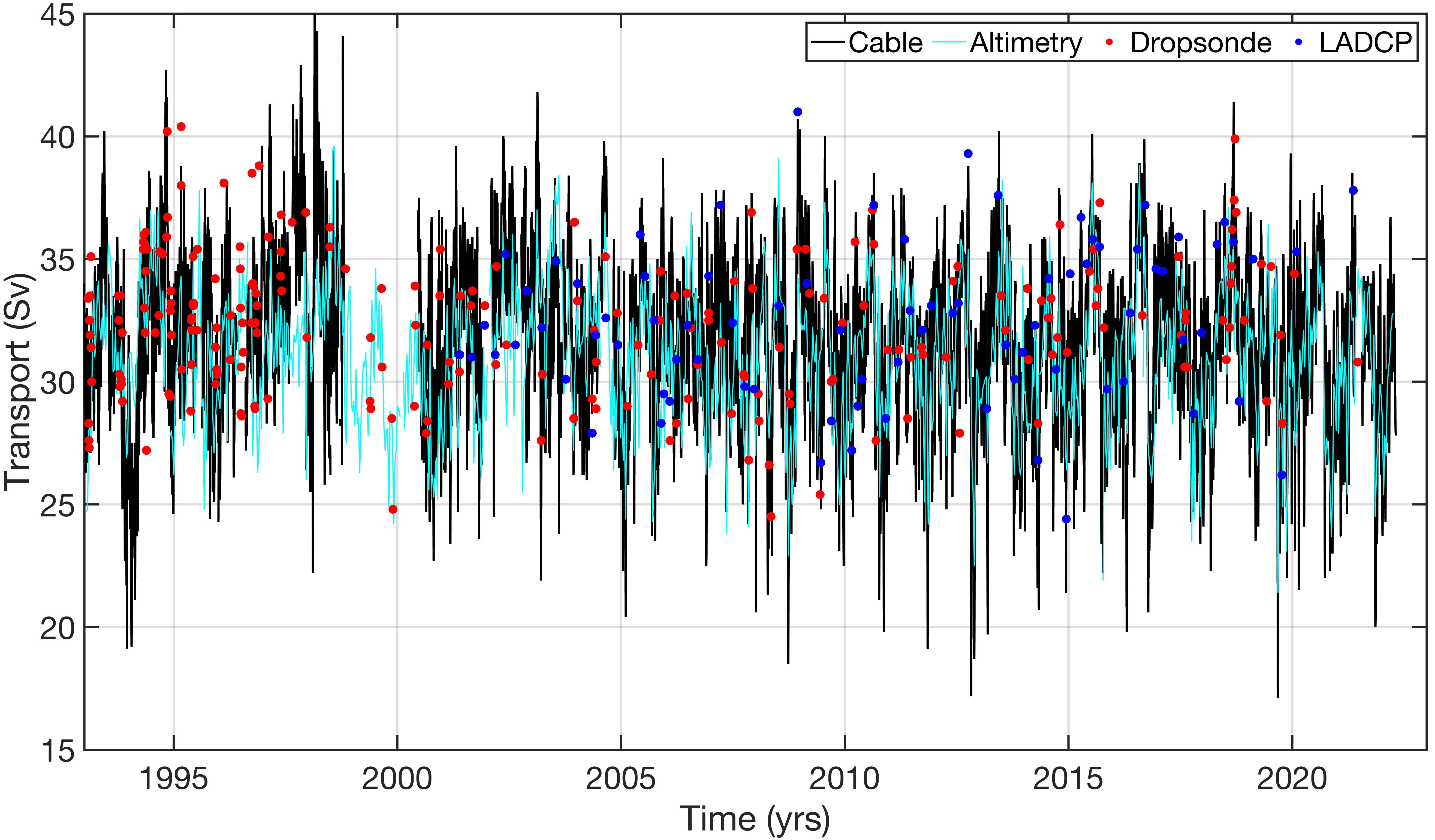
The Florida Current volume transport: (black) cable transport estimates, subsampled at 10-day intervals at the times of satellite overpasses, (cyan) altimetry-derived transport estimates, (red dots) transports measured with dropsonde floats, and (blue dots) transports measured with LADCP. The 10-day altimetry-derived estimates of the Florida Current volume transport from 1993 until the present can be downloaded from here.