Skip to Content

Blog Archives

Indian Ocean Hydrographic Cruise Allows Scientists to Sample for the First Time Since 1995

Existing observations show that Indian Ocean surface water temperatures have been increasing since the 1970’s. But has the deep ocean warmed? Have the regional concentrations of dissolved oxygen, carbon dioxide, or nutrients changed? Has the western Indian Ocean become more acidic? These and more questions will be addressed by scientists after the completion of this cruise.

0 Continue Reading →

Collaborative NOAA Research Cruise Studies Role of Ocean Currents in Larval Fish Distribution in Gulf of Mexico and Caribbean

A team of NOAA oceanographers sets sail from Miami aboard the NOAA Ship Nancy Foster on May 7th to investigate ocean currents and fish larvae distribution in the southern Gulf of Mexico and western Caribbean. The joint cruise between NOAA’s Atlantic Oceanographic and Meteorological Laboratory (AOML) and Southeast Fisheries Science Center (SEFSC) is a new chapter in a long-term effort that pools cross-line office resources to better understand the early life history and larval recruitment pathways of important fisheries in the region, including the ecologically important and commercially valuable Atlantic bluefin tuna.

0 Continue Reading →

AOML Oceanographers Collect Coast to Coast Measurements on the GO-SHIP Indian Ocean Cruise

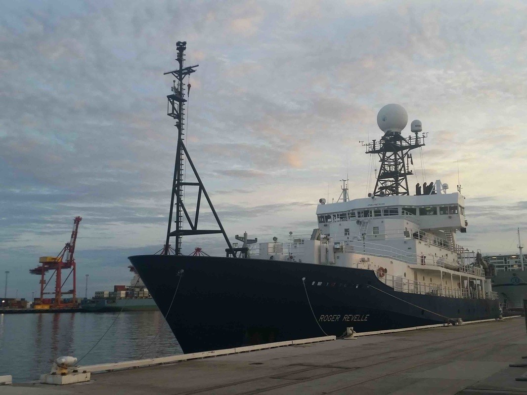
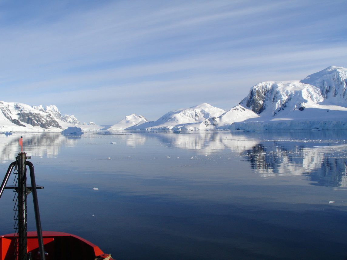
During the months of March and April, AOML joined an international team of oceanographers to actively sample the Indian Ocean in support of the Global Ocean Ship-Based Hydrographic Investigation Program (GO-SHIP), an initiative to measure and investigate the ocean basins from coast to coast and from top to bottom. Aboard the R/V Roger Revelle, the team transected the Indian Ocean from the Antarctic northward into the Bay of Bengal, collecting seawater samples at 113 stations as part of a multi-decadal effort to measure various ocean properties, including temperature, salinity, nutrients, carbon and other gases.

0 Continue Reading →

NOAA and Cuba Open Doors to Marine Science Cooperation

When Barack Obama becomes the first president to visit Cuba since Calvin Coolidge, his visit will highlight not only a new course in international relations, but showcase on-going scientific opportunities with the country only 90 miles off the Florida coast.

0 Continue Reading →

AOML Joins Ocean Acidification Program Research Cruise Along U.S. East Coast

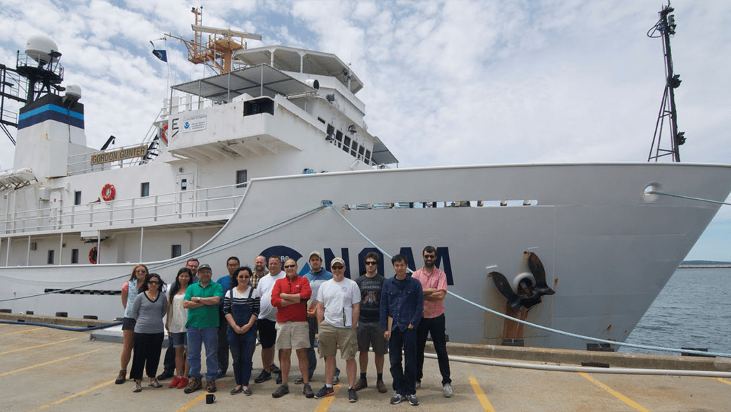
A team of researchers, including scientists from AOML and the University of Miami, set sail June 19th on a research cruise aboard the NOAA ship Gordon Gunter to provide increased understanding of ocean acidification and its drivers along the U.S. East coast. The cruise, which is part of a larger effort supported by NOAA’s Ocean Acidification Program, investigated near-shore and deep waters, and provided researchers with more detailed information about changing ocean chemistry in different environments.

Ocean acidification is a fundamental change in ocean chemistry involving a progressive decline in pH over decades caused primarily by the absorption of increasing carbon dioxide emissions. Additionally, freshwater and nutrient run off from the coasts can alter seawater chemistry. The rise in dissolved CO2 and concurrent drop in pH (lower pH indicates higher acidity), changes ocean chemistry in a way that robs marine organisms, such as mollusks and corals, of the carbonate ions they need to build shells and skeletons. At the same time, the increasing acidity can erode the structures they’ve already built, and appears capable of disrupting their bodies in other ways that make it hard for them to thrive.

The Gunter traveled north from Newport, RI to survey the waters of the Nova Scotia Shelf and then steamed south, surveying waters close to shore to provide detailed information about water chemistry within the Gulf of Maine, Long Island Sound, the Mid-Atlantic and Southern Bight regions. The ship also investigated central Florida waters before reaching Miami on July 24. Similar Ocean Acidification Program cruises have taken place on the U.S. West Coast and the Gulf of Mexico. Understanding why and how fast ocean chemistry is changing along our coasts will allow scientists to better predict future changes, explore ways to adapt to those shifts, and provide insight into where marine organisms may be at greatest risk along U.S. coasts.

AOML researchers measured inorganic carbon dioxide, partial pressure of carbon dioxide, and collect nutrient samples to be analyzed later at AOML. By collecting and analyzing samples in near-shore and deeper waters, scientists will better understand what drives the process of ocean acidification in different regions of the East Coast. The East Coast has a broad shallow shelf, which could be a significant source of potentially corrosive, freshwater discharge from rivers into the coastal ocean. Sampling along the coast will allow scientists to understand how fresher waters, coastal influences, and phytoplankton may alter our ocean chemistry. This environmental information about ocean acidification is essential to predicting its effects on important marine resources, so that communities can mitigate and adapt to these changes.

0 Continue Reading →

Scientists Find Southern Ocean Removing CO2 from the Atmosphere More Efficiently

A research vessel ploughs through the waves, braving the strong westerly winds of the Roaring Forties in the Southern Ocean in order to measure levels of dissolved carbon dioxide in the surface of the ocean. (Nicolas Metzl, LOCEAN/IPSL Laboratory).

0 Continue Reading →

AOML Partners with NOAA Fisheries to Study Larval Fish in the Caribbean

AOML is partnering with NOAA’s Southeast Fisheries Science Center (SEFSC) to conduct an interdisciplinary research cruise aboard the NOAA Ship Nancy Foster from April 11, 2015 through June 3, 2015. The cruise will begin in the U.S. Virgin Islands and extend westward across the northern Caribbean conducting various biological and physical oceanographic surveys.

Leg 1: U.S. Virgin Islands

During the first leg of the cruise, NOAA oceanographers surveyed reef fish populations and ocean currents in the U.S. Virgin Islands. In particular, research focused on the Virgin Islands coastal shelf ecosystem where data collected will provide insight into the processes that drive spawning aggregations of economically important reef fish species in the region. Results from the expedition should also enhance scientists’ understanding of the differences in larval reef fish distributions between managed and non-managed areas of the coastal shelf. Armed with the data and accompanying knowledge of where “hot spots” of species richness and diversity are likely to occur in the seascape, the scientists are in a unique position to inform resource managers about the effectiveness of various approaches to managing living resources in the coastal shelf.

The reef fish larvae surveys involve casting a large net behind the vessel for 10-minute intervals. Scientists use a special kind of net known as a MOCNESS, which is a much-improved, high-tech version of the average sampling net. The letters in MOCNESS refer to the specific improvements: it’s a Multiple Opening and Closing Net, with an Environmental Sensing System. As MOCNESS tows behind the ship, each net can be opened and shut independently so that it samples a discrete patch of water. By using the environmental sensing system, the researcher can pinpoint exactly when and where to deploy the net. The sensing system is made up of an array of sensors mounted on the instrument frame that relays water conditions up to the ship in real time. The data also help researchers match what they find in their sample to the physical properties of the seawater.

After retrieving the nets, the contents are brought to the on board lab where scientists sample and document the species of fish. Scientists classified about 25,000 fish during each survey. This survey will build upon previous surveys conducted between 2007 and 2014, the resulting data of which is still being analyzed and studied. That data helps create a baseline for researchers to compare with new results. The long-term sustainability of fisheries in these banks will depend on the understanding of the transport, spawning aggregations and overall larval recruitment in these waters.

Aside from conducting surveys, NOAA oceanographers also participated in outreach opportunities with the local community. Students from Charlotte Amalie High School on St. Thomas toured the Nancy Foster and learned about the importance of larval reef fish. They even had a chance to examine larval specimens under a stereo-microscope and got a lesson in fish identification and classification.

Leg 2: Northern Caribbean

The second leg of the cruise began April 27th from Montego Bay, Jamaica and will take the team westward across the northern Caribbean, concluding in Cozumel, Mexico on May 5th. The biological focus of the research will shift from larval reef fish to the larvae of the pelagic Atlantic Bluefin Tuna. Oceanographers will continue to use the MOCNESS to collect their samples. Measurements and samples collected will provide species abundance and distribution data, and will help to improve tuna stock assessments for the western Caribbean Sea and Gulf of Mexico. The results will also be used to further develop a regional larval habitat model for Atlantic Bluefin Tuna.

Leg 3: Mexico/Mesoamerican Barrier Reef System

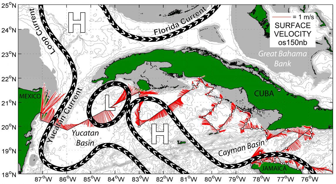
The third leg of the cruise began May 9th from Cozumel, Mexico. Oceanographers sampled along the Mesoamerican Barrier Reef System, the 2nd largest reef in the world, in an effort to learn more about the ecology and oceanography of this extremely diverse region. In this part of the Mesoamerican Barrier Reef, the rapidly moving Yucatan Current comes very close to shore, transporting fish larvae and other creatures. During this leg of the cruise, the focus on larval tuna continues but researchers will also sample larval lobster in an effort to measure species abundance and distribution data in the Mexican Caribbean.

In addition to NOAA participants, scientific collaborators from the University of Miami, the University of South Florida, the University of the Virgin Islands, the University of Oregon, the University of Puerto Rico, the University of the West Indies (Jamaica), the Department of Natural Resources (St. Thomas), the Colegio de la Frontera Sur (Mexico), the Instituto Nacional de Pesca (Mexico), and the Instituto Espanol de Oceanografia (Spain) will participate aboard the Nancy Foster as part of this interdisciplinary, multi-institutional, and international research cruise.

Originally Published in April 2015 by Edward Pritchard 
  • Panoramic sunset of the island of St. Thomas taken aboard the Nancy Foster. Image Credit: NOAA

  • Small Atlantic bluefin tuna larvae collected on the Mesoamerican Barrier Reef. Image Credit: NOAA

    The track of the Nancy Foster through the U.S. Virgin Islands over the course of Leg 1.

    Image Credit: NOAA

  • A translucent larval parrotfish under the microscope. Image Credit: NOAA


  • The Nancy Foster team deploys the MOCNESS net during Leg 2 in the northern Caribbean. Image Credit: NOAA


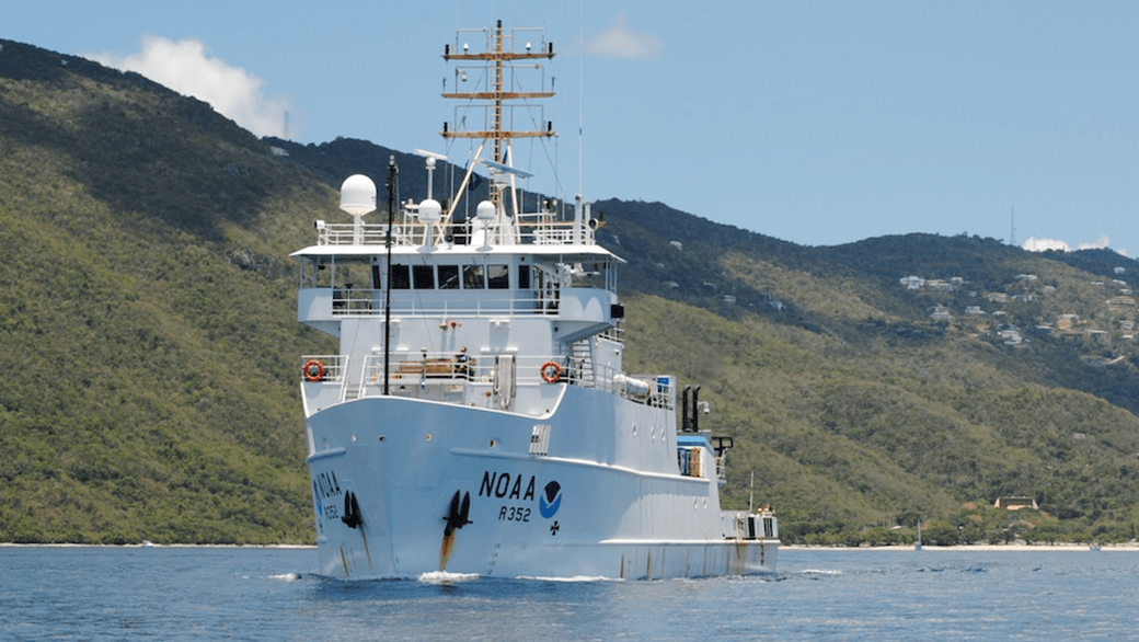
  • The NOAA ship Nancy Foster in St. Thomas, U.S. Virgin Islands. Image Credit: NOAA


  •  

0 Continue Reading →