NOAA will soon launch a fleet of 15 unmanned gliders in the Caribbean Sea and tropical Atlantic Ocean this hurricane season to collect important oceanic data that could prove useful to forecasters. “If you want to improve prediction of how hurricanes gain strength or weaken as they travel over the ocean, it’s critical to take the ocean’s temperature and measure how salty it is,” said Gustavo Goni, an oceanographer at NOAA’s Atlantic Oceanographic and Meteorological Laboratory who is helping lead the glider research. “Not just at the surface, which we measure with satellites, but down into deeper layers of ocean waters.”
Underwater Gliders Contribute to Atlantic Hurricane Season Operational Forecasts
Scientists strategically deployed the gliders during the peak of hurricane season, from July through November 2017, collecting data in regions where hurricanes commonly travel and intensify. The gliders continually gathered temperature and salinity profile data, generating more than 4,000 profiles to enhance scientific understanding of the air-sea interaction processes that drive hurricane intensification.
Gliders Patrol Ocean Waters with a Goal of Improved Prediction of Hurricane Intensity
Gliders Patrol Ocean Waters with a Goal of Improved Prediction of Hurricane Intensity
(This feature represents an ongoing mission or event. Most recent updates can be found by scrolling to the bottom of the page)

2014 Glider Mission:
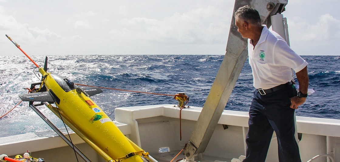
Scientists at NOAA’s Atlantic Oceanographic and Meteorological Laboratory are in the Caribbean to launch two underwater gliders from a vessel off Puerto Rico to collect temperature and other weather data to improve hurricane forecasting.
One of the gliders will collect observations in the Caribbean Sea, and another in the North Atlantic Ocean. They are positioned to operate over the next six months (June-November) collecting data in areas where hurricanes are common and areas where there is a lack of environmental data.
“The goal of the research is to see how these unmanned tools can help us to gather unique observations initialize and evaluate ocean models used for hurricane predictions,” said Gustavo Goni, director of AOML’s Physical Oceanography Division and lead investigator on the project. “This experiment will also help assess the impact of these types of ocean observations in hurricane forecasts using observing system simulation experiments.”
 |
 |
 |

The gliders will collect data on temperature and salinity from the surface of the ocean down to 1000 meters over the next six months through the rest of the Atlantic hurricane season.
The two gliders are being deployed with the help of scientists and students from the University of Puerto Rico, who are partners in the project along with the Maritime Authority of the Dominican Republic. The university contributed its research vessel, La Sultana, for the deployments. University students assisted with the deployment and will assist with data collection.
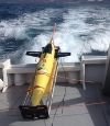
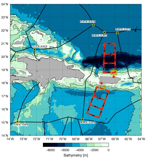
The underwater gliders are durable, autonomous, and powered by battery. Scientists from AOML, with support from NOAA’s National Data Buoy Center, steer the gliders remotely using computers. They will traverse the two regions (identified in the image below), making repetitive dives as they descend and ascend back and forth, weaving through the upper 1000 meters of the ocean. As the gliders reach the ocean surface at the end of each dive cycle they will transmit their data in real-time to be used by scientists all over the through the Global Telecommunications System.
These observations are a component of AOML’s Hurricane Research Division’s field program and will be used to analyze thermal conditions of the upper ocean and to evaluate existing ocean models, with the goal of improving our understanding of the role the ocean plays in the formation and intensification of tropical cyclones.
The project is funded through the Disaster Relief Appropriations Act of 2013 and AOML. It is a partnership between NOAA’s AOML, NDBC, and Environmental Modeling Center, the University of Miami’s Cooperative Institute of Marine and Atmospheric Studies, University of South Florida, the University of Puerto Rico at Mayaguez, and the Maritime National Authority of the Dominican Republic.
Update: October 2014
AOML’s two underwater gliders recently completed their one thousandth dive.
Since late July, both gliders have provided temperature and salinity profiles down to 1000 meters from the Caribbean Sea and Tropical North Atlantic Ocean. The data collected by these gliders include observations made during Tropical Storm Bertha and Hurricane Gonzalo. The gliders will continue to record temperature and salinity profiles until their planned recovery during the week of November 17th.
The glider located in the Tropical North Atlantic, north of Puerto Rico, was situated close to the path of Hurricane Gonzalo. During Gonzalo’s passage, the glider obtained information on how the storm’s winds altered local ocean temperature and salinity conditions. Observations show changes in salinity and temperature in the upper 100m due to mixing. Two days after the passage of the storm, the glider moved northward to obtain more information from areas traveled by Hurricane Gonzalo.
Data from this underwater glider were used in real-time numerical model intensity forecasts. In addition, this data will be analyzed in combination with those obtained during Hurricane Bertha, which also traveled over this same glider. Oceanographers will assess the impact of this data on the Tropical Cyclone intensification forecasts. The main goal of this project is to provide ocean observations to help assess the impact of these observations on tropical cyclone intensity forecast, and of seasonal forecasts.
Update: November 2014
On November 18-19th, researchers with AOML’s Physical Oceanography Division (PhOD) successfully recovered their two underwater gliders in the North Atlantic Ocean and Caribbean Sea from the RV La Sultana of the University of Puerto Rico Mayaguez (see map below for recovery locations). These recoveries marked the end of the first underwater glider mission for AOML, which started in mid July 2014.
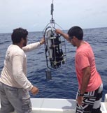
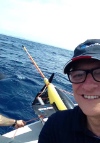
The recovery involved a field team at sea retrieving the gliders and a pilot team at AOML controlling the gliders and steering them to an area where they could be safely recovered. PhOD-University of Miami Cooperative Institute personnel Grant Rawson and Kyle Seaton participated in their at-sea recovery, while PhOD personnel Francis Bringas and Gustavo Goni provided the piloting support from AOML.
2015 Glider Mission:
AOML’s 2015 underwater glider campaign started successfully with the deployment of two gliders in the Caribbean Sea off Puerto Rico. AOML and partners deployed the underwater gliders on February 6, 2015. The gliders’ second mission will transect a region in the eastern Caribbean Sea providing approximately 3000 profile observations of temperature and salinity until their planned recovery in April 2015.

Professor Julio Morell and Luis Pomales of The University of Puerto Rico at Mayaguez deploy the underwater glider. Photo Credit: NOAA/AOML
What’s new? During this mission, in addition to temperature and salinity data, the gliders now feature oxygen sensors that can measure dissolved oxygen during the ocean profiles. This new addition will help scientists learn about changes in oxygen in the upper ocean which might impact ecosystems in the Caribbean Sea. During hurricane season, the oxygen sensor will be used by scientists to monitor how dissolved oxygen is affected by the passage of a storm. Scientists also completed a firmware update which allows collection of pH profile data by using the sensors already installed in the gliders. Data from this mission will allow scientists to observe upper ocean conditions in this area to help seasonal forecasts of the Atlantic Warm Pool.
Update: March 2015
On March 19, 2015, AOML’s underwater gliders completed dive number 500 during their second mission, being carried out completely in the Caribbean Sea, which corresponds to the collection of 3000 temperature and salinity profiles. The two AOML gliders have been collecting observations at fixed locations during the last two weeks, simulating what would be observations from moorings with high vertical resolution. The gliders will continuously provide researchers with temperature, salinity, and dissolved oxygen profiles to 1000 meters until their planned recovery in late April 2015.

On April 27th, researchers with AOML’s Physical Oceanography Division (PhOD) partnered with the University of Puerto Rico to successfully recover their two underwater gliders in the Caribbean Sea from the RV La Sultana of the University of Puerto Rico Mayaguez. The recovery involved a field team at sea retrieving the gliders and a pilot team at AOML controlling the gliders and steering them to an area where they could be safely recovered.
After recovery, the gliders were brought to the University of Puerto Rico Mayaguez in La Parguera where they underwent a thorough refurbishment.

A team of scientists from AOML and the University of Puerto Rico bring one of the gliders aboard the R/V La Sultana. Image Credit: NOAA
Update: July 2015The third mission began on July 14 with the deployment of an ocean glider in the Caribbean Sea off the southern coast of Puerto Rico. What’s new? For the first time, the gliders will collect ocean current velocity profiles which will be used by researchers to assist hurricane forecast models in reproducing the key ocean dynamic processes associated with tropical storm-induced surface ocean cooling. The gliders will also continue to provide real-time temperature, salinity, and oxygen data to be used in the models. These observations will help researchers investigate the upper ocean thermal structure in regions that have been linked to rapid intensification of tropical cyclones. AOML scientists also equipped the glider with an improved battery which will allow the glider to record more profile measurements. The second of the two gliders will be deployed in the Tropical North Atlantic in the upcoming weeks.
Update: November 2015On November 16th-18th, AOML physical oceanographers partnered with the University of Puerto Rico to successfully recover two underwater gliders from the Caribbean Sea aboard the M/V La Sultana of the University of Puerto Rico Mayaguez. Over the course of the summer, the gliders successfully transected a region in the eastern Caribbean providing approximately 3000 profile observations of temperature, salinity, oxygen, and surface as well as depth-average current velocities. The gliders were also on location during the passage of Tropical Storm Erika in August, gathering temperature measurements that are critical to understanding the ocean’s role in how storms form, evolve, and change in intensity. These data should also provide researchers with a better understanding of the ocean’s response to the passage of storms which, in turn, will improve ocean models used in hurricane forecasts.
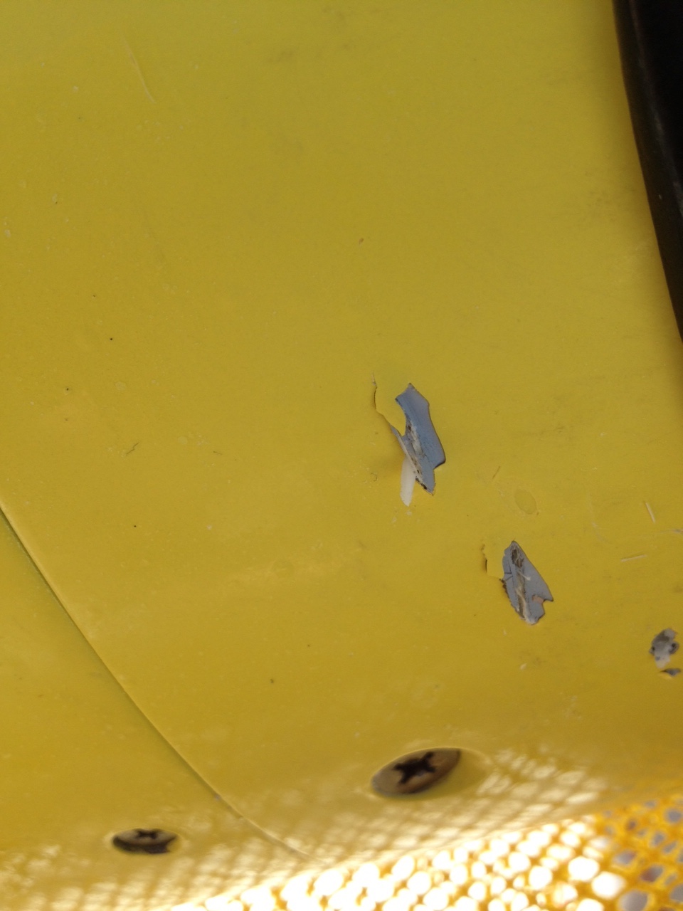
After recovery, the gliders were brought to the University of Puerto Rico Mayaguez in La Parguera where they will undergo a thorough refurbishment in preparation for their deployment in 2016. Included in the refurbishment will be repairs to the body of one of the gliders after researchers found evidence of a shark encounter, including puncture wounds and an embedded shark tooth.
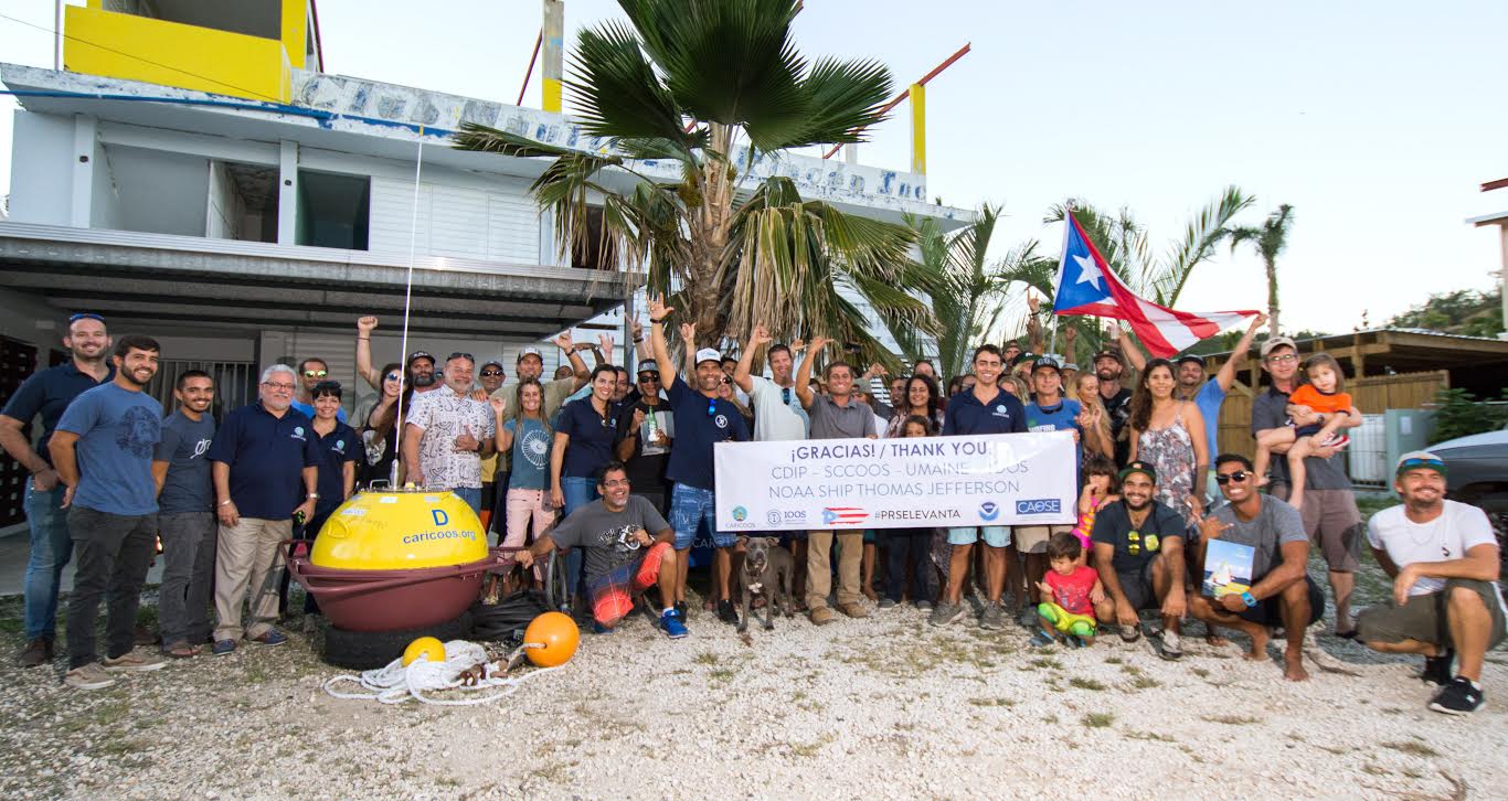
More information about the locations of gliders, data, and a summary of objectives can be found at AOML’s glider program page.