Skip to Content

Category Archives: Ocean Chemistry and Ecosystems

NOAA Partners Join CalCofi to Examine the Potential of ‘Omics Research

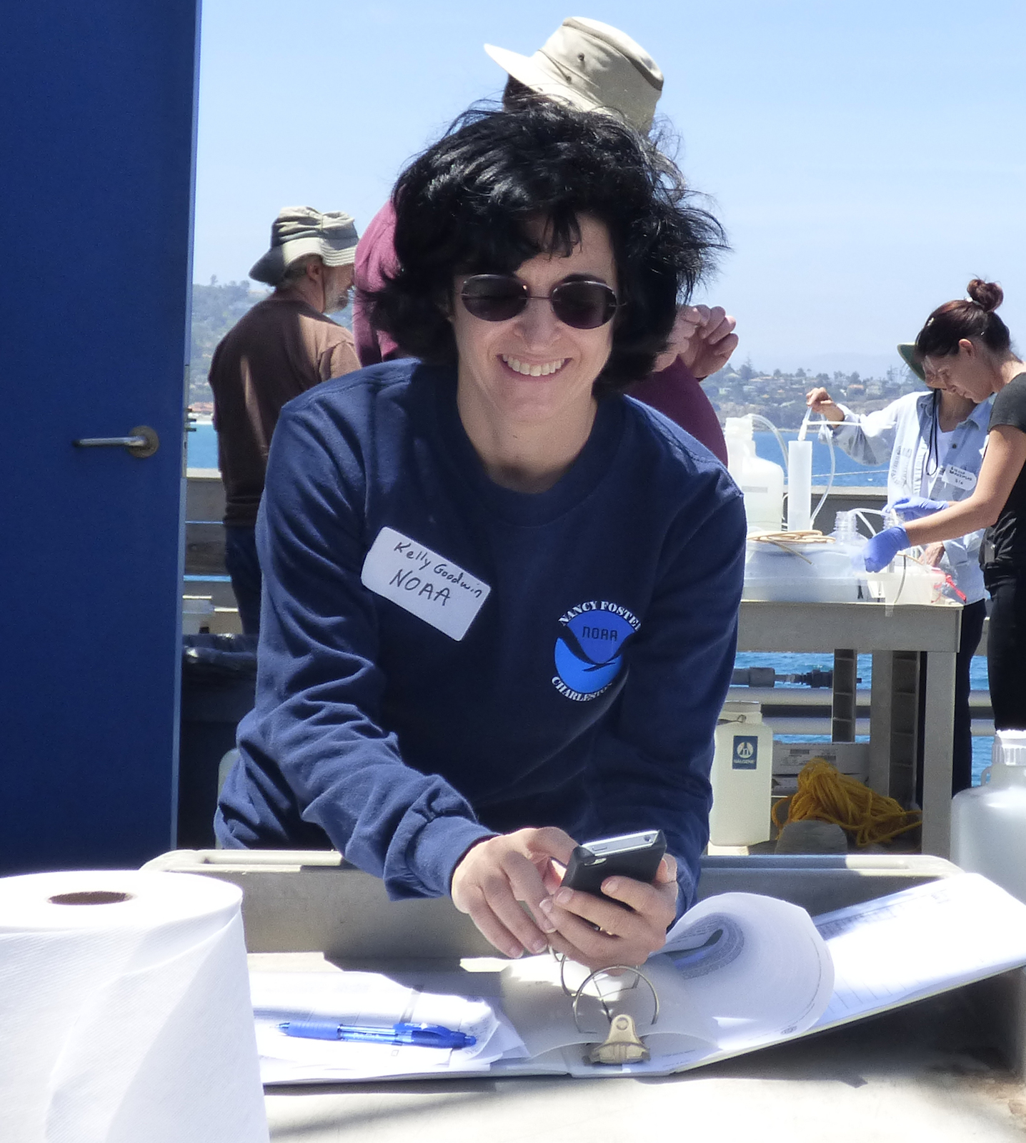
NOAA’s Atlantic Oceanographic and Meteorological Laboratory is teaming up with NOAA’s Office of Ocean Exploration and ResearchNational Marine Fisheries Service, and Integrated Ocean Observing System, as well as the J.C. Venter Institute and the Scripps Institution of Oceanography to enhance ecosystem observation programs by integrating genome-enabled techniques and technologies (i.e., ‘omics) into the California Cooperative Oceanic Fisheries Investigations (CalCOFI). CalCOFI is a multi-partner, long-term ecosystem and fisheries study off the coast of California. The first quarterly CalCOFI expedition that included ‘omics recently completed at the end of November.

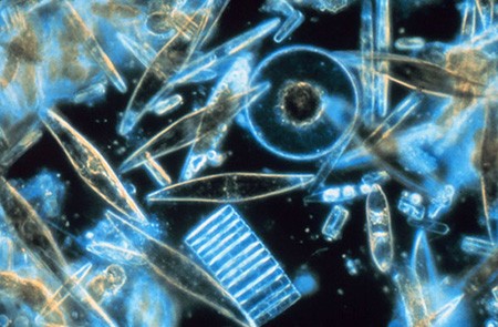
‘Omics is the term for a set of genome-based technologies used to examine DNA, RNA, and proteins from a variety of sample types ranging from single cells to organisms to communities in order to understand who is where, what they are doing, and how they are affected by changing environmental conditions.

The incorporation of ‘Omics into CalCOFI will help scientists better understand the diversity and functional activity of microbes in the area—enabling scientists to more accurately predict ecosystem tipping points, augment understanding of factors that enable or reduce ecosystem resiliency, and potentially unearth critical information regarding ocean response to large-scale pressures, including climate change. This project is a pilot for potential broader applications to other regions and across the NOAA fleet.

In the long term, ‘omics will ideally add to scientists’ ability to predict, monitor, and recommend responses to environmental changes and their associated effects on human health and the health of ocean and coastal ecosystems, leading to broader application to other regions and improved national efforts in ecosystem monitoring and management. Read more about other environmental microbial research in AOML features about Ocean Sampling Day and King Tide sampling on Miami Beach.

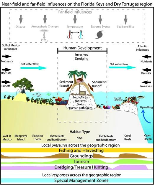
CalCOFI is a unique partnership of the California Department of Fish and Game, NOAA Fisheries Service, and the Scripps Institution of Oceanography. The organization was formed in 1949 to study the ecological aspects of the sardine population collapse off California. Today the focus has shifted to the study of the marine environment off the coast of California, the management of its living resources, and monitoring the indicators of El Nino and climate change. CalCOFI conducts quarterly cruises off southern and central California, collecting a suite of hydrographic and biological data on station and underway.

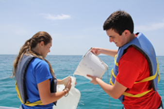
  • A CTD cast collects water samples during the CalCofi cruise.  Photo Credit: CalCofi  


  • The RV New Horizon is the research vessel that supported the November 2014 CalCofi cruise. Photo Credit: CalCofi

0 Continue Reading →

Research Fit for a King Tide

King Tide: tide at 8:30am marks a before with low watermark on a bridge in Coconut GroveKing Tide: tide at 10:30am shows high watermark on a bridge in Coconut Grove
King Tide: tide at 10:30am shows high watermark on a bridge in Coconut GroveKing Tide: tide at 8:30am marks a before with low watermark on a bridge in Coconut Grove

AOML scientists part of team sampling water quality of extreme high tide floodwaters on Miami Beach

The colloquial term ‘king tides’, referring to the highest astronomical tides of the year, is now part of most Miami Beach residents and city managers’ vocabulary. Exacerbated by rising seas, these seasonal tides can add up to 12 inches of water to the average high tide, threatening the urbanized landscape of Miami Beach. During these events, AOML’s Microbiology Team is on the scene to investigate these tidal waters as they rise and recede. The microbiologists are part of a research consortium for sea level rise and climate change, led by Florida International University’s Southeast Environmental Research Center. The research effort focuses on collecting samples and monitoring water quality at locations along the Biscayne Bay watershed where the City of Miami Beach has installed pumps to actively push these super-tidal floodwaters back into the bay.

Because Miami Beach now regularly floods during super-tidal events or severe storms, it is important to understand how such coastal inundation events may cause land-based sources of pollution to enter the marine environment and how this pollution may impact both the ecosystem and human health.

“We don’t really know what comes from brackish water tidal floods in a built environment like Miami Beach, where water can spill over roads, yards, parking lots, and commercial sites” said AOML’s Dr. Chris Sinigalliano. “We have not yet measured how such tidal floodwater is similar or different to regular stormwater in the kinds of contaminants it accumulates and the potential risks associated with it.”

Researchers participating in this sampling effort continuously monitor and collect water samples over a 5-hour period near city pumps and storm drains where floodwaters re-enter Biscyane Bay. Onshore sampling sites include Maurice Gibb Memorial Park, 14th Street, and 27th Street at Indian Creek Drive. Samples are also collected by boat along canals and waterways that feed into the bay. During sampling, physical water properties such as temperature, salinity, pH, turbidity, and dissolved oxygen content are also measured.

The extent of flooding in the city during the king tides varies from year to year, especially around the area of Gibbs Memorial Park, due to Miami Beach’s pumping efforts.  As the tidal waters recede, the discharges from the area of 14th Street generate noticeable plumes of turbid water in the bay, which scientists sample every hour.

The samples collected are brought back to the lab, where scientists prepare for hours of filtration and examination. FIU will test for a wide array of nutrients and biogeochemical markers while AOML tests for a variety of bacterial contamination markers to characterize the microbial water quality of the samples.

AOML also helps develop and validate molecular genetic techniques for analyzing the sources of various bacterial contaminants, a process known as ‘Molecular Microbial Source Tracking’. This analysis will help scientists, managers, and stakeholders understand what types of microbial pollutants exist in the tidal floodwaters and the possible environmental impacts of pumping this water back into the bay. Overall, AOML’s contributions to the king tide sampling effort include field sampling, analytical detection, measurement of microbial contaminants, including specific fecal-indicating bacteria, and identification of their potential sources using the Molecular Microbial Source Tracking method.

AOML scientists will also measure live enterococci (the fecal bacteria used for regulatory water quality monitoring of marine bathing waters) and quantify the abundance of specific source tracking bacteria. These source-tracking methods can determine the animal source the fecal bacteria originated from, including human, dog, birds, cows, and pigs.

Knowing the potential source of contamination provides actionable ‘Environmental Intelligence’ that can inform managers as they address contamination problems. Sewage and septic contamination is a human marker, terrestrial runoff can be linked to a canine marker, and agricultural waste contamination is linked to pig, cattle, and/or horse markers. Bird markers can also be detected and can indicate how much fecal contamination may be coming from seabirds and waterfowl.

FIU’s Southeast Environmental Research Center is leading the floodwater-sampling project and has provided the primary funding. This relatively small-scale pilot study leverages FIU’s partnerships with NOAA-AOML, the University of Miami, and Nova Southeastern University.

The analytical results from all participating laboratories will take several months to compile. A summary of the results will be made publicly available on FIU and AOML’s websites in order to inform stakeholders and interested parties.

The collective water quality information gathered from the king tide floodwaters on Miami Beach will be integrated across the multi-institutional research team. Results could further the understanding of the environmental impacts from tidal flooding of urban coastal landscapes and improve understanding of current and future impacts of sea level rise.

Originally Published October 2014 by Shannon Jones

0 Continue Reading →

The Science Behind Coral Bleaching in the Florida Keys


bleached pillar coral

Photograph of bleached pillar coral on November 13, 2014 at Sand Key. Image credit: NOAA’s Florida Keys National Marine Sanctuary.

2014 was a relatively warm summer in South Florida, and local divers noticed the effects of this sustained weather pattern. Below the ocean surface, corals were bleaching. In the month of August, the Coral Bleaching Early Warning Network, jointly supported by Mote Marine Lab and NOAA’s Florida Keys National Marine Sanctuary, received 34 reports describing paling or partial bleaching and an additional 19 reports indicating significant bleaching. Scientists continue to monitor the impact of this severe bleaching event to determine the extent of coral mortality.

This image, taken on November 13, 2014 by the Florida Keys National Marine Sanctuary, shows a severely bleached pillar coral at Sand Key in the Florida Keys. Images like this one indicate that some regions and species will definitely be affected. Pillar coral is one of the species of coral listed as threatened under the Endangered Species Act.

AOML Coral Ecologists Derek Manzello and Jim Hendee provide insight as to how the environmental conditions they are tracking indicate that a mass bleaching event is possible and even likely in the Florida Keys.


What is coral bleaching?

Coral colonies are made up of hundreds or even thousands of genetically identical individuals called polyps. These polyps have microscopic colorful algae called zooxanthellae living within their tissues. The zooxanthellae work like an internal symbiotic vegetable garden, carrying out photosynthesis and providing energy to their coral hosts, which helps reef-building corals create reef structures. When a coral bleaches, it expels its zooxanthellae, and can die within a matter of weeks unless the zooxanthellae populations are able to recover. The term bleaching is used because the dazzling colors of living corals are due to the zooxanthellae in coral tissue, and when zooxanthellae are lost, corals appear white, or “bleached.”


Extensive bleaching of the soft coral Palythoa caribaeorum on Emerald Reef, Key Biscayne, FL.

Extensive bleaching of the soft coral Palythoa caribaeorum on Emerald Reef, Key Biscayne, Fl. (Credit:NOAA)

What causes coral bleaching?


It is well established that elevated sea temperatures cause widespread coral bleaching. Warmer waters “stress” corals and trigger coral bleaching.

There are two types of heat stress that can trigger bleaching:  (1) short-term, acute temperature stress (several days of very high water temperatures) and, (2) cumulative temperature stress (weeks of consistent moderately elevated water temperatures). Scientists have documented that coral communities around the world have different heat stress thresholds that typically trigger bleaching in response to heat stress. Scientists rely on long-term observing stations co-located with coral reefs to identify the specific conditions that correlate to bleaching within different regions.

What specifically triggers bleaching of coral found in the FL Keys?

Using long-term in situ datasets such as the Coastal-Marine Automated Network, or C-MAN, stations in the Florida Keys, AOML scientists identified specific patterns of warm waters on coral reefs that tend to precede bleaching

events.  The indices that proved to be the most reliable indicators for bleaching for the Florida Reef Tract are maximum monthly sea surface temperature and the number of days >30.5 C (86.9 F).

What patterns have scientists noticed leading up to this most recent bleaching event?

Data from the Molasses Reef C-MAN station showed that the winter of 2014 was the warmest on record since these stations began recording data in 1988.  The second warmest winter on record was the winter of 1996/97, which preceded back-to-back bleaching years in the Keys (1997/98) and was the worst bleaching event ever documented in the Florida Keys.  The most recent significant bleaching event in the Florida Keys occurred in 2005, and there have been mild localized bleaching events since then.

The image on the left shows a coral colony at Cheeca Rocks from July 2013. The image at the right shows the same coral colony in August 2014, with the colony now bleached.

The images above were taken from a coral colony at Cheeca Rocks in the Florida Keys. On the left shows the coral colony from July 2013. The image at the right shows the same coral colony in August 2014, with the colony now bleached. (Credit: NOAA)

The warm winter and warm water temperatures this spring caused scientists to start watching the long-term average water temperatures at these stations to see if the average daily temp was regularly reaching or exceeding 30.4 C, the trigger point for previous bleaching in the FL Keys. The Molasses Reef C-MAN site quickly approached this temperature threshold in July and August. Average temperatures were also warmer than normal at the Fowey Rocks C-MAN station and the Cheeca Rocks Atlantic Ocean Acidification Testbed in the northern Keys. With water temperatures now exceeding this threshold for more than thirty days, and reports of bleaching beginning to pour in, there are concerns about widespread bleaching throughout the region.  To assess the extent of the bleaching event, Florida Keys National Marine Sanctuary has been working with its partners to monitor the current state of corals along the reef tract.

Jim Hendee is the acting division director of AOML’s Ocean Chemistry and Ecosystems Division. Jim leads the coral group at AOML and studies the environmental conditions that cause ecosystem-wide changes on coral reefs using in situ observing stations. Derek Manzello is a coral ecologist at AOML and leads research of the impacts of ocean acidification on coral reefs. Derek also studies the impact of other changes in environmental conditions on reefs such as temperature and tropical storm impacts.

Originally Published September 2014 by Shannon Jones

0 Continue Reading →

NOAA Participates in International Ocean Sampling for Microbes

NOAA’s Atlantic Oceanographic and Meteorological Laboratory (AOML) participated in Ocean Sampling Day on June 21, the first global simultaneous sampling for microbes in ocean, coastal and Great Lakes waters. Over time, sampling will support international and NOAA missions to provide a snapshot of the diversity of microbes, their functions, and their potential economic benefits. Among other economic applications, microbes have been used for novel medicines, as biofuels, and to consume spilled oil. Organized and led by the European Union’s MicroB3 organization, NOAA coordinated twelve sampling sites for Ocean Sampling Day 2014 within U.S. coastal waters.

sampling in La Jolla, CA

AOML scientists Kelly Goodwin enters data from water samples from La Jolla, CA.

“Small organisms make up the majority of the ocean’s biomass and drive the cycles that sustain life on earth, but not until recently have we had the tools to reveal their diversity and function,” said Kelly Goodwin, a microbiologist at AOML. “Ocean Sampling Day and future efforts in Genomic Observatories will employ state-of-the art ‘omic technologies to uncover how the oceans are adapting to a multitude of stressors and how those changes translate up to ecosystem services – including seafood supply and healthy swimming waters and coastal habitats.”

NOAA’s Marine Microbes Working Group coordinated 12 sampling locations, part of more than 150 international sites, and supported cross-line NOAA efforts to include NOAA Research centers, including AOML, NOAA Fisheries centers, and NOAA’s National Ocean Service Sanctuary locations (Grays Reef and Humpback Whale National Marine Sanctuaries). NOAA’s Office of Ocean Exploration and Research coordinated the broader NOAA science and outreach/education aspects. Sampling sites are expected to be monitored long-term as part of the international ocean Genomic Observatories Network and the database will serve as a baseline, accessible to the research community, industry, policy makers and the public. The Smithsonian’s Global Genome Initiative will archive samples.

AOML staff, with support from a cadre of summer interns, coordinated five locations in south Florida and in California. Sites included Port Everglades, Tennessee Reef offshore of Long Key in the Florida Keys National Marine Sanctuary, and near the mouth of Tampa Bay at Fort DeSoto in Saint Petersburg. AOML collaborators from the University of Southern Mississippi conducted sampling at Horn Island offshore of the Mississippi Coast. AOML scientists also coordinated the sampling the OSD site at the Scripps Institute Pier in La Jolla, California.

FL Keys OSD sample collection

AOML student interns collect samples from the Florida Keys

Citizen Scientists all over the world also collected environmental data (water and air temperature, salinity, oxygen, etc.) to support the microbial sampling collected globally on the summer solstice. In La Jolla, CA, one of AOML’s remote employees worked with a local scout troop to guide them in collecting similar environmental data. These local efforts were designed to raise general awareness about Ocean Sampling Day.

0 Continue Reading →

New Tools Bring Ecosystem Benefits to the Forefront of Decision Making

The Marine and Estuarine Goal Setting for South Florida (MARES) project, led by NOAA’s Cooperative Institute for Marine and Atmospheric Studies at the University of Miami, continues to increase awareness of and appreciation for the value of coastal marine ecosystems, and their impacts upon human society. From 2009 through 2013, NOAA’s National Centers for Coastal Ocean Science funded MARES with the goal of creating a consensus-based process for managing South Florida’s coastal marine environments. MARES is unique in that it was among the first major efforts to include human benefits in a systematic framework to enable integrated ecosystem based management. The MARES approach embodies NOAA’s effort to serve as the Nation’s environmental intelligence agency by providing actionable information from science-based models to support environmentally-sensitive decisions made every day by individuals, communities, and governments.

“NOAA took a leadership role in funding the MARES project, and it is a step in the right direction”, said Eric Millibrandt, director of the Marine Laboratory at Sanibel. “I’ve used the concepts provided by MARES to help colleagues and non-technical individuals to better understand the ecosystem and its preservation.”

When natural resource managers make decisions, it is important that they take both the needs of the environment, as well as human population requirements and perspectives into consideration. This integrated approach is necessary to sustain a physically and economically balanced and healthy ecosystem. Coastal populations rely on and interact with their unique marine and estuarine flora and fauna on a daily basis.

In the last century, increased population, coastal development, climate change and sea level rise have damaged South Florida’s marine environment. As these changes continue, the long-term status of South Florida’s ecosystems and valuable resources will continue degrading. The coastal habitat is crucial to the regional economy, which relies on ocean related jobs such as, fishing and tourism. Since a healthy ecosystem is needed for economic survival, the interactions between Florida’s population and the ecosystem is important and can be used to help guide the management decisions regarding South Florida’s coastal ecosystems.

Typically, research and management on marine ecosystems have focused primarily upon the negative impacts humans have on the environment. MARES investigators realized that for citizens to embrace marine policy, it is essential they understand not only the variety of pressures on the system, but the benefits they derive from it and their role within it. Over 50 researchers (both natural system and human dimensions scientists), managers, and stakeholders collaborated to understand and document cause and effect relationships and the societal benefits of South Florida’s coastal marine environments. By studying coastal waters in the Florida Keys/Dry Tortugas, the Southeast Florida Coast, and on the Southwest Florida Shelf, MARES was able to reach a consensus as to which regulating processes were most significant and which key characteristics must be sustained. The MARES team is publishing their findings in 15 research papers in a special issue (volume 44) of the journal Ecological Indicators entitled: “Tools to support ecosystem based management of South Florida’s coastal resources.”

The tools MARES developed are currently being used in community planning projects to show the existing status of the marine environment and to incorporate human benefits in ecosystem management. One of the most popular MARES products used by resource managers are the conceptual diagrams designed for the Southwest Florida Shelf, Southeast Florida Coast, and the Dry Tortugas/Florida Keys.


MARES conceptual diagram

MARES conceptual diagram showing connections between FL Keys and Dry Tortugas

Additionally, NOAA’s National Marine Sanctuaries are evolving to include the MARES conceptual model framework in their guidelines. Sanctuaries’ Condition Reports currently provide a summary of resources in the Sanctuaries, pressures on those resources, the current condition and trends, and management responses to the pressures that threaten the integrity of the marine environment.  Specifically, the current Condition Reports include information on the status and trends of water quality, habitat, living resources and maritime archaeological resources and the human activities that affect them. Future reports will be based on the MARES DPSER (Driver, Pressure, State, Ecosystem Services, Response) Model to clearly document ecosystem benefits to the public.

“MARES products and tools helped show us we need to integrate ecosystem services into our next generation of Conditions Reports said Bob Leeworthy, chief economist for NOAA’s Office of National Marine Sanctuaries. “These Next Generation Condition Reports will emphasize the value of services provided by ecosystems, all as a result of the MARES project.”

0 Continue Reading →

Volcanic Island of Maug Provides Natural Lab for Ocean Acidification

diver swimming at maug reefs 

CIMAS researcher Ian Enochs “diving in champagne” at the Maug reefs Photo credit: Open Boat Films/NOAA


Ian Enochs, a scientist with NOAA’s Cooperative Institute for Marine and Atmospheric Studies at the University of Miami, traveled in May to the Island of Maug in the Pacific Ocean as part of a NOAA expedition aboard NOAA Ship Hi’ialakai to study coral reef ecosystems. The expedition was led by NOAA’s Pacific Island Fisheries Science Center Coral Reef Ecosystem Division and the Pacific Marine Environmental Lab’s Earth-Ocean Interaction group. Enochs focused his research on underwater vents that seep carbon dioxide into the Pacific.

Why journey to the Island of Maug to study ocean acidification?

Maug is a unique natural laboratory that allows us to study how ocean acidificationaffects coral reef ecosystems. We know of no other area like this in U.S. waters. Increasing carbon dioxide in seawater is a global issue because it makes it harder for animals like corals to build skeletons.

What is the Island of Maug like?

Maug is an uninhabited volcanic island in the Commonwealth of the Northern Mariana Islands about 450 miles north of Guam. The volcano breaks through the ocean surface in three areas to form islands and the relatively shallow water surrounding these islands is full of coral reefs. The underwater vents that seep carbon dioxide are found on the side of the caldera or crater formed by the volcano. Usually when I scuba dive, the moment I enter the water, air bubbles surround me and fade away quickly. On Maug, the bubbles never ceased and it felt like I was swimming in a glass of champagne.

collecting underwater gas samples
A funel is used to collect carbon
dioxide gas bubbles from the
seeps near the coral reefs.
Photo credit: Open Boat Films/NOAA 

What are your goals for studying the carbon dioxide vents?

We’re mapping carbonate chemistry over time and space to examine the extent of carbon dioxide at the site. We’re looking at how that chemistry changes over this area as you get farther from the vents and what corresponding changes there are in the coral community. We hope to learn more about which coral species are especially sensitive to elevated carbon dioxide and which may be resilient. Finally, we will look at how elevated carbon dioxide levels in seawater may influence the response of various organisms over time, including their growth rate.

What does your sampling show so far?

The carbon dioxide appears to be strongly influencing the growth of corals and algae in a small area around the vents. While there is weedy algae near the vent due to high levels of carbon dioxide, this gives way to healthier coral reefs as you get farther away from the site.

How do you measure these effects over time?

This first trip has allowed us to begin measuring the effects of carbon dioxide and to place instruments in the area that will continuously measure temperature, light, the partial pressure of carbon dioxide, seawater pH, and water currents. When we return in August, we’ll have three months of data on how this special environment has been changing day to day. Additionally, we are able to measure coral growth over time by taking core samples and by using a special dye to measure new growth.


diver drilling for coral core samples

CIMAS researcher Ian Enochs uses a drill to take coral core samples to measure changes in growth. Photo credit: Open Boat Films/NOAA
 

How can this research help our understanding of this and other areas of the ocean?

Research at the Maug site will help us determine the effects of elevated carbon dioxide on an entire natural ecosystem. Using this information, we’ll have a better understanding of how the rest of the ocean’s coral reefs may react to global increases in carbon dioxide and acidification. If the predictions of the Intergovernmental Panel on Climate Change remain the same, by the end of the century, the impact of ocean acidification on coral reefs around the world will be comparable to what we see on the reefs near Maug’s carbon dioxide seeps today.

Note: Ian Enochs’ research is part of a much larger research mission involving NOAA Fisheries, NOAA’s Coral Program, NOAA Research’s Pacific Marine Environmental Lab, the National Institute of Standards and Technology and other partners, including Scripps Institution of Oceanography, the University of Guam, and Open Boat Films. NOAA worked closely with CNMI coral management and monitoring experts at the Division of Coastal Resource Management and the Department of Environmental Quality. More information on the research mission is posted online.


0 Continue Reading →

Tropical Cyclones Worsen Ocean Acidification at Coral Reefs

While tropical cyclones can dramatically impact coral reefs, a recent study reveals their passage also exacerbates ocean acidification, rendering reef structures even more vulnerable to damage. Calcifying marine organisms such as corals that thrive in alkaline-rich waters are increasingly imperiled as seawater becomes more acidic due to the ocean’s uptake of carbon dioxide. The detrimental effects upon these organisms have been documented, but less is known about how reefs might react to ocean acidification when coupled with an additional stress factor such as a tropical cyclone.

To assess how reefs might respond to such a scenario, coral researchers Derek Manzello, Ian Enochs, and Renee Carlton from the Cooperative Institute for Marine and Atmospheric Studies at the University of Miami’s Rosenstiel School and NOAA’s Atlantic Oceanographic and Meteorological Laboratory, along with researchers from the University of Washington and NOAA’s Ocean Acidification Program, collected data from reefs in the Florida Keys before, during, and after the passage of Tropical Storm Isaac in August-September 2012. Their findings appear online in the Journal of Geophysical ­Research.

Tropical Storm Isaac as it passes over the Florida Keys on August 26, 2012. Image Credit: NOAA

Tropical Storm Isaac as it passes over the Florida Keys on August 26, 2012. Image Credit: NOAA

The team analyzed seawater carbonate chemistry and environmental data from Cheeca Rocks and Little Conch Reef, both coral monitoring sites, as well as data from a coastal marine automated network station at Molasses Reef.

They found that Tropical Storm Isaac caused both an immediate and prolonged decline in seawater pH and carbonate saturation state at the two coral reef sites studied. The post-storm pH levels were the lowest recorded values to date from over two years of high-resolution data measured at the Cheeca Rocks ocean acidification monitoring site, and this depression in pH lingered for more than a full week.

Prior concerns regarding ocean acidification and coral reefs assumed carbonate undersaturation would not occur at reefs in the foreseeable future due to their location within the highly supersaturated tropical oceans. However, the study demonstrates that carbonate undersaturation at reefs will occur from even the passage of a modest tropical storm when coupled with ocean acidification.

Coral bleaching at Cheeca Rocks in the Florida Keys after the passage of Tropical Storm Isaac in August 2012. Image credit: NOAA

Coral bleaching at Cheeca Rocks in the Florida Keys. Image credit: NOAA

With climate models projecting a steady increase in the rate of ocean acidification, along with stronger, more frequent tropical cyclones, the future for coral reefs thus appears bleak. In the coming decades, tropical cyclones could depress carbonate seawater saturation ­levels to such an extent that reefs will undergo periods of post-storm dissolution, weakening coral reef frameworks and worsening the widespread ecological and economic consequences of the coral reef crisis.

0 Continue Reading →

AOML Travels to Saipan to Expand Coral Observations

NOAA oceanographers traveled to Saipan this spring to refurbish the Coral Reef Early Warning System (CREWS) station in Lao Lao Bay and conduct site surveys for the potential location of a moored autonomous pCO2 (MApCO2) buoy. Staff from the Pacific Islands Ocean Observing System (PacIOOS) program in Honolulu joined them during the site visit hosted by the Division of Environmental Quality (DEQ) of the Commonwealth of the Northern Mariana Islands (CNMI).

NOAA is currently implementing its National Coral Reef Monitoring Plan, which calls for sustained monitoring of climate, biological, and socio-economic metrics at all U.S. coral reefs. As part of the plan, three sentinel sites in the Atlantic and Pacific basins are to be established for high resolution monitoring of climate change variables such as temperature and carbon dioxide. Researchers identified Saipan as a potential candidate for one of the Pacific sentinel sites based on the successful installation of the CREWS pylon in 2011 and the ongoing relationship between DEQ, AOML, and other groups.

Over a two-week period, work on the two projects proceeded in tandem. CNMI personnel performed all of the refurbishment efforts on the upper portion of the CREWS station with guidance, as needed, from the AOML team, while AOML and PacIOOS divers deployed the underwater sensors and secured their cables.

The MApCO2 team arrived in Saipan with the hope of finding the optimal buoy site close to the CREWS station in Lao Lao Bay. Somewhat to their surprise, however, Sugar Dock emerged as the most favorable buoy deployment site due to its almost year-round accessibility and freedom from issues that might interfere with ocean acidification monitoring such as groundwater, runoff, and sedimentation.

While no final decisions have yet been made about the MApCO2 buoy placement, the team departed Saipan having met with many of the key people in CNMI and having learned a great deal about the ongoing data collection efforts at these sites for the past many years. The AOML team thanks all of their collaborators in these two projects.

0 Continue Reading →