Skip to Content

Category Archives: Engineering Solutions

AOML Temperature Sensor to be Deployed at Reef Sites Worldwide

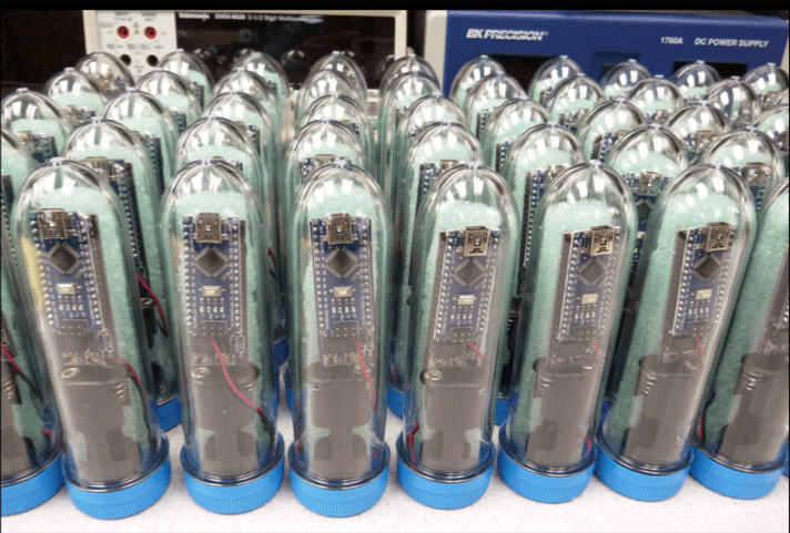
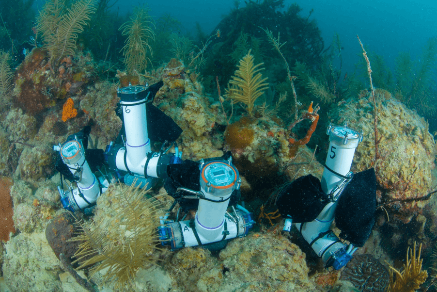
Researchers with AOML’s Ocean Chemistry and Ecosystems Division have entered into a collaborative agreement with Reef Check Foundation to deploy an AOML-designed temperature sensor at coral reef sites around the world. Measuring only six inches in height, the inexpensive, highly-accurate sensors will greatly enhance efforts to more precisely monitor small-scale temperature fluctuations that occur at reefs over time and at various depths.

0 Continue Reading →

Scientists Use 3D Printing Technology to Study Water Chemistry at Coral Reefs

AOML researchers have taken an innovative approach to studying the changing carbonate chemistry of seawater at shallow coral reef sites. Using 3D printing technology made possible by the new Advanced Manufacturing and Design Lab at AOML, researchers with the Acidification, Climate, and Coral Reef Ecosystems Team, or ACCRETE, have created a water sampler in-house.

0 Continue Reading →

New Antenna System Design Improves Reliability and Significantly Reduces Cost

Scientists and engineers from NOAA have successfully designed, built, and tested a new antenna system that dramatically increases data transmission reliability while drastically reducing operating costs. The new Iridium-based transmission system, developed by NOAA’s Atlantic Oceanographic & Meteorological Laboratory (AOML) & the Cooperative Institute for Marine & Atmospheric Studies (CIMAS), has no restrictions on data format or size, allowing data from various ocean and land-based observation platforms to be transmitted more reliably and at a fraction of the cost of the older Inmarsat-C platform. Since completion, the Iridium system has been adopted on a number of Expendable Bathythermographs (XBTs) observation transects and have been simultaneously tested and implemented in other AOML observing systems.

The development of this new system involved creating new transmission hardware and software. The system includes state of the art technologies combined with advanced algorithms to allow for the fast and stable transmission of digital data.  Results from the initial tests carried out in 2013 were used to optimize the system and to reduce or eliminate connection drops and data loss. The new system began its transition to operational capacity in 2015 and is currently being used on all cargo ships with XBT observation transects operated by AOML and Scripps Oceanographic Institution. The adoption of this system has resulted in a 95% reduction of the average transmission cost per XBT profile.

NOAA deploys approximately 12,000 XBTs per year as part of its contribution to the global XBT Network, a component of the Global Ocean Observing System. XBTs are probes that measure temperature profiles to a depth of 800m. This global network consists of approximately 50 fixed transects that are repeated several times a year. Historically, the real-time transmission of this data was carried out using the Inmarsat-C satellite network, which was implemented in the early 2000s, and relies on twelve geostationary telecommunications satellites. The Inmarsat-C network is costlier and does not allow for the transmission of different data types.

Although originally developed for XBT observations, the new Iridium-based transmission system is capable of transmitting various types and amounts of data. Its applicability has been expanded to data transmissions for ThermoSalinoGraph (TSG), pCO2, and marine weather observations. Other global oceanographic observational platforms such as Argo floats and drifting buoys also use the Iridium network for data transmission, however these platforms use a protocol only suitable for smaller amounts of data. With the application of the new antenna system, which can transmit files of arbitrary size, this data can be transmitted at a lower cost and at a faster rate.

In addition to Iridium transmissions, the new system can be also be configured to transmit data over telephone landlines or computer networks, potentially decreasing many other operational costs.  Future plans for the system include increasing its use along XBT transects run by other XBT partner institutions as well as its application to other types of real-time environmental data transmissions.

This work was funded by the Climate Observations Division of the NOAA Climate Program Office and by AOML, through the XBT Network and the Ship of Opportunity Program.

Left: New Iridium antenna and housing. Right: Antenna installed aboard the CMA CGM Racine cargo vessel in Miami, FL, before the start of the January 2016 AX07 (Miami to Gibraltar) XBT transect.

Originally Published in March 2015 by Shannon Jones

0 Continue Reading →

New X/L-Band Satellite Receiving System Premieres at AOML

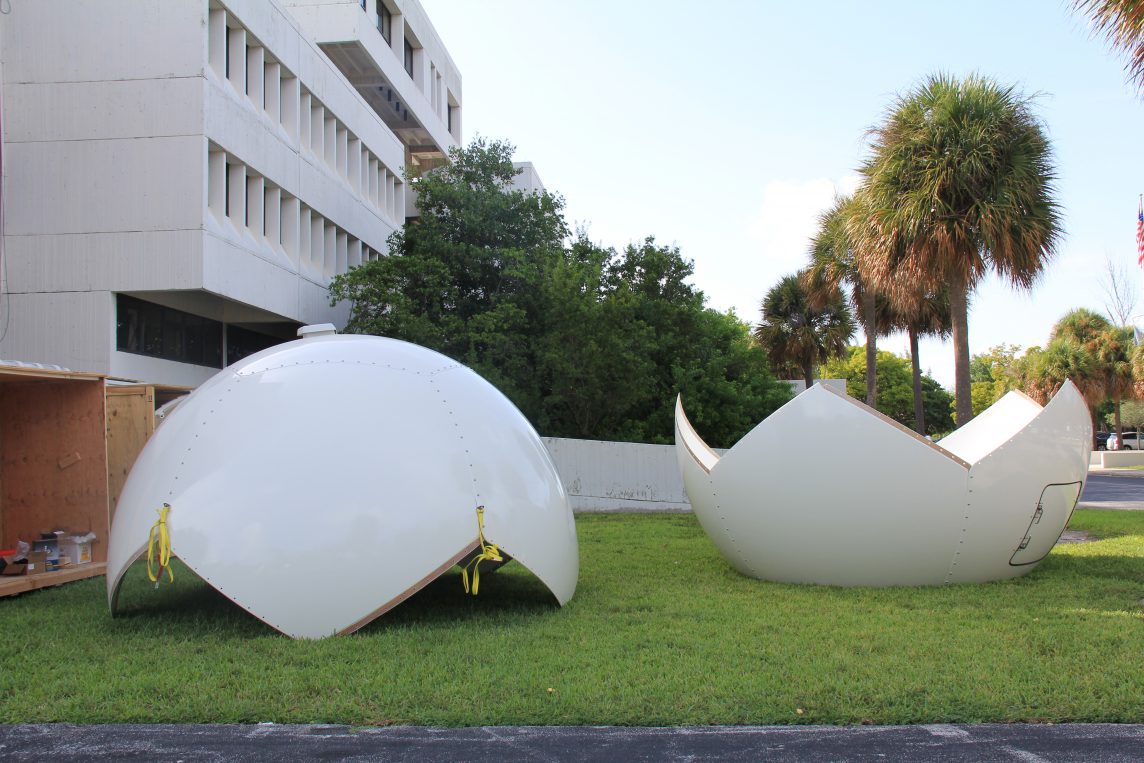
After months of preparation, on September 16th contractors completed the installation of a new X/L-band satellite receiving system on the AOML roof. Funded by the Disaster Relief Appropriations Act of 2013, the new system includes a radome-protected, 2.4-meter antenna and associated data processing and storage equipment. This project is designed to demonstrate the value of improved turnaround times from satellite observations to availability of processed data for operational applications.

The new system augments AOML’s existing L-band antenna, in place since 2000, and expands AOML’s ability to receive telemetry for remote monitoring of environmental conditions. It also enables AOML to create products in support of climate research and operational weather forecasts from the next generation of NOAA’s polar-orbiting satellites, including the Suomi National Polar ­orbiting Partnership (S-NPP) and Joint Polar Satellite System constellation (JPSS). Sensors received by the new antenna include the Cross-track Infrared Sounder, Advanced Technology Microwave Sounder, Visible Infrared Imager Radiometer Suite, and Ozone Mapping and Profiler Suite.

The dual nature of the new system provides backup reception for the Polar Operational Environmental Satellite (POES) and MetOp satellites, a series of three polar orbiting meteorological satellites operated by the European Organization for the Exploitation of Meteorological Satellites. POES and MetOp satellite telemetry are received by the L-band system. The use of both antennas allows AOML to expand the range of satellites and sensors received, solve previous pass-scheduling problems, and guarantee the operational distribution of the Argos Data Collection and location System in-situ data to the Argos program. Infrared and microwave sounder data from the system will be delivered to NOAA’s National Centers for Environmental Prediction for assimilation into numerical weather prediction models.

NOAA’s National Environmental Satellite, Data, and Information Service (NESDIS) chose AOML as the site for the system

because of its unique location, as well as other advantages: immediate technical support; excellent line-of-sight that ensures optimal coverage of the Caribbean, Gulf of Mexico, and U.S. east coast regions; low radio-frequency interference; close interaction with federal and university researchers; synergy with a community of local entities; and good bandwidth for rapid product dissemination. AOML also hosts the Caribbean-Gulf of Mexico regional node of NOAA’s CoastWatch program and will host NOAA’s Atlantic OceanWatch node, which expands upon the CoastWatch program by gathering satellite observations over large ocean and/or global areas.

  • First true color image received at AOML from the visible infrared imager radiometer suite sensor. September 18th 2014

  • Radome is placed over the satellite dish. Credit: NOAA/AOML

  • Radome is lifted to the AOML roof. Credit: NOAA/AOML

Originally Published September 2014 by Shannon Jones

0 Continue Reading →