
Scientists at NOAA’s Atlantic Oceanographic and Meteorological Laboratory (AOML) are gearing up for a busy season at sea with three research cruises departing in the month of February. The A13.5 Global Ocean Ship-based Hydrographic Investigations Program (GO-SHIP) cruise, the I08S GO-SHIP cruise, and the Prediction and Research Moored Array in the Tropical Atlantic (PIRATA) Northeast Extension cruise will all depart in February to collect samples from the surface to the depths of the ocean and improve our understanding of ocean circulation, carbon uptake, biological conditions, and climate variability.
GO-SHIP
As part of an international effort, scientists at AOML are participating in two cruises under GO-SHIP aimed at answering crucial questions in marine biogeochemistry on a global scale. From assessing how the deep ocean’s global uptake of carbon fluctuates to measuring the difference in key oceanic parameters over thousands of meters, these cruises play an essential role in understanding how the global ocean will be impacted by climate change and rising carbon emissions. Every decade, these cruises are completed along a set of designated transect lines collectively covering every ocean, and this week, two are set to begin: A13.5 and I08S.
Exploring the South Atlantic Ocean along A13.5
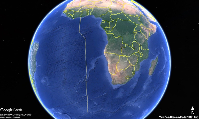
The A13.5 GO-SHIP cruise departed Mindelo, Cape Verde off the western coast of Africa on February 1st aboard the R/V Marcus G. Langseth to gather measurements of heat, freshwater, carbon, oxygen, and nutrients from the ocean’s surface to the seafloor as they travel along the 0E meridional line in the South Atlantic Ocean. AOML’s Ocean Carbon Cycle (OCC) group is among a team of scientists from 20 institutions embarking on this cruise track with the goal of understanding long-term trends in the health and functioning of our oceans. Upon the ship’s return, AOML scientists within the ‘Omics lab will also analyze Environmental DNA (eDNA) samples collected during the cruise as part of the more recently established Bio-GO-SHIP effort to assess the biogeochemical role of planktonic communities in the ocean.
The cruise is expected to end in Cape Town, South Africa in March after over 50 days at sea. This cruise is funded by NOAA’s Global Ocean Monitoring and Observing Program (GOMO), NOAA’s Office of Marine and Aviation Operations (OMAO), NOAA’s AOML, NOAA’s Pacific Marine and Environmental Laboratory (PMEL), and the National Science Foundation’s division of Ocean Sciences.
Sampling the Changing Southern Ocean along I08S
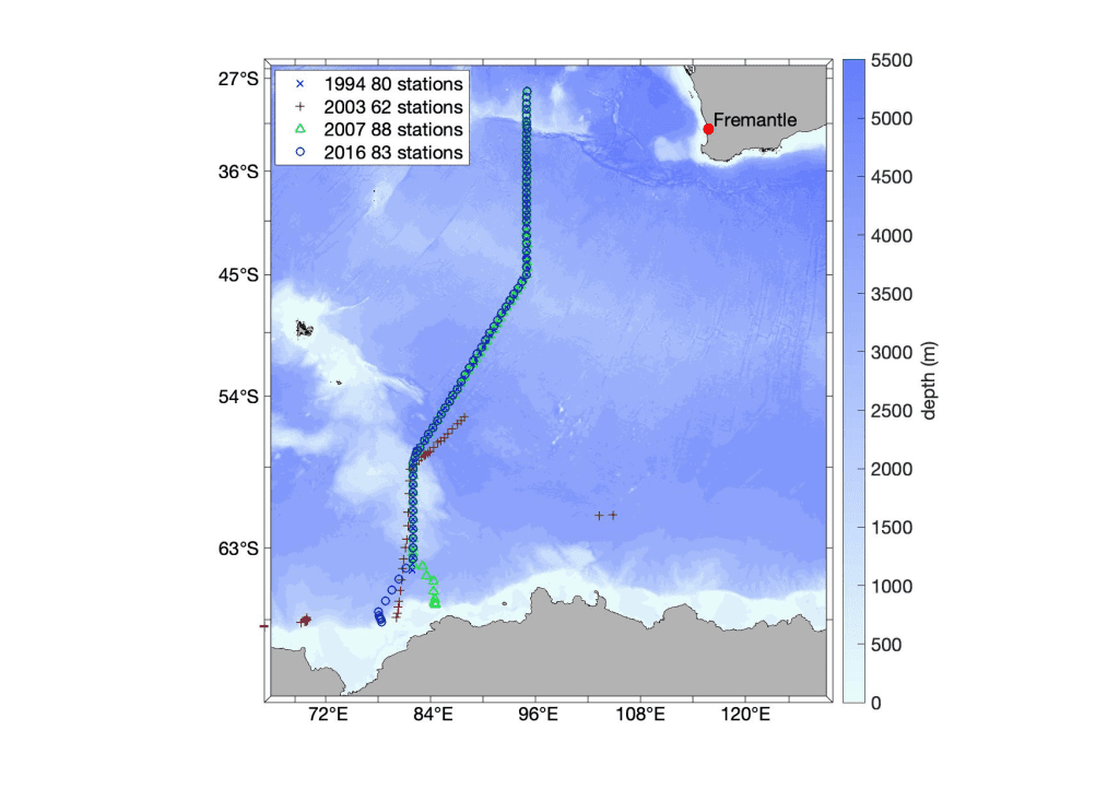
The I08S GO-SHIP cruise will sample the Southeast Indian sector of the Southern Ocean and is planned to depart Fremantle, Australia aboard the R/V Thomas Thompson on February 21. With members of AOML’s Ocean Carbon Cycle group aboard, the expedition will last approximately six weeks and will return to Fremantle in early April. This is only the fourth hydrographic cruise along this line in the Southern Ocean with previous cruises occurring in 1994, 2007, and 2016. Scientists at AOML within the ‘Omics group will also contribute to the sampling of eDNA along this track.
This cruise is funded by the National Science Foundation and NOAA’s GOMO.
Data gathered on these two GO-SHIP cruises will address critical questions regarding changes to ocean circulation and the ocean’s uptake of human-released carbon dioxide. Scientists will investigate how the warming of our ocean impacts the movement of ocean water across the entire planet and influences our climate.
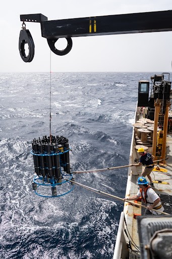
(left) A CTD is lowered into the ocean from the NOAA Ronald H. Brown Ship. Credit: NOAA AOML (right) CTD deployment. Credit: Richard A. Feely, NOAA Pacific Marine Environmental Laboratory, Seattle, WA
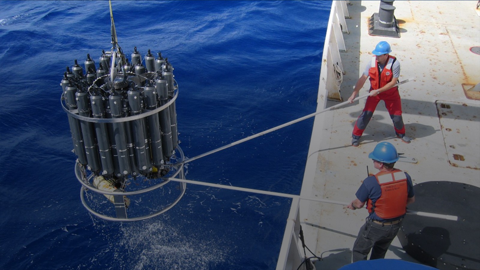
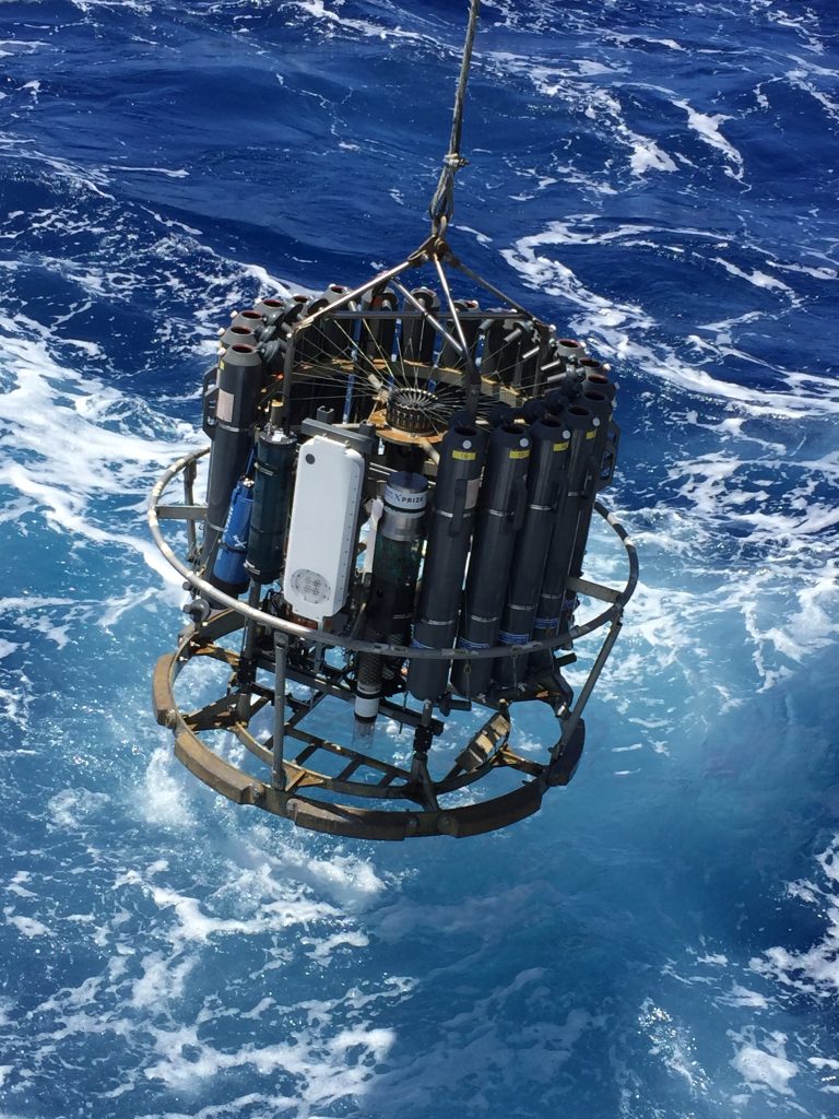
The crew and scientists will collect water samples across thousands of meters using a CTD (Conductivity, Temperature, Depth) rosette to measure parameters such as carbon, nutrients, oxygen and several other key biological elements. Data collected from these cruises will help track the changes in large-scale ocean water property distributions, as well as the drivers of those changes, and will help address questions about how a future ocean will increase in dissolved inorganic carbon, become more acidified and more stratified, and experience changes in circulation and ventilation processes due to global warming and an altered water cycle.
Biological samples will be collected for the first time on these cruises and will allow scientists to start evaluating biological changes in the South Atlantic Ocean and the Indian sector of the Southern Ocean and increase our general understanding of the diverse life in these waters. In addition to collecting water samples, scientists aboard the two GO-SHIP cruises will deploy Argo floats, including floats capable of measuring biogeochemistry and the deep ocean, and drifters as a part of NOAA’s Global Drifter Program.
The cruises will bring together researchers from different institutions and countries to take measurements of the highest accuracy, test new instrumentation, and work towards improving our understanding and modeling of the ocean environment.
PIRATA Northeast Extension
The PIRATA Northeast Extension cruise will travel to the tropical Atlantic to service moorings and collect oceanographic and atmospheric samples. This cruise will be split into 5 legs aboard the NOAA Ship Gordon Gunter and will be at sea for over 100 days. The first leg departed on January 23, 2024 from Pascagoula, Mississippi and arrived in San Juan, Puerto Rico. The ship departed on its second leg on February 4th with researchers from NOAA’s PMEL, NOAA’s National Environmental Satellite, Data and Information Service (NESDIS), and University and Cooperative Institute partners. The third leg will depart from Las Palmas, Spain on March 4th with researchers from NOAA’s AOML, NOAA’s PMEL, and partners.
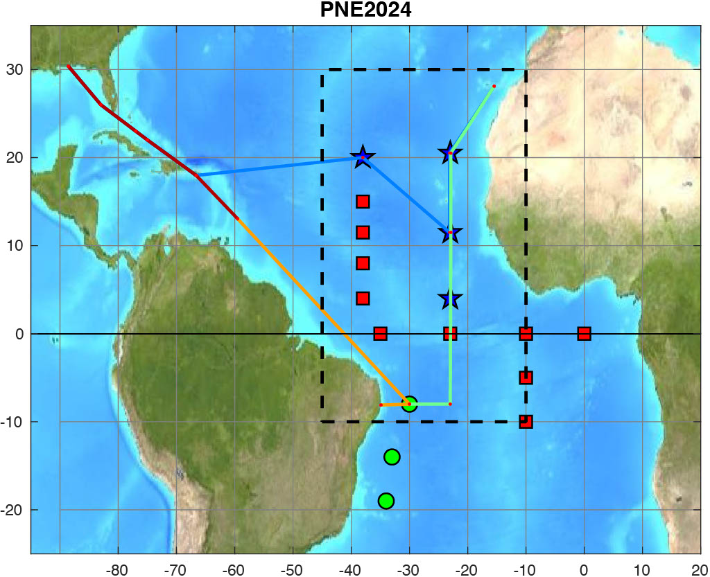
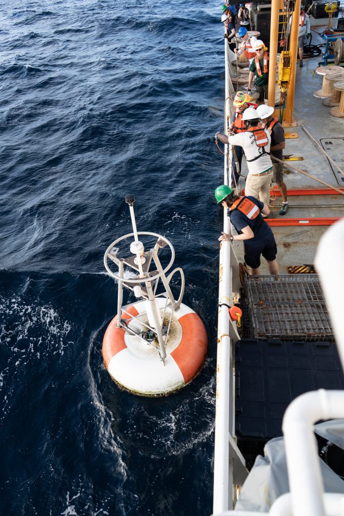
The crew and scientists will recover and redeploy 4-5 key moorings that measure subsurface ocean temperature, salinity, velocity, and atmospheric variables like wind direction and speed, air temperature, humidity, solar radiation, and rainfall. One of the moorings has been augmented with 15 current meters to measure ocean currents in the upper 100 meters of the water column, as part of the Tropical Atlantic Current Observations Study (TACOS), and a new mooring will be instrumented with 15 current meters during this cruise.
PIRATA is a nearly 30 year old collaborative effort between Brazil, France, and the United States to study and improve the predictability of ocean-atmosphere interactions in the tropical Atlantic Ocean. PIRATA Northeast Extension is a joint project between NOAA’s AOML and NOAA’s PMEL that expanded the array of moored buoys into the northern and northeastern sectors of the tropical Atlantic Ocean which is crucial because this is the main development region for hurricanes in this region. The cruise also collects water, atmospheric, and Sargassum seaweed samples across the Atlantic oxygen minimum zone and the equatorial Atlantic.
The cruise will also support several research projects while at sea. Scientists and crew will deploy Argo profiling floats and five drifters at various locations along the cruise track where there are gaps in information about the global ocean and collect over 60 profiles of ocean temperature, salinity, and depth using a CTD rosette, which collects data from the ocean’s surface to about a mile depth. The CTD rosette augmented by total dissolved oxygen and Lowered Acoustic Doppler Current Profilers gives scientists a detailed look into the properties of the water column by detecting how the salinity, temperature, dissolved oxygen, and velocity of the water change relative to depth.
Scientists from Woods Hole Oceanographic Institute will conduct Sargassum sampling experiments to study the environmental conditions that affect Sargassum growth, its species diversity, and how its spatial distribution and abundance change from month to month and year to year.
Additionally, researchers aboard the cruise from NOAA’s NESDIS, University of Wisconsin, Arizona State University, and University of Maryland Baltimore will collect aerosol measurements and perform approximately 50 radiosonde launches in support of the Aerosols and Oceanographic Science Expeditions project. This project’s goal is to gain an understanding of the weather and climate impacts of long-range transport of mineral dust and smoke aerosols over the tropical Atlantic.
The PIRATA Northeast Extension cruise typically occurs annually and serves as a place for academic and international collaboration to advance the understanding of the ocean and to work towards improved prediction of weather and climate variability. This cruise is funded by NOAA’s OMAO and NOAA’s GOMO, with personnel support from NOAA’s AOML, and NOAA’s PMEL.
We wish the participants in all of these cruises a safe and rewarding voyage!