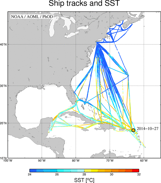
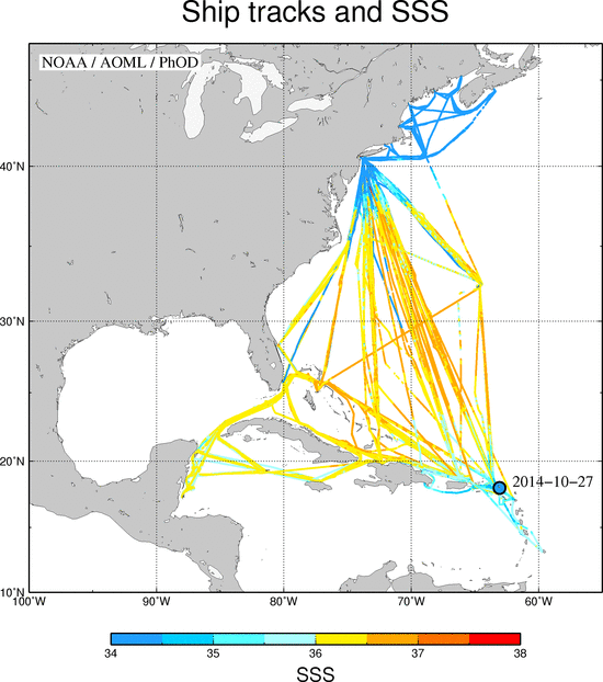
The figures below show the tracks of the Explorer of the Seas. The date and location of the last TSG data record received is indicated. Colors indicate the sea surface temperature (SST) (upper) or sea surface salinity (SSS) (lower) values. These maps are updated daily.