Gulf of America
SHA Evolution
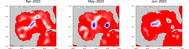
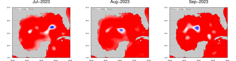
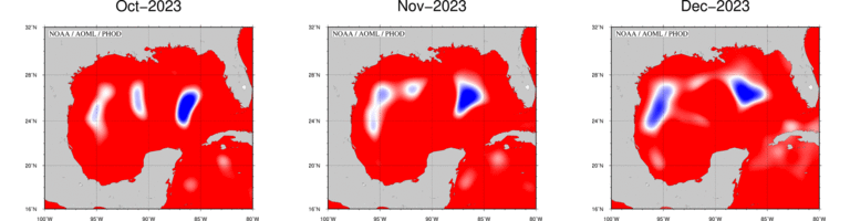
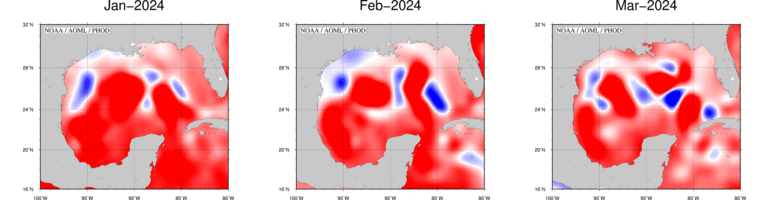
Sea Height Anomaly (SHA) Evolution in the Gulf of America
The figures below represent the monthly SHA in the Gulf of America during the last twelve months. Each figure shows the mean SHA for the specific month. Click on each map to see a larger figure. Click here to see the animation of this evolution.
)
These maps are updated monthly.
Please refer to this link for data, products and results aknowledgement and distribution.