North Atlantic
Latest SST Maps
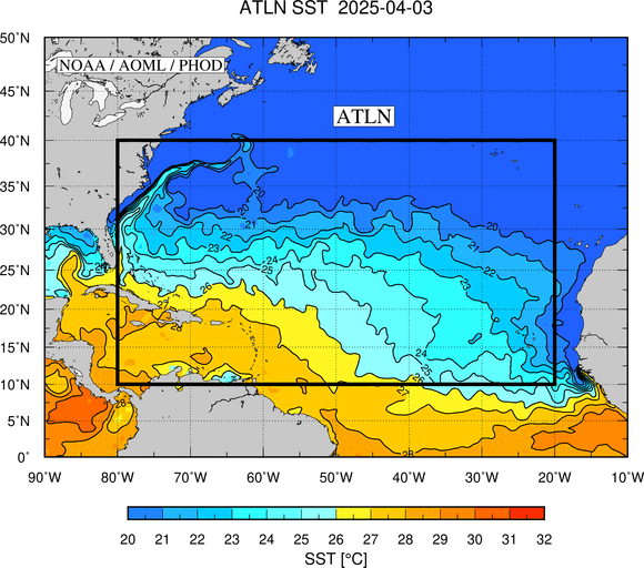
Animation of the latest seven days of the sea surface temperature (SST) in the North Atlantic (ATLN).
These maps are updated daily.
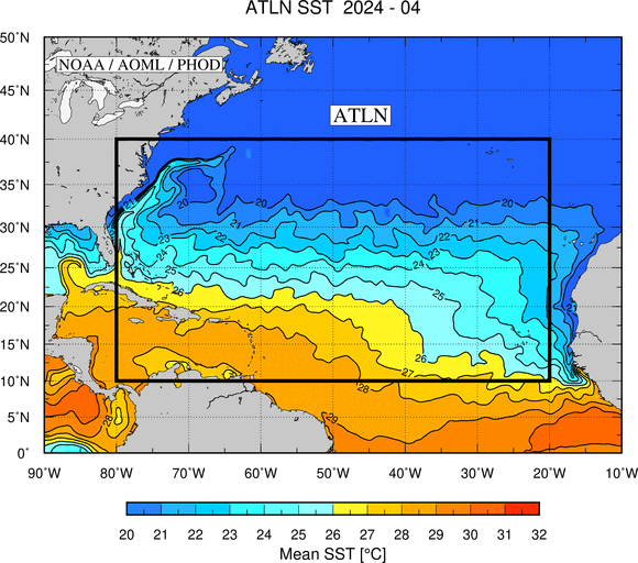
Animation of the monthly mean SST in the North Atlantic during the latest twelve months.
These maps are updated monthly.
Please refer to this link for data, products and results aknowledgement and distribution.