North Brazil Current
Time Series of Geostrophic Transport
Geostrophic transport time-series across transect #1
Time series of geostrophic transport of both the northwestward flow (blue) and the retroflected flow (red) of the North Brazil Current (NBC). The transport is estimated across transect #1 ( see map ) using a combination of sea height anomaly (SHA) fields from satellite altimetry (AVISO) and climatological data (Levitus).
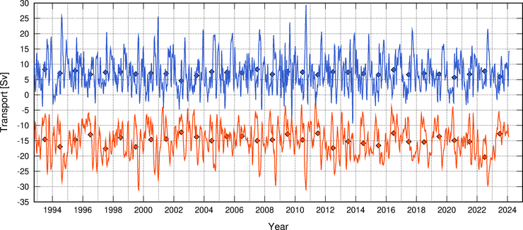
The diamonds indicate the anual mean values. This timeseries is updated on a monthly basis using near real time altimetry data (4 week delay). Last updated on 02/12/24 02:58.
Time series of transport anomaly
This time series of geostrophic transport anomaly of the NBC retroflected flow is produced using sea height anomaly fields from AVISO.
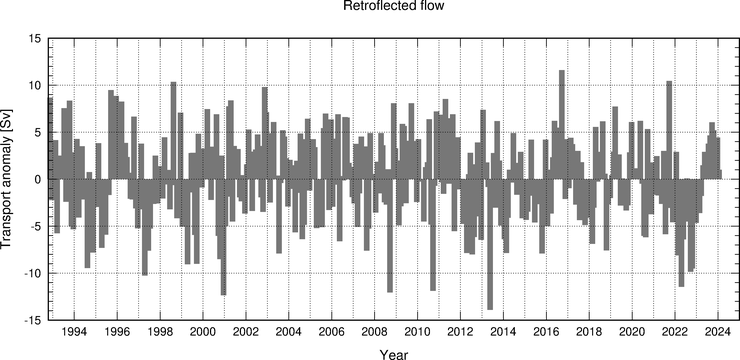
This timeseries is updated on a monthly basis using near real time altimetry data (4 week delay). Last updated on 02/12/24 02:58.
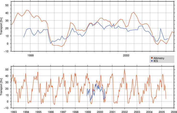
Comparison between altimetry and inverted echo sounders (IES) estimates
The time series of geostrophic transport of the NBC retroflected flow is also estimated across the transect defined by IES17 and IES14 locations ( see map ). A combination of sea height anomaly (SHA) fields from satellite altimetry (AVISO) and climatological data (Levitus) are used to estimate the geostrophic transport. These results are compared to the time series obtained using a combination of IES and CTD data during the NBC Ring Experiment.
Last updated on 02/12/24 02:58.