Agulhas Current
Time Series of Geostrophic Transport
This time series of geostrophic transport of the Agulhas Current is produced using a combination of sea height anomaly (SHA) fields from satellite altimetry (AVISO) and climatological data (Levitus).
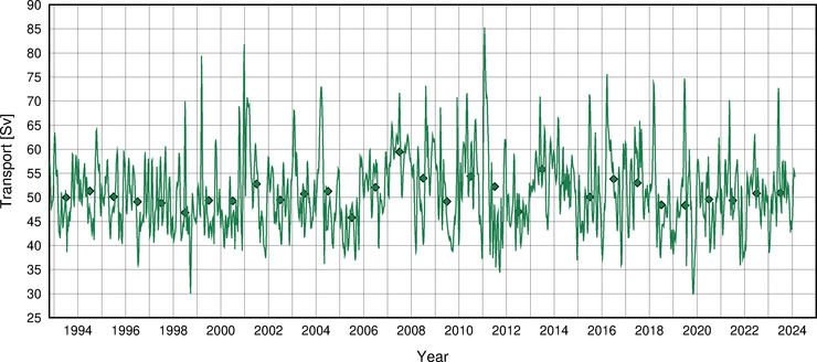
The diamonds indicate the anual mean values. This timeseries is updated on a monthly basis using near real time altimetry data (4 week delay). Last updated on 02/12/24 01:25.
Time series of transport anomaly
This time series of geostrophic transport anomaly of the Agulhas Current is produced using sea height anomaly (SHA) fields from satellite altimetry (AVISO).
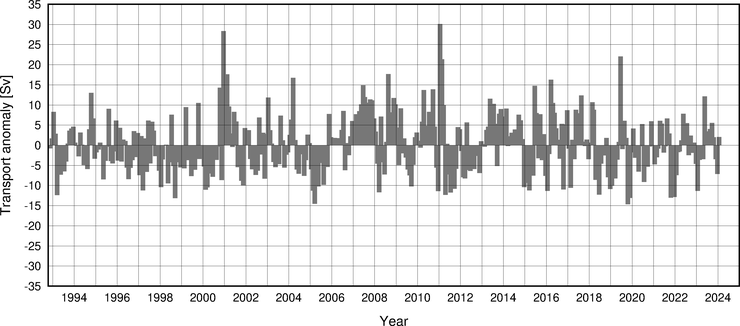
This timeseries is updated on a monthly basis using near real time altimetry data (4 week delay). Last updated on 02/12/24 01:25.