Mission Catalog
Sfc. Wind Anal.
Syn. Surveillance
Re-Anal. Proj.
Basin-Wide Data
Data Formats
OAR
NOAA Aircraft Operations Center
Site Map
Staff
Data Center
Contact
Information
Research Divisions
Ike 2008 radar data
Airborne radar data
Graphics for entire storm by aircraft
Doppler wind analyses
CAUTION : CLICK LINK BELOW
Important information on Doppler radar data
N42RF by flight leg
tar'd JPEG plots of Doppler winds from all levels
tar'd JPEG plots of vertical profiles of radar data
tar'd ASCII 3D Doppler analyses
zip'd Doppler radials TEXT files
N43RF by flight leg
tar'd JPEG plots of Doppler winds from all levels
tar'd JPEG plots of vertical profiles of radar data
tar'd ASCII 3D Doppler analyses
zip'd Doppler radials TEXT files
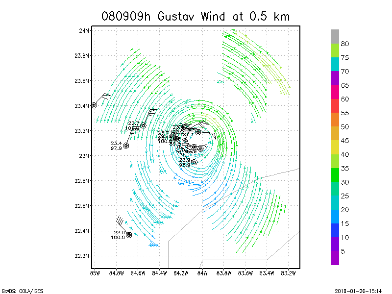
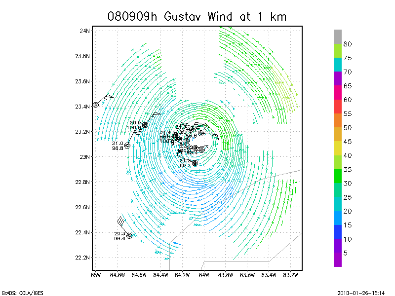
September 09, 2008
N42RF
Composited Doppler winds and dropsonde data
g'zipped and tar'd graphics
Gridded radar data
GrADS control file radar data
Gridded dropsonde data
GrADS control file dropsonde data
GrADS map of dropsonde data
Winds at :
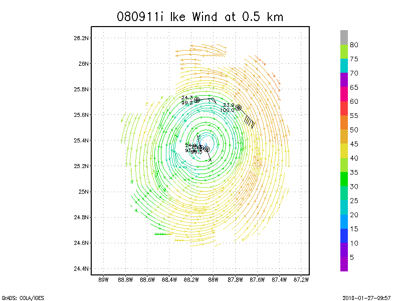
.5 km
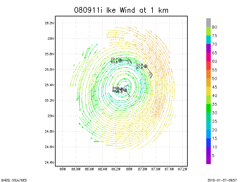
1.0 km
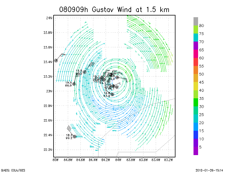
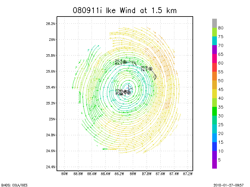
1.5 km
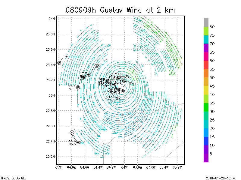
2.0 km
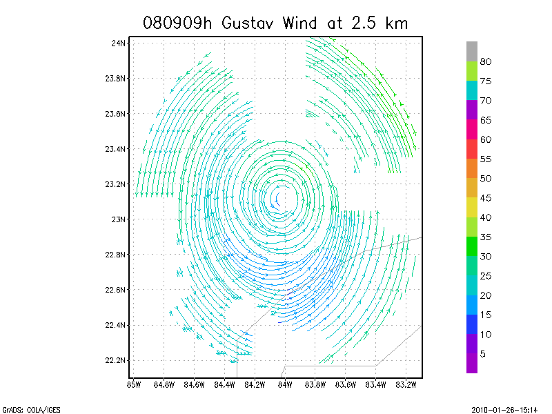
2.5 km
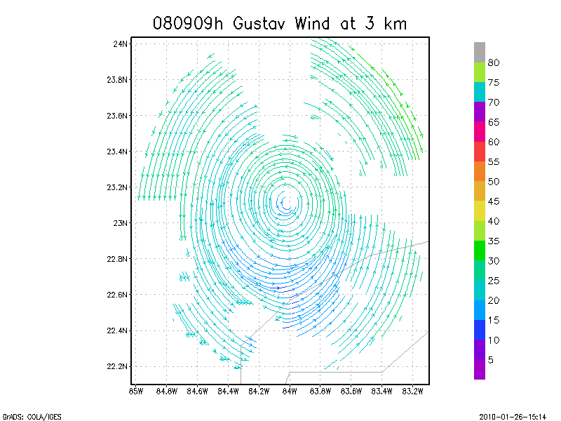
3.0 km
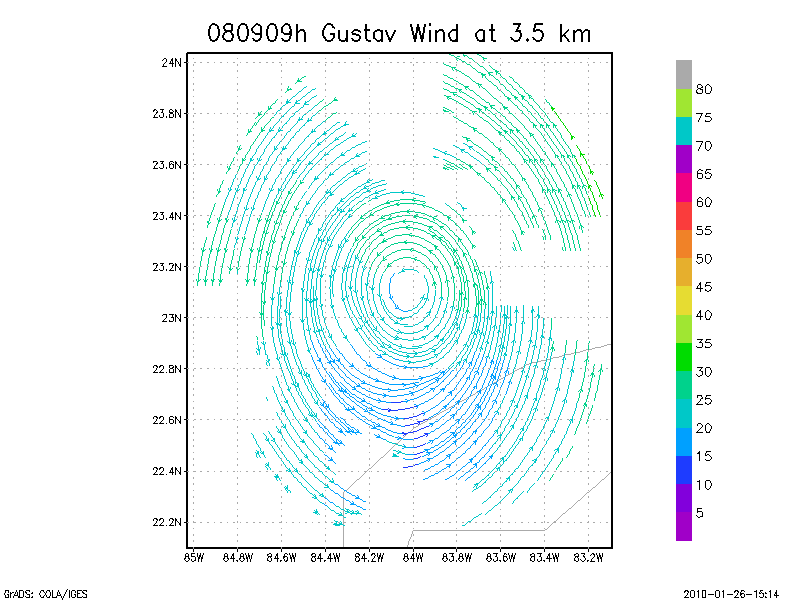
3.5 km
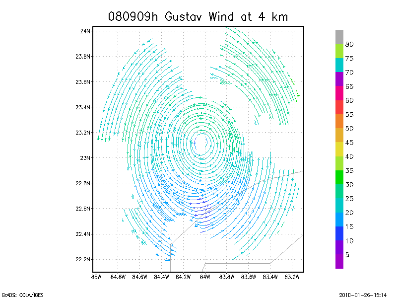
4.0 km
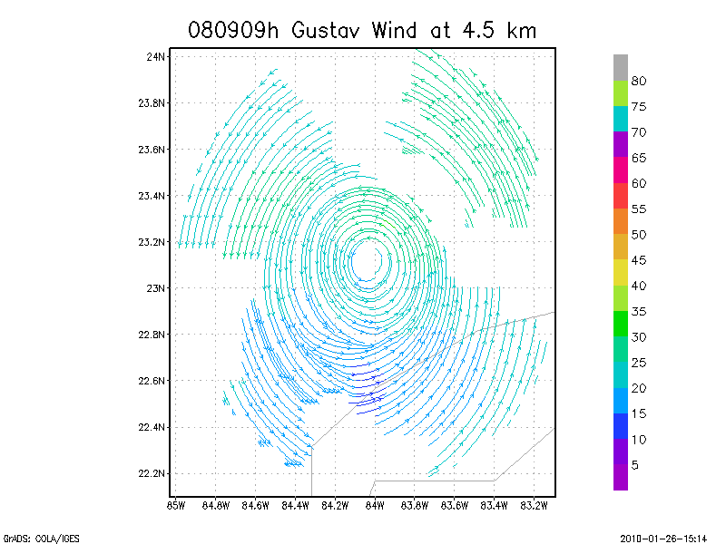
4.5 km
Winds at :
5.0 km
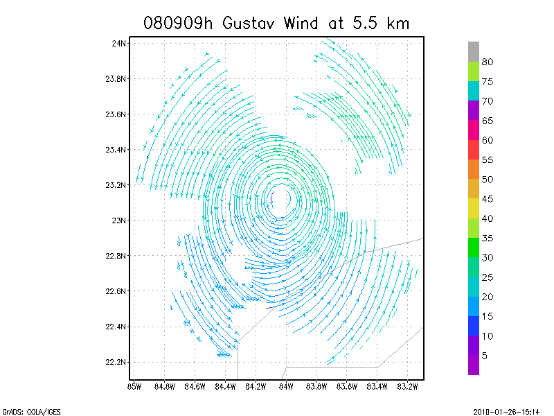
5.5 km
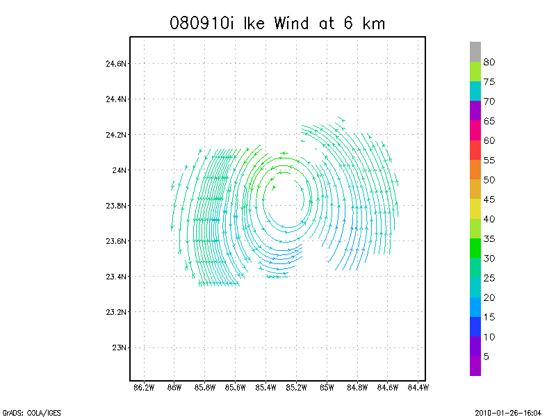
6.0 km
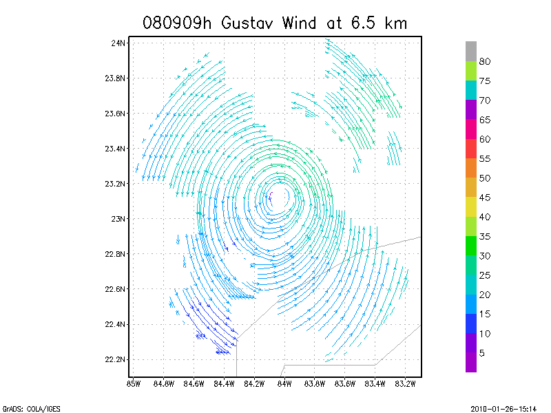
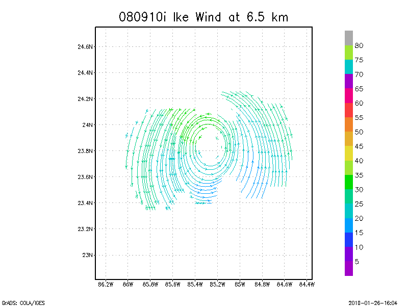
6.5 km
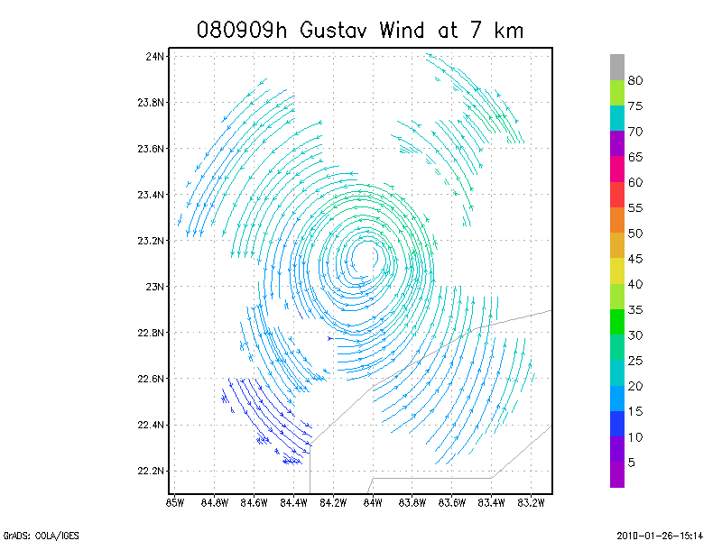
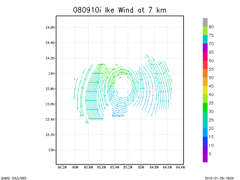
7.0 km
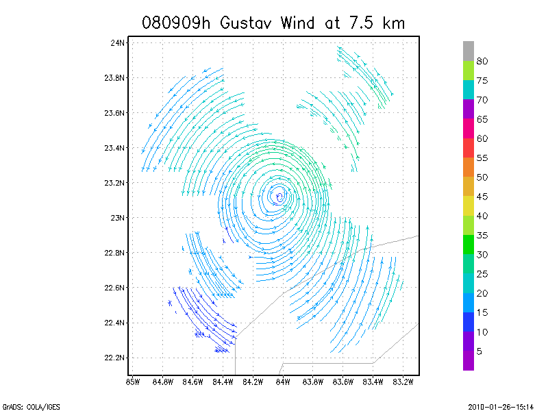
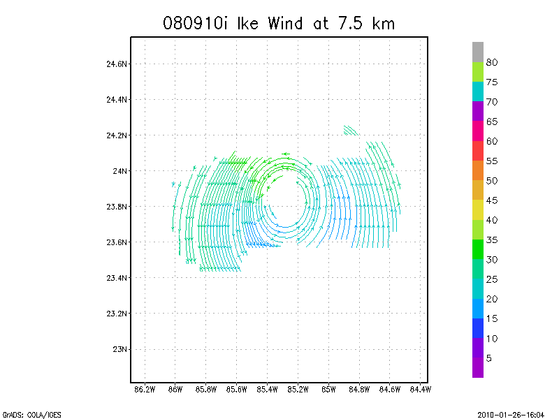
7.5 km
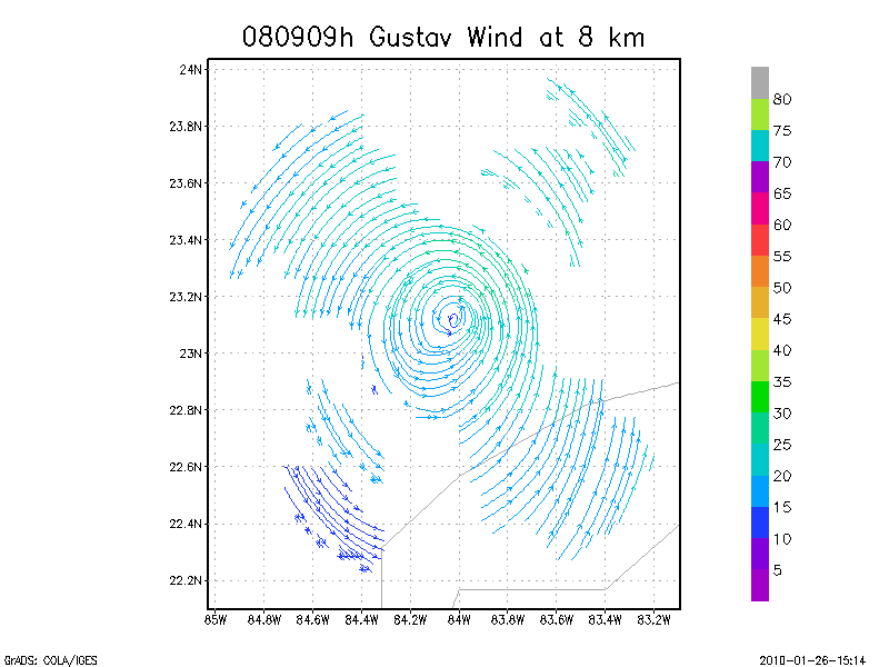
8.0 km
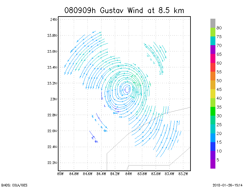
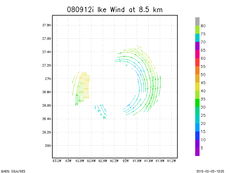
8.5 km
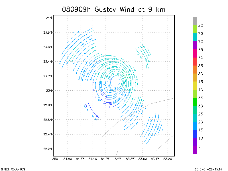
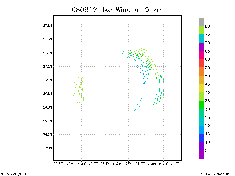
9.0 km
Winds at :
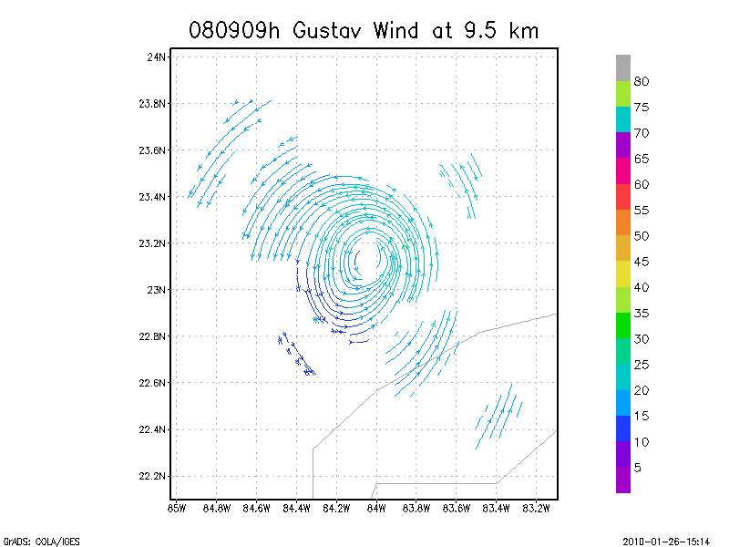
9.5 km
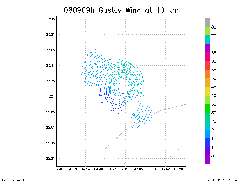
10.0 km
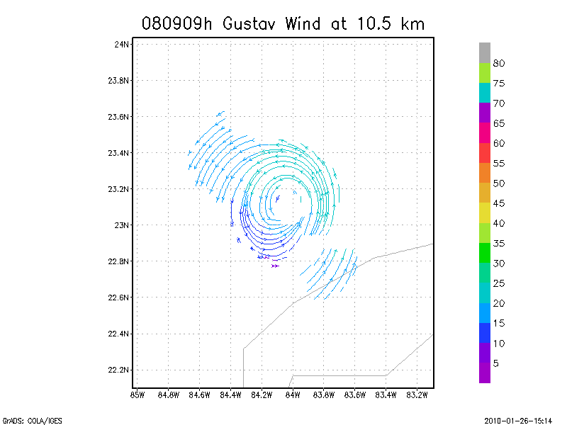
10.5 km
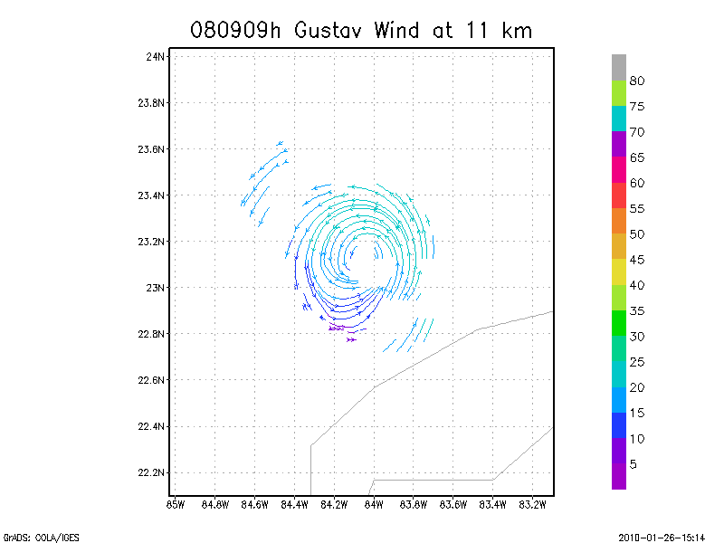
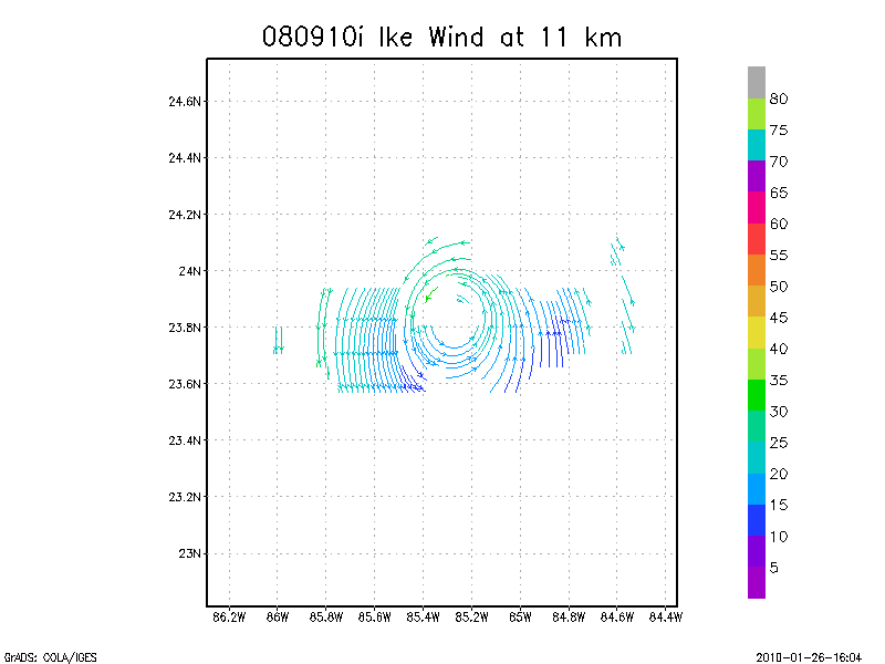
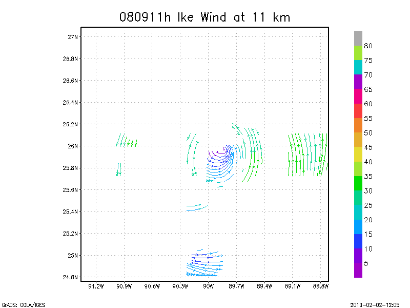
11.0 km
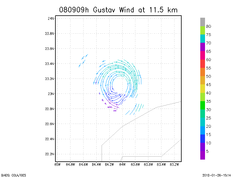
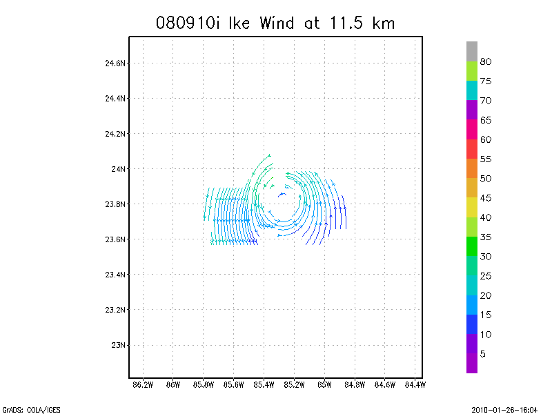
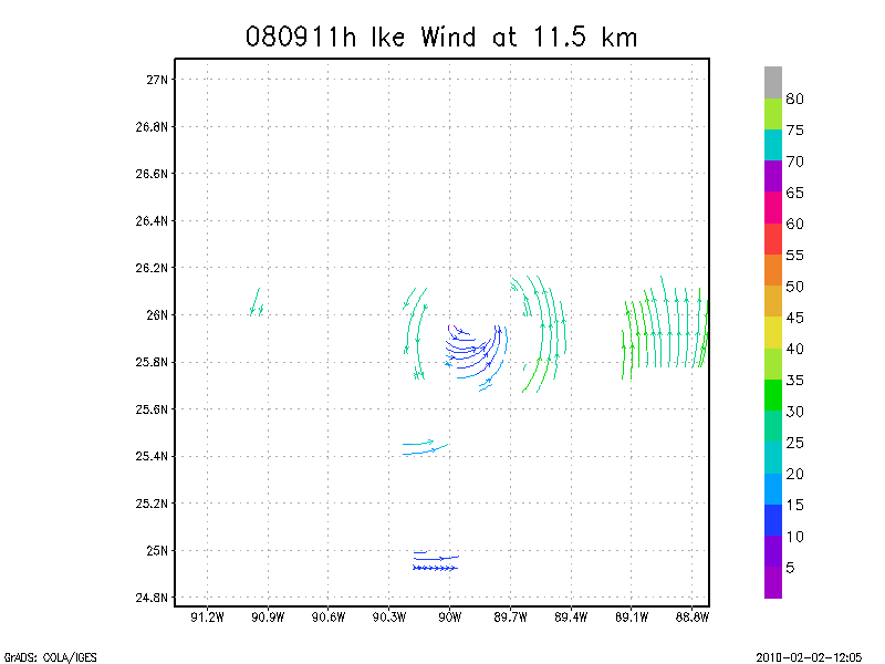
11.5 km
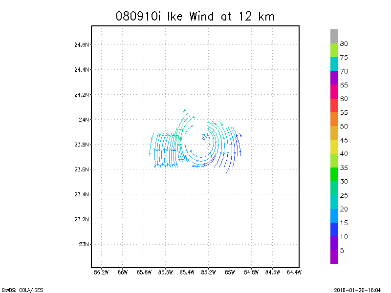
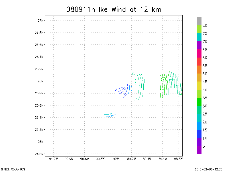
12.0 km
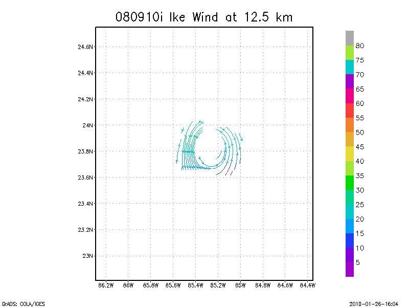
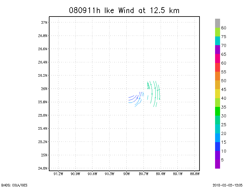
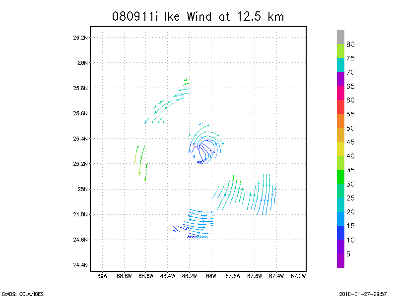
12.5 km
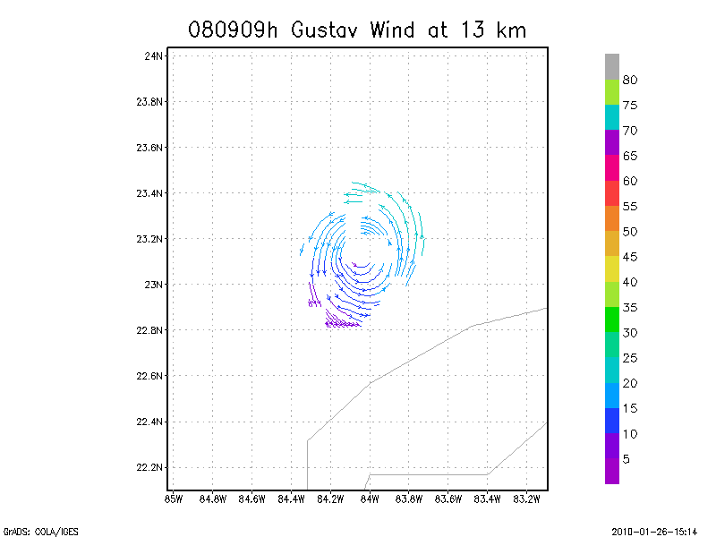
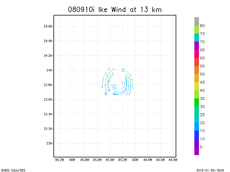
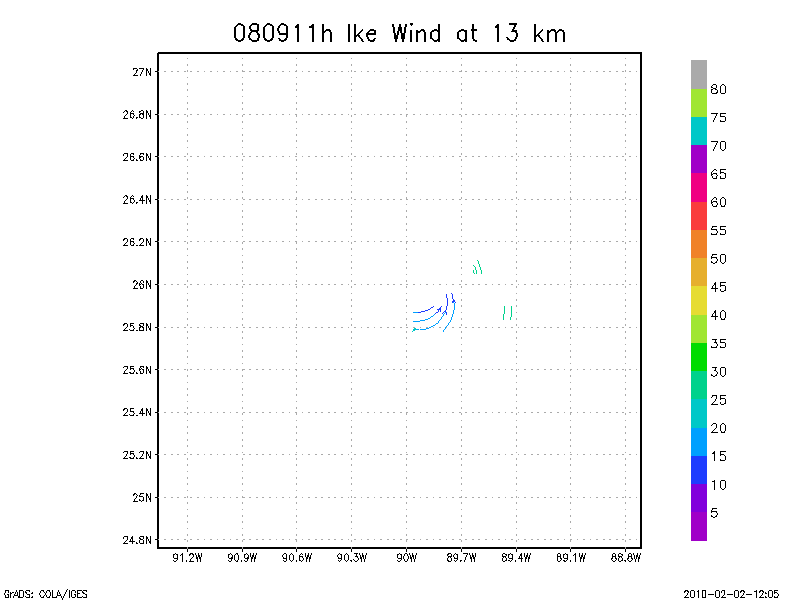
13.0 km
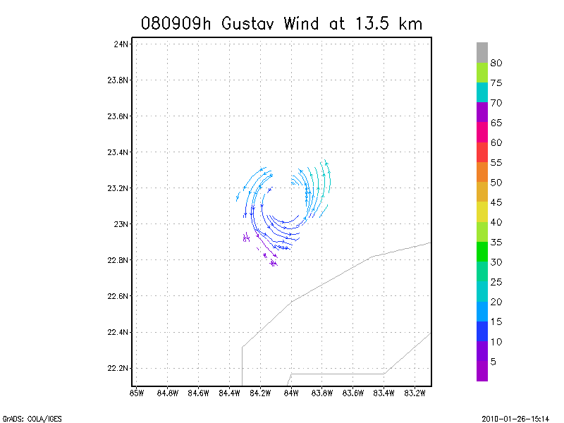
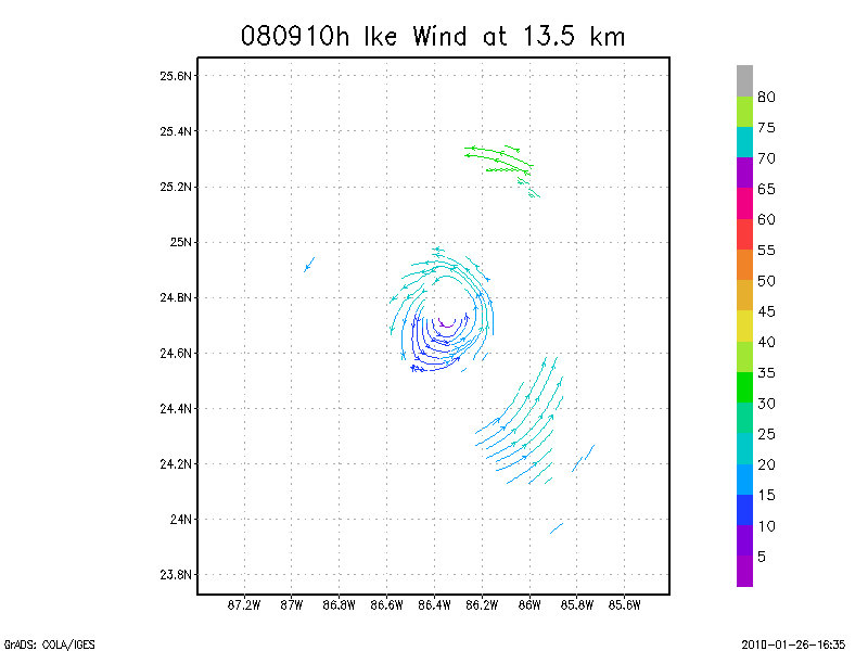
13.5 km
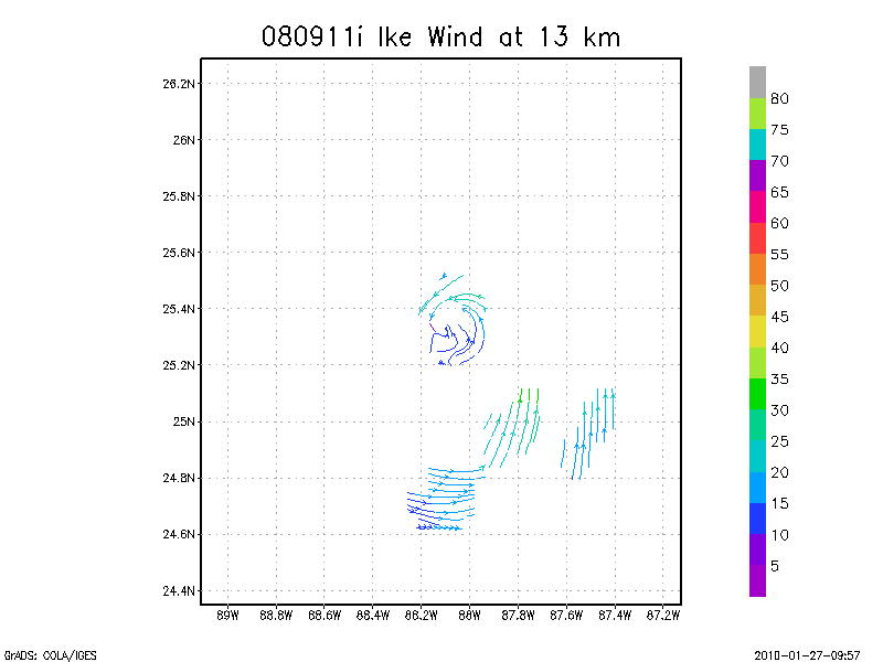
Winds at :
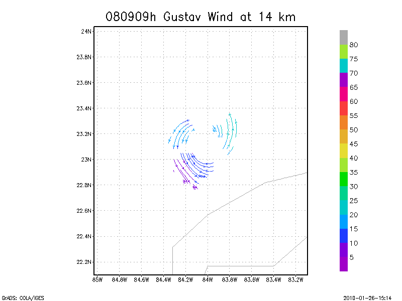
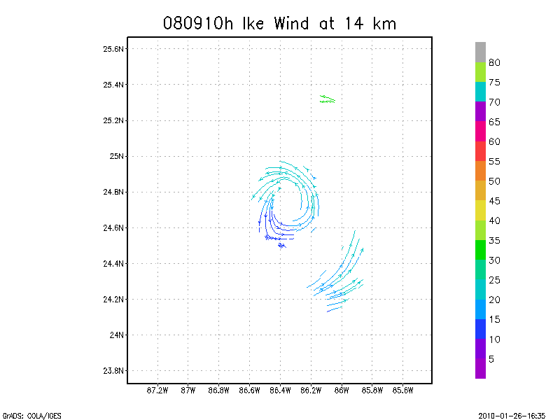
14.0 km
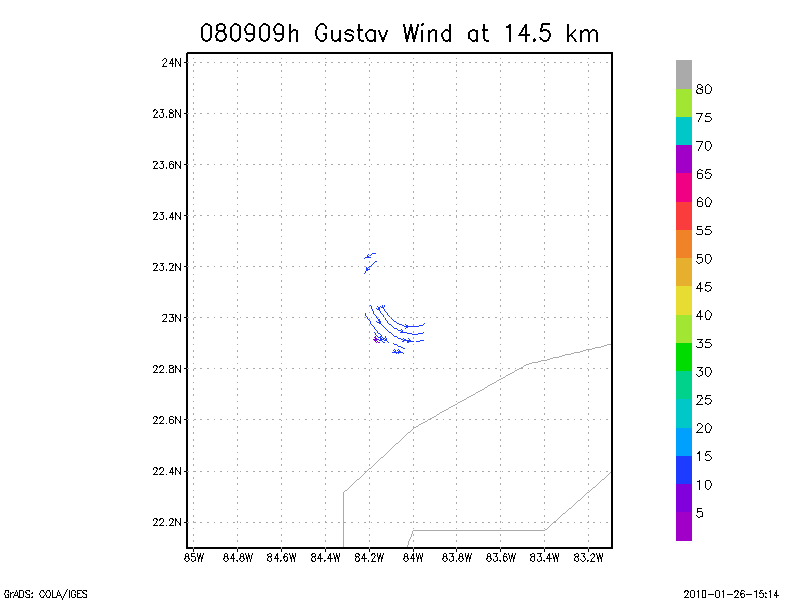
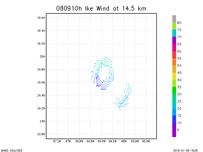
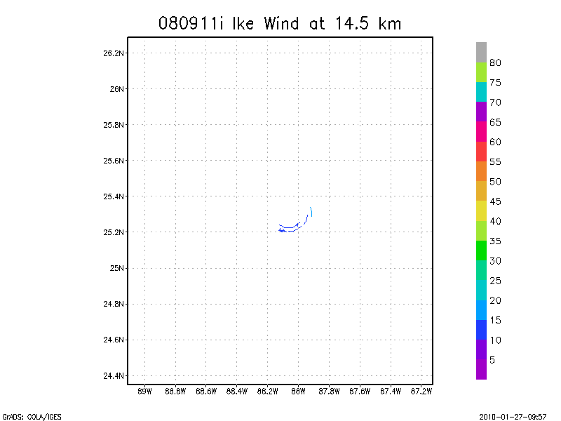
14.5 km
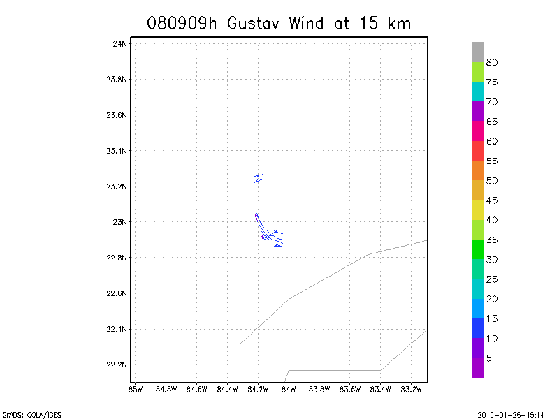
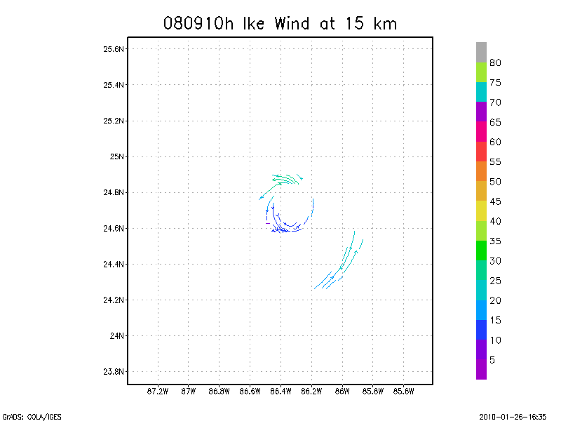
15.0 km
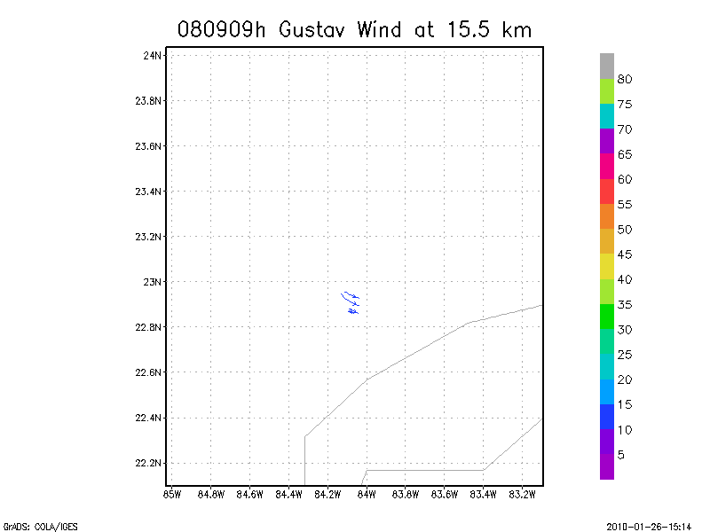
15.5 km
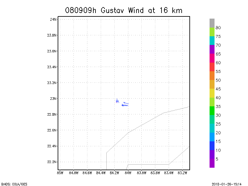
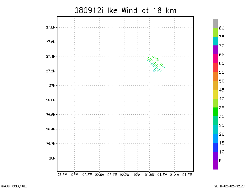
16.0 km
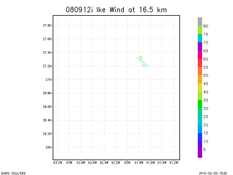
16.5 km
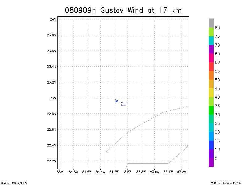
17.0 km
17.5 km
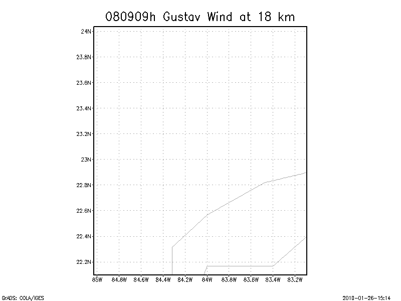
18.0 km
September 10, 2008
N42RF
Composited Doppler winds and dropsonde data
g'zipped and tar'd graphics
Gridded radar data
GrADS control file radar data
Gridded dropsonde data
GrADS control file dropsonde data
GrADS map of dropsonde data
Winds at :
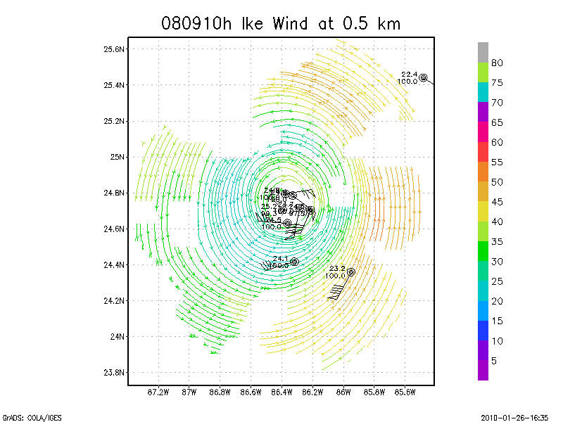
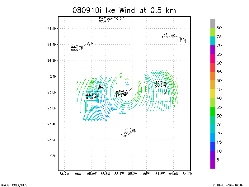
.5 km
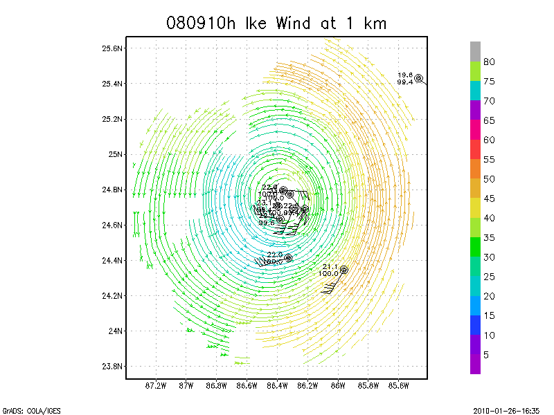
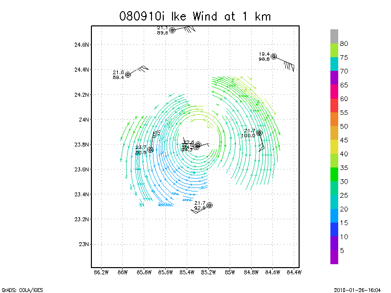
1.0 km
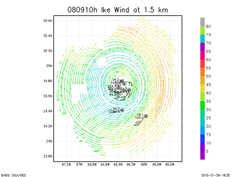
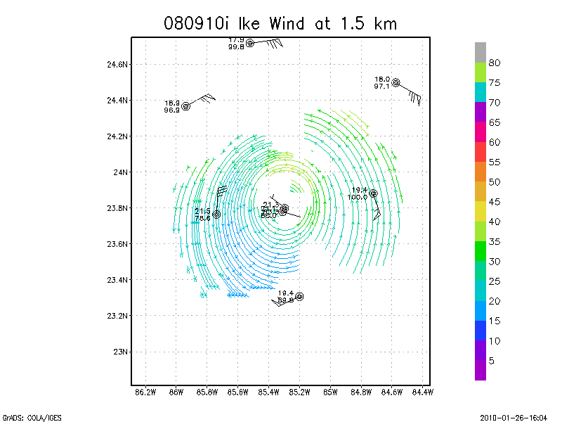
1.5 km
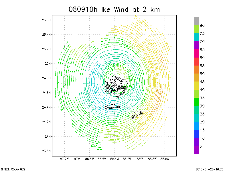
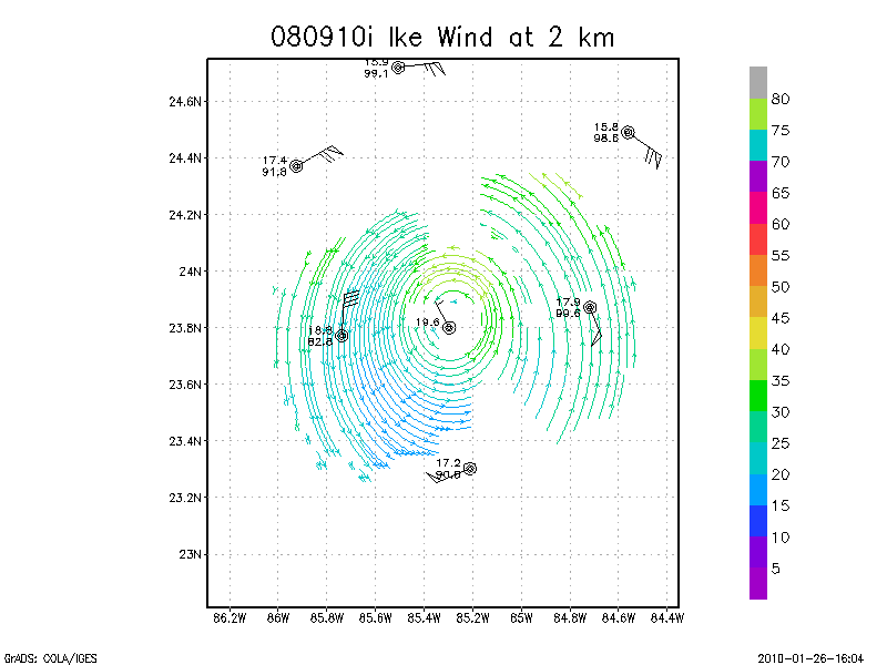
2.0 km
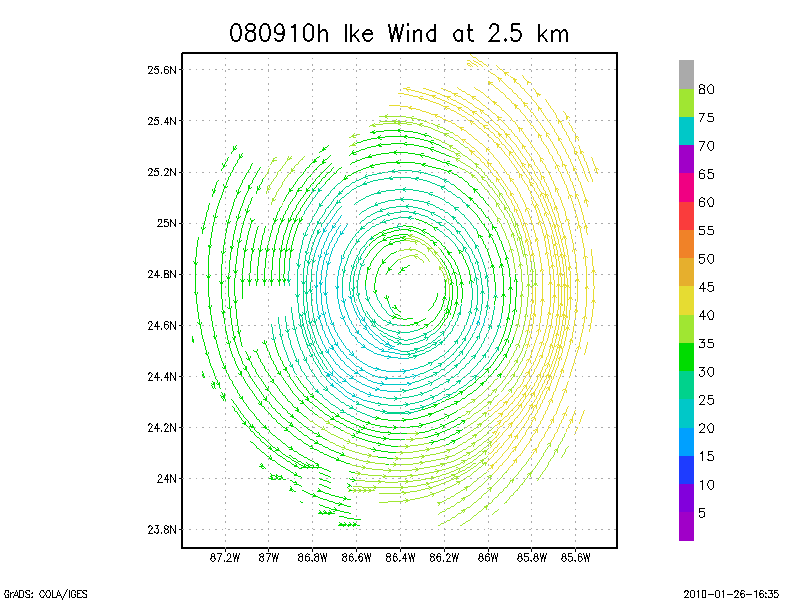
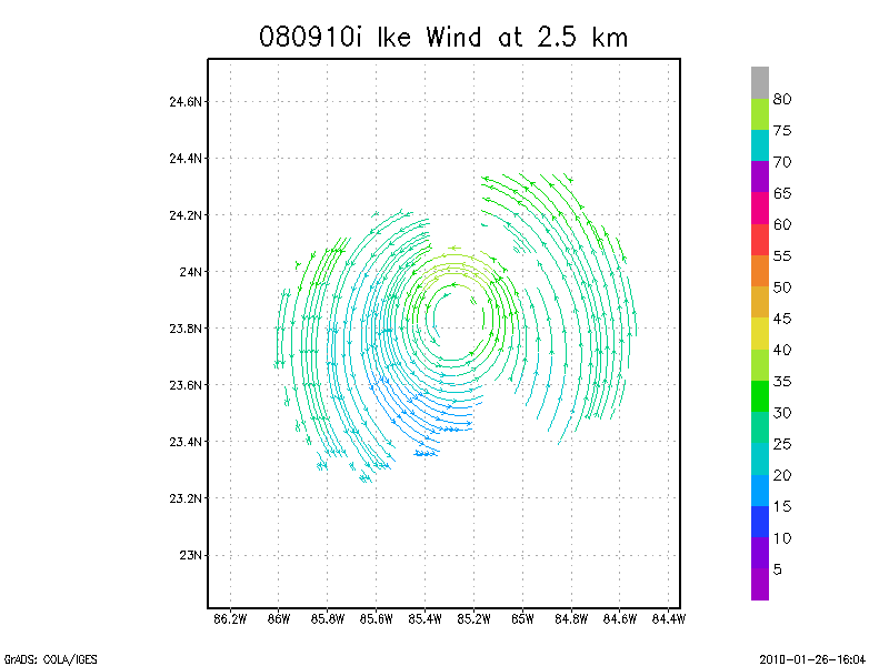
2.5 km
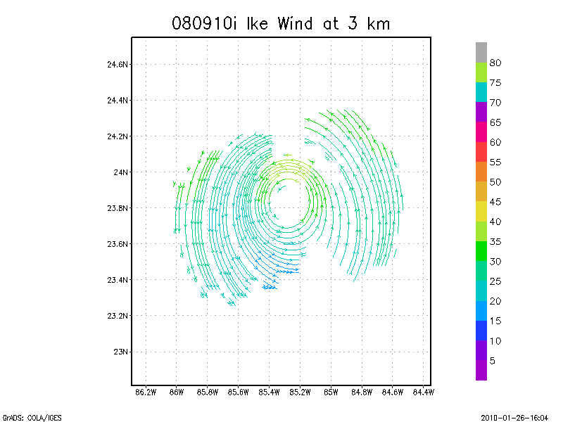
3.0 km
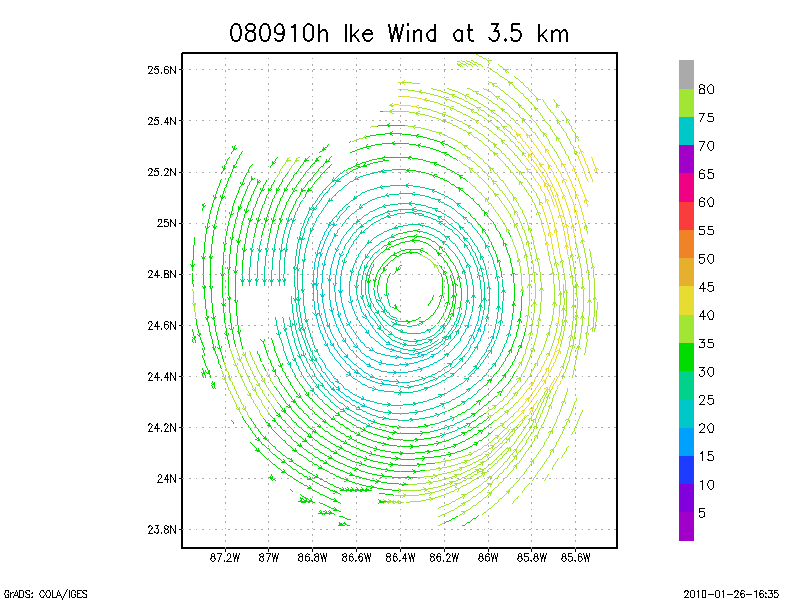
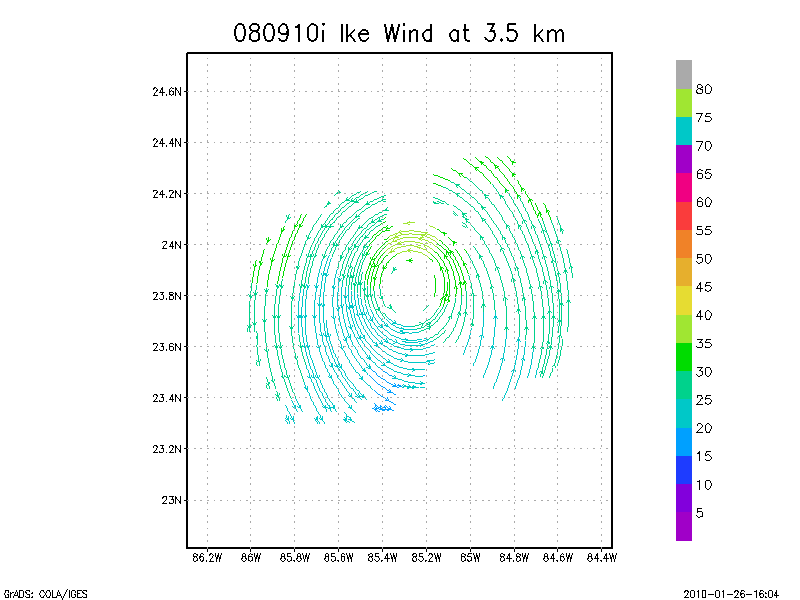
3.5 km
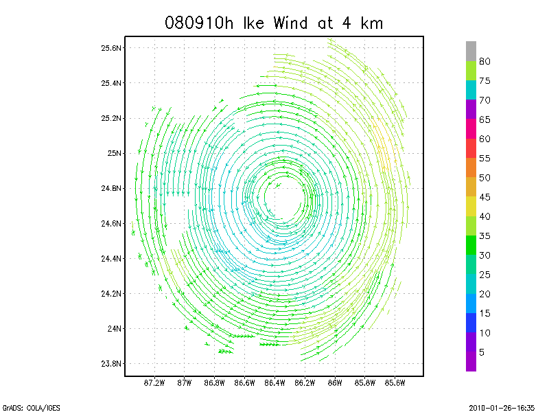
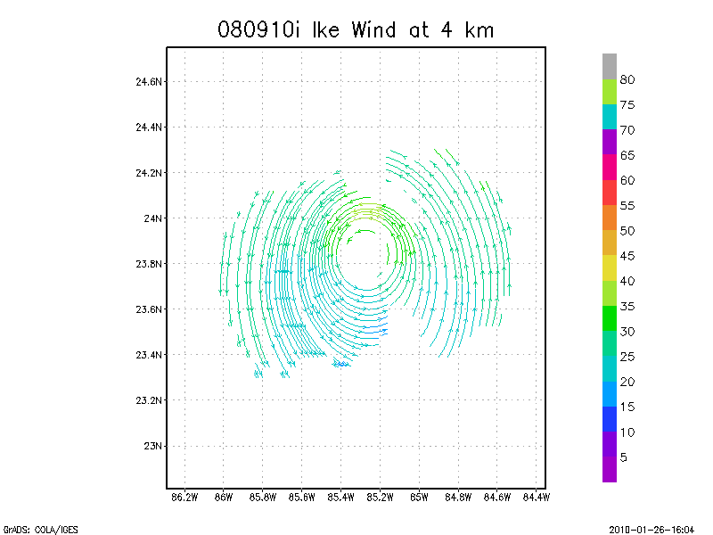
4.0 km
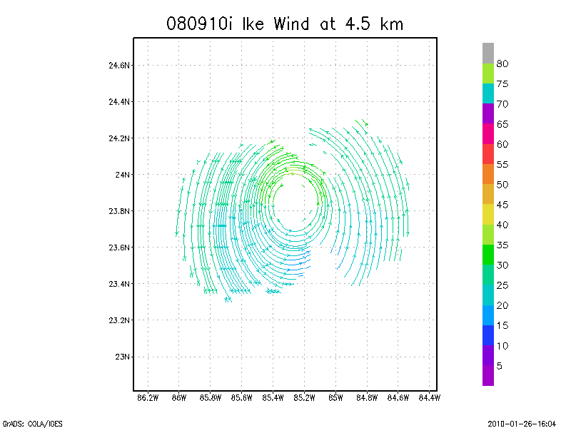
4.5 km
Winds at :
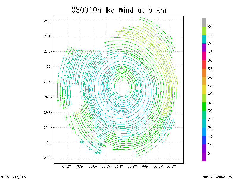
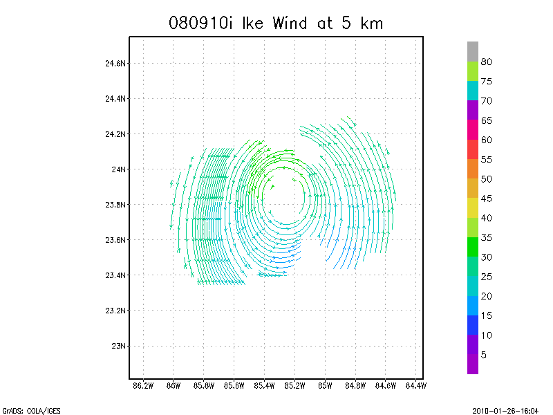
5.0 km
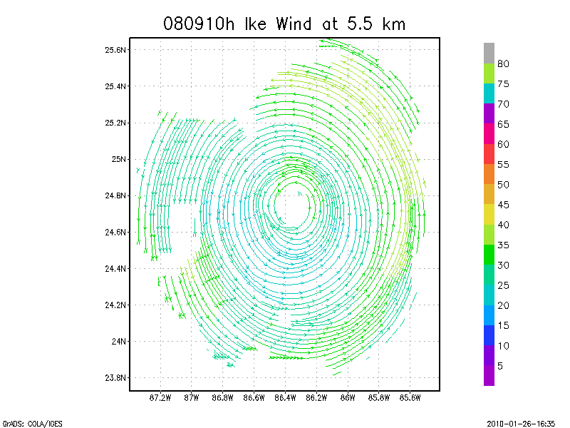
5.5 km
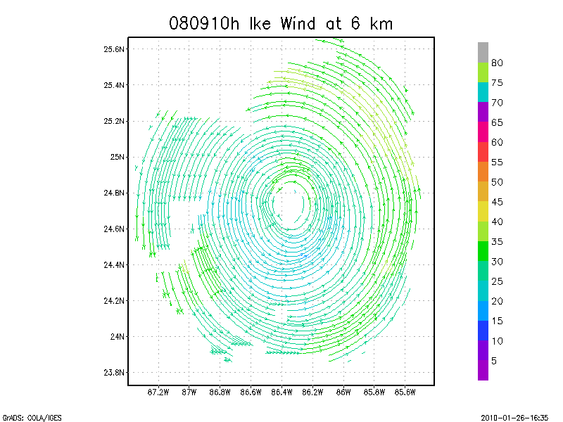
6.0 km
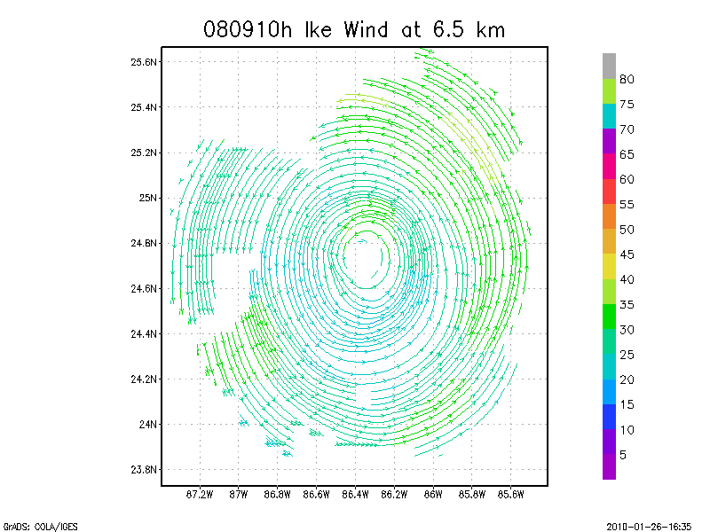
6.5 km
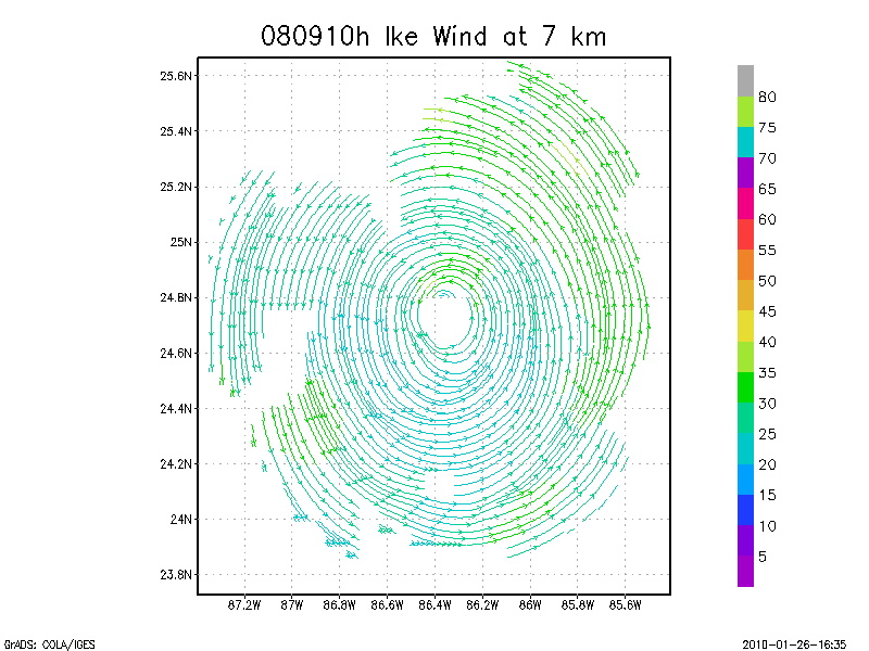
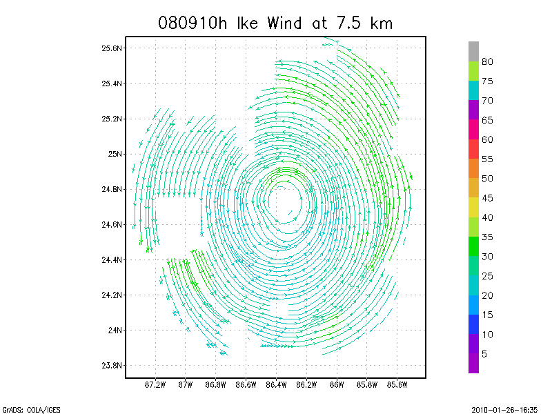
7.0 km
7.5 km
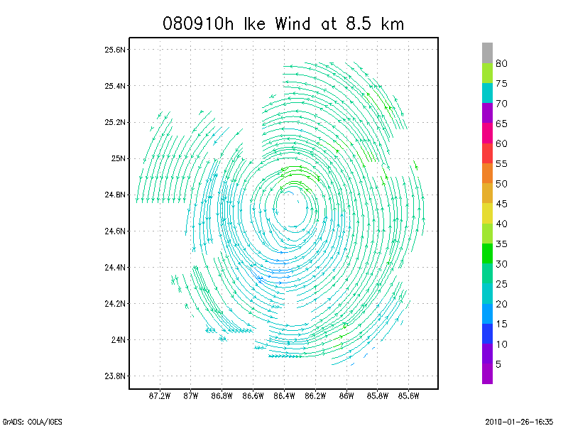
8.0 km
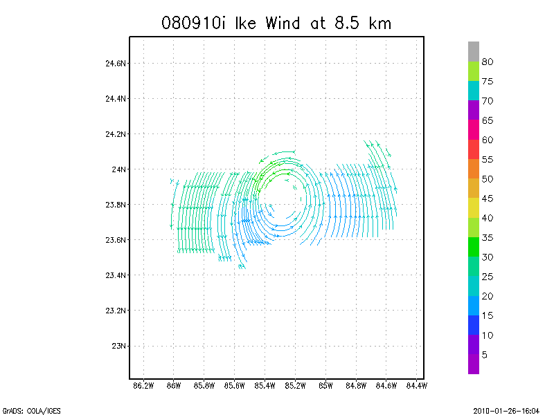
8.5 km
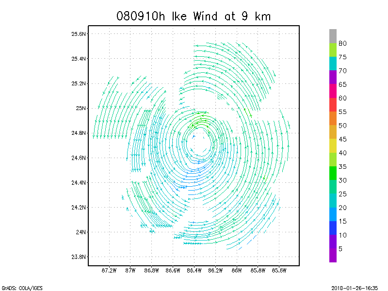
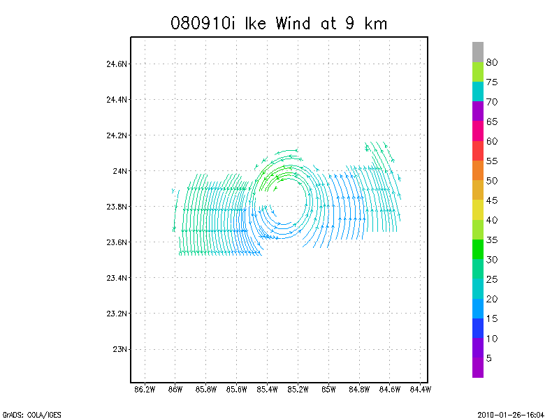
9.0 km
Winds at :
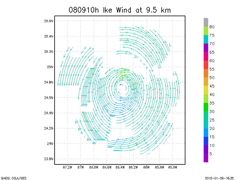
9.5 km
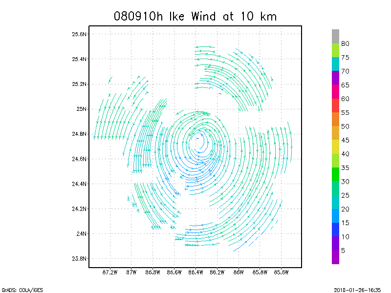
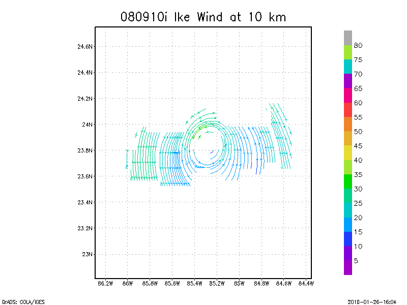
10.0 km
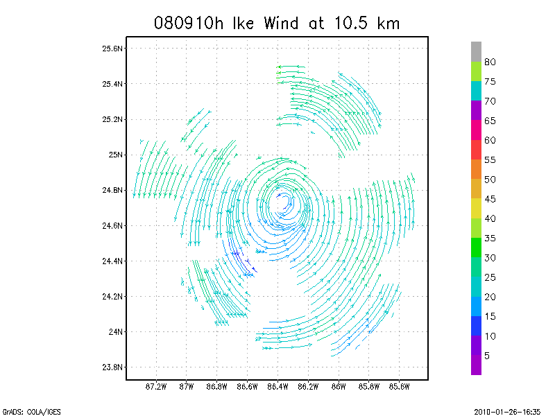
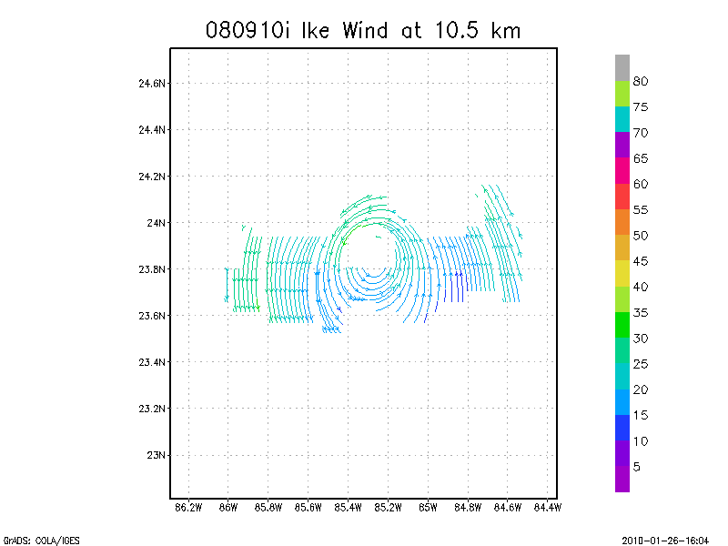
10.5 km
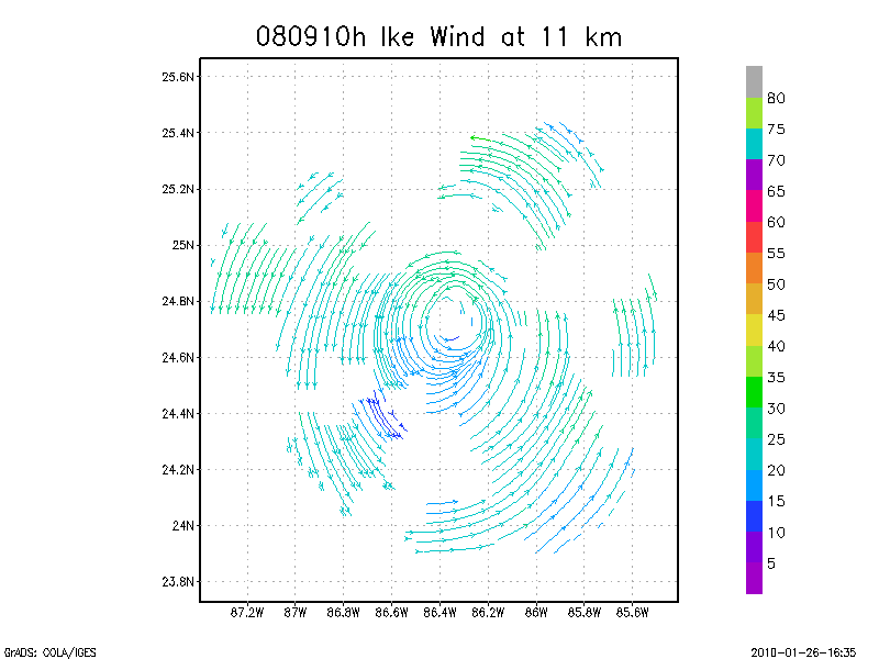
11.0 km
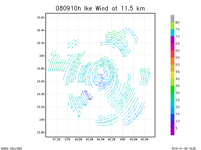
11.5 km
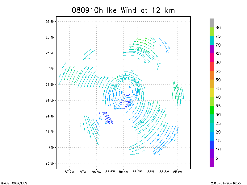
12.0 km
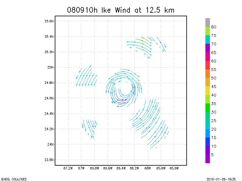
12.5 km
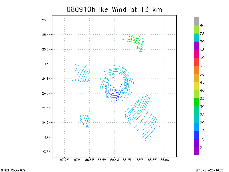
13.0 km
13.5 km
Winds at :
14.0 km
14.5 km
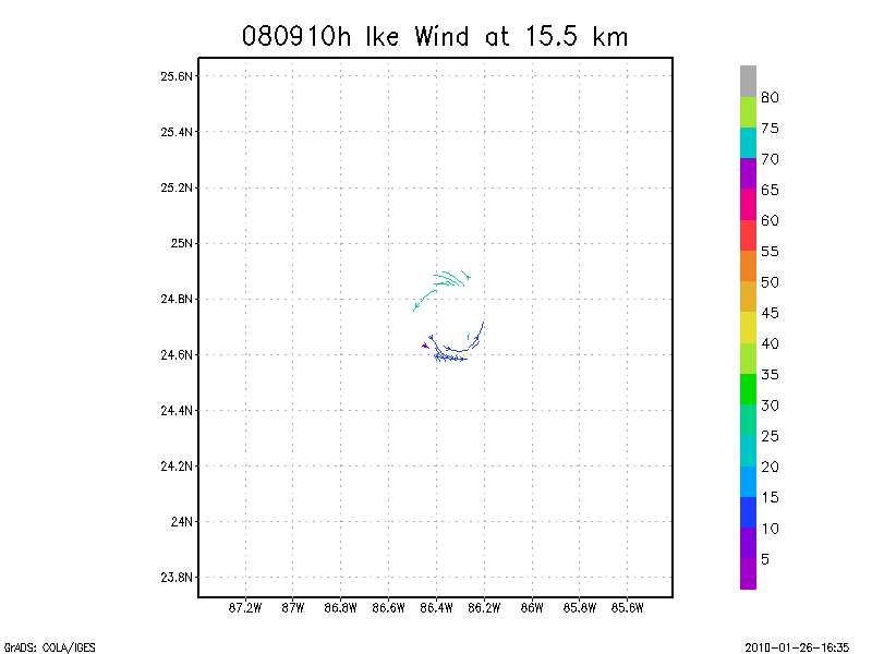
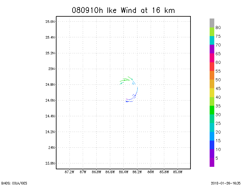
15.0 km
15.5 km
16.0 km
16.5 km
17.0 km
17.5 km
18.0 km
September 10, 2008
N43RF
Composited Doppler winds and dropsonde data
g'zipped and tar'd graphics
Gridded radar data
GrADS control file radar data
Gridded dropsonde data
GrADS control file dropsonde data
GrADS map of dropsonde data
Winds at :
.5 km
1.0 km
1.5 km
2.0 km
2.5 km
3.0 km
3.5 km
4.0 km
4.5 km
Winds at :
5.0 km
5.5 km
6.0 km
6.5 km
7.0 km
7.5 km
8.0 km
8.5 km
9.0 km
Winds at :
9.5 km
10.0 km
10.5 km
11.0 km
11.5 km
12.0 km
12.5 km
13.0 km
13.5 km
Winds at :
14.0 km
14.5 km
15.0 km
15.5 km
16.0 km
16.5 km
17.0 km
17.5 km
18.0 km
Individual sweeps
(aircraft relative)
Animated radar
tar'd and gzipped single frame GIFs
tar'd and gzipped sweep data
Individual sweeps
(storm relative)
Animated radar
tar'd and gzipped single frame GIFs
tar'd and gzipped sweep data
Individual sweeps
660 x 660 km
(storm relative)
Animated radar
tar'd and gzipped single frame GIFs
tar'd and gzipped sweep data
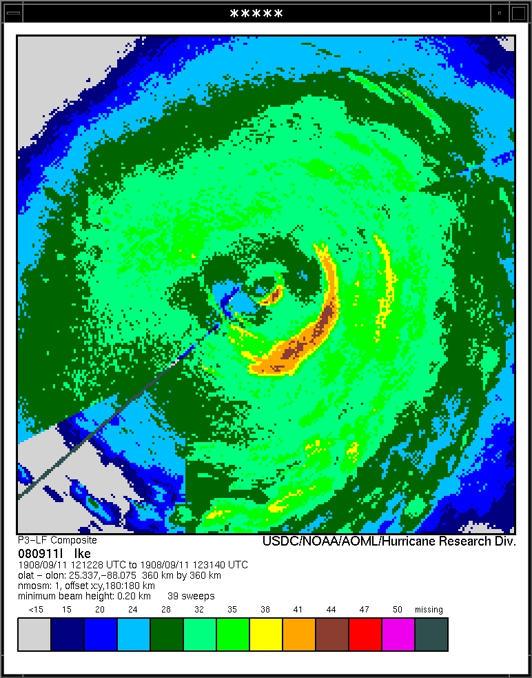
Research Composites
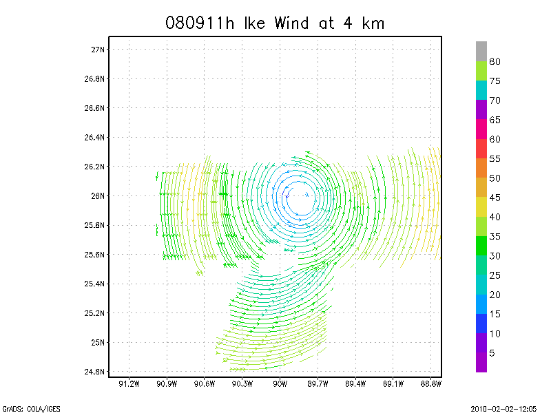
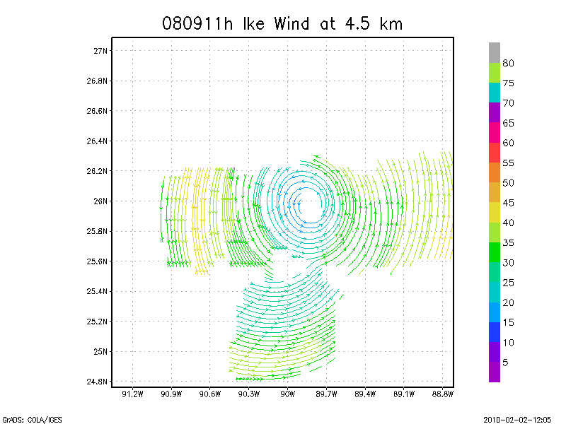
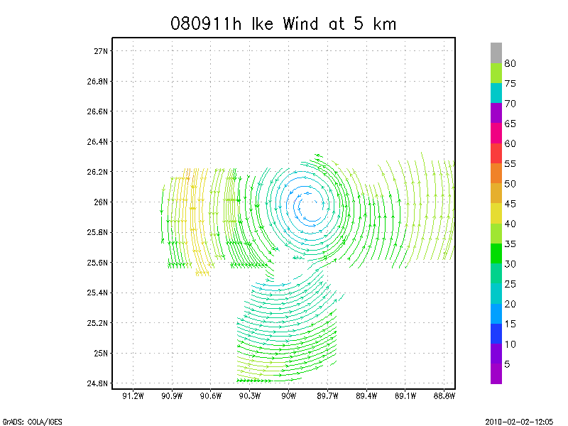
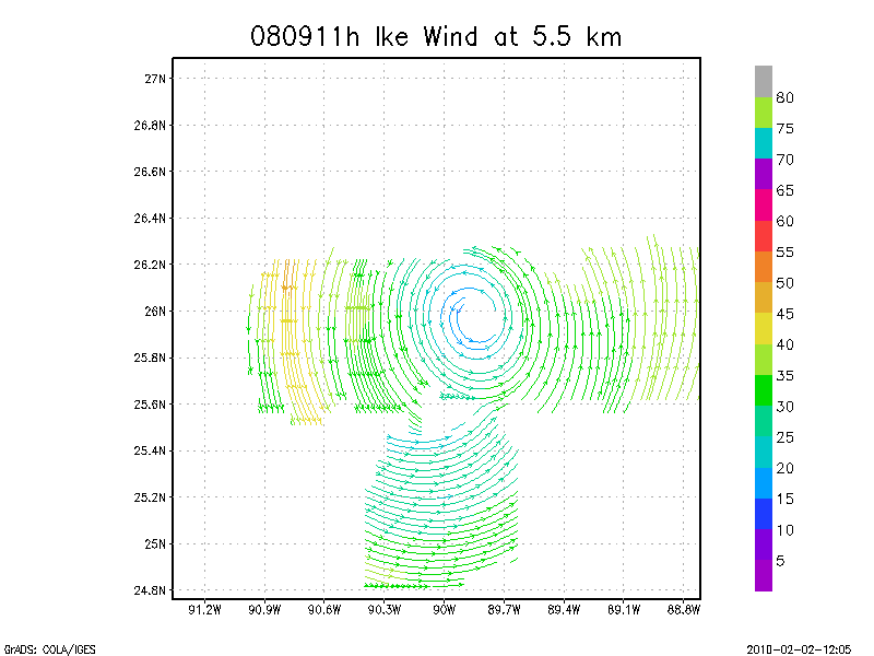
11:33 - 12:05 Z
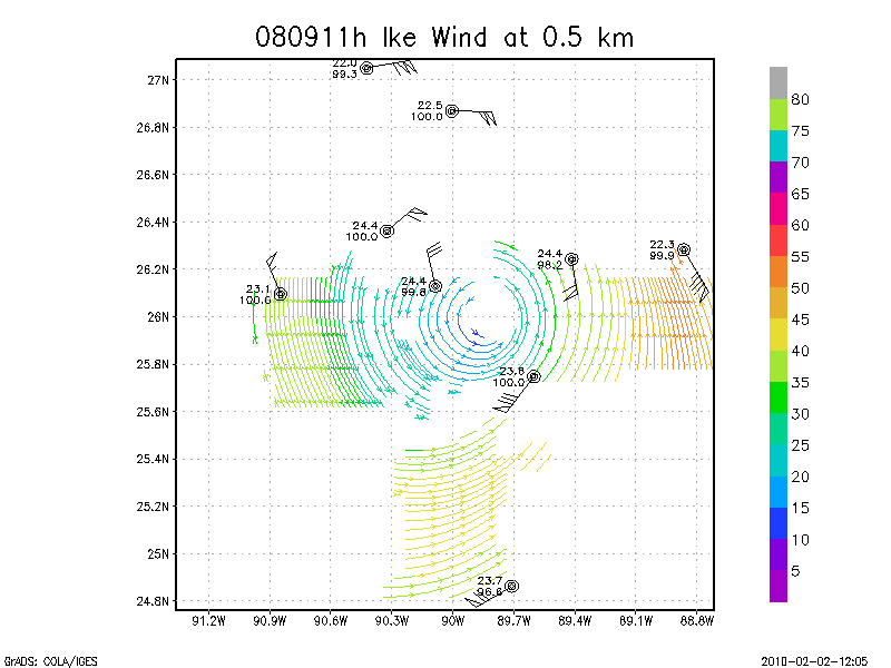
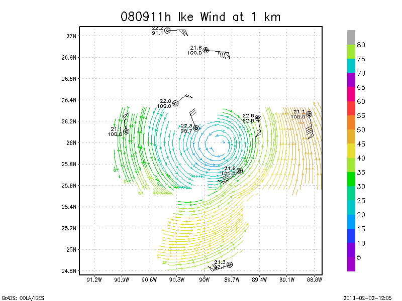
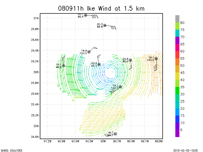
September 11, 2008
N42RF
Composited Doppler winds and dropsonde data
g'zipped and tar'd graphics
Gridded radar data
GrADS control file radar data
Gridded dropsonde data
GrADS control file dropsonde data
GrADS map of dropsonde data
Winds at :
.5 km
1.0 km
1.5 km
2.0 km
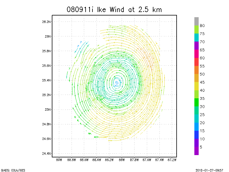
2.5 km
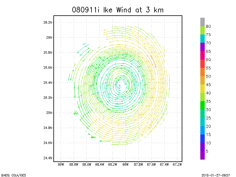
3.0 km
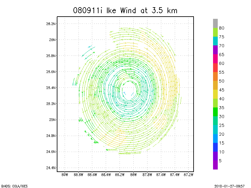
3.5 km
4.0 km
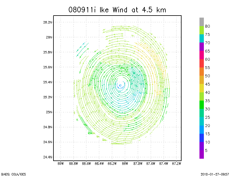
4.5 km
Winds at :
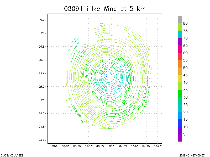
5.0 km
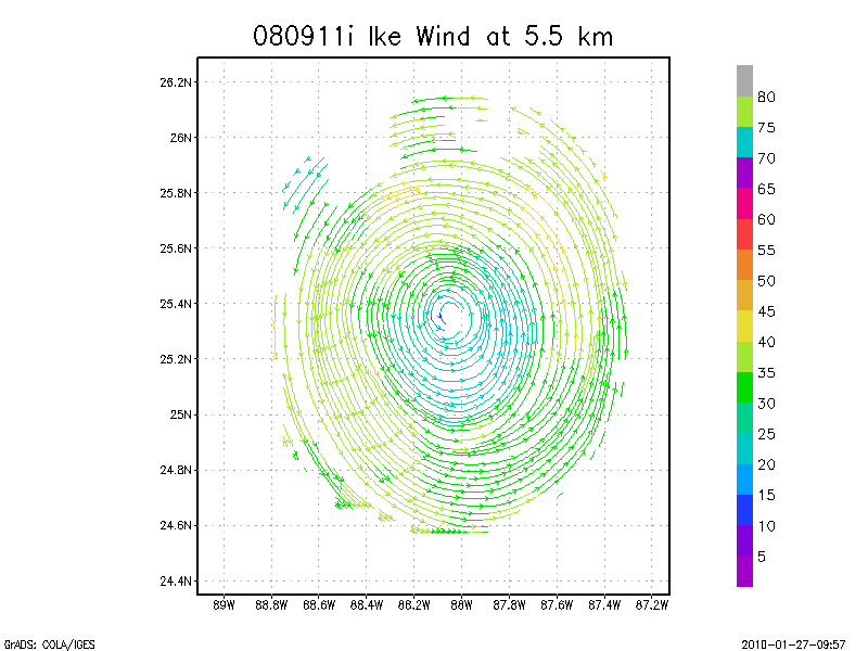
5.5 km
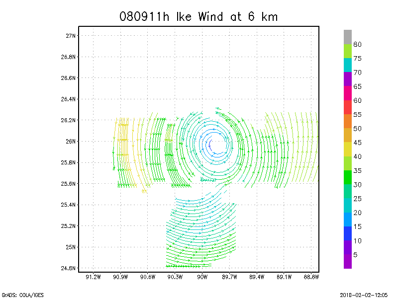
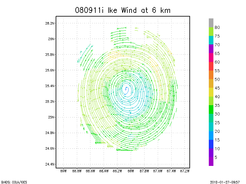
6.0 km
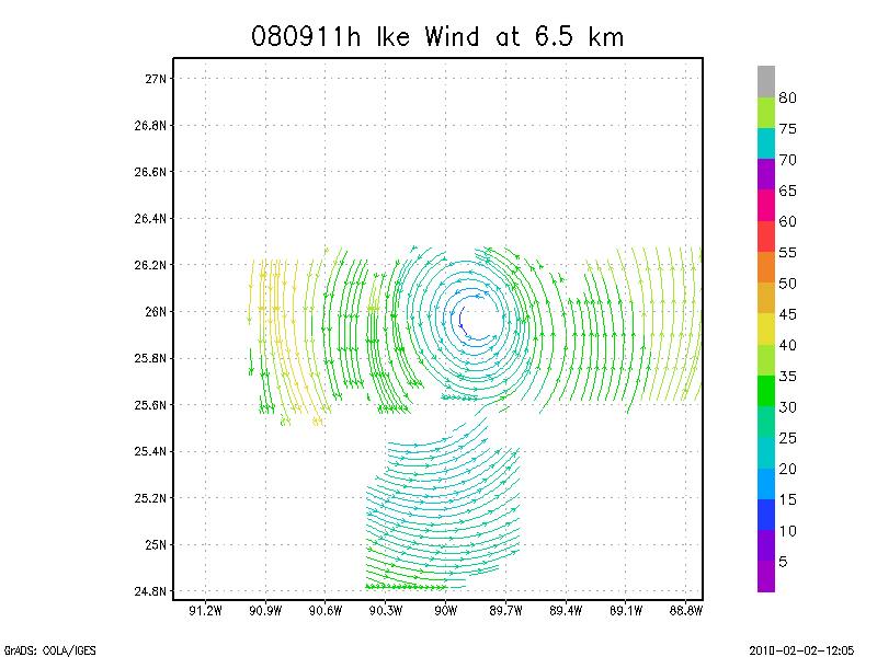
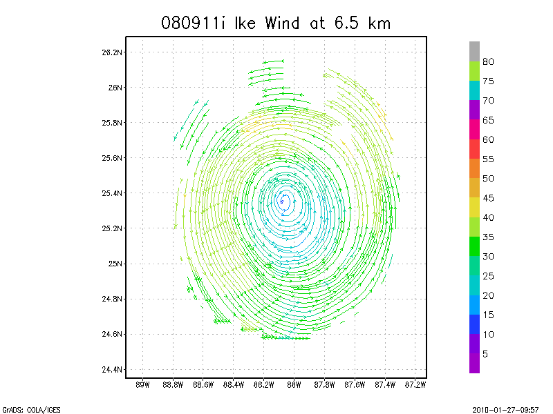
6.5 km
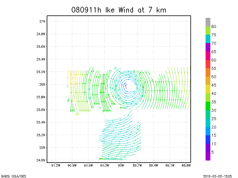
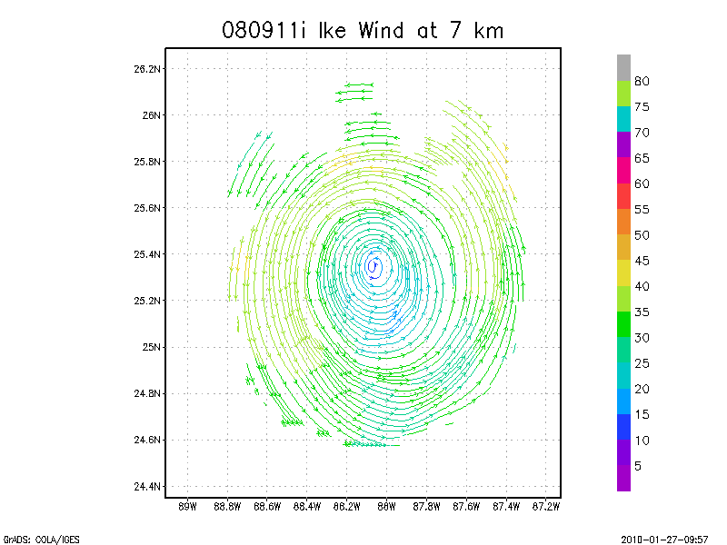
7.0 km
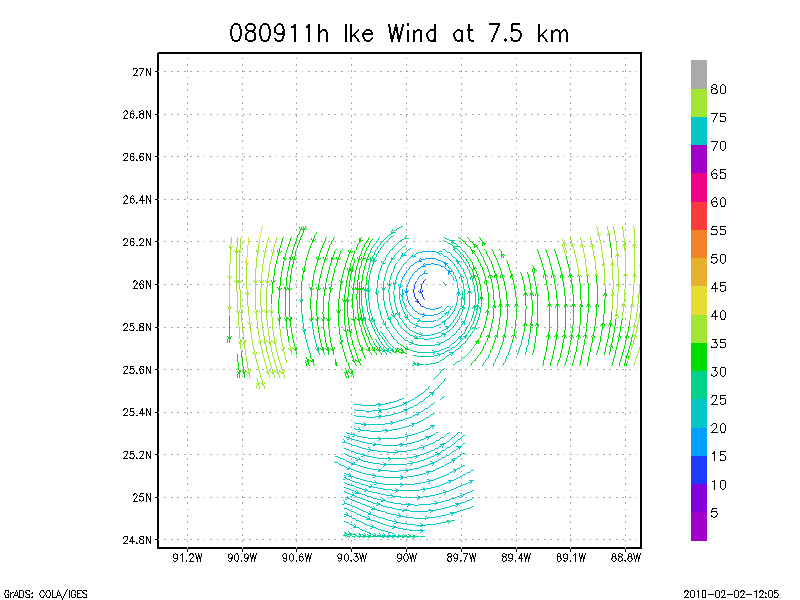
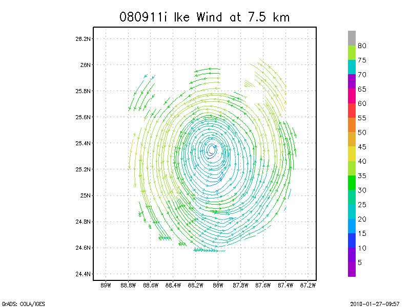
7.5 km
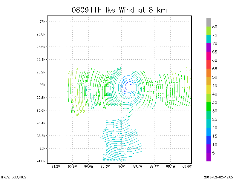
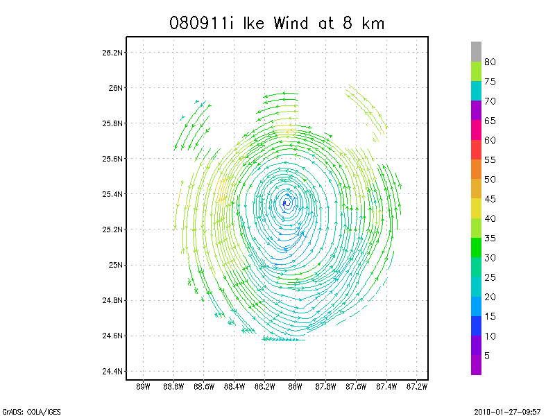
8.0 km
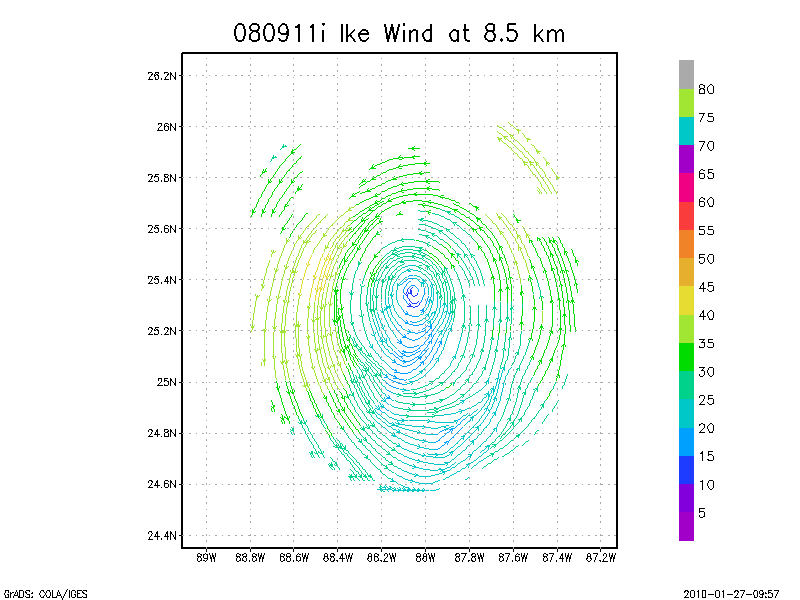
8.5 km
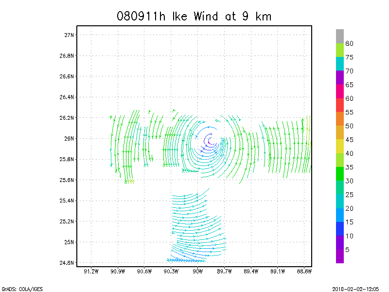
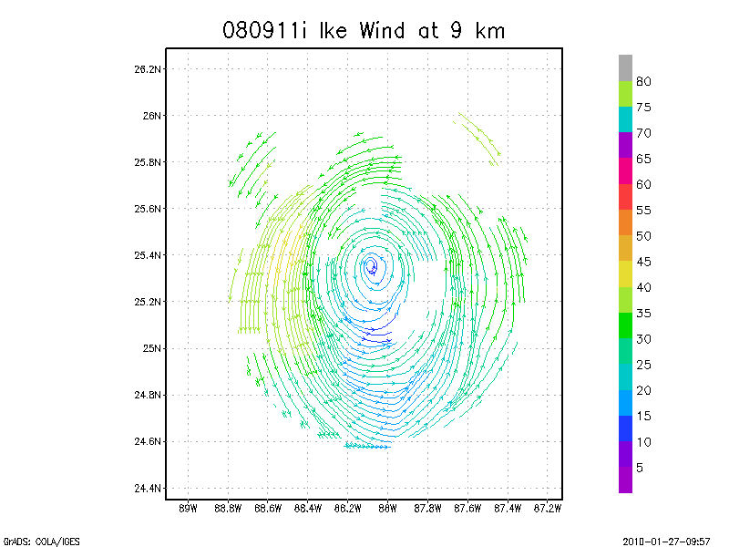
9.0 km
Winds at :
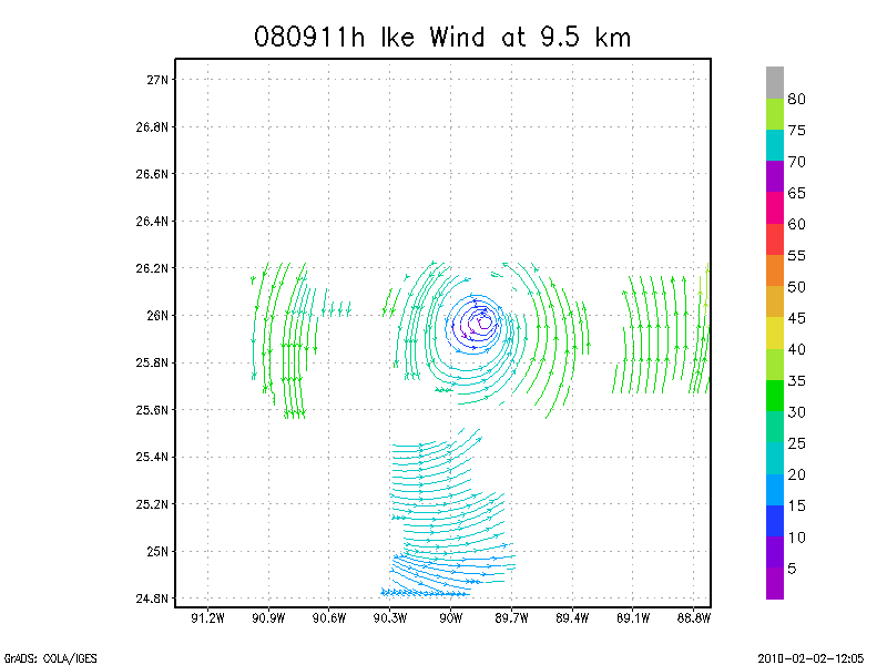
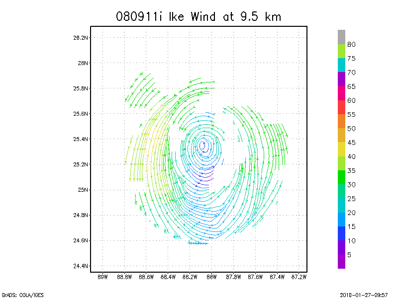
9.5 km
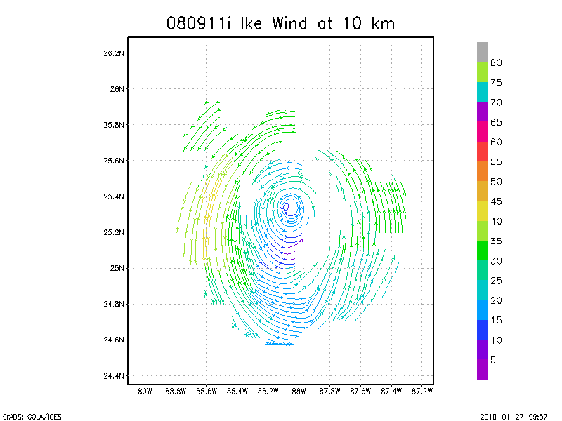
10.0 km
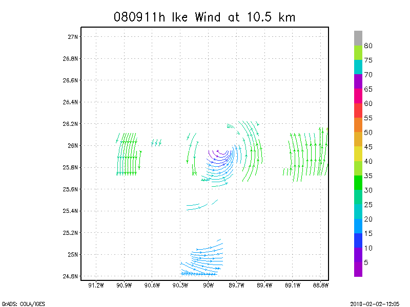
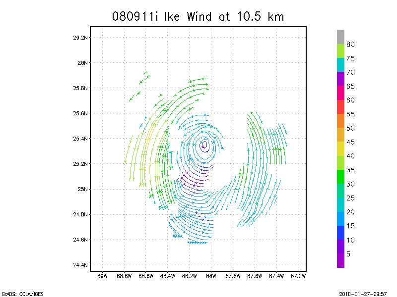
10.5 km
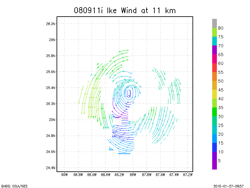
11.0 km
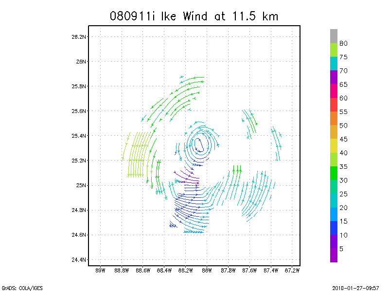
11.5 km
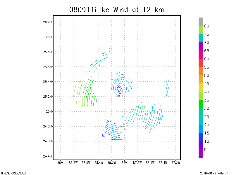
12.0 km
12.5 km
13.0 km
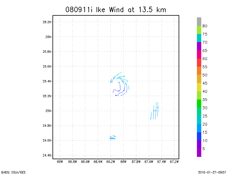
13.5 km
Winds at :
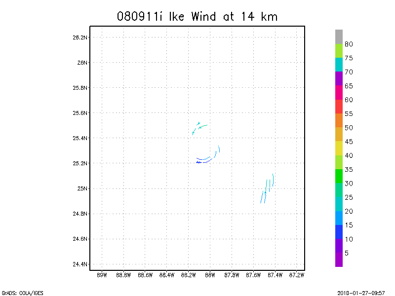
14.0 km
14.5 km
15.0 km
15.5 km
16.0 km
16.5 km
17.0 km
17.5 km
18.0 km
September 11, 2008
N43RF
Composited Doppler winds and dropsonde data
g'zipped and tar'd graphics
Gridded radar data
GrADS control file radar data
Gridded dropsonde data
GrADS control file dropsonde data
GrADS map of dropsonde data
Winds at :
.5 km
1.0 km
1.5 km
2.0 km
2.5 km
3.0 km
3.5 km
4.0 km
4.5 km
Winds at :
5.0 km
5.5 km
6.0 km
6.5 km
7.0 km
7.5 km
8.0 km
8.5 km
9.0 km
Winds at :
9.5 km
10.0 km
10.5 km
11.0 km
11.5 km
12.0 km
12.5 km
13.0 km
13.5 km
Winds at :
14.0 km
14.5 km
15.0 km
15.5 km
16.0 km
16.5 km
17.0 km
17.5 km
18.0 km
Individual sweeps
(aircraft relative)
Animated radar
tar'd and gzipped single frame GIFs
tar'd and gzipped sweep data
Individual sweeps
(storm relative)
Animated radar
tar'd and gzipped single frame GIFs
tar'd and gzipped sweep data
Individual sweeps
660 x 660 km
(storm relative)
Animated radar
tar'd and gzipped single frame GIFs
tar'd and gzipped sweep data
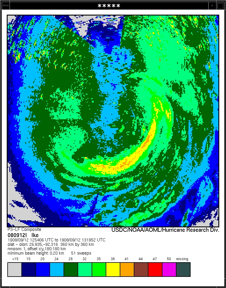
Research Composites
12:12 - 12:32 Z
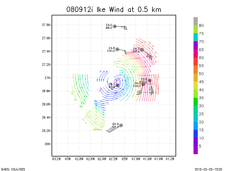
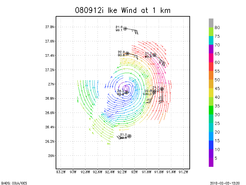
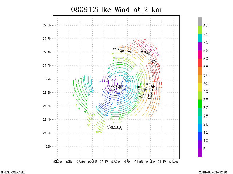
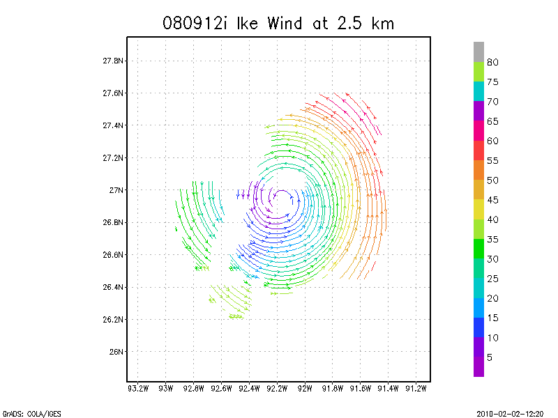
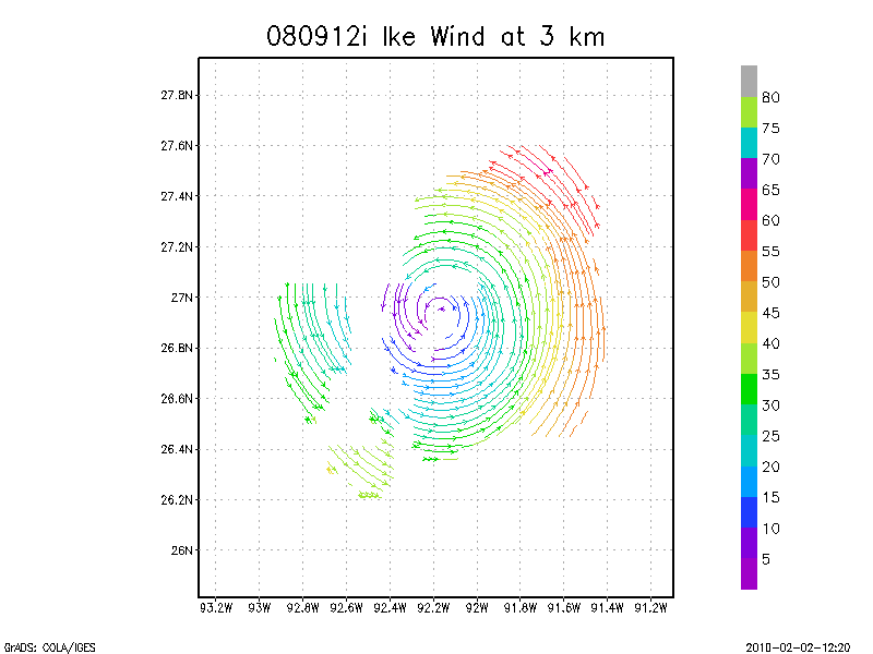
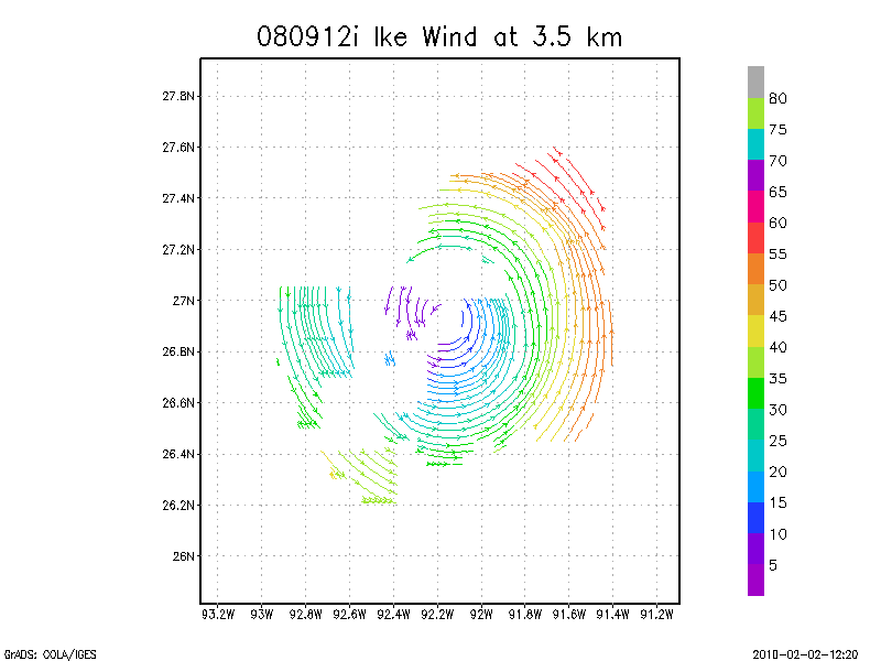
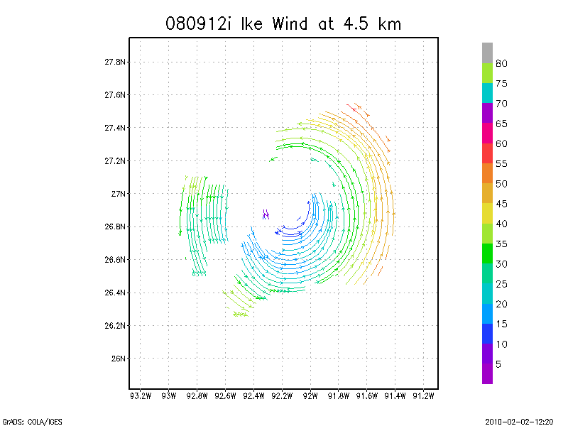
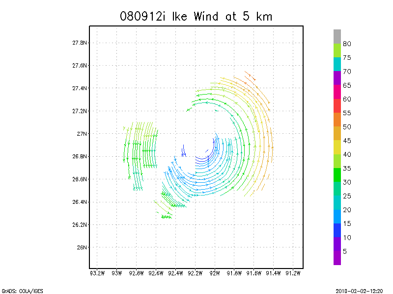
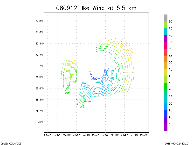
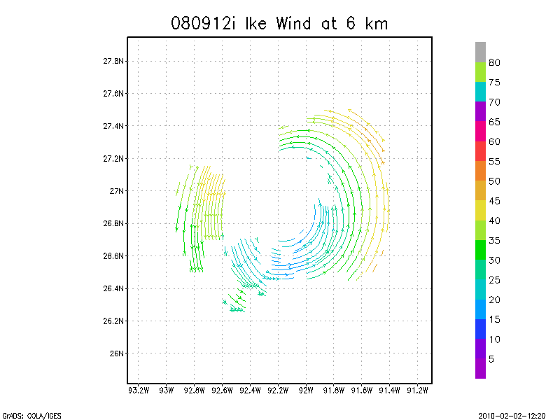
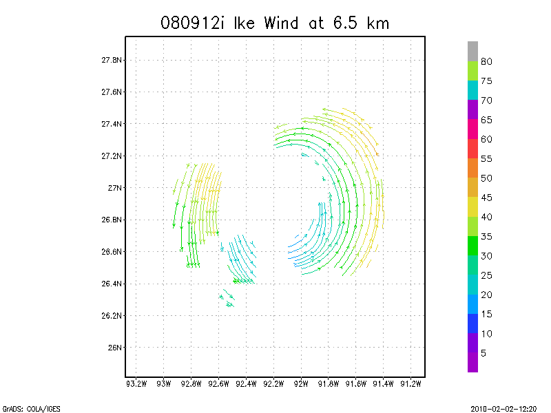
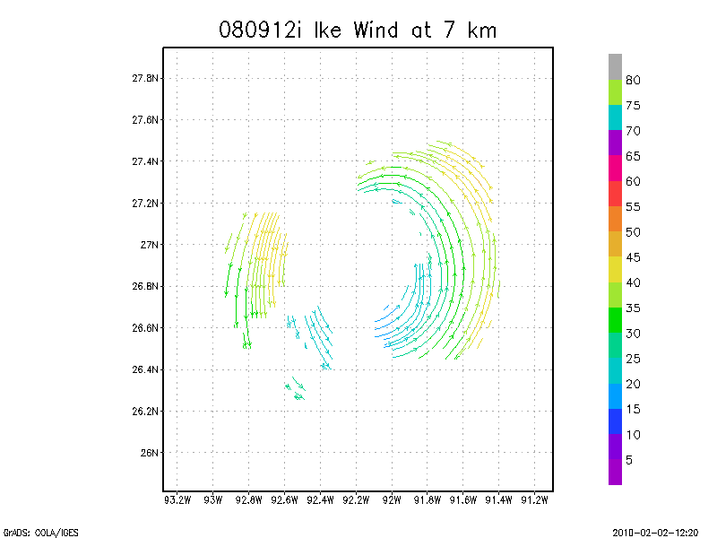
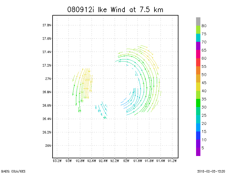
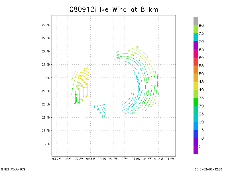
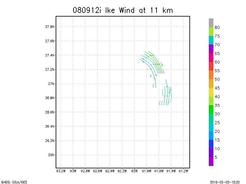
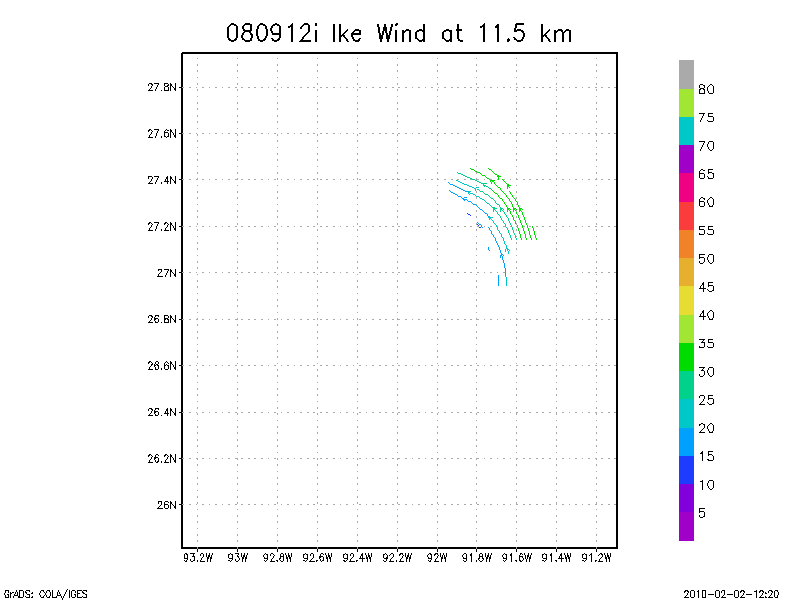
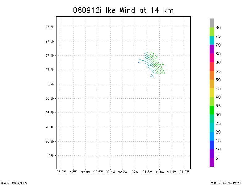
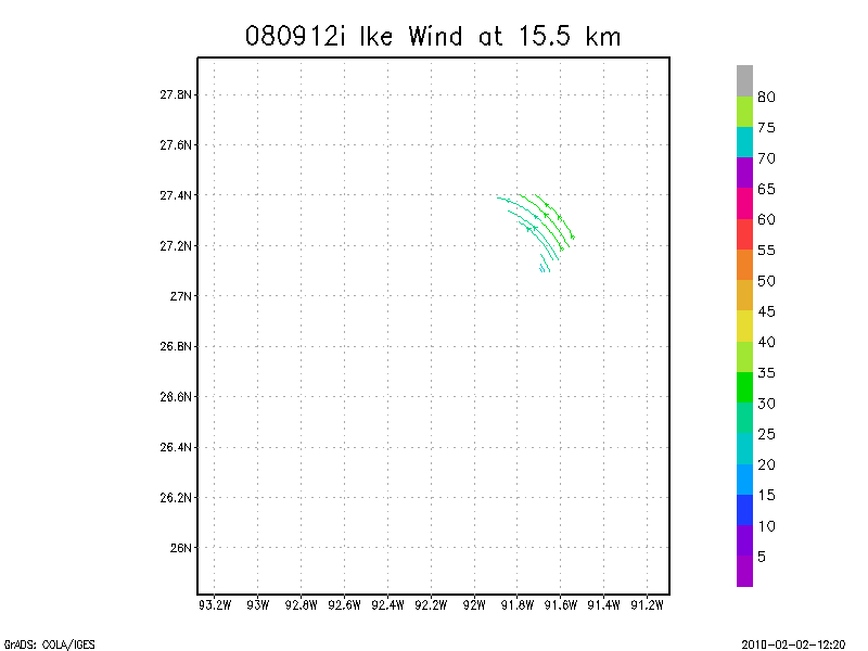
September 12, 2008
N43RF
Composited Doppler winds and dropsonde data
g'zipped and tar'd graphics
Composite of all legs and dropsondes
Gridded radar data
GrADS control file radar data
Gridded dropsonde data
GrADS control file dropsonde data
GrADS map of dropsonde data
Winds at :
.5 km
1.0 km
1.5 km
2.0 km
2.5 km
3.0 km
3.5 km
4.0 km
4.5 km
Winds at :
5.0 km
5.5 km
6.0 km
6.5 km
7.0 km
7.5 km
8.0 km
8.5 km
9.0 km
Winds at :
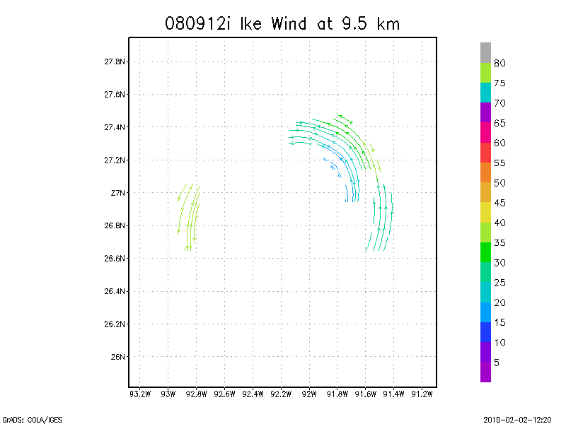
9.5 km
10.0 km
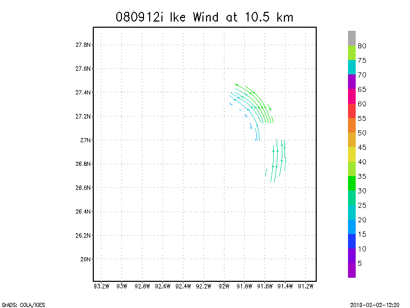
10.5 km
11.0 km
11.5 km
12.0 km
12.5 km
13.0 km
13.5 km
Winds at :
14.0 km
14.5 km
15.0 km
15.5 km
16.0 km
16.5 km
17.0 km
17.5 km
18.0 km
Individual sweeps
(aircraft relative)
Animated radar
tar'd and gzipped single frame GIFs
tar'd and gzipped sweep data
Individual sweeps
(storm relative)
Animated radar
tar'd and gzipped single frame GIFs
tar'd and gzipped sweep data
Individual sweeps
660 x 660 km
(storm relative)
Animated radar
tar'd and gzipped single frame GIFs
tar'd and gzipped sweep data
Research Composites
12:54 - 13:20 Z
Return to Ike Page.
Disclaimer
|
Privacy Policy
DOC
/
NOAA
/
AOML
/
HRD
aoml.hrdwebmaster@noaa.gov


![[OAR/DOC/NOAA Logos]](../../oar_noaa_doc_logos3.jpg)