
In a new study, scientists from NOAA, University of South Florida, Florida International University, University of Miami, and LGL Ecological Associates, compared wind information alongside Sargassum Inundation Risk (SIR) maps against citizen science reports of inundation in the coasts of Florida, Gulf of Mexico, Bahamas, and Caribbean regions. With present SIR maps, inundation is considered as more likely if large densities of satellite-detected Sargassum are near a coast. The scientists in the study found that shoreward wind velocity used in conjunction with SIR indicators greatly improves the agreement with coastal observations of Sargassum beaching compared to SIR indicators alone. Including wind metrics in SIR maps will allow for improved understanding of Sargassum trajectories in coastal areas for forecast purposes.
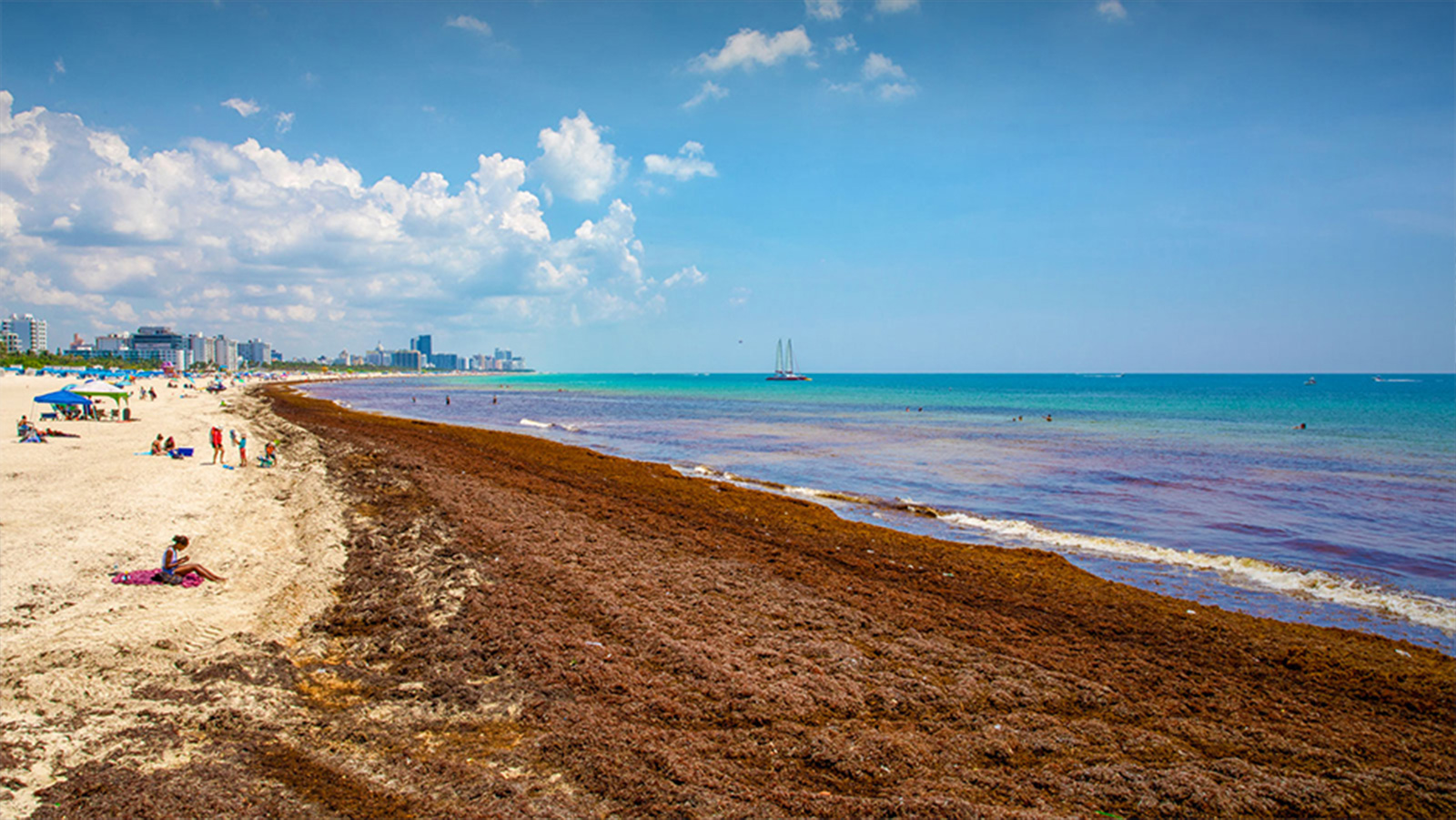
For more than a decade, massive blooms of Sargassum, a floating macroalgae, have caused environmental, economic, and human health problems to coastal communities and ecosystems throughout the tropical Atlantic, Caribbean Sea, and Gulf of Mexico. Out at sea, Sargassum is an important habitat for fish, sea turtles, and other marine organisms, but as it accumulates in large amounts close to the coastlines it can smother valuable corals, seagrass beds, and beaches. Efforts to monitor and predict these occurrences are challenging because of the complexities associated with the growth and movement of Sargassum and the extensive area it impacts.
SIRs were first produced in 2019 to estimate the potential risk of Sargassum inundation to coastlines throughout the Caribbean, tropical Atlantic, and Gulf of Mexico. The SIR algorithm uses 7-day floating algae density fields calculated from satellite imagery to estimate the potential for Sargassum to wash ashore. SIRs show the current conditions of Sargassum density in the open ocean and identifies coastal areas where Sargassum is within 50 km (30 miles) and may potentially be impacted by Sargassum in the following days. The inundation potential is then categorized into three levels: low, medium, and high. Coastlines are color coded according to the potential for Sargassum reaching the coast.
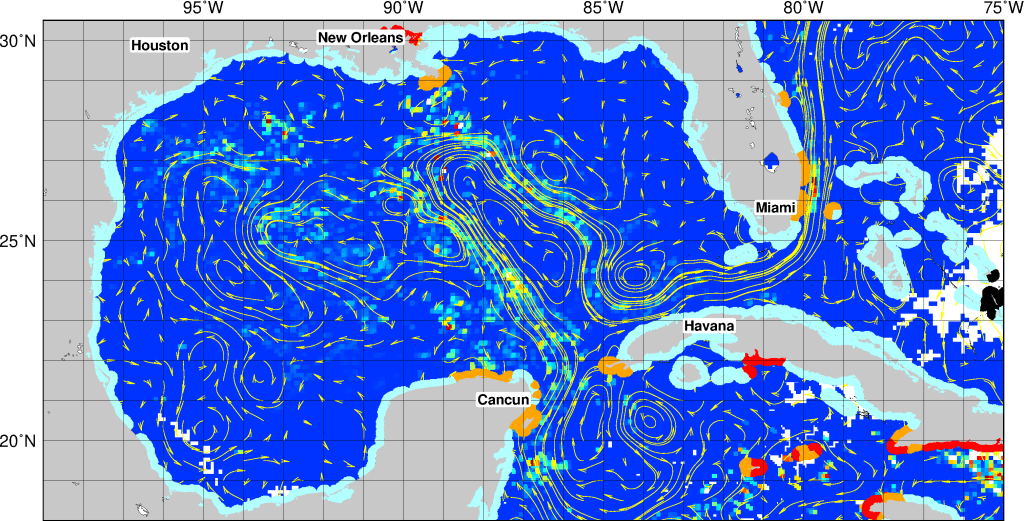
This study examines whether including wind metrics in SIRs improves the agreement between the estimated beaching risk and actual observations of Sargassum along the coastline. Winds play an important role in the movement of Sargassum from offshore to coastal areas, and considering wind effects could be an important component for improving inundation risk assessments. Other effects being currently evaluated include waves, geography of the coast, and tidal currents.
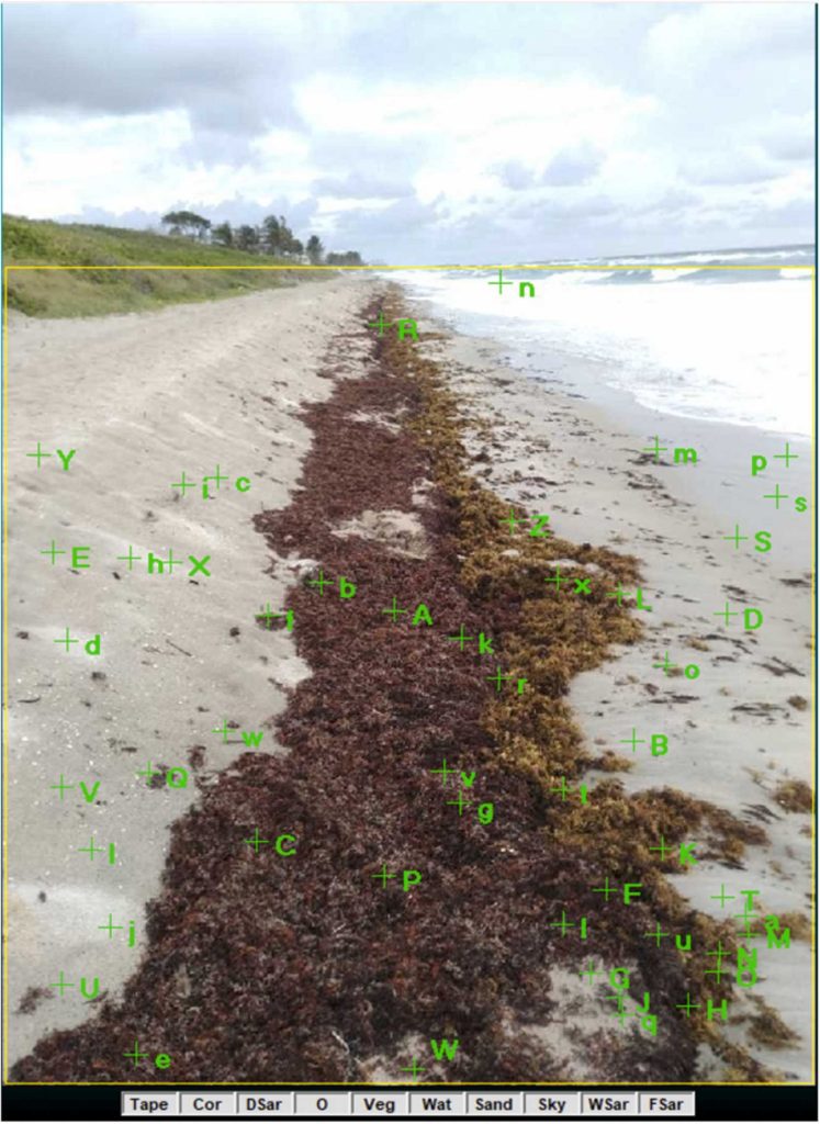
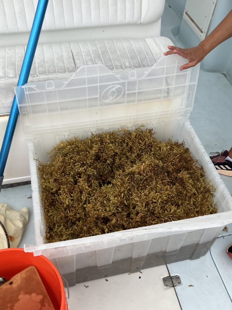
For coastal observations, scientists quantified the percent coverage of Sargassum in photos and videos obtained from the Epicollect Sargassum Watch project and correlated them with the corresponding University of South Florida floating algae density index used in the SIR assessments. The Sargassum Watch project is an international citizen science effort to collect coastal observations of Sargassum led by Florida International University. Sargassum Watch invites the public to submit time-stamped, georeferenced photos of Sargassum at beaches throughout the region. Sargassum reports can also be uploaded the the NOAA/AOML Sargassum Reporting form linked in the SIR web page.
Scientists found that including wind metrics dramatically improves the agreement between offshore densities used in SIRs and observations of Sargassum by citizen scientists at coastal sites. This finding suggests that part of the disagreement between offshore Sargassum densities and Sargassum observed on the coast is due to not accounting for the movement of Sargassum.
Monitoring and forecasting Sargassum beaching events are necessary to improve mitigation and clean-up responses, work towards long-term adaptive management operations, and provide information to the growing community attempting to assign value to these influxes of Sargassum. Improvement of SIR assessments are likely to be achieved by including shoreward wind velocities into existing algorithms and other additional factors affecting motion and life span of Sargassum.
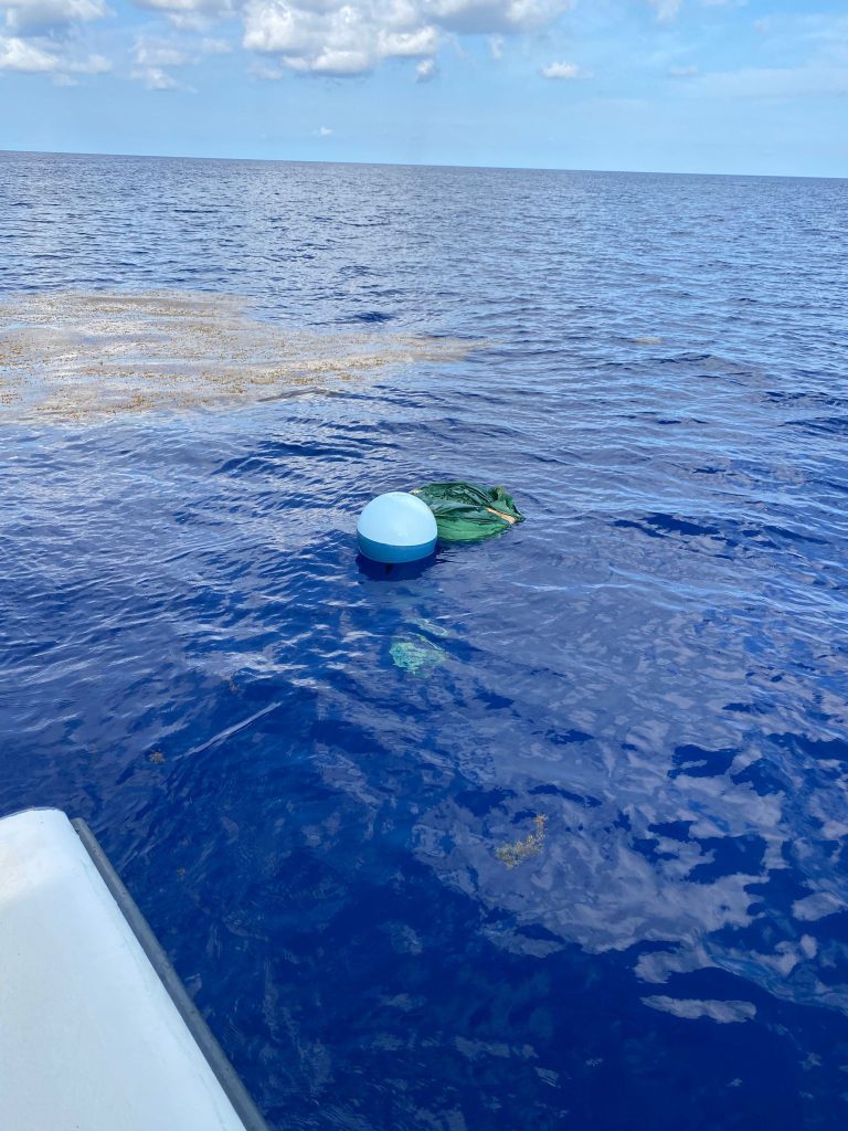
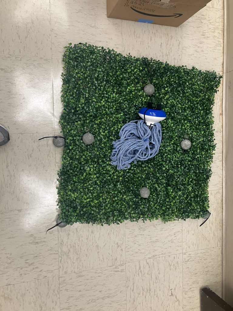
Several field and laboratory experiments in support of Sargassum motion research have been conducted by AOML and partners during the last 5 years. Under the lead of University of Miami scientists, two experiments were recently carried out by University of Miami, AOML, and LGL scientists. The first one consisted of attaching GPS trackers to Sargassum mats located off the coast of South Florida. This experiment is geared towards assessing the impact of the Florida Current on Sargassum transport. The second experiment was a controlled experiment conducted in the University of Miami water tank to assess the combined effect of waves, winds, and currents on the motion of mats of different sizes of Sargassum. It is expected that the results obtained from these experiments will be able to provide new insights into the evolution of Sargassum areal extension in the tropical Atlantic.
New Sargassum Reporting Form
In support of using citizen science data to improve Sargassum monitoring, NOAA has released a new Sargassum reporting form!
Have you recently seen Sargassum and taken a picture? Maybe you were at the beach, walking along the boardwalk, or even out on a boat while fishing or snorkeling. By filling out the Sargassum Reporting form and uploading pictures of what you saw, you can help scientists improve Sargassum monitoring and research. Some of the information collected will be shared with the Florida International University Sargassum Epicollect database, which is the largest regional effort to collect citizen science data. A set of the data used in the study above was contributed by this Citizen Science Sargassum Reporting Form.
This is the NOAA (National Oceanic and Atmospheric Administration) NESDIS (National Environmental, Satellite, Data and Information Service) CoastWatch and NOAA AOML (Atlantic Oceanographic and Meteorological Laboratory) Citizen Science Sargassum Reporting Form.
The form can be accessed through the Sargassum Inundation Report (SIR) web page.
Reference:
Putman, N.F., R.T. Beyea, L.A.R. Iporac, J. Trinanes, E.G. Ackerman, M.J. Olascoaga, C.M. Appendini, J. Arriaga, L. Collado-Vides, R. Lumpkin, C. Hu, and G. Goni, 2023: Improving satellite monitoring of coastal inundations of pelagic Sargassum algae with wind and citizen science data. Aquatic Botany, 188:103672.