
NOAA’s P-3 aircraft will continue Environmental Modeling Center (EMC) tasked reconnaissance into Hurricane Isaias by penetrating the core of its circulation multiple times in order to obtain the most reliable measurements of its environmental conditions. The aircraft took off from Lakeland, FL Friday at 4:00 PM.
AOML scientists acquire and process data in real-time before these observations are ingested into operational weather models. Flight take off times reflect the precise time at which measurements are expected to be most beneficial to available global and hurricane prediction models.
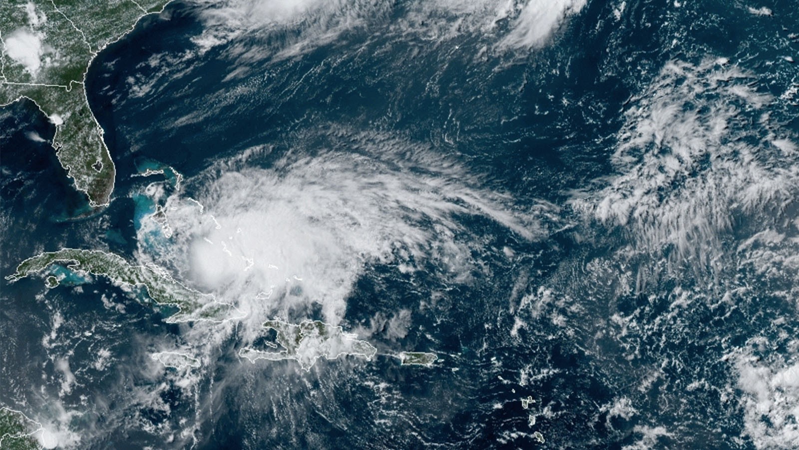
While Hurricane Isaias battles vertical wind shear imposed by its environment, the system continues to strengthen. According to the National Hurricane Center, Isaias is expected to strengthen over the next 24-36 hours as it tracks over the very warm waters of the Bahamas region.
Although the surface circulation of Hurricane Isaias was exposed this morning, convection developed and continues to occur near the center of the storm and radar still indicates an existing partial eyewall. Earlier aircraft reconnaissance found a contracting wind field and a developing mid-level eye within Hurricane Isaias’ structure, consistent with intensification.
The trajectory of Hurricane Isaias will depend on the interaction between Isaias’ circulation and its environment throughout the next couple of days. The possibility of Florida landfall has prompted hurricane watches and warnings along the eastern U.S. coastline.
The majority of rainfall produced by Hurricane Isaias exists in the north and east sections of the hurricane. This limits the ability for radar instrumentation to obtain full coverage of the system’s wind characteristics especially on the southern side.
The asymmetric appearance of Isaias’ precipitation requires hurricane scientists and forecasters to rely on flight-level, stepped frequency microwave radiometer (SFMR), and dropsonde wind observations to properly characterize the appearance of Isaias’ wind field structure.
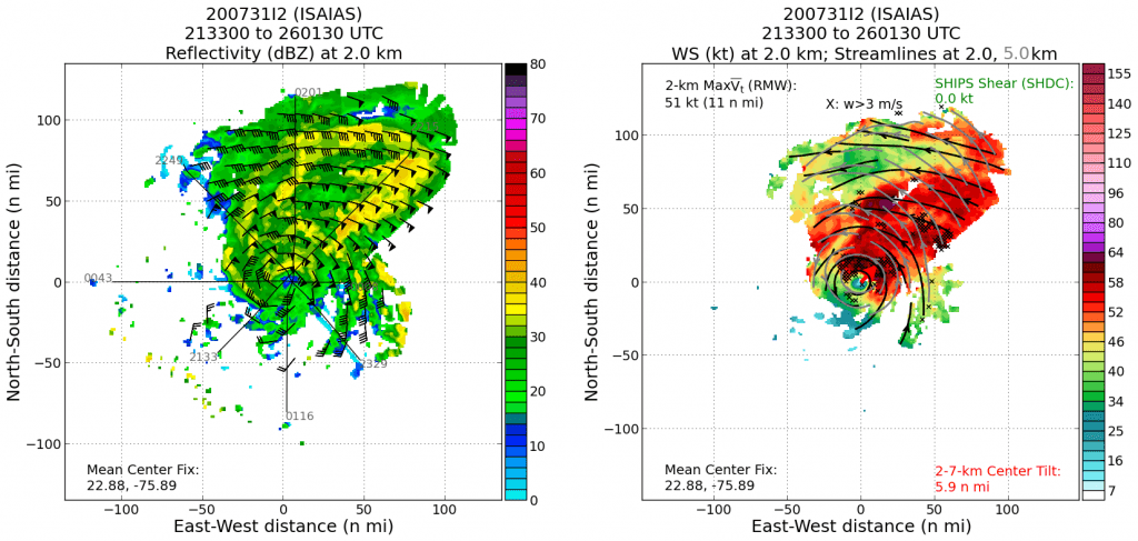
NOAA’s P-3 aircraft is sampling all quadrants of Isaias’ wind field, flying at 10,000 feet, where the measurements acquired from dropsondes will provide the majority of thermodynamic information for numerical models. This will shed light on Hurricane Isaias’ ability to fight the infringement of dry air known to inhibit intensification.
Isaias has proven to restrict any intrusion of dry air into its core, despite extremely dry environmental conditions ahead of the system associated with a recent Saharan Air Layer outbreak. AOML scientists can use dropsonde moisture measurements to assess the evolution of this process.
For the latest information about tropical cyclones and other weather systems, visit the NOAA National Weather Service National Hurricane Center.
For information on numerical prediction of tropical cyclones, visit the NOAA National Centers for Environmental Prediction Environmental Modeling Center.