Land Use Change
Wetlands and urban Development
Land cover change
Land cover and land cover change data obtained from satellite imagery can give an overall picture of environmental change and is an important indicator for pressures on various ecosystems within the Gulf of Mexico coastal environment. Land cover change data have also been shown to provide a useful indicator of ecosystem services provided in the region (Burkhard et al 2009). The data used in these analyses are derived from the Coastal Change Analysis Program (C-CAP) within the National Oceanic and Atmospheric Administration (NOAA) Office for Coastal Management.
Below is a visualization of land loss in the Louisiana Delta
wetlands
Wetland land cover change in the Gulf of Mexico represents a relatively large proportion of total land area in the Gulf of Mexico coastal environment with approximately 20% of the total land cover. This includes Palustrine Forested, Palustrine Emergent, Palustrine Shrub/Scrub, Estuarine Forest, Estuarine Shrub/Scrub, Estuarine Emergent, and Unconsolidated Shore land cover types. Wetlands are especially dynamic and change from year to year with both gains in some areas and losses in others; however, the general trend across the Gulf of Mexico is wetlands loss. Approximately 1000 square miles of wetland have been lost or converted to other land use types between 1996 and 2010. Similarly to Urban development, the extremes in wetland land cover change are highly localized and vary geographically with the most wetland loss occurring along coastal Louisiana in the Louisiana Delta as well as in Cameron Parish Louisiana, which is home to both the Sabine National Wildlife Refuge, and the Rockefeller Wildlife Refuge. Wetland loss is primarily attributed to impact from storms, subsidence, erosion, saltwater intrusion, and the lack of sediment replenishment for marsh habitat.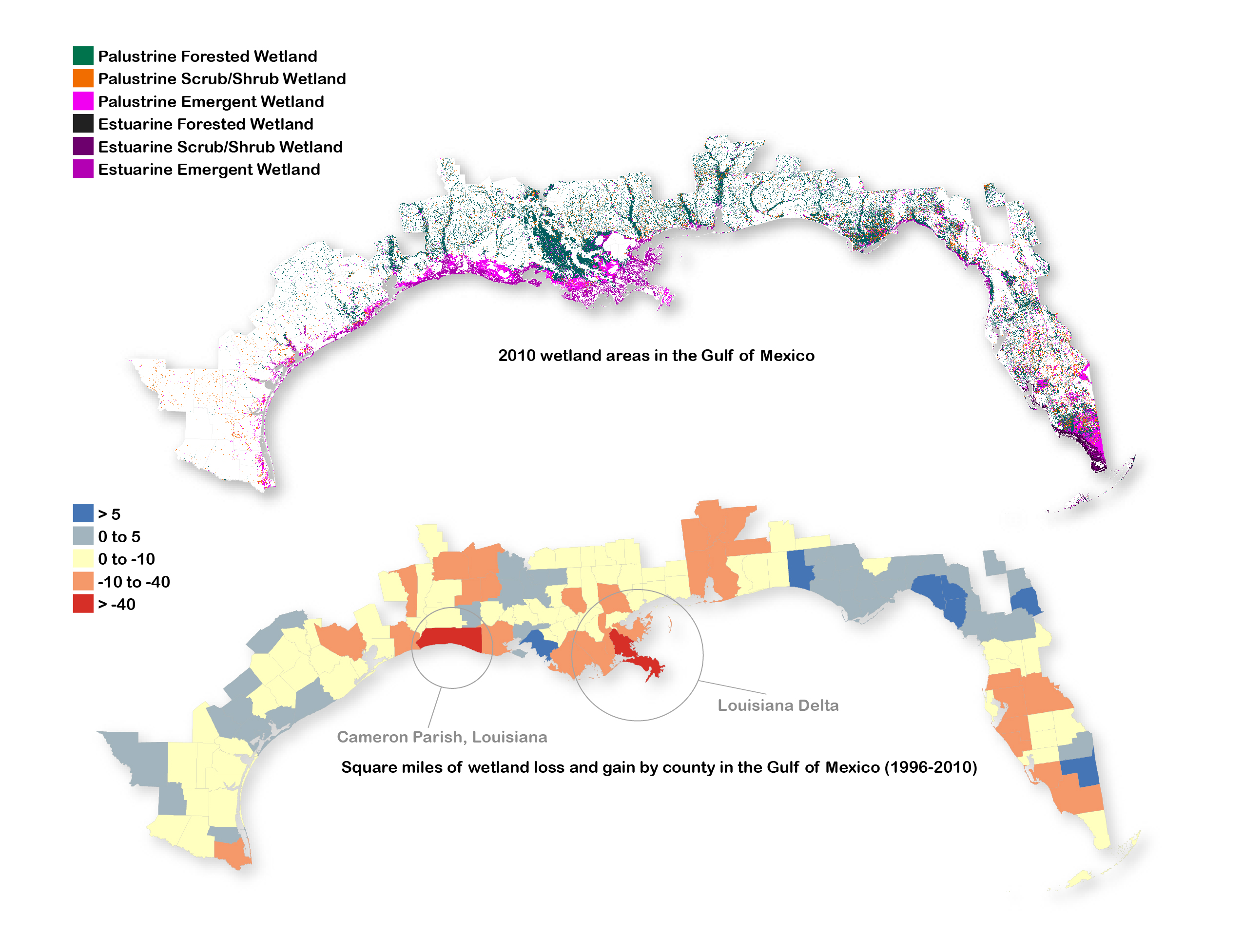
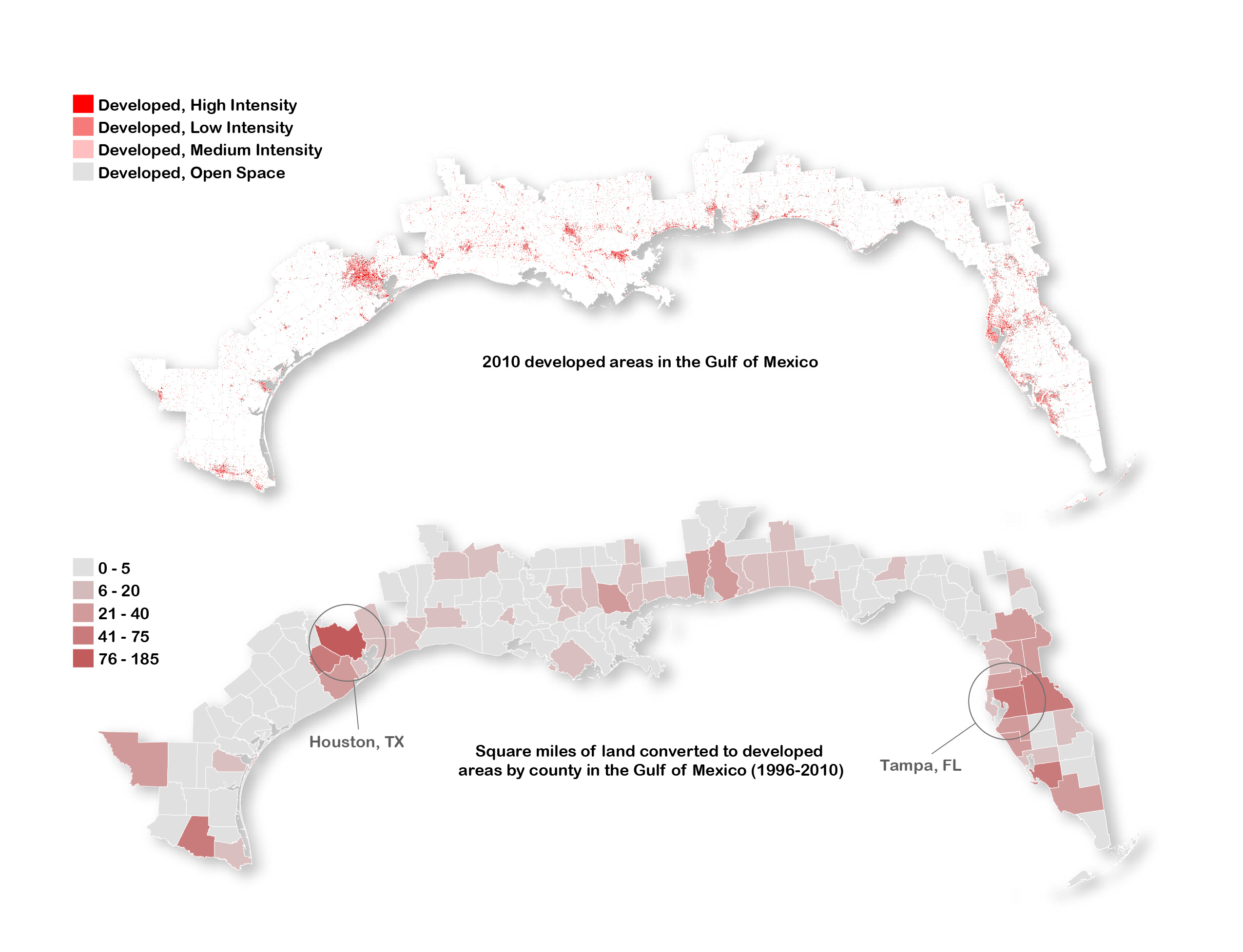
Development
Urban land cover represents a relatively small amount of the total land cover at approximately 5% coverage of the Gulf of Mexico region. This land use type, while covering a spatially small area, represents a significant strain on the environment due to the influence on ecosystems, high degree of impervious surfaces, amount of pollutants discharged, and these areas contain the vast majority of the human population. Urban land cover classes which include low-intensity development (21 to 49 percent impervious surfaces), medium-intensity development (50 to 79 percent impervious surfaces), high-intensity (80 to 100 percent impervious surfaces), and well as developed open spaces increased in the Gulf of Mexico between 1996 to 2010 at a rate of more than 15%. While this urban expansion is significant across the region as a whole, this increase in development occurred at a much higher pace in certain geographic areas. For example in Harris County and Fort Bend County, Texas which contain the city of Houston approximately 240 miles of land were converted into developed land representing a rate of change of more than 80% in these counties between 1996 and 2010.