IN-FLIGHT |
Time [UTC] | Event |
1448 | Takeoff from St. Croix |
1513 | En route to Larry…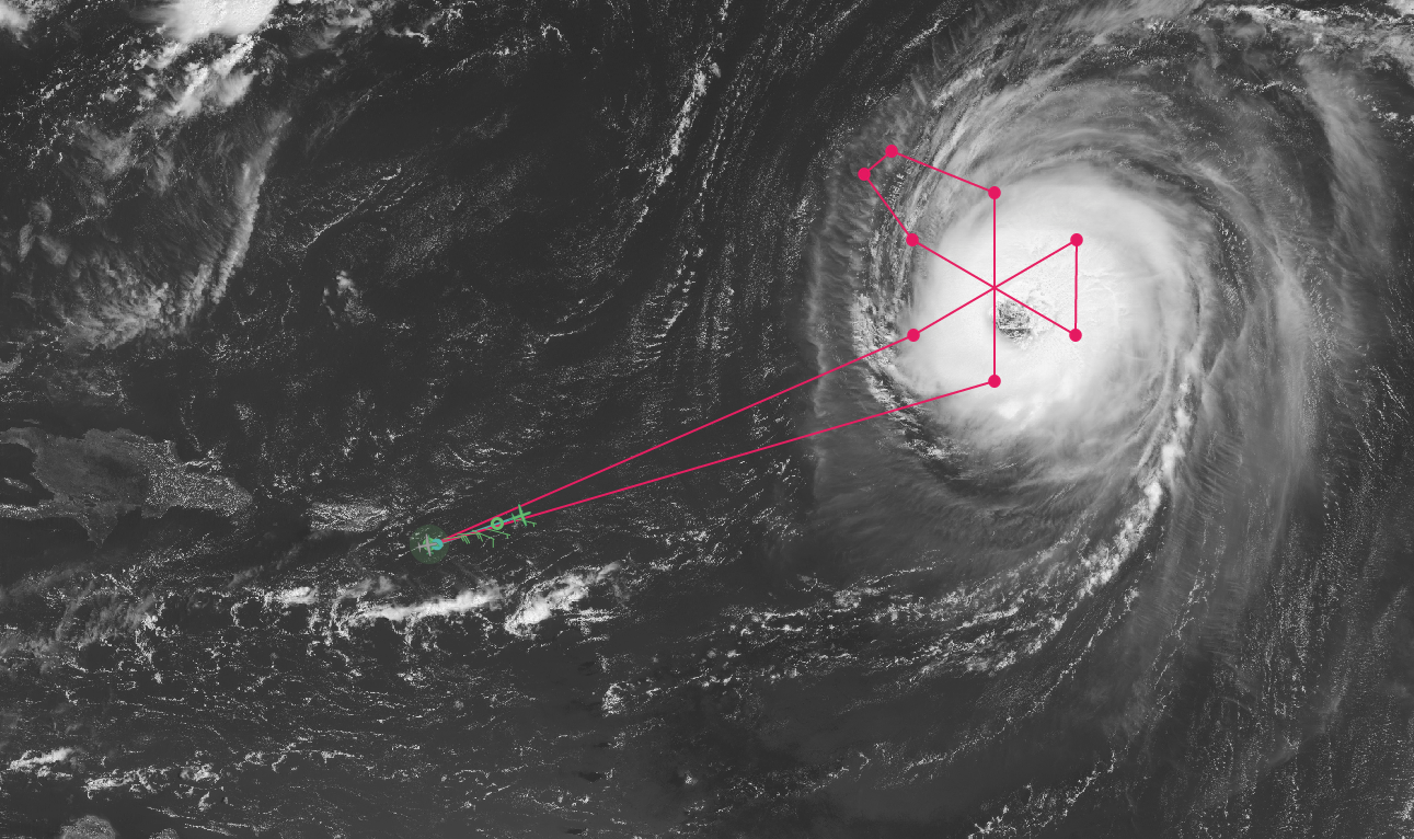 |
1618 | Data comms issues. Everyone on N43 logged off of x-chat. Also, no flight-level wind data showing up in MTS |
1630 | Comms is back. Heather reported that they can see some pretty decent swells propagating towards us (outward from Larry) |
1644 | Crew reported that they can see the curvature in the outer banding as we're approaching the outer edge of Larry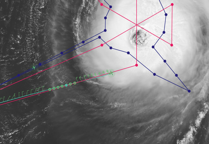 |
1654 | Started descent |
1659 | Quite a few visuals of whitecaps before starting the pattern. SFMR reports ~24 m/s |
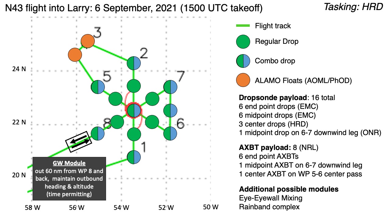
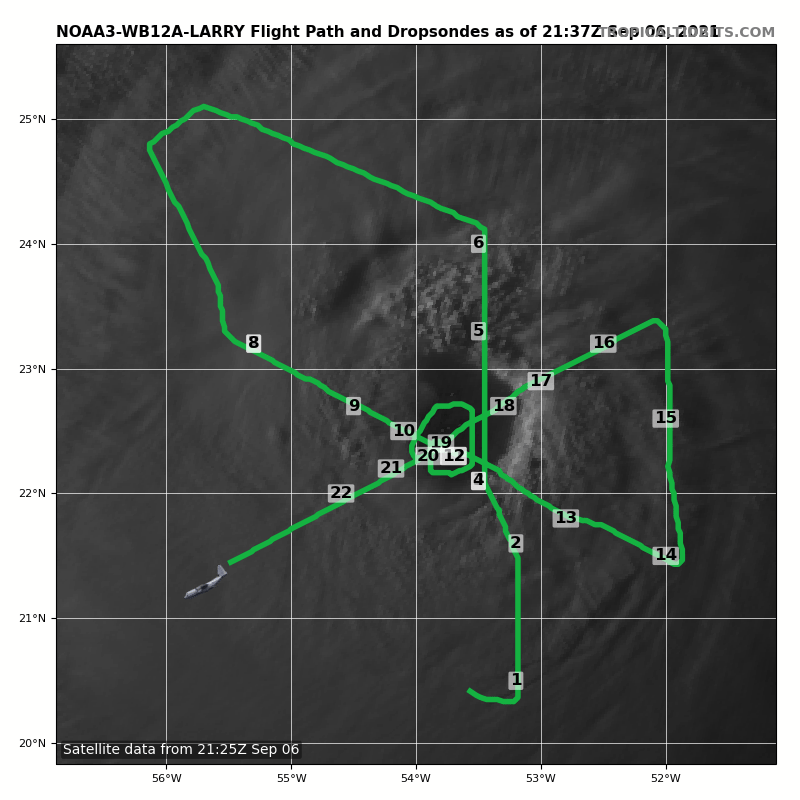
1703 | Starting pattern at 10 kft. Combo drop 1 out. SST is 27.5°C which was questioned by the flight crew. It is possible since the storm is near a SST gradient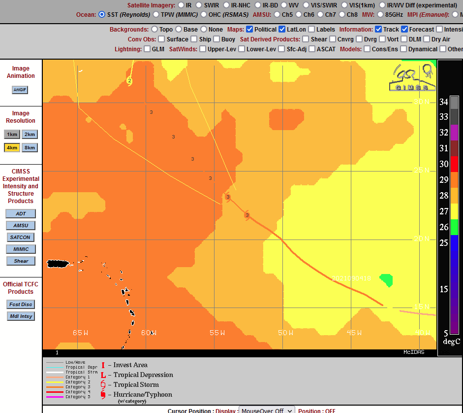 |
1709 | Heading towards the eye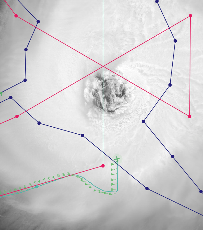 |
1718 | Sonde 2, Midpoint inbound pass 1 (2nd sonde) |
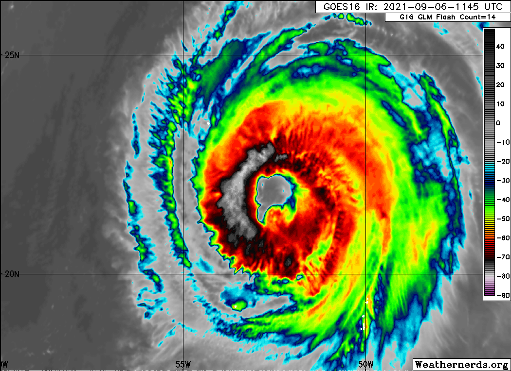
1722 | Penetration through the eyewall reported different. Not as defined as usual |
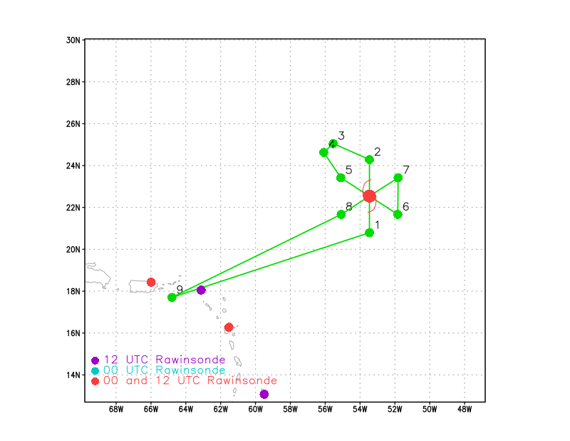
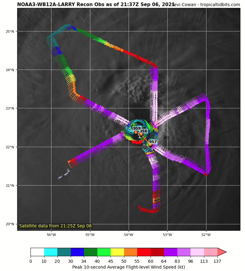
1725 | Hunting the center in the eye (marked at 1326) Gamache gave center fix for radar analyses: 172607, 22.06N, 53.45W |
1726 | Center sonde, pressure of 957.5 mb (3rd sonde) |
1731 | Echo tops are only showing to ~ 5-6 km on the edge of the scans (as going into northern eyewall) |
1738 | Heather reported much broader area of moderate precip on the N side |
1744 | Midpoint outbound sonde. Leg 1 (4th sonde) |
1754 | EP combo drop out (5th sonde), 28.31°C SST. Interesting comparison to SHIPS which has 28.8°C, though there might be a gradient with higher SSTs ahead of storm motion |
1821 | 1st ALAMO float released
|
1831 | 2nd ALAMO float released |
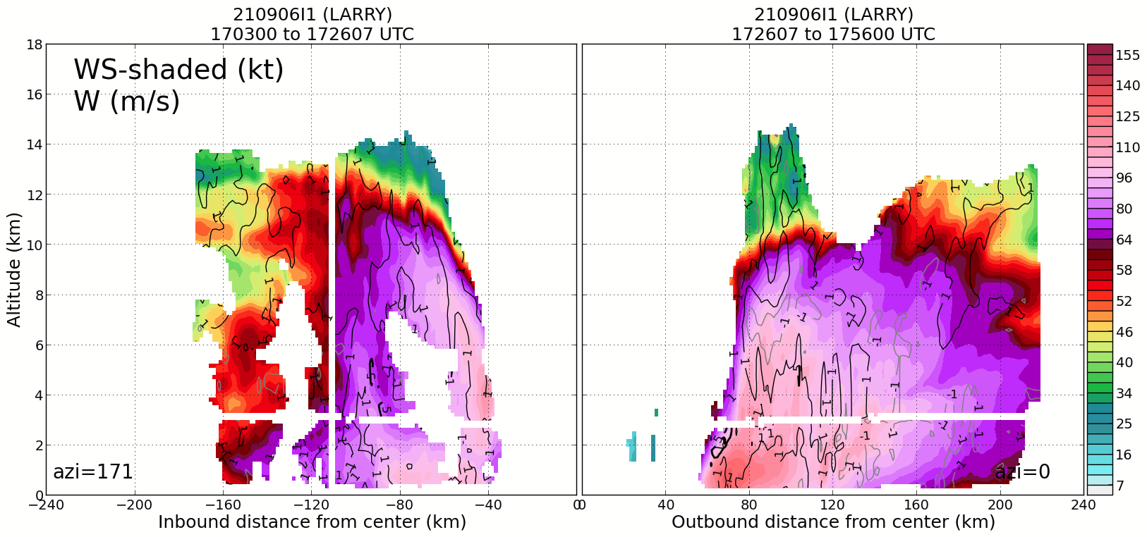
| Radar analyses from 1st pass 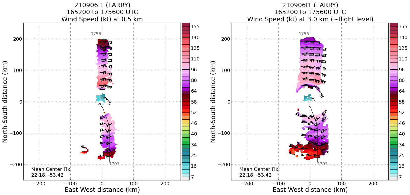
|
1853 | Combo sonde, inbound pass 2 (sonde 6) |
1905 | MP sonde inbound pass 2 (sonde 7) |
1912 | RMW sonde inbound pass 2 (sonde 8, NW eyewall) |
| Once we were inside the reflectivity eye, we hit our worst turbulence of the flight. They wonder if that was one of our mesovortices |
1918 | Center sonde (sonde 9) |
1933 | Midpoint sonde outbound pass 2 (sonde 10) |
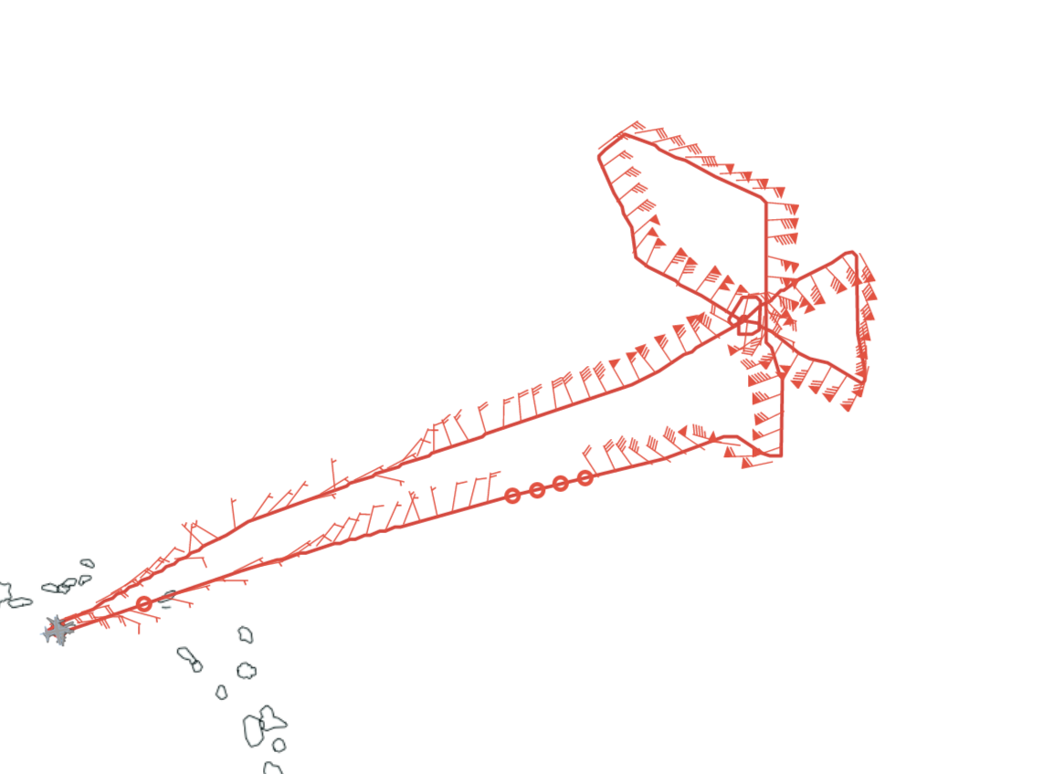
1940 | Close overlap between P-3 and G-IV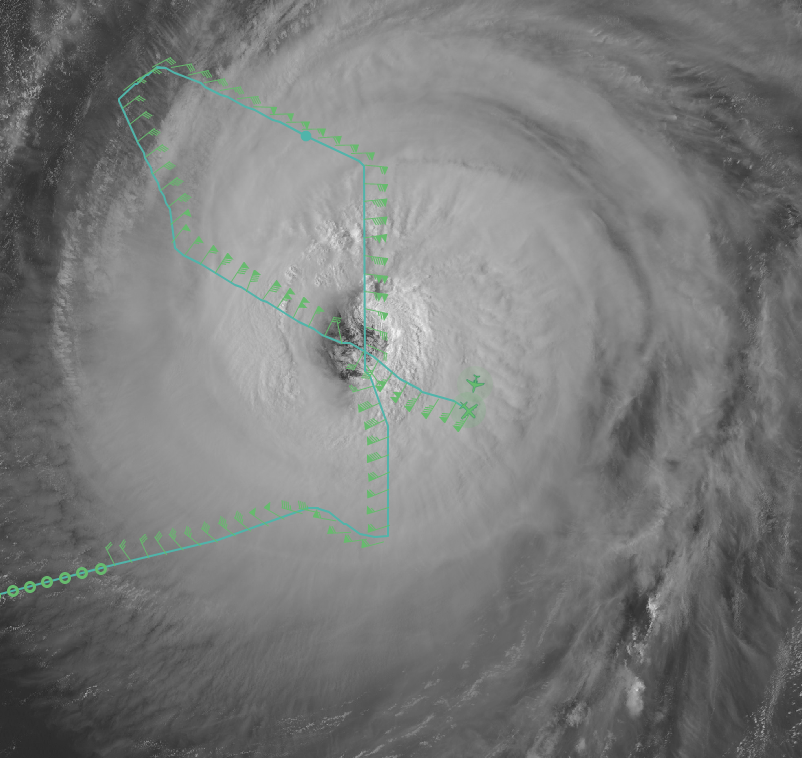 |
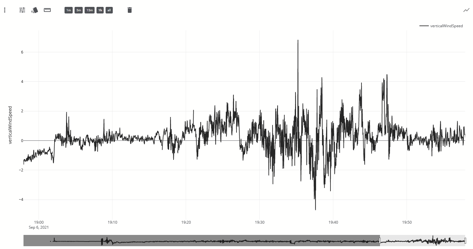
| Snapshot from tidbits to highlight the “bounce” the aircraft took during the pass (bottom right plot) 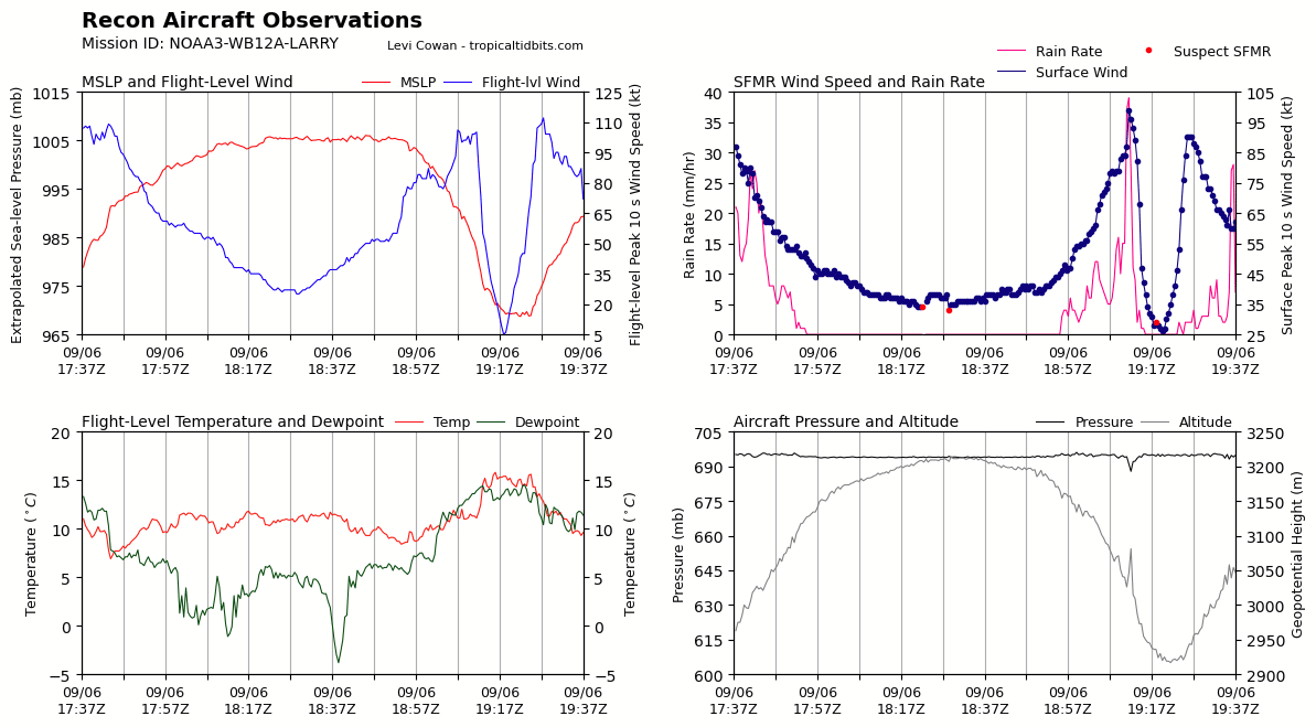
|
1945 | EP combo sonde pass 2 (sonde 11) (26.92°C SST) |
| Last hour of vertical velocities. Very turbulent on the outbound of the previous pass
|
1959 | Midpoint sonde on downwind leg (sonde 12) |
2011 | Initial point (IP) combo drop pass 3 (27.96°SST) - sonde died (sonde 13) |
2015 | Backup IP sonde (sonde 14) |
2023 | Midpoint sonde Inbound leg 3 (sonde 15) |
2028 | RMW sonde inbound leg 3, NW eyewall (sonde 16) |
2036 | Center sonde (sonde 17) |
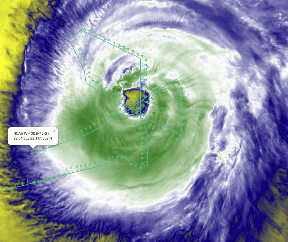
2039 | Begin Eye-eyewall Mixing Module. Circling eye clockwise |
2053 | Image captured orbiting the eye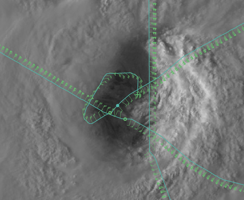 |
2107 | Sonde (#18) in mesovortex for Eye-eyewall Mixing Module. Visible imagery is fading, so hard to see where it was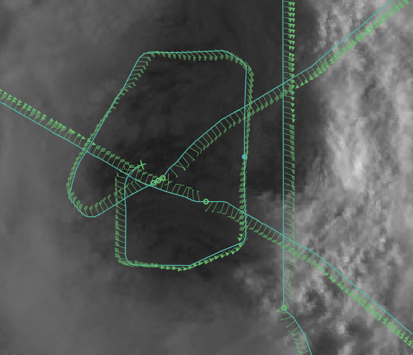
|
2116 | RMW sonde outbound pass 3 (SW eyewall) (sonde 19) |
2122 | Midpoint sonde outbound pass 3 (sonde 20) |
2136 | Endpoint combo sonde (sonde 21) |
| Updated satellite loops at the end of mission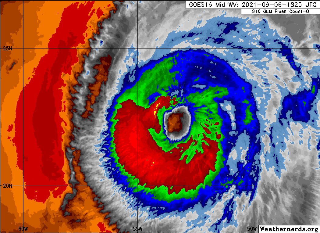 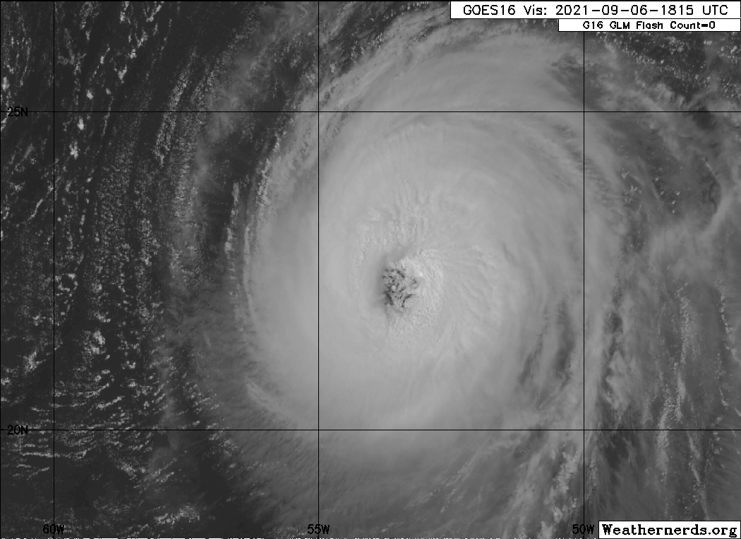 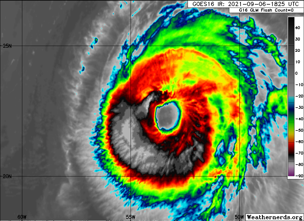 |
| KAIA Significant Wave Height from mission 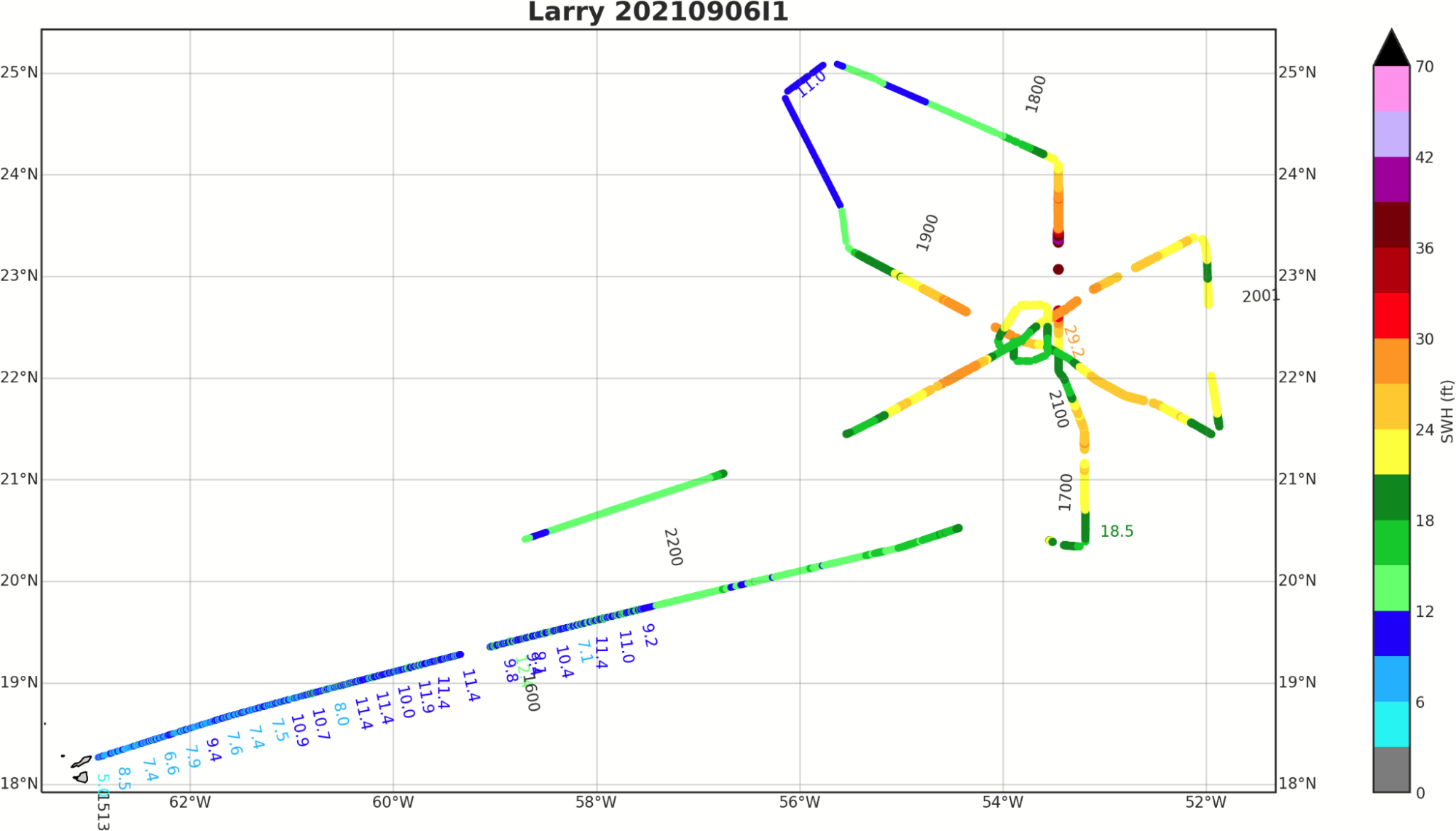
|