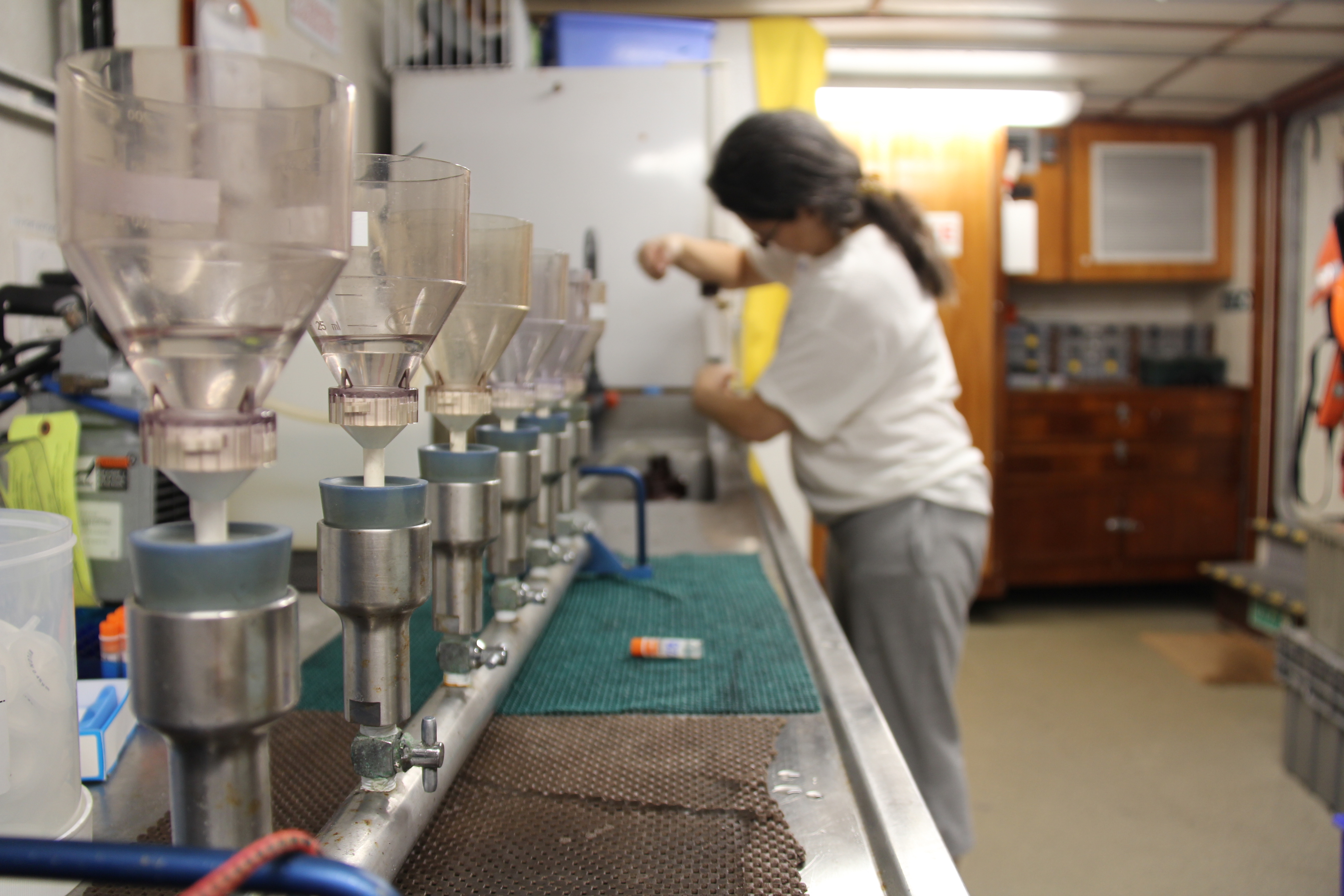
AOML Photo GalleryThis photo gallery highlights AOML scientists conducting field activities and related events or accomplishments. Mouse over each image for a description of the image content.
NOAA Collaborates with Partners to Test Unmanned Underwater Vehicles which Record Harmful Algal Blooms in Lake ErieIn a collaborative effort between NOAA, the Cooperative Institute for Great Lakes Research, and the Monterey Bay Aquarium Research Institute, research merging robotics with biochemistry will give us a detailed, three-dimensional picture of harmful algal blooms in Lake Erie in near real-time and take water samples for genomic analysis. The end goal is a Harmful Algal Bloom forecast to help managers make decisions about environmental health and public safety pertaining to the lake. AOML’s own Dr. Kelly Goodwin is participating in the project to help with instrument and sample recovery. For more information, read the article on NOAA Research: https://go.usa.gov/xUhDd.
|
||||||||||||||||||||||||||||||||||||||||||||||||||||||||||||||||||||||||||||||||||||||||||||||||||||||||||||||||||||||||||||||||||||||||||||||||||||||||||||||||||||||||||||||||||||||||||||||||||||||||||||||||||||||||||||||||||||||||||||||||||||||||||||||||||||||||||||||||||||||||||||||||||||||||||||||||||||||||||||||||||||||||||||||||||||||||||||||||||||||||||||||||||||||||||||||||||||||||||||||||||||||||||||||||||||||||||||||||||||||||||||||||||||||||||||||||||||||||||||||||||||||||||||||||||||||||||||||||||||||||||||||||||||||||||||||||||||||||||||||||||||||||||||||||||||||||||||||||||||||||||||||||||||||||||||||||||||||||||||||||||||||||||||||||||||||||||||||||||||||||||||||||||||||||||||||||||||||||||||||||||||||||||||||||||||||||||||||||||||||||||||||||||||||||||||||


 |
 |
 |
 |
 |
 |
 |
 |
 |
 |
 |
 |
 |
 |
 |
AOML Researchers Partcipate in South Florida Ecosystem Restoration Cruise
AOML researchers recently participated in the South Florida Ecosystem Restoration Research Cruise, a survey of south Florida’s coastal waters on June 22-26 aboard the R/V Savannah. These cruises have investigated coastal water quality in south Florida since the late 1990s. The science crew collected samples to measure nutrients, plankton, productivity, chlorophyll a, and dissolved inorganic carbon. They also recorded salinity and temperature to help monitor ecosystem restoration efforts in south Florida. These cruises have an additional focus on lower trophic level dynamics downstream from the Shark River on the southwest Florida shelf.
 |
 |
 |
 |
 |
NOAA Ship Ronald H. Brown Creates a Global Network of Ocean Data
NOAA Ship Ronald H. Brown continues to make its way around the world deploying many devices to observe the ocean. These platforms measure temperature, salinity, and ocean currents. This creates a network of ocean data that can be used to understand its physical dynamics and help us understand and anticipate change in weather, climate, and even ecosystems. Read more about it on the I07N GO-SHIP Blog: https://goo.gl/hqNXwC
 |
 |
 |
 |
 |
 |
Live Science Update from the I07 GO-SHIP Cruise: Biome Beneath the Surface
Below the surface of our ocean there is another, smaller world that moves fast and breathes in and out with the ocean. Zooplankton communities likely create the fastest source of sinking carbon to the deeper ocean, and studying this process can help us understand more about the carbon cycle and how it affects us. Victoria Coles, Scientist aboard the NOAA Ship Ronald H. Brown, can tell you more. Get it here: https://goo.gl/hqNXwC.
 |
 |
 |
 |
 |
 |
Live Science Update from the I07N GO-SHIP Cruise: Intro to Oceanography
The NOAA Ship Ronald H. Brown is taking scientists across the Indian Ocean on a research cruise to study the ocean's chemistry, water temperature, and other physical dynamics. Holly Westbrook, a RSMAS scientist aboard the Ronald H. Brown talks about life on a research cruise. Close quarters, beautiful sunrises, and making friends- sub the lab coats for sunglasses! Visit the GO-SHIP I07N Cruise blog here: https://goo.gl/hqNXwC.
 |
 |
 |
 |
 |
Update from the GO-SHIP I07N Cruise:
Acoustic Measurements Determine Water Column Dynamics with LADCP Technology
NOAA Ship Ronald H. Brown is taking scientists across the Indian Ocean on a research cruise to understand more about our ocean’s chemistry, temperature, and physical processes. The newest Live Science update follows Amanda Fay as she uses a Lowered Acoustic Doppler Current Profiler (LADCP) to measure the speed of the water through the water column. When the instrument is lowered to depth, sound is sent out and reflected back from particles in the water, giving a complete profile of water column movement. To find out more about how this works in action, visit the GO-SHIP I07N Cruise blog here: https://goo.gl/hqNXwC.
 |
 |
 |
Live Science Update from the GO-SHIP I07N Cruise:
Port of Seychelles: A Break from Operations
Scientists aboard the Ronald H. Brown for the GO-SHIP cruise arrive at port for some welcomed R&R in the Seychelles Islands, a chain of rocky islands northeast of Madagascar. Read about the island experience on the GO-SHIP Blog.
 |
 |
 |
 |
Premiere of New VR Film, Generation Ocean: Coral Reefs Coming to NOAA's Open House
The premiere of Generation Ocean: Coral Reefs is open to the public and will take place during NOAA’s Open House this Saturday, May 12th, from 10 am – 3 pm at AOML, 4301 Rickenbacker Causeway, Miami, FL. During the Open House, attendees will be able to not only experience the premiere of ANGARI Foundation’s new 360/VR film, but will also have the opportunity to meet NOAA scientists, tour the facilities, and learn about hurricanes, corals, fisheries, weather, and more. For additional information regarding the NOAA Open House, please click here.
 |
Live Science Update from the GO-SHIP 107N Cruise: International Collaboration at Sea
Scientists aboard the Ronald H. Brown for the GO-SHIP engage in international collaboration to monitor carbon dioxide dynamics to understand how the oceans help the Earth regulate its temperature. JAMSTEC and NOAA have a long history of international collaboration, find out more about it on the GO-SHIP Blog.
 |
 |
 |
Live Science Update from the GO-SHIP 107N Cruise: CFCs, Unintentional Ocean Tracers
How does the ocean move, and how can you tell? Katey Williams aboard the GO-SHIP I07 Cruise is tracking Chloroflurocarbons (CFCs) through gas chromatography to study how water masses migrate through the ocean. Find out more on the GO-SHIP I07N Blog.
 |
 |
 |
 |
 |
Live Science Update from the GO-SHIP 107N Cruise
NOAA Scientists, along with partnering institutions have embarked on a two-month research cruise in the Western Indian Ocean to monitor the ocean basins from coast to coast and top to bottom to find out how the ocean has evolved over the past 23 years. The Global Ocean Ship-Based Hydrographic Investigations Program (GO-SHIP) 107N cruise is sending live updates from the Indian Ocean. Check out the cruise blog post to find out what it’s like aboard a NOAA research vessel. Here are some photos of CTD operation and deployment by one of our partnering scientists, Yashwant Meghare.
 |
 |
 |
 |
 |
 |
NOAA/Raytheon Team Honored with Aviation Week Magazine's Laureate Award
NOAA/AOML hurricane scientists attended the Aviation Week and Science Technology Laureate Awards in Washington D.C. to receive Aviation Week magazine’s prestigious Laureate award for Dual Defense Use. The NOAA/Raytheon team was recognized for using Coyote Unmanned Aircraft Systems (UAS) during missions into Hurricane Maria, to help track and model hurricanes. More information on the successful Coyote missions into Hurricane Maria here.
Photo credit: NOAA (click on photos to view larger images).
 |
 |
 |
AOML Hosts Take Your Child to Work Day 2018
Each year, AOML scientists have the opportunity to bring their children to work, where they are taught about different aspects of the research being performed within the three divisions of AOML. This year, the children partook in lessons and activies in the subjects of buoyancy, density, ocean currents and circulation, marine debris, ecosystem based management, and ocean observations.
Photo credit: NOAA (click on photos to view larger images).
 |
 |
 |
 |
 |
 |
New Year, Continued Restoration and Monitoring
AOML scientists recently returned from the first cruise of 2018. As part of the South Florida Project, regional surveys over the southwest Florida shelf and the Florida Keys reef tract are routinely performed aboard the R/V F.G. Walton Smith on a bimonthly basis, to keep a watchful eye over sensitive marine habitats found in the region. Sampling methodologies include discrete sampling and flow through measurements of water quality and chemistry, and biological oceanographic parameters.
Photo credit: NOAA (click on photos to view larger images).
 |
 |
 |
 |
 |
 |
Changing Waters
This past Saturday, December 2nd, the FIU School of Environment, Arts and Society and FIU Sea Level Solutions Center hosted their "Changing Waters" event: an innovative science-art event focused on the issue of sea level rise. The event featured a science panel with experts from a variety of disciplines in addition to musical and theatrical performances inspired by the global rise of sea levels and the search for solutions. AOML researcher and oceanographer Chris Kelble sat on the panel, sharing his unique knowledge of water quality in Biscayne Bay and the impact of sea level rise in South Florida’s coastal communities
Photo credit: NOAA (click on photos to view larger images).
 |
 |
 sharing his knowledge on the scientific panel. Image credit: NOAA") |
Drifters to Help Recover Lost Aircraft
Researchers from AOML's Physical Oceanography Division recently deployed three surface drifters and ten special spot trace drift buoys, all contributed by NOAA, in the Caribbean Sea to help to identify the site of where an Argentine Air Force C-54E Skymaster aircraft crashed in 1965. The data gathered by the drifters will help back track the possible location of the lost aircraft based on the location of life vests recovered during search operations after the crash. These deployments are part of a larger effort in support of tje Argentine Air Force and search and resuce operations professionals from the US, Costa Rica, Panama and Argentina to locate the remains of the flights. Mr. Jose Rivera of NOAA, Captain Marcelo Covelli from Perfectura Naval Argentina and Licenciado Mariano Torres Garcia, representing the Argentine Air Force, are closely coordinating the 4th Expedition in the Caribbean Sea to locate the remains of TC48 and its 68 crew members on April 2018.
Photo credit: NOAA (click on photos to view larger images).
 |
 |
 |
South Florida Coastal Ecosystem Surveys Post Hurricane Irma
Throughout the month of October, AOML scientists were hard at work surveying south Florida's coastal waters. The research team focused on monitoring water quality, seagrass beds, and juvenile sport fish populations throughout Florida Bay, Biscayne Bay, Florida Keys and the southwest Florida shelf. These surveys assessed ocean temperatures, salinity, nutrients, environmental DNA and primary productivity to better understand how south Florida's coastal ecosystems were impacted by the passage of Hurricane Irma.
Photo credit: NOAA (click on photos to view larger images).
 |
 |
 |
 |
 |
 |
NOAA Hurricane Hunters Fly Harvey & Irma
The 2017 hurricane season has already fulfilled forecaster predictions of a busy year. Hurricane Harvey rapidly strengthened to a Category 4 hurricane before making landfall in Texas, late on August 25th. Harvey was the first major hurricane to make landfall in the United States since Wilma in 2005. As Harvey dissipated, Irma began to form in the Eastern Atlantic and rapidly intensified into a Category 5 hurricane on September 5th. Irma quickly became the strongest hurricane outside of the Caribbean Sea and Gulf of Mexico ever recorded. AOML hurricane scientists flew these catastrophic storms to collect critical data both inside the eye and within the surrounding eyewall.
Photo credit: NOAA (click on photos to view larger images).
 |
 |
 |
 |
 |
 |
GOMECC-3 Cruise
AOML scientists have returned from the third Gulf of Mexico Ecosystems and Carbon Cycle cruise (GOMECC-3), which took place to perform a large-scale survey of ocean acidification trends and dynamics in the Gulf of Mexico aboard NOAA ship Ronald H. Brown from July 18 through August 21, 2017. This research cruise was just one part of a larger effort supported by the NOAA Ocean Acidification Program to better understand how ocean chemistry along all the U.S. coasts is changing in response to ocean acidification and where marine organisms may be at greatest risk. For more infomation, visit the cruise blog here.
Photo credit: NOAA (click on photos to view larger images).
 |
 |
 |
 |
 |
 |
 |
 |
 |
25th Anniversary of Hurricane Andrew
Hurricane Andrew made landfall in Homestead, Florida, on August 24, 1992, with sustained wind speeds maxing out at 165 mph. This year marks the 25th anniversary of the storm, still one of the most catastrophic and costliest hurricanes in US History. Andrew was a small, compact, fast-moving, Category-5 storm that, unlike most major hurricanes, caused catastrophic damage from wind rather than storm surge and flooding. Not only did the storm reconfigure much of south Florida, causing an estimated $26.5 billion in direct damages in 1992, but it also led to a reconfiguration of the tools now used to study, forecast, prepare for, and respond to hurricanes.
Photo credit: NOAA (click on photos to view larger images).
 |
 |
 |
 |
 |
 |
2017 Solar Eclipse
On August 21st, 2017, the entire nation celebrated a unique celestial event: the first total solar eclipse to cross the contiguous United States in 99 years. This extraordinary visual experience was captured through many different lenses here at our laboratory. While AOML’s Miami location was not on the path of totality, we were still fortunate enough to see roughly 80% of the solar eclipse, through a number of both high-tech and homemade viewing tools.
Photo credit: NOAA (click on photos to view larger images).
 |
 |
 |
 |
||
Frost Science IMPACT Summer Camp
This June, AOML hosted students from the Frost Science Upward Bound Math and Science program. This program provides high school students with access to mentors and technology, interaction with scientists, as well the IMPACT (Integrated Marine Program and College Training) Summer Program, in which they delve specifically into marine science. Students were given a tour of AOML, where they were educated on research topics such as microbial and molecular ecology, ecosystem water quality, coral reef ecology, fisheries ecology and population genetics. Students also met with current AOML interns, who provided perspective on NOAA internships and educational opportunities.
Photo credit: NOAA (click on photos to view larger images).
 |
 |
 |
 |
 |
 |
2017 May Western Boundary Time Series Cruise
This May, AOML scientists and colleagues from the University of Miami took part in a 17-day research cruise aboard R/V Endeavor in support of the NOAA-funded Western Boundary Time Series project. The science team gathered a total of 44 CTD profiles, which measure full water column values of salinity, temperature, and oxygen. Data from four recovered NOAA pressure-equipped inverted echo sounder (PIES) moorings were acoustically downloaded, and three new PIES moorings were deployed. Excitingly, the scientists also successful recovered a prototype PIES-data pod system, equipped with the Adaptable Bottom Instrument Information Shuttle System (ABIISS), which was deployed in October 2015.
Photo credit: NOAA (click on photos to view larger images).
 |
 |
 |
Congratulations Gladys, We Will Miss You!
AOML employees commemorated Gladys Medina's retirement after 45 years of federal service as executive assistant to the AOML director. Thank you Gladys, for all of your hard work and dedication at AOML.
Photo credit: NOAA (click on photos to view larger images).
 |
 |
 |
52nd Annual Federal Employee of the Year Award Program
Congratulations to AOML's research oceanographer Sang-Ki Lee for winning the scientific category at the 52nd Annual Federal Employee of the Year Award Program on May 12th. Sang-Ki is the author of numerous publications related to climate and weather phenomena, and leads projects including a study of the impact of regional sea surface temperature variability on ocean acidification and fisheries. His recent work on US tornado outbreak risk was the #1 NOAA Research story in 2016 based on public interest on NOAA's social media accounts. Dr. Lee's extensive publication history can be found here: https://www.aoml.noaa.gov/phod/people/lee/index.php.
 |
2017 Hurricane Awareness Tour
This past Friday, May 12th, AOML oceanographic and meteorological scientists participated in the final leg of NOAA's Hurricane Awareness Tour in Miami at the Opa-Locka Executive Airport. The tour provided an opportunity for NOAA’s National Weather Service and partner agencies to visit locations along the east coast that could be impacted by hurricanes, and to teach visitors about weather safety and preparedness. Visitors were also given the opportunity to climb aboard “Kermit” - one of the P-3 aircrafts used by NOAA Hurricane Hunters - to tour the "flying laboratory" and meet the scientists and pilots who fly into storms to gather data.
Photo credit: NOAA (click on photos to view larger images).
 |
 |
 |
 |
 |
 |
CalCOFI Cruise Aboard NOAA Ship Bell M. Shimada
The California Cooperative Oceanic Fisheries Investigations (CalCOFI) cruise sampling was completed on April 21st aboard NOAA Ship Bell M. Shimada. NOAA and partners participated in the first of two field tests of a prototype long-range autonomous underwater vehicle (AUV) equipped with genomic sampling capability developed by the Monterey Bay Aquarium Research Institute (MBARI). Scientists collected samples by traditional methods for comparison to the eAUVs ability to intelligently sample water column features, such as the chlorophyll maximum. Learn more about genomics and the unique CalCOFI partnership here: https://www.aoml.noaa.gov/keynotes/keynotes_1114_omics_calcofi.html.
Photo credit: NOAA (click on photos to view larger images).
 |
 |
NOAA Ship Ronald H. Brown Cruise
NOAA AOML scientists participated in the 2017 annual PIRATA Northeasten Extension (PNE) and Saharan Dust AERosols and Ocean Science Expeditions (AEROSE) cruise aboard the NOAA Ship Ronald H. Brown from February 19 to March 25. The purpose of the PNE cruise was to measure upper ocean and near surface atmosphere in the Tropical Atlantic. This region is known for strong climate variations with impacts on rainfall rates and storm strikes for the surrounding regions of Africa and the Americas. AEROSE is an internationally recognized series of field campaigns led by scientists at Howard University and NOAA designed to explore African air mass outflows and their impacts on climate, weather and environmental health.
Photo credit: NOAA (click on photos to view larger images).
 |
 |
 |
 |
 |
 |
Hurricane-Hunting Technology Explores Atmospheric and Oceanic Interactions in the Caribbean
Throughout the Atlantic hurricane season, this autonomous underwater vehicle dives to depths of up to 1,000 meters and travels thousands of kilometers across the Caribbean Sea. The gliders are deployed in the Caribbean and tropical North Atlantic. Researchers use the ocean profile data from the underwater gliders to assess the impact of tropical cyclone conditions on upper ocean thermal structure, and to improve tropical cyclone intensity forecasts. By improving models and forecasts, NOAA researchers help the public prepare for dangerous weather, and keep communities both informed and safe.
Photo credit: NOAA (click on photos to view larger images).
 |
 |
 |
 |
 |
 |
 |
 |
 |
NOAA AOML Hosts Take Your Child to Work Day
NOAA's Atlantic Oceanographic and Meteorological Laboratory hosted take your child to work day at the lab. The children were first shown two presentations by NOAA scientists on sea level rise and hurricanes. Afterwards, the children were taken to the University of Miami's Rosenstiel School of Marine and Atmospheric Science, where the children were shown around the new coral reef lab and had the unique opportunity to see the University's wave tank.
Photo credit: NOAA (click on photos to view larger images).
 |
 |
 |
 |
 |
 |
 |
 |
 |
NOAA Hurricane Hunters Fly into Hurricane Matthew
NOAA's Hurricane Hunters fly into hurricanes to help study important features and improve forecasts. The photos below highlight two different flights, on October 5 & 6, 2016, that were taken from flights into Hurricane Matthew as it moved through the Atlantic and up the East Coast of the United States. Hurricane Matthew eventually moved off the East Coast and would dissipate out in the Atlantic Ocean.
Photo credit: NOAA (click on photos to view larger images)
 |
 |
 |
 |
 |
 |
 |
 |
 |
 |
 |
 |
Images Referenced During Reddit Ask Me Anything (AMA)
NOAA AOML will play host to a Reddit Ask Me Anything (AMA) on September 22, 2016 from 1:00-3:00pm EST. Frank Marks, Sc.D., Director of the Hurricane Research Division at AOML, and P-3 hurricane hunter pilot Commander Justin Kibbey of the NOAA Corps will answer questions.
Posted: September 21, 2016
Photo credit: NOAA (Click on photos to view larger images)
 |
 |
 |
 |
 |
 |
 |
 |
NOAA Hurricane Hunters Fly into Tropical Storm Hermine
NOAA's Hurricane Hunters regularly fly into developing systems that may threaten landfall or to study important features to improve forecasts. Photos below highlight flights into Tropical Storm Hermine that moved from the Atlantic over to the Gulf of Mexico in late August and early September 2016. What began as an experiment to study the genesis of a storm, Tropical Storm Hermine eventually moved into the Gulf of Mexico with landfall expected in North Florida.
Posted: August 31, 2016
Updated: September 1, 2016
Photo credit: NOAA (click on photos to view larger images)
 |
 |
 |
 |
 |
. Image credit: NOAA") |
 |
 |
 |
Juvenile Sportfish Monitoring in the Florida Bay
With an average depth of only 3 feet, the Florida Bay is home to a number of marine populations, as well as a vital nursery ground for commercial and recreational reef fish species. The Florida Bay also plays host to a group of NOAA researchers who are investigating how habitat changes in Florida Bay are impacting juvenile sportfish populations, with a focus on the spotted seatrout. The study aims to examine the relationship between juvenile spotted seatrout abundance, salinity, temperature, and seagrass, and use the data to quantify and predict the impacts of Everglades Restoration.
View the entire photo essay here: Spotting the Seatrout, by: Hanna Payne
Photo credit: NOAA (click on photos to view larger images)
 |
 |
 |
 |
 |
 |
 |
 |
 |
 |
 |
 |
 |
 |
 |
Puerto Rico Underwater Glider Mission
On Thursday July 21st, PHOD began its fifth underwater glider mission in the Caribbean Sea. Two underwater gliders, SG609 and SG630, were successfully deployed off of Puerto Rico. The deployment was carried out by AOML researchers on board the R/V La Sultana with the help of personnel from the University of Puerto Rico Mayaguez (UPRM). The refurbished gliders have sensors that measure temperature, salinity, oxygen, Chlorophyll-a, and turbidity. This deployment is the beginning of the 2016 Atlantic Hurricane Season deployment, with two more gliders scheduled for deployment in the tropical North Atlantic in August.
Photo credit: NOAA (click on photos to view larger images)
 |
 |
 |
 |
 |
 |
 |
 |
 |
 |
 |
 |
F.G. Walton Smith Florida Straits Cruise
From July 13th to 14th, AOML researchers conducted a hydrographic survey along 27N in the Florida Straits as part of the Western Boundary Time Series project aboard the R/V F.G. Walton Smith. The cruise conducts surveys to quantify Florida Current volume transport and water mass changes.
Photo credit: NOAA (click on photos to view larger images)
 |
 |
 |
 |
 |
 |
 |
 |
 |
 |
 |
 |
NOAA Nancy Foster Research Cruise
Photos from the scientsts and data from the NOAA Nancy Foster Cruise that sailed off in May. The Nancy Foster sailed out on a research survey to search for bluefin tuna larvae among other fishy creatures. Read more about the cruise in this web feature.
Photo credit: NOAA (click on photos to view larger images)
 |
 |
 |
 |
 |
 |
 |
 |
 |
AOML Scientists Conclude Fourth Underwater Glider Mission
On Thursday June 2nd, PHOD concluded its fourth underwater glider mission in the Caribbean Sea. Along with their partners at the University of Puerto Rico at Mayaguez, the glider was recovered from the R/V La Sultana. Since the beginning of AOML glider operations in July 2014, approximately 9000 temperature and salinity profiles have been collected in the Caribbean Sea and the Tropical North Atlantic. AOML's underwater glider operations are carried out in support of tropical cyclone studies. The next deployments will be carried out in June and July, with two gliders in the Caribbean Sea and two gliders in the tropical North Atlantic Ocean.
Photo credit: NOAA (click on photos to view larger images)
 |
 |
 |
AOML Participates in CBS4 Miami's S.T.E.A.M. Day
On Tuesday, May 24th, AOML Associate Director and hurricane hunter pilot LCDR Justin Kibbey and AOML Communications staff participated in the S.T.E.A.M. (Science, Technology, Engineering, Arts, Mathematics) Day event at Marlins Park, hosted by local news station CBS4. Thousands of elementary and middle school students from across Miami-Dade and Broward were on hand as part of the fun-filled, science-focused educational field trip at the ballpark. The pre-game programming was designed to teach students the basic concepts of weather and climate and how these topics relate to living in South Florida. LCDR Kibbey discussed what it is like to fly into hurricanes and introduced the Coyote Unmanned Aerial System, a small aircraft used by NOAA to conduct research inside of a hurricane.
Photo credit: NOAA (click on photos to view larger images)
 |
 |
 |
 |
 |
 |
 |
GO-SHIP Indian Ocean Cruise
Photos from the ongoing GO-SHIP cruise transecting the Indian Ocean. Read more about the cruise in this web feature.
Photo credit: NOAA (click on photos to view larger images)
 |
 |
 |
 |
 |
 |
 |
||
 |
Underwater Gliders Begin Fourth Mission
The fourth underwater glider mission began in March with the deployment of two refurbished gliders in the Caribbean Sea off Puerto Rico. The deployment was carried out by AOML researchers on board the R/V La Sultana with the help of personnel from the University of Puerto Rico Mayaguez (UPRM). The refurbished gliders have sensors that measure temperature, salinity, oxygen, Chlorophyll-a, and turbidity. The gliders will obtain approximately 2500 ocean profiles during this mission, which will last until June. In addition, several experiments will be carried out to assess glider-derived currents and sensor accuracy. The fifth mission is scheduled to start in August and will be geared towards obtaining critical temperature/salinity profile data that can be used in ocean-atmospheric models to help forecast tropical cyclone intensification.
Photo credit: NOAA (click on photos to view larger images)
 |
. Image credit: NOAA") |
Deputy NOAA Administrator Vice Admiral Manson Brown Visits AOML
VADM Brown took a tour of AOML and the Southeast Fisheries Science Center on March 15th to learn about current research and addressed staff during a town hall session.
Photo credit: NOAA (click on photos to view larger images)
 |
 |
 |
 |
 |
 |
 |
 |
 |
Coral Scientists Replace Instrumentation for Ongoing Coral Bleaching Study
From March 1st through March 3rd, AOML coral scientists traveled to reefs in the Upper and Lower Florida Keys to swap out instruments being used for an ongoing coral bleaching study. Both pH and light loggers were collected and deployed at inshore and offshore study sites. The pH loggers, known as SeaFETs, are used to provide accurate measurements of seawater pH over long periods of time. For light measurements, ECO-PAR sensors are installed to record highly accurate measurements of PAR, or photosynthetically active radiation, the spectral range of solar radiation from 400 to 700 nanometers that photosynthetic organisms are able to use in the process of photosynthesis.
Photo credit: NOAA (click on photos to view larger images)
 |
 |
 |
 |
 |
 |
AOML Engages Local Students in STEM Activities for National Labs Week
On Friday, March 4th, AOML hosted 35 students from Miami's Booker T. Washington High School for the Obama Administration’s My Brother's Keeper National Labs Week. This national event is designed to introduce students from communities that are not well represented in STEM (Science, Technology, Engineering, Mathematics) careers to federal employees and lab facilities in the hopes of inspiring interest in these fields. Students from this Title 1 Miami-Dade County public high school soared into a hurricane though the eyes of our hurricane hunter scientists, experienced the challenge of engineering ocean observing technologies, discovered the microorganisms in our coastal beaches and met the programmers who create our next generation hurricane models to predict storms. AOML researchers brought their science within reach as hands-on experiments introduced concepts of ocean circulation, water properties, and microbial sampling. AOML partnered with The University of Miami's Cooperative Institute for Marine and Atmospheric Studies to provide the bus services needed to bring the students to the federal laboratory.
Photo credit: NOAA (click on photos to view larger images)
 |
 |
 |
 |
 |
 |
 |
 |
 |
 |
 |
 |
 |
 |
 |
 |
 |
AOML Participates in El Niño Rapid Response Campaign
AOML hurricane researcher Jason Dunion participated in NOAA's El Niño Rapid Response Field Campaign, a comprehensive land, sea, and air sampling effort in the tropical Pacific, to study the current El Niño and improve weather forecasts thousands of miles away. Dunion was part of the team of NOAA scientists and partners that deployed NASA’s Global Hawk unmanned aircraft, a key asset for the Sensing Hazards with Operational Unmanned Technology (SHOUT) project led by researchers with NOAA's Unmanned Aircraft System Program. The Global Hawk carried a suite of meteorological sensors and dropped parachuted weather instruments during four research flights in February in the eastern Pacific, near the U.S. West Coast. Data from the flights will help improve the models that are used to support weather forecasts. The data will also provide insights that researchers hope will improve year-to-year El Niño forecasts, as well as the accuracy of the models predicting the longer-term effects of climate change.
Photo credit: NOAA (click on photos to view larger images)
 at the Global Hawk Operations Center at Edwards Airforce Base. Image credit: NOAA") |
 in front of the Global Hawk at NASA's Armstrong Flight Research Center at Edwards Air Force Base. Image credit: NOAA") |
February 2016 Western Boundary Time Series Cruise
AOML researchers completed a Western Boundary Times Series cruise in February aboard the UNOLS Ship R/V Endeavor. The AOML team was supported by additional crew from the University of Puerto Rico. During their 2 weeks at sea, the science team gathered full water column values of salinity, temperature, and oxygen with a CTD (conductivity-temperture-depth) instrument, as well as deployed three pressure inverted echo sounder (PIES) moorings. The PIES moorings will measure the strength of the Atlantic meridional overturning circulation at 26°N in support of the RAPID (Rapid Research and Response) program, a joint effort of NOAA and the National Science Foundation.
Photo credit: NOAA (click on photos to view larger images)
 |
 |
 |
 |
 |
 |
 |
AOML Hosts Young Scientists on Take Your Child To Work Day
On February 5, 2016, AOML was a proud participant in the annual 'Take Your Child to Work Day' tradition. This year's theme focused on the global ocean observing system, a network of ocean buoys and drifters to which AOML contributes to, that collects vital data on the world's oceans. After an overview of the program by AOML oceanographer Dr. Rick Lumpkin, students had the opportunity to inspect and learn about AOML's array of ocean-going instruments. With these drifter designs in mind, students then got to build and test their own! Thanks to all the AOML staff and young scientists who joined us this year!
Photo credit: NOAA (click on photos to view larger images)
 |
 |
 |
 |
 |
 |
 |
 |
 |
100th Successful Dropsonde Cruise for the Western Boundary Time Series Project
In October, AOML scientists, technicians and engineers involved in the Western Boundary Time Series (WBTS) project completed the 100th successful dropsonde cruise in the Florida Current since the project's inception in 2000. The dropsonde cruises measure volume transport in the Florida Current using an out-of-service telephone cable between Florida and Grand Bahama Island. The oceanographic dropsonde is a key instrument in taking these measurements and has been used since the 1960s. The modern version was pioneered at AOML in the mid-1990s via the introduction of a Global Positioning System (GPS) receiver inside the instrument. Further improvements over the years have led to a very robust dropsonde that provides highly accurate estimates of depth-averaged ocean velocity. Collecting 100 dropsonde cruises over the past 15 years is an important milestone for the WBTS project and has been an effort of many, from the engineers who build the dropsondes, to the technicians who process the data, to the numerous engineers and technicians who go to sea to collect the data on small boats every year.
Photo credit: NOAA (click on photos to view larger images)
 |
Underwater Gliders Retrieved After Successful Third Mission
On November 16th-18th, AOML physical oceanographers partnered with the University of Puerto Rico to successfully recover two underwater gliders from the Caribbean Sea aboard the M/V La Sultana of the University of Puerto Rico Mayaguez. Over the course of the summer, the gliders successfully transected a region in the eastern Caribbean providing approximately 3000 profile observations of temperature, salinity, oxygen, and surface as well as depth-average current velocities. The gliders were also on location during the passage of Tropical Storm Erika in August, gathering temperature measurements that are critical to understanding the ocean’s role in how storms form, evolve, and change in intensity. These data should also provide researchers with a better understanding of the ocean’s response to the passage of storms which, in turn, will improve ocean models used in hurricane forecasts.
The recovery involved a field team at sea retrieving and a pilot team at AOML steering the gliders to an area where they could be safely recovered. After recovery, the gliders will be brought to the University of Puerto Rico Mayaguez in La Parguera where they will undergo a thorough refurbishment in preparation for their next deployment. Included in the refurbishment will be repairs to the body of one of the gliders after researchers found evidence of a shark encounter, including puncture wounds and an embedded shark tooth.
For the latest observations and data from the underwater gliders, click here.
Photo credit: NOAA (click on photos to view larger images)
 |
 |
 |
 |
Coral Team Conducts Monitoring Activities at Cheeca Rocks
AOML coral researchers conducted a number of reef monitoring activities during the month of October at Cheeca Rocks off of Islamorada, Florida. Among the activities was the installation of new sensors to measure pH and photosynthetic light levels at the on-site MapCO2 buoy. The team also conducted benthic surveys and deployed a pH sensor at an inshore patch reef where they are conducting an experiment to examine the impacts of bleaching across Florida Keys reefs. They were also joined by a colleague from the University of Miami who conducted photo mosaic surveys of the reefs. A photo mosaic is a tool used by researchers to map reefscapes and involves the stitching together of hundreds of photos taken simultaneously across the reef to form one giant image. Photo mosaics provide coral researchers with an important tool to more accurately document community-wide changes in reef health. Read more about AOML's efforts to monitor coral bleaching across the Caribbean here.
Photo credit: NOAA (click on photos to view larger images)
 |
 |
 |
 |

October 2015 Western Boundary Time Series Cruise
AOML oceanographers are participating in a joint research cruise to study the Meridional Overturning Circulation onboard the R/V Endeavor during October 3-20. The team will sail from Fort Lauderdale, FL to collect roughly 55 full-depth conductivity-temperature-depth (CTD) profiles in the Florida Current and the Deep Western Boundary Current east of the Bahamas. The scientists will also work with their partners from the University of Miami to recover, redeploy, and maintain three tall moorings and nine smaller moored instruments during this cruise in support of the NOAA Western Boundary Time Series project and its partner National Science Foundation project.
Photo credit: NOAA (click on photos to view larger images)
 |
 |
 explains to one of the university students participating in the cruise how data is acoustically downloaded from one of the NOAA subsurface moored instruments. Image credit: NOAA") |
 |
AOML Researchers Take Water Samples at Annual King Tide
On September 29th, researchers from AOML's Environmental Microbiology Lab along with scientists from Florida International University’s Southeast Environmental Research Center collected water samples along Miami Beach during a king tide event, the highest astronomical tide of the year. Sample sites were located adjacent to pumps installed by the City of Miami Beach to actively pump super-tidal floodwaters out of the streets and back into Biscayne Bay. AOML’s team continuously monitored and collected water samples over a 5-hour period at locations in Maurice Gibb Memorial Park, along 14th Street, and at 27th Street and Indian Creek Drive. During sampling, physical water properties such as temperature, salinity, pH, turbidity, and dissolved oxygen content were also measured. For more on this sampling effort, click here.
Photo credit: NOAA (click on photos to view larger images)
 |
 |
 |
 |
 |
 |
 |
 |
 |
SEFSC & AOML Partner to Tag Leatherback Turtles in the Gulf of Mexico
A team of NOAA scientists from the Southeast Fisheries Science Center (SEFSC) and AOML conducted a survey aboard the NOAA research vessel Hildebrand to capture, tag and release leatherback sea turtles in the Gulf of Mexico. The survey, which took place off the coast of the Florida Panhandle, was the first directed research on leatherbacks in Gulf waters. The team of scientists sought to obtain accurate information on these endangered animals in order to answer questions relating to habitat use, migrations, and distribution within the Gulf region. After locating a turtle with help from spotters in NOAA aircraft, each turtle was secured with a net and brought to the vessel to be measured and equipped with a satellite tag, which will collect data on dive patterns and water temperatures in addition to long-term movement. The team successfully tagged a total of six turtles during the survey. The team also assisted in the scheduled release of a female leatherback that had stranded earlier in September off of Fort Walton Beach, FL. The turtle, which had been rehabilitated at the local Gulfarium Marine Adventure Park, was brought aboard the R/V Hildebrand in Destin, FL and successfully released 20 miles offshore.
Photo credit: NOAA (click on photos to view larger images)
 |
 |
 |
 |
 |
 |
AOML Conducts Water Quality Monitoring in Florida Bay
AOML scientists aboard the R/V F.G. Walton Smith conducted the bimonthly water quality research cruise in support of the South Florida Project during the week of September 21st. The AOML South Florida Project (SFP), and its associated field operations, have enabled scientists and resource managers to keep a watchful eye on the sensitive marine habitats found in the region and have served as a sentinel during periods when the ecosystem has been subjected to extreme events such as hurricanes, harmful algal blooms (HAB), and more recently, potential oil spill contaminants. Additionally, the AOML SFP has produced a comprehensive, long-term baseline regarding regional circulation, salinity, water quality, and biology for the ecosystem.
Photo credit: Sarah Rivard, NOAA (click on photos to view larger images)
 |
AOML Begins Biscayne Bay Canal Sampling Surveys
AOML's ecosystem assessment and modeling group is collaborating with the protected species and biodiversity lab at NOAA's SEFSC to begin a water quality monitoring survey of South Florida's Biscayne Bay watershed. Biscayne Bay is a designated Habitat Focus Area under NOAA’s Habitat Blueprint, a program which offers opportunities for NOAA to partner with organizations to address coastal and marine habitat loss and degradation issues. Scientists will collect continuous temperature, salinity, turbidity, dissolved organic matter, and fluorescense measurements, as well as discrete samples for Chrlorophyll a, nutrients, and phytoplankton. The surveys will occur quarterly and will examine the sources of potential contaminants from canals and waterways, and the subsequent effects these contaminants will have on the Bay.
Photo credit: NOAA (click on photos to view larger images)
 |
 |
Video: Coral Spawning in the Florida Keys
AOML coral scientists participated in a NOAA National Marine Fisheries Service-led project to document coral spawning in the Florida Keys National Marine Sanctuary during August & September 2015. The project aims to measure spawning success for two imperiled Caribbean species, elkhorn coral (Acropora palmata) and mountainous star coral (Orbicella faveolata) in the Florida Keys. The team collected gametes from both species to be used in experiments that aim to improve the understanding of factors that may enhance the likelihood of coral larvae to survive and settle on the ocean floor. Experiments will also assess impacts of current and future global environmental changes, such as ocean acidification, on these vulnerable early life stages of corals. Click on the image below to view a video of a spawning mountainous star colony.
Photo and Video credit: NOAA (click on image to view video)
 spawning in the Florida Keys National Marine Sanctuary. Image credit: NOAA") |
Tropical Storm Fred
On September 5th, NASA's Global Hawk took off from Wallops Island, Virginia to fly a 24 hour mission over Tropical Storm Fred. The Global Hawk launched dropwindsondes to measure the wind structure of the storm and gathered other meteorological data such as temperature and moisture with instruments on board. The Global Hawk is part of NOAA’s Sensing Hazards with Operational Unmanned Technology (SHOUT) field campaign.
Photo credit: NOAA (click on photos to view larger images)
 |
 |
Tropical Storm Erika
AOML is partnering with Woods Whole Oceanographic Institution in their effort to deploy eight more Air-Launched Autonomous Micro Observer (ALAMO) floats in the path of Tropical Storm Erika. ALAMO profiling floats will be air-deployed through a chute in the belly of a US Air Force C-130 airplane. ALAMOs are a smaller Argo-style floats that will make 11 profile per day of the upper ocean down to 300m. They communicate via satellite and AOML will receive and conduct data processing to upload ocean temperature data onto the Global Telecommunication System so that it can be incorporated into ocean models. The ALAMO floats are manufactured by MRV Systems.
Photo credit: NOAA (click on photos to view larger images)
 |
Hurricane Danny
Photos taken from NOAA's P-3 aircraft during Hurricane Hunter flights conducted on Saturday, August 22nd and Sunday, August 23rd inside Hurricane Danny. Peaking at Category 3 strength on Friday, August 21, Danny had maximum sustained winds of 115 mph as it churned in the Atlantic. Danny then weakened to a tropical depression due to interaction with high levels of wind shear and a mass of dry air in the Caribbean as it moved across the Lesser Antilles. The Hurricane Hunter missions profiled Danny's wind structure with Tail Doppler Radar, conducted various projects in support of the Hurricane Research Division's 2015 Field Program, and surveyed the ocean ahead of the storm in order to improve forecasts.
Photo credit: NOAA (click on photos to view larger images)
 |
 |
 |
 |
 |
 |
 |
Scientists Conduct Juvenile Sport Fish Surveys in Florida Bay
A team of scientists from NOAA's AOML and Southeast Fisheries Science Center have conducted a series of surveys in Florida Bay this year as part of an ongoing project to investigate how juvenile sport fish in the bay respond to changes in water quality and habitat resulting from Everglades restoration. During the survey, scientists collected water quality and seagrass measurements and conducted otter trawls to sample the juvenile sport fish populations.
Photo credit: NOAA (click on photos to view larger images)
 |
 |
 |
 |
 |
 |
 |
 |
 |
 |
 |
Underwater Gliders Begin Third Mission
On July 14th, 2015, AOML physical oceanographers deployed one of two sea gliders in the Caribbean from the University of Puerto Rico's R/V La Sultana. The third deployment will continue the project's mission to gather important data in the Caribbean and Tropical North Atlantic Ocean to help with hurricane intensity forecasting and provide valuable information about the role the ocean plays in tropical cyclone development. What's new for this mission? For the first time, the gliders will collect ocean current velocity profiles in addition to the real-time temperature, salinity, and oxygen data. AOML scientists also equipped the glider with an improved battery which will allow the glider to record more profile measurements. The second of the two gliders will be deployed in the Tropical North Atlantic in the upcoming weeks.
Track the progress of the gliders by visiting the project page.
Photo credit: NOAA (click on photos to view larger images)
 |
|
 |
 |
 |
 |

July Hydrographic Survey Conducted in the Florida Straits
AOML physical oceanographers and interns conducted a hydrographic survey along the 27th north parallel in the Florida Straits aboard the R/V F.G. Walton Smith on July 14-15 as a component of the Western Boundary Time Series project. These 2-day cruises are designed to calibrate daily estimates and quantify Florida Current volume transport and water mass changes.
Cruise participants also set adrift a series of messages in bottles written by Miami schoolchildren who attended AOML's Open House in May. These messages were cast into the Florida Current, a component of the larger Gulf Stream which travels northward from Florida to Newfoundland before crossing the Atlantic Ocean.
Photo credit: NOAA (click on photos to view larger images)
 |
 |
 |
 |
 |
 |
Ocean Sampling Day (OSD) 2015
Photos of AOML microbiologists, interns and citizen scientists collecting samples on Ocean Sampling Day at sites in the Florida Keys, Miami, and La Jolla.
Photo credit: NOAA (click on photos to view larger images)
 |
 |
 |
 |
 |
 |
 |
 |
 |
ACCRETE Scientists Establish Ocean Acidification Monitoring Site at Flower Garden Banks
AOML's ACCRETE (Acidification, Climate and Coral Reef Ecosystems TEam) lab successfully established the final of three sentinel climate and ocean acidification monitoring sites at the Flower Garden Banks National Marine Sanctuary in the Gulf of Mexico this month. Below are a few photos taken by ACCRETE researchers of the biodiversity found on the reefs at the Flower Garden Banks.
Photo credit: Lauren Valentino, NOAA
(click on photos to view larger images)
 |
 |
 |
 |
 |
 |
 |
 |
 |
 |
Hurricane Researchers "Feel The Force" at the Frost Museum of Science
On Saturday, May 30th, personnel from AOML's Hurricane Research Division along with Outreach & Communications staff participated in the Patricia and Philip Frost Museum of Science’s annual “Feel the Force” event. The one-day outreach event drew over 1000 people who learned about preparing their homes and families to deal with disasters, especially hurricanes. HRD scientists staffed the permanent museum exhibit dedicated to explaining how scientists fly into storms to gather scientific data. In addition to speaking to people about the experience of flying into tropical cyclones, they also took the opportunity to explain the latest innovations in technology being tested this season and how their work will benefit hurricane intensity forecasts. HRD scientists also granted media interviews throughout the day and led a team of children in the Museum’s “Wild and Crazy Weather Challenge”.
Photo credit: NOAA (click on photos to view larger images)
 |
 |
 |
AOML Participates in CBS4 Miami's 10th Annual Weather Day
On Thursday, May 21st, AOML hurricane researcher Dr. Eric Uhlhorn participated in the 10th annual Weather Day event at Marlins Park, hosted by local news station CBS4. Thousands of elementary and middle school students from across Miami-Dade, Broward and Palm Beach counties were on hand as part of the fun-filled, science-focused educational field trip at the ballpark. The pre-game program was designed to teach students the basic concepts of weather and climate and how these topics relate to living in South Florida. Dr. Uhlhorn discussed the unmanned technology that NOAA uses to conduct research on hurricanes, including ocean gliders and the Coyote unmanned aircraft system.
Photo credit: NOAA (click on photos to view larger images)
 |
 |
 |

NOAA and Partners Host Open House for 1300
NOAA’s Atlantic Oceanographic and Meteorological Laboratory (AOML) and the National Marine Fisheries Service/Southeast Fisheries Science Center (SEFSC) partnered with the University of Miami Rosenstiel School for Marine and Atmospheric Science to host an open house May 14th-16th. The three day event brought over 1300 people to Virginia Key to learn about a variety of scientific topics including hurricane research, climate science, oceanography, local fisheries, coral communities, and endangered species. NOAA and UM scientists were on-hand to describe their research projects and answer questions and visitors got to participate in a number of hands-on demonstrations at AOML, SEFSC, the University of Miami, and the Maritime and Science Technology (MAST) Academy Land SHARC and Weather on Wheels mobile outreach programs.
Photo credit: NOAA (click on photos to view larger images)
 |
 |
 |
 |
 |
 |
 |
 |
 |
 |
 |
 |
 |
 |
 |
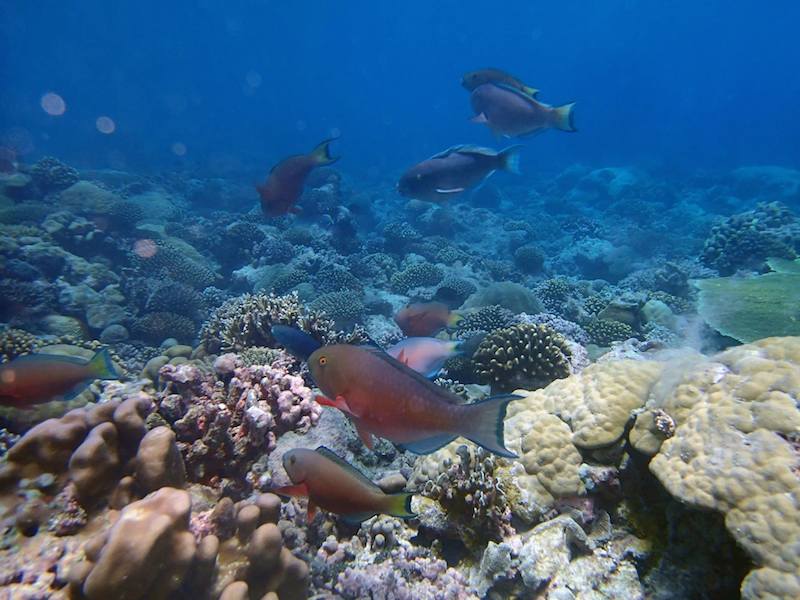
ACCRETE Marks 13th Trip Aboard Global Reef Expedition Cruise
During the months of March & April, ACCRETE researchers participated in the Khaled bin Sultan Living Oceans Foundation's Global Reef Expedition cruise which took place in the waters of the British Indian Ocean Territory. Some of the areas explored included the Maldives and the Chagos archipelago, home to the world's largest Marine Protected Area. Aboard the R/V Golden Shadow and working under the theme "Science Without Borders," the Global Reef Expedition team researches remote coral reef locations around the globe documenting their health to better understand which factors are crucial to reef resilience. ACCRETE has participated in 12 Global Reef Expedition cruises since June 2012.
Photo credit: Lauren Valentino, NOAA
(click on photos to view larger images)
 |
 hover near a coral head.") |
 glides over a reef in the Chagos Marine Protected Area.") |
 |
 to determine growth rates over time.") |
 take refuge in a vibrant anemone.") |
.") |
 |
 |
 |
 |
 |
 |
 |
 |
.") |
 |
NOAA Conducts Interdisciplinary Research Cruise in the Caribbean Aboard the Nancy Foster
AOML partnered with NOAA's Southeast Fisheries Science Center (SEFSC) to conduct an interdisciplinary research cruise aboard the NOAA Ship Nancy Foster from April 11, 2015 through June 3, 2015. The cruise began in the U.S. Virgin Islands and extended westward across the northern Caribbean to Mexico. Researchers from various institutions conducted a myriad of biological and physical oceanographic surveys during the three month cruise.
Photo credit: NOAA (click on photos to view larger images)
 |
 |
 |
. Image credit: NOAA") |
 |
 |
 |
 on the back deck, Daniel Otis (USF) filtering some water samples. Bottom: Vanessa Wright (UVI), Trika Gerard (NOAA SEFSC), Sarah Privoznik (UM/CIMAS) sorts through the plankton sample and Josue Millan Lugo (UPR) gets the filtering apparatus ready for the next station. Image credit: NOAA") |
 |
 are observed around the west end of the island. Image credit: NOAA") |
 |
 |
 |
 |
 |
 |
 |
 |
 |
 |
 |
 |
 |
 |
 |
 |


Underwater Gliders Retrieved After Successful Second Mission
On April 27th, AOML physical oceanographers partnered with the University of Puerto Rico to successfully recover two underwater gliders from the Caribbean Sea aboard the R/V La Sultana of the University of Puerto Rico Mayaguez. The gliders successfully transected a region in the eastern Caribbean providing approximately 3000 profile observations of temperature, salinity, oxygen, and surface as well as depth-average current velocities.
The recovery involved a field team at sea retrieving the gliders and a pilot team at AOML steering them to an area where they could be safely recovered. After recovery, the gliders were brought to the University of Puerto Rico Mayaguez in La Parguera where they underwent a thorough refurbishment in preparation for their next deployment in July.
Photo credit: NOAA (click on photos to view larger images)
 |
 |
 |
 |
 |
 |
 |
 |
 |
Happy Earth Day from AOML!
Photos of AOML personnel celebrating Earth Day 2015 on land and at sea!
Photo credit: NOAA (click on photos to view larger images)
 |
 |
 |
|
 |
 |
April Hydrographic Survey Conducted in the Florida Straits
AOML physical oceanographers conducted a hydrographic survey along the 27th north parallel in the Florida Straits aboard the R/V F.G. Walton Smith on April 9-10, 2015. The cruise was conducted as part of the ongoing Western Boundary Time Series project, which is designed to quantify Florida Current volume transport and water mass changes. Scientists measured full water column values of salinity, temperature, and oxygen using CTD equipment. This survey and others help to calibrate daily estimates of the Florida Current volume transport.
Photo credit: NOAA (click on photos to view larger images)
 |
 |
 |
 |
 |
 |
 |
 |
AOML Hosts Young Scientists on Take Your Child To Work Day
On April 10, 2015, AOML personnel participated in the annual 'Take Your Child to Work Day' tradition. Parents and students shared a day full of science which included a tour of the UM Rosenstiel School's new Marine Technology & Life Sciences Seawater Complex (MTLSSC). At the MTLSSC, participants observed the SUSTAIN wave tank in action, interacted with the resident aplysia, and toured a coral nursery. Thanks to all the AOML staff and young scientists who joined us this year!
Photo credit: NOAA (click on photos to view larger images)
 |
 |
 |
March Numeric Nutrient Criteria Study Cruise
AOML scientists conducted a Numeric Nutrient Criteria Study cruise Wednesday and Thursday, March 18-19th in Biscayne Bay off of Broward and Miami-Dade Counties aboard the NOAA R/V Hildebrand. The study provides concurrent water column and coral reef status data for four coral assemblies off of Miami-Dade and Broward County. These results will be employed by the Florida Department of Environmental Protection to determine numeric nutrient criteria for the coastal waters of SE Florida.
Photo credit: NOAA (click on photos to view larger images)
 instrument for the next cast into the coastal ocean near Miami-Dade. Image credit: NOAA") |
  |
Science Communication Workshop
Jana Goldman, a science communicator and plain language trainer, traveled to Miami on Wednesday, March 11, 2015 to engage AOML employees in a workshop on how to communicate science effectively to non-science audiences. While participating in the science communications exercises, AOML staff learned a myriad of successful plain language techniques as well as effective methods to develop clear scientific messages.
Photo credit: NOAA (click on photos to view larger images)
 |
 |
 |
 |
 |
|
February 2015 Western Boundary Time Series Cruise
AOML physical oceanographers Molly Baringer, Ulises Rivero, Pedro Pena, Andrew Stefanick, Grant Rawson, Jay Hooper and Francis Bringas conducted a Western Boundary Times Series cruise aboard the UNOLS R/V Endeavor on February 15, 2015. Molly Baringer, AOML Deputy Director, served as chief scientist and was supported by additional crew from the University of Puerto Rico. Scientists measured full water column values of salinity, temperature, and oxygen. Scientists also telemetered data from a series of moorings along the 26th north parallel for a joint NOAA and National Science Foundation program designed to monitor the Atlantic meridional overturning circulation current. Francis Bringas also conducted a fall rate experiment that consisted of deploying 200 XBTs from different launch heights.
Photo credit: NOAA (click on photos to view larger images)
 |
 |
 |
 |
 |
 |
 |
 |
 |
 |
 |
|
 |
 |
 |
 |
 |
 |
. Image credit: NOAA") |
 |
|
 |
AOML Hosts Satellite Workshop
Scientists from University of Wisconsin-Madison Space Science and Engineering Center (SSEC) and the Cooperative Institute for Meteorological Satellite Studies visited AOML to provide training on how to use direct broadcast polar-orbiting satellite data for the enhancement of environmental forecasting and decision making. The course focused on the use of data from the new AOML antenna, including SuomiNPP and Aqua/Terra instrument observations and products.
Photo credit: NOAA (click on photos to view larger images)
 |
 |
Underwater Gliders Second Deployment
On February 6, 2015, AOML physical oceanographers deployed two underwater sea gliders from the University of Puerto Rico's R/V La Sultana in hopes of improving prediction of hurricane intensity. This is the second deployment trial after two gliders had a successful first mission at sea from July-November 2014. The main goal of this project is to deploy a pilot network of underwater gliders in the Caribbean Sea and Tropical North Atlantic Ocean to help with hurricane intensity forecasting and provide valuable information about the role the ocean plays in tropical cyclone development.
Photo credit: NOAA (click on photos to view larger images)
 |
 |
 |
 |
|
PIRATA Northeast Extension Cruise
On December 28, 2014 scientists with the PIRATA Northeast Extension (PNE) cruise deployed drifters, collected CTD casts and deployed/recovered moorings. Aboard the UNOLS R/V Endeavor, the PNE project is a joint AOML and PMEL effort to expand the PIRATA array of tropical Atlantic ATLAS moorings into the northern and northeastern sectors of the Tropical Atlantic Ocean.
Photo credit: NOAA (click on photos to view larger images)
 |
 |
DOC Gold Medal Awarded to HWRF
Congratulations to the Hurricane Research Division and the Hurricane Weather Research & Forecast System modeling team for receiving DOC Gold Medal and aiding in the advancement of hurricane intensity prediction.
Photo credit: NOAA (click on photos to view larger images)
 |
Swearing-In Ceremony of U.S Representatives
Dr. Robert Atlas was a guest at the swearing-in ceremony for U.S. Representatives Wasserman Schultz, Frederica Wilson, and Lois Frankel at the Fort Lauderdale Federal Courthouse on January 23, 2015. Pictured at left (L to R) are Congresswoman Lois Frankel, Judge Beth Bloom Congresswoman Wasserman Schultz, Dr. Fred Lippman, and Congresswoman Wilson. Pictured at right are Dr. Robert Atlas and Congresswoman Debbie Wasserman Schultz.
Photo credit: NOAA (click on photos to view larger images)
 |
 |
|
|
|
|
Hydrographic Survey Conducted in the Florida Straits
PhOD personnel Ryan Smith, Grant Rawson, and Jay Hooper conducted a hydrographic survey along 27N in the Florida Straits aboard the R/V F.G. Walton Smith on January 12-13, 2015. The cruise was part of the Western Boundary Time Series project, which is designed to quantify Florida Current volume transport and water mass changes. This survey and others help to calibrate daily estimates of the Florida Current volume transport derived from a submarine telephone cable deployed across the Straits. Divers also exchanged a project pressure gauge on the west side of the 27N section.
Photo credit: NOAA (click on photos to view larger images)
 |
 |
 |
Congratulations to Universty of Miami RSMAS Graduates Who Worked at NOAA
Shannon Jones, Austin Flinn, and Chloe Fleming celebrated their graduation from the University of Miami's Rosenstiel School of Marine and Atmospheric Science. All three worked with NOAA in south Florida as part of their graduate research. Austin Flinn also received funding for his degree from NOAA's Environmental Partnership Program (EPP). Congratulations to all graduates!
Photo credit: NOAA (click on photos to view larger images)
 |
Hydrographic Survey Conducted in the Florida Straits
Ryan Smith, Robert Roddy, and Jay Hooper conducted a hydrographic survey along 27N in the Florida Straits aboard the R/V F.G. Walton Smith December 11-12, 2014. The cruise was performed as part of the Western Boundary Time Series project, which conducts regular surveys such as this to quantify Florida Current volume transport and water mass changes in the Straits of Florida. This survey and others also help to calibrate daily estimates of the Florida Current volume transport derived from a submarine telephone cable deployed across the Straits.
Photo credit: NOAA (click on photos to view larger images)
 |
 |
 |
Living Oceans Foundation's Global Reef Expedition
AOML coral scientists Renee Carlton participated in the Living Oceans Foundation (LOF) Global Reef Expedition (GRE) to the Solomon Islands from October 27, 2014 through November 25, 2014. Carlton collected seawater carbon dioxide data and coral cores for calcification analysis as part of the ongoing collaboration between LOF and OCED to obtain baseline ocean acidification-related data from remote coral reef locations across the Pacific Ocean.
Photo credit: Living Oceans Foundation
(click on photos to view larger images)
 |
Dr. Thomas Carsey Presents Observations of FL's Coastal Oceans with Key Biscayne's Citizen Science Project
On November 12, 2014, Dr. Thomas Carsey presented results from investigations his team has conducted in the waters off of Miami-Dade, Broward and Palm Beach Counties for the Key Biscayne's Citizen Science Project.
Photo credit: NOAA (click on photos to view larger images)
 |
The Central Caribbean Marine Institute (CCMI) Redeploys Coral Reef Early Warning System (CREWS) Buoy
During the month of October, the Central Caribbean Marine Institute (CCMI) finished redeploying their buoy, which is part of the Coral Reef Early Warning System (CREWS). The buoy was first deployed in October 2013 and needs to be returned to land each year for cleaning, repainting and instrumentation swapout. The buoy was towed from its deployment site on October 14th and returned to position on October 29th. AOML's Mike Jankulak worked remotely with CCMI personnel to update the buoy's programming and develop procedures for instrument configuration. As of October 31st all data feeds from the buoy to AOML and NDBC has fully resumed.
Photo credit: Central Caribbean Marine Institute
(click on photos to view larger images)
 finished redeploying their CREWS buoy off Little Cayman Island during the month of October. Image credit: Central Caribbean Marine Institute") |
NOAA Researchers Take Water Samples at Annual 'King Tide'
On October 9th, researchers from AOML's Environmental Microbiology Lab monitored and collected water samples in Maurice Gibb Memorial Park during the King Tide, the highest astronomical tide of the year.
Photo credit: NOAA (click on photos to view larger images)
 |
 |
 |
 |
 |
 |
NOAA Leadership Visits AOML and SEFSC
NOAA's Vice Admiral Devany, Dr. Richard Spinrad, and Craig McLean, Deputy Assistant Administrator for Programs and Administration joined AOML and SEFSC to learn about current research and happenings in South Florida.
Photo credit: NOAA (click on photos to view larger images)
 |
 |
 |
 |
Coral Bleaching at Cheeca Rocks
Images of corals taken on September 17, 2014, at Cheeca Rocks, which is in the Florida Keys off of Islamorada.
Photo credit: NOAA (click on photos to view larger images)
 |
 |
 |
 |
 |
 |
Coral Bleaching in the Northern Florida Keys
Images of corals taken from Horseshoe Reef and Little Grecian Rocks, in the vicinity of Key Largo, Florida.
Photo credit: NOAA (click on photos to view larger images)
 |
 |
 |
 |
 |
Coyote UAS Released in Hurricane Edouard
NOAA successfully deployed a Coyote Unmanned Aircraft System (UAS) directly into a hurricane from a NOAA P-3 Hurricane Hunter for the first time. During flights conducted September 15-17, 2014 out of Bermuda, scientists aboard the P-3 aircraft received meteorological data from the Coyote UAS in both the eye and surrounding eyewall of Hurricane Edouard.
Photo credit: NOAA (click on photos to view larger images)
 |
 |
 |
 |
 |
Hurricane Edouard
Photos taken from a NOAA P-3 aircraft during a Hurricane Hunter flight inside Hurricane Edouard.
Photo credit: NOAA (click on photos to view larger images)
 |
 |
 |
| |
X-Band Satellite Receiver Installation
On Tuesday, September 16, 2014, a new X/L-band satellite receiving system was installed on the roof of AOML, augmenting the existing L-band antenna. This new system will expand AOML capabilities to receive telemetry and create products from the next generation of NOAA's polar-orbiting environmental satellites, including Suomi NPP and the Joint Polar Satellite System (JPSS) constellation. Infrared and microwave sounder data from the system will be delivered to NOAA NCEP for assimilation in NWP models.
Photo credit: NOAA (click on photos to view larger images)
 |
 |
 |
 |
 |
 |
Coyote UAS Logs Successful Calibration Flight
AOML, NOAA's Aircraft Operations Center, and partners from Sensitel completed a successful calibration flight of the Coyote unmanned aircraft system (UAS) on September 3, 2014.
Photo credit: NOAA (click on photos to view larger images)
 |
 |
 |
 |
 |
 |
 |
 |
AOML Records Coral Bleaching off South Florida Coast
Images of bleached corals off of Key Biscayne, Florida and in Biscayne National Park.
Photo credit: NOAA (click on photos to view larger images)
 |
 |
 |
 in Biscayne National Park. Image credit: NOAA") |
 |
 |
 |
 |
The image below on the left shows a coral colony at Cheeca Rocks from July 2013. The image at the right shows the same coral colony in August 2014, with the colony now bleached.
Photo credit: NOAA (click on photos to view larger images)
 |
 |
Undergraduates From University of Miami Learn About Ocean Observations with AOML
Undergraduate students from the University of Miami started off the fall semester with a tour of AOML's ocean observing platforms and the engineering group that makes it all happen.
Photo credit: NOAA (click on photos to view larger images)
 |
U.S. Representative Mario Diaz-Balart Visits AOML
The Congressman representing Florida's 25th district took a tour of AOML to learn about current research supporting south Florida and the Nation.
Photo credit: NOAA (click on photos to view larger images)
 |
 which is used to obtain information on ocean temperature. Image credit: NOAA") |
 |
 |
 |
 |
 |
 |
 model with AOML hurricane researchers. Image credit: NOAA") |
Wave Glider Deployments in the Gulf of Mexico
AOML joined Mississippi State University to deploy three wave gliders in the Gulf of Mexico to observe hurricanes and underlying oceans.
Photo credit: NOAA and Liquid Robotics
(click on photos to view larger images)
 |
 |
 |
 |
 |
 |
 |
 |
 |
 |
 |
 |
 |
|

Happy 9th Anniversary, Dr. Atlas!
AOML employees commemorated Dr. Robert Atlas' nine years (and counting) as the AOML director!
Photo credit: NOAA (click on photos to view larger images)
 celebrates 9 years as the AOML director with AOML scientists. Image credit: NOAA") |
|
Maug Research Cruise
Photos from two recent cruises to the Pacific Island of Maug to study the effect of ocean acidification on coral ecosystems.
Photo credit: NOAA (click on photos to view larger images)
 |
 |
 |
 |
 off the coast of Maug. Image credit: NOAA") |
 |
 |
 |
 |
 |
 |
|
CREWS Station Deployment 2014
Photos from Little Cayman CREWS Station deployed by NOAA AOML.
Photo credit: NOAA (click on photos to view larger images)
 |
 |
Ocean Glider Deployment 2014
Photos from Caribbean deployment sites by NOAA AOML.
Photo credit: NOAA (click on photos to view larger images)
 |
 |
 |
 |
Ocean Sampling Day (OSD) 2014
Photos of AOML researchers and interns at Ocean Sampling Day sites in Ft. Lauderdale, the Florida Keys, and La Jolla, California.
Photo credit: NOAA (click on photos to view larger images)
 |
 |
 |
 |
 |
 |
 |
 |
 |
