| ![[noaa logo]](/ocd/hurricaneresponse/noaalogo.gif) ![[aoml logo]](/ocd/hurricaneresponse/aomllogo.gif) 2005 Post
Hurricane Oceanographic Sampling 2005 Post
Hurricane Oceanographic Sampling
|
Recognizing that model predictions
and local observations alone will not suffice to determine the probability
of downstream pollutant exposures, OAR and NMFS, in cooperation with
the academic community and the State of Florida, have initiated a coordinated
field observation, satellite remote-sensing and modelling effort. Shortly
after the landfall of RITA, AOML scientists led a NOAA survey of the
northern Gulf of Mexico aboard the NOAA Ship
Nancy Foster. AOML, USF and UM oceanographers
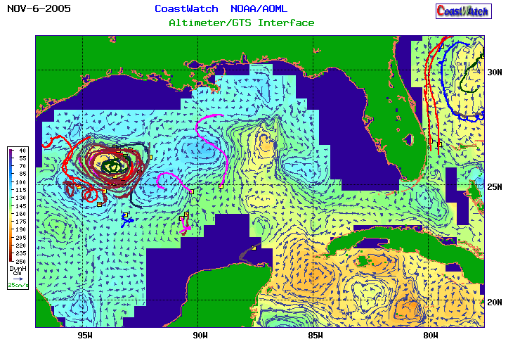
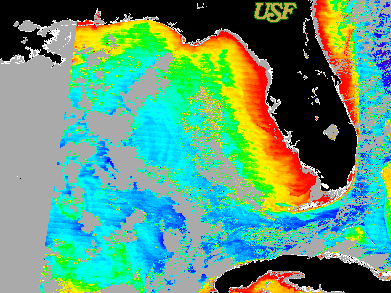
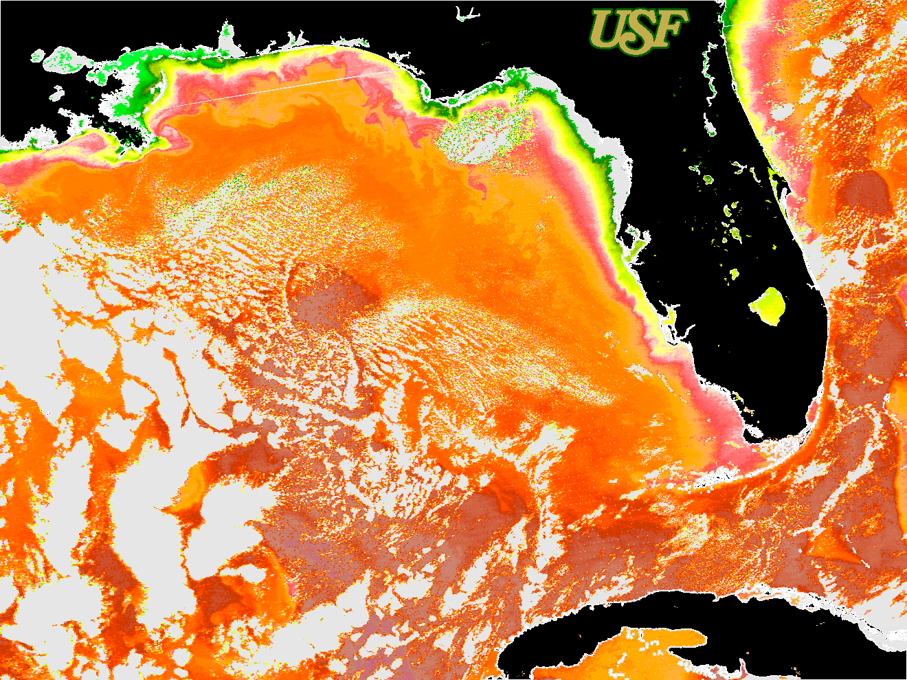
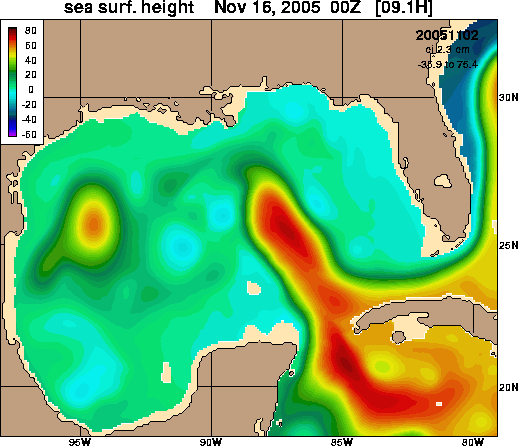
are using satellite remote-sensing data
(altimetry, color
and SST)
and large
scale hydrodynamic models to make preliminary assessments
of the downstream trajectory, distribution and concentration of dissolved
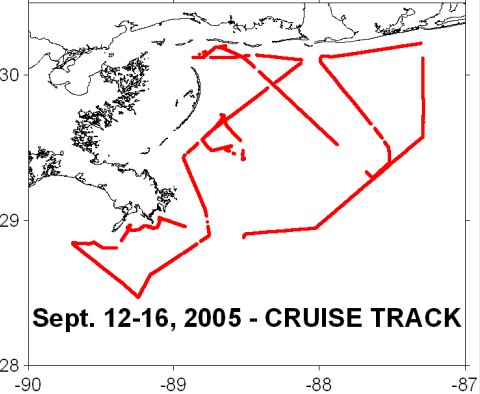
contaminants and toxics. September 22-24, the RV/Cape Hatteras deployed
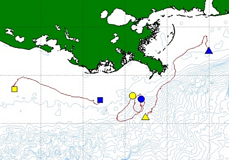
satellite-tracked open ocean SVP drifters
from AOML's
Global Drifter Center from the Dry Tortugas to the northern
Gulf of Mexico and simultaneously
surveyed currents and water quality along the track . The
week of September 26, the FV/Patricia Jean deployed the first set of
coastal
satellite-tracked drifters along the coast of Louisiana
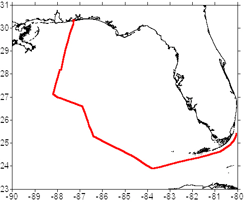
and Mississippi. Cruises in which AOML, NMFS and Florida DEP will participate
will study the oceanography, provide satellite ground-truth data and
analyze water quality in the Gulf of Mexico. Regional high resolution
hydrodynamic models incorporating tracer simulations will be used to
provide rigorous 5-7 day forecasts of downstream exposure over the three
month period following the landfalls of Katrina and Rita. Essential
to these efforts will be incorporation of water quality assessments
being made in coastal Louisiana, Mississippi and Texas by the EPA, USGC,
NOAA and regional collaborators.
|
|
Synoptic Products
NOTE: If you have problems viewing the following maps, use Internet Explorer or Netscape
This
website will be updated frequently as additional data is analyzed.

|