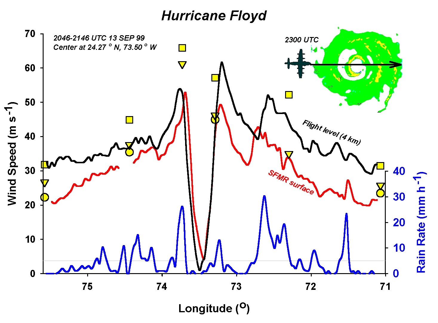
A west-to-east aircraft pass across Hurricane Floyd when it was a Category 4 hurricane due east of Miami, heading west. This graph compares wind measured at 6 km altitude (black curve) with that sensed remotely at the surface by the Stepped-Frequency Microwave Radiometer (SFMR, red) and measured by dropsondes (yellow symbols). SFMR also measures rain rate (blue).