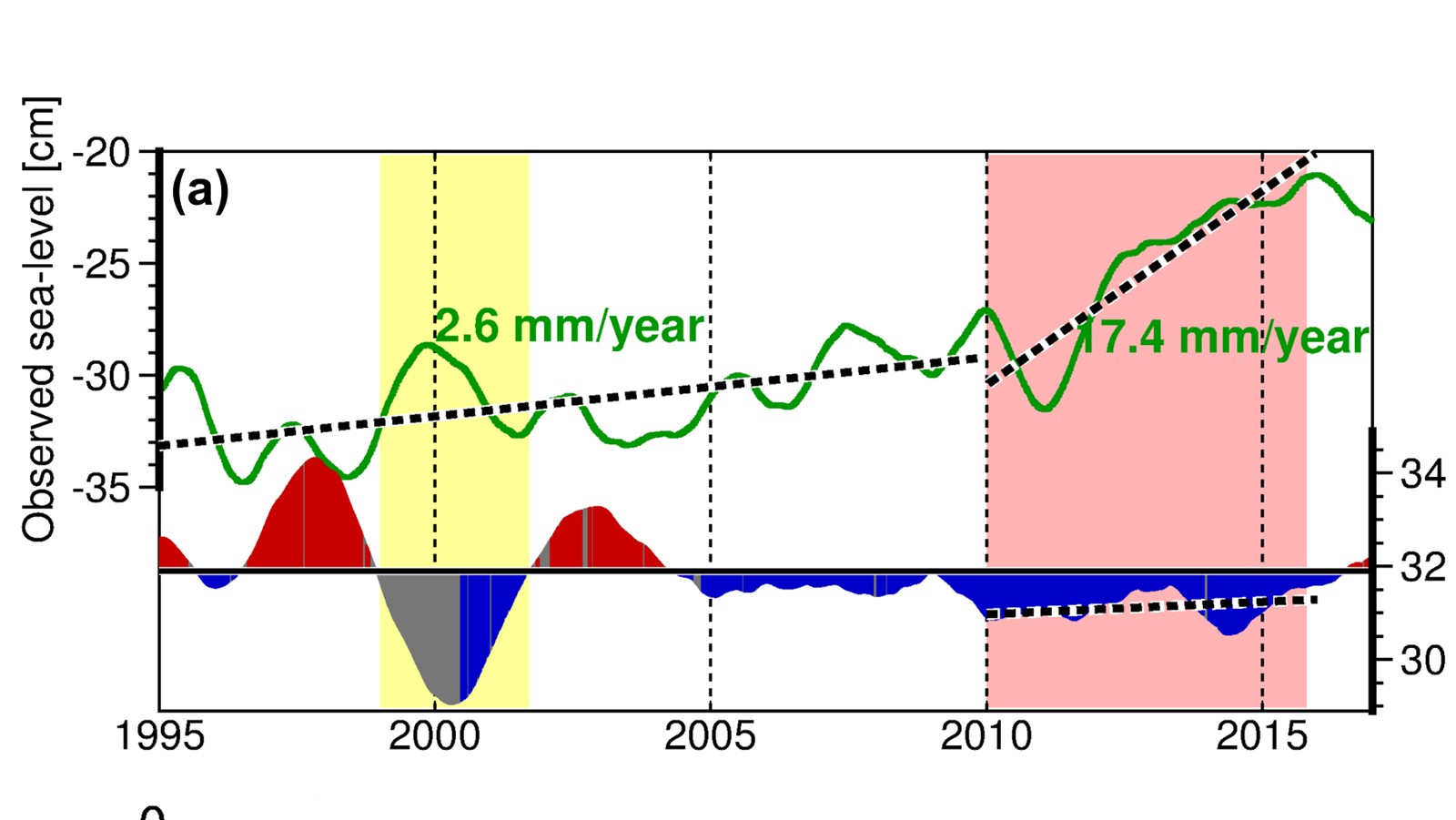

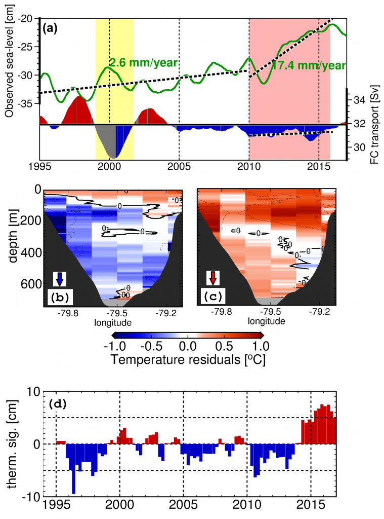
In a new article accepted for publication in the Geophysical Research Letters, Ricardo Domingues (CIMAS University of Miami & NOAA/AOML) and his coauthors explored the observed rapid sea level rise along the U.S. East Coasts during 2010-2015, which is linked to extensive flooding and “sunny day” flooding (or nuisance flooding) events in large urban areas including Norfolk, Baltimore, Charleston, and Miami, among others. The study found that the 2010‐2015 sea level rise extended from Key West to Cape Hatteras, and was mostly caused by the increasing temperature of the upper ocean (~ 300 m) along the path of the Florida Current, which led to the coastal sea level rise through thermal expansion of the water column. The study also reported that the U.S. sea level north of Cape Hatteras declined during 2010-2015 largely due to changes in atmospheric conditions.
Reference
Domingues, R., Goni, G., Baringer, M., & Volkov, D. (2018). What caused the accelerated sea level changes along the United States East Coast during 2010‐2015?. Geophysical Research Letters, https://doi.org/10.1029/2018GL081183. [PDF]