
A recent study in the journal Monthly Weather Review is the first to examine how the direction of wind shear changes how much heat and moisture are available to a tropical cyclone and how these factors influence tropical cyclone intensity change.
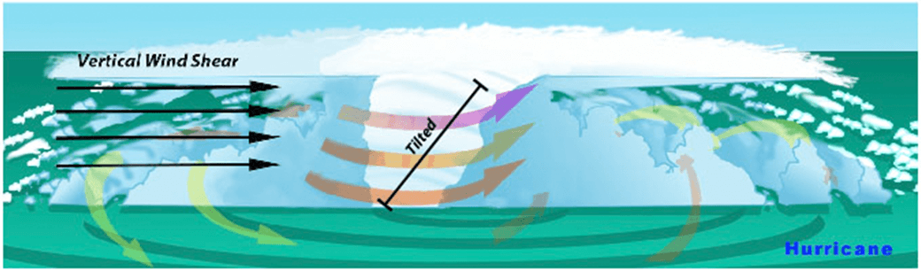
The amount of wind shear, i.e., the change of the wind with height, is one of the most commonly used predictors of tropical cyclone intensity change, with large amounts of wind shear generally being unfavorable for intensification. Regardless of the direction of the wind shear, tropical cyclones in the North Atlantic basin usually have warm, moist air from the environment near the sea surface on their east side (solid red arrows in the images) and cool, dry air from the environment on their west side (solid blue arrows in images).
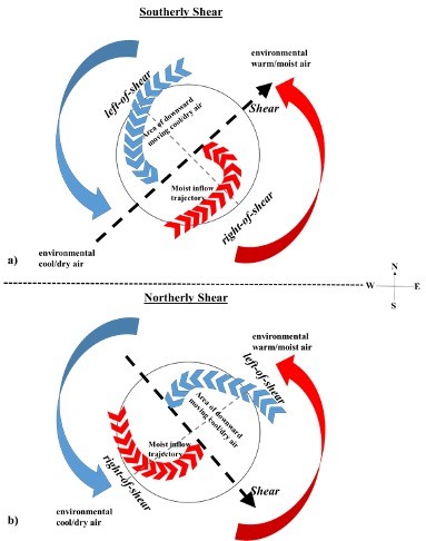
In addition to environmental air, when tropical cyclones are experiencing wind shear, an area of warm, moist air moves inward toward the tropical cyclone center from right-of-shear (dashed red lines in images) and an area of cool, dry air moves inward from downward-moving air left-of-shear (blue dashed lines in images). Previous studies have shown that when a tropical cyclone has temperature and humidity evenly distributed around its eyewall, known as symmetry, conditions are favorable for intensification.
When wind shear is southerly (top image), the downward moving cool, dry air left-of-shear is in the same location (northwest quadrant) as the cool, dry air in the environment. Additionally, the area of environmental warm, moist air coincides with the area of inward moving warm, moist air (southeast quadrant).
This overlapping cool, dry air in the northwest quadrant and overlapping warm, moist air in the southeast quadrant leads to an asymmetric distribution of temperature and moisture around the storm, which is unfavorable for intensification because the warm, moist air that tropical cyclones require to sustain their strong thunderstorms and intensify is limited.
In contrast, when the wind shear is northerly (bottom image), the downward moving cool, dry air left-of-shear is in the northeast quadrant in a region of warm, moist environmental air. In this scenario, the inward moving warm, moist air coincides with the region of cool, dry environmental air.
Since these air masses partially cancel each other out, the temperature and moisture near the ocean surface in environments of northerly wind shear are more symmetrically distributed around the tropical cyclone, making these storms more likely to intensify. Conversely, tropical cyclones exposed to southerly wind shear environments have a more asymmetric distribution of temperature and moisture, making them less likely to intensify.
These relationships show that tropical cyclone structure and intensity are directly influenced by the surrounding environment and that knowledge of the wind environment provides tropical cyclone forecasters with another tool to predict intensity change, helping better protect both life and property.