 RealTime Loop of Gulf of Mexico Eddy
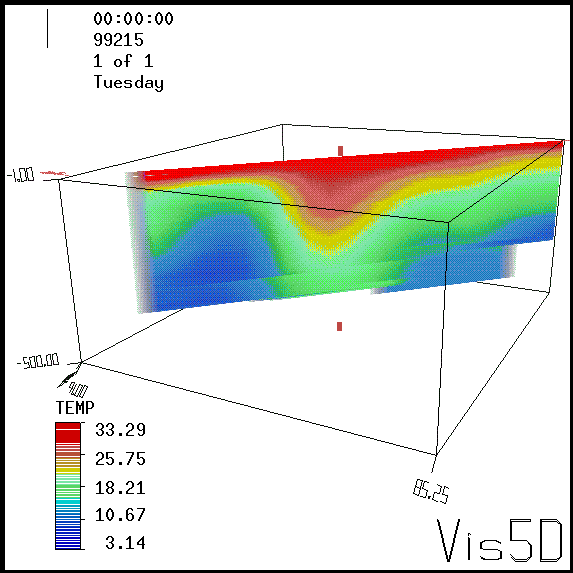
The above figure shows a series of vertical slices of
water temperature in the Gulf of Mexico. This sequence is
oriented SE to NW so as to capture the warm eddy's "core"
stucture. The temperature data used for this analysis was
obtained from bathythermographs deployed from NOAA's WP-3D
aircraft on 8/3/99. The domain shown extends from the surface
to a depth of 500 meters, between 23° and 29° North
latitude and 85° to 91° West longitude.
Quick Time movie of eddy
profile
To load the QuickTime
Player plug-in
Return to Air-Sea page.
|
 |
|
 |
|
 |
|
 |
|
 |
|
 |
|
 |
|
DOC NOAA OAR AOML HRD NHC
AOC