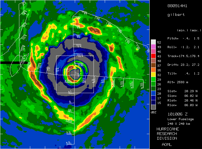
Lower-fuselage radar image from sweep collected at 1010 UTC on 14
September 1988. Domain is 240 x 240 km, and the white box encloses the
60 x 60 km pseudo-dual Doppler analysis grid. The aircraft track is plotted
in white with wind barbs plotted every two minutes. White lines also
denote the storm track and the coastline of the Yucatan peninsula of
Mexico.