SATELLITE IMAGERY INVESTIGATIONS OF TROPICAL CYCLONE ACTIVITY

PRINCIPAL INVESTIGATOR
Dr. Christopher W. Landsea

OTHER PERSONNEL:
Mr. Neal Dorst
Dr. Ray Zehr (NOAA/Cooperative Institute for Research in the Atmosphere)

OBJECTIVE OF THE WORK

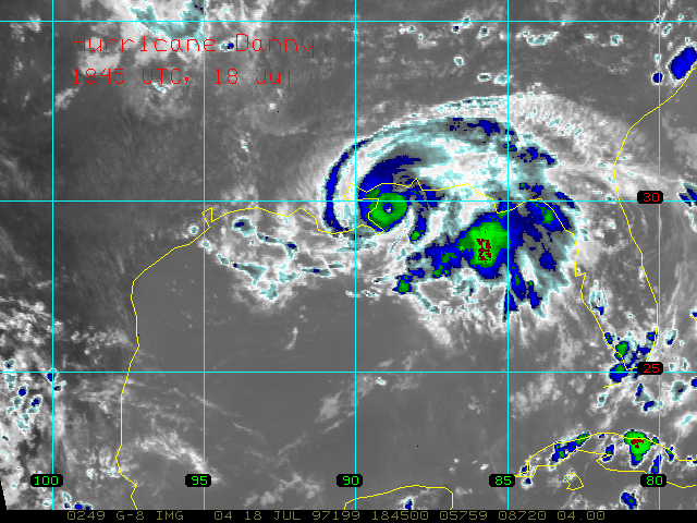
To help provide satellite imagery both in real-time and for research purposes via the RAMSDIS computer.

RATIONALE

Satellite imagery has assisted greatly in the operational forecasting of hurricanes by allowing for estimates to be made for storms' position and intensity. However, most applications in the past have been of a primarily qualitative basis and not of a quantitative nature that can be utilized for research studies or for ingestion as data into numerical models. Recently, there has been much effort to provide more quantitative information from satellite imagery covering the tropics. A goal of this project is to make available to researchers here at AOML visible, infrared and water vapor imagery taken from the geostationary satellites both in real-time and for post-analysis.

METHOD

  1. Each summer and fall, the NOAA/ERL/AOML Hurricane Research Division conducts a Hurricane Field Project. The availability of real-time satellite data via our RAMSDIS PC allows for more informed decisions as to whether aircraft research flights will be made into the hurricanes. Previously, the Hurricane Research Division had no direct access to real-time satellite data and thus were quite limited in available data.
  2. (Contributed by Bob Black.) The RAMSDIS images you provide are being used in conjunction with the long-range lightning detection (sferics) equipment to map the electrically active portions of hurricanes, and to determine the life cycle of these events. It is not currently possible to obtain the sferics data in real-time, so this must be done in a post- processing mode with archived data. We will use the knowledge gained to assess the longevity of lightning events in hurricanes, the regions of the storm that contain lightning, and the relationships (if any) of lightning to changes in either storm intensity or motion.
  3. (Contributed by Chris Landsea.) Quantitative data over the tropical oceans is quite sparse, many times limited to just an occasional ship over regions covering thousands of square kilometers. Work is in progress to test whether high-density low-level cloud vectors derived from GOES and Meteosat visible and IR imagery can assist in better defining features such as easterly waves and the outer core circulation of tropical cyclones.

ACCOMPLISHMENTS

Since October 1995, we have successfully been accessing real-time satellite imagery via our RAMSDIS PC that has been provided to us by NOAA's Cooperative Institute for Research in the Atmosphere. We have been interacting with CIRA's Ray Zehr and associates to help maintain and better develop this real-time link. During 1996, Neal Dorst and I collected over a gigabyte of satellite imagery that has been archived. During the 1997 hurricane season, we should be able to archive several gigabytes of data for research studies after the season. Additionally, the RAMSDIS PC has been quite useful during 1996 and 1997 in planning for and designing our Hurricane Field Project.

KEY REFERENCE:

(None)


Administration page
Program page
Subject page
Main page