Large-scale features
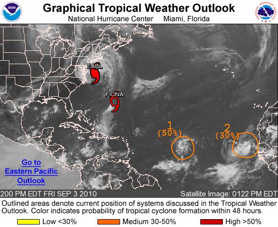
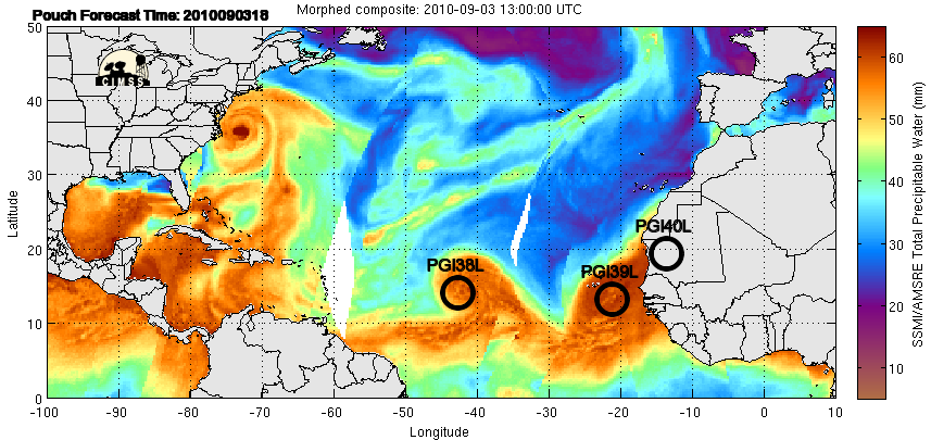
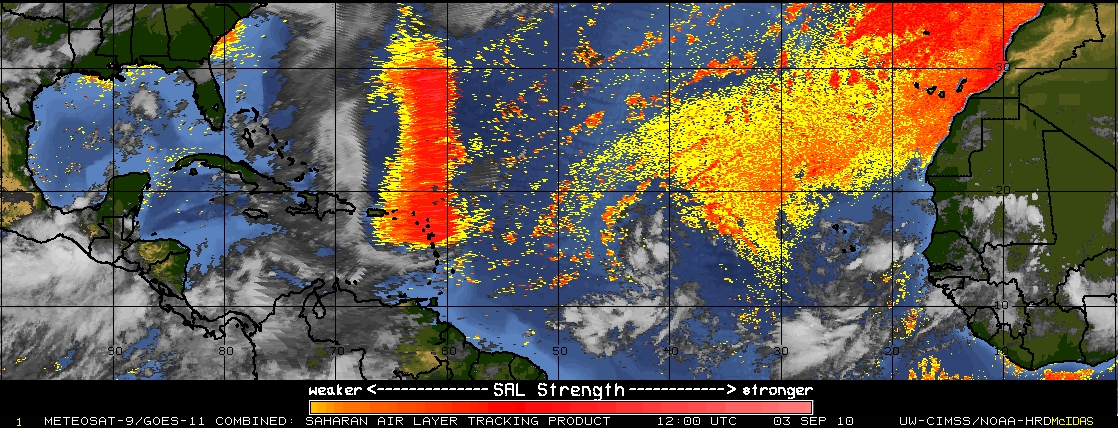
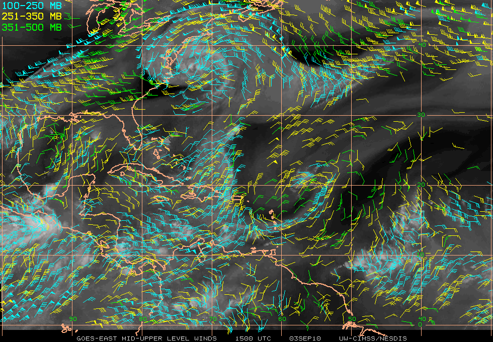
The primary features of interest in the Atlantic basin are Hurricane Earl, Tropical Storm Fiona, the remnants of Tropical Depression Gaston (labeled with a "1", and newly named AL99 (labeled with a "2"), as seen in Fig. 1. These features are also evident as areas of high total precipitable water (TPW) in Fig. 2. Regions of relatively low TPW are presently surrounding the remnants of Gaston (PGI38L) except to the east, and seem to be impinging on the western and northern edges of AL99 (PGI39L). These regions of lower TPW can also be seen in the CIMMS Saharan Air-Layer imagery (Fig. 3). The primary upper-level feature depicted in the CIMMS upper-level wind analysis (Fig. 4) is a large anti-cyclone representing the outflow of Hurricane Earl that is producing relatively strong northeasterly flow over Tropical Storm Fiona. A trailing upper-level low is seen just east of the Lesser Antilles, but is not impacting any of the systems. The flow is mainly easterly over the the remnants of Gaston.
Hurricane Earl
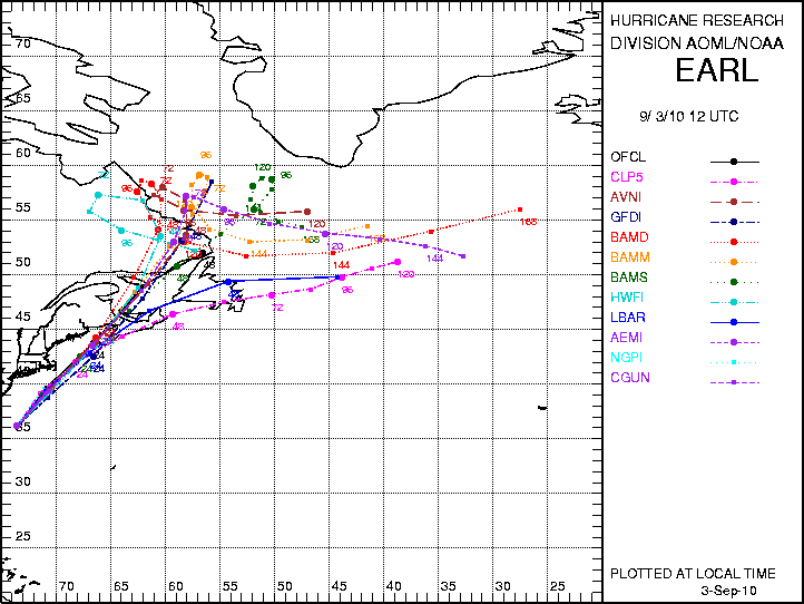
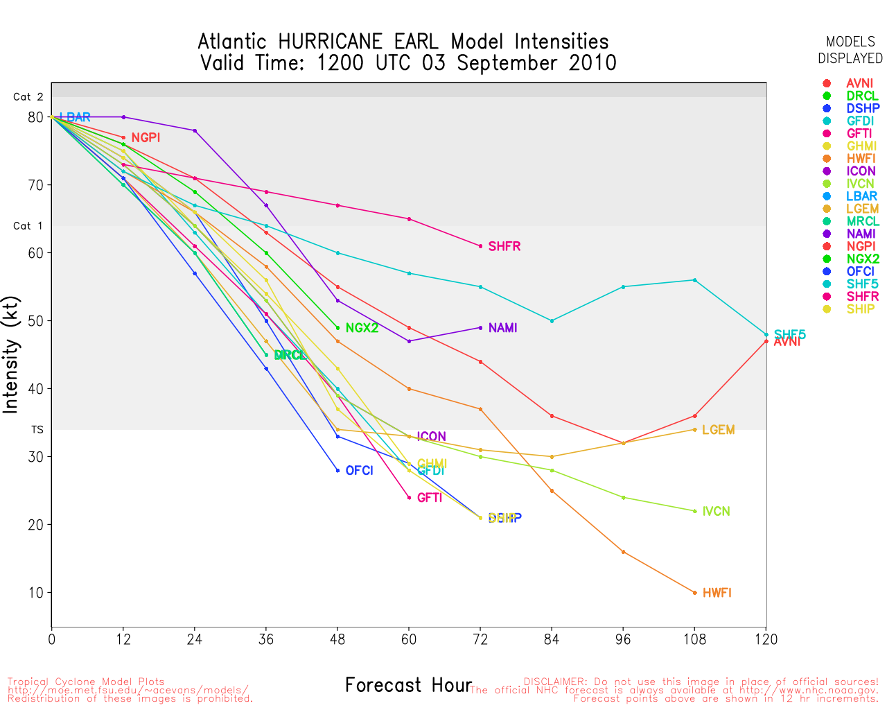
At 1200 UTC, Hurricane Earl was located near 36.2 N 73.5 W (Fig. 5) with 80 kt maximum sustained surface winds and was moving NNE at 16 kt. Convection within the system has eroded quite a bit during the last 24 h, with most located to the north of the center. The cloud shield remains quite circular, but evidence of extratropical transition are seen in the beginning elongation of the shield toward the north. The track guidance from 1200 UTC in very good agreement, showing a north-northeastward motion until landfall Saturday morning over southwestern Nova Scotia (Fig. 6). The intensity guidance (Fig. 7) continues to show steady weakening until landfall as Earl moves over progressively cooler waters. Earl is likely to have made landfall and dissipated as a tropical cyclone by this time tomorrow.
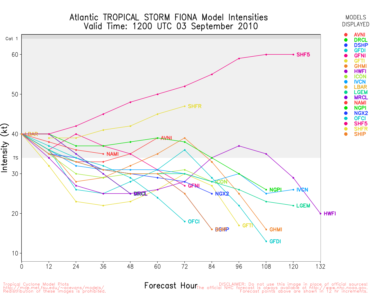
Tropical Storm Fiona
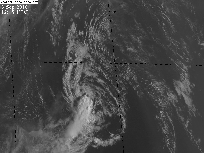
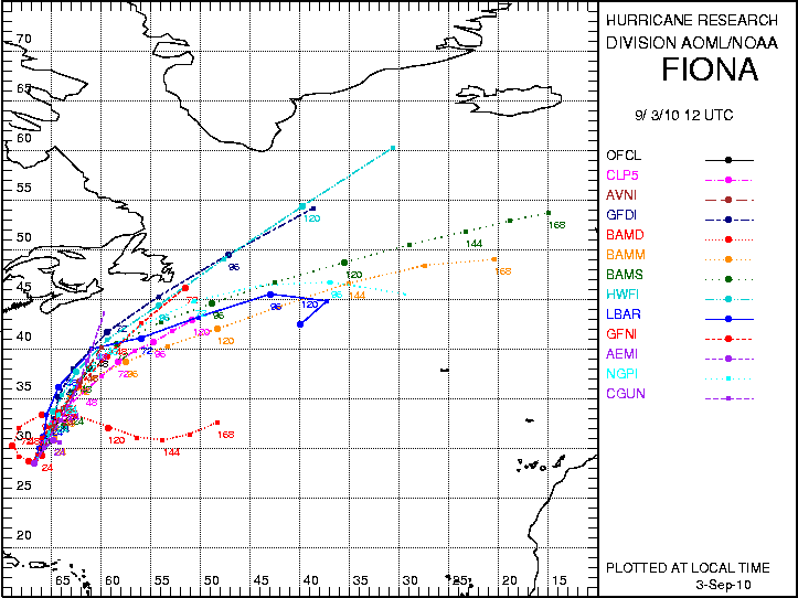
At 1200 UTC, Tropical Storm Fiona was located near 28.5 N and 66.7 W with maximum sustained surface winds of 40 kt and was moving north at 11 kt. Figure 8 shows that only one small thunderstorm remains in association with Fiona and that that convection is being sheared southware in the outflow of Earl. Fiona has been holding on tenaciously, and aircraft reconnaissance data shows that it remains of tropical storm intensity. The track guidance (Fig. 9) show Fiona continuing on a north to northeast track and remaining out to sea, though a close call with Bermuda is likely. The intensity guidance (Fig. 10) indicates that Fiona should continue to slowly weaken during the next few days, though given its current status in satellite imagery, the weakening may go faster than the models anticipate. As Fiona and Earl begin to separate, the shear over Fiona is likely to lessen, but by that time, Fiona will be over cooler water and reintensification is unlikely. Fiona is likely to no longer be a tropical cyclone by this time tomorrow.
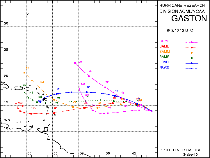
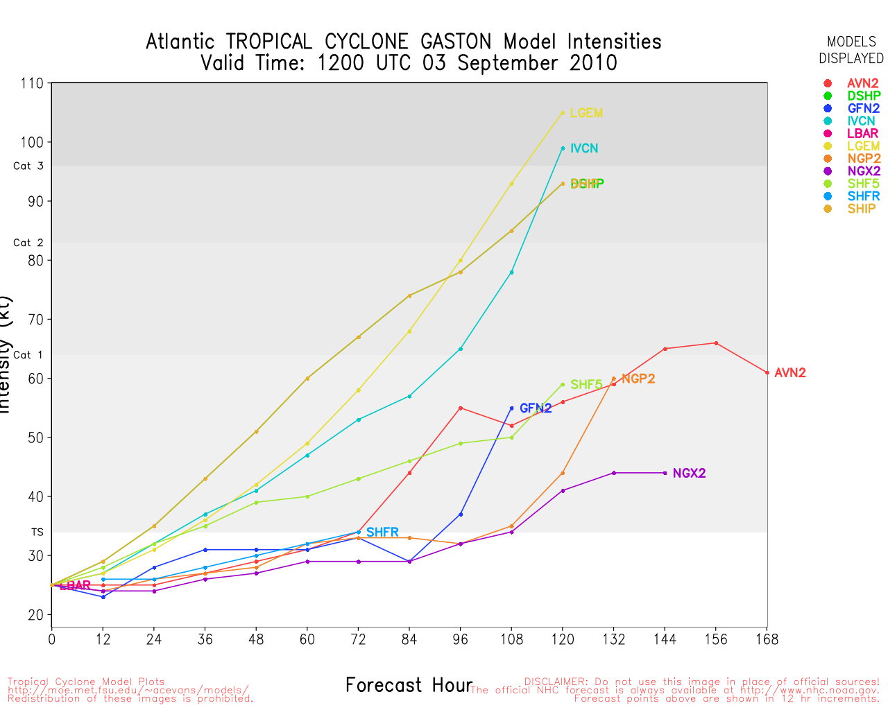
The remnants of Tropical Depression Gaston
At 1200 UTC, the remnants of Gaston was located near 14.9 N and 41.1 W (Fig. 11) with maximum sustained winds of 25 kt and was moving to the west at 5 kt. Convection is no longer concentrated near the center, with small cells spread throughout the region. The reason for the dissipation of the system are controversial, but may have something to do with dry air in the environment (though it is not clear that the dry air made its way into the core). Dropwindsonde data from recent PREDICT flights show ample dry air in the environment, but not in the core of the system. The track guidance (Fig. 12) shows Gaston moving to the west during the next 120 h, possibly approaching St. Croix late in the period. The intensity guidance (Fig. 13) shows steady intensification during the next five days, though it must be mentioned that they showed this before dissipation as well. The ECMWF, which has been assimilating PREDICT dropwindsonde data, shows a drier environment than GFS, and dissipates Gaston east of the Antilles.
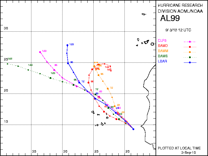
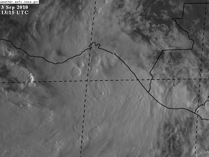
AL99
PGI39 was declared AL99 this morning at 1200 UTC, when it was located at 14.3N and 18.6 W with an intensity of 25 kt, moving northwestward at 8 kt. Convection seems to be organizing around a perceived center of circulation (Fig. 14), and NHC gives the system a 20% chance of development into a tropical cyclone during the next two days. The track guidance (Fig. 15) shows continued northwestward motion during the next five days, and suggests that the system will remain outside the region of possible aircraft observations. The only intensity guidance available (SHIPS and LGEM) suggest only moderate development during the next few days, mainly due to negative thermodynamic factors.
EP95
A broad area of low pressure has developed over the Gulf of Tehuantepec (Fig. 16) and has been designated EP95. The disturbance has gotten much better organized during the morning, and NHC gives the region a 50% chance of development. Though it is on the Pacific side, it is of interest since it is moving northward and some of the global model consensus has it redeveloping in the Bay of Campeche Sunday.
Sim Aberson, Altug Aksoy, and Neal Dorst