Effects of Synoptic Surveillance on model forecasts for
Hurricane Keith.
Quicktime movie of DLM wind analyses
Quicktime movie of DLM wind data initial increments
| Oct. 1, 2000 | Oct. 2, 2000 |
| Oct. 3, 2000 | Oct. 4, 2000 |
| October 2, 2000 | 18 Z | |||
| October 3, 2000 | 00 Z * | 06 Z | 12 Z | 18 Z |
| October 4, 2000 | 00 Z * | 06 Z | 12 Z | 18 Z |
| October 5, 2000 | 00 Z * | 06 Z | 12 Z |
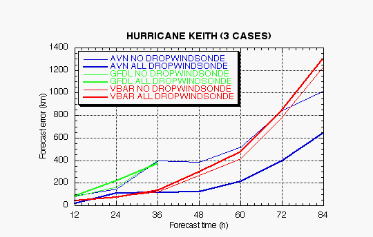
Figure 1a. Track forecast errors for the no dropwindsonde and the all dropwindsonde runs for the AVN, GFDL, and VBAR models for three Hurricane Keith synoptic surveillance missions.
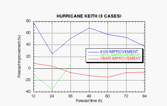
Figure 1b. Track forecast improvements for the AVN, GFDL, and VBAR models for the three Hurricane Keith synoptic surveillance missions.
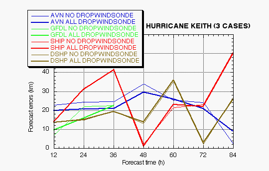
Figure 2a. Intensity forecast errors for the no dropwindsonde and the all dropwindsonde runs for the AVN, GFDL, and VBAR models for three Hurricane Keith synoptic surveillance missions.
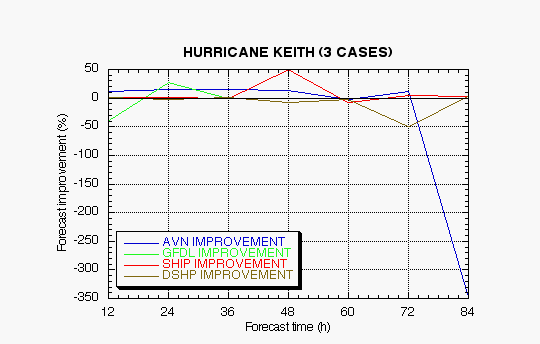
Figure 2b. Intensity forecast improvements for the AVN, GFDL, and VBAR models for the three Hurricane Keith synoptic surveillance missions.
(a)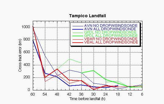
(b)
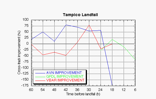
Figure 3. Track forecast errors (a) and improvements (b) for the landfall of Hurricane Keith at Tampico, MX, in the cross-track direction for the no dropwindsonde and the all dropwindsonde runs for the AVN, GFDL, and VBAR models.
(a)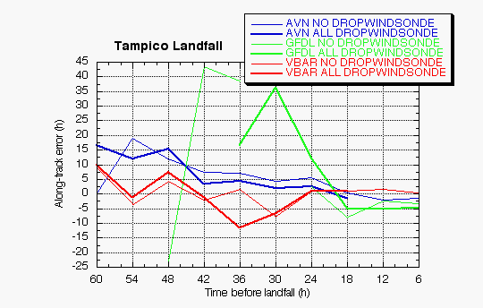
(b)
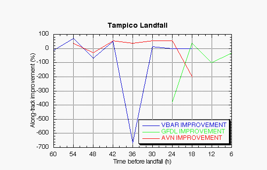
Figure 4. Track forecast errors (a) and improvements (b) for the landfall of Hurricane Keith at Tampico, MX, in the along-track direction for the no dropwindsonde and the all dropwindsonde runs for the AVN, GFDL, and VBAR models.
Return to 2000 assessment page
Return to HRD home page