Effects of Synoptic Surveillance on model forecasts for
Hurricane Ernesto.
| August 27, 2006 | 18 Z | |||
| August 28, 2006 | 00 Z | 06 Z | 12 Z | 18 Z |
| August 29, 2006 | 00 Z | 06 Z | 12 Z | 18 Z |
| August 30, 2006 | 00 Z | 06 Z | 12 Z | 18 Z |
| August 31, 2006 | 00 Z | 06 Z | 12 Z |
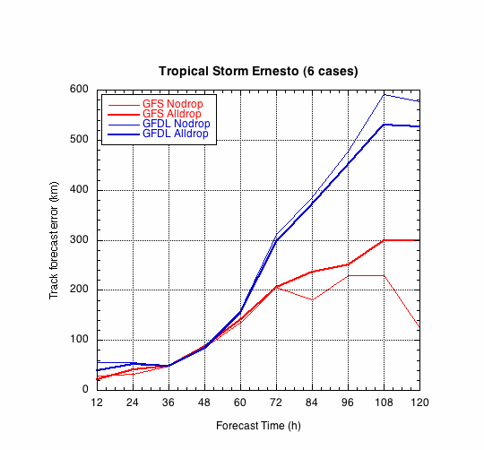
Figure 1a. Track forecast errors for the no dropwindsonde and the all dropwindsonde runs for the GFS and GFDL models for the Hurricane Ernesto synopitc surveillance missions.
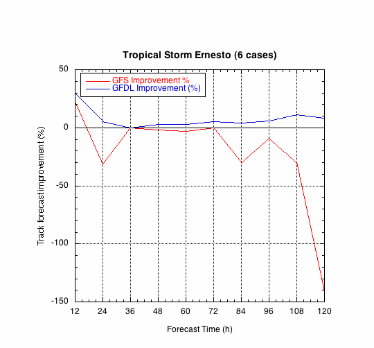
Figure 1b. Track forecast improvements for the GFS and GFDL models for the Hurricane Ernesto synoptic surveillance missions.
(a)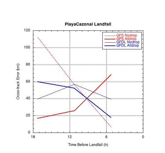
(b)
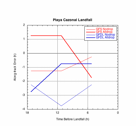
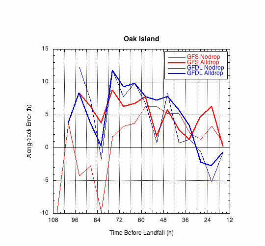
Figure 2. Forecast errors for the landfall of Ernesto at Playa Cazonal, in the (a) cross- and (b) along-track directions for the no dropwindsonde and the all dropwindsonde runs for the GFS and GFDL models.
(a)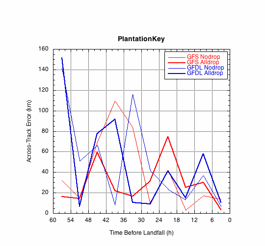
(b)
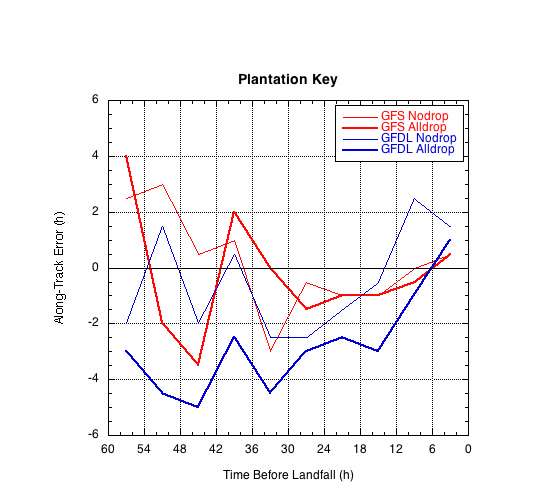
Figure 3. Forecast errors for the landfall of Ernesto at Plantation Key, in the (a) cross- and (b) along-track directions for the no dropwindsonde and the all dropwindsonde runs for the GFS and GFDL models.
(a)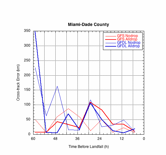
(b)
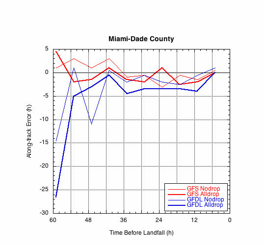
Figure 4. Forecast errors for the landfall of Ernesto at Miami-Dade County, in the (a) cross- and (b) along-track directions for the no dropwindsonde and the all dropwindsonde runs for the GFS and GFDL models.
(a)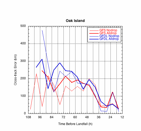
(b)