Mission Summary
20101106I1 Aircraft 43RF
TDR Mission Summary
Tropical Storm Tomas
Aircraft Crew (43RF)
| Aircraft Commander | Mark Nelson |
| Co-pilot | Harris Halverson |
| Co-pilot | Mark Sweeny |
| Flight Engineer | Dewie Floyd |
| Flight Engineer | Paul Darby |
| Navigator | Chris Sloan |
| Flight Director | Barry Damiano |
| System Engineer | Dana Naeher |
| Data Technician | Mike Mascaro |
| Dropsonde Operator | Jeff Smith |
| Crew Chief | Kevin Rotteveel |
Scientific Crew (43RF)
| Lead Scientist | Sim Aberson |
| Radar Scientist | John Gamache |
| Dropsonde Scientist | Tomislava Vukicevic |
| Cloud Physics Scientist | Terry Lathem (GeorgiaTech) |
Mission Plan :
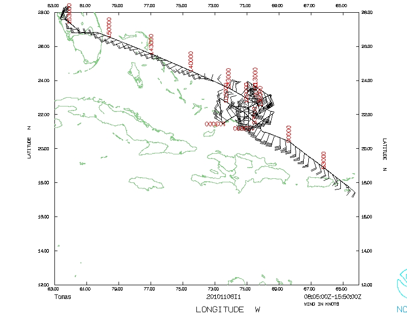
N43RF is scheduled to fly an EMC-tasked Tail Doppler Radar mission into
weakening Tropical Storm Tomas north of Hispañola. The plan is for a
butterfly pattern with 90-nm legs, taking off from St. Croix at 0800 UTC and
recovering at MacDill. To get microphysical data, after the second pass, the
plan was to descend to 2500 ft for the downwind leg, rising 500 ft every 10
minutes. At the end of the downwind leg, the plan was to go to 5000 ft for the
center pass, releasing dropwindsondes every minute to get turbulence data. The
subsequent downwind leg was to also be a stairstep, rising 1000 ft every 10
minutes. The final pass was to be completed at 10000 feet. Because Tomas was
weakening, the mission was conducted as planned, except for the rapid
dropwindsonde releases on the third pass.
Mission Summary :
| Take off
| Landing
| St. Croix, USVI
| 06/08:00UTC
| MacDill AFB, FL
| 06/15:48 UTC
| |
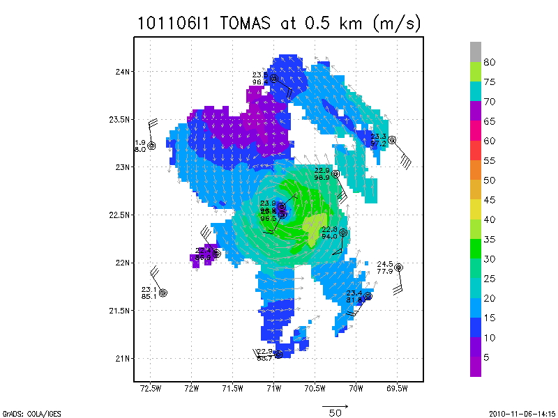
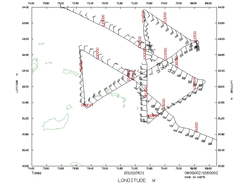
Figure 1. Dropwindsonde/Doppler radar composite at 0.5 km altitude from
20101106I1 flight into Tomas.
The mission was fully successful with four passes through the center and four
radar analyses sent. Fifteen dropwindsondes were released at the endpoints and
in the center; one was a fast fall. Also very successful was a test of getting
the radar data sent directly from the aircraft to NCEP/NCO.
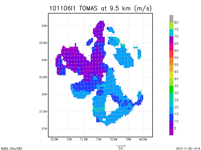
Figure 2: As in Fig. 1, but at 9.5 km altitude.
Tomas had been disrupted by its passage near Hispañola, but was expected
to restrengthen into a hurricane sometime either during the mission or shortly
thereafter. Radar composites showed that Tomas was not as asymmetric as during
the previous flight. Maximum winds at 0.5 km altitude (Fig.1) were 70-80 kt,
suggesting that Tomas was near hurricane strength. A front just to the
northwest was expected to bring cool, dry air into the system; the strong
northerly winds near the surface behind the front can ben seen in Fig. 1, and
the dropwindsonde at the northwest point shows the dry air. A well defined wind
center, nearly vertically stacked, extended up to at least 10 km (Fig. 2) in
the Doppler composites, suggesting a lack of strong shear affecting the core.
The radar analysis from the first pass alone (not shown) showed strong
mid-level westerly winds beginning to encroach on the core. However, these
strong winds disappeared by the last pass and are not evident on the composite
analyses. The relaxation of these winds allowed for Tomas to strengthen after
the mission into a hurricane.
Problems :
No major problems encountered. Scientists are to be reminded to bring their
passports with them whenever we travel for the field program as we never know
where we might recover.
Mission Data :
LPS forms |
Radar forms |
Dropsonde forms
Serial data |
1 second data |
NetCDF data |
SFMR
(NetCDF) data |
Page last updated February 22, 2011
Return to Mission page.