Mission Summary
20100707H1 Aircraft 42RF
Genesis/TDR flight into Tropical Disturbance AL96 2010
Aircraft Crew (42RF)
| Aircraft Commander | Al Girimonte |
| Co-pilot | Cathy Martin |
| Co-pilot | Harris Halverson |
| Flight Engineer | Greg Bast |
| Navigator | Devin Brakob |
| Flight Director | Barry Damiano |
| Lead El Tech | Bill Olney |
| El Tech | Charles Lynch |
| Data Tech | Bobby Peek |
| Data Tech | Terry Lynch |
Scientific Crew (42RF)
| Lead Project Scientist | Sim Aberson |
| Dropsonde Scientist | Kathryn Sellwood |
| Radar Scientist | Jun Zhang |
Mission Plan :
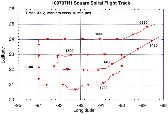
The P-3 is tasked by HRD to fly a square spiral pattern around developing
AL96 in the Gulf of Mexico to investigate genesis. Drops are to be released
every 60 nm. Tail Doppler radar data to be collected, analyzed, and sent in
real time as part of the Genesis/TDR mission. The aircraft will depart
MacDill AFB, FL at 08:00 UTC and arrive back at MacDill by 16:00 UTC later
in the day.
Mission Summary :
| Take off
| Landing
| MacDill AFB, FL | 08:02 UTC
| MacDill AFB, FL | 16:00 UTC
| |
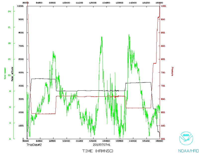
Before the mission, the SFMR was replaced on the aircraft as it was reporting
incorrect data on the previous mission. Takeoff from MacDill at 0802 UTC. By
0925 UTC, the aircraft passed through an area of convection well northeast of
AL96. The SFMR reported wind speeds of > 50 kt during this transect (Fig. 1).
The LPS decided that this leg, before the regular pattern, should be analyzed
by the Doppler scientist and sent off the plane. Descent into the pattern
began shortly afterward, and the pattern began at 0947 UTC.
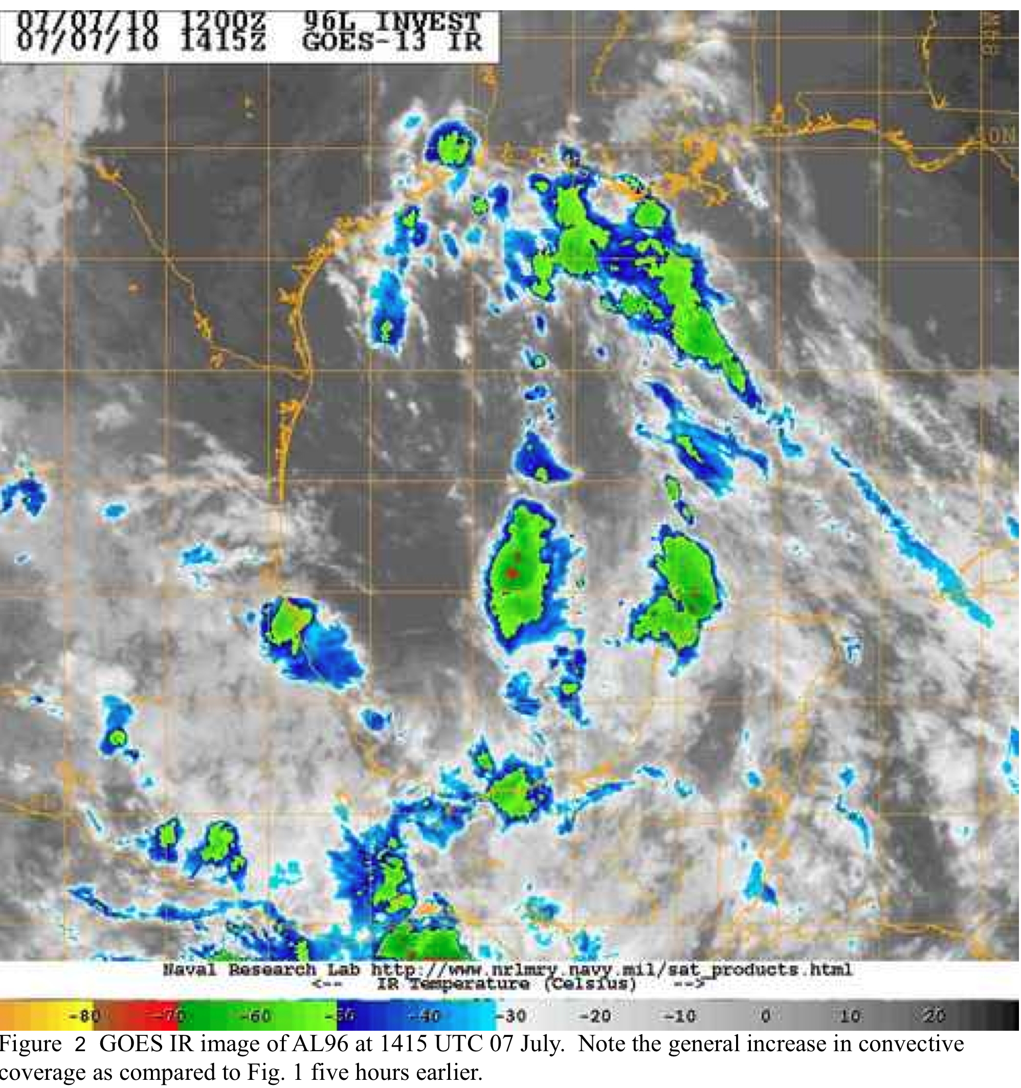
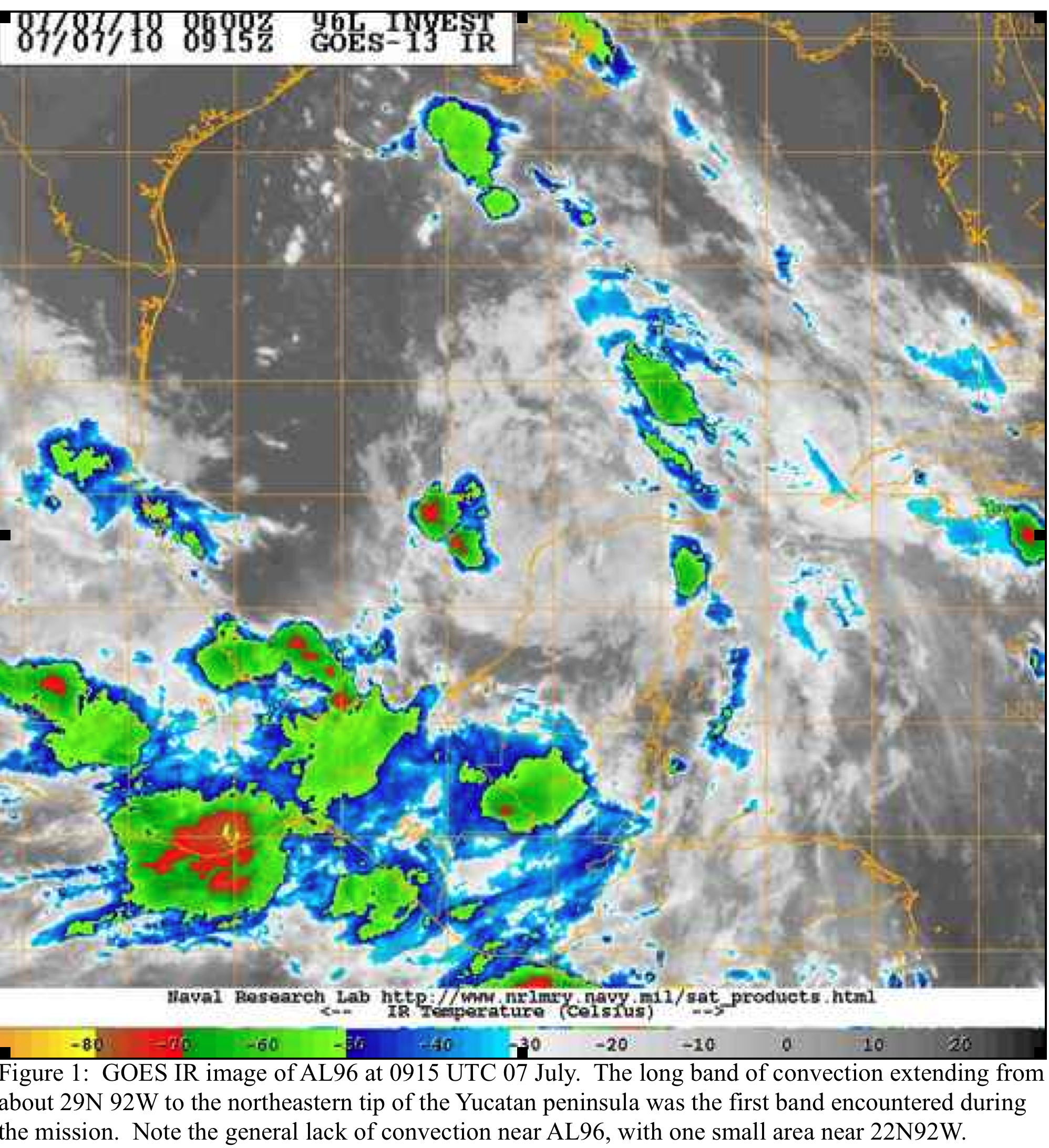
At the beginning of the mission, very little convection was seen around what
was identified as the center of AL96. During the mission, convection increased
greatly, with numerous high-dBZ cells firing throughout the area, seen on the
aircraft radar as much as an hour before satellite. The greater coverage of
convection allowed for good coverage of radar analyses during the flight.
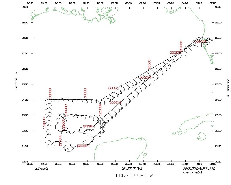
Radar/dropwindsonde composites from the flight suggest a complicated pattern
throughout the region.
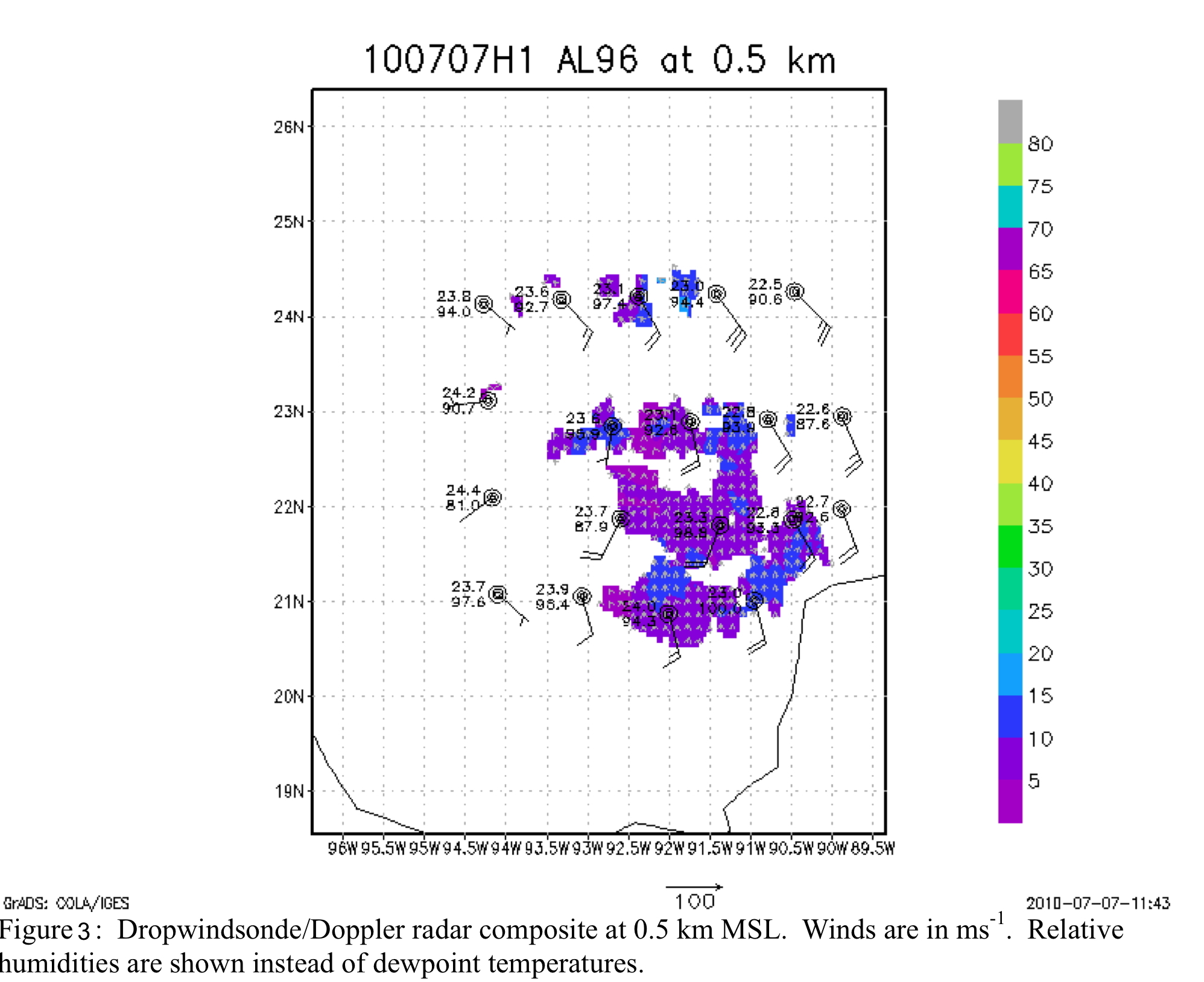
At low levels (Fig. 3), a shallow, weak circulation is evident in the
dropwindsonde data along 94W. By 2 km altitude, a weak circulation is seen
near 22.5N 92W, within the area of convection. This circulation extended above
the flight level where dropwindsonde data were no longer available. However,
the Doppler radar data showed that this circulation likely extended to near 6
km altitude. Clearly, this circulation did not yet extend to the surface, nor
was convection well enough organized to allow for the classification of this
system as a tropical depression.

Problems :
Except for some minor deviations for Mexican airspace due to offshore coral
reefs claimed by Mexico, the mission was completed as planned. Only one sonde
was problematic (a fast fall), the radar remained up except for one short
period during the beginning of the pattern, and other systems worked well.
Sim D. Aberson
07/14/2010
Mission Data :
Serial data |
1 Second data |
SFMR (text) |
SFMR (NetCDF)
LPS log |
Radar log |
Dropsonde log |
Page last updated August 11, 2010
Return to Mission page.